Thanks for submitting!
You will be contacted as soon as possible


QUICK LINKS


PROFILES
PUBLICATIONS
EXPOSURE
VULNERABILTY
SOFTWARE
EQ MODELS
Search Results
1135 results found with an empty search
- GFDRR-DFID | Global Earthquake Model Foundation
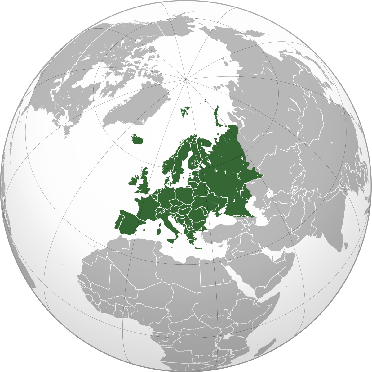
Projects GFDRR-DFID GFDRR-DFID Challenge Funds Versión en español English version Share Facebook LinkedIn Overview Anchor 6 Background The Global Facility for Disaster Reduction and Recovery (GFDRR) and the UK Department for International Development's (DFID) competitive Challenge Fund pilots new and innovative approaches to overcoming technical and technological challenges in order to strengthen disaster and climate risk decision-making in developing countries. To this end, this project is supporting the development of data, products, and approaches to support disaster risk management decision-making and build resilience, including through better information, but also strengthening key steps in moving from information to insight and behaviour change. Each challenge is focusing on the development of a database with hazard footprints, exposure information and vulnerability models. The viability of the databases will be demonstrated using exposure data for Tanzania and another DFID priority country. Objectives The project is divided into three components. The British Geological Survey leads the development of a data schema and data for a multi-hazard database (Challenge 1) while GEM and University College London lead the development of a global exposure database (Challenge 2) and open vulnerability platform for evaluating risk (Challenge 3) respectively. GEM also contributes to Challenge Fund 1 and 3. GEM leads Challenge Fund 2 on the development of a global exposure data framework, which includes the physical vulnerability characteristics and exposure taxonomy. The aim is to identify the most important vulnerability characteristics; ways to account for uncertainties in exposure and vulnerability models; type of assets that should be supported by the vulnerability and exposure database; and the most common and useful intensity measure types. The objective of this project is to develop a Data Exploration Tool to promote the ability of a user to access, understand and use hazard, exposure and vulnerability data stored in a format that follows the data schema developed by the Challenge Fund consortia. British Geological Survey (BGS) leads the development of a data schema and data for a multi-hazard database (Challenge 1) GEM Foundation leads the development of a global exposure database (Challenge 2) University College London (UCL) leads the development of open vulnerability platform for evaluating risk (Challenge 3) Various organizations also participated and contributed to the project such as the Geological Survey of Tanzania; Ardhi University (Tanzania); Dar Es Salaam University (Tanzania); DFID Tanzania; Prime Minister's Office - Disaster Management Department (Tanzania); DoMA (Malawi); INGC (Mozambique); Ministry of Energy & Mineral Development (Uganda); ImageCat (USA); Humanitarian OpenStreetMap Team (HOT Indonesia); NSET (Nepal); IDF (Switzerland); UA (Netherlands); NGI (Norway); NOC (UK); CIMA (Italy); and UCL-EPI (UK). Locations Tanzania and neighbouring countries Anchor 1 Anchor 5 Anchor 4 The GFDRR-DFID Challenge Fund projects on the development of exposure, vulnerability and hazard footprints databases kicked off with a 2-day inception workshop. The University College London (UCL) EPICentre and CatLin XL hosted the second workshop held on July 27 in London to collect feedback. A consortium led by the GEM Foundation with partners ImageCat Inc. and the Humanitarian OpenStreetMap Team completed recently an open exposure database for multi-hazard risk assessment... Anchor3 Publications GFDRR-UK Aid Challenge Fund: Final Learning Report: Value of Risk Information for Decision Making May 31, 2018 How can innovative approaches make communities more resilient to climate change and natural disasters? GFDRR-DFID Challenge Funds Round 2 Extensible Data Schemas for Multiple Hazards, Exposure and Vulnerability Data published as part of the UNDRR GAR2019 . Data schema and data: for multi-hazard database (BGS), for global exposure database (GEM), for a global database of vulnerability functions (UCL)
- GEOINQUIRE | Global Earthquake Model Foundation
Projects GEOINQUIRE GeoINQUIRE: Geosphere INfrastructures for QUestions into Integrated REsearch Versión en español English version Share Facebook LinkedIn Overview Anchor 6 Background The GeoINQUIRE project provides and enhances access to selected key data, products, and services, enabling the dynamic processes within the geosphere to be monitored and modelled at new levels of spatial and temporal detail and precision. Geo-INQUIRE benefits from a unique partnership of 51 partners consisting of major national research institutes, universities, national geological surveys, and European consortia. Geo-INQUIRE will enhance and make interoperable the activities of the involved partners and conduct dedicated training programs for their optimal use. A portfolio of 150 Virtual Access (VA) and Transnational Access (TA, both virtual and on-site) installations will be offered to the scientific community. The GEM Foundation is offering one of the Virtual Access services within the geohazard-and-multi-risk-assessment portfolio of services; this service will provide access to earthquake and secondary hazards impact data. More information: https://www.geo-inquire.eu/about/about-geo-inquire Duration: 2022 - 2026 Objectives The project aims to overcome cross-domain barriers, especially the land-sea-atmosphere environments, and will exploit innovative data management techniques, modelling and simulations methods, developments in AI and big data, and extend existing data infrastructures to disseminate these resources to the wider scientific community, including the EOSC landscape. Collaborators Please refer to: https://www.geo-inquire.eu/about/partners Funding partner: European Commission Location Potsdam, Germany Anchor 1 Anchor 5 Anchor 4 Anchor3 Publications
- INDONESIA DRR | Global Earthquake Model Foundation
Projects INDONESIA DRR Seismic Resilience Baseline Analysis and Investment Option Needs in Indonesia Versión en español English version Share Facebook LinkedIn Overview Anchor 6 Background This project, funded by the World Bank's GFDRR, aims to conduct a seismic baseline analysis to support the development of a potential national seismic risk mitigation program in Indonesia. The study focuses on public assets, which include education facilities (primary and secondary schools, universities), health facilities (health clinics, hospitals), commercial facilities (shophouse), emergency services facilities (e.g., ambulance stations, fire stations, early warning service providers), and critical government administration buildings (e.g., local disaster management offices). The project has five main tasks: 1. Inception: literature review on seismic risk in Indonesia, methodology, definition of stakeholder/consultation workshops, preliminary data collection 2. Baseline analysis of Indonesia’s exposure and vulnerabilities to seismic hazards (earthquakes and tsunami) 3. Seismic Risk Assessment and Rapid Prioritization of Potential Investments in Three Selected Districts 4. Development of Baseline Data and Conceptual Framework Design 5. Final Report and Completion Report The GEM Risk Team contributes to all tasks, ranging from support on hazard modelling, development of exposure, selection of vulnerbaility models and the computation of seismic risk using the OpenQuake engine. Duration: 2022-2023 Objectives The methodology, workplan, programme and potential target cities is elaborated together with the World Bank and Indonesian Ministry of Public Works and Housing (MPWH) stakeholders and other relevant agencies such as Ministry of National Development Planning (Bappenas), National Disaster Management Authority (BNPB), Ministry of Home Affairs (MoHA) and Agency for Meteorology, Climatology and Geophysics (BMKG). The objectives include: (a) a rapid baseline analysis of the exposure and vulnerability of the country and three Indonesian districts to earthquakes and tsunami, baseline information/data, and gap analysis, including disaggregated analysis of risk and vulnerability of women and other vulnerable groups; (b) a conceptual framework for improving seismic resilience and recommendations for a national program that aims to reduce the vulnerability of people (with consideration for diverse groups) and assets to earthquakes and tsunami through an integrated package of structural and non-structural investments; and (c) stakeholder consultations to seek inputs on the potential program design, investment funding mechanisms, and institutional set-up options for the national program. Collaborators GEM Foundation, Arup, LAPI-ITB and Kota Kita Funding partner: World Bank GFDRR Locations Three cities in Indonesia: ‣ Kota Bengkulu, Bengkulu province ‣ Kota Cilegon, Banten province ‣ Kota Gorontalo, Gorontalo province Anchor 1 Anchor 5 Anchor 4 Anchor3 Publications
- AZERBAIJAN DRR | Global Earthquake Model Foundation
Projects AZERBAIJAN DRR Risk modeling and scenario analysis for Azerbaijan - Seismic risk analysis Versión en español English version Share Facebook LinkedIn Overview Anchor 6 Background One of the analyses to be conducted under the World Bank Groups' Country Climate and Development Reports (CCDRs), is to look at the fiscal and economic impacts of disasters in Azerbaijan, including the size of the macro-fiscal risk posed by earthquakes, floods, and droughts, and identify potential opportunities to increase financial resilience. For the risk modeling and scenario analysis for Azerbaijan, the GEM Risk Team further expands the Azerbaijan model in GEM's Global Seismic Risk Model, by projecting the exposure and risk to 2050 by taking into account the evolving demographics and socio-economic conditions in Azerbaijan. Duration: 2022 Objectives The World Bank is preparing the Country Climate and Development Report for Azerbaijan. The CCDR aims to inform policy dialogue and engagement with the Government of Azerbaijan. This provides an opportunity to carry out several analytical pieces, including in the area of Disaster Risk Management, bringing together existing knowledge on the economic and social impacts of disasters and climate change, and delivering new analytical insights to support policy recommendations. Collaborators GEM Foundation Funding partner: World Bank Group Location Azerbaijan Anchor 1 Anchor 5 Anchor 4 Anchor3 Publications
- CAYMAN ISLANDS PSHA | Global Earthquake Model Foundation
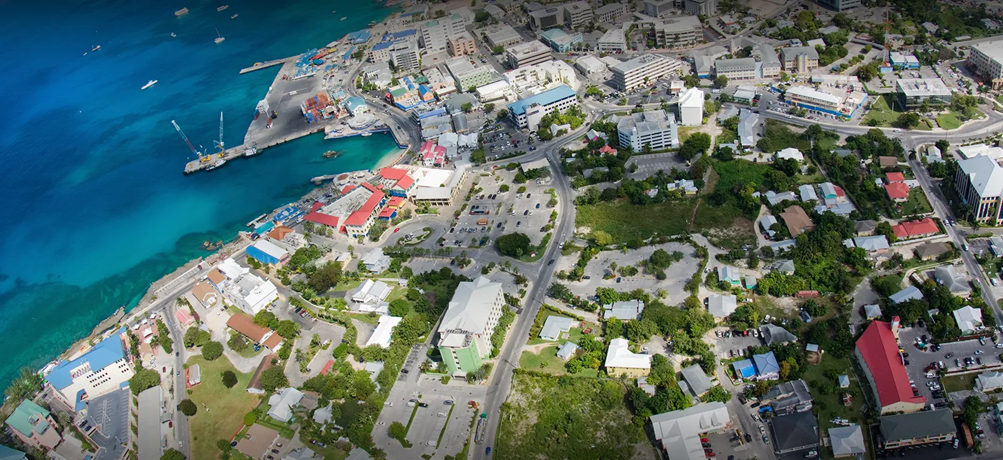
Projects CAYMAN ISLANDS PSHA Probabilistic seismic hazard assessment of Cayman Islands Versión en español English version Share Facebook LinkedIn Overview Anchor 6 Background Thr project aims to perform a probabilistic seismic hazard assessment for the Cayman Islands, and provide the seismic input necessary for the International Building Code (IBC). The GEM Hazard Team is responsible for the seismotectonic and geodynamic characterisation of the study area, the definition of distributed seismicity and fault sources, and the modelling of the epistemic uncertainties. Duration: 2020 Objectives The main objective is to provide input to the 2016 Cayman Islands Building Code, to support engineers in the seismic design and assessment of structures. Collaborators GEM Foundation, EUCENTRE Foundation Funding partner: Cayman Islands Government Location Cayman Islands Anchor 1 Anchor 5 Anchor 4 Anchor3 Publications
- AELO | Global Earthquake Model Foundation
Projects AELO ASCE Earthquake Loads Overseas (AELO) Versión en español English version Share Facebook LinkedIn Overview Anchor 6 Background The project is carried out within a collaboration between GEM and the U.S. Geological Survey (USGS) and is sponsored by the U.S. Department of State (DoS) and the U.S. Department of Defence (DoD). The aim of the project is to provide a web service for computing design ground motions (on rock and soil) that are compliant with the ASCE guidelines (ASCE 7-16, ASCE 41-17, ASCE 7-22, ASCE 41-23) for 500 locations worldwide. In its inaugural year, AELO focuses on rigorously calculating seismic parameters, including Peak Ground Acceleration (PGA), Ss, and S1 design values across 500 diverse global locations, particularly emphasizing rock site conditions. This aims to ensure compliance with ASCE7-16 and ASCE41-17 standards, essential for seismic assessment and design practices. In the following year, the project progresses to establish a secure webservice for computing design ground motions. This password-protected platform will provide access to ASCE7-16 and ASCE41-17 aligned calculations, simplifying access to these critical seismic design parameters. Transitioning into the third year, AELO expands its computational scope to encompass ground motion calculations across various soil conditions worldwide, encompassing 500 locations to adhere to ASCE 7-22 and ASCE 41-23 standards. This phase seeks to enhance the breadth of seismic assessments, offering a comprehensive understanding of seismic hazards on diverse soil types. Finally, in its fourth year, the project concludes with the introduction of a sophisticated, password-protected webservice. This platform offers the capability to compute design ground motions based on the latest ASCE7-22 and ASCE41-23 standards, supporting seismic engineers and researchers globally by providing accurate, standardized, and essential seismic design parameters for diverse geographical locations. Duration: 2022 - 2026 Objectives The primary objective of the project is to create a web service capable of calculating design ground motions, both on rock and soil, in adherence to the American Society of Civil Engineers (ASCE) guidelines. These guidelines include ASCE 7-16, ASCE 41-17, ASCE 7-22, and ASCE 41-23. This web service heavily relies on the hazard models that are part of GEM’s global mosaic and the OpenQuake Engine. Collaborators GEM, the U.S. Geological Survey (USGS), with support from the U.S. Department of State (DoS) and the U.S. Department of Defense (DoD). Location Global (Washington DC, USA) Anchor 1 Anchor 5 Anchor 4 Anchor3 Publications
- Proyecto TREQ | Global Earthquake Model Foundation
Projects Proyecto TREQ Comunicación y Formación en la Evaluación de Riesgos por Terremotos (TREQ) Versión en español English version Share Facebook LinkedIn Visión general Resultados Capacitación Comunicación Fotos Publicaciones Anchor 6 Resumen El Proyecto de Capacitación y Comunicación para la Evaluación de Riesgos de Terremotos (TREQ) fue diseñado para demostrar cómo la evaluación de la amenaza y el riesgo sísmico puede informar a los tomadores de decisiones en el desarrollo de políticas de reducción de riesgos, así como también cómo se puede comunicar adecuadamente el riesgo de terremotos a las partes interesadas y al público en general. [PDF Executive Summary English ] Objetivos El proyecto se organizó en dos partes principales. El primero tuvo como objetivo desarrollar la capacidad para la evaluación de la amenaza y el riesgo sísmico a nivel urbano en América Latina, Quito (Ecuador), Cali (Colombia) y Santiago de los Caballeros (República Dominicana); mientras que la segunda parte fue desarrollar material de capacitación, educación y comunicación para mejorar la comprensión del riesgo de terremotos en todo el mundo. El programa se diseñó para un amplio espectro de partes interesadas, categorizadas en cuatro grupos principales: gobierno(tomadores de decisiones/autoridades públicas), industria (practicantes y profesionales), academia (investigadores y profesores) y la comunidad. Ecuador Municipalidad de Quito Escuela Politécnica Nacional (EPN) Instituto Geofísico (IG) Colegio de Ingenieros Civiles de Pichincha (CICP) Pontificia Universidad Católica del Ecuador Dominican Republic Servicio Geológico Nacional (SGN) Oficina Nacional de Evaluación Sísmica y Vulnerabilidad de Infraestructuras y Edificaciones (ONESVIE) Comité Técnico Nacional (CTN) Pontificia Universidad Católica Madre y Maestra (PUCMM) Colombia Servicio Geológico Colombiano (SGC) Departamento Administrativo de Planeación Municipal (DAPM), Cali Unidad Nacional de Gestión del Riesgo de Desastres (UNGRD) Universidad EAFIT, Medellin Costa Rica Universidad de Costa Rica (UCR) Mexico Universidad Autónoma de Baja California (UABC) Ubicación Quito (Ecuador), Cali (Colombia) y Santiago de los Caballeros (República Dominicana) a. Informes de la ciudad Evaluación de Riesgo Sísmico para el Distrito Metropolitano de Quito [Español ] Evaluación de Riesgo Sísmico para Santiago de Cali [Español ] Evaluación de Riesgo Sísmico para Santiago de los Caballeros [Español ] Evaluación del riesgo urbano en América Latina y el Caribe En este componente se generaron los siguientes entregables: evaluación de amenaza y riesgo sísmico a escala urbana para las tres ciudades TREQ: Quito (Ecuador), Cali (Colombia) y Santiago de los Caballeros (República Dominicana). Se desarrollaron modelos de vanguardia para cada ciudad en estrecha colaboración con socios locales. Los modelos de entrada y los resultados están disponibles en la siguiente dirección URL: [github.com/gem/treq-riesgo-urbano/ ] b. Evaluación de peligros sísmicos Modelos probabilísticos de amenaza sísmica (PSHA) y conjuntos de datos para la evaluación de la amenaza a nivel urbano [PDF English ] Modelo Probabilístico de Amenaza Sísmica para la República Dominicana [PDF English | Español ] [Descargar Modelo ] Resultados de amenaza sísmica (condiciones en roca y en suelo [PDF English ] Análisis de la amenaza sísmica a escala urbana [PDF English ] d. Escenarios de la ciudad Base de datos con rupturas seleccionadas para análisis de escenarios [Cali ] [Quito ] [Santiago ] Evaluación del escenarios de amenaza para sismos representativos en Quito, Cali y Santiago de los Caballeros [PDF English ] e. Aplicaciones Urbanas Deslizamientos y licuefacción inducidos por sismo en Cali [PDF English ] c. Evaluación de Riesgo Sísmico Resumen ejecutivo sobre la evaluación del riesgo sísmico urbano para las ciudades de Quito, Cali y Santiago de los Caballeros [PDF English ] Tipologías constructivas en Quito, Cali and Santiago de los Caballeros [PDF Español ] Base de datos de exposición georreferenciada de población y edificios en cada ciudad de TREQ [Cali ] [Quito ] [Santiago ] Base de datos de funciones de fragilidad y vulnerabilidad para cada clase de edificio presente en el modelo de exposición [Datos ] Mapas y métricas de riesgo para cada ciudad [Cali ] [Quito ] [Santiago ] Anchor 1 Anchor 5 a. Sitio web para la capacitación en línea de OpenQuake La capacitación en línea de OpenQuake se diseñó para diferentes tipos de audiencia con diversos antecedentes y experiencia. A través de esta plataforma, los participantes interactuaron con los equipos científicos y técnicos del GEM para conocer los principales conceptos de la evaluación del riesgo sísmico, así como las características básicas del software de OpenQuake. [English | Español ] Mejora de la comprensión mundial sobre la amenaza y riesgo sísmico Esta parte del programa fue diseñada para mejorar la comprensión y el conocimiento de la amenaza y el riesgo sísmico, y para ayudar a cerrar la brecha entre la información producida en estudios detallados de amenaza y riesgo y su comunicación a una amplia variedad de partes interesadas (que van desde locales expertos con competencias para evaluar el riesgo sísmico, a los tomadores de decisiones responsables de la implementación de medidas de reducción del riesgo). e. Capacitando a educadores TREQ ha colaborado con cinco profesores universitarios de América Latina para conceptualizar, crear e implementar un curso unificado para el estudio del riesgo sísmico a nivel universitario. Los folletos en inglés y español explican con más detalle el concepto detrás de esta iniciativa y describen los primeros resultados y experiencias de los profesores de Colombia, Costa Rica, El Salvador, Guatemala y México. [PDF English | Español ] b. Manual de OpenQuake en formato online El manual oficial se convirtió de látex al formato reStructuredText gracias al apoyo de @USAID. El nuevo manual está ahora en línea en formato HTML y se puede accederse en: [Webpage English ] d. Manual para realizar análisis de amenaza sísmica Este manual presenta los conceptos básicos de la metodología clásica de PSHA y el amplio espectro de alternativas para modelar la sismicidad y las incertidumbres (epistémicas y aleatorias) en el software de OpenQuake. La evaluación probabilística del peligro sísmico (PSHA) es la metodología principal para evaluar el peligro potencial que representan los terremotos. Los mapas de amenaza se utilizan ampliamente en los códigos sísmicos nacionales para la zonificación de la amenaza sísmica y las disposiciones de diseño estructural. [PDF English ] c. Tutoriales en video sobre peligros sísmicos y análisis de riesgos usando OpenQuake El proyecto ha producido 15 videos de capacitación técnica utilizando el software de OpenQuake (en inglés y español), 7 videos con material para difundir los modelos y resultados de la evaluación del riesgo urbano en las ciudades TREQ y 2 videos para comunicar el riesgo sísmico al público en general. público. OQ Engine Video Tutorials [ English | Español ] Anchor 4 a. Material didáctico para sensibilizar a la comunidad sobre el riesgo sísmico: Aplicación para el área Metropolitana del Valle de Aburrá (AMVA) [PDF Español ] Artículos de noticias Eventos El seminario web Comprensión del riesgo sísmico a través del desarrollo de capacidades y el intercambio de conocimientos atrae a cientos de participantes de todo el mundo. [Article ] [Event page English | Español ] [Video ] Presentación del modelo PSHA nacional para la República Dominicana: un seminario web conjunto organizado por el Servicio Geológico Nacional Dominicano en cooperación con GEM, Oficina Nacional de Evaluación Sísmica y Vulnerabilidad de Infraestructura y la Oficina de Asistencia Humanitaria de USAID. [Event flyer Español ] [Video English | Español ] ---- Artículos Raising Earthquake Risk Awareness: TREQ’s community workshops for the general public Urban hazard assessment of selected cities in Latin America Local solutions to global problems: reducing disaster risk through collaboration and openness TREQ Project Updates: Site Effects Modelling and Urban Exposure Models USGS has joined the TREQ initiative for urban earthquake scenarios TREQ capacity building: OQ online training updates Jan-Feb 2021 TREQ2020 – Capacity development and OpenQuake online training, year in review TREQ OpenQuake Online Training: Earthquake Scenarios - Ground Motion Fields Sept 2020 Más en la sección GEM News d. Perfiles de respuesta y mitigación de riesgos urbanos para las ciudades TREQ [Cali ] [Quito ] [Santiago ] Comunicación y sensibilización sobre terremotos Las actividades de este componente se centraron en sensibilizar al público sobre la amenaza y el riesgo sísmico mediante la capacitación de un grupo diverso de profesionales en reducción del riesgo de desastres (RRD), junto con el personal a cargo de comunicar los riesgos al público, y mediante la realización de talleres comunitarios en áreas seleccionadas de las ciudades piloto. b. Video para comunicar el riesgo de terremoto al público en general [English | Español ] c. Guía para profesores para el desarrollo de un curso introductorio de riesgo sísmico [PDF Español ] Boletin informativo El boletín del proyecto TREQ tiene la intención de compartir actividades en evaluación de riesgos urbanos y materiales de capacitación y educación sobre riesgos de terremotos con una amplia gama de partes interesadas locales de la academia, los sectores público y privado, así como la sociedad civil en América Latina,el Caribe, y más allá. Newsletter no. 3 - May 2021 Newsletter no. 2 - September 2020 Newsletter no. 1 - March 2020 Maiden issue [English ] Maiden issue [Españo ] Anchor3 BUSINESS NEWS Reuniones en Guayaquil 1/1 BUSINESS NEWS Fotos de la formación OpenQuake Online de noviembre de 2020 1/2 BUSINESS NEWS Concientizando el Riesgo: talleres para el público en general 1/4 BUSINESS NEWS Reuniones en Quito 1/10 BUSINESS NEWS Inicio del proyecto de marzo de 2020 1/4 Publications Visión general TREQ Resumen Ejecutivo [English ] Evaluación de la amenaza sísmica Modelos probabilísticos de amenaza sísmica (PSHA) y conjuntos de datos para la evaluación de la amenaza a nivel urbano [English ] Modelo Probabilístico de Amenaza Sísmica para la República Dominicana [English | Español ] [Descargar Modelo ] Resultados de amenaza sísmica (condiciones en roca y en suelo [English ] Análisis de la amenaza sísmica a escala urbana [English ] Evaluación de Riesgo Sísmico Resumen ejecutivo sobre la evaluación del riesgo sísmico urbano para las ciudades de Quito, Cali y Santiago de los Caballeros [English ] Tipologías constructivas en Quito, Cali and Santiago de los Caballeros [Español ] Escenarios sísmicos Evaluación del escenarios de amenaza para sismos representativos en Quito, Cali y Santiago de los Caballeros [English ] Aplicaciones urbanas Deslizamientos y licuefacción inducidos por sismo en Cali [English ] Informes de la ciudad Evaluación de Riesgo Sísmico para el Distrito Metropolitano de Quito [Español ] Evaluación de Riesgo Sísmico para Santiago de Cali [Español ] Evaluación de Riesgo Sísmico para Santiago de los Caballeros [Español ] Formación y comunicación del riesgo sísmico Manual de capacitación sobre análisis probabilístico de riesgos sísmicos (PSHA) [English ] Material didáctico para sensibilizar a la comunidad sobre el riesgo sísmico. Aplicación para el área Metropolitana del Valle de Aburrá (AMVA) [Español ] Guía para profesores para el desarrollo de un curso introductorio de riesgo sísmico [Español ] Disclaimer The contents of this project website such as studies, reports, audio-visual, news articles, blogs, and other information or media products including those in the external links are made possible by the generous support of the American people through the United States Agency for International Development (USAID). The contents are the responsibility of the Global Earthquake Model (GEM) Foundation and do not necessarily reflect the views of USAID or the United States Government.
- CAREC | Global Earthquake Model Foundation
Projects CAREC Developing a Disaster Risk Transfer Facility in the Central Asia Regional Economic Cooperation Region Versión en español English version Share Facebook LinkedIn Overview Outreach Anchor 6 Background Willis Towers Watson, a GEM Advisor Sponsor is leading the consortium of organizations to implement the project, “Developing a Disaster Risk Transfer Facility in the Central Asia Regional Economic Cooperation Region” supported by the Asian Development Bank. The GEM Risk Team is responsible for the exposure and seismic vulnerability components of the project, with the Hazard Team providing support in the preparation of risk profiles for countries in the Central Asia Regional Economic Cooperation Region. Objectives The project has three main components: (i) development of disaster risk assessments and modeling in all CAREC countries; (ii) design of a regional pilot disaster risk transfer facility for at least three CAREC countries; and (iii) capacity building and awareness raising activities to sensitize key public and private stakeholders in all CAREC countries about the benefits of disaster risk reduction, risk retention and risk transfer solutions. Willis Towers Watson, a GEM Advisor Sponsor is leading the consortium of organizations that will implement the project. The Central Asia Regional Economic Cooperation, or CAREC Program is a partnership of 11 countries (Afghanistan, Azerbaijan, People's Republic of China, Georgia, Kazakhstan, Kyrgyz Republic, Mongolia, Pakistan, Tajikistan, Turkmenistan, and Uzbekistan), supported by 6 multilateral institutions, working together to promote development through cooperation, leading to accelerated growth and poverty reduction. Location Central Asia Anchor 1 Anchor 5 Anchor 4 ADB project overview and data sheet Read more GEM has started a new project with WTW supported by the Asian Development Bank Read more About the CAREC program Read more Anchor3 Publications
- WESTERN BALKANS CCDR | Global Earthquake Model Foundation
Projects WESTERN BALKANS CCDR Input to World Banks' Country Climate and Development Report (CCDR) for Western Balkans Versión en español English version Share Facebook LinkedIn Overview Anchor 6 Background As part of the World Bank Groups' Country Climate and Development Reports (CCDRs), the GEM Foundation and JBA Risk Management are working together to provide current (2021) and future (2050) earthquake and flood risk assessment for 6 West Balkans countries: Albania, Bosnia and Herzegovina, Kosovo, Montenegro, North Macedonia and Serbia. The GEM Risk Team is providing the exposure database (property and population data) for both the flood and seismic risk assessment for six Western Balkan countries at the lowest administrative level, using both existing datasets for 2021 and socio-economic projections for forecasted exposure to 2050. Seismic hazard and risk assessment for the current and future exposure is also being undertaken with the OpenQuake engine, leading to average annual losses and losses for specific return periods for each country. Duration: 2023 Objectives The World Bank is preparing the Country Climate and Development Report for the Western Balkans. The CCDR aims to inform policy dialogue and engagement with governments. This provides an opportunity to carry out several analytical pieces, including in the area of Disaster Risk Management, bringing together existing knowledge on the economic and social impacts of disasters and climate change, and delivering new analytical insights to support policy recommendations. Collaborators JBA Risk Management, GEM Foundation Funding partner: World Bank Group Locations Albania, Bosnia and Herzegovina, Kosovo, Montenegro, North Macedonia and Serbia. Anchor 1 Anchor 5 Anchor 4 Anchor3 Publications
- CCARA | Global Earthquake Model Foundation
Projects CCARA Caribbean and Central America Earthquake Risk Assessment (CCARA) Versión en español English version Share Facebook LinkedIn Overview Outcomes Training Outreach Photos Publications Anchor 6 Background Earthquake risk is on the rise and earthquakes are expected to take an increasing number of lives. Hazard and risk assessments are the foundation for raising awareness among policy makers and the general public, forming the basis for decisions and actions that effectively build resilience and can reduce risk. While important work has been carried out in the Central American and Caribbean region to understand earthquake risk assessment and management there is still ample room to enhance that understanding and properly introduce it in decision- and policy-making processes. In many areas of the world, state-of-the-art information and tools to assess earthquake risk have been inaccessible for a long time. As a first step to tackle this problem, the Global Earthquake Model (GEM) has been created and spent the past 11 years collaboratively advancing open source science and technology for global state-of-the-art seismic hazard and risk modeling, data collection, and risk assessment at scales from local to national, regional, and global. Objectives The project aims to calculate hazard and risk, and to estimate the compounding social and economic factors that increase the physical damage and decrease the post-event capacities of populations to respond to and recover from damaging earthquake events in The Caribbean and Central America, by involving local experts from throughout the region. The goal of the Program in Central America and the Caribbean is to develop capacity in the region for earthquake risk assessment by leveraging GEM tools and resources, to enhance the understanding of earthquake risk, and to bridge the gap between risk assessment and disaster risk reduction. To improve the understanding of earthquake risk in the Central America and Caribbean region while developing local capacities to use open source resources for producing earthquake hazard and risk information at regional, national and local scales. To engage with decision-makers and other end-users to make the connection between advanced risk assessment by local experts and risk-reducing action and so influence DRR policy. Collaborators The CCARA project would not have been possible without the contributions of all the municipalities in particular: the Municipality of San José (Costa Rica), National Commission of Emergencies (CNE), University of Costa Rica (UCR) - Laboratorio Nacional de Materiales y Estructuras (LANAMME), INETER, ONESVIE, ODPEM, BRGM, Bureau des Mines, VT, Geologica UPR Mayaquez, UNI, SRC and UMG. Location Caribbean and Central America countries Website Caribbean and Central America Earthquake Risk Assessment (CCARA) wiki site contains an overview of the project. Anchor 1 Anchor 5 The CCARA project hosted four participants from South America to introduce seismic hazard and risk assessment using tools developed by GEM – specifically the OpenQuake engine. Anchor 4 Modelling subduction earthquakes: GEM experiences in Latin America CCARA project GEM presents the results of the USAID-funded CCARA Project in Santo Domingo, Dominican Republic A hazard workshop in San José, Costa Rica from September 18th to 22nd as part of the risk assessment activities of the CCARA project. Anchor3 Publications CCAF-DB: The Caribbean and Central American Active Fault Database Disclaimer The contents of this project website such as studies, reports, audio-visual, news articles, blogs, and other information or media products including those in the external links are made possible by the generous support of the American people through the United States Agency for International Development (USAID). The contents are the responsibility of the Global Earthquake Model (GEM) Foundation and do not necessarily reflect the views of USAID or the United States Government.