Thanks for submitting!
You will be contacted as soon as possible


QUICK LINKS


PROFILES
PUBLICATIONS
EXPOSURE
VULNERABILTY
SOFTWARE
EQ MODELS
Search Results
1135 results found with an empty search
- ARMENIA PSHA MODELLING | Global Earthquake Model Foundation
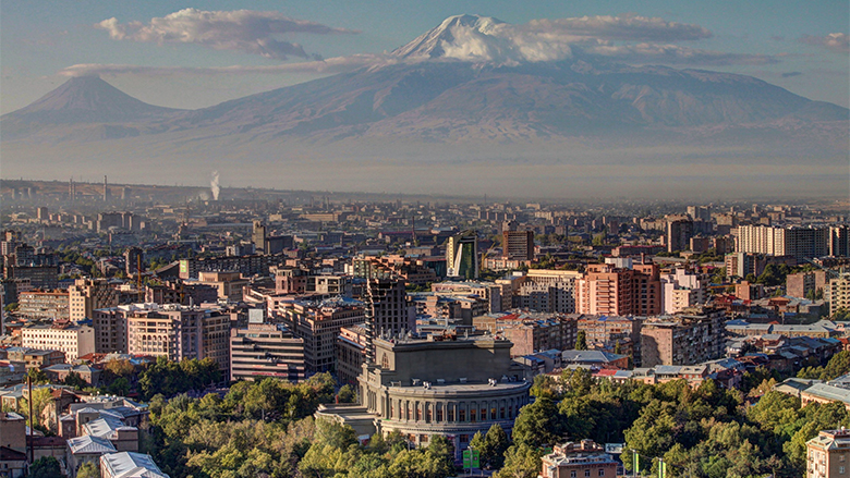
Projects ARMENIA PSHA MODELLING Probabilistic Seismic Hazard Assessment for the Republic of Armenia Versión en español English version Share Facebook LinkedIn Overview Anchor 6 Background This project responds to a World Bank request for a probabilistic seismic hazard assessment for the Republic of Armenia. The goal of this study is to better understand the existing seismic hazard information in the country, and to provide an updated hazard model. The GEM Hazard Team supports all aspects of the model development, and in the running of the analyses with the OpenQuake engine. Duration: 2017 Objectives Probabilistic seismic hazard models, such as this model for the Republic of Armenia, can be used as a rigorous and robust basis for the design of a national disaster risk financing and insurance strategy. Collaborators Verisk (AIR Worldwide), GEM Foundation, Georisk Scientific Research Company Funding partner: World Bank Group Location Armenia Anchor 1 Anchor 5 Anchor 4 Anchor3 Publications
- TREQ Project | Global Earthquake Model Foundation
Projects TREQ Project Training and Communication for Earthquake Risk Assessment (TREQ) Versión en español English version Share Facebook LinkedIn Overview Risk Assessment Training Outreach Photos Publications Anchor 6 Summary The Training and Communication for Earthquake Risk Assessment (TREQ) Project was designed to demonstrate how earthquake hazard and risk assessment can inform decision makers in the development of risk reduction policies, as well as how earthquake risk can be properly communicated to stakeholders and the public in general. [PDF Executive Summary English ] Objectives The project was organized into two main parts. The first one aimed to develop capacity for urban earthquake hazard and risk assessment in Latin America, Quito (Ecuador), Cali (Colombia), and Santiago de los Caballeros (Dominican Republic); while the second part was to develop training, educational and communication material to enhance the understanding of earthquake risk worldwide. The program was tailored for a wide spectrum of stakeholders, categorized into four main groups: governance (decision-makers/public authorities), industry (practitioners and professionals), academia (researchers and professors), and the community. Collaborators Ecuador Municipalidad de Quito Escuela Politécnica Nacional (EPN) Instituto Geofísico (IG) Colegio de Ingenieros Civiles de Pichincha (CICP) Pontificia Universidad Católica del Ecuador Dominican Republic Municipalidad de Santiago de los Caballeros Servicio Geológico Nacional (SGN) Oficina Nacional de Evaluación Sísmica y Vulnerabilidad de Infraestructuras y Edificaciones (ONESVIE) Comité Técnico Nacional (CTN) Pontificia Universidad Católica Madre y Maestra (PUCMM) Colombia Municipalidad de Santiago de Cali Servicio Geológico Colombiano (SGC) Departamento Administrativo de Planeación Municipal (DAPM), Cali Universidad EAFIT, Medellin Unidad Nacional de Gestión del Riesgo de Desastres (UNGRD) Costa Rica Universidad de Costa Rica (UCR) Mexico Universidad Autónoma de Baja California (UABC) Location Quito (Ecuador), Cali (Colombia), and Santiago de los Caballeros (Dominican Republic) Urban risk assessment in Latin America and the Caribbean The following deliverables were generated in this component: seismic hazard and risk assessment at the urban scale for the three TREQ cities: Quito (Ecuador), Cali (Colombia), and Santiago de los Caballeros (Dominican Republic). State-of-art models were developed for each city in close collaboration with local partners. The input models and results are available at the URL address below: [github.com/gem/treq-riesgo-urbano/ ] a. City reports Seismic Risk Assessment for the Metropolitan District of Quito [Evaluación de Riesgo Sísmico para el Distrito Metropolitano de Quito] [Español ] Seismic Risk Assessment for Santiago de Cali [Evaluación de Riesgo Sísmico para Santiago de Cali] [Español ] Seismic Risk Assessment for Santiago de los Caballeros [Evaluación de Riesgo Sísmico para Santiago de los Caballeros] [Español ] c. Seismic Risk Assessment Executive summary Urban seismic risk assessment for the cities of Quito, Cali and Santiago de los Caballeros [Resumen ejecutivo sobre la evaluación del riesgo sísmico urbano para las ciudades de Quito, Cali y Santiago de los Caballeros] [PDF English ] Building classes in Quito, Cali and Santiago de los Caballeros [Tipologías constructivas en Quito, Cali and Santiago de los Caballeros] [PDF Español ] Geo-referenced exposure database of population and buildings in the TREQ city [Base de datos de exposición georreferenciada de población y edificios en cada ciudad de TREQ] [Cali ] [Quito ] [Santiago ] Database of fragility and vulnerability functions for each building class present in the exposure model [Base de datos de funciones de fragilidad y vulnerabilidad para cada clase de edificio presente en el modelo de exposición] [Data ] Maps and risk metrics generated for each city [Mapas y métricas de riesgo para cada ciudad] [Cali ] [Quito ] [Santiago ] e. Urban Applications Earthquake induced landslides and liquefaction in Cali [Deslizamientos y licuefacción inducidos por sismo en Cali] [PDF English ] b. Seismic Hazard Assessment PSHA models and datasets for urban hazard assessment [Modelos probabilísticos de amenaza sísmica (PSHA) y conjuntos de datos para la evaluación de la amenaza a nivel urbano] [PDF English ] Probabilistic seismic hazard model for the Dominican Republic [Modelo Probabilístico de Amenaza Sísmica para la República Dominicana] [PDF English | Español ] [Download Model ] Seismic hazard results (rock and soil conditions) [Resultados de amenaza sísmica (condiciones en roca y en suelo)] [PDF English ] Seismic hazard analysis at the urban scale [Análisis de la amenaza sísmica a escala urbana] [PDF English ] d. City scenarios Database with ruptures selected for scenario analysis [Base de datos con rupturas seleccionadas para análisis de escenarios] [Cali ] [Quito ] [Santiago ] Scenario hazard assessment for the representative earthquakes in Quito, Cali and Santiago de los Caballeros [Evaluación del escenarios de amenaza para sismos representativos en Quito, Cali y Santiago de los Caballeros] [PDF English ] Anchor 1 Anchor 5 a. Website for OpenQuake online training The OpenQuake online training was designed for different types of audience with diverse background and expertise. Through this platform, participants interacted with GEM scientific and technical teams to learn the main concepts of earthquake risk assessment, along with the basic features of the engine. [English | Español ] b. OpenQuake manual in online format The official manual has been converted from latex into reStructuredText format made possible by @USAID support. The new manual is now online in HTML format and can be accessed at: [Webpage English ] c. Video tutorials on seismic hazard and risk analysis using OpenQuake The project has produced 15 videos on technical training using the OpenQuake-engine (in English and Spanish), 7 videos with material to disseminate the models and results of urban risk assessment in the TREQ cities, and 2 videos for communicating earthquake risk to the general public. OQ Engine Video Tutorials [ English | Español ] Improving global capacity for seismic hazard and risk This part of the program was designed to improve the understanding and awareness of earthquake hazard and risk, and to help bridge the gap between the information produced in detailed hazard and risk assessment studies and its communication to a wide variety of stakeholders (which range from local experts with the remit to assess seismic risk to decision-makers responsible for the implementation of risk reduction measures). e. Training the Trainers TREQ has engaged and collaborated with five university professors from Latin America to conceptualize, create and implement a unified course for the study of seismic risk at the university level. Brochures in English and Spanish further explain the concept behind this initiative and outline the early results and experiences of the professors from Colombia, Costa Rica, El Salvador, Guatemala and Mexico. [PDF English | Español ] d. Manual to perform seismic hazard analysis This manual presents the basic concepts of classical PSHA and the wide spectrum of alternatives to model seismicity and uncertainties (epistemic and aleatory) in the OpenQuake-engine. Probabilistic Seismic Hazard Assessment (PSHA) is the principal methodology for assessing the potential hazard posed by earthquakes. The hazard maps generated with the hazard calculator are widely used in national seismic codes for hazard zonation and structural design provisions. [PDF English ] [Example materials ] [More info ] Anchor 4 c. Guidelines for teachers for the development of an introductory course on seismic risk [Guía para profesores para el desarrollo de un curso introductorio de riesgo sísmico] [PDF Español ] Communicating and raising earthquake risk awareness The activities in this component focused on raising awareness of the public on earthquake hazard and risk by training a diverse group of disaster risk reduction (DRR) professionals together with personnel in charge of communicating risk to the public, and by conducting community-based workshops in selected areas of the pilot cities by those who were trained by the project. b. Video to communicate earthquake risk to the general public [Video para comunicar el riesgo de terremoto al público en general] [English | Español ] News articles Events Understanding seismic risk through capacity development and knowledge sharing webinar draws hundreds of participants from around the world [Article ] [Event page English | Español ] [Video ] Presentation of the national PSHA model for the Dominican Republic: a joint webinar hosted by Servicio Geológico Nacional Dominicano in cooperation with GEM, Oficina Nacional de Evaluación Sísmica y Vulnerabilidad de Infraestructura. and USAID's Bureau for Humanitarian Assistance . [Event flyer Español ] [Video English | Español ] ---- Articles Raising Earthquake Risk Awareness: TREQ’s community workshops for the general public Urban hazard assessment of selected cities in Latin America Local solutions to global problems: reducing disaster risk through collaboration and openness TREQ Project Updates: Site Effects Modelling and Urban Exposure Models USGS has joined the TREQ initiative for urban earthquake scenarios TREQ capacity building: OQ online training updates Jan-Feb 2021 TREQ2020 – Capacity development and OpenQuake online training, year in review TREQ OpenQuake Online Training: Earthquake Scenarios - Ground Motion Fields Sept 2020 More at GEM News section d. Urban risk mitigation and response profiles for the TREQ cities [Perfiles de respuesta y mitigación de riesgos urbanos para las ciudades TREQ] [Cali ] [Quito ] [Santiago ] a. Educational material to raise seismic risk awareness: Application for the Metropolitan Area of Aburra Valley (AMVA) [Material didáctico para sensibilizar a la comunidad sobre el riesgo sísmico: Aplicación para el área Metropolitana del Valle de Aburrá (AMVA)] [PDF Español ] Newsletter The TREQ project newsletter was intented to share activities in urban risk assessment, and earthquake risk training and education materials with a wide-range of local stakeholders from the academia, private and public sectors, as well as the civil society in Latin America, the Caribbean and beyond. Newsletter no. 3 - May 2021 Newsletter no. 2 - September 2020 Newsletter no. 1 - March 2020 Maiden issue [English ] Maiden issue [Españo ] Anchor3 BUSINESS NEWS Meetings in Quito 1/10 BUSINESS NEWS Meetings in Guayaquil 1/1 BUSINESS NEWS Photos from the November 2020 OpenQuake Online training 1/2 BUSINESS NEWS More TREQ photos here Facebook album 1/4 BUSINESS NEWS March 2020 Project Kickoff 1/4 BUSINESS NEWS Raising Risk Awareness: workshops for the general public 1/4 Publications Overview TREQ Executive Summary [English ] Seismic Hazard Assessment PSHA models and datasets for urban hazard assessment [English ] Probabilistic seismic hazard model for the Dominican Republic [English | Español ] [Download Model ] Seismic Hazard Results (rock and soil conditions) [English ] Seismic hazard analysis at the urban scale [English ] Seismic Risk Assessment Executive summary Urban seismic risk assessment for the cities of Quito, Cali and Santiago de los Caballeros [English ] Building classes in Quito, Cali and Santiago de los Caballeros [Español ] City Scenarios Scenario selection for representative earthquakes in Quito, Cali and Santiago de los Caballeros [English ] Urban applications Earthquake-induced liquefaction and landslides in Cali, Colombia [English ] City reports Seismic Risk Assessment for the Metropolitan District of Quito [Español ] Seismic Risk Assessment for Santiago de Cali [Español ] Seismic Risk Assessment for Santiago de los Caballeros [Español ] Training and communicating earthquake risk Probabilistic Seismic Hazard Analysis (PSHA) Training Manual [English ] [Example materials ] [More info ] Educational material to raise seismic risk awareness: Application for the Metropolitan Area of Aburra Valley (AMVA) [Español ] Guidelines for teachers for the development of an introductory course on seismic risk [Español ] Disclaimer The contents of this project website such as studies, reports, audio-visual, news articles, blogs, and other information or media products including those in the external links are made possible by the generous support of the American people through the United States Agency for International Development (USAID). The contents are the responsibility of the Global Earthquake Model (GEM) Foundation and do not necessarily reflect the views of USAID or the United States Government.
- EU DRR | Global Earthquake Model Foundation
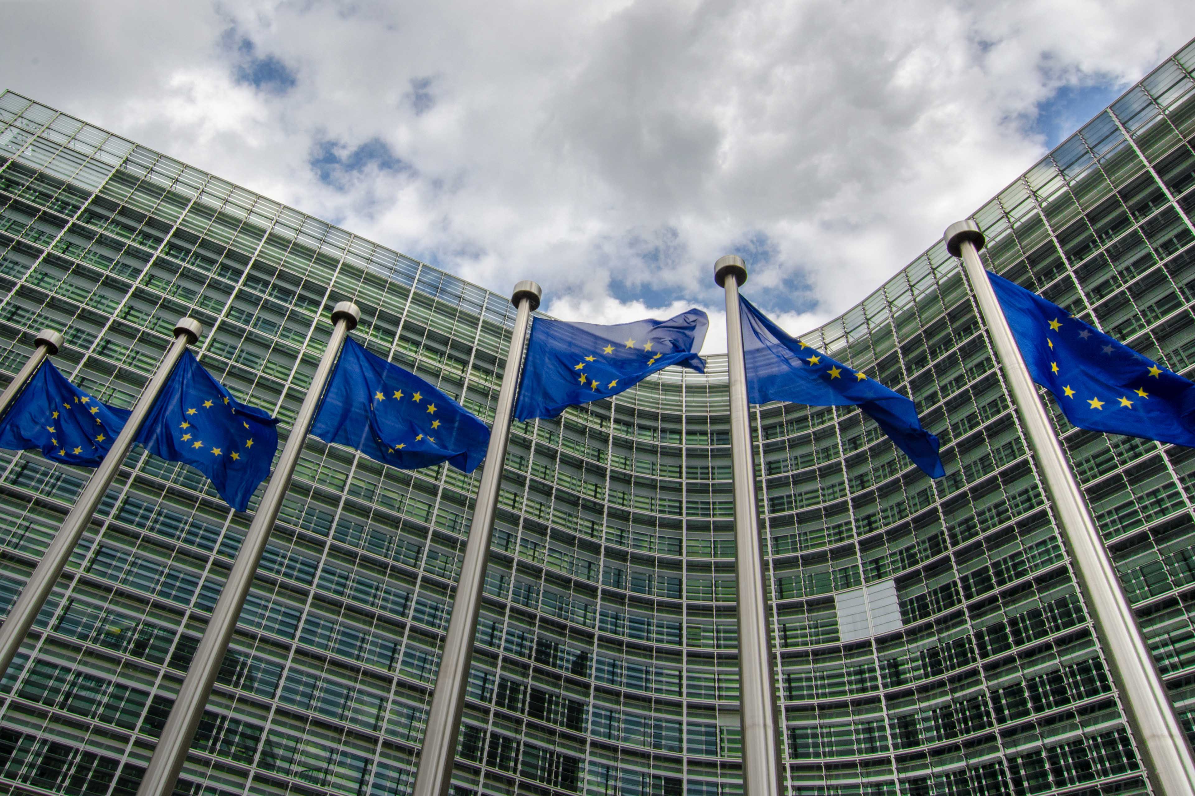
Projects EU DRR Regional risk modelling and scenario analysis for EU Member States - Seismic risk analysis and exposure data Versión en español English version Share Facebook LinkedIn Overview Anchor 6 Background This project supports the World Bank Technical Assistance project "Economic Analysis of Prevention and Preparedness in European Union Member States and Countries under EU Civil Protection Mechanism". The GEM Risk Team provides exposure and probabilistic seismic risk assessments for the 27 EU member states and 6 participating states, building upon the EFEHR ESHM20 hazard and ESRM20 exposure datasets [insert link www.efehr.org ], adding educational and healthcare building stock, and forecasting exposure to 2050. Further, retrofitted vulnerability curves are derived to inform the seismic impact analyses and a cost-benefit analysis. Duration: 2020-2021 Objectives The project is conducted in collaboration with the European Commission’s (EC) Directorate-General for European Civil Protection and Humanitarian Aid Operations (DG ECHO). The objectives of this project are to: 1. Provide regionally-consistent probabilistic seismic risk metrics across Union Civil Protection Mechanism (UCPM) countries for population and selected structure types, to inform macro-economic analysis that is to be conducted by the World Bank project team. 2. Provide seismic impact analysis for two selected earthquake scenarios with and without specified DRM intervention, to estimate the impact of that intervention on i) loss due to direct damage and ii) fatalities. This will contribute to cost-benefit analysis of EU-funded DRM investments conducted by the WB project team using the Triple-Dividend framework. Collaborators GEM Foundation Funding partner: World Bank Group Locations EU Member States Anchor 1 Anchor 5 Anchor 4 Anchor3 Publications
- TREAD | Global Earthquake Model Foundation
Projects TREAD daTa and pRocesses in sEismic hAzarD Versión en español English version Share Facebook LinkedIn Overview Anchor 6 Background GEM is one of the partners of the Marie Skłodowska-Curie Actions (MSCA) funded TREAD project, which involves a consortium of 14 academic institutions and 8 private partners of the highest scientific level from 7 European countries. TREAD will train a new generation of seismic hazard scientists to tackle the challenges of earthquake forecasting in complex tectonic contexts such as the Europe and Mediterranean regions. During the 4 year project GEM will host and supervise two PhD students, one working with the hazard team and the other with the risk team, on the following topics: 1. Modelling distributed seismicity under innovative approaches (under joint supervision with the University of Milano, Bicocca, 2. Assessment of the impact of advanced seismic hazard modelling approaches on earthquake risk (under joint supervision with the University of Chieti-Pescara) More information at https://tread-horizon.eu/ . Duration: 2023-2027 Objectives The aim of TREAD is to train a new generation of seismic hazard scientists to tackle the challenges of earthquake forecasting in complex tectonic contexts such as the Europe and Mediterranean regions. A change of paradigm in seismic hazard is necessary to be able to fully account for the specific properties of earthquake source and seismic modes in those areas. For example, to calculate the probability of having multiple earthquake ruptures, the interaction between active faults across various space-time scales needs to be accounted for, as well as the effects of stress transfer and fault-fluid interaction in earthquake triggering. TREAD objectives are: 1) Developing a novel integrative approach to seismic hazard analysis in Europe and the Mediterranean by bridging the gap from small-scale laboratory experiments to large-scale observations. 2) Establishing physics-based earthquake modelling by linking computational modelling of earthquakes from millions of years to fractions of a second. 3) Transferring earthquake geology and computational modelling to hazard and risk assessment adapted to the needs of government, industry and scientific stakeholders. Collaborators University of Chieti-Pescara, CNRS, University of Utrecht, GEM Foundation, University of Grenoble Alps, Ludwig Maximilians University, University of Barcelona, University of Padova, ETH Zurich, IRSN, OGS, INGV, Ruhr University Bochum, IPGP, Helmholz Centre, Willis, IFP, EDF, University of Milan Bicocca, Munich Re, TNO, Tre Altamira, University D'Aix Marseille Funding partner: Marie Skłodowska-Curie Actions (MSCA), European Commission Location Pavia, Italy Anchor 1 Anchor 5 Anchor 4 Anchor3 Publications
- BACK TO NORMAL | Global Earthquake Model Foundation
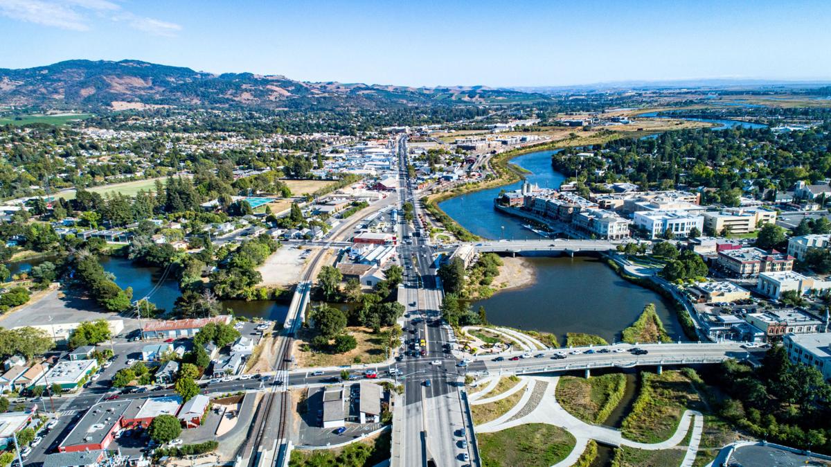
Projects BACK TO NORMAL Earthquake Recovery Modelling Versión en español English version Share Facebook LinkedIn Overview Anchor 6 Background To address some of the key factors that influence recovery following a potentially devastating earthquake, the Alfred E. Alquist Seismic Safety Commission (SSC) engaged the GEM (Global Earthquake Model) Foundation and the University of California at Los Angeles (UCLA), Department of Civil and Environmental Engineering, a) to develop a methodology and an open-source and transparent software tool to estimate recovery states and recovery times following an earthquake; and b) to investigate the effect of external socio-economic factors on these recovery times. Objectives This project achieved the following main objectives: 1. Development of a user-friendly, non-commercial and transparent software tool, herein referred as the Integrated Risk Modelling Toolkit (IRMT), to make map-based comparisons showing the effect of different resilient actions on the recovery times. 2. Development of an analytic methodology, referred as the Reconstruction Recovery Model, to estimate post-earthquake recovery 3. Integration of the Reconstruction Recovery Model for practical use into GEM’s OpenQuake modelling platform. 4. Demonstration of reasonable results by using the methodologies to model past earthquakes. In this context, the 2014 M6 South Napa Earthquake was used as a case study. Collaborators Department of Civil and Environmental Engineering at the University of California at Los Angeles (UCLA) Location California, United States Anchor 1 Anchor 5 Anchor 4 Anchor3 Publications
- CAREC Phase II | Global Earthquake Model Foundation
Projects CAREC Phase II CAREC Phase II: Developing a Disaster and Climate Risk Transfer Facility in the Central Asia Regional Economic Cooperation Region Versión en español English version Share Facebook LinkedIn Overview Updates Anchor 6 Overview This project builds upon the modelling and analytical work conducted under TA-9878 ( https://www.globalquakemodel.org/proj/carec ) and involves the preparation and implementation of a pilot disaster relief bond (DRB) that will be issued by the Asian Development Bank (ADB) for two countries, namely, the Kyrgyz Republic and Tajikistan. The pilot DRB will complement existing climate and disaster risk financing tools and will be structured to encourage the adoption of risk-reduction and climate-adaptation actions. It will also direct relief assistance to the most vulnerable groups, including women and small and medium-sized enterprises, through pre-agreed response plans developed with the pilot countries. GEM's contribution to the project includes: Build upon the work conducted under TA-9878, review modeling to ensure that it is up-to-date and aligned with the pilot countries’ and investors’ expectations Update exposure data for the two pilot countries based on updated housing and socio-economic data Update seismic hazard and risk modelling for the two pilot countries to serve as the basis for the DRB structuring and placement Undertake historical events analysis for the two pilot countries, considering all potentially damaging events since 1907 Provide earthquake model outputs required to determine the trigger form, level of coverage, and size and positioning of the DRB (when the policy attaches, detaches and how much it pays), in close consultation with WTW, Munich Re, Verisk, ADB, and the pilot countries Update the earthquake data underlying the user-friendly graphic interface developed in the previous CAREC project for the two pilot countries, to help illustrate modeling results and cost-benefits of the risk transfer options as well as disaster risk reduction measures, allowing capacity building, facilitating consultation workshops and supporting the decision process Support the preparation of knowledge products on earthquake risk modeling and financing Duration: 2025-2026 Objectives Key objectives involved: Review existing risk modelling for earthquakes in the Kyrgyz Republic and Tajikistan, and update and perform more detailed and granular risk modeling, as required; Conduct dynamic risk analysis to estimate capital requirements, reinsurance options, and the impacts of various historical or possible future scenarios on the facility’s operations; Support capacity building workshops to enhance countries’ understanding of disaster risk, including insurance solutions, and the process required for making informed disaster risk financing decisions; and Provide modeling outputs through a transparent and user-friendly interface/tool to inform the terms and design of the facility’s initial product offering, ensuring that is both relevant to the countries and financially sustainable over the longer term. Collaborators Collaborators: Willis Towers Watson (WTW), GEM Foundation, Munich Re, Verisk Funding partner: Asian Development Bank (ADB) Location Kyrgyz Republic Tajikistan Anchor 1 Anchor 5 Anchor 4 New ADB Program to Help Kyrgyz Republic and Tajikistan Respond to Disasters The Asian Development Bank (ADB) has approved a $56.4 million program to help the Kyrgyz Republic and Tajikistan boost their capacity to respond to disasters. Both countries are vulnerable to disasters, such as earthquakes and floods, but lack the fiscal capacity and risk transfer mechanisms to effectively respond to hazards. The Risk-Layered Disaster Relief Finance Program will enhance their financial preparedness through a combination of two pre-arranged ADB financing instruments targeting different layers of disaster risks. Project Data Sheet Asian Development Bank (ADB) project materials - overview, project details, documents. Anchor3 Publications
- Project locations world map | GEM Foundation
Close Completed Location Ongoing
- PAPERS | Global Earthquake Model Foundation
Projects PAPERS Piattaforma Analisi Pericolosità E Rischio Sismico Versión en español English version Share Facebook LinkedIn Overview Anchor 6 Background The Global Earthquake Model (GEM) Foundation has launched the PAPERS project (Piattaforma Analisi Pericolosità E Rischio Sismico), an initiative aimed at developing a new WebGIS platform for scenario hazard and risk assessment in Italy. The project has been funded as one of the cascade grants launched by the High-Performance Computing, Big Data e Quantum Computing Research Centre, one of the five National Centres established by the Italian National Recovery and Resilience Plan (NRRP), under Spoke 5 - Environment and Natural Disasters . The first training workshop of the project related to the use of the OpenQuake engine was successfully conducted online on April 1st, 2025, marking the first in a series of planned training events. This first workshop also served for exploring potential third-party contributions to models that could be integrated into the platform. Objectives PAPERS will enhance seismic risk assessment in Italy through advanced computational techniques and open-source models and tools. The project is organised into three modules, each focusing on a critical objective. The first module involves building the operational platform, leveraging the OpenQuake (OQ) Engine. The integration of High-Performance Computing (HPC) will facilitate complex analyses, while interoperability with external software will streamline data management. The second module focuses on updating Italy’s national exposure models. This involves compiling databases of buildings, critical infrastructure, and distributed networks at different geographic scales in the country. The project will integrate existing models with newly available datasets. This effort will provide a more comprehensive understanding of the seismic vulnerability of the Italian-built environment. As part of the third module, the platform will feature preloaded models of seismic hazard, exposure, and vulnerability, along with a range of earthquake scenarios, including historical earthquakes and events from a stochastic catalog based on the 2020 European Seismic Hazard Model (ESHM20). Alternative risk mitigation strategies will also be explored through dedicated multi-criteria decision-making approaches. Collaborators Project Coordination: Fondazione GEM (Global Earthquake Model Foundation) Main Collaborating Institution: Università degli Studi di Bari Aldo Moro Funding Agency: The project is funded under the Italian National Recovery and Resilience Plan (PNRR), Mission 4, "Education and Research" - Component 2, "From Research to Business" - Investment Line 1.4, supported by NextGenerationEU. Locations Pilot Site for Seismic Risk Analysis: An Italian city to be determined during the project, intended as a demonstration case for urban-scale seismic risk analysis. Testing Locations: The project will involve data collection and analysis on a national scale across Italy. Anchor 1 Anchor 5 Anchor 4 Anchor3 Publications
- AELO | Global Earthquake Model Foundation
Projects AELO ASCE Earthquake Loads Overseas (AELO) Versión en español English version Share Facebook LinkedIn Overview Anchor 6 Background The project is carried out within a collaboration between GEM and the U.S. Geological Survey (USGS) and is sponsored by the U.S. Department of State (DoS) and the U.S. Department of Defence (DoD). The aim of the project is to provide a web service for computing design ground motions (on rock and soil) that are compliant with the ASCE guidelines (ASCE 7-16, ASCE 41-17, ASCE 7-22, ASCE 41-23) for 500 locations worldwide. In its inaugural year, AELO focuses on rigorously calculating seismic parameters, including Peak Ground Acceleration (PGA), Ss, and S1 design values across 500 diverse global locations, particularly emphasizing rock site conditions. This aims to ensure compliance with ASCE7-16 and ASCE41-17 standards, essential for seismic assessment and design practices. In the following year, the project progresses to establish a secure webservice for computing design ground motions. This password-protected platform will provide access to ASCE7-16 and ASCE41-17 aligned calculations, simplifying access to these critical seismic design parameters. Transitioning into the third year, AELO expands its computational scope to encompass ground motion calculations across various soil conditions worldwide, encompassing 500 locations to adhere to ASCE 7-22 and ASCE 41-23 standards. This phase seeks to enhance the breadth of seismic assessments, offering a comprehensive understanding of seismic hazards on diverse soil types. Finally, in its fourth year, the project concludes with the introduction of a sophisticated, password-protected webservice. This platform offers the capability to compute design ground motions based on the latest ASCE7-22 and ASCE41-23 standards, supporting seismic engineers and researchers globally by providing accurate, standardized, and essential seismic design parameters for diverse geographical locations. Duration: 2022 - 2026 Objectives The primary objective of the project is to create a web service capable of calculating design ground motions, both on rock and soil, in adherence to the American Society of Civil Engineers (ASCE) guidelines. These guidelines include ASCE 7-16, ASCE 41-17, ASCE 7-22, and ASCE 41-23. This web service heavily relies on the hazard models that are part of GEM’s global mosaic and the OpenQuake Engine. Collaborators GEM, the U.S. Geological Survey (USGS), with support from the U.S. Department of State (DoS) and the U.S. Department of Defense (DoD). Location Global (Washington DC, USA) Anchor 1 Anchor 5 Anchor 4 Anchor3 Publications
- WB-Istanbul | Global Earthquake Model Foundation
Projects WB-Istanbul Seismic impact scenarios for Istanbul Versión en español English version Share Facebook LinkedIn Overview Anchor 6 Background Türkiye is situated in a seismically active region, with a history of significant earthquakes that have led to substantial loss of life, economic disruption, and damage to infrastructure. The country's rapid urbanization and the presence of numerous buildings constructed before the introduction of modern building codes contribute to its vulnerability to seismic events. Istanbul, Türkiye’s largest city, is of particular concern due to its high population density, economic significance, and the potential impact of a major earthquake. The city has a mix of old and new structures, with many residential buildings constructed before the year 2000, when the country's modern building codes were introduced. These older structures are often not designed to withstand significant seismic forces, making them particularly susceptible to damage or collapse in the event of an earthquake. Given this context, there is a critical need to understand the costs associated with retrofitting and reconstructing buildings to meet current seismic safety standards. The World Bank was interested in preparing accurate unit cost estimations for both reconstruction and retrofitting scenarios. Such estimations are essential for planning, budgeting, and implementing risk reduction activities. Additionally, preparing seismic impact scenarios for Istanbul is imperative to quantify the potential post-earthquake recovery and reconstruction costs, identify the most vulnerable structures, and inform prioritization of interventions that can mitigate the risks posed by earthquakes. Duration: 2024 Objectives The objectives of this Consultancy were: Provide information on the cost per square meter (USD) for reconstruction and various retrofitting options in the case of Türkiye for pre-2000 residential buildings, considering emerging information from the 2023 earthquakes on building performance/vulnerability. Provide seismic impact scenarios for the Istanbul metropolitan area, with disaggregated information on building types, building age, and spatial areas, considering at least four different earthquake scenarios. The analysis was expected to consider damage estimates (considering pre-earthquake costs), as well as recovery and reconstruction costs that consider build back better, emergency response costs, surge pricing, etc. Collaborators Collaborators: GEM Foundation Funding partner: World Bank Group Anchor 1 Anchor 5 Anchor 4 Anchor3 Publications