Thanks for submitting!
You will be contacted as soon as possible


QUICK LINKS


PROFILES
PUBLICATIONS
EXPOSURE
VULNERABILTY
SOFTWARE
EQ MODELS
Search Results
Search this site
1170 results found with an empty search
- Assessing seismic hazard of the East African Rift: a pilot study from GEM and AfricaArray | GEM Foundation
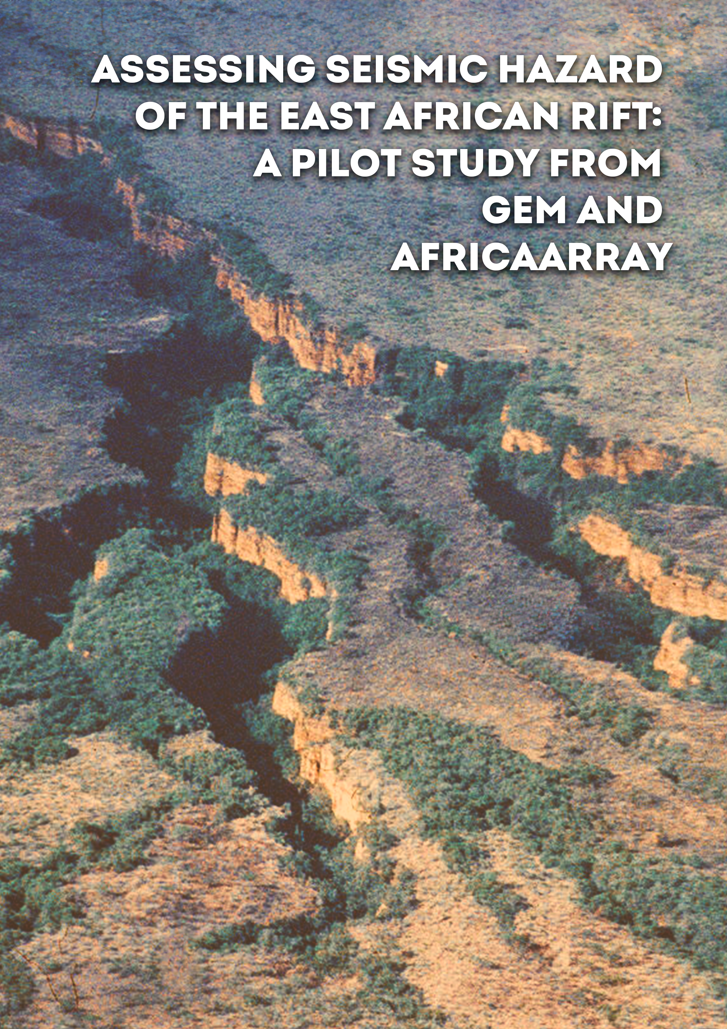
Publications Assessing seismic hazard of the East African Rift: a pilot study from GEM and AfricaArray Share Facebook LinkedIn Download 2017 | Peer-reviewed The East African Rift System is the major active tectonic feature of the Sub-Saharan Africa region. Although the seismicity level of this divergent plate boundary can be described as moderate, several damaging earthquakes have been reported in historical times, and the seismic risk is exacerbated by the high vulnerability of the local buildings and structures. Formulation and enforcement of national seismic codes is therefore an essential future risk mitigation strategy. Nonetheless, a reliable risk assessment cannot be done without the calibration of an updated seismic hazard model for the region. A major limitation affecting the assessment of seismic hazard in Sub-Saharan Africa is the lack of basic information needed to construct source and ground motion models. The historical earthquake record is sparse, with significant variation in completeness over time across different regions. The instrumental catalogue is complete down to sufficient magnitude only for a relatively short time span. In addition, mapping of seismogenically active faults is still an on-going task, and few faults in the region are sufficiently constrained as to allow them to be directly represented within the seismic hazard model. Recent studies have identified major seismogenic lineaments, but there is substantial lack of kinematic information for intermediate-to-small scale tectonic features, information that is essential for the proper calibration of earthquake recurrence models. In this study, we use new data and Global Earthquake Model (GEM) computational tools such as the Hazard Modeller’s Toolkit and the OpenQuake engine to perform a pilot study of the seismic hazard associated with the East African Rift. The hazard model obtained has been created using the most recent information available from scientific literature, global bulletins and local earthquake catalogues, including those from AfricaArray projects. In this report, in accordance with the GEM philosophy, we describe in detail all working assumptions, main processing steps, data analyses and interpretations used for the model setup.
- Request demo for South America Hazard | GEM Foundation
You have chosen to request a demo on: South America Hazard First Name Last Name Email Company or Institution Name Country Sector Provide Details I accept the license terms and the conditions of products use. Email us at product@globalquakemodel.org if you're experiencing problems submitting this form or if you have any inquiries. Thank you. Request Thanks for submitting! You will be contacted as soon as possible Add answer here
- Successful GEM Industry Event at Zurich Insurance’s Quai Zurich Campus - GEM Foundation
News Successful GEM Industry Event at Zurich Insurance’s Quai Zurich Campus By: Oct 9, 2024 Sep 5, 2024 Share Facebook LinkedIn On September 5th, 2024, over 30 participants from Zurich-based companies and academic institutions gathered for the Global Earthquake Model (GEM) Foundation’s industry event, hosted by Zurich Insurance at its Quai Zurich campus. The agenda featured presentations from leading experts, including GEM's Secretary General Helen Crowley, Vitor Silva, Head of Risk Engineering, Marco Pagani, Head of Seismic Hazards, and Andrés Abarca, Product Manager. Their discussions highlighted the scientific work behind GEM's models, focusing on how the findings can be applied to products and services of importance to both humanitarian efforts and commercial initiatives. Attendees gained valuable insights into GEM's cutting-edge tools and data, which are designed to inform risk assessment practices across various sectors. GEM expresses gratitude to all attendees for their participation and contributions, which were instrumental in making the event a success. The organization looks forward to continued collaboration in advancing the field of earthquake risk assessment in Switzerland and beyond. ## No images found. GALLERY 1/8 VIDEO RELATED CONTENTS
- Japan Hazard | Global EarthQuake Model Foundation
OpenQuake engine input model to perform hazard calculations for Japan Products Japan Hazard OpenQuake engine input model to perform hazard calculations for Japan Share Facebook LinkedIn Description The v2021 model for Japan was based on the 2014 seismic hazard model issued by the Headquarters for Earthquake Research Promotion (HERP). The model is described by Fujiwara et al. (2009), Fujiwara et al. (2015), and Fujiwara et al. (2023). The v2025 model has been developed by the National Research Institute for Earth Science and Disaster Resilience (NIED) and will be publicly released at the end of 2025. The models have been translated from its original format into the OpenQuake (OQ) engine within a collaboration between the National Research Institute for Earth Science and Disaster Resilience (NIED) of Japan, and GEM. How to cite this work The v2025.0.0 model, by N. Morikawa and A.Iwaki, has not yet been published. The v2021 version of the model can be cited as follows: Fujiwara, H., Kawai, S., Aoi, S., Morikawa, N., Senna, S., Kudo, N., Ooi, M., Hao, K. X., Wakamatsu, K., Ishikawa, Y., Okumura, T., Ishii, T., Matsushima, S., Hayakawa, Y., Toyama, N. and Narita, A. (2009). Technical reports on national seismic hazard maps for Japan, Technical Note of the National Research Institute for Earth Science and Disaster Resilience, No. 336, 512 pp. Fujiwara, H., Morikawa, N., Kawai, S., Aoi, S., Senna, S., Maeda, T., Azuma, H., Hao, K. X., Iwaki, A., Wakamatsu, K., Imoto, M., Hasegawa, N., Okumura, T., Hayakawa, T., Takahashi, M. (2015). Improved seismic hazard assessment after the 2011 great East Japan earthquake,” Technical Note of the National Research Institute for Earth Science and Disaster Resilience, No. 399 Fujiwara, H., Morikawa, N., Maeda, T., Iwaki, A., Senna, S., Kawai, S., Azuma, H., Hao, X., Imoto, M., Wakamatsu, K., Miyakoshi, J., Morii, T., Shimazu, N., Takahashi, M. and Akatsuka, M. (2023). Improved seismic hazard assessment after the 2011 great East Japan earthquake (Part 2). Technical Note of the National Research Institute for Earth Science and Disaster Resilience, No. 489 Available Versions The latest available version (v2021.0.0) translated from its original format into the OpenQuake engine by NIED and GEM can be requested by clicking on the "License Request", where a specific license will be provided, depending on the use case. Instead, the v2025.0.0 model can be requested from NIED (http://www.j- shis.bosai.go.jp/en) License information Currently, only the v2021 model is available under a restricted license that has to be tailored for each specific use case. Please click on "License Request". Those that are interested in the v2025.0.0 model should contact NIED. Facebook LinkedIn Share Latest Version v2025.0.0 License Custom license Available resources License Request Documentation License Request text Map View Search Popup title Close Country/Region Available Resources Afghanistan Exposure Africa Exposure Alaska Exposure Country/Region Available Resources Afghanistan Vulnerability Africa Vulnerability Alaska Vulnerability Country/Region Resource Url Afghanistan Risk Profile Africa Risk Profile Alaska Risk Profile Search Found Country/Region Resource Url Afghanistan Exposure Africa Exposure Alaska Exposure Preview Preview is not available. Search Found Country/Region Resource Url Afghanistan Vulnerability Africa Vulnerability Alaska Vulnerability Preview Preview is not available. Search Found Country/Region Resource Url Afghanistan Risk Profile Africa Risk Profile Alaska Risk Profile Preview Preview is not available. Related products Global Liquefaction Hazard Global Exposure Model Global Vulnerability Model Global Seismic Embodied Carbon Risk Global Seismic Risk Map Country-Territory Seismic Risk Profiles Model Builder's Toolkit (oq-mbtk) Global Seismic Hazard Map Related publications Appraising the PSHA earthquake source models of Japan, New Zealand, and Taiwan Read More For downloading or accessing detailed product information like PNG/PDF maps, datasets, license request, shapefiles and more, please switch to a desktop or laptop computer. Thank you for your understanding.
- ATLAS 2.0: Ground-shaking intensities at multiple return periods all over the world | GEM Foundation
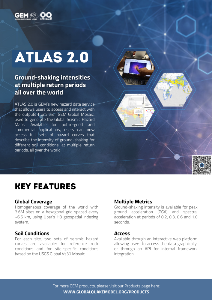
Publications ATLAS 2.0: Ground-shaking intensities at multiple return periods all over the world Share Facebook LinkedIn Download 2024 | Brochure ATLAS 2.0 is GEM’s new hazard data service that allows users to access and interact with the outputs from the GEM Global Mosaic, used to generate the Global Seismic Hazard Maps. Available for public-good and commercial applications, users can now access full sets of hazard curves that describe the intensity of ground-shaking for different soil conditions, at multiple return periods, all over the world.
- Global Earthquake Model (GEM): Status, perspectives and use cases - GEM Foundation
News Global Earthquake Model (GEM): Status, perspectives and use cases By: Mar 12, 2019 Share Facebook LinkedIn John Schneider, Secretary General (GEM) presented an update on the development of GEM's global earthquake hazard and risk model and other applications during this year’s edition of the OASIS Conference: The Good, The Bad and The Ugly. The annual conference, which focuses on issues in catastrophe risk modelling for application to the insurance and risk financing sector, attracted over 200 participants from across public, private and academic institutions to the event held in London from September 13-14, 2018. In particular, John’s presentation highlighted an overview of the Global Earthquake Model which will be completed and launched in December, and results of a pilot project to deploy a GEM risk model using the OASIS Loss Modelling Framework. Paul Henshaw, GEM Director of Technology and Development who was also present at the conference, noted particular excitement among participants in GEM’s new models, with particular interest in GEM’s open and transparent approach in model development. “The OASIS conference was an excellent forum for us to demonstrate not just GEM’s products but also how GEM is delivering information and products of value to the industry,” John said. Joerg Steffensen, Hannover Re General Manager of Group Risk Management Modelling, and concurrent GEM Governing Board member presented a user's perspective on the application of GEM's OpenQuake tools and risk models. He highlighted that GEM’s full model transparency on data, assumptions and parameterizations perfectly meets the demand of new initiatives, markets and consumers of Hannover Re and is in line with expectations and interests of the industry. Paul Della Marta, Head of Catastrophe Research, PartnerRe and GEM Governing Board Advisor, presented valuable perspectives on risk modelling transparency sensitivity analysis, in respective sessions. In addition, based on his conversations with many participants, Paul said “there is increasing interest in the cat risk community to work with, and support GEM and to use GEM’s models and tools to help inform their view of risk. We are looking forward to the pending completion of the global model in a few months time.” The 2-day conference concluded with a panel discussion on the future of Cat modelling emphasizing the implications of technology for model developers and users, and how it will affect the way models are developed, calibrated and validated. No images found. GALLERY 1/0 VIDEO RELATED CONTENTS
- Global Seismic Risk Map | Global EarthQuake Model Foundation
Global earthquake risk, mapped with the latest science Products Global Seismic Risk Map Global earthquake risk, mapped with the latest science Share Facebook LinkedIn Description The v2026.1 Global Seismic Risk Model covers economic losses, number of buildings destroyed, built-up area destroyed, fatalities, population rendered homeless, and equivalent embodied carbon loss. The main seismic risk map presents the geographic distribution of the average annual number of buildings destroyed due to earthquake ground shaking across the residential, commercial, and industrial building stock. The assessment does not account for secondary earthquake- triggered hazards, such as tsunamis, liquefaction, landslides, or post-earthquake fires. Economic losses represent the direct physical impacts of earthquakes. These results are an update of the global maps released in 2018, as described in Silva et al. (2020), and those released in 2023, and are based on best available and publicly accessible datasets and models, which have been collected, curated and maintained in collaboration between local experts and GEM Foundation scientists. The underlying dataset used to create the main map can be requested as a shapefile for use in research and public-good applications without cost, or for a licensing fee in the case of commercial applications. How to cite this work If you make use of this work, please cite both the publication and the poster. Publication: Silva, V.; Amo-Oduro, D.; Calderon, A, et al. (2020) Development of a global seismic risk model, Earthquake Spectra, vol. 36, no. 1_suppl, 2020, pp. 372–394. https://journals.sagepub.com/doi/abs/10.1177/8755293019899953 Poster: Silva V, Aljawhari K, Baiguera M, Calderon A, Caruso M, Costa C, Crowley H, González D, Nafeh AMB, Rao A, Yepes-Estrada C (2026). Global Earthquake Model (GEM) Seismic Risk Model Map (version 2026.1), https://doi.org/10.5281/zenodo.20208596 Available Versions A PDF poster, as well as a set of high-resolution PNGs with each of the risk metrics calculated globally, is available for direct download under a CC BY-SA license. If your use case does not meet the open license requirements, or if you are interested in obtaining the underlying dataset as a shapefile, please submit a request in our system by clicking on the "License Request", where a specific license will be provided, depending on the use case. Additionally, users interested in the previous versions of the Global Seismic Risk Maps can access these from the table at the bottom of this page. License information The downloadable resources are available under a Creative Commons CC BY-SA 4.0 license, which requires: Attribution (you must give appropriate credit, provide a link to the license, and indicate if changes were made) ShareAlike (derivatives created must be made available under the same license as the original) Any deviation from these terms incur in license infringement and requires a license agreement that must be made tailored to your use case, in such instance please click on "License Request". Facebook LinkedIn Share Latest Version v2026.1 License CC BY-SA 4.0 Available resources Geoviewer PNG Poster Download Documentation License Request Contributors Acknowledgements Map View Search Popup title Close Country/Region Available Resources Afghanistan Exposure Africa Exposure Alaska Exposure Country/Region Available Resources Afghanistan Vulnerability Africa Vulnerability Alaska Vulnerability Country/Region Resource Url Afghanistan Risk Profile Africa Risk Profile Alaska Risk Profile Search Found Country/Region Resource Url Afghanistan Exposure Africa Exposure Alaska Exposure Preview Preview is not available. Search Found Country/Region Resource Url Afghanistan Vulnerability Africa Vulnerability Alaska Vulnerability Preview Preview is not available. Search Found Country/Region Resource Url Afghanistan Risk Profile Africa Risk Profile Alaska Risk Profile Preview Preview is not available. Previous Product Versions Version Number Data Image Poster Documentation Geoviewer v2018.1 N/A N/A PDF Silva et al. (2020) View v2023.1 Repository PNG PDF Read View Related products Global Liquefaction Hazard Global Exposure Model Global Vulnerability Model Global Seismic Embodied Carbon Risk Global Seismic Risk Map Country-Territory Seismic Risk Profiles OpenQuake Engine Global Seismic Hazard Map Related publications Development of a global seismic risk model Read More For downloading or accessing detailed product information like PNG/PDF maps, datasets, license request, shapefiles and more, please switch to a desktop or laptop computer. Thank you for your understanding.
- News Briefs: October - December 2025 - GEM Foundation
News News Briefs: October - December 2025 By: Dec 16, 2025 Dec 18, 2025 Share Facebook LinkedIn The GEM Foundation continues to expand its global outreach through active participation in international conferences, training workshops, and governance meetings. These engagements highlight GEM's ongoing efforts to advance seismic risk reduction, strengthen collaboration with key global partners, and contribute to the development of innovative risk assessment tools. In this section, we bring you the latest updates from GEM’s involvement in these various events. GEM joins Overture Maps Foundation The Global Earthquake Model (GEM) Foundation became a contributing member of the Overture Maps Foundation on 7 November 2025, following the acceptance of its application. Overture Maps Foundation is a collaborative initiative that brings together organisations to develop and maintain open, interoperable global map datasets, including building and infrastructure data. As a non-profit member, GEM will participate in Overture’s working groups and task forces, supporting collaboration on global building datasets relevant to seismic exposure modelling. The membership aligns with GEM’s ongoing work to improve the quality, consistency and transparency of global exposure data used in seismic risk assessment. Through this engagement, GEM aims to contribute to and benefit from shared efforts to advance open geospatial data for risk-informed decision-making. PHIVOLCS becomes first information partner for GEM Learning Centre The Global Earthquake Model (GEM) Foundation has received formal consent from the Philippine Institute of Volcanology and Seismology (PHIVOLCS) to feature publicly available information from its official website on GEM’s forthcoming Learning Centre. The Philippines will serve as one of the pilot country pages for the Learning Centre, which is being developed as a web-based educational platform to share earthquake science, hazard information, preparedness resources and examples of disaster risk reduction practice. PHIVOLCS will be acknowledged as an information and contribution partner, with all materials properly cited and linked to their original sources. The collaboration marks an initial step in GEM’s plans to expand accessible, science-based learning resources for diverse audiences. First OpenQuake Engine certifications awarded The Global Earthquake Model (GEM) Foundation has issued the first OpenQuake Engine certifications, marking the launch of a new accreditation initiative linked to structured OpenQuake training. The certification page went live on 10 October 2025, providing a dedicated platform for issuing and verifying credentials. Certificates were awarded on 12 September 2025 to 17 participants who successfully completed the Scenario Analysis course at the GEM–EGU Summer School on GeoHazards Risk, held from 8 to 12 September 2025 at the University of Aveiro, Portugal. Each certificate is issued with a unique, verifiable URL, allowing participants to reference their certification directly, including on professional profiles such as LinkedIn. The initiative supports GEM’s efforts to recognise technical competence in the use of OpenQuake tools and to promote consistent and transparent application of seismic hazard and risk methodologies. OpenQuake training delivered at EDF/CEA GEM staff delivered an OpenQuake training at EDF/CEA Training in Aix-en-Provence, France, supporting capacity building in seismic hazard and risk assessment. The training was led by Marco Pagani, Head of Seismic Hazards, Michele Simionato, Senior Software Developer, and Christopher Brooks, Seismic Hazard Scientist, who introduced participants to OpenQuake methodologies and workflows relevant to hazard and risk analysis. The activity forms part of GEM’s ongoing engagement with technical and institutional partners to support the application of open, science-based tools in operational contexts. GEM expertise shared at IAEA workshop on seismic hazard assessment GEM participated in the IAEA International Workshop on Seismic Hazard Assessment of Nuclear Installation Sites in Low Seismicity Regions, held in Brussels, Belgium, from 4 to 7 November 2025. The workshop brought together experts to discuss approaches and challenges in assessing seismic hazard for nuclear facilities in regions of low to moderate seismicity. GEM was represented by Marco Pagani, Head of Seismic Hazards, and Manuela Villani, Senior Seismic Hazard Scientist, who contributed to technical discussions during the training meeting organised by the International Atomic Energy Agency. EPOS Seismology and Geo-INQUIRE Workshop 2025 GEM participated in the EPOS Seismology and Geo-INQUIRE Workshop 2025: From Big and Novel Datasets to AI for Frontier Seismological Science and Services, held from 24 to 27 November 2025 at the National and Kapodistrian University of Athens, Greece. The workshop focused on the use of large and emerging datasets, including artificial intelligence methods, to advance seismological science and services. GEM was represented by Lana Todorović, Liquefaction and Landslide Modeller, and Vitor Silva, Head of Risk Engineering, who took part in discussions on data-driven approaches and their application to seismic hazard and risk assessment. The workshop was co-organised by EFEHR, ORFEUS and EMSC, with support from the Geo-INQUIRE project. GEM’s exposure modelling expertise featured at EU Science for Preparedness Conference GEM participated in the EU Science for Preparedness Conference, held in Turin, Italy, from 4 to 6 November 2025. The conference brought together experts from science, policy and crisis-response communities to examine how evidence-based knowledge can strengthen Europe’s capacity to anticipate and respond to disasters. Organised by the Copernicus Emergency Management Service (CEMS) and the Disaster Risk Management Knowledge Centre (DRMKC) of the European Commission’s Joint Research Centre, the event featured sessions on early-warning systems, impact modelling, exposure mapping and resilience planning. GEM was represented by Marco Baiguera, Exposure Analyst, who contributed to a session on the Global Human Settlement Layer (GHSL) by presenting GEM’s exposure modelling activities and their relevance for exposure mapping and risk-informed decision-making. Exposure modelling for global risk assessment presented at Human Planet Forum 2025 GEM participated in the Human Planet Forum 2025, held at the European Commission’s Joint Research Centre in Ispra, Italy, which brought together scientists, policymakers, UN agencies and practitioners to examine how open geospatial data can support disaster risk reduction, sustainability and societal resilience. Marco Baiguera, Exposure Analyst at GEM, presented how Earth observation datasets are being integrated into GEM’s exposure modelling to support seismic risk assessment. His presentation highlighted recent improvements in estimating building characteristics, increasing the spatial detail of exposure models, and developing scenarios of how populations and structures may evolve over time. A recording of the presentation is available via the event webcast, starting at 15:15:29. https://webcast.ec.europa.eu/geo-human-planet-forum-2025-25-11-20 Shake-table demonstration at EUCENTRE attended by GEM staff GEM staff took part in a technical shake-table demonstration at EUCENTRE, illustrating how buildings respond to strong ground shaking under different structural configurations. The demonstration used EUCENTRE’s six-degree-of-freedom shake table, with a payload capacity of 30 tonnes, to reproduce motions from the 1999 Chi-Chi earthquake (Mw 7.7) in Taiwan. The exercise highlighted how engineering design choices influence structural behaviour during earthquakes and reinforced the importance of accurate modelling, robust standards and informed decision-making for public safety. The demonstration also provided practical insight into the link between ground motion characteristics and structural response, supporting GEM’s ongoing work in seismic risk assessment and resilience. ## No images found. GALLERY 1761651862070.jfif 1761651862707.jfif IMG_1394.HEIC 1761651862070.jfif 1/39 VIDEO RELATED CONTENTS
- Request demo for Global EarthquakE ScEnarios (GEESE) | GEM Foundation
You have chosen to request a demo on: Global EarthquakE ScEnarios (GEESE) First Name Last Name Email Company or Institution Name Country Sector Provide Details I accept the license terms and the conditions of products use. Email us at product@globalquakemodel.org if you're experiencing problems submitting this form or if you have any inquiries. Thank you. Request Thanks for submitting! You will be contacted as soon as possible Add answer here
- Disaster Risk Reduction: The role of geological survey organizations (GSOs) in understanding risk and informing risk reduction actions - GEM Foundation
News Disaster Risk Reduction: The role of geological survey organizations (GSOs) in understanding risk and informing risk reduction actions By: Apr 11, 2023 Share Facebook LinkedIn Disaster Risk Reduction: The role of geological survey organizations (GSOs) in understanding risk and informing risk reduction actions The online forum, divided into three sessions held on February 6th (Enablers), February 13th (Science and Technology) and February 20th (Risk Management Goal), aimed at providing a high-level overview of the role of GSOs in disaster risk reduction, including strategies, awareness of and advocacy on hazards and risks, financial risk management, building codes, and early warning systems. The virtual event, organized by the World Community of Geological Surveys, NRCan, GEM Foundation and GNS New Zealand, was attended by more than 532 individuals from 97 countries. Keynote topics included an introduction to GSOs in Disaster Risk Reduction by Sahar Safaie (Sage On Earth Consulting); the Global tsunami early warning program and its cross-jurisdiction approach by Denis Chang Seng (Intergovernmental Oceanographic Commission); The evolution of earthquake building codes and recommended approaches for advancing building codes by Tunar Onur (Onur Seemann Consulting); and an Overview of the Global Earthquake Model and the lessons learned about partnerships at local, national, regional and global level by John Schneider (GEM Foundation). John’s presentation focused on GEM’s achievements built upon collaborations and partnerships at different geographic scales: Local - TREQ project to develop capacity for urban earthquake hazard and risk assessment in Quito, Santiago and Cali); Country - (national seismic risk model for Canada, earthquake risk assessment and retrofit scenarios for Türkiye and earthquake hazard model for the Philippines; Regional - European seismic hazard and risk model; and Global - global earthquake hazard and risk model. John emphasized that these multi-level engagements were guided by GEM principles (openness, credibility, collaboration and public good), and international drivers such as the Sendai Framework Agreement and Sustainable Development Goals. Two questions highlighted the Q&A portion of the GEM session: 1) why aren't risk models used every five years to audit whether progress is being made in risk reduction by measuring and reporting expected economic damages and casualties?, and 2) how might GEM’s exposure database be used in other applications such as for the risk assessments of other hazards or in post-disaster impact assessments? For the first question, John expressed that it’s an area the GEM ought to be striving to be able to do. He added that over short time periods, it's quite difficult to do and explained that “I think it’s possible to monitor things like changes in building stock, look at earthquakes that are happening historically, and compare over different time scales in different countries”. John further added, “I think we're getting to a point where this is becoming more possible - not only for earthquakes but also for other hazards - as we evolve our capabilities, as we get better at measuring risk and collecting the data. We will be able to use modeling tools together with observations to do exactly that in the future”. For the second question, John answered that GEM’s global exposure database can be used for other perils because it’s hazard agnostic. He explained that the database contains information about the fundamental properties of residential, commercial and industrial buildings, construction practices, economic data and other variables that can be used for exposure modelling for climate change, floods, storms and other natural hazards. To watch all the presentations and recordings, please visit the American Geosciences Institute YouTube channel . No images found. GALLERY 1/0 VIDEO RELATED CONTENTS