Thanks for submitting!
You will be contacted as soon as possible


QUICK LINKS


PROFILES
PUBLICATIONS
EXPOSURE
VULNERABILTY
SOFTWARE
EQ MODELS
Search Results
1074 results found with an empty search
- Global Earthquake Model Foundation | Italy
Global Earthquake Model Foundation: For a world that is resilient to earthquakes through earthquake hazard and risk assessment. Global Earthquake Model foundation Global Earthquake Model foundation For a world that is resilient to earthquakes and other natural hazards. For a world that is resilient to earthquakes and other natural hazards. presents presents GEM CONFERENCE 2026 GEM CONFERENCE 2026 From Faults to Future Scenarios From Faults to Future Scenarios FIND OUT MORE Global Earthquake Model foundation For a world that is resilient to earthquakes and other natural hazards. Latest RED ALERT Earthquake: 31st August 2025 M6.0 Afghanistan More Details What We Do Our purpose is to develop, together with the global community, scientific resources for transparent earthquake hazard and risk assessment, and to facilitate their application for risk management. PROVIDE Global standards for earthquake hazard and risk modelling. SUPPORT Partner with communities for disaster risk reduction STRENGTHEN Build capacity, especially in the Global South Latest Updates Conference GEM2026 Conference: Join us LIVE on YouTube on June 23rd! More Product ATLAS Online Now Available! More Workshop Mapping Exposure, Advancing Resilience: GEM’s One-Day Workshop More Available Seismic Hazard and Risk Models and Datasets By selecting a region in the global map below, a table will appear to quickly take you to the available resources in that region. You can also use the Search box to look up any specific region, country or territory. Popup title Close Country/Region North and South Korea Hazard Exposure Vulnerability Risk Profile Conterminous US Hazard Exposure Vulnerability Risk Profile Northwest Asia Hazard Exposure Vulnerability Risk Profile Northeast Asia Hazard Exposure Vulnerability Risk Profile Pacific Islands Hazard Exposure Vulnerability Risk Profile Hawaii Hazard Exposure Vulnerability Risk Profile Arabia Hazard Exposure Vulnerability Risk Profile Alaska Hazard Exposure Vulnerability Risk Profile Sub-Saharan Africa Hazard Exposure Vulnerability Risk Profile West Africa Hazard Exposure Vulnerability Risk Profile North Africa Hazard Exposure Vulnerability Risk Profile Tuvalu Hazard Exposure Vulnerability Risk Profile Uganda Hazard Exposure Vulnerability Risk Profile Ukraine Hazard Exposure Vulnerability Risk Profile United Arab Emirates Hazard Exposure Vulnerability Risk Profile United Kingdom Hazard Exposure Vulnerability Risk Profile United States of America Hazard Exposure Vulnerability Risk Profile Uruguay Hazard Exposure Vulnerability Risk Profile US Virgin Islands Hazard Exposure Vulnerability Risk Profile Uzbekistan Hazard Exposure Vulnerability Risk Profile Vanuatu Hazard Exposure Vulnerability Risk Profile Venezuela Hazard Exposure Vulnerability Risk Profile Vietnam Hazard Exposure Vulnerability Risk Profile Yemen Hazard Exposure Vulnerability Risk Profile Zambia Hazard Exposure Vulnerability Risk Profile Zimbabwe Hazard Exposure Vulnerability Risk Profile Africa Hazard Exposure Vulnerability Risk Profile Caribbean Central America Hazard Exposure Vulnerability Risk Profile Central Asia Hazard Exposure Vulnerability Risk Profile East Asia Hazard Exposure Vulnerability Risk Profile Europe Hazard Exposure Vulnerability Risk Profile Middle East Hazard Exposure Vulnerability Risk Profile North America Hazard Exposure Vulnerability Risk Profile North Asia Hazard Exposure Vulnerability Risk Profile Oceania Hazard Exposure Vulnerability Risk Profile South America Hazard Exposure Vulnerability Risk Profile South Asia Hazard Exposure Vulnerability Risk Profile Southeast Asia Hazard Exposure Vulnerability Risk Profile Palestine Hazard Exposure Vulnerability Risk Profile Panama Hazard Exposure Vulnerability Risk Profile Papua New Guinea Hazard Exposure Vulnerability Risk Profile Paraguay Hazard Exposure Vulnerability Risk Profile Peru Hazard Exposure Vulnerability Risk Profile Philippines Hazard Exposure Vulnerability Risk Profile Poland Hazard Exposure Vulnerability Risk Profile Portugal Hazard Exposure Vulnerability Risk Profile Puerto Rico Hazard Exposure Vulnerability Risk Profile Qatar Hazard Exposure Vulnerability Risk Profile Romania Hazard Exposure Vulnerability Risk Profile Russia Hazard Exposure Vulnerability Risk Profile Rwanda Hazard Exposure Vulnerability Risk Profile Saint Kitts and Nevis Hazard Exposure Vulnerability Risk Profile Saint Lucia Hazard Exposure Vulnerability Risk Profile Saint Vincent and the Grenadines Hazard Exposure Vulnerability Risk Profile Samoa Hazard Exposure Vulnerability Risk Profile Sao Tome and Principe Hazard Exposure Vulnerability Risk Profile Saudi Arabia Hazard Exposure Vulnerability Risk Profile Senegal Hazard Exposure Vulnerability Risk Profile Serbia Hazard Exposure Vulnerability Risk Profile Seychelles Hazard Exposure Vulnerability Risk Profile Sierra Leone Hazard Exposure Vulnerability Risk Profile Singapore Hazard Exposure Vulnerability Risk Profile Slovakia Hazard Exposure Vulnerability Risk Profile Slovenia Hazard Exposure Vulnerability Risk Profile Solomon Islands Hazard Exposure Vulnerability Risk Profile Somalia Hazard Exposure Vulnerability Risk Profile South Africa Hazard Exposure Vulnerability Risk Profile South Korea Hazard Exposure Vulnerability Risk Profile South Sudan Hazard Exposure Vulnerability Risk Profile Spain Hazard Exposure Vulnerability Risk Profile Sri Lanka Hazard Exposure Vulnerability Risk Profile Sudan Hazard Exposure Vulnerability Risk Profile Suriname Hazard Exposure Vulnerability Risk Profile Sweden Hazard Exposure Vulnerability Risk Profile Switzerland Hazard Exposure Vulnerability Risk Profile Syria Hazard Exposure Vulnerability Risk Profile Taiwan Hazard Exposure Vulnerability Risk Profile Tajikistan Hazard Exposure Vulnerability Risk Profile Tanzania Hazard Exposure Vulnerability Risk Profile Thailand Hazard Exposure Vulnerability Risk Profile Timor Leste Hazard Exposure Vulnerability Risk Profile Togo Hazard Exposure Vulnerability Risk Profile Tonga Hazard Exposure Vulnerability Risk Profile Trinidad and Tobago Hazard Exposure Vulnerability Risk Profile Tunisia Hazard Exposure Vulnerability Risk Profile Turkey Hazard Exposure Vulnerability Risk Profile Turkmenistan Hazard Exposure Vulnerability Risk Profile Turks and Caicos Islands Hazard Exposure Vulnerability Risk Profile Kiribati Hazard Exposure Vulnerability Risk Profile Kosovo Hazard Exposure Vulnerability Risk Profile Kuwait Hazard Exposure Vulnerability Risk Profile Kyrgyzstan Hazard Exposure Vulnerability Risk Profile Laos Hazard Exposure Vulnerability Risk Profile Latvia Hazard Exposure Vulnerability Risk Profile Lebanon Hazard Exposure Vulnerability Risk Profile Lesotho Hazard Exposure Vulnerability Risk Profile Liberia Hazard Exposure Vulnerability Risk Profile Libya Hazard Exposure Vulnerability Risk Profile Liechtenstein Hazard Exposure Vulnerability Risk Profile Lithuania Hazard Exposure Vulnerability Risk Profile Luxembourg Hazard Exposure Vulnerability Risk Profile Macao Hazard Exposure Vulnerability Risk Profile Madagascar Hazard Exposure Vulnerability Risk Profile Malawi Hazard Exposure Vulnerability Risk Profile Malaysia Hazard Exposure Vulnerability Risk Profile Mali Hazard Exposure Vulnerability Risk Profile Malta Hazard Exposure Vulnerability Risk Profile Marshall Islands Hazard Exposure Vulnerability Risk Profile Martinique Hazard Exposure Vulnerability Risk Profile Mauritania Hazard Exposure Vulnerability Risk Profile Mauritius Hazard Exposure Vulnerability Risk Profile Mexico Hazard Exposure Vulnerability Risk Profile Micronesia Hazard Exposure Vulnerability Risk Profile Moldova Hazard Exposure Vulnerability Risk Profile Monaco Hazard Exposure Vulnerability Risk Profile Mongolia Hazard Exposure Vulnerability Risk Profile Montenegro Hazard Exposure Vulnerability Risk Profile Montserrat Hazard Exposure Vulnerability Risk Profile Morocco Hazard Exposure Vulnerability Risk Profile Mozambique Hazard Exposure Vulnerability Risk Profile Myanmar Hazard Exposure Vulnerability Risk Profile Namibia Hazard Exposure Vulnerability Risk Profile Nauru Hazard Exposure Vulnerability Risk Profile Nepal Hazard Exposure Vulnerability Risk Profile Netherlands Hazard Exposure Vulnerability Risk Profile New Caledonia Hazard Exposure Vulnerability Risk Profile New Zealand Hazard Exposure Vulnerability Risk Profile Nicaragua Hazard Exposure Vulnerability Risk Profile Niger Hazard Exposure Vulnerability Risk Profile Nigeria Hazard Exposure Vulnerability Risk Profile Niue Hazard Exposure Vulnerability Risk Profile North Korea Hazard Exposure Vulnerability Risk Profile North Macedonia Hazard Exposure Vulnerability Risk Profile Northern Mariana Islands Hazard Exposure Vulnerability Risk Profile Norway Hazard Exposure Vulnerability Risk Profile Oman Hazard Exposure Vulnerability Risk Profile Pakistan Hazard Exposure Vulnerability Risk Profile Palau Hazard Exposure Vulnerability Risk Profile Democratic Republic of the Congo Hazard Exposure Vulnerability Risk Profile Denmark Hazard Exposure Vulnerability Risk Profile Djibouti Hazard Exposure Vulnerability Risk Profile Dominica Hazard Exposure Vulnerability Risk Profile Dominican Republic Hazard Exposure Vulnerability Risk Profile Ecuador Hazard Exposure Vulnerability Risk Profile Egypt Hazard Exposure Vulnerability Risk Profile El Salvador Hazard Exposure Vulnerability Risk Profile Equatorial Guinea Hazard Exposure Vulnerability Risk Profile Eritrea Hazard Exposure Vulnerability Risk Profile Estonia Hazard Exposure Vulnerability Risk Profile Eswatini Hazard Exposure Vulnerability Risk Profile Ethiopia Hazard Exposure Vulnerability Risk Profile Fiji Hazard Exposure Vulnerability Risk Profile Finland Hazard Exposure Vulnerability Risk Profile France Hazard Exposure Vulnerability Risk Profile French Guiana Hazard Exposure Vulnerability Risk Profile Gabon Hazard Exposure Vulnerability Risk Profile Gambia Hazard Exposure Vulnerability Risk Profile Georgia Hazard Exposure Vulnerability Risk Profile Germany Hazard Exposure Vulnerability Risk Profile Ghana Hazard Exposure Vulnerability Risk Profile Gibraltar Hazard Exposure Vulnerability Risk Profile Greece Hazard Exposure Vulnerability Risk Profile Grenada Hazard Exposure Vulnerability Risk Profile Guadeloupe Hazard Exposure Vulnerability Risk Profile Guam Hazard Exposure Vulnerability Risk Profile Guatemala Hazard Exposure Vulnerability Risk Profile Guinea Hazard Exposure Vulnerability Risk Profile Guinea Bissau Hazard Exposure Vulnerability Risk Profile Guyana Hazard Exposure Vulnerability Risk Profile Haiti Hazard Exposure Vulnerability Risk Profile Honduras Hazard Exposure Vulnerability Risk Profile Hong Kong Hazard Exposure Vulnerability Risk Profile Hungary Hazard Exposure Vulnerability Risk Profile Iceland Hazard Exposure Vulnerability Risk Profile India Hazard Exposure Vulnerability Risk Profile Indonesia Hazard Exposure Vulnerability Risk Profile Iran Hazard Exposure Vulnerability Risk Profile Iraq Hazard Exposure Vulnerability Risk Profile Ireland Hazard Exposure Vulnerability Risk Profile Isle of Man Hazard Exposure Vulnerability Risk Profile Israel Hazard Exposure Vulnerability Risk Profile Italy Hazard Exposure Vulnerability Risk Profile Ivory Coast Hazard Exposure Vulnerability Risk Profile Jamaica Hazard Exposure Vulnerability Risk Profile Japan Hazard Exposure Vulnerability Risk Profile Jordan Hazard Exposure Vulnerability Risk Profile Kazakhstan Hazard Exposure Vulnerability Risk Profile Kenya Hazard Exposure Vulnerability Risk Profile Afghanistan Hazard Exposure Vulnerability Risk Profile Albania Hazard Exposure Vulnerability Risk Profile Algeria Hazard Exposure Vulnerability Risk Profile American Samoa Hazard Exposure Vulnerability Risk Profile Andorra Hazard Exposure Vulnerability Risk Profile Angola Hazard Exposure Vulnerability Risk Profile Anguilla Hazard Exposure Vulnerability Risk Profile Antigua and Barbuda Hazard Exposure Vulnerability Risk Profile Argentina Hazard Exposure Vulnerability Risk Profile Armenia Hazard Exposure Vulnerability Risk Profile Aruba Hazard Exposure Vulnerability Risk Profile Australia Hazard Exposure Vulnerability Risk Profile More Products Downloadable Resources OpenQuake OpenQuake Engine Risk Profiles Country-Territory Seismic Risk Profiles Risk Global Seismic Risk Map Exposure Global Exposure Map Hazard Global Seismic Hazard Map Vulnerability Global Vulnerability Model Collaborative Projects Close Completed Location Ongoing More Projects
- MONGOLIA DRR | Global Earthquake Model Foundation
Projects MONGOLIA DRR Strengthening capacity on disaster risk assessment, reduction and transfer instruments in Mongolia Versión en español English version Share Facebook LinkedIn Overview Anchor 6 Background This project aims to support Mongolia in developing a set of key disaster risk information and knowledge products for mainstreaming Disaster Risk Management (DRM) into development, including Disaster Risk Financing and Insurance (DRFI). A hazard and risk assessment is conducted at the national and provincial levels and Disaster Risk Reduction (DRR) is promoted for resilience within development and DRFI, and to strengthen the capacity and ability of NEMA, ministries, local government officials and communities to better understand and plan for disaster risks. The project is made up of the following four main components: Conducting multi-hazard disaster risk assessments at the national and local levels; Facilitation of Disaster Reduction planning and mainstreaming through the preparation and delivery of a DRR training program; Development of a strategy for disaster risk financing and revision of the national draft disaster risk insurance law; and Building institutional, technical, and management capacity for DRR and DRF The GEM Risk Team's main contribution to the project is the development of a significantly improved exposure model for Mongolia, based on the latest population and housing census of Mongolia, and a probabilistic seismic risk analyses, making use of GEM's global seismic hazard mosaic. Duration: 2022-2023 Objective The project is implemented in close collaboration with Mongolia’s National Emergency Management Agency (NEMA) and the Department of Disaster Risk Management (DRMD), who are the executing agency and the implementing agency respectively. The Ministry of Finance is also engaged in strengthening DRF and insurance options. This project advances Mongolia’s progress in addressing the Sendai Framework on Disaster Risk Reduction (DRR) priorities by improving the institutional capacities of key ministries and local governments; enhancing understanding of risk; strengthening disaster risk governance; and investing in DRR for resilience through promoting mechanisms for disaster risk transfer, risk-sharing, and insurance. Collaborators GEM Foundation, ICEM Asia Consulting, PwC India, Environ LLC, Willis Towers Watson (WTW), JBA Group, Overseas Development Institute Funding partner: Funded by the Japan Fund of Poverty and Reduction and administered by the Asian Development Bank (ADB) Location Mongolia Anchor 1 Anchor 5 Anchor 4 Anchor3 Publications
- BACK TO NORMAL | Global Earthquake Model Foundation
Projects BACK TO NORMAL Earthquake Recovery Modelling Versión en español English version Share Facebook LinkedIn Overview Anchor 6 Background To address some of the key factors that influence recovery following a potentially devastating earthquake, the Alfred E. Alquist Seismic Safety Commission (SSC) engaged the GEM (Global Earthquake Model) Foundation and the University of California at Los Angeles (UCLA), Department of Civil and Environmental Engineering, a) to develop a methodology and an open-source and transparent software tool to estimate recovery states and recovery times following an earthquake; and b) to investigate the effect of external socio-economic factors on these recovery times. Objectives This project achieved the following main objectives: 1. Development of a user-friendly, non-commercial and transparent software tool, herein referred as the Integrated Risk Modelling Toolkit (IRMT), to make map-based comparisons showing the effect of different resilient actions on the recovery times. 2. Development of an analytic methodology, referred as the Reconstruction Recovery Model, to estimate post-earthquake recovery 3. Integration of the Reconstruction Recovery Model for practical use into GEM’s OpenQuake modelling platform. 4. Demonstration of reasonable results by using the methodologies to model past earthquakes. In this context, the 2014 M6 South Napa Earthquake was used as a case study. Collaborators Department of Civil and Environmental Engineering at the University of California at Los Angeles (UCLA) Location California, United States Anchor 1 Anchor 5 Anchor 4 Anchor3 Publications
- Proyecto TREQ | Global Earthquake Model Foundation
Projects Proyecto TREQ Comunicación y Formación en la Evaluación de Riesgos por Terremotos (TREQ) Versión en español English version Share Facebook LinkedIn Visión general Resultados Capacitación Comunicación Fotos Publicaciones Anchor 6 Resumen El Proyecto de Capacitación y Comunicación para la Evaluación de Riesgos de Terremotos (TREQ) fue diseñado para demostrar cómo la evaluación de la amenaza y el riesgo sísmico puede informar a los tomadores de decisiones en el desarrollo de políticas de reducción de riesgos, así como también cómo se puede comunicar adecuadamente el riesgo de terremotos a las partes interesadas y al público en general. [PDF Executive Summary English ] Objetivos El proyecto se organizó en dos partes principales. El primero tuvo como objetivo desarrollar la capacidad para la evaluación de la amenaza y el riesgo sísmico a nivel urbano en América Latina, Quito (Ecuador), Cali (Colombia) y Santiago de los Caballeros (República Dominicana); mientras que la segunda parte fue desarrollar material de capacitación, educación y comunicación para mejorar la comprensión del riesgo de terremotos en todo el mundo. El programa se diseñó para un amplio espectro de partes interesadas, categorizadas en cuatro grupos principales: gobierno(tomadores de decisiones/autoridades públicas), industria (practicantes y profesionales), academia (investigadores y profesores) y la comunidad. Ecuador Municipalidad de Quito Escuela Politécnica Nacional (EPN) Instituto Geofísico (IG) Colegio de Ingenieros Civiles de Pichincha (CICP) Pontificia Universidad Católica del Ecuador Dominican Republic Servicio Geológico Nacional (SGN) Oficina Nacional de Evaluación Sísmica y Vulnerabilidad de Infraestructuras y Edificaciones (ONESVIE) Comité Técnico Nacional (CTN) Pontificia Universidad Católica Madre y Maestra (PUCMM) Colombia Servicio Geológico Colombiano (SGC) Departamento Administrativo de Planeación Municipal (DAPM), Cali Unidad Nacional de Gestión del Riesgo de Desastres (UNGRD) Universidad EAFIT, Medellin Costa Rica Universidad de Costa Rica (UCR) Mexico Universidad Autónoma de Baja California (UABC) Ubicación Quito (Ecuador), Cali (Colombia) y Santiago de los Caballeros (República Dominicana) Evaluación del riesgo urbano en América Latina y el Caribe En este componente se generaron los siguientes entregables: evaluación de amenaza y riesgo sísmico a escala urbana para las tres ciudades TREQ: Quito (Ecuador), Cali (Colombia) y Santiago de los Caballeros (República Dominicana). Se desarrollaron modelos de vanguardia para cada ciudad en estrecha colaboración con socios locales. Los modelos de entrada y los resultados están disponibles en la siguiente dirección URL: [github.com/gem/treq-riesgo-urbano/ ] a. Informes de la ciudad Evaluación de Riesgo Sísmico para el Distrito Metropolitano de Quito [Español ] Evaluación de Riesgo Sísmico para Santiago de Cali [Español ] Evaluación de Riesgo Sísmico para Santiago de los Caballeros [Español ] b. Evaluación de peligros sísmicos Modelos probabilísticos de amenaza sísmica (PSHA) y conjuntos de datos para la evaluación de la amenaza a nivel urbano [PDF English ] Modelo Probabilístico de Amenaza Sísmica para la República Dominicana [PDF English | Español ] [Descargar Modelo ] Resultados de amenaza sísmica (condiciones en roca y en suelo [PDF English ] Análisis de la amenaza sísmica a escala urbana [PDF English ] c. Evaluación de Riesgo Sísmico Resumen ejecutivo sobre la evaluación del riesgo sísmico urbano para las ciudades de Quito, Cali y Santiago de los Caballeros [PDF English ] Tipologías constructivas en Quito, Cali and Santiago de los Caballeros [PDF Español ] Base de datos de exposición georreferenciada de población y edificios en cada ciudad de TREQ [Cali ] [Quito ] [Santiago ] Base de datos de funciones de fragilidad y vulnerabilidad para cada clase de edificio presente en el modelo de exposición [Datos ] Mapas y métricas de riesgo para cada ciudad [Cali ] [Quito ] [Santiago ] d. Escenarios de la ciudad Base de datos con rupturas seleccionadas para análisis de escenarios [Cali ] [Quito ] [Santiago ] Evaluación del escenarios de amenaza para sismos representativos en Quito, Cali y Santiago de los Caballeros [PDF English ] e. Aplicaciones Urbanas Deslizamientos y licuefacción inducidos por sismo en Cali [PDF English ] Anchor 1 Anchor 5 Mejora de la comprensión mundial sobre la amenaza y riesgo sísmico Esta parte del programa fue diseñada para mejorar la comprensión y el conocimiento de la amenaza y el riesgo sísmico, y para ayudar a cerrar la brecha entre la información producida en estudios detallados de amenaza y riesgo y su comunicación a una amplia variedad de partes interesadas (que van desde locales expertos con competencias para evaluar el riesgo sísmico, a los tomadores de decisiones responsables de la implementación de medidas de reducción del riesgo). a. Sitio web para la capacitación en línea de OpenQuake La capacitación en línea de OpenQuake se diseñó para diferentes tipos de audiencia con diversos antecedentes y experiencia. A través de esta plataforma, los participantes interactuaron con los equipos científicos y técnicos del GEM para conocer los principales conceptos de la evaluación del riesgo sísmico, así como las características básicas del software de OpenQuake. [English | Español ] b. Manual de OpenQuake en formato online El manual oficial se convirtió de látex al formato reStructuredText gracias al apoyo de @USAID. El nuevo manual está ahora en línea en formato HTML y se puede accederse en: [Webpage English ] c. Tutoriales en video sobre peligros sísmicos y análisis de riesgos usando OpenQuake El proyecto ha producido 15 videos de capacitación técnica utilizando el software de OpenQuake (en inglés y español), 7 videos con material para difundir los modelos y resultados de la evaluación del riesgo urbano en las ciudades TREQ y 2 videos para comunicar el riesgo sísmico al público en general. público. OQ Engine Video Tutorials [ English | Español ] d. Manual para realizar análisis de amenaza sísmica Este manual presenta los conceptos básicos de la metodología clásica de PSHA y el amplio espectro de alternativas para modelar la sismicidad y las incertidumbres (epistémicas y aleatorias) en el software de OpenQuake. La evaluación probabilística del peligro sísmico (PSHA) es la metodología principal para evaluar el peligro potencial que representan los terremotos. Los mapas de amenaza se utilizan ampliamente en los códigos sísmicos nacionales para la zonificación de la amenaza sísmica y las disposiciones de diseño estructural. [PDF English ] e. Capacitando a educadores TREQ ha colaborado con cinco profesores universitarios de América Latina para conceptualizar, crear e implementar un curso unificado para el estudio del riesgo sísmico a nivel universitario. Los folletos en inglés y español explican con más detalle el concepto detrás de esta iniciativa y describen los primeros resultados y experiencias de los profesores de Colombia, Costa Rica, El Salvador, Guatemala y México. [PDF English | Español ] Anchor 4 Comunicación y sensibilización sobre terremotos Las actividades de este componente se centraron en sensibilizar al público sobre la amenaza y el riesgo sísmico mediante la capacitación de un grupo diverso de profesionales en reducción del riesgo de desastres (RRD), junto con el personal a cargo de comunicar los riesgos al público, y mediante la realización de talleres comunitarios en áreas seleccionadas de las ciudades piloto. Artículos de noticias Eventos El seminario web Comprensión del riesgo sísmico a través del desarrollo de capacidades y el intercambio de conocimientos atrae a cientos de participantes de todo el mundo. [Article ] [Event page English | Español ] [Video ] Presentación del modelo PSHA nacional para la República Dominicana: un seminario web conjunto organizado por el Servicio Geológico Nacional Dominicano en cooperación con GEM, Oficina Nacional de Evaluación Sísmica y Vulnerabilidad de Infraestructura y la Oficina de Asistencia Humanitaria de USAID. [Event flyer Español ] [Video English | Español ] ---- Artículos Raising Earthquake Risk Awareness: TREQ’s community workshops for the general public Urban hazard assessment of selected cities in Latin America Local solutions to global problems: reducing disaster risk through collaboration and openness TREQ Project Updates: Site Effects Modelling and Urban Exposure Models USGS has joined the TREQ initiative for urban earthquake scenarios TREQ capacity building: OQ online training updates Jan-Feb 2021 TREQ2020 – Capacity development and OpenQuake online training, year in review TREQ OpenQuake Online Training: Earthquake Scenarios - Ground Motion Fields Sept 2020 Más en la sección GEM News a. Material didáctico para sensibilizar a la comunidad sobre el riesgo sísmico: Aplicación para el área Metropolitana del Valle de Aburrá (AMVA) [PDF Español ] b. Video para comunicar el riesgo de terremoto al público en general [English | Español ] c. Guía para profesores para el desarrollo de un curso introductorio de riesgo sísmico [PDF Español ] d. Perfiles de respuesta y mitigación de riesgos urbanos para las ciudades TREQ [Cali ] [Quito ] [Santiago ] Boletin informativo El boletín del proyecto TREQ tiene la intención de compartir actividades en evaluación de riesgos urbanos y materiales de capacitación y educación sobre riesgos de terremotos con una amplia gama de partes interesadas locales de la academia, los sectores público y privado, así como la sociedad civil en América Latina,el Caribe, y más allá. Newsletter no. 3 - May 2021 Newsletter no. 2 - September 2020 Newsletter no. 1 - March 2020 Maiden issue [English ] Maiden issue [Españo ] Anchor3 BUSINESS NEWS Concientizando el Riesgo: talleres para el público en general 1/4 BUSINESS NEWS Inicio del proyecto de marzo de 2020 1/4 BUSINESS NEWS Fotos de la formación OpenQuake Online de noviembre de 2020 1/2 BUSINESS NEWS Reuniones en Quito 1/10 BUSINESS NEWS Reuniones en Guayaquil 1/1 Publications Visión general TREQ Resumen Ejecutivo [English ] Evaluación de la amenaza sísmica Modelos probabilísticos de amenaza sísmica (PSHA) y conjuntos de datos para la evaluación de la amenaza a nivel urbano [English ] Modelo Probabilístico de Amenaza Sísmica para la República Dominicana [English | Español ] [Descargar Modelo ] Resultados de amenaza sísmica (condiciones en roca y en suelo [English ] Análisis de la amenaza sísmica a escala urbana [English ] Evaluación de Riesgo Sísmico Resumen ejecutivo sobre la evaluación del riesgo sísmico urbano para las ciudades de Quito, Cali y Santiago de los Caballeros [English ] Tipologías constructivas en Quito, Cali and Santiago de los Caballeros [Español ] Escenarios sísmicos Evaluación del escenarios de amenaza para sismos representativos en Quito, Cali y Santiago de los Caballeros [English ] Aplicaciones urbanas Deslizamientos y licuefacción inducidos por sismo en Cali [English ] Informes de la ciudad Evaluación de Riesgo Sísmico para el Distrito Metropolitano de Quito [Español ] Evaluación de Riesgo Sísmico para Santiago de Cali [Español ] Evaluación de Riesgo Sísmico para Santiago de los Caballeros [Español ] Formación y comunicación del riesgo sísmico Manual de capacitación sobre análisis probabilístico de riesgos sísmicos (PSHA) [English ] Material didáctico para sensibilizar a la comunidad sobre el riesgo sísmico. Aplicación para el área Metropolitana del Valle de Aburrá (AMVA) [Español ] Guía para profesores para el desarrollo de un curso introductorio de riesgo sísmico [Español ] Disclaimer The contents of this project website such as studies, reports, audio-visual, news articles, blogs, and other information or media products including those in the external links are made possible by the generous support of the American people through the United States Agency for International Development (USAID). The contents are the responsibility of the Global Earthquake Model (GEM) Foundation and do not necessarily reflect the views of USAID or the United States Government.
- GFDRR-DFID | Global Earthquake Model Foundation
Projects GFDRR-DFID GFDRR-DFID Challenge Funds Versión en español English version Share Facebook LinkedIn Overview Anchor 6 Background The Global Facility for Disaster Reduction and Recovery (GFDRR) and the UK Department for International Development's (DFID) competitive Challenge Fund pilots new and innovative approaches to overcoming technical and technological challenges in order to strengthen disaster and climate risk decision-making in developing countries. To this end, this project is supporting the development of data, products, and approaches to support disaster risk management decision-making and build resilience, including through better information, but also strengthening key steps in moving from information to insight and behaviour change. Each challenge is focusing on the development of a database with hazard footprints, exposure information and vulnerability models. The viability of the databases will be demonstrated using exposure data for Tanzania and another DFID priority country. Objectives The project is divided into three components. The British Geological Survey leads the development of a data schema and data for a multi-hazard database (Challenge 1) while GEM and University College London lead the development of a global exposure database (Challenge 2) and open vulnerability platform for evaluating risk (Challenge 3) respectively. GEM also contributes to Challenge Fund 1 and 3. GEM leads Challenge Fund 2 on the development of a global exposure data framework, which includes the physical vulnerability characteristics and exposure taxonomy. The aim is to identify the most important vulnerability characteristics; ways to account for uncertainties in exposure and vulnerability models; type of assets that should be supported by the vulnerability and exposure database; and the most common and useful intensity measure types. The objective of this project is to develop a Data Exploration Tool to promote the ability of a user to access, understand and use hazard, exposure and vulnerability data stored in a format that follows the data schema developed by the Challenge Fund consortia. British Geological Survey (BGS) leads the development of a data schema and data for a multi-hazard database (Challenge 1) GEM Foundation leads the development of a global exposure database (Challenge 2) University College London (UCL) leads the development of open vulnerability platform for evaluating risk (Challenge 3) Various organizations also participated and contributed to the project such as the Geological Survey of Tanzania; Ardhi University (Tanzania); Dar Es Salaam University (Tanzania); DFID Tanzania; Prime Minister's Office - Disaster Management Department (Tanzania); DoMA (Malawi); INGC (Mozambique); Ministry of Energy & Mineral Development (Uganda); ImageCat (USA); Humanitarian OpenStreetMap Team (HOT Indonesia); NSET (Nepal); IDF (Switzerland); UA (Netherlands); NGI (Norway); NOC (UK); CIMA (Italy); and UCL-EPI (UK). Locations Tanzania and neighbouring countries Anchor 1 Anchor 5 Anchor 4 The University College London (UCL) EPICentre and CatLin XL hosted the second workshop held on July 27 in London to collect feedback. A consortium led by the GEM Foundation with partners ImageCat Inc. and the Humanitarian OpenStreetMap Team completed recently an open exposure database for multi-hazard risk assessment... The GFDRR-DFID Challenge Fund projects on the development of exposure, vulnerability and hazard footprints databases kicked off with a 2-day inception workshop. Anchor3 Publications GFDRR-DFID Challenge Funds Round 2 How can innovative approaches make communities more resilient to climate change and natural disasters? GFDRR-UK Aid Challenge Fund: Final Learning Report: Value of Risk Information for Decision Making May 31, 2018 Data schema and data: for multi-hazard database (BGS), for global exposure database (GEM), for a global database of vulnerability functions (UCL) Extensible Data Schemas for Multiple Hazards, Exposure and Vulnerability Data published as part of the UNDRR GAR2019 .
- SARA Project | Global Earthquake Model Foundation
Projects SARA Project South American Risk Assessment (SARA) Versión en español English version Share Facebook LinkedIn Overview Outcomes Training Outreach Photos Publications Anchor 6 Overview South America incorporates some of the most seismically active regions on the planet, where the South American subduction zone generates the forces to create the Andes Mountains and drives the occurrence of destructive earthquakes across Chile, western Argentina, Bolivia, Ecuador, Peru, Colombia and Venezuela. In turn, the high vulnerability of many structures and the high population density of the main cities are factors that contribute to the region’s high seismic risk. In the last two decades alone, over 3,000 fatalities have been reported, and the economic losses have exceeded 30 billion USD (EM-DAT, www.emdat.be ). While expert capabilities exist in these countries to assess earthquake risk, the information, infrastructure, tools, and collaboration networks necessary to develop comprehensive knowledge among scientists and engineers and to move this knowledge into the mainstream of disaster risk reduction activities has been lacking. Objectives The approach is to bring together international best practice tools and methodologies with local expertise and knowledge needed to establish local ownership and define risk assessment objectives and priorities. GEM Foundation combined these elements and focused on developing local capacities across sectors (academic, public and private), across technical disciplines (e.g., hazard, risk, IT), and through the implementation of disaster risk reduction policies and programs. The program of capacity development was initiated in 2013 with the South America Risk Assessment (SARA) Project to bring experts, institutions, and stakeholders from 7 countries to develop a regional assessment of earthquake hazard and risk. GEM provided its OpenQuake earthquake hazard and risk analysis software and other tools and databases freely and openly to all participants. More than 50 of the region’s experts across 17 institutions collaborated to produce critical data sets, develop common approaches, and develop open-source tools for both data collection and interpretation. Collaborators The SARA Project, completed in December 2015, provided the foundation for formal and informal collaborations at many levels and for many purposes. GEM subsequently developed formal partnerships across public and private sectors (e.g., SuraAmerica Insurance, the Geological Survey of Colombia, EcoPetrol), academic partnerships (e.g., EAFIT Univ, Univ del Norte, Univ Catolica Chile), non-profits (e.g., OSSO), and most recently, with municipal governments (Cali, Colombia and Quito, Ecuador), for urban risk assessments. (complete list ) Location Andean Region (Venezuela, Colombia, Ecuador, Peru, Bolivia, Chile and Argentina) Introduction The project was carried out by experts and institutions from the region using to the extent possible open data sets, methodologies and tools such as GEM’s new open source software, the OpenQuake Engine and other OpenQuake tools. The project revolved around 5 modules: hazard, exposure and physical vulnerability, socio-economic vulnerability and resilience, loss estimates and city scenarios. The modules were carried out by a variety of experts/scientists from the region , in collaboration with the project coordinators and, where relevant, the GEM Secretariat. 1. Seismic hazard In early 2013 the Global Earthquake Model (GEM) published seven Requests for Proposal covering topics related to the compilation of basic datasets as well as the creation and calculation of an updated probabilistic seismic hazard input model for South America. Five consortia of South American researchers responded to this request and submitted proposals, which were reviewed in an initial stage by scientists working at the GEM Secretariat, and successively discussed in a meeting in Bogota held in December 2013 at the “Servicio Geologico Colombiano”. 2. Exposure and Physical Vulnerability Development of exposure datasets and vulnerability functions for South America at regional, national and/or sub-national levels have been considered. Modelling of exposure and physical vulnerability in the most earthquake prone countries is the main goal in the first stage of the project. 3. Social Vulnerability and Resilience The social vulnerability component of SARA comprises the development of composite indicators of social vulnerability and resilience along with their robustness testing and validation. The objective is to provide tools and information useful for understanding the potential effects of earthquakes in communities of South America. 4. National and subnational estimation of losses An open and transparent seismic risk assessment for the Andean countries has been performed. A probabilistic approach was followed for the calculation of risk metrics, that includes average annual economic and human loss maps, mean loss exceedance curves per country, and statistics that reveal which building classes are most vulnerable to earthquakes. 5. City Scenarios Following the objectives of SARA, the development of city scenarios is crucial for planning risk management strategies in cities with larger concentration of population and exposed to significant hazard. In this sense, the GEM Secretariat has been seeking collaborations with research groups and governmental stakeholders that will be the end users of case studies in Lima (Peru), Quito (Ecuador), Medellín (Colombia), Iquique, Osorno and Rancagua (Chile). Anchor 1 Anchor 5 Capacity development and institutional strengthening To promote sustainability, SARA’s work included the following: capacity development and institutional strengthening, and stakeholder engagement. The outcomes of activities in these areas are described below. Anchor 4 A blog by Carlos Costa featuring the SARA project workshop in Chile 2014. [News ] A wiki project website containing technical information about the SARA project. [Website ] Anchor3 BUSINESS NEWS Quito workshops 2015 1/3 BUSINESS NEWS Lima workshops 2015 1/2 Publications SARA Project Executive Summary [PDF ] Probabilistic Seismic Risk Assessment Of The Residential Building Stock In South America [PDF ] A conference paper on Building A Ground-Motion Logic Tree For South America Within The Gem-Sara Project Framework [PDF ] SARA (South America Risk Assessment Project Workshop) on “Inventory of Quaternary deformation of South America” [PDF ]
- MYANMAR RISK MODELLING | Global Earthquake Model Foundation
Projects MYANMAR RISK MODELLING Development of an Earthquake Risk Model for Myanmar. GEM contribution to ADB TA 9307-MYA: Strengthening Climate and Disaster Resilience of Myanmar Communities Versión en español English version Share Facebook LinkedIn Overview Anchor 6 Background The Government of Myanmar has identified in its disaster risk management (DRM) and climate change adaptation (CCA) related policy frameworks the increasing suffering of the population from disasters, and the need for support in strengthening resilience to extreme weather events. Accordingly, since 2015, the Asian Development Bank (ADB) has supported the Government of Myanmar develop a National Framework for Community Disaster Resilience, which identifies potential opportunities for strengthening resilience of communities through investments in key sectors and themes of development, such as, agriculture, rural development, and financial inclusion, among others. The proposed technical assistance (TA) project responds to the request from the Government of Myanmar to support its implementation of the National Framework for Community Disaster Resilience. As part of this project, the ADB contracted the GEM Foundation to provide updated seismic hazard, exposure, vulnerability, and seismic risk information for Myanmar, with risk information presented at the third administrative level. Objective The main objective of this project was to develop, in collaboration with experts from the Myanmar Earthquake Committee, updated exposure, vulnerability, and seismic risk information for Myanmar, with risk information presented at the third administrative level. Collaborators GEM Foundation, Myanmar Earthquake Committee (MEC) Funding partner: Asian Development Bank (ADB) Location Myanmar Anchor 1 Anchor 5 Anchor 4 Anchor3 Publications
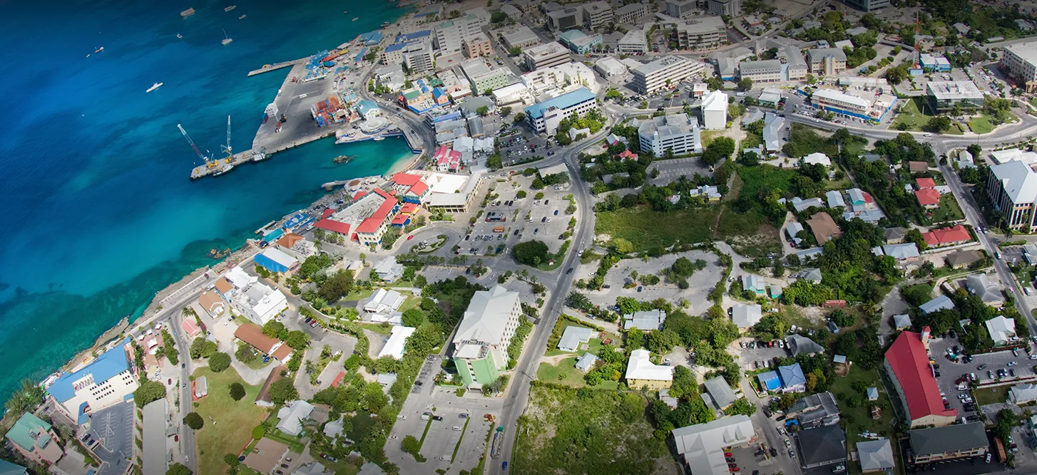
- CAYMAN ISLANDS PSHA | Global Earthquake Model Foundation
Projects CAYMAN ISLANDS PSHA Probabilistic seismic hazard assessment of Cayman Islands Versión en español English version Share Facebook LinkedIn Overview Anchor 6 Background Thr project aims to perform a probabilistic seismic hazard assessment for the Cayman Islands, and provide the seismic input necessary for the International Building Code (IBC). The GEM Hazard Team is responsible for the seismotectonic and geodynamic characterisation of the study area, the definition of distributed seismicity and fault sources, and the modelling of the epistemic uncertainties. Duration: 2020 Objectives The main objective is to provide input to the 2016 Cayman Islands Building Code, to support engineers in the seismic design and assessment of structures. Collaborators GEM Foundation, EUCENTRE Foundation Funding partner: Cayman Islands Government Location Cayman Islands Anchor 1 Anchor 5 Anchor 4 Anchor3 Publications
- CAREC | Global Earthquake Model Foundation
Projects CAREC Developing a Disaster Risk Transfer Facility in the Central Asia Regional Economic Cooperation Region Versión en español English version Share Facebook LinkedIn Overview Outreach Anchor 6 Background Willis Towers Watson, a GEM Advisor Sponsor is leading the consortium of organizations to implement the project, “Developing a Disaster Risk Transfer Facility in the Central Asia Regional Economic Cooperation Region” supported by the Asian Development Bank. The GEM Risk Team is responsible for the exposure and seismic vulnerability components of the project, with the Hazard Team providing support in the preparation of risk profiles for countries in the Central Asia Regional Economic Cooperation Region. Objectives The project has three main components: (i) development of disaster risk assessments and modeling in all CAREC countries; (ii) design of a regional pilot disaster risk transfer facility for at least three CAREC countries; and (iii) capacity building and awareness raising activities to sensitize key public and private stakeholders in all CAREC countries about the benefits of disaster risk reduction, risk retention and risk transfer solutions. Willis Towers Watson, a GEM Advisor Sponsor is leading the consortium of organizations that will implement the project. The Central Asia Regional Economic Cooperation, or CAREC Program is a partnership of 11 countries (Afghanistan, Azerbaijan, People's Republic of China, Georgia, Kazakhstan, Kyrgyz Republic, Mongolia, Pakistan, Tajikistan, Turkmenistan, and Uzbekistan), supported by 6 multilateral institutions, working together to promote development through cooperation, leading to accelerated growth and poverty reduction. Location Central Asia Anchor 1 Anchor 5 Anchor 4 About the CAREC program Read more GEM has started a new project with WTW supported by the Asian Development Bank Read more ADB project overview and data sheet Read more Anchor3 Publications
- CRAVE | Global Earthquake Model Foundation
Projects CRAVE Collaborative Risk Assessment for Volcanoes and Earthquakes (CRAVE) Versión en español English version Share Facebook LinkedIn Overview Outcomes Training Outreach Photos Publications Anchor 6 Summary The need to better understand the existing earthquake and volcano risk led to the establishment of the Global Earthquake Model (GEM) and the Global Volcano Model (GVM) network. GEM, founded in Italy in 2009, has been developing open tools and models to calculate and communicate seismic hazard and risk worldwide. Similarly, the GVM network represents an international community aiming to provide systematic evidence, data and analysis of volcanic hazards and risk on national, regional and global scales working with monitoring institutions to implement the best science and DRR strategies. Both GEM and the GVM network are currently leading international efforts that aim to mitigate the adverse effects from these perils. South America and ASEAN regions have been the target of numerous studies in the last two decades. However, most of these studies only focused on one component of the risk problem (e.g. hazard, vulnerability). Such limitation prevents the development of a comprehensive risk profile to properly inform decision-makers. The CRAVE project, through the current GEM and GVM network tools will offer a timely and unique opportunity to advance the understanding of seismic and volcanic risk in the region. Objectives This project aims to develop a common framework for the assessment of the impact from earthquakes and volcanoes, with an application in three countries located around the Pacific Rim. The activities comprised in this project feature several events to bring together global partners with the mandate to calculate and communicate seismic and volcanic risk, as well as training events to increase the capacity of local institutions in the assessment of their hazard and risk. Collaborators This project includes several partners including the following: British Geological Survey; the Earth Observatory of Singapore (EOS); the University of Edinburgh; the Volcano Disaster Assistance Program (VDAP) of the United States Geological Survey (USGS); and key organizations from the region including: the Colombian Geological Survey; the Philippine Institute of Volcanology and Seismology;(PHIVOLCS); and Badan Geologi (Indonesia). Location Colombia, Indonesia and the Philippines Volcano Scenario tool for OpenQuake The CRAVE project required the implementation of a new calculator in the OpenQuake Engine called ‘multi_risk’, which is able to manage at the same time different types of hazards, specifically ash fall, pyroclastic density currents flow, lava flow and lahar flow, passed as CSV files with headers ‘lon’, ‘lat’, ‘intensity’. The calculator is also able to consider the difference between dry and wet ash by setting the `ash_wet_amplification_factor` parameter in the job.ini file. The output of the calculator is a CSV file with ‘Exposure + Risk’ fields. For convenience we also produced a ‘Total Risk’ output which is simply the sum over the assets of the values in the ‘Exposure + Risk’ output. In order to support other formats used in the volcanic hazard community we prepared tools to convert hazard footprints into the format accepted by the OpenQuake-engine. These tools were included in the Input Preparation Toolkit. [Software ] Volcano Model example Full example of the volcano model developed with the Servicio Geológico Colombiano (SGC). [Data ] OpenQuake Volcano Risk Assessment OpenQuake for volcano risk assessment? Yes! Now you can perform volcanic scenarios. Checkout our tutorial! [Video ] Anchor 1 Anchor 5 Introduction The presentation of the tools and datasets from CRAVE took place in Bogota (Colombia) and Bandung (Indonesia). These events were organized by the Colombian Geological Survey and the Institute of Technology of Bandung. Kick-off Meeting The kick-off meeting took place in Bogota at the offices of the Colombian Geological Survey (SGC) on the 22nd of February 2018. During the meeting the goals of the CRAVE project were presented by GEM, as well as some concepts on seismic hazard, vulnerability and risk modelling. The British Geological Survey (BGS) presented general aspects of volcano hazard modelling and the mission of the Global Volcano Model, the SGC demonstrated how three volcanoes are currently being monitored and how seismic hazard maps have been developed in the past and the Rabaul Volcano Observatory (RVO) presented the current situation in terms of volcano hazard monitoring and assessment in Papua New Guinea. During this event all partners also discussed the way forward, including the division of tasks, case studies, relevant risk outputs and the timeframe for the next workshops. Bandung, Indonesia (20-22 of May) Workshop – IT Bandung With support from the Institute of Technology of Bandung (ITB), the event featured a day of presentations and discussion with representatives from the Center for Volcanology and Geological Hazard Mitigation (CVGHM), the Indonesian Ministry of Public Works, the National Disaster Management Agency (Badan Nasional Penanggulangan Bencana - BNPB), the Meteorology, Climatology and Geophysics Agency (Badan Meteorologi, Klimatologi dan Geofisika - BMKG), the Philippine Institute of Volcanology and Seismology (PHIVOLCS) and the British Geological Survey (BGS). Bogota, Colombia (13-17 of May) Workshop - Geological Survey of Colombia Five days in Bogota provided a fruitful time to share and discuss the national volcanic hazard and risk assessment, as well as risk management challenges in the country. The workshop was divided into two main parts: The first part focused on the technical aspects of volcanic hazard and risk assessment. Representatives from the three mains national volcanological observatories participated in the sessions (Manizales, Popayan and Pasto). The second part of the workshop was conceived for a broader audience, involving stakeholders that contribute to the Disaster Risk Reduction strategy in the country. Anchor 4 CRAVE project kicks off in Colombia The USAID project – Collaborative Risk Assessment for Volcanoes and Earthquakes or CRAVE successfully kicked off with a workshop in Bogota, Colombia. [News ] CRAVE in Colombia and Indonesia Members of the USAID-supported project – CRAVE from Colombia and Indonesia participated in two separate workshops to discuss volcanic threats and risks. [News ] CRAVE workshop, Bandung, Indonesia Workshop at IT Bandung exploring open tools and models for #earthquake and #volcano #hazard and #risk assessment with project partners. [Social Media ] Anchor3 BUSINESS NEWS CRAVE project workshops held in Bogota, Colombia 1/3 BUSINESS NEWS CRAVE project workshops held in Bandung, Indonesia 1/5 Publications CRAVE Project Final Report Final Report to USAID/OFDA for: CRAVE-Collaborative Risk Assessment for Volcanoes and Earthquakes [Report ] Disclaimer The contents of this project website such as studies, reports, audio-visual, news articles, blogs, and other information or media products including those in the external links are made possible by the generous support of the American people through the United States Agency for International Development (USAID). The contents are the responsibility of the Global Earthquake Model (GEM) Foundation and do not necessarily reflect the views of USAID or the United States Government.