CLOSE

QUICK LINKS


PROFILES
PUBLICATIONS
EXPOSURE
VULNERABILTY
SOFTWARE
EQ MODELS
Search Results
538 items found for ""
- CRAVE | Global Earthquake Model Foundation
Projects CRAVE Collaborative Risk Assessment for Volcanoes and Earthquakes (CRAVE) Versión en español English version Share Facebook X (Twitter) LinkedIn Overview Outcomes Training Outreach Photos Publications Summary The need to better understand the existing earthquake and volcano risk led to the establishment of the Global Earthquake Model (GEM) and the Global Volcano Model (GVM) network. GEM, founded in Italy in 2009, has been developing open tools and models to calculate and communicate seismic hazard and risk worldwide. Similarly, the GVM network represents an international community aiming to provide systematic evidence, data and analysis of volcanic hazards and risk on national, regional and global scales working with monitoring institutions to implement the best science and DRR strategies. Both GEM and the GVM network are currently leading international efforts that aim to mitigate the adverse effects from these perils. South America and ASEAN regions have been the target of numerous studies in the last two decades. However, most of these studies only focused on one component of the risk problem (e.g. hazard, vulnerability). Such limitation prevents the development of a comprehensive risk profile to properly inform decision-makers. The CRAVE project, through the current GEM and GVM network tools will offer a timely and unique opportunity to advance the understanding of seismic and volcanic risk in the region. Objectives This project aims to develop a common framework for the assessment of the impact from earthquakes and volcanoes, with an application in three countries located around the Pacific Rim. The activities comprised in this project feature several events to bring together global partners with the mandate to calculate and communicate seismic and volcanic risk, as well as training events to increase the capacity of local institutions in the assessment of their hazard and risk. Collaborators This project includes several partners including the following: British Geological Survey; the Earth Observatory of Singapore (EOS); the University of Edinburgh; the Volcano Disaster Assistance Program (VDAP) of the United States Geological Survey (USGS); and key organizations from the region including: the Colombian Geological Survey; the Philippine Institute of Volcanology and Seismology;(PHIVOLCS); and Badan Geologi (Indonesia). Location Colombia, Indonesia and the Philippines Volcano Scenario tool for OpenQuake The CRAVE project required the implementation of a new calculator in the OpenQuake Engine called ‘multi_risk’, which is able to manage at the same time different types of hazards, specifically ash fall, pyroclastic density currents flow, lava flow and lahar flow, passed as CSV files with headers ‘lon’, ‘lat’, ‘intensity’. The calculator is also able to consider the difference between dry and wet ash by setting the `ash_wet_amplification_factor` parameter in the job.ini file. The output of the calculator is a CSV file with ‘Exposure + Risk’ fields. For convenience we also produced a ‘Total Risk’ output which is simply the sum over the assets of the values in the ‘Exposure + Risk’ output. In order to support other formats used in the volcanic hazard community we prepared tools to convert hazard footprints into the format accepted by the OpenQuake-engine. These tools were included in the Input Preparation Toolkit. [Software ] Volcano Model example Full example of the volcano model developed with the Servicio Geológico Colombiano (SGC). [Data ] OpenQuake Volcano Risk Assessment OpenQuake for volcano risk assessment? Yes! Now you can perform volcanic scenarios. Checkout our tutorial! [Video ] Introduction The presentation of the tools and datasets from CRAVE took place in Bogota (Colombia) and Bandung (Indonesia). These events were organized by the Colombian Geological Survey and the Institute of Technology of Bandung. Kick-off Meeting The kick-off meeting took place in Bogota at the offices of the Colombian Geological Survey (SGC) on the 22nd of February 2018. During the meeting the goals of the CRAVE project were presented by GEM, as well as some concepts on seismic hazard, vulnerability and risk modelling. The British Geological Survey (BGS) presented general aspects of volcano hazard modelling and the mission of the Global Volcano Model, the SGC demonstrated how three volcanoes are currently being monitored and how seismic hazard maps have been developed in the past and the Rabaul Volcano Observatory (RVO) presented the current situation in terms of volcano hazard monitoring and assessment in Papua New Guinea. During this event all partners also discussed the way forward, including the division of tasks, case studies, relevant risk outputs and the timeframe for the next workshops. Bandung, Indonesia (20-22 of May) Workshop – IT Bandung With support from the Institute of Technology of Bandung (ITB), the event featured a day of presentations and discussion with representatives from the Center for Volcanology and Geological Hazard Mitigation (CVGHM), the Indonesian Ministry of Public Works, the National Disaster Management Agency (Badan Nasional Penanggulangan Bencana - BNPB), the Meteorology, Climatology and Geophysics Agency (Badan Meteorologi, Klimatologi dan Geofisika - BMKG), the Philippine Institute of Volcanology and Seismology (PHIVOLCS) and the British Geological Survey (BGS). Bogota, Colombia (13-17 of May) Workshop - Geological Survey of Colombia Five days in Bogota provided a fruitful time to share and discuss the national volcanic hazard and risk assessment, as well as risk management challenges in the country. The workshop was divided into two main parts: The first part focused on the technical aspects of volcanic hazard and risk assessment. Representatives from the three mains national volcanological observatories participated in the sessions (Manizales, Popayan and Pasto). The second part of the workshop was conceived for a broader audience, involving stakeholders that contribute to the Disaster Risk Reduction strategy in the country. CRAVE project kicks off in Colombia The USAID project – Collaborative Risk Assessment for Volcanoes and Earthquakes or CRAVE successfully kicked off with a workshop in Bogota, Colombia. [News ] CRAVE in Colombia and Indonesia Members of the USAID-supported project – CRAVE from Colombia and Indonesia participated in two separate workshops to discuss volcanic threats and risks. [News ] CRAVE workshop, Bandung, Indonesia Workshop at IT Bandung exploring open tools and models for #earthquake and #volcano #hazard and #risk assessment with project partners. [Social Media ] BUSINESS NEWS CRAVE project workshops held in Bogota, Colombia 1/3 BUSINESS NEWS CRAVE project workshops held in Bandung, Indonesia 1/5 CRAVE Project Final Report Final Report to USAID/OFDA for: CRAVE-Collaborative Risk Assessment for Volcanoes and Earthquakes [Report ] Disclaimer The contents of this project website such as studies, reports, audio-visual, news articles, blogs, and other information or media products including those in the external links are made possible by the generous support of the American people through the United States Agency for International Development (USAID). The contents are the responsibility of the Global Earthquake Model (GEM) Foundation and do not necessarily reflect the views of USAID or the United States Government.
- BACK TO NORMAL | Global Earthquake Model Foundation
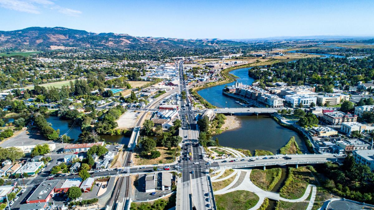
Projects BACK TO NORMAL Earthquake Recovery Modelling Versión en español English version Share Facebook X (Twitter) LinkedIn Overview Background To address some of the key factors that influence recovery following a potentially devastating earthquake, the Alfred E. Alquist Seismic Safety Commission (SSC) engaged the GEM (Global Earthquake Model) Foundation and the University of California at Los Angeles (UCLA), Department of Civil and Environmental Engineering, a) to develop a methodology and an open-source and transparent software tool to estimate recovery states and recovery times following an earthquake; and b) to investigate the effect of external socio-economic factors on these recovery times. Objectives This project achieved the following main objectives: 1. Development of a user-friendly, non-commercial and transparent software tool, herein referred as the Integrated Risk Modelling Toolkit (IRMT), to make map-based comparisons showing the effect of different resilient actions on the recovery times. 2. Development of an analytic methodology, referred as the Reconstruction Recovery Model, to estimate post-earthquake recovery 3. Integration of the Reconstruction Recovery Model for practical use into GEM’s OpenQuake modelling platform. 4. Demonstration of reasonable results by using the methodologies to model past earthquakes. In this context, the 2014 M6 South Napa Earthquake was used as a case study. Collaborators Department of Civil and Environmental Engineering at the University of California at Los Angeles (UCLA) Location California, United States
- Proyecto TREQ | Global Earthquake Model Foundation
Projects Proyecto TREQ Comunicación y Formación en la Evaluación de Riesgos por Terremotos (TREQ) Versión en español English version Share Facebook X (Twitter) LinkedIn Visión general Resultados Capacitación Comunicación Fotos Publicaciones Resumen El Proyecto de Capacitación y Comunicación para la Evaluación de Riesgos de Terremotos (TREQ) fue diseñado para demostrar cómo la evaluación de la amenaza y el riesgo sísmico puede informar a los tomadores de decisiones en el desarrollo de políticas de reducción de riesgos, así como también cómo se puede comunicar adecuadamente el riesgo de terremotos a las partes interesadas y al público en general. [PDF Executive Summary English ] Objetivos El proyecto se organizó en dos partes principales. El primero tuvo como objetivo desarrollar la capacidad para la evaluación de la amenaza y el riesgo sísmico a nivel urbano en América Latina, Quito (Ecuador), Cali (Colombia) y Santiago de los Caballeros (República Dominicana); mientras que la segunda parte fue desarrollar material de capacitación, educación y comunicación para mejorar la comprensión del riesgo de terremotos en todo el mundo. El programa se diseñó para un amplio espectro de partes interesadas, categorizadas en cuatro grupos principales: gobierno(tomadores de decisiones/autoridades públicas), industria (practicantes y profesionales), academia (investigadores y profesores) y la comunidad. Ecuador Municipalidad de Quito Escuela Politécnica Nacional (EPN) Instituto Geofísico (IG) Colegio de Ingenieros Civiles de Pichincha (CICP) Pontificia Universidad Católica del Ecuador Dominican Republic Servicio Geológico Nacional (SGN) Oficina Nacional de Evaluación Sísmica y Vulnerabilidad de Infraestructuras y Edificaciones (ONESVIE) Comité Técnico Nacional (CTN) Pontificia Universidad Católica Madre y Maestra (PUCMM) Colombia Servicio Geológico Colombiano (SGC) Departamento Administrativo de Planeación Municipal (DAPM), Cali Unidad Nacional de Gestión del Riesgo de Desastres (UNGRD) Universidad EAFIT, Medellin Costa Rica Universidad de Costa Rica (UCR) Mexico Universidad Autónoma de Baja California (UABC) Ubicación Quito (Ecuador), Cali (Colombia) y Santiago de los Caballeros (República Dominicana) Evaluación del riesgo urbano en América Latina y el Caribe En este componente se generaron los siguientes entregables: evaluación de amenaza y riesgo sísmico a escala urbana para las tres ciudades TREQ: Quito (Ecuador), Cali (Colombia) y Santiago de los Caballeros (República Dominicana). Se desarrollaron modelos de vanguardia para cada ciudad en estrecha colaboración con socios locales. Los modelos de entrada y los resultados están disponibles en la siguiente dirección URL: [github.com/gem/treq-riesgo-urbano/ ] a. Informes de la ciudad Evaluación de Riesgo Sísmico para el Distrito Metropolitano de Quito [Español ] Evaluación de Riesgo Sísmico para Santiago de Cali [Español ] Evaluación de Riesgo Sísmico para Santiago de los Caballeros [Español ] b. Evaluación de peligros sísmicos Modelos probabilísticos de amenaza sísmica (PSHA) y conjuntos de datos para la evaluación de la amenaza a nivel urbano [PDF English ] Modelo Probabilístico de Amenaza Sísmica para la República Dominicana [PDF English | Español ] [Descargar Modelo ] Resultados de amenaza sísmica (condiciones en roca y en suelo [PDF English ] Análisis de la amenaza sísmica a escala urbana [PDF English ] c. Evaluación de Riesgo Sísmico Resumen ejecutivo sobre la evaluación del riesgo sísmico urbano para las ciudades de Quito, Cali y Santiago de los Caballeros [PDF English ] Tipologías constructivas en Quito, Cali and Santiago de los Caballeros [PDF Español ] Base de datos de exposición georreferenciada de población y edificios en cada ciudad de TREQ [Cali ] [Quito ] [Santiago ] Base de datos de funciones de fragilidad y vulnerabilidad para cada clase de edificio presente en el modelo de exposición [Datos ] Mapas y métricas de riesgo para cada ciudad [Cali ] [Quito ] [Santiago ] d. Escenarios de la ciudad Base de datos con rupturas seleccionadas para análisis de escenarios [Cali ] [Quito ] [Santiago ] Evaluación del escenarios de amenaza para sismos representativos en Quito, Cali y Santiago de los Caballeros [PDF English ] e. Aplicaciones Urbanas Deslizamientos y licuefacción inducidos por sismo en Cali [PDF English ] Mejora de la comprensión mundial sobre la amenaza y riesgo sísmico Esta parte del programa fue diseñada para mejorar la comprensión y el conocimiento de la amenaza y el riesgo sísmico, y para ayudar a cerrar la brecha entre la información producida en estudios detallados de amenaza y riesgo y su comunicación a una amplia variedad de partes interesadas (que van desde locales expertos con competencias para evaluar el riesgo sísmico, a los tomadores de decisiones responsables de la implementación de medidas de reducción del riesgo). a. Sitio web para la capacitación en línea de OpenQuake La capacitación en línea de OpenQuake se diseñó para diferentes tipos de audiencia con diversos antecedentes y experiencia. A través de esta plataforma, los participantes interactuaron con los equipos científicos y técnicos del GEM para conocer los principales conceptos de la evaluación del riesgo sísmico, así como las características básicas del software de OpenQuake. [English | Español ] b. Manual de OpenQuake en formato online El manual oficial se convirtió de látex al formato reStructuredText gracias al apoyo de @USAID. El nuevo manual está ahora en línea en formato HTML y se puede accederse en: [Webpage English ] c. Tutoriales en video sobre peligros sísmicos y análisis de riesgos usando OpenQuake El proyecto ha producido 15 videos de capacitación técnica utilizando el software de OpenQuake (en inglés y español), 7 videos con material para difundir los modelos y resultados de la evaluación del riesgo urbano en las ciudades TREQ y 2 videos para comunicar el riesgo sísmico al público en general. público. OQ Engine Video Tutorials [ English | Español ] d. Manual para realizar análisis de amenaza sísmica Este manual presenta los conceptos básicos de la metodología clásica de PSHA y el amplio espectro de alternativas para modelar la sismicidad y las incertidumbres (epistémicas y aleatorias) en el software de OpenQuake. La evaluación probabilística del peligro sísmico (PSHA) es la metodología principal para evaluar el peligro potencial que representan los terremotos. Los mapas de amenaza se utilizan ampliamente en los códigos sísmicos nacionales para la zonificación de la amenaza sísmica y las disposiciones de diseño estructural. [PDF English ] e. Capacitando a educadores TREQ ha colaborado con cinco profesores universitarios de América Latina para conceptualizar, crear e implementar un curso unificado para el estudio del riesgo sísmico a nivel universitario. Los folletos en inglés y español explican con más detalle el concepto detrás de esta iniciativa y describen los primeros resultados y experiencias de los profesores de Colombia, Costa Rica, El Salvador, Guatemala y México. [PDF English | Español ] Comunicación y sensibilización sobre terremotos Las actividades de este componente se centraron en sensibilizar al público sobre la amenaza y el riesgo sísmico mediante la capacitación de un grupo diverso de profesionales en reducción del riesgo de desastres (RRD), junto con el personal a cargo de comunicar los riesgos al público, y mediante la realización de talleres comunitarios en áreas seleccionadas de las ciudades piloto. Artículos de noticias Eventos El seminario web Comprensión del riesgo sísmico a través del desarrollo de capacidades y el intercambio de conocimientos atrae a cientos de participantes de todo el mundo. [Article ] [Event page English | Español ] [Video ] Presentación del modelo PSHA nacional para la República Dominicana: un seminario web conjunto organizado por el Servicio Geológico Nacional Dominicano en cooperación con GEM, Oficina Nacional de Evaluación Sísmica y Vulnerabilidad de Infraestructura y la Oficina de Asistencia Humanitaria de USAID. [Event flyer Español ] [Video English | Español ] ---- Artículos Raising Earthquake Risk Awareness: TREQ’s community workshops for the general public Urban hazard assessment of selected cities in Latin America Local solutions to global problems: reducing disaster risk through collaboration and openness TREQ Project Updates: Site Effects Modelling and Urban Exposure Models USGS has joined the TREQ initiative for urban earthquake scenarios TREQ capacity building: OQ online training updates Jan-Feb 2021 TREQ2020 – Capacity development and OpenQuake online training, year in review TREQ OpenQuake Online Training: Earthquake Scenarios - Ground Motion Fields Sept 2020 Más en la sección GEM News a. Material didáctico para sensibilizar a la comunidad sobre el riesgo sísmico: Aplicación para el área Metropolitana del Valle de Aburrá (AMVA) [PDF Español ] b. Video para comunicar el riesgo de terremoto al público en general [English | Español ] c. Guía para profesores para el desarrollo de un curso introductorio de riesgo sísmico [PDF Español ] d. Perfiles de respuesta y mitigación de riesgos urbanos para las ciudades TREQ [Cali ] [Quito ] [Santiago ] Boletin informativo El boletín del proyecto TREQ tiene la intención de compartir actividades en evaluación de riesgos urbanos y materiales de capacitación y educación sobre riesgos de terremotos con una amplia gama de partes interesadas locales de la academia, los sectores público y privado, así como la sociedad civil en América Latina,el Caribe, y más allá. Newsletter no. 3 - May 2021 Newsletter no. 2 - September 2020 Newsletter no. 1 - March 2020 Maiden issue [English ] Maiden issue [Españo ] BUSINESS NEWS Concientizando el Riesgo: talleres para el público en general 1/4 BUSINESS NEWS Inicio del proyecto de marzo de 2020 1/4 BUSINESS NEWS Fotos de la formación OpenQuake Online de noviembre de 2020 1/2 BUSINESS NEWS Reuniones en Quito 1/10 BUSINESS NEWS Reuniones en Guayaquil 1/1 Visión general TREQ Resumen Ejecutivo [English ] Evaluación de la amenaza sísmica Modelos probabilísticos de amenaza sísmica (PSHA) y conjuntos de datos para la evaluación de la amenaza a nivel urbano [English ] Modelo Probabilístico de Amenaza Sísmica para la República Dominicana [English | Español ] [Descargar Modelo ] Resultados de amenaza sísmica (condiciones en roca y en suelo [English ] Análisis de la amenaza sísmica a escala urbana [English ] Evaluación de Riesgo Sísmico Resumen ejecutivo sobre la evaluación del riesgo sísmico urbano para las ciudades de Quito, Cali y Santiago de los Caballeros [English ] Tipologías constructivas en Quito, Cali and Santiago de los Caballeros [Español ] Escenarios sísmicos Evaluación del escenarios de amenaza para sismos representativos en Quito, Cali y Santiago de los Caballeros [English ] Aplicaciones urbanas Deslizamientos y licuefacción inducidos por sismo en Cali [English ] Informes de la ciudad Evaluación de Riesgo Sísmico para el Distrito Metropolitano de Quito [Español ] Evaluación de Riesgo Sísmico para Santiago de Cali [Español ] Evaluación de Riesgo Sísmico para Santiago de los Caballeros [Español ] Formación y comunicación del riesgo sísmico Manual de capacitación sobre análisis probabilístico de riesgos sísmicos (PSHA) [English ] Material didáctico para sensibilizar a la comunidad sobre el riesgo sísmico. Aplicación para el área Metropolitana del Valle de Aburrá (AMVA) [Español ] Guía para profesores para el desarrollo de un curso introductorio de riesgo sísmico [Español ] Disclaimer The contents of this project website such as studies, reports, audio-visual, news articles, blogs, and other information or media products including those in the external links are made possible by the generous support of the American people through the United States Agency for International Development (USAID). The contents are the responsibility of the Global Earthquake Model (GEM) Foundation and do not necessarily reflect the views of USAID or the United States Government.
- TURKEY DRR | Global Earthquake Model Foundation
Projects TURKEY DRR Seismic risk and exposure data for Turkey Versión en español English version Share Facebook X (Twitter) LinkedIn Overview Background The World Bank is developing a thematic Paper on Building Climate and Disaster Resilience in Turkey that will apply a new World Bank Guidance Note on how to prepare resilience and adaptation strategies. The Guidance Note provides a practical guide for designing national strategies for climate change adaptation and resilience. It specifies actions that reflect universal principles of effective climate change adaptation and disaster resilience, emphasizing that each country needs to tailor the relative importance and sequencing of these actions to its specific needs and priorities. Given the best practice of mitigating natural hazards for a more resilient future, and the high risk of catastrophic earthquakes, the adaptation paper needs to consider seismic risk in Turkey. To contribute to the seismic risk component of this adaptation paper, the GEM Risk Team is responsible for the following tasks: - Assessment of earthquake ground shaking hazard in Turkey - Definition of the exposure: residential, commercial and industrial buildings; education and healthcare facilities; population - Assessment of vulnerability/fragility for the exposed elements - Risk modelling based on the current exposure - Risk projections to 2030 and 2050 (based on future socio-economic conditions) Duration: 2021 Objectives The World Bank thematic Paper on Building Climate and Disaster Resilience in Turkey aims to support the Turkish government by providing guidance on how to prepare resilience and adaptation strategies, including those related to earthquakes. The objectives of this project are to: 1. Provide deterministic and probabilistic seismic risk metrics in Turkey for population and selected structure types, to inform macro-economic and public finance analysis (conducted by the World Bank project team). 2. Provide seismic impact analysis for three earthquake scenarios aimed at reducing risk in Turkey to estimate the impact of these interventions on i) loss due to direct damage and ii) fatalities. Collaborators GEM Foundation Funding partner: World Bank Group Location Turkey
- ARMENIA PSHA MODELLING | Global Earthquake Model Foundation
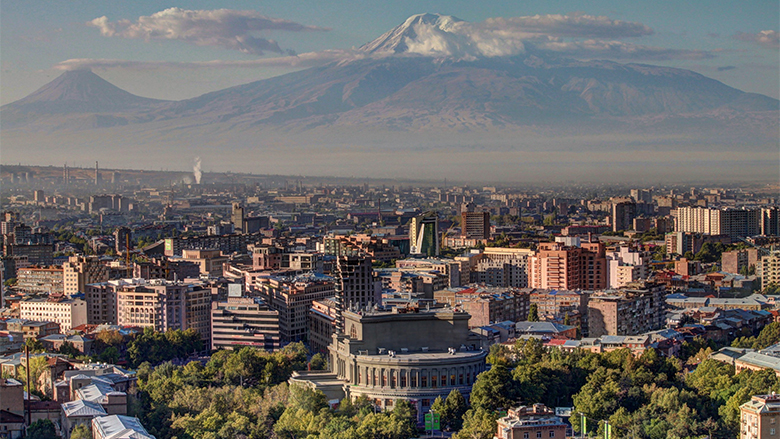
Projects ARMENIA PSHA MODELLING Probabilistic Seismic Hazard Assessment for the Republic of Armenia Versión en español English version Share Facebook X (Twitter) LinkedIn Overview Background This project responds to a World Bank request for a probabilistic seismic hazard assessment for the Republic of Armenia. The goal of this study is to better understand the existing seismic hazard information in the country, and to provide an updated hazard model. The GEM Hazard Team supports all aspects of the model development, and in the running of the analyses with the OpenQuake engine. Duration: 2017 Objectives Probabilistic seismic hazard models, such as this model for the Republic of Armenia, can be used as a rigorous and robust basis for the design of a national disaster risk financing and insurance strategy. Collaborators Verisk (AIR Worldwide), GEM Foundation, Georisk Scientific Research Company Funding partner: World Bank Group Location Armenia
- GEORGIA DRR | Global Earthquake Model Foundation
Projects GEORGIA DRR Capacity building to understand and take action on seismic risks in Georgia Versión en español English version Share Facebook X (Twitter) LinkedIn Overview Background This project aims to enhance the understanding of earthquake impacts in Georgia and to address the following two challenges: i. The lack of understanding of potential earthquake risk and the impact on people, infrastructure and the economy at large; and ii. the lack of efforts to reduce the vulnerability of existing infrastructure, particularly critical emergency response infrastructure. The project is divided into 5 tasks, with the GEM Risk Team contributing to all tasks, with a specific emphasis on developing exposure models, identifying vulnerability models and running the probabilistic seismic risk assessment with the OpenQuake engine: Task 1 – Project Inception Task 2 – Preparation of Input Data & Development of Input Models Task 3 – Seismic Risk Analysis Task 4 – Recommendations on Risk Reduction Strategy Task 5 – Capacity Building Workshops Duration: 2020-2021 Objectives The objective of this project is to provide greater insight to the World Bank into the exposure of Georgia’s emergency response sectors to earthquakes and the potential consequences, as well as strategies to build seismic resilience in these sectors. The findings allow the World Bank to develop recommendations and better advise the Government of Georgia on how to: i. enhance its capacity to plan for future risk reduction investment programs based on a better understanding of earthquake risk in emergency response buildings; ii. develop options for a framework for a future short, medium and long-term intervention strategy; and iii. communicate and build consensus on earthquake risks and potential interventions in key sectors. Collaborators GEM Foundation, Arup, Progress Project LLC, Ilia State University Funding partner: World Bank Group Location Georgia
- CAREC | Global Earthquake Model Foundation
Projects CAREC Developing a Disaster Risk Transfer Facility in the Central Asia Regional Economic Cooperation Region Versión en español English version Share Facebook X (Twitter) LinkedIn Overview Background Willis Towers Watson, a GEM Advisor Sponsor is leading the consortium of organizations to implement the project, “Developing a Disaster Risk Transfer Facility in the Central Asia Regional Economic Cooperation Region” supported by the Asian Development Bank. The GEM Risk Team is responsible for the exposure and seismic vulnerability components of the project, with the Hazard Team providing support in the preparation of risk profiles for countries in the Central Asia Regional Economic Cooperation Region. Objectives The project has three main components: (i) development of disaster risk assessments and modeling in all CAREC countries; (ii) design of a regional pilot disaster risk transfer facility for at least three CAREC countries; and (iii) capacity building and awareness raising activities to sensitize key public and private stakeholders in all CAREC countries about the benefits of disaster risk reduction, risk retention and risk transfer solutions. Willis Towers Watson, a GEM Advisor Sponsor is leading the consortium of organizations that will implement the project. The Central Asia Regional Economic Cooperation, or CAREC Program is a partnership of 11 countries (Afghanistan, Azerbaijan, People's Republic of China, Georgia, Kazakhstan, Kyrgyz Republic, Mongolia, Pakistan, Tajikistan, Turkmenistan, and Uzbekistan), supported by 6 multilateral institutions, working together to promote development through cooperation, leading to accelerated growth and poverty reduction. Location Central Asia GEM has started a new project with WTW supported by the Asian Development Bank.
- INDONESIA DRR | Global Earthquake Model Foundation
Projects INDONESIA DRR Seismic Resilience Baseline Analysis and Investment Option Needs in Indonesia Versión en español English version Share Facebook X (Twitter) LinkedIn Overview Background This project, funded by the World Bank's GFDRR, aims to conduct a seismic baseline analysis to support the development of a potential national seismic risk mitigation program in Indonesia. The study focuses on public assets, which include education facilities (primary and secondary schools, universities), health facilities (health clinics, hospitals), commercial facilities (shophouse), emergency services facilities (e.g., ambulance stations, fire stations, early warning service providers), and critical government administration buildings (e.g., local disaster management offices). The project has five main tasks: 1. Inception: literature review on seismic risk in Indonesia, methodology, definition of stakeholder/consultation workshops, preliminary data collection 2. Baseline analysis of Indonesia’s exposure and vulnerabilities to seismic hazards (earthquakes and tsunami) 3. Seismic Risk Assessment and Rapid Prioritization of Potential Investments in Three Selected Districts 4. Development of Baseline Data and Conceptual Framework Design 5. Final Report and Completion Report The GEM Risk Team contributes to all tasks, ranging from support on hazard modelling, development of exposure, selection of vulnerbaility models and the computation of seismic risk using the OpenQuake engine. Duration: 2022-2023 Objectives The methodology, workplan, programme and potential target cities is elaborated together with the World Bank and Indonesian Ministry of Public Works and Housing (MPWH) stakeholders and other relevant agencies such as Ministry of National Development Planning (Bappenas), National Disaster Management Authority (BNPB), Ministry of Home Affairs (MoHA) and Agency for Meteorology, Climatology and Geophysics (BMKG). The objectives include: (a) a rapid baseline analysis of the exposure and vulnerability of the country and three Indonesian districts to earthquakes and tsunami, baseline information/data, and gap analysis, including disaggregated analysis of risk and vulnerability of women and other vulnerable groups; (b) a conceptual framework for improving seismic resilience and recommendations for a national program that aims to reduce the vulnerability of people (with consideration for diverse groups) and assets to earthquakes and tsunami through an integrated package of structural and non-structural investments; and (c) stakeholder consultations to seek inputs on the potential program design, investment funding mechanisms, and institutional set-up options for the national program. Collaborators GEM Foundation, Arup, LAPI-ITB and Kota Kita Funding partner: World Bank GFDRR Locations Three cities in Indonesia: ‣ Kota Bengkulu, Bengkulu province ‣ Kota Cilegon, Banten province ‣ Kota Gorontalo, Gorontalo province
- ALBANIA HAZARD MODELLING | Global Earthquake Model Foundation
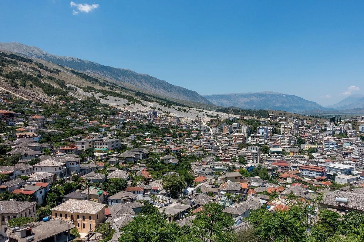
Projects ALBANIA HAZARD MODELLING Joint development of the Albanian seismic hazard model Versión en español English version Share Facebook X (Twitter) LinkedIn Overview Background GEM and IGEO-Albania are currently implementing a 1-year project funded by the European Investment Fund and supported by the Electrical Corporation of Albania to update Albania’s probabilistic seismic hazard model through a series of technical workshops. The GEM Hazard Team is providing support on the use of its open source tools for hazard model building and assessment. Duration: 2023 Objectives The main objectives of this project are to update the national seismic hazard model for Albania, and provide the outputs that can be used in the National Annex of Eurocode 8, for the seismic design of buildings in Albania. Collaborators GEM Foundation, Institute of Geosciences (IGEO) Funding Partner: European Investment Fund, Electrical Corporation of Albania Location Albania
- SERA Project | Global Earthquake Model Foundation
Projects SERA Project Seismology and Earthquake Engineering Research Infrastructure Alliance for Europe (SERA) Versión en español English version Share Facebook X (Twitter) LinkedIn Overview Background The Seismology and Earthquake Engineering Research Infrastructure Alliance for Europe (SERA) aims to reduce the risk posed by natural and anthropogenic earthquakes based on innovative research and development projects. SERA will significantly improve the access to data, services and research infrastructures for scientists and other professionals. GEM's contributions focus on taxonomy and exposure of residential, commercial and industrial buildings in Europe; physical vulnerability assessment for buildings; integrated earthquake risk analysis using the risk assessment framework and OpenQuake software established by the Global Earthquake Model. SERA is a Horizon 2020-supported programme responding to the priorities identified in the topic INFRAIA-01-2016-2017 ‘Integrating Activities for Advanced Communities’. SERA involves 31 partners and 8 linked third parties in Europe. It started in May 2017 and will last for three years. Objectives The EUCENTRE-SERA project is collaborating closely with the GEM Foundation (Global Earthquake Model) to: develop a European Risk Modelling framework that brings together the strengths of previous projects such as SHARE, NERA and fills in the research gaps; integrate knowledge and data from other SERA working packages; and build on the risk assessment framework and software developed by GEM. SERA is engaging 31 partners from 16 European countries. They all have leading expertise in the operation of experimental facilities, monitoring infrastructures, and data repositories in the fields of seismology, anthropogenic hazards or earthquake engineering. (complete list ) Location Europe EM-SERA OpenQuake Training in Istanbul, Turkey SERA European Building Exposure Workshop: From European Hazard to Risk