CLOSE

QUICK LINKS


PROFILES
PUBLICATIONS
EXPOSURE
VULNERABILTY
SOFTWARE
EQ MODELS
Search Results
538 items found for ""
- MONGOLIA DRR | Global Earthquake Model Foundation
Projects MONGOLIA DRR Strengthening capacity on disaster risk assessment, reduction and transfer instruments in Mongolia Versión en español English version Share Facebook X (Twitter) LinkedIn Overview Background This project aims to support Mongolia in developing a set of key disaster risk information and knowledge products for mainstreaming Disaster Risk Management (DRM) into development, including Disaster Risk Financing and Insurance (DRFI). A hazard and risk assessment is conducted at the national and provincial levels and Disaster Risk Reduction (DRR) is promoted for resilience within development and DRFI, and to strengthen the capacity and ability of NEMA, ministries, local government officials and communities to better understand and plan for disaster risks. The project is made up of the following four main components: Conducting multi-hazard disaster risk assessments at the national and local levels; Facilitation of Disaster Reduction planning and mainstreaming through the preparation and delivery of a DRR training program; Development of a strategy for disaster risk financing and revision of the national draft disaster risk insurance law; and Building institutional, technical, and management capacity for DRR and DRF The GEM Risk Team's main contribution to the project is the development of a significantly improved exposure model for Mongolia, based on the latest population and housing census of Mongolia, and a probabilistic seismic risk analyses, making use of GEM's global seismic hazard mosaic. Duration: 2022-2023 Objective The project is implemented in close collaboration with Mongolia’s National Emergency Management Agency (NEMA) and the Department of Disaster Risk Management (DRMD), who are the executing agency and the implementing agency respectively. The Ministry of Finance is also engaged in strengthening DRF and insurance options. This project advances Mongolia’s progress in addressing the Sendai Framework on Disaster Risk Reduction (DRR) priorities by improving the institutional capacities of key ministries and local governments; enhancing understanding of risk; strengthening disaster risk governance; and investing in DRR for resilience through promoting mechanisms for disaster risk transfer, risk-sharing, and insurance. Collaborators GEM Foundation, ICEM Asia Consulting, PwC India, Environ LLC, Willis Towers Watson (WTW), JBA Group, Overseas Development Institute Funding partner: Funded by the Japan Fund of Poverty and Reduction and administered by the Asian Development Bank (ADB) Location Mongolia
- CCARA | Global Earthquake Model Foundation
Projects CCARA Caribbean and Central America Earthquake Risk Assessment (CCARA) Versión en español English version Share Facebook X (Twitter) LinkedIn Overview Outcomes Training Outreach Photos Publications Background Earthquake risk is on the rise and earthquakes are expected to take an increasing number of lives. Hazard and risk assessments are the foundation for raising awareness among policy makers and the general public, forming the basis for decisions and actions that effectively build resilience and can reduce risk. While important work has been carried out in the Central American and Caribbean region to understand earthquake risk assessment and management there is still ample room to enhance that understanding and properly introduce it in decision- and policy-making processes. In many areas of the world, state-of-the-art information and tools to assess earthquake risk have been inaccessible for a long time. As a first step to tackle this problem, the Global Earthquake Model (GEM) has been created and spent the past 11 years collaboratively advancing open source science and technology for global state-of-the-art seismic hazard and risk modeling, data collection, and risk assessment at scales from local to national, regional, and global. Objectives The project aims to calculate hazard and risk, and to estimate the compounding social and economic factors that increase the physical damage and decrease the post-event capacities of populations to respond to and recover from damaging earthquake events in The Caribbean and Central America, by involving local experts from throughout the region. The goal of the Program in Central America and the Caribbean is to develop capacity in the region for earthquake risk assessment by leveraging GEM tools and resources, to enhance the understanding of earthquake risk, and to bridge the gap between risk assessment and disaster risk reduction. To improve the understanding of earthquake risk in the Central America and Caribbean region while developing local capacities to use open source resources for producing earthquake hazard and risk information at regional, national and local scales. To engage with decision-makers and other end-users to make the connection between advanced risk assessment by local experts and risk-reducing action and so influence DRR policy. Collaborators The CCARA project would not have been possible without the contributions of all the municipalities in particular: the Municipality of San José (Costa Rica), National Commission of Emergencies (CNE), University of Costa Rica (UCR) - Laboratorio Nacional de Materiales y Estructuras (LANAMME), INETER, ONESVIE, ODPEM, BRGM, Bureau des Mines, VT, Geologica UPR Mayaquez, UNI, SRC and UMG. Location Caribbean and Central America countries Website Caribbean and Central America Earthquake Risk Assessment (CCARA) wiki site contains an overview of the project. The CCARA project hosted four participants from South America to introduce seismic hazard and risk assessment using tools developed by GEM – specifically the OpenQuake engine. Modelling subduction earthquakes: GEM experiences in Latin America CCARA project GEM presents the results of the USAID-funded CCARA Project in Santo Domingo, Dominican Republic A hazard workshop in San José, Costa Rica from September 18th to 22nd as part of the risk assessment activities of the CCARA project. CCAF-DB: The Caribbean and Central American Active Fault Database Disclaimer The contents of this project website such as studies, reports, audio-visual, news articles, blogs, and other information or media products including those in the external links are made possible by the generous support of the American people through the United States Agency for International Development (USAID). The contents are the responsibility of the Global Earthquake Model (GEM) Foundation and do not necessarily reflect the views of USAID or the United States Government.
- READY2RESPOND | Global Earthquake Model Foundation
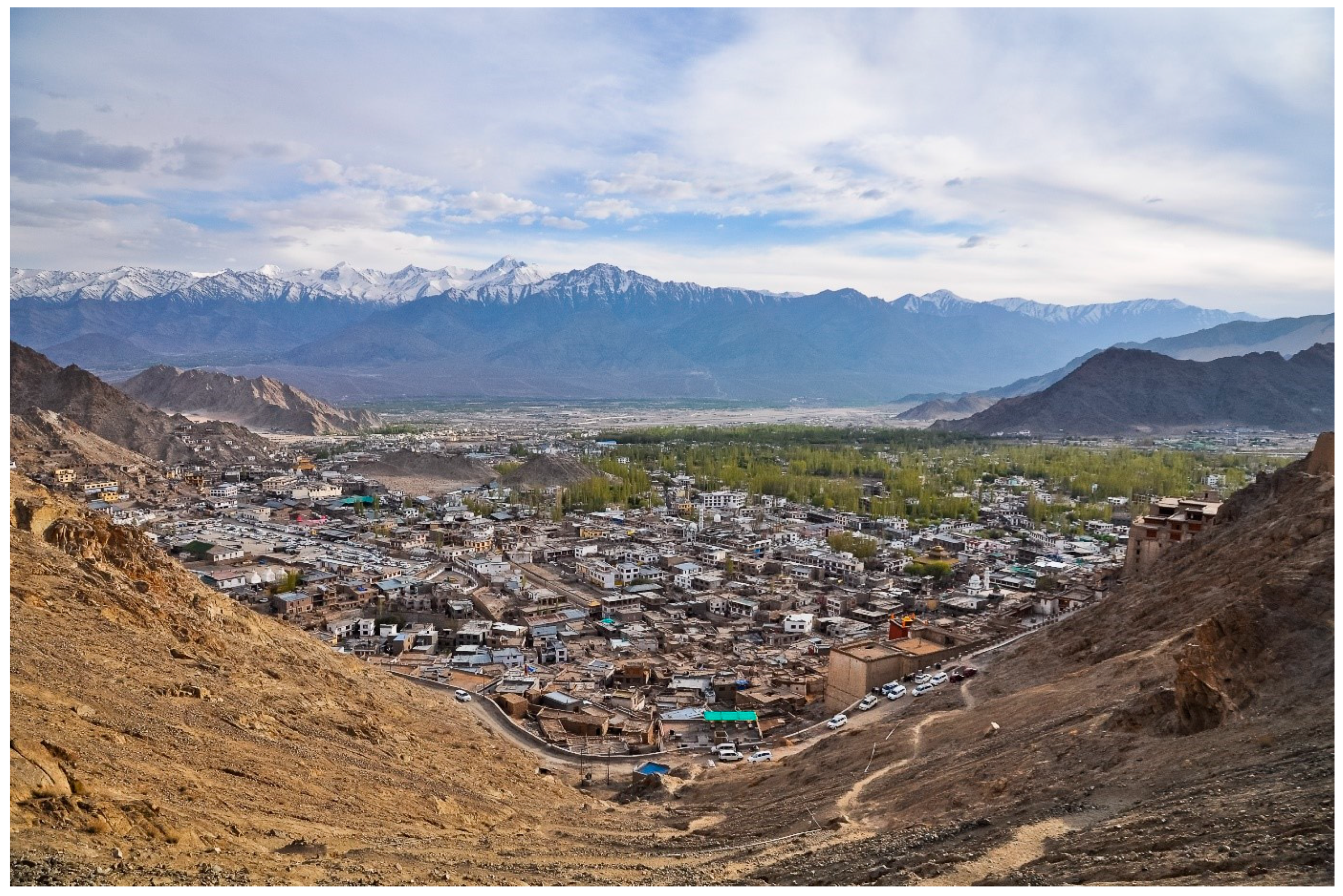
Projects READY2RESPOND Rapid Diagnostic in Uttarakhand and Himachal Pradesh Versión en español English version Share Facebook X (Twitter) LinkedIn Overview Background Ready2Respond (R2R) is a rapid diagnostic guide, designed to improve national, sub-national and city resilience mechanisms and to protect development gains through investments in emergency preparedness and response systems. It is informed by the World Bank Group (WBG) City Resilience Program (CRP) and other WBG resilience platforms. In this project R2R is applied to the Uttarakhand and Himachal Pradesh states in the Himalayan region of India. The GEM Risk Team contributes to the project by providing: Literature review and stakeholder mapping around hazard and risk initiatives, risk data and models for both states Provision of seismic hazard/risk model outputs and related descriptive information for both states (to support diagnostic activities) Review of legal regulation of the built environment and associated initiatives Review of seismic preparedness of the critical infrastructure defined in the project Preparation and remote input into stakeholder workshops Duration: 2023 Objectives This project responds to the need to provide effective and comprehensive diagnosis of the Uttarakhand and Himachal Pradesh states’ emergency preparedness and response systems in the Himalayan region of India. This enables the World Bank and the government to tailor investments to strengthen institutional capacity and capability, ensure public safety, and limit economic disruption in the face of multiple, and often cascading, geological and hydrometeorological hazards. Collaborators GEM Foundation, JBA Consulting, Geo Climate Risk Solutions (GCRS) Funding partner: World Bank Group Location India Himalayas
- BANGLADESH | Global Earthquake Model Foundation
Projects BANGLADESH Earthquake Vulnerability and Systemic Risk Assessment in Bangladesh Versión en español English version Share Facebook X (Twitter) LinkedIn Overview Outcomes Training Outreach Photos Publications Background This project follows a specific support request made by the Ministry of Disaster Management and Relief (MoMDR) to the UN Office for Disaster Risk Reduction (UNDRR) and UN Resident Coordinator’s Office (UNRCO) for a sub-national earthquake hazard and risk assessment in Bangladesh. The GEM Foundation has the role of technical expert lead of the project which will include the following activities: Needs and Gaps Assessment Technical Panel Formation and Initial Consultations Seismic Hazard Mapping Exposure Mapping Seismic Vulnerability Assessment Seismic Risk Mapping and Interpretation Stakeholder Consultation and Validation Preliminary Model Dissemination and Training Workshop Funding and technical partner: UNDRR Duration: 2023 - 2024 Objectives The main objective of this project is to develop a detailed, open, sub-national earthquake risk model and evaluate seismic risk for Bangladesh at the zila and upazila level. The complete risk model itself will comprise a probabilistic seismic hazard model, a building exposure model, and a seismic fragility and vulnerability model for the building stock of Bangladesh. Additionally, it includes critical scenarios for key cities, identified based on the results of the probabilistic risk assessment and in consultation with local stakeholders and experts, in a panel led by the Ministry of Disaster Management and Relief (MoMDR), and including representatives from the Ministry of Housing and Public Works, Bangladesh Bureau of Statistics, Geological Survey of Bangladesh, Bangladesh University of Engineering and Technology, and University of Dhaka.` Collaborators In collaboration with the GEM Foundation, the Technical Panel steering this seismic risk assessment initiative is a collaborative assembly of key stakeholders and experts. Led by the Additional Secretary of Bangladesh's Ministry of Disaster Management and Relief (MoDMR), it comprises representatives from vital entities, including the Department Of Disaster Management (DDM), the Fire Service and Civil Defence of Bangladesh, the Ministry of Housing & Public Works (MoHPW), and the Statistics and Informatics Division (SID) of the Bangladesh Bureau of Statistics (BBS). In addition, the panel includes the participation of seasoned national experts specializing in seismic hazard and risk assessment from institutions such as the University of Dhaka (DU), Bangladesh University of Engineering and Technology (BUET), and Jahangirnagar University (JU). Further enriching the panel's knowledge base are contributions from the Geological Survey of Bangladesh, the Centre for Urban Studies (CUS), and the United Nations Development Programme (UNDP), Bangladesh.) Location Bangladesh Earthquake Hazard and Risk Assessment Results This section summarises the various assessments conducted to understand the potential impact of earthquakes in Bangladesh. These assessments cover a range of factors, including the likelihood and severity of ground shaking, liquefaction potential, exposure of people and buildings, vulnerability of infrastructure, and the overall seismic risk posed to the country. The following list details the outputs generated from each assessment. Bangladesh Profiles | Past Earthquakes ***ALL OUTPUTS ARE PRELIMINARY*** a. Population and Building Exposure The "Population and Building Exposure" section utilised data from various sources to create an exposure model for Bangladesh. The 2011 Population and Housing Census and the 2013 Economic Census provided the foundation for residential and commercial/industrial exposure, respectively. While detailed housing information from the 2022 census wasn't yet available at lower administrative levels, preliminary population counts at the district level were incorporated to update the model at the start of the project. Additionally, information on building materials used throughout the country, derived from the 2011 census, was employed. For informal urban constructions, data from the 2014 Slum Areas and Floating Population Census was used to infer vulnerability based on dwelling unit types, though specific construction materials weren't available. Finally, the project team actively sought and obtained upazila-level data on building materials from the 2022 census to further refine the exposure model. Maps | Profile b. Infrastructure Exposure In addition to residential, industrial, and commercial structures that were previously covered by GEM’s exposure models at the zila level (which have been updated to the upazila level during this project), we have also developed exposure models for the healthcare and educational facilities at the country, including all hospitals and clinics, and all schools, colleges, and universities. Map | Profile c. Earthquake Scenarios The project also constructed the rupture geometries for these events, selected a range of ground motion models, and assessed the potential impact—both in terms of damage and losses—that each event could inflict on the country if it were to occur today. The full scenario set consists of twelve events: seven historical events from 1664-1918, chosen out of many in this period, supplemented by five hypothetical events. Maps | Profile d. Probabilistic Seismic Hazard Assessment The seismic hazard modelling and mapping section describes the approach taken to assess the seismic hazard in Bangladesh with the goal of creating a comprehensive seismic hazard model for Bangladesh that can be used for risk assessment and mitigation. The project started with a probabilistic seismic hazard model for the Indian subcontinent, which was updated and implemented for the OpenQuake engine. The model includes seismogenic source models, ground motion models, and considers various tectonic regions. This section also mentions the review of the seismic source model for northeast India and the improvements made to the model. Maps | Profile e. Liquefaction Hazard Assessment The section "Liquefaction susceptibility and hazard assessment" discusses the inclusion of regional liquefaction occurrence models in the project, which predict ground failure using existing mapped information and above-ground inferences of below-ground conditions. These models were used for the national scale liquefaction hazard assessment in the second phase of the project identifying the factors that contribute to liquefaction, the methods used for assessment, and the potential damage and losses that can result from liquefaction. Maps | Charts | Tables f. Seismic Risk Assessment The project estimated seismic risk metrics utilising the OpenQuake-engine's stochastic event-based risk assessment calculator. A probabilistic seismic hazard analysis model was employed to generate earthquake rupture forecasts, forming a stochastic event set over a 100,000-year span. Economic and human losses were computed for each event, producing event loss tables and year loss tables. Risk metrics included exceedance probability curves and average annualized losses. Fatality and injury estimates relied on vulnerability models informed by global earthquake data, with a focus on South Asian building characteristics. Results were tabulated nationally and regionally by the project. The assessment also considers the exposure and risk of healthcare facilities, educational facilities, and the national road network to seismic hazards. Maps set 1 | Maps set 2 | Profile Improving global capacity for seismic hazard and risk This part of the program was designed to improve the understanding and awareness of earthquake hazard and risk, and to help bridge the gap between the information produced in detailed hazard and risk assessment studies and its communication to a wide variety of stakeholders (which range from local experts with the remit to assess seismic risk to decision-makers responsible for the implementation of risk reduction measures). a. Website for OpenQuake online training The OpenQuake online training was designed for different types of audiences with diverse backgrounds and expertise. Through this platform, participants interact with GEM scientific and technical teams to learn the main concepts of earthquake risk assessment, along with the basic features of the engine. [English ] b. Onsite Training Workshop One-day workshop designed to improve the understanding and awareness of earthquake hazard and risk and to help bridge the gap between the information produced in the project and its communication to a wide variety of stakeholders. The session allowed participants to explore and prepare the required input files for earthquake scenarios in the OpenQuake engine. OQ Engine Video Tutorials | English | Example Material Communicating and raising earthquake risk awareness The activities in this component focused on raising the awareness of the public on earthquake hazard and risk by training a diverse group of disaster risk reduction (DRR) professionals together with personnel in charge of communicating risk to the public, and by conducting community-based workshops in selected areas of the pilot cities by those who were trained by the project. a. GEM presentation to the Ministry of Disaster Management and Relief (MoDR), Bangladesh This is an introductory presentation on Bangladesh's earthquake risk assessment project that outlines past efforts, emphasises the need for a nationwide evaluation, and introduces the GEM Foundation's methodology. It highlights completed division-level risk maps and ongoing project activities like data collection, vulnerability assessment, and stakeholder engagement. Additionally, five other presentations below will address different aspects of the project in Bangladesh. View Presentation b. Technical Panel Session #1 This presentation discusses the methodology used to collect and process data related to earthquake risk components such as hazard, exposure, and vulnerability. It also mentions the project activities and the formation of a technical panel for consultation and validation. View Presentation c. Technical Panel Session (PSHA) #2 This presentation is about the tailored version of the PSHA (Probabilistic Seismic Hazard Assessment) model for the Indian sub-continent, which is based on the original model developed by Nath and Thingbaijam in 2012. The presentation discusses the main areas identified for improvement in the model, the changes that were introduced, and the impact of these changes on the hazard results. View Presentation d. Technical Panel Session (Scenario Ruptures) #2 This presentation is about the hazard analysis of earthquakes in Bangladesh, including an overview of the fault systems, historical ruptures, and potential ruptures. It also mentions the ground motion models used for the analysis. View Presentation e. Technical Panel Session #3 This presentation focuses on exposure and physical and social vulnerability, as components of seismic risk. It discusses the details of exposure models, seismic vulnerability analysis, and social vulnerability. The presentation also mentions the use of the Global Earthquake Model (GEM) and the INFORM Index in assessing and understanding the seismic risk in Bangladesh. View Presentation f. Technical Panel Session (Scenarios and Risk) #4 This presentation details data collection and processing methods for seismic hazards, exposure, and vulnerability. It presents preliminary results on potential earthquake impacts like building collapse and economic loss using an 1885 event as an example. The presentation also mentions probabilistic risk assessment and division-level risk maps, alongside details about 12 "scenario ruptures" based on historical and potential earthquake events. View Presentation g. Technical Panel Session (Liquefaction) #4 This presentation focuses on factors such as soil liquefaction, susceptibility to ground failure, population density, urbanisation, and the country's river delta geography. It discusses various methodologies and models used to assess liquefaction hazard and suggests the use of geospatial methodologies for identifying areas with a higher likelihood of occurrence. View Presentation BUSINESS NEWS Images from online meetings: September to December 2023 1/1 Interim Substantive Reports The documents below are interim substantive reports on the project "Earthquake Vulnerability and Systemic Risk Assessment in Bangladesh". The main objective of the project is to develop a detailed earthquake risk model for Bangladesh at the zila and upazila levels. They describe the development of an open-source probabilistic seismic risk model for Bangladesh and provide key insights to decision-makers and stakeholders in the disaster risk mitigation community. a. First Interim Substantive Report This report highlights the need for a seismic risk model in the country and discusses the gaps and needs assessment. The report also explains the technical approach and methodology for developing the risk model, including seismic hazard modeling, liquefaction susceptibility and hazard assessment, exposure modeling, and seismic fragility and vulnerability modeling. The seismic risk assessment process is described, along with the formation of a technical panel and stakeholder engagement. Download the Report b. Second Interim Substantive Report This report provides updates on various aspects of the project, including the development of earthquake scenarios, liquefaction susceptibility and hazard assessment, exposure modeling, and social vulnerability modeling. The report mentions that the project has engaged a technical panel comprising key experts and stakeholders, and their feedback and suggestions are being incorporated into the project. The report also includes information on the distribution of hospitals, clinics, schools, and colleges in Bangladesh. Download the Report
- ARISTOTLE | Global Earthquake Model Foundation
Projects ARISTOTLE Multi-Hazard Expert Advice System for ERCC Versión en español English version Share Facebook X (Twitter) LinkedIn Overview Background The ARISTOTLE consortium combines a number of services that enable a rapid understanding of events from various natural hazards (earthquakes and tsunami, volcanoes, severe weather and floods) and how they might unfold, thus aiding a deeper interpretation of the resulting hazards and impact. The GEM Foundation is supporting the consortium by providing an assessment of the impact of earthquakes using GEM's global exposure and vulnerability models, with a focus on metrics such as collapsed buildings and displaced people, such that it may provide an added value to existing rapid loss assessment services such as the USGS's Prompt Assessment of Global Earthquakes for Response (PAGER). Duration: 2022 - 2024 Objectives ARISTOTLE aims to provide Multi-Hazard Advice to the European Research Coordination Centre, either in advance of / during the activation of the EC Civil Protection Mechanism (CPM), in order to increase preparedness and response levels of the EU and to improve the ERCC’s assessment capacity. Collaborators ARISTOTLE is a multi-disciplinary partnership consisting of world-leading scientific centres in the areas of Earth and Climate sciences, providing operational and monitoring services, early warning and information systems as well as contributing to innovation and research actions. Location Global (Rome, Italy)
- SSAHARA Project | Global Earthquake Model Foundation
Projects SSAHARA Project Sub Saharan Hazard and Risk Assessment (SSAHARA) Versión en español English version Share Facebook X (Twitter) LinkedIn Overview Outcomes Training Outreach Photos Publications Background The East African Rift System (EARS) is the major active tectonic feature of the Sub-Saharan Africa (SSA) region. Although the seismicity level of such a divergent plate boundary can be described as moderate, several damaging earthquakes have been reported in historical times, and the seismic risk is exacerbated by the high vulnerability of the local buildings and structures. Formulation and enforcement of national seismic codes is therefore an essential risk mitigation strategy. A reliable risk assessment must be based on an updated and reliable seismic hazard model for the region. The last published regional model for SSA was developed within the frame of the GSHAP project and is almost 20 years old (Midzi et al., 1999). The availability of new data, local and regional seismotectonic studies and recently developed methods and tools prompt the development of a new PSHA model summarizing the current state of knowledge in Sub-Saharan Africa. Objectives In September 2014, the United States Agency for International Development (USAID) GEM funding support to implement a program entitled “Reducing Earthquake Risk collaboratively by Building Capacity and Leveraging GEM’s Open Tools and Resources”. One of the objectives of this program was: to build the capacity in sub-Saharan Africa for integrated risk assessment and development of city earthquake scenarios involving local decision-makers. The project produced the SSA-GEM homogenized catalogue; the Seismic Source Zones; the Probabilistic Hazard Calculations; the Strain Rate Model; earthquake risk in East Sub-Saharan Africa; the residential building stock; and the Social Vulnerability and Integrated Risk in Sub Sahara Africa. Collaborators The development of a regional model would not have been possible without the contribution of experts from the local scientific community. Partnership with local governmental institutions and authorities was an essential step to facilitate model acceptance and for potential integration with national seismic codes. GEM worked with the following institutions for the implementation of the SSAHARA project. African Union; AfricaArray; FEPRA – Ethiopia; University of Pennsylvania; Addis Ababa City Government; UNDP Regional Office; and international agencies, municipalities and government agencies Location Burundi, Ethiopia, Kenya, Malawi, Mozambique, Rwanda, Tanzania, Uganda Website SSAHARA wiki website containing technical descriptions and overview of the project. News Preventionweb article on the release of the Africa Model developed as part of the Sub-Sahara Hazard and Risk Assessment (SSAHARA) project funded by USAID. Disclaimer The contents of this project website such as studies, reports, audio-visual, news articles, blogs, and other information or media products including those in the external links are made possible by the generous support of the American people through the United States Agency for International Development (USAID). The contents are the responsibility of the Global Earthquake Model (GEM) Foundation and do not necessarily reflect the views of USAID or the United States Government.
- Strengthening Bhutan's Resilience: GEM's Collaborative Efforts in Seismic Risk Reduction - GEM Foundation
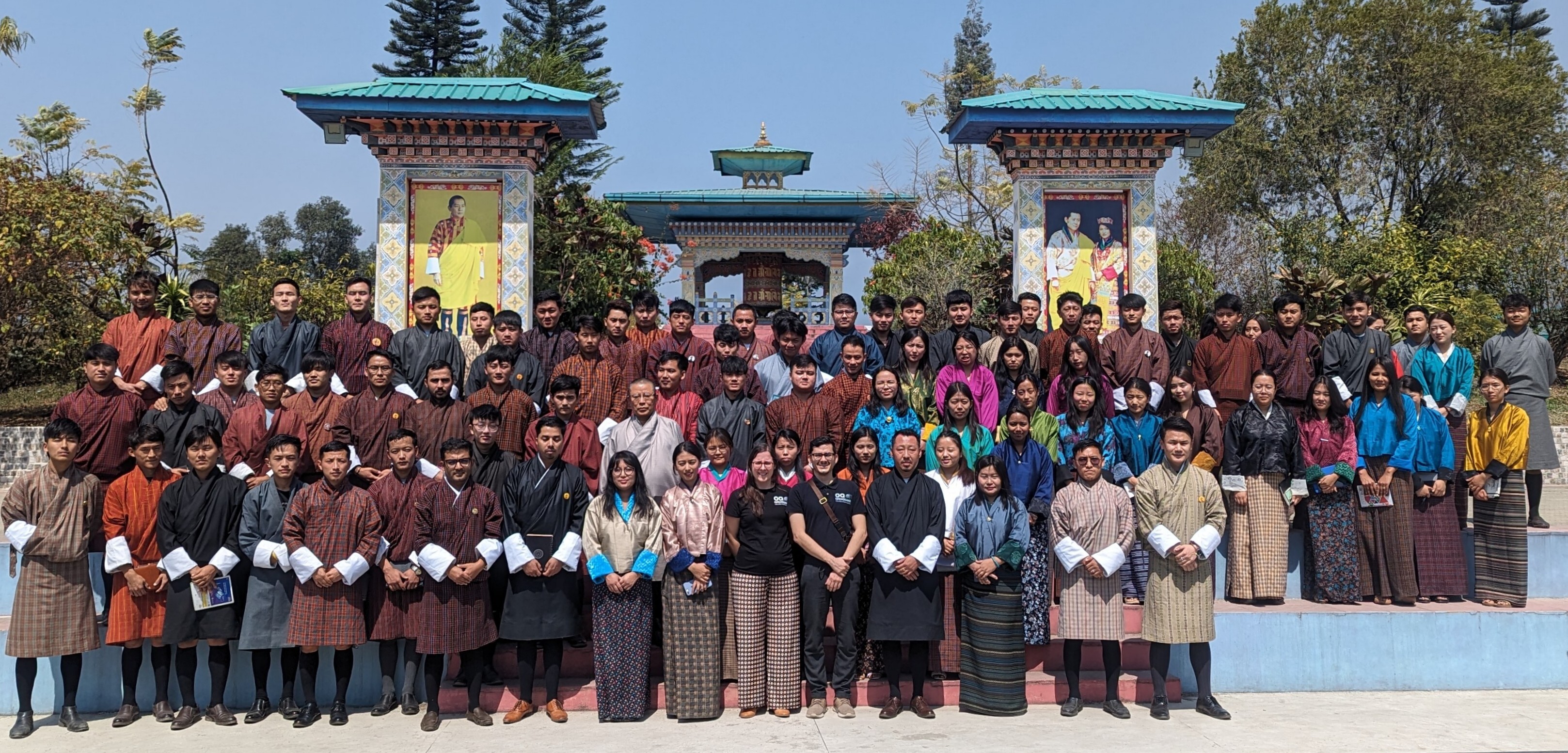
News Strengthening Bhutan's Resilience: GEM's Collaborative Efforts in Seismic Risk Reduction By: Mar 27, 2024 Mar 15, 2024 Share Facebook X (Twitter) LinkedIn Thimphu, Bhutan - March 15, 2024. The Global Earthquake Model (GEM) Foundation's USAID-supported project, Forecasting and Communicating Earthquake Hazard and Risk (FORCE), recently concluded a successful week of activities in Bhutan (March 11-15, 2024), led by GEM's Alejandro Calderon and Catarina Costa. In Bhutan, the FORCE project focuses on strengthening local capacities and improving earthquake risk reduction in the country ( report with detailed information ). Engaging Stakeholders: Collaborative Efforts for Risk Reduction The activities in Bhutan commenced with productive meetings on March 11th, where Alejandro Calderon and Catarina Costa engaged in constructive dialogues with key government agencies responsible for disaster management and cultural preservation. These discussions laid the groundwork for collaborative efforts, ensuring that the FORCE project's objectives align closely with Bhutan's specific needs. Specifically, discussions with the Department of Disaster Management (DDM) highlighted their interest in participating in training programs and potentially hosting project results on their online Geonode platform, expected to be operational by mid-2025. This collaboration will ensure wider accessibility of critical risk information. The Department of Cultural Heritage (DCH), responsible for safeguarding Bhutan's heritage sites, echoed similar enthusiasm. They highlighted their existing database of classified buildings and risk maps and expressed keen interest in leveraging the project's training and OpenQuake software to gain a deeper understanding of earthquake risks to cultural heritage structures. On March 12th, Day 2 a workshop titled "Seismic Risk in Bhutan: What we know and where we are headed," brought together a diverse group of 25 participants from government, academia, and emergency response sectors. Supported by USAID BHA and RUB, this session served as a platform for knowledge exchange and discussion on how the project's outcomes can inform policy decisions and future risk reduction strategies in Bhutan. Empowering Future Generations: Knowledge Dissemination and Capacity Building The Royal University of Bhutan (RUB) serves as the central hub for the FORCE project in Bhutan. A meeting with the university's President reaffirmed their commitment to the project and opened doors for future collaborations with GEM. Building upon this momentum, a well-attended session introduced participants to the concepts of earthquake hazard and risk assessment and showcased the functionalities of OpenQuake held at RUB's College of Science and Technology in Phuntsholing. The sessions gathered over 70 participants, including students and faculty members from civil engineering and geology programs. This session not only showcased the project's objectives but also laid the groundwork for future capacity-building initiatives within Bhutan's scientific community. “The project outcomes will significantly benefit various stakeholders, including informing local building codes, risk mitigation strategies, resource allocation, and emergency response plans. Students and faculty from the College of Science and Technology have actively participated in the project workshops and are using the provided materials for teaching and research. The project is expected to equip students with practical skills and provide research opportunities for faculty to integrate findings into curriculum and building code development.” - Nimesh Chhetri, Lecturer - Head of the Centre for Disaster Risk Reduction and Community Development Studies, CST-RUB. More on Nimesh’s insights here . Reflecting on the successful week in Bhutan, Alejandro highlighted the importance of collaborative partnerships, stating, "Our engagement with key stakeholders and the enthusiastic participation from the Bhutanese scientific community underscore the collective commitment towards enhancing earthquake resilience in Bhutan." Catarina Costa echoed these sentiments, highlighting the significance of knowledge-sharing initiatives in seismic risk reduction. "Through collaborative efforts like the FORCE project, we aim to support local communities with the necessary tools and insights to mitigate seismic risks effectively," she remarked. Moving Forward: A Shared Vision for a More Resilient Bhutan The FORCE project activities in Bhutan illustrated the importance of collaboration in earthquake risk reduction. Stakeholders across government, academia, and the public domains have expressed their interest in leveraging the project's outcomes. “The successful workshops and meetings have opened up extensive possibilities for further collaboration between RUB, GEM, and USAID BHA. RUB can act as GEM's local representative, facilitating communication, data acquisition, and curriculum development focused on disaster management and risk reduction. The collaboration offers exciting opportunities for joint research in areas like landslide and flood hazard assessment, along with studies on non-structural elements in Bhutan. Additionally, RUB can leverage financial aid from USAID BHA and expertise from GEM to enhance ongoing or planned earthquake research projects.” - Nimesh Chhetri, CST-RUB. During the discussions, the College of Science and Technology (CST) has been identified as the central hub for future project communication and knowledge exchange in Bhutan. This includes facilitating access to existing data, ensuring the maintenance and distribution of project results, and collaborating with the Royal University of Bhutan to develop and update earthquake risk models. Looking beyond the current project, stakeholders expressed interest in collaborating on future initiatives. These include: Refining earthquake hazard models Conducting detailed studies on the vulnerability of traditional buildings Expanding risk assessments to include cultural heritage sites, bridges, and dams Investigating other natural hazards like floods, landslides, and rockfalls The FORCE project's multifaceted approach, covering stakeholder engagement, knowledge dissemination, and capacity building, demonstrates the transformative potential of collaborative efforts in disaster risk reduction. With gratitude extended to Bhutanese partners, including the Royal University of Bhutan (RUB) and associated institutions, as well as the continued support from USAID BHA, the Foundation remains steadfast in its mission to help create a more earthquake-resilient Bhutan through collaboration. Learn more about the FORCE project: https://www.globalquakemodel.org/proj/force . Disclaimer This web article about the FORCE project activities in Bhutan is made possible by the generous support of the American people through the United States Agency for International Development (USAID). The contents are the responsibility of the Global Earthquake Model (GEM) Foundation and do not necessarily reflect the views of USAID or the United States Government. No images found. GALLERY 14 march FORCE project in Bhutan.png bhutan 11.03.2024.png bhutan 12.03.2024.png 14 march FORCE project in Bhutan.png 1/3 VIDEO RELATED CONTENTS
- Latest News | Global Earthquake Model Foundation | Italy
LATEST UPDATES Top Story 15 Years of GEM: Transforming the Latest Science into Action for a Safer World Since its inception in 2009, the Global Earthquake Model (GEM) Foundation has been at the forefront of seismic risk reduction efforts worldwide. With a mission to enhance understanding and resilience against earthquakes and other natural hazards, GEM has catalysed transformative change through its collaborative approach and innovative solutions. More Share Facebook X (Twitter) LinkedIn MORE NEWS Search Archive 1 2 3 4 5 1 ... 1 2 3 4 5 6 7 8 9 10 11 12 13 14 15 16 17 18 19 20 21 22 23 24 25 26 27 28 29 30 31 32 33 34 35 36 37 38 39 40 41 42 43 44 45 46 47 48 49 50 51 52 53 ... 53 Strengthening Bhutan's Resilience: GEM's Collaborative Efforts in Seismic Risk Reduction Making Seismic Risk Information Open and Accessible: A Collaboration Between PreventionWeb and GEM Foundation Helen Crowley, GEM Secretary General Receives Prestigious Joyner Memorial Lecture Award GEM Foundation Strengthens Ties with the Global Tsunami Model Community 15 Years of GEM: Transforming the Latest Science into Action for a Safer World GEM Concludes Comprehensive Earthquake Risk Assessment in Bangladesh