CLOSE

QUICK LINKS


PROFILES
PUBLICATIONS
EXPOSURE
VULNERABILTY
SOFTWARE
EQ MODELS
Search Results
538 items found for ""
- CAREC | Global Earthquake Model Foundation
Projects CAREC Developing a Disaster Risk Transfer Facility in the Central Asia Regional Economic Cooperation Region Versión en español English version Share Facebook X (Twitter) LinkedIn Overview Background Willis Towers Watson, a GEM Advisor Sponsor is leading the consortium of organizations to implement the project, “Developing a Disaster Risk Transfer Facility in the Central Asia Regional Economic Cooperation Region” supported by the Asian Development Bank. The GEM Risk Team is responsible for the exposure and seismic vulnerability components of the project, with the Hazard Team providing support in the preparation of risk profiles for countries in the Central Asia Regional Economic Cooperation Region. Objectives The project has three main components: (i) development of disaster risk assessments and modeling in all CAREC countries; (ii) design of a regional pilot disaster risk transfer facility for at least three CAREC countries; and (iii) capacity building and awareness raising activities to sensitize key public and private stakeholders in all CAREC countries about the benefits of disaster risk reduction, risk retention and risk transfer solutions. Willis Towers Watson, a GEM Advisor Sponsor is leading the consortium of organizations that will implement the project. The Central Asia Regional Economic Cooperation, or CAREC Program is a partnership of 11 countries (Afghanistan, Azerbaijan, People's Republic of China, Georgia, Kazakhstan, Kyrgyz Republic, Mongolia, Pakistan, Tajikistan, Turkmenistan, and Uzbekistan), supported by 6 multilateral institutions, working together to promote development through cooperation, leading to accelerated growth and poverty reduction. Location Central Asia GEM has started a new project with WTW supported by the Asian Development Bank.
- ARMENIA POST DRR | Global Earthquake Model Foundation
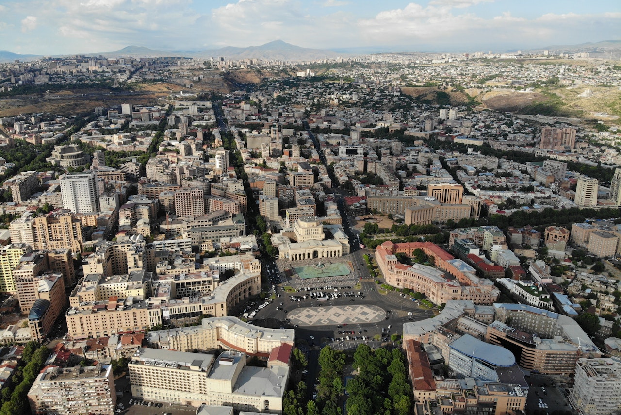
Projects ARMENIA POST DRR Improving Post-Disaster Damage Data Collection to Inform Decision Making Versión en español English version Share Facebook X (Twitter) LinkedIn Overview Background This project, responding to a request from the World Bank for improved post-disaster damage collection, focuses on the collection of data on physical damage to assets such as buildings (residential, commercial, industrial, public), infrastructure, and crops. The aim is to evaluate the current state-of-the-art in post-disaster damage collection – in protocols, tools and systems – in order to identify a suitable protocol and toolset that could be adopted by the Government of Armenia that would be generalisable and available, allowing adoption by other national government agencies or interested parties. The GEM Foundation leads the consortium working on this project, with the GEM Risk Team undertaking the following main tasks: Review of existing protocols, tools and systems Design of a conceptual protocol and toolset Application to the context of Armenia Recommendations Duration: 2018 Objectives Collection of damage data following major disaster events is a fundamental exercise for a multitude of purposes, such as emergency management, resource allocation, fund mobilization and reconstruction planning. The processes involved, and scales of damage assessments vary by country, peril and context. Numerous sector-specific data collection activities provide an estimation of damage, loss and post-disaster needs in order to provide relief and facilitate the commencement of reconstruction and recovery efforts. The project includes identifying and reviewing tools for collecting data in the field as well as damage data aggregation and reporting tools. Of particular interest is the use case in Armenia, demonstrating the needs of a Ministry of Finance requiring national-level reporting of damage on a sub-national level in a transparent system that allows the user to store, retrieve and interrogate damage data down to the asset-level. Collaborators GEM Foundation, JBA Consulting, CIMA Foundation and Geocom Ltd Funding partner: World Bank Group Location Armenia
- CAYMAN ISLANDS PSHA | Global Earthquake Model Foundation
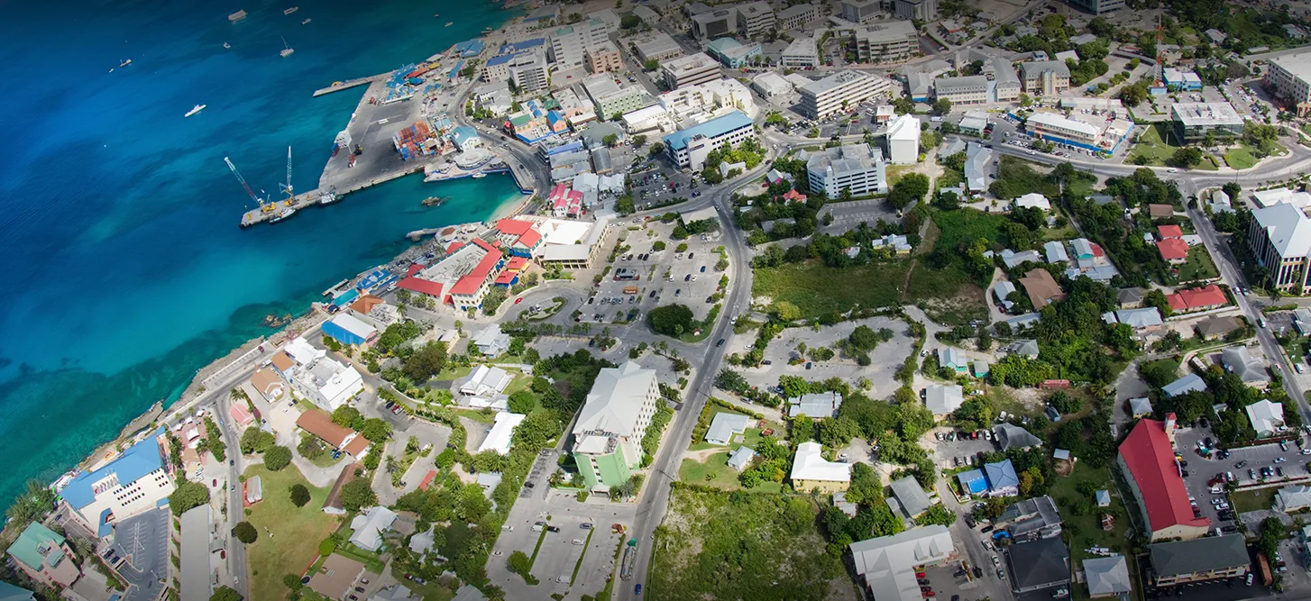
Projects CAYMAN ISLANDS PSHA Probabilistic seismic hazard assessment of Cayman Islands Versión en español English version Share Facebook X (Twitter) LinkedIn Overview Background Thr project aims to perform a probabilistic seismic hazard assessment for the Cayman Islands, and provide the seismic input necessary for the International Building Code (IBC). The GEM Hazard Team is responsible for the seismotectonic and geodynamic characterisation of the study area, the definition of distributed seismicity and fault sources, and the modelling of the epistemic uncertainties. Duration: 2020 Objectives The main objective is to provide input to the 2016 Cayman Islands Building Code, to support engineers in the seismic design and assessment of structures. Collaborators GEM Foundation, EUCENTRE Foundation Funding partner: Cayman Islands Government Location Cayman Islands
- SERA Project | Global Earthquake Model Foundation
Projects SERA Project Seismology and Earthquake Engineering Research Infrastructure Alliance for Europe (SERA) Versión en español English version Share Facebook X (Twitter) LinkedIn Overview Background The Seismology and Earthquake Engineering Research Infrastructure Alliance for Europe (SERA) aims to reduce the risk posed by natural and anthropogenic earthquakes based on innovative research and development projects. SERA will significantly improve the access to data, services and research infrastructures for scientists and other professionals. GEM's contributions focus on taxonomy and exposure of residential, commercial and industrial buildings in Europe; physical vulnerability assessment for buildings; integrated earthquake risk analysis using the risk assessment framework and OpenQuake software established by the Global Earthquake Model. SERA is a Horizon 2020-supported programme responding to the priorities identified in the topic INFRAIA-01-2016-2017 ‘Integrating Activities for Advanced Communities’. SERA involves 31 partners and 8 linked third parties in Europe. It started in May 2017 and will last for three years. Objectives The EUCENTRE-SERA project is collaborating closely with the GEM Foundation (Global Earthquake Model) to: develop a European Risk Modelling framework that brings together the strengths of previous projects such as SHARE, NERA and fills in the research gaps; integrate knowledge and data from other SERA working packages; and build on the risk assessment framework and software developed by GEM. SERA is engaging 31 partners from 16 European countries. They all have leading expertise in the operation of experimental facilities, monitoring infrastructures, and data repositories in the fields of seismology, anthropogenic hazards or earthquake engineering. (complete list ) Location Europe EM-SERA OpenQuake Training in Istanbul, Turkey SERA European Building Exposure Workshop: From European Hazard to Risk
- BANGLADESH | Global Earthquake Model Foundation
Projects BANGLADESH Earthquake Vulnerability and Systemic Risk Assessment in Bangladesh Versión en español English version Share Facebook X (Twitter) LinkedIn Overview Outcomes Training Outreach Photos Publications Background This project follows a specific support request made by the Ministry of Disaster Management and Relief (MoMDR) to the UN Office for Disaster Risk Reduction (UNDRR) and UN Resident Coordinator’s Office (UNRCO) for a sub-national earthquake hazard and risk assessment in Bangladesh. The GEM Foundation has the role of technical expert lead of the project which will include the following activities: Needs and Gaps Assessment Technical Panel Formation and Initial Consultations Seismic Hazard Mapping Exposure Mapping Seismic Vulnerability Assessment Seismic Risk Mapping and Interpretation Stakeholder Consultation and Validation Preliminary Model Dissemination and Training Workshop Funding and technical partner: UNDRR Duration: 2023 - 2024 Objectives The main objective of this project is to develop a detailed, open, sub-national earthquake risk model and evaluate seismic risk for Bangladesh at the zila and upazila level. The complete risk model itself will comprise a probabilistic seismic hazard model, a building exposure model, and a seismic fragility and vulnerability model for the building stock of Bangladesh. Additionally, it includes critical scenarios for key cities, identified based on the results of the probabilistic risk assessment and in consultation with local stakeholders and experts, in a panel led by the Ministry of Disaster Management and Relief (MoMDR), and including representatives from the Ministry of Housing and Public Works, Bangladesh Bureau of Statistics, Geological Survey of Bangladesh, Bangladesh University of Engineering and Technology, and University of Dhaka.` Collaborators In collaboration with the GEM Foundation, the Technical Panel steering this seismic risk assessment initiative is a collaborative assembly of key stakeholders and experts. Led by the Additional Secretary of Bangladesh's Ministry of Disaster Management and Relief (MoDMR), it comprises representatives from vital entities, including the Department Of Disaster Management (DDM), the Fire Service and Civil Defence of Bangladesh, the Ministry of Housing & Public Works (MoHPW), and the Statistics and Informatics Division (SID) of the Bangladesh Bureau of Statistics (BBS). In addition, the panel includes the participation of seasoned national experts specializing in seismic hazard and risk assessment from institutions such as the University of Dhaka (DU), Bangladesh University of Engineering and Technology (BUET), and Jahangirnagar University (JU). Further enriching the panel's knowledge base are contributions from the Geological Survey of Bangladesh, the Centre for Urban Studies (CUS), and the United Nations Development Programme (UNDP), Bangladesh.) Location Bangladesh Earthquake Hazard and Risk Assessment Results This section summarises the various assessments conducted to understand the potential impact of earthquakes in Bangladesh. These assessments cover a range of factors, including the likelihood and severity of ground shaking, liquefaction potential, exposure of people and buildings, vulnerability of infrastructure, and the overall seismic risk posed to the country. The following list details the outputs generated from each assessment. Bangladesh Profiles | Past Earthquakes ***ALL OUTPUTS ARE PRELIMINARY*** a. Population and Building Exposure The "Population and Building Exposure" section utilised data from various sources to create an exposure model for Bangladesh. The 2011 Population and Housing Census and the 2013 Economic Census provided the foundation for residential and commercial/industrial exposure, respectively. While detailed housing information from the 2022 census wasn't yet available at lower administrative levels, preliminary population counts at the district level were incorporated to update the model at the start of the project. Additionally, information on building materials used throughout the country, derived from the 2011 census, was employed. For informal urban constructions, data from the 2014 Slum Areas and Floating Population Census was used to infer vulnerability based on dwelling unit types, though specific construction materials weren't available. Finally, the project team actively sought and obtained upazila-level data on building materials from the 2022 census to further refine the exposure model. Maps | Profile b. Infrastructure Exposure In addition to residential, industrial, and commercial structures that were previously covered by GEM’s exposure models at the zila level (which have been updated to the upazila level during this project), we have also developed exposure models for the healthcare and educational facilities at the country, including all hospitals and clinics, and all schools, colleges, and universities. Map | Profile c. Earthquake Scenarios The project also constructed the rupture geometries for these events, selected a range of ground motion models, and assessed the potential impact—both in terms of damage and losses—that each event could inflict on the country if it were to occur today. The full scenario set consists of twelve events: seven historical events from 1664-1918, chosen out of many in this period, supplemented by five hypothetical events. Maps | Profile d. Probabilistic Seismic Hazard Assessment The seismic hazard modelling and mapping section describes the approach taken to assess the seismic hazard in Bangladesh with the goal of creating a comprehensive seismic hazard model for Bangladesh that can be used for risk assessment and mitigation. The project started with a probabilistic seismic hazard model for the Indian subcontinent, which was updated and implemented for the OpenQuake engine. The model includes seismogenic source models, ground motion models, and considers various tectonic regions. This section also mentions the review of the seismic source model for northeast India and the improvements made to the model. Maps | Profile e. Liquefaction Hazard Assessment The section "Liquefaction susceptibility and hazard assessment" discusses the inclusion of regional liquefaction occurrence models in the project, which predict ground failure using existing mapped information and above-ground inferences of below-ground conditions. These models were used for the national scale liquefaction hazard assessment in the second phase of the project identifying the factors that contribute to liquefaction, the methods used for assessment, and the potential damage and losses that can result from liquefaction. Maps | Charts | Tables f. Seismic Risk Assessment The project estimated seismic risk metrics utilising the OpenQuake-engine's stochastic event-based risk assessment calculator. A probabilistic seismic hazard analysis model was employed to generate earthquake rupture forecasts, forming a stochastic event set over a 100,000-year span. Economic and human losses were computed for each event, producing event loss tables and year loss tables. Risk metrics included exceedance probability curves and average annualized losses. Fatality and injury estimates relied on vulnerability models informed by global earthquake data, with a focus on South Asian building characteristics. Results were tabulated nationally and regionally by the project. The assessment also considers the exposure and risk of healthcare facilities, educational facilities, and the national road network to seismic hazards. Maps set 1 | Maps set 2 | Profile Improving global capacity for seismic hazard and risk This part of the program was designed to improve the understanding and awareness of earthquake hazard and risk, and to help bridge the gap between the information produced in detailed hazard and risk assessment studies and its communication to a wide variety of stakeholders (which range from local experts with the remit to assess seismic risk to decision-makers responsible for the implementation of risk reduction measures). a. Website for OpenQuake online training The OpenQuake online training was designed for different types of audiences with diverse backgrounds and expertise. Through this platform, participants interact with GEM scientific and technical teams to learn the main concepts of earthquake risk assessment, along with the basic features of the engine. [English ] b. Onsite Training Workshop One-day workshop designed to improve the understanding and awareness of earthquake hazard and risk and to help bridge the gap between the information produced in the project and its communication to a wide variety of stakeholders. The session allowed participants to explore and prepare the required input files for earthquake scenarios in the OpenQuake engine. OQ Engine Video Tutorials | English | Example Material Communicating and raising earthquake risk awareness The activities in this component focused on raising the awareness of the public on earthquake hazard and risk by training a diverse group of disaster risk reduction (DRR) professionals together with personnel in charge of communicating risk to the public, and by conducting community-based workshops in selected areas of the pilot cities by those who were trained by the project. a. GEM presentation to the Ministry of Disaster Management and Relief (MoDR), Bangladesh This is an introductory presentation on Bangladesh's earthquake risk assessment project that outlines past efforts, emphasises the need for a nationwide evaluation, and introduces the GEM Foundation's methodology. It highlights completed division-level risk maps and ongoing project activities like data collection, vulnerability assessment, and stakeholder engagement. Additionally, five other presentations below will address different aspects of the project in Bangladesh. View Presentation b. Technical Panel Session #1 This presentation discusses the methodology used to collect and process data related to earthquake risk components such as hazard, exposure, and vulnerability. It also mentions the project activities and the formation of a technical panel for consultation and validation. View Presentation c. Technical Panel Session (PSHA) #2 This presentation is about the tailored version of the PSHA (Probabilistic Seismic Hazard Assessment) model for the Indian sub-continent, which is based on the original model developed by Nath and Thingbaijam in 2012. The presentation discusses the main areas identified for improvement in the model, the changes that were introduced, and the impact of these changes on the hazard results. View Presentation d. Technical Panel Session (Scenario Ruptures) #2 This presentation is about the hazard analysis of earthquakes in Bangladesh, including an overview of the fault systems, historical ruptures, and potential ruptures. It also mentions the ground motion models used for the analysis. View Presentation e. Technical Panel Session #3 This presentation focuses on exposure and physical and social vulnerability, as components of seismic risk. It discusses the details of exposure models, seismic vulnerability analysis, and social vulnerability. The presentation also mentions the use of the Global Earthquake Model (GEM) and the INFORM Index in assessing and understanding the seismic risk in Bangladesh. View Presentation f. Technical Panel Session (Scenarios and Risk) #4 This presentation details data collection and processing methods for seismic hazards, exposure, and vulnerability. It presents preliminary results on potential earthquake impacts like building collapse and economic loss using an 1885 event as an example. The presentation also mentions probabilistic risk assessment and division-level risk maps, alongside details about 12 "scenario ruptures" based on historical and potential earthquake events. View Presentation g. Technical Panel Session (Liquefaction) #4 This presentation focuses on factors such as soil liquefaction, susceptibility to ground failure, population density, urbanisation, and the country's river delta geography. It discusses various methodologies and models used to assess liquefaction hazard and suggests the use of geospatial methodologies for identifying areas with a higher likelihood of occurrence. View Presentation BUSINESS NEWS Images from online meetings: September to December 2023 1/1 Interim Substantive Reports The documents below are interim substantive reports on the project "Earthquake Vulnerability and Systemic Risk Assessment in Bangladesh". The main objective of the project is to develop a detailed earthquake risk model for Bangladesh at the zila and upazila levels. They describe the development of an open-source probabilistic seismic risk model for Bangladesh and provide key insights to decision-makers and stakeholders in the disaster risk mitigation community. a. First Interim Substantive Report This report highlights the need for a seismic risk model in the country and discusses the gaps and needs assessment. The report also explains the technical approach and methodology for developing the risk model, including seismic hazard modeling, liquefaction susceptibility and hazard assessment, exposure modeling, and seismic fragility and vulnerability modeling. The seismic risk assessment process is described, along with the formation of a technical panel and stakeholder engagement. Download the Report b. Second Interim Substantive Report This report provides updates on various aspects of the project, including the development of earthquake scenarios, liquefaction susceptibility and hazard assessment, exposure modeling, and social vulnerability modeling. The report mentions that the project has engaged a technical panel comprising key experts and stakeholders, and their feedback and suggestions are being incorporated into the project. The report also includes information on the distribution of hospitals, clinics, schools, and colleges in Bangladesh. Download the Report
- HORUS | Global Earthquake Model Foundation
Projects HORUS Horus: Pilot for a generic damage evaluation methodology based on remote-sensing data Versión en español English version Share Facebook X (Twitter) LinkedIn Overview Background Horus is a pilot project that explores the combination of high-resolution building inventory data from OpenStreetMap and other local sources with image-processing algorithms for the detection of earthquake damage and flood extents using remote-sensing data, along with supplementary geospatial datasets as inputs to a machine learning (ML) classification model. The ML model is trained using detailed building damage datasets from past events in a supervised learning framework, and the trained model is intended to be used to estimate the extent of damage and loss in events previously unseen by the model. The proposed framework is applied in three case study applications: March 2020 Mw5.3 Zagreb earthquake; January 2020 Mw6.4 Puerto Rico earthquake and August 2016 Louisiana floods. The GEM Risk Team is responsible for the overall coordination of the project involving multiple partners, compilation of building-level earthquake damage datasets, development of the ML models, and training and testing of the models. Duration: 2020 Objectives This pilot project, initiated and funded by the World Bank, aims to develop a framework for semi-automated damage and loss assessment due to earthquake and floods from Earth Observation (EO) data and other supplementary datasets, while also leveraging recent advances in machine-learning algorithms. These damage and loss estimates can potentially be used for transparent financial compensation and to target the distribution of resources geographically and temporally. Collaborators Advanced Rapid Imaging and Analysis (ARIA) team at the National Aeronautics and Space Administration’s (NASA) Jet Propulsion Laboratory (JPL) and California Institute of Technology (Caltech), the Global Earthquake Model (GEM) Foundation, JBA Risk, and the Humanitarian OpenStreetMap Team (HOT) Funding partner: World Bank Group Locations Earthquake case studies: Gorkha, Nepal; Puebla, Mexico; Puerto Rico, United States; Zagreb, Croatia Flood case study: Louisiana, United States
- Collaborative Projects | Global Earthquake Model Foundation | Italy
PROJECTS GEM’s collaborative network comprises more than 100 public and private institutions, which has led to GEM’s participation in more than 50 regional, national, and multilateral projects covering Europe, Middle East, South America, Central America, North America, Sub-Saharan Africa, Asia and the Pacific. Share Facebook X (Twitter) LinkedIn Anchor 1 Key Projects - 2013 and beyond Sort by Order by 1 2 3 4 5 1 ... 1 2 3 4 5 6 7 8 ... 8 0 Filters: 37 results found View: Map List Gallery ASCE Earthquake Loads Overseas (AELO) Status: Ongoing The project is carried out within a collaboration between GEM and the U.S. Geological Survey (USGS), and is sponsored by the U.S. Department of State (DoS) and the U.S. Department of Defence (DoD). The aim of the project is provide a web service for computing design ground motions (on rock and soil) that are compliant with the ASCE guidelines (ASCE 7-16, ASCE 41-17, ASCE 7-22, ASCE 41-23) for 500 locations worldwide. View Strengthening capacity on disaster risk assessment, reduction and transfer instruments in Mongolia Status: Completed This project aims to support Mongolia to develop a set of key disaster risk information and knowledge products for mainstreaming Disaster Risk Management (DRM) into development, including on Disaster Risk Financing and Insurance (DRFI). View Assessing the Risk Exposure of Road Network to Climate and Natural Hazard Risks in Solomon Islands Status: Completed This project aims to conduct a robust multi-hazard risk assessment of the road network to climate and natural hazards in the Solomon Islands, both historically and under future climate projections. View Seismic Resilience Baseline Analysis and Investment Option Needs in Indonesia Status: Completed This project, funded by the World Bank's GFDRR, aims to conduct a seismic baseline analysis to support the development of a potential national seismic risk mitigation program in Indonesia. View Seismic risk and exposure data for Turkey Status: Completed The World Bank is developing a thematic Paper on Building Climate and Disaster Resilience in Turkey that will apply a new World Bank Guidance Note on how to prepare resilience and adaptation strategies. View Title Location Status ASCE Earthquake Loads Overseas (AELO) Global (Washington DC, USA) Ongoing Strengthening capacity on disaster risk assessment, reduction and transfer instruments in Mongolia Mongolia Completed Assessing the Risk Exposure of Road Network to Climate and Natural Hazard Risks in Solomon Islands Solomon Islands Completed Seismic Resilience Baseline Analysis and Investment Option Needs in Indonesia Indonesia: ‣ Kota Bengkulu, Bengkulu province ‣ Kota Cilegon, Banten province ‣ Kota Gorontalo, Gorontalo province Completed Seismic risk and exposure data for Turkey Turkey Completed Input to World Banks' Country Climate and Development Report (CCDR) for Western Balkans Albania, Bosnia and Herzegovina, Kosovo, Montenegro, North Macedonia and Serbia. Completed Regional risk modelling and scenario analysis for EU Member States - Seismic risk analysis and exposure data EU Member States Completed Rapid Diagnostic in Uttarakhand and Himachal Pradesh Global Completed Capacity building to understand and take action on seismic risks in Georgia Georgia Completed Comprehensive Multi hazard Risk Assessment in Malawi Malawi Ongoing Page 1 of 4 1 2 3 4 5 1 ... 1 2 3 4 5 6 7 8 ... 8 Completed Ongoing Washington DC
- TREQ Project | Global Earthquake Model Foundation
Projects TREQ Project Training and Communication for Earthquake Risk Assessment (TREQ) Versión en español English version Share Facebook X (Twitter) LinkedIn Overview Risk Assessment Training Outreach Photos Reports Summary The Training and Communication for Earthquake Risk Assessment (TREQ) Project was designed to demonstrate how earthquake hazard and risk assessment can inform decision makers in the development of risk reduction policies, as well as how earthquake risk can be properly communicated to stakeholders and the public in general. [PDF Executive Summary English ] Objectives The project was organized into two main parts. The first one aimed to develop capacity for urban earthquake hazard and risk assessment in Latin America, Quito (Ecuador), Cali (Colombia), and Santiago de los Caballeros (Dominican Republic); while the second part was to develop training, educational and communication material to enhance the understanding of earthquake risk worldwide. The program was tailored for a wide spectrum of stakeholders, categorized into four main groups: governance (decision-makers/public authorities), industry (practitioners and professionals), academia (researchers and professors), and the community. Collaborators Ecuador Municipalidad de Quito Escuela Politécnica Nacional (EPN) Instituto Geofísico (IG) Colegio de Ingenieros Civiles de Pichincha (CICP) Pontificia Universidad Católica del Ecuador Dominican Republic Municipalidad de Santiago de los Caballeros Servicio Geológico Nacional (SGN) Oficina Nacional de Evaluación Sísmica y Vulnerabilidad de Infraestructuras y Edificaciones (ONESVIE) Comité Técnico Nacional (CTN) Pontificia Universidad Católica Madre y Maestra (PUCMM) Colombia Municipalidad de Santiago de Cali Servicio Geológico Colombiano (SGC) Departamento Administrativo de Planeación Municipal (DAPM), Cali Universidad EAFIT, Medellin Unidad Nacional de Gestión del Riesgo de Desastres (UNGRD) Costa Rica Universidad de Costa Rica (UCR) Mexico Universidad Autónoma de Baja California (UABC) Location Quito (Ecuador), Cali (Colombia), and Santiago de los Caballeros (Dominican Republic) Urban risk assessment in Latin America and the Caribbean The following deliverables were generated in this component: seismic hazard and risk assessment at the urban scale for the three TREQ cities: Quito (Ecuador), Cali (Colombia), and Santiago de los Caballeros (Dominican Republic). State-of-art models were developed for each city in close collaboration with local partners. The input models and results are available at the URL address below: [github.com/gem/treq-riesgo-urbano/ ] a. City reports Seismic Risk Assessment for the Metropolitan District of Quito [Evaluación de Riesgo Sísmico para el Distrito Metropolitano de Quito] [Español ] Seismic Risk Assessment for Santiago de Cali [Evaluación de Riesgo Sísmico para Santiago de Cali] [Español ] Seismic Risk Assessment for Santiago de los Caballeros [Evaluación de Riesgo Sísmico para Santiago de los Caballeros] [Español ] b. Seismic Hazard Assessment PSHA models and datasets for urban hazard assessment [Modelos probabilísticos de amenaza sísmica (PSHA) y conjuntos de datos para la evaluación de la amenaza a nivel urbano] [PDF English ] Probabilistic seismic hazard model for the Dominican Republic [Modelo Probabilístico de Amenaza Sísmica para la República Dominicana] [PDF English | Español ] [Download Model ] Seismic hazard results (rock and soil conditions) [Resultados de amenaza sísmica (condiciones en roca y en suelo)] [PDF English ] Seismic hazard analysis at the urban scale [Análisis de la amenaza sísmica a escala urbana] [PDF English ] c. Seismic Risk Assessment Executive summary Urban seismic risk assessment for the cities of Quito, Cali and Santiago de los Caballeros [Resumen ejecutivo sobre la evaluación del riesgo sísmico urbano para las ciudades de Quito, Cali y Santiago de los Caballeros] [PDF English ] Building classes in Quito, Cali and Santiago de los Caballeros [Tipologías constructivas en Quito, Cali and Santiago de los Caballeros] [PDF Español ] Geo-referenced exposure database of population and buildings in the TREQ city [Base de datos de exposición georreferenciada de población y edificios en cada ciudad de TREQ] [Cali ] [Quito ] [Santiago ] Database of fragility and vulnerability functions for each building class present in the exposure model [Base de datos de funciones de fragilidad y vulnerabilidad para cada clase de edificio presente en el modelo de exposición] [Data ] Maps and risk metrics generated for each city [Mapas y métricas de riesgo para cada ciudad] [Cali ] [Quito ] [Santiago ] d. City scenarios Database with ruptures selected for scenario analysis [Base de datos con rupturas seleccionadas para análisis de escenarios] [Cali ] [Quito ] [Santiago ] Scenario hazard assessment for the representative earthquakes in Quito, Cali and Santiago de los Caballeros [Evaluación del escenarios de amenaza para sismos representativos en Quito, Cali y Santiago de los Caballeros] [PDF English ] e. Urban Applications Earthquake induced landslides and liquefaction in Cali [Deslizamientos y licuefacción inducidos por sismo en Cali] [PDF English ] Improving global capacity for seismic hazard and risk This part of the program was designed to improve the understanding and awareness of earthquake hazard and risk, and to help bridge the gap between the information produced in detailed hazard and risk assessment studies and its communication to a wide variety of stakeholders (which range from local experts with the remit to assess seismic risk to decision-makers responsible for the implementation of risk reduction measures). a. Website for OpenQuake online training The OpenQuake online training was designed for different types of audience with diverse background and expertise. Through this platform, participants interacted with GEM scientific and technical teams to learn the main concepts of earthquake risk assessment, along with the basic features of the engine. [English | Español ] b. OpenQuake manual in online format The official manual has been converted from latex into reStructuredText format made possible by @USAID support. The new manual is now online in HTML format and can be accessed at: [Webpage English ] c. Video tutorials on seismic hazard and risk analysis using OpenQuake The project has produced 15 videos on technical training using the OpenQuake-engine (in English and Spanish), 7 videos with material to disseminate the models and results of urban risk assessment in the TREQ cities, and 2 videos for communicating earthquake risk to the general public. OQ Engine Video Tutorials [ English | Español ] d. Manual to perform seismic hazard analysis This manual presents the basic concepts of classical PSHA and the wide spectrum of alternatives to model seismicity and uncertainties (epistemic and aleatory) in the OpenQuake-engine. Probabilistic Seismic Hazard Assessment (PSHA) is the principal methodology for assessing the potential hazard posed by earthquakes. The hazard maps generated with the hazard calculator are widely used in national seismic codes for hazard zonation and structural design provisions. [PDF English ] [Example materials ] [More info ] e. Training the Trainers TREQ has engaged and collaborated with five university professors from Latin America to conceptualize, create and implement a unified course for the study of seismic risk at the university level. Brochures in English and Spanish further explain the concept behind this initiative and outline the early results and experiences of the professors from Colombia, Costa Rica, El Salvador, Guatemala and Mexico. [PDF English | Español ] Communicating and raising earthquake risk awareness The activities in this component focused on raising awareness of the public on earthquake hazard and risk by training a diverse group of disaster risk reduction (DRR) professionals together with personnel in charge of communicating risk to the public, and by conducting community-based workshops in selected areas of the pilot cities by those who were trained by the project. a. Educational material to raise seismic risk awareness: Application for the Metropolitan Area of Aburra Valley (AMVA) [Material didáctico para sensibilizar a la comunidad sobre el riesgo sísmico: Aplicación para el área Metropolitana del Valle de Aburrá (AMVA)] [PDF Español ] b. Video to communicate earthquake risk to the general public [Video para comunicar el riesgo de terremoto al público en general] [English | Español ] c. Guidelines for teachers for the development of an introductory course on seismic risk [Guía para profesores para el desarrollo de un curso introductorio de riesgo sísmico] [PDF Español ] d. Urban risk mitigation and response profiles for the TREQ cities [Perfiles de respuesta y mitigación de riesgos urbanos para las ciudades TREQ] [Cali ] [Quito ] [Santiago ] News articles Events Understanding seismic risk through capacity development and knowledge sharing webinar draws hundreds of participants from around the world [Article ] [Event page English | Español ] [Video ] Presentation of the national PSHA model for the Dominican Republic: a joint webinar hosted by Servicio Geológico Nacional Dominicano in cooperation with GEM, Oficina Nacional de Evaluación Sísmica y Vulnerabilidad de Infraestructura. and USAID's Bureau for Humanitarian Assistance . [Event flyer Español ] [Video English | Español ] ---- Articles Raising Earthquake Risk Awareness: TREQ’s community workshops for the general public Urban hazard assessment of selected cities in Latin America Local solutions to global problems: reducing disaster risk through collaboration and openness TREQ Project Updates: Site Effects Modelling and Urban Exposure Models USGS has joined the TREQ initiative for urban earthquake scenarios TREQ capacity building: OQ online training updates Jan-Feb 2021 TREQ2020 – Capacity development and OpenQuake online training, year in review TREQ OpenQuake Online Training: Earthquake Scenarios - Ground Motion Fields Sept 2020 More at GEM News section Newsletter The TREQ project newsletter was intented to share activities in urban risk assessment, and earthquake risk training and education materials with a wide-range of local stakeholders from the academia, private and public sectors, as well as the civil society in Latin America, the Caribbean and beyond. Newsletter no. 3 - May 2021 Newsletter no. 2 - September 2020 Newsletter no. 1 - March 2020 Maiden issue [English ] Maiden issue [Españo ] BUSINESS NEWS More TREQ photos here Facebook album 1/4 BUSINESS NEWS Raising Risk Awareness: workshops for the general public 1/4 BUSINESS NEWS March 2020 Project Kickoff 1/4 BUSINESS NEWS Photos from the November 2020 OpenQuake Online training 1/2 BUSINESS NEWS Meetings in Quito 1/10 BUSINESS NEWS Meetings in Guayaquil 1/1 Overview TREQ Executive Summary [English ] Seismic Hazard Assessment PSHA models and datasets for urban hazard assessment [English ] Probabilistic seismic hazard model for the Dominican Republic [English | Español ] [Download Model ] Seismic Hazard Results (rock and soil conditions) [English ] Seismic hazard analysis at the urban scale [English ] Seismic Risk Assessment Executive summary Urban seismic risk assessment for the cities of Quito, Cali and Santiago de los Caballeros [English ] Building classes in Quito, Cali and Santiago de los Caballeros [Español ] City Scenarios Scenario selection for representative earthquakes in Quito, Cali and Santiago de los Caballeros [English ] Urban applications Earthquake-induced liquefaction and landslides in Cali, Colombia [English ] City reports Seismic Risk Assessment for the Metropolitan District of Quito [Español ] Seismic Risk Assessment for Santiago de Cali [Español ] Seismic Risk Assessment for Santiago de los Caballeros [Español ] Training and communicating earthquake risk Probabilistic Seismic Hazard Analysis (PSHA) Training Manual [English ] [Example materials ] [More info ] Educational material to raise seismic risk awareness: Application for the Metropolitan Area of Aburra Valley (AMVA) [Español ] Guidelines for teachers for the development of an introductory course on seismic risk [Español ] Disclaimer The contents of this project website such as studies, reports, audio-visual, news articles, blogs, and other information or media products including those in the external links are made possible by the generous support of the American people through the United States Agency for International Development (USAID). The contents are the responsibility of the Global Earthquake Model (GEM) Foundation and do not necessarily reflect the views of USAID or the United States Government.
- READY2RESPOND | Global Earthquake Model Foundation
Projects READY2RESPOND Rapid Diagnostic in Uttarakhand and Himachal Pradesh Versión en español English version Share Facebook X (Twitter) LinkedIn Overview Background Ready2Respond (R2R) is a rapid diagnostic guide, designed to improve national, sub-national and city resilience mechanisms and to protect development gains through investments in emergency preparedness and response systems. It is informed by the World Bank Group (WBG) City Resilience Program (CRP) and other WBG resilience platforms. In this project R2R is applied to the Uttarakhand and Himachal Pradesh states in the Himalayan region of India. The GEM Risk Team contributes to the project by providing: Literature review and stakeholder mapping around hazard and risk initiatives, risk data and models for both states Provision of seismic hazard/risk model outputs and related descriptive information for both states (to support diagnostic activities) Review of legal regulation of the built environment and associated initiatives Review of seismic preparedness of the critical infrastructure defined in the project Preparation and remote input into stakeholder workshops Duration: 2023 Objectives This project responds to the need to provide effective and comprehensive diagnosis of the Uttarakhand and Himachal Pradesh states’ emergency preparedness and response systems in the Himalayan region of India. This enables the World Bank and the government to tailor investments to strengthen institutional capacity and capability, ensure public safety, and limit economic disruption in the face of multiple, and often cascading, geological and hydrometeorological hazards. Collaborators GEM Foundation, JBA Consulting, Geo Climate Risk Solutions (GCRS) Funding partner: World Bank Group Location India Himalayas
- SARA Project | Global Earthquake Model Foundation
Projects SARA Project South American Risk Assessment (SARA) Versión en español English version Share Facebook X (Twitter) LinkedIn Overview Outcomes Training Outreach Photos Publications Overview South America incorporates some of the most seismically active regions on the planet, where the South American subduction zone generates the forces to create the Andes Mountains and drives the occurrence of destructive earthquakes across Chile, western Argentina, Bolivia, Ecuador, Peru, Colombia and Venezuela. In turn, the high vulnerability of many structures and the high population density of the main cities are factors that contribute to the region’s high seismic risk. In the last two decades alone, over 3,000 fatalities have been reported, and the economic losses have exceeded 30 billion USD (EM-DAT, www.emdat.be ). While expert capabilities exist in these countries to assess earthquake risk, the information, infrastructure, tools, and collaboration networks necessary to develop comprehensive knowledge among scientists and engineers and to move this knowledge into the mainstream of disaster risk reduction activities has been lacking. Objectives The approach is to bring together international best practice tools and methodologies with local expertise and knowledge needed to establish local ownership and define risk assessment objectives and priorities. GEM Foundation combined these elements and focused on developing local capacities across sectors (academic, public and private), across technical disciplines (e.g., hazard, risk, IT), and through the implementation of disaster risk reduction policies and programs. The program of capacity development was initiated in 2013 with the South America Risk Assessment (SARA) Project to bring experts, institutions, and stakeholders from 7 countries to develop a regional assessment of earthquake hazard and risk. GEM provided its OpenQuake earthquake hazard and risk analysis software and other tools and databases freely and openly to all participants. More than 50 of the region’s experts across 17 institutions collaborated to produce critical data sets, develop common approaches, and develop open-source tools for both data collection and interpretation. Collaborators The SARA Project, completed in December 2015, provided the foundation for formal and informal collaborations at many levels and for many purposes. GEM subsequently developed formal partnerships across public and private sectors (e.g., SuraAmerica Insurance, the Geological Survey of Colombia, EcoPetrol), academic partnerships (e.g., EAFIT Univ, Univ del Norte, Univ Catolica Chile), non-profits (e.g., OSSO), and most recently, with municipal governments (Cali, Colombia and Quito, Ecuador), for urban risk assessments. (complete list ) Location Andean Region (Venezuela, Colombia, Ecuador, Peru, Bolivia, Chile and Argentina) Introduction The project was carried out by experts and institutions from the region using to the extent possible open data sets, methodologies and tools such as GEM’s new open source software, the OpenQuake Engine and other OpenQuake tools. The project revolved around 5 modules: hazard, exposure and physical vulnerability, socio-economic vulnerability and resilience, loss estimates and city scenarios. The modules were carried out by a variety of experts/scientists from the region , in collaboration with the project coordinators and, where relevant, the GEM Secretariat. 1. Seismic hazard In early 2013 the Global Earthquake Model (GEM) published seven Requests for Proposal covering topics related to the compilation of basic datasets as well as the creation and calculation of an updated probabilistic seismic hazard input model for South America. Five consortia of South American researchers responded to this request and submitted proposals, which were reviewed in an initial stage by scientists working at the GEM Secretariat, and successively discussed in a meeting in Bogota held in December 2013 at the “Servicio Geologico Colombiano”. 2. Exposure and Physical Vulnerability Development of exposure datasets and vulnerability functions for South America at regional, national and/or sub-national levels have been considered. Modelling of exposure and physical vulnerability in the most earthquake prone countries is the main goal in the first stage of the project. 3. Social Vulnerability and Resilience The social vulnerability component of SARA comprises the development of composite indicators of social vulnerability and resilience along with their robustness testing and validation. The objective is to provide tools and information useful for understanding the potential effects of earthquakes in communities of South America. 4. National and subnational estimation of losses An open and transparent seismic risk assessment for the Andean countries has been performed. A probabilistic approach was followed for the calculation of risk metrics, that includes average annual economic and human loss maps, mean loss exceedance curves per country, and statistics that reveal which building classes are most vulnerable to earthquakes. 5. City Scenarios Following the objectives of SARA, the development of city scenarios is crucial for planning risk management strategies in cities with larger concentration of population and exposed to significant hazard. In this sense, the GEM Secretariat has been seeking collaborations with research groups and governmental stakeholders that will be the end users of case studies in Lima (Peru), Quito (Ecuador), Medellín (Colombia), Iquique, Osorno and Rancagua (Chile). Capacity development and institutional strengthening To promote sustainability, SARA’s work included the following: capacity development and institutional strengthening, and stakeholder engagement. The outcomes of activities in these areas are described below. A blog by Carlos Costa featuring the SARA project workshop in Chile 2014. [News ] A wiki project website containing technical information about the SARA project. [Website ] BUSINESS NEWS Quito workshops 2015 1/3 BUSINESS NEWS Lima workshops 2015 1/2 SARA Project Executive Summary [PDF ] Probabilistic Seismic Risk Assessment Of The Residential Building Stock In South America [PDF ] A conference paper on Building A Ground-Motion Logic Tree For South America Within The Gem-Sara Project Framework [PDF ] SARA (South America Risk Assessment Project Workshop) on “Inventory of Quaternary deformation of South America” [PDF ]