Thanks for submitting!
You will be contacted as soon as possible


QUICK LINKS


PROFILES
PUBLICATIONS
EXPOSURE
VULNERABILTY
SOFTWARE
EQ MODELS
Search Results
Search this site
1170 results found with an empty search
- Newsletter | Global Earthquake Model Foundation | Italy
TOPIQS is GEM's bi-monthly newsletter which features the latest from GEM, expert opinions and a round up of earthquake risk and related issues in DRR policy and practice, insurance and financial applications, innovations in earthquake engineering, NEWSLETTER TOPIQS is GEM's bi-monthly newsletter which features the latest from GEM, expert opinions and a round up of earthquake risk and related issues in DRR policy and practice, insurance and financial applications, innovations in earthquake engineering, hazard and risk assessment, and others. Subscribe Now Share Facebook LinkedIn Most recent July-Sept 2026 October 2026 TOPIQS This edition brings together the latest in earthquake risk research, field investigations, scientific collaboration & training. July 16, 2026 July 2026 TOPIQS This issue looks back at the 2026 GEM Conference – From Faults to Future Scenarios. April 29, 2026 April 2026 Topiqs Governance milestones, OQ 3.24, global training & outreach, & key updates as GEM closes 2025 & looks ahead to 2026. Archive Issue Date Teaser July-Sept 2026 This edition brings together the latest in earthquake risk research, field investigations, scientific collaboration & training. July 16, 2026 This issue looks back at the 2026 GEM Conference – From Faults to Future Scenarios. April 29, 2026 Governance milestones, OQ 3.24, global training & outreach, & key updates as GEM closes 2025 & looks ahead to 2026. Oct-Dec 2025 Governance milestones, OQ 3.24, global training & outreach, & key updates as GEM closes 2025 & looks ahead to 2026. October 8, 2025 Marking 15 years of OpenQuake, summer school, earthquake response updates, and more. July 9, 2025 This quarter’s newsletter captures key developments and partnerships that are shaping GEM’s global impact. Jan-Mar 2025 The recent earthquake in Myanmar reminds us why advancing earthquake risk reduction 𝘣𝘦𝘧𝘰𝘳𝘦 earthquakes occur is more urgent than ever. December 19, 2024 Discover GEM’s latest milestones, including highlights from our INGV presentation + more! Oct 10, 2024 Read how we're supporting the next generation’s disaster preparedness for #IDDRR2024, plus more updates inside. June 30, 2024 Busy Q2 for GEM! Showcased our work & collab spirit at #UR24 & @wcee2024, teamed up with USGS & NormanMax for earthquake safety. April 3, 2024 This release highlights a busy first quarter including the celebration of GEM's 15th anniversary. December 19, 2023 Explore our commitment to global seismic risk reduction through strengthened public-private partnerships. September 29, 2023 Advancing Earthquake Resilience: GEM Set to Unveil Cutting-Edge Global Seismic Hazard and Risk Products on the... June 30, 2023 In this newsletter: the Top Story will provide you with updates and a summary of the 2023 GEM Conference, the InFocus will feature John's story. April 17, 2023 Welcome to our first newsletter for 2023! Our Top Story is the release of GEM’s new global earthquake hazard and risk maps, models... December 8, 2022 GEM Topiqs is out! In this issue, we are happy to announce our partnership with Aon and CelsiusPro. We are also welcoming back Guy Carpenter... September 19, 2022 In this issue of Topiqs we are pleased to announce a new partnership with Allianz Group, which joined GEM as a Private Governor in June. June 6, 2022 In our Top Story, we are happy to announce the release of GEM’s commercial China Earthquake Model, developed by GEM staff. March 21, 2022 The Top Story for GEM’s first newsletter of 2022 is a partnership between GEM and RMS, which kicked off with a two-hour introductory meeting on March 16th. December 15, 2021 The latest updates from GEM highlights an award from EERI and an overview of GEM Strategic Plan and Roadmap to 2030. This issue also includes...
- Global Map of Road Exposure to Ground Shaking and Liquefaction | Global EarthQuake Model Foundation
Assessment of the impact of earthquakes on road networks Products Global Map of Road Exposure to Ground Shaking and Liquefaction Assessment of the impact of earthquakes on road networks Share Facebook LinkedIn Description Following the development of GEM's v2026.1 Global Liquefaction Hazard Map , a global dataset of roads from OpenStreetMap (OSM) has been overlain with this map, as well as the v2026.1 Global Maps of Seismic Hazard and the results in terms of the top 15 countries and territories according to road length, roads exposed to high ground shaking (PGA>0.3g), and roads exposed to severe liquefaction are summarised in the downloadable poster. The global network comprises 18% highways, 14% primary roads, 22% secondary roads, and 46% tertiary roads. Road density varies substantially across countries and regions, reflecting differences in infrastructure development and mapping practices. Although comparisons with national statistics generally show good agreement, OSM completeness remains uneven, particularly in parts of the Global South. Consequently, results should be interpreted as a global-scale approximation of road exposure. How to cite this work Todorović L, Costa C, Rao A, Silva V (2026). Global Earthquake Model (GEM) Global Map of Liquefaction and Road Exposure (version 2026.1), https:// doi.org/10.5281/zenodo.20208650 Available Versions A PDF poster is available for direct download under a CC BY-SA license. If your use case does not meet the open license requirements, or if you are interested in obtaining the underlying dataset as a shapefile, please submit a request in our system by clicking on the "License Request", where a specific license will be provided, depending on the use case. License information The downloadable resources are available under a Creative Commons CC BY-SA 4.0 license, which requires: Attribution (you must give appropriate credit, provide a link to the license, and indicate if changes were made) ShareAlike (derivatives created must be made available under the same license as the original) Any deviation from these terms incur in license infringement and requires a license agreement that must be made tailored to your use case, in such instance please click on "License Request". Facebook LinkedIn Share Latest Version v2026.1 License CC BY-SA 4.0 Available resources Geoviewer Poster Download Acknowledgements Contributors License Request text Map View Search Popup title Close Country/Region Available Resources Afghanistan Exposure Africa Exposure Alaska Exposure Country/Region Available Resources Afghanistan Vulnerability Africa Vulnerability Alaska Vulnerability Country/Region Resource Url Afghanistan Risk Profile Africa Risk Profile Alaska Risk Profile Search Found Country/Region Resource Url Afghanistan Exposure Africa Exposure Alaska Exposure Preview Preview is not available. Search Found Country/Region Resource Url Afghanistan Vulnerability Africa Vulnerability Alaska Vulnerability Preview Preview is not available. Search Found Country/Region Resource Url Afghanistan Risk Profile Africa Risk Profile Alaska Risk Profile Preview Preview is not available. Related products Global Liquefaction Hazard Global Exposure Model Global Vulnerability Model Global Seismic Embodied Carbon Risk Global Seismic Risk Map Country-Territory Seismic Risk Profiles OpenQuake Engine Global Seismic Hazard Map Related publications For downloading or accessing detailed product information like PNG/PDF maps, datasets, license request, shapefiles and more, please switch to a desktop or laptop computer. Thank you for your understanding.
- GEM2021: Year in Review - GEM Foundation
News GEM2021: Year in Review By: Feb 3, 2022 Share Facebook LinkedIn Despite the ongoing pandemic, the year 2021 proved to be another busy year for GEM, kicking off the year with the and celebration of . The year was capped with the , and the launch of . The USAID-supported added close to 400 risk professionals to the list of individuals trained online on seismic hazard and risk analysis using OpenQuake engine software. The project is further boosted by the to deliver a suite of National Earthquake Information Center’s (NEIC) real-time shaking, impact, and aftershock forecast products for the TREQ earthquake scenarios. After three years, , a consortium led by the British Geological Survey, has come to a successful conclusion, releasing , and delivering all the expected outputs for pilot countries Nepal and Tanzania. GEM, a member of the consortium, contributed to the structural vulnerability assessment and propagation of uncertainty to disaster risk estimates for multiple perils including earthquakes, landslides, floods, and volcanoes; and knowledge sharing and dissemination of project outputs and protocols through the use of web portals and training workshops with local partners. Four partners teamed up with GEM to work in several related but different areas of research and application: seismic risk in China and the ASEAN region; hazard, exposure and risk information for global risk and disaster management; development and promotion of better understanding of earthquake risk through research and application of science; and in improved parametric risk financing mechanisms for earthquakes. GEM launched its and new pages offering collaborative services, products and resources, and flexible mechanisms to enable potential partners to contribute to GEM’s ongoing and future work programs. GEM open is nearing its 10,000th download as of December. In addition to this milestone, GEM has released commercial earthquake loss models for on the Nasdaq Risk Modelling Solution service and the . GEM’s risk model for China will be released by the end of March. GEM has also released Global Earthquake Hazard map on and the , and the on Oasis Hub. The OpenQuake development team released versions featuring optimization and enhancement of the event-based risk and damage calculators and GMPE library plus other new performance improvements. In relation to this, a new toolkit, , was also released, integrating in a single environment all phases of seismic vulnerability assessment. On UN’s IDRR Day, effectively renewing its commitment to help implement the Sendai Framework targets till 2030. At the COP26 in Glasgow, GEM as partner, participated in the . GEM also contributed to two major publications: where GEM contributed earthquakes and exposure analysis, including seismic risk in 2020 as well as projected exposure estimates for the years 2030, 2040, and 2050; and to the (HIPs) published by UNDRR and the International Science Council, where GEM provided the HIPs for earthquakes and associated or triggered hazards. GEM hosted the TREQ project’s webinar: which attracted more than 240 participants from around the world and across various sectors. In addition to this major event, GEM scientists participated in more than 30 international conferences on loss models, earthquake risk assessment, and global challenges in earthquake risk and catastrophe modelling. No images found. GALLERY 1/10 Gallery VIDEO RELATED CONTENTS
- GEM: set to release its new global earthquake hazard and risk models in June - GEM Foundation
News GEM: set to release its new global earthquake hazard and risk models in June By: Apr 11, 2023 Share Facebook LinkedIn In December 2018, GEM released the Global Earthquake Hazard and Risk maps to the public, viewed by industry experts as a major milestone in developing a unified view of seismic risk. Since then, the global maps have been downloaded thousands of times and the data behind the maps have also been publicly released. Furthermore, other products derived from the global models i.e. Atlas 1.0 – an interactive global seismic hazard map, and the comprehensive and simplified hazard maps available from GEM and distributor platforms were also released in the succeeding years. After four years, GEM is set to release the new global earthquake hazard and risk models, maps, and databases through an international conference on June 13th in Bergamo, Italy. The conference will bring leading researchers and risk management experts worldwide together to discuss recent developments and future directions on the road to earthquake resilience. What’s New? -The global earthquake hazard model- The Global Hazard Mosaic consists of 31 models covering the globe, each of which is maintained in its own repository that includes the model input files, and a set of precomputed hazard results (hazard curves, hazard maps, and uniform hazard spectra). “The hazard team performed a large-scale update on all the existing models, in which the team improved the homogeneity among independent models, we used a new reference grid ( https://h3geo.org/ ) and increased spatial resolution of the sites at which results are computed. We also extended the intensity measure levels (IMLs) in the hazard curves to higher values, and included more intensity measure types (IMTs) in the hazard outputs”, said Marco Pagani, Hazard Team Coordinator, on what’s new in the 2023 version of the global seismic hazard. -The global earthquake risk model- Vitor Silva, Risk Team Coordinator on what’s new with the seismic risk model that will be presented in June said: “Practically everything. Starting with the exposure component, dozens of new datasets have been incorporated into the national exposure models, and a new algorithm to spatially disaggregate the assets has been implemented. Moreover, given the large inflation observed in the last years and the rapid population growth in some parts of the world, the cost and number of buildings have been updated globally”. “On the vulnerability side, additional classes have been added to better represent local construction practices, and now the building vulnerability and the vulnerability of contents are evaluated separately. Several adjustments have also been implemented based on the development of earthquake scenarios considering the characteristics of past events. Finally, improvements in the hazard models are also reflected in the risk results.” Vitor further added that the new global seismic risk model covers additional risk metrics, some of them focusing more on the human impact, such as human losses and injuries, or the population left homeless. Furthermore, significant efforts have been devoted to the documentation of specific parts of the world, as well as to the collection of data from past events, which is fundamental for the proper verification, validation and calibration of the models. Details of both the hazard and risk models and much more will be discussed at the Conference in June! ---------- The event is by invitation only for in-person attendance. It is open for online registration for those who wish to attend virtually. If you would like to attend in person, please contact communication@globalquakemodel.org to request a spot. To join the event online and to learn more about the Conference, please visit https://www.globalquakemodel.org/gem-conference-2023 . No images found. GALLERY 1/0 VIDEO RELATED CONTENTS
- Conterminous US Hazard | Global EarthQuake Model Foundation
OpenQuake engine input model to perform hazard calculations for conterminous territories of the United States (including California) Products Conterminous US Hazard OpenQuake engine input model to perform hazard calculations for conterminous territories of the United States (including California) Share Facebook LinkedIn Description The 2023 United States National Seismic Hazard Model (Petersen et al., 2023), covers the conterminous United States and was developed by the United States Geological Survey (USGS) within the National Seismic Hazard Model Project (NSHMP). The model has been translated from its original format into the OpenQuake engine by GEM. How to cite this work Petersen, M. D., Shumway, A. M., Powers, P. M., Field, E. H., Moschetti, M. P., Jaiswal, K. S., Milner, K. R., Rezaeian, S., Frankel, A. D., Llenos, A. L., Michael, A. J., Altekruse, J. M., Ahdi, S. K., Withers, K. B., Mueller, C. S., Zeng, Y., Chase, R. E., Salditch, L. M., Luco, N., … Herrick, J. A. (2023). The 2023 US 50-State National Seismic Hazard Model: Overview and implications. Earthquake Spectra, 40(1), 5–88. https://doi.org/10.1177/87552930231215428 Available Versions The latest version (v2023.0.0) translated from its original format into the OpenQuake engine by GEM can be requested by clicking on the "License Request", where a specific license will be provided, depending on the use case. Previous versions of this model are listed in the table at the bottom of this page. License information Currently, the model is only available under a restricted license that has to be tailored for each specific use case. Please click on "License Request". Facebook LinkedIn Share Latest Version v2023.0.0 License Custom license Available resources License Request Documentation License Request text Map View Search Popup title Close Country/Region Available Resources Afghanistan Exposure Africa Exposure Alaska Exposure Country/Region Available Resources Afghanistan Vulnerability Africa Vulnerability Alaska Vulnerability Country/Region Resource Url Afghanistan Risk Profile Africa Risk Profile Alaska Risk Profile Search Found Country/Region Resource Url Afghanistan Exposure Africa Exposure Alaska Exposure Preview Preview is not available. Search Found Country/Region Resource Url Afghanistan Vulnerability Africa Vulnerability Alaska Vulnerability Preview Preview is not available. Search Found Country/Region Resource Url Afghanistan Risk Profile Africa Risk Profile Alaska Risk Profile Preview Preview is not available. Previous Product Versions Product Version License Documentation Access Request / Open Repository v2018.0.0 Custom License Read License request Related products Global Liquefaction Hazard California UCERF3 Global Exposure Model Global Vulnerability Model Global Seismic Embodied Carbon Risk Alaska Hazard Global Seismic Risk Map Country-Territory Seismic Risk Profiles Model Builder's Toolkit (oq-mbtk) Hawaii Hazard Global Seismic Hazard Map Related publications For downloading or accessing detailed product information like PNG/PDF maps, datasets, license request, shapefiles and more, please switch to a desktop or laptop computer. Thank you for your understanding.
- Alaska Hazard | GEM Foundation
License Request Form You have chosen to get more information about: Alaska Hazard Hazard Please check the link below to see if this product already meets your your requirements before submitting your request for a license. Thank you. DOWNLOAD THE OPEN VERSION Summary of steps to obtain a license for the requested product. Fill in the application form below. Click Submit. Please check your email Inbox or Spam folder for the summary of your request. You will then be contacted by the GEM Product Manager with either a request for more information, or a request to sign the license. If you do not hear from us within 2 weeks, please send an email to product@globalquakemodel.org . REQUEST DETAILS A. Requesting party information First Name Last Name Role/Job Email Business type Business type Other business Sector Sector Other sector B. License agreement signatory information The signatory must be someone who is authorised to sign license agreements on your behalf such as your immediate supervisor, manager or legal officer. If you’re a PhD student, the signatory must be your adviser or a university officer in charge of license agreements or similar legal documents. Full Name of Signatory Position Company Email of Signatory Organisation name Complete Address C. Purpose of request GEM is able to offer products for free because of the support of our project partners, national collaborators and institutional sponsors. All of GEM’s products are freely available for public good, non-commercial use, but with different license restrictions. In most cases we release products under an open license (e.g., CC BY-SA or CC BY-NC-SA), which permits (re)distribution. In this case, we are granting access under a more restricted license that forbids distribution or disclosure and requires signing by GEM and the licensee in order to better assure accountability for the confidentiality of the information. In order for GEM to properly assess your request, please answer the following questions below. 1. Explain briefly how will the GEM product be used e.g. project, research including the expected results and the foreseen public benefit. Minimum 60 words. 2. Will you be able to share the results of your work with GEM? YES NO 3. Will you be able to provide feedback to GEM on the quality and usefulness of this product via a survey? YES NO D. Privacy Policy By submitting this form, you consent to the processing of your personal data in accordance with our Privacy Policy and the EU General Data Protection Regulation (GDPR). We are committed to safeguarding your information and ensuring it is only used for the purpose outlined in this form. You have the right to access, rectify, or delete your data at any time. For more information, please refer to our Privacy Policy. I agree Words: 0 Email us at product@globalquakemodel.org if you're experiencing problems submitting your application. Thank you. Submit Thanks for submitting! You will be contacted as soon as possible Incomplete data. Please fill in all required fields. Thank you.
- UK Space Agency project METEOR quarterly meeting in Kathmandu - GEM Foundation
News UK Space Agency project METEOR quarterly meeting in Kathmandu By: Dec 18, 2019 Share Facebook LinkedIn METEOR meeting in Kathmandu, Nepal Anirudh Rao and Nicole Paul participated in the quarterly UK Space Agency #METEOR Project meeting and workshops in Kathmandu, Nepal. The weeklong event was hosted by the National Society for Earthquake Technology - Nepal (NSET) from 11-14 November. The event was attended by representatives from the British Geological Survey (BGS), ImageCat, National Society for Earthquake Technology (NSET)- Nepal, and Humanitarian OpenStreetMap Team (HOT). From November 11th-12th, project collaborators presented updates on their respective work packages, and reviewed project progress. Anirudh presented GEM updates on the compilation of a library of vulnerability functions for multiple perils for use in the project, and on the identification and propagation of uncertainties in risk assessment. The host organization, NSET provided an International Partner presentation, discussing the details of building code compliance programs in Nepal. On November 13th, METEOR stakeholders from the policy-making level, the acting UK Ambassador to Nepal, NSET personnel and various university professors met to discuss policies and gaps in risk information. The following day was devoted to technical discussions on exposure, landslide, seismic hazard and flood, which was well attended by various technical and scientific staff from government ministries, bureaus and academic institutions. The next METEOR project stakeholders meeting is scheduled in 2020. For more information on the METEOR project, please visit . No images found. GALLERY 1/12 Gallery VIDEO RELATED CONTENTS
- Building Resilience for the Next Big One: The Global Earthquake Model (GEM) Foundation at the AXA XL Science Team Event - GEM Foundation
News Building Resilience for the Next Big One: The Global Earthquake Model (GEM) Foundation at the AXA XL Science Team Event By: Jul 8, 2024 Jun 13, 2024 Share Facebook LinkedIn In June, the Global Earthquake Model (GEM) Foundation participated in the AXA XL Science Team event, "Between Shaking and Climate: How We Build Resilience for the Next Large Event." Held on June 13th, 2024, in London and virtually, the event explored strategies for enhancing preparedness and building resilience against future natural disasters in a changing climate. GEM Secretary General, Helen Crowley, presented a comprehensive overview of the foundation's work in earthquake risk assessment. Helen's presentation covered GEM's mission and the valuable resources being currently offered, including datasets, models, and software specifically designed for earthquake risk assessment such as the OpenQuake Engine. Looking ahead, Helen highlighted GEM's ongoing projects and future areas of focus. These include developing improved global earthquake catalogues and ground motion data, utilising machine learning to identify areas susceptible to earthquake-induced landslides and liquefaction, and refining models to forecast the potential impact of earthquakes on populations and infrastructure. Additionally, GEM is studying the environmental consequences of earthquakes and collaborating with other natural hazard modelling initiatives such as the Global Tsunami Model (GTM) and global sea level rise modelling efforts. The presentation is available for viewing on LinkedIn (21:28 - 41:24) . It provides a concise summary of the Secretariat's current work at GEM and is a valuable resource for anyone interested in learning more about GEM's ongoing efforts to mitigate earthquake risks and build resilience for future events. No images found. GALLERY 1/0 VIDEO RELATED CONTENTS
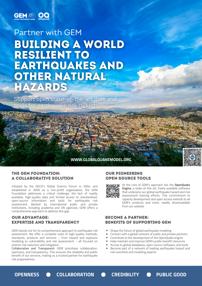
- Building a World Resilient to Earthquakes and other Natural Hazards | GEM Foundation
Publications Building a World Resilient to Earthquakes and other Natural Hazards Share Facebook LinkedIn Download 2024 | Brochure An overview of the GEM Foundation's history, collaborative and transparent approach, pioneering scientific tools such as the OpenQuake Engine and the benefits of supporting GEM.
- Understanding seismic risk in Santiago de Cali (Colombia) for its application in risk management | GEM Foundation
Publications Understanding seismic risk in Santiago de Cali (Colombia) for its application in risk management Share Facebook LinkedIn Download 2025 | Peer-reviewed This study presents the results of the seismic risk assessment for the city of Santiago de Cali (Colombia), a collaborative effort between the Mayor's Office of Santiago de Cali (including the Municipal Planning Office and the Disaster Risk Management Secretariat), the Colombian Geological Survey (SGC), the United States Geological Survey (USGS), EAFIT University and the GEM Foundation. The primary objective was to provide actionable insights for Disaster Risk Management (DRM) across its stages: awareness, risk reduction, and disaster response, and to enable the creation of a risk assessment specifically tailored to the city's needs, ensuring that its results can be effectively integrated into local risk management processes. Early engagement with stakeholders ensured that the models aligned with local needs, facilitating their integration into DRM policies. The seismic risk analysis utilizes the latest hazard model developed for Colombia, advanced non-linear site effects characterization, and a detailed building inventory with local expertise. For the first time, data-driven deterministic and probabilistic seismic risk estimates are presented for the city. The results indicate that destructive events could heavily impact the city, particularly events coming from the Dagua-Calima Fault or Nazca Plate subduction zone. Moreover, probabilistic outcomes show that human casualties and building damage disproportionally affect low-income areas, while almost 50 % of economic losses occur to middle-to high-income areas due to higher asset values. These findings highlight the importance of risk reduction strategies that address simultaneously the physical vulnerability and socio-economic disparities.