Thanks for submitting!
You will be contacted as soon as possible


QUICK LINKS


PROFILES
PUBLICATIONS
EXPOSURE
VULNERABILTY
SOFTWARE
EQ MODELS
Search Results
1074 results found with an empty search
- HORUS | Global Earthquake Model Foundation
Projects HORUS Horus: Pilot for a generic damage evaluation methodology based on remote-sensing data Versión en español English version Share Facebook LinkedIn Overview Anchor 6 Background Horus is a pilot project that explores the combination of high-resolution building inventory data from OpenStreetMap and other local sources with image-processing algorithms for the detection of earthquake damage and flood extents using remote-sensing data, along with supplementary geospatial datasets as inputs to a machine learning (ML) classification model. The ML model is trained using detailed building damage datasets from past events in a supervised learning framework, and the trained model is intended to be used to estimate the extent of damage and loss in events previously unseen by the model. The proposed framework is applied in three case study applications: March 2020 Mw5.3 Zagreb earthquake; January 2020 Mw6.4 Puerto Rico earthquake and August 2016 Louisiana floods. The GEM Risk Team is responsible for the overall coordination of the project involving multiple partners, compilation of building-level earthquake damage datasets, development of the ML models, and training and testing of the models. Duration: 2020 Objectives This pilot project, initiated and funded by the World Bank, aims to develop a framework for semi-automated damage and loss assessment due to earthquake and floods from Earth Observation (EO) data and other supplementary datasets, while also leveraging recent advances in machine-learning algorithms. These damage and loss estimates can potentially be used for transparent financial compensation and to target the distribution of resources geographically and temporally. Collaborators Advanced Rapid Imaging and Analysis (ARIA) team at the National Aeronautics and Space Administration’s (NASA) Jet Propulsion Laboratory (JPL) and California Institute of Technology (Caltech), the Global Earthquake Model (GEM) Foundation, JBA Risk, and the Humanitarian OpenStreetMap Team (HOT) Funding partner: World Bank Group Locations Earthquake case studies: Gorkha, Nepal; Puebla, Mexico; Puerto Rico, United States; Zagreb, Croatia Flood case study: Louisiana, United States Anchor 1 Anchor 5 Anchor 4 Anchor3 Publications
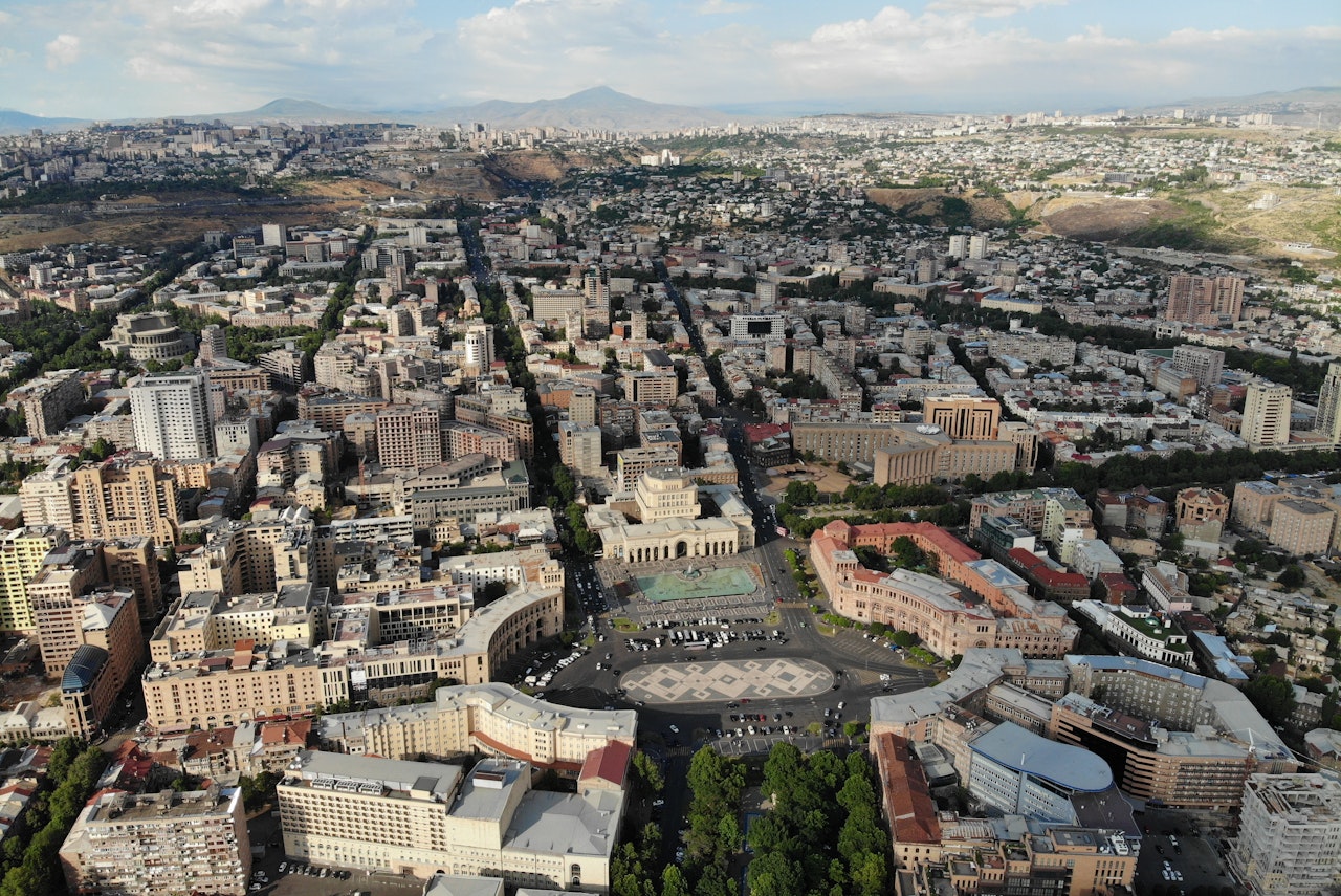
- ARMENIA POST DRR | Global Earthquake Model Foundation
Projects ARMENIA POST DRR Improving Post-Disaster Damage Data Collection to Inform Decision Making Versión en español English version Share Facebook LinkedIn Overview Anchor 6 Background This project, responding to a request from the World Bank for improved post-disaster damage collection, focuses on the collection of data on physical damage to assets such as buildings (residential, commercial, industrial, public), infrastructure, and crops. The aim is to evaluate the current state-of-the-art in post-disaster damage collection – in protocols, tools and systems – in order to identify a suitable protocol and toolset that could be adopted by the Government of Armenia that would be generalisable and available, allowing adoption by other national government agencies or interested parties. The GEM Foundation leads the consortium working on this project, with the GEM Risk Team undertaking the following main tasks: Review of existing protocols, tools and systems Design of a conceptual protocol and toolset Application to the context of Armenia Recommendations Duration: 2018 Objectives Collection of damage data following major disaster events is a fundamental exercise for a multitude of purposes, such as emergency management, resource allocation, fund mobilization and reconstruction planning. The processes involved, and scales of damage assessments vary by country, peril and context. Numerous sector-specific data collection activities provide an estimation of damage, loss and post-disaster needs in order to provide relief and facilitate the commencement of reconstruction and recovery efforts. The project includes identifying and reviewing tools for collecting data in the field as well as damage data aggregation and reporting tools. Of particular interest is the use case in Armenia, demonstrating the needs of a Ministry of Finance requiring national-level reporting of damage on a sub-national level in a transparent system that allows the user to store, retrieve and interrogate damage data down to the asset-level. Collaborators GEM Foundation, JBA Consulting, CIMA Foundation and Geocom Ltd Funding partner: World Bank Group Location Armenia Anchor 1 Anchor 5 Anchor 4 Anchor3 Publications
- CAREC Phase II | Global Earthquake Model Foundation
Projects CAREC Phase II CAREC Phase II: Developing a Disaster and Climate Risk Transfer Facility in the Central Asia Regional Economic Cooperation Region Versión en español English version Share Facebook LinkedIn Overview Updates Anchor 6 Overview This project builds upon the modelling and analytical work conducted under TA-9878 ( https://www.globalquakemodel.org/proj/carec ) and involves the preparation and implementation of a pilot disaster relief bond (DRB) that will be issued by the Asian Development Bank (ADB) for two countries, namely, the Kyrgyz Republic and Tajikistan. The pilot DRB will complement existing climate and disaster risk financing tools and will be structured to encourage the adoption of risk-reduction and climate-adaptation actions. It will also direct relief assistance to the most vulnerable groups, including women and small and medium-sized enterprises, through pre-agreed response plans developed with the pilot countries. GEM's contribution to the project includes: Build upon the work conducted under TA-9878, review modeling to ensure that it is up-to-date and aligned with the pilot countries’ and investors’ expectations Update exposure data for the two pilot countries based on updated housing and socio-economic data Update seismic hazard and risk modelling for the two pilot countries to serve as the basis for the DRB structuring and placement Undertake historical events analysis for the two pilot countries, considering all potentially damaging events since 1907 Provide earthquake model outputs required to determine the trigger form, level of coverage, and size and positioning of the DRB (when the policy attaches, detaches and how much it pays), in close consultation with WTW, Munich Re, Verisk, ADB, and the pilot countries Update the earthquake data underlying the user-friendly graphic interface developed in the previous CAREC project for the two pilot countries, to help illustrate modeling results and cost-benefits of the risk transfer options as well as disaster risk reduction measures, allowing capacity building, facilitating consultation workshops and supporting the decision process Support the preparation of knowledge products on earthquake risk modeling and financing Duration: 2025-2026 Objectives Key objectives involved: Review existing risk modelling for earthquakes in the Kyrgyz Republic and Tajikistan, and update and perform more detailed and granular risk modeling, as required; Conduct dynamic risk analysis to estimate capital requirements, reinsurance options, and the impacts of various historical or possible future scenarios on the facility’s operations; Support capacity building workshops to enhance countries’ understanding of disaster risk, including insurance solutions, and the process required for making informed disaster risk financing decisions; and Provide modeling outputs through a transparent and user-friendly interface/tool to inform the terms and design of the facility’s initial product offering, ensuring that is both relevant to the countries and financially sustainable over the longer term. Collaborators Collaborators: Willis Towers Watson (WTW), GEM Foundation, Munich Re, Verisk Funding partner: Asian Development Bank (ADB) Location Kyrgyz Republic Tajikistan Anchor 1 Anchor 5 Anchor 4 Project Data Sheet Asian Development Bank (ADB) project materials - overview, project details, documents. New ADB Program to Help Kyrgyz Republic and Tajikistan Respond to Disasters The Asian Development Bank (ADB) has approved a $56.4 million program to help the Kyrgyz Republic and Tajikistan boost their capacity to respond to disasters. Both countries are vulnerable to disasters, such as earthquakes and floods, but lack the fiscal capacity and risk transfer mechanisms to effectively respond to hazards. The Risk-Layered Disaster Relief Finance Program will enhance their financial preparedness through a combination of two pre-arranged ADB financing instruments targeting different layers of disaster risks. Anchor3 Publications
- TREAD | Global Earthquake Model Foundation
Projects TREAD daTa and pRocesses in sEismic hAzarD Versión en español English version Share Facebook LinkedIn Overview Anchor 6 Background GEM is one of the partners of the Marie Skłodowska-Curie Actions (MSCA) funded TREAD project, which involves a consortium of 14 academic institutions and 8 private partners of the highest scientific level from 7 European countries. TREAD will train a new generation of seismic hazard scientists to tackle the challenges of earthquake forecasting in complex tectonic contexts such as the Europe and Mediterranean regions. During the 4 year project GEM will host and supervise two PhD students, one working with the hazard team and the other with the risk team, on the following topics: 1. Modelling distributed seismicity under innovative approaches (under joint supervision with the University of Milano, Bicocca, 2. Assessment of the impact of advanced seismic hazard modelling approaches on earthquake risk (under joint supervision with the University of Chieti-Pescara) More information at https://tread-horizon.eu/ . Duration: 2023-2027 Objectives The aim of TREAD is to train a new generation of seismic hazard scientists to tackle the challenges of earthquake forecasting in complex tectonic contexts such as the Europe and Mediterranean regions. A change of paradigm in seismic hazard is necessary to be able to fully account for the specific properties of earthquake source and seismic modes in those areas. For example, to calculate the probability of having multiple earthquake ruptures, the interaction between active faults across various space-time scales needs to be accounted for, as well as the effects of stress transfer and fault-fluid interaction in earthquake triggering. TREAD objectives are: 1) Developing a novel integrative approach to seismic hazard analysis in Europe and the Mediterranean by bridging the gap from small-scale laboratory experiments to large-scale observations. 2) Establishing physics-based earthquake modelling by linking computational modelling of earthquakes from millions of years to fractions of a second. 3) Transferring earthquake geology and computational modelling to hazard and risk assessment adapted to the needs of government, industry and scientific stakeholders. Collaborators University of Chieti-Pescara, CNRS, University of Utrecht, GEM Foundation, University of Grenoble Alps, Ludwig Maximilians University, University of Barcelona, University of Padova, ETH Zurich, IRSN, OGS, INGV, Ruhr University Bochum, IPGP, Helmholz Centre, Willis, IFP, EDF, University of Milan Bicocca, Munich Re, TNO, Tre Altamira, University D'Aix Marseille Funding partner: Marie Skłodowska-Curie Actions (MSCA), European Commission Location Pavia, Italy Anchor 1 Anchor 5 Anchor 4 Anchor3 Publications
- FORCE | Global Earthquake Model Foundation
Projects FORCE Forecasting and Communicating Earthquake Hazard and Risk (FORCE) Versión en español English version Share Facebook LinkedIn Profile Outcomes Training Schedule Outreach Photos Publications Anchor 6 Overview This project, supported by USAID Bureau for Humanitarian Assistance (BHA), aims to enhance earthquake hazard modeling capabilities in small communities, as well as to provide better risk models to account for changes in the number of occupants, structures and economic value exposed to earthquakes and the adverse effects of climate change. The project will evaluate future earthquake risk losses, thus supporting decision makers with risk metrics that account for the expected evolution of the built environment, which are fundamental for the design and implementation of long-term risk reduction measures. Objectives The project aims to strengthen the capacities and understanding to manage and respond to future earthquake risk by: introducing future growth or change into national and global exposure models to enable the quantification of future disaster losses, including those associated with climate change; developing communication and dissemination tools to maximize the uptake of disaster risk information in policy making bodies; and improving the reliability of earthquake hazard and risk assessment, in particular in regions that lack information. To achieve the above, the project will implement five components below: Predicting the evolution of the built environment and population Forecasting future disaster risk due to earthquakes Incorporating infrastructure in exposure modeling for risk assessment Modeling earthquake hazard and risk for small communities Advancing communication and dissemination of risk information Collaborators Funding partner: USAID Bureau for Humanitarian Assistance (BHA) El Salvador: Science partner: University of El Salvador (contact Manual Menjivar, associate Professor). Government partner: Ministerio de Medio Ambiente y Recursos Naturales, MARN (contacts Douglas Antonio Hernández, Geology Area Coordinator, and Luis Mixco, seismologist). Nepal: Science partner: National Society for Earthquake Technology, NSET (contact Surya Narayan Shrestha, Executive Director). Government partner: National Disaster Risk Reduction and Management Authority (NDRRMA). Bhutan: Science partner: College of Science and Technology-Royal University of Bhutan (contact Chimi Wangmo, Head of Department, Civil Engineering DepartmentCheki Dorji). Pacific partners: Secretariat of Pacific Community (SPC), Geoscience, Energy and Maritime Division (contact Litea Biukoto, Geohazards Risk Management Leader) Indian Ocean partner: The Indian Ocean Commission IOC, (contact Gina Bonne, Director) Government partners: Member states and territories of the SPC and IOC through their representatives. Additionally, collaboration is expected from GEM partners Geoscience Australia (GA) and Geological and Nuclear Sciences (GNS), New Zealand, considering their active role in the region. Location Bhutan, El Salvador, Nepal, and small communities in oceans Seismic Risk Forecasting for a Safer El Salvador The FORCE project assesses El Salvador’s seismic risk today and projects future impacts over the next 30 years under two scenarios: continuing current construction practices or fully adopting modern seismic codes. The findings highlight the urgent need for stronger building regulations to reduce economic and human losses. View summary of results | Download 1. Historical Earthquakes and Their Destructive Potential El Salvador has experienced numerous significant earthquakes, each shaping the country’s approach to disaster preparedness. This dashboard provides a comprehensive analysis of historical seismic events, highlighting their destructive potential and reinforcing the need for proactive risk management to reduce future impacts. Eventos_históricos_potencial_destructivo_Dashboard_Luis_Mixco_PPT View details | Download 2. Seismic Codes and Future Risk Scenarios What role do building regulations play in disaster risk reduction? This study examines the impact of seismic codes on El Salvador’s future risk landscape. By comparing scenarios with and without strengthened regulations, the findings emphasize how improved construction practices can significantly reduce losses and enhance community resilience. Codigo-Riesgo_Futuro View details | Download 3. Forecasting Seismic Risk in El Salvador How will seismic risk evolve in the next 30 years? This risk forecast presents two possible futures - one where risk remains high due to unregulated construction and another where proactive policies and seismic codes reduce vulnerabilities. The results underscore the importance of long-term planning for disaster resilience. Pronostico_Riesgo View details | Download Anchor 1 Anchor 5 Online and Onsite Training Workshops This part of the program is designed to improve the understanding and awareness of earthquake hazards and risks and to help bridge the gap between the information produced in the project sites and its communication to a wide variety of stakeholders through online and onsite training workshops. Under the FORCE project, Spring and Autumn OpenQuake training courses will be offered. Please check back regularly for the latest training activities. Modules covered by the OpenQuake Online Training Courses The online training Modules 2-4, discuss how to explore and prepare the required input files for earthquake scenarios, PSHA (such as hazard maps for different return periods, hazard curves, and uniform hazard spectra), and event-based risk analysis in the OpenQuake-engine, how to run an example and visualise the results. Module 1 OQ Introduction is a self-learning module available at training.openquake.org . OpenQuake Online Training Language: Spanish Upcoming session dates Module II (part 1) February 6, 2024 Module II (part 2) February 20, 2024 Module III February 13, 2024 Module IV February 27, 2024 ----- OpenQuake Training: an online course for beginners Language: English Completed session dates March 20, 2023 March 27, 2023 April 17, 2023 April 24, 2023 ----- Anchor 4 Advancing communication and dissemination of risk information The activities in this component are focused on raising awareness of the public on earthquake hazard and risk by training a diverse group of disaster risk reduction (DRR) professionals together with personnel in charge of communicating risk to the public, and by conducting community-based workshops in the pilot countries. Luis Mixco and GEM’s Cata Yepes Featured on El Salvador’s National News El Salvador’s Ministry of Environment has launched a new tool designed to quickly estimate earthquake damage, enabling a faster response to affected communities. Watch as Luis Mixco, Ministry of Environment and Natural Resources of El Salvador, and GEM’s Cata Yepes discuss this important development in a national news segment. https://youtu.be/MfGn347363c?si=WrpbeeVkjsVFrnZ3 Strengthening Pacific Resilience: Highlights from the Workshop GEM concluded a successful two-day training workshop in Suva, Fiji, as part of the FORCE project. Held on November 18-19, the workshop focused on understanding earthquake hazard and risk in the Southwest Pacific - a region highly vulnerable to seismic activity. Facilitated by GEM’s Catalina Yepes Estrada, Exposure Development Lead, and Kendra Johnson, Senior Seismic Hazard Scientist, the training brought together local stakeholders and experts to explore practical approaches to earthquake risk assessment and disaster preparedness. Participants engaged in hands-on exercises using GEM’s OpenQuake engine, explored probabilistic seismic hazard and risk analysis, and discussed ways to improve resilience through better data and modeling. A key takeaway was the importance of tailoring risk models to local needs, with opportunities for participants to share insights on addressing data and resource challenges unique to the Pacific region. The workshop was held alongside the STAR Conference, where GEM also presented on leveraging hazard and risk models for sustainable development and disaster risk reduction. A big thank you to all participants for their active engagement and to our partners - the Mineral Resources Department (MRD) in Fiji, the Pacific Community (SPC), UNESCO, and the USAID Bureau for Humanitarian Assistance, GEM's funding partner for the FORCE project - for their collaboration in making this event possible. These shared efforts are crucial as we work toward a safer and more resilient future for communities in the Pacific. Read more PSHA for the Oceans Webinar In this webinar, we explored the key features of the Global Seismic Hazard Mosaic and the PAC model, with a special focus on the ocean models in the Southwest Pacific. We presented GEM’s approach to building PSHA models that span vast regions, even in data-scarce areas. Additionally, we highlighted seismic hazard trends across the region, including insights for key population centers. The recording and presentation are now available and can be accessed here: https://www.globalquakemodel.org/gemevents/psha-oceans-force-project Read more FORCE project: Groundwork activities gain strong support from local and national stakeholders in Nepal GEM’s USAID-supported Forecasting and Communicating Earthquake Hazard and Risk (FORCE) project kicked off in Kathmandu, Nepal from February 20th to 24th by meeting local and national partners involved in disaster risk reduction activities in the country. A half-day introductory workshop for key project stakeholders on February 24th capped the groundwork activities. (report with detailed information ) Read more Strengthening Bhutan's Resilience: GEM's Collaborative Efforts in Seismic Risk Reduction Thimphu, Bhutan - March 15, 2024. The Global Earthquake Model (GEM) Foundation's USAID-supported project, Forecasting and Communicating Earthquake Hazard and Risk (FORCE), recently concluded a successful week of activities in Bhutan (March 11-15, 2024). Led by GEM's Alejandro Calderon and Catarina Costa, the project focuses on strengthening local capacities and improving earthquake risk reduction in the country (report with detailed information ). Read more A Resilient Future: Embracing Innovation and Leveraging Local Expertise and Collaboration to Enhance Seismic Risk Reduction in El Salvador The Global Earthquake Model (GEM) Foundation's USAID-supported project, Forecasting and Communicating Earthquake Hazard and Risk (FORCE), has been working to help strengthen local capacities and improve earthquake risk reduction in El Salvador. The project has conducted two visits to the country, bringing together government agencies, scientists, engineers, and other stakeholders to discuss seismic hazard assessment, risk analysis, and communication strategies (report with detailed information ). Read more - English | Spanish FORCE Project Update: Predicting Urban Growth and Population Evolution One critical component of this project involves predicting urban growth and population evolution. This involves analysing more than 20 potential drivers of urban development over several decades. These encompass factors such as demographic trends, economic metrics, and land-use patterns. The FORCE team is actively developing urban growth models utilising techniques like regression analysis and machine learning. Currently, these models are undergoing meticulous evaluation to ensure their ability to replicate observed increases in dwelling numbers and construction areas. Read more Earthquakes in El Salvador: What Do We Know and How Could They Affect Us in the Coming Years? GEM's FORCE project made notable developments in #ElSalvador last week. Various meetings and technical activities were conducted highlighted by a workshop that convened stakeholders to discuss the topic "#Earthquakes in El Salvador: What Do We Know and How Could They Affect Us in the Coming Years?" In collaboration with the USAID - Bureau for Humanitarian Assistance (USAID/BHA), and national partners Ministerio de Medio Ambiente y Recursos Naturales de El Salvador (MARN) and Dirección General de Protección Civil de El Salvador, this session marked a crucial step in advancing #seismic #risk #understanding and response capabilities. Thanks to all for the productive discussions and active participation! FORCE Project Updates: City Zonation workshops Our sessions with USAID focused on city zonation for #emergencyresponse in #Medellin, followed by a workshop communicating #seismic #risk to first responders in our ongoing collaboration with Universidad EAFIT, #SIATA - Sistema de Alerta Temprana del Valle de Aburrá, and #AMVA - Área Metropolitana del Valle de Aburrá. These initiatives are fundamental in enhancing emergency preparedness efforts. #EmergencyPreparedness #SeismicRiskCommunication SATIC Event, OpenQuake Conference, Cali Risk Assessment and Community Awareness Workshops An event was held at the Banco de la República Auditorium in Cali, Colombia from November 21-25 to present seismic scenarios for Cali using Cali risk models; introduction of OpenQuake Tools; and training workshop for the use of the information repository and risk models, including awareness workshops for the community (local trainers, firefighters, civil defense). Read more Workshop on Probabilistic Seismic Hazard Assessment (PSHA), Risk Analysis, and the OpenQuakeEngine at FEPADE in El Salvador The Ministry of Environment and Natural Resources (MARN) of #ElSalvador and the GEM Foundation successfully concluded a workshop on Probabilistic Seismic Hazard Assessment (#PSHA), #Risk #Analysis, and the #OpenQuakeEngine at FEPADE in El Salvador, as part of the USAID - Bureau for Humanitarian Assistance-supported #FORCE #Project. This workshop substantially contributes to building local expertise in this crucial pilot project area, reinforcing El Salvador's #earthquake #resilience. We extend heartfelt thanks to our dedicated #local #partners for their invaluable contributions, pivotal in ensuring the success of this event! Read more Online session on seismic hazard and risk assessment in the Pacific Our FORCE project team successfully concluded an online session on seismic hazard and risk assessment in the #Pacific. With participation from 15 attendees representing 7 countries, the session explored Session 1 - Seismic #hazard and #risk information available in the Global Mosaic. Attendees were informed of various #earthquake #hazard and #risk outputs within the GEM Foundation, such as hazard maps, hazard curves, uniform hazard spectra, #exposure models, #vulnerability and #fragility models, and risk metrics. Discussions also focused on what information is included in GEM’s Country Seismic Risk Profiles. These insights underscored the significance of #seismic #assessment in the region. Stay tuned for updates on future sessions! #FORCEProject #SeismicAssessment #GEMFoundation New GEM-USAID Project Forecasting and Communicating Earthquake Hazard and Risk (FORCE) launched On the heels of the successful completion of the TREQ project partnership this year, GEM and USAID Bureau for Humanitarian Assistance (BHA) are embarking on a new project called Forecasting and Communicating Earthquake Hazard and Risk or FORCE. The project aims to strengthen the capacities and understanding to manage and respond to future earthquake risk. Read more Anchor3 BUSINESS NEWS Workshop summarising the USAID-supported initiative in El Salvador led by GEM’s local partners, January 21-24, 2025 The activities focused on sharing and communicating the project's outcomes, including updated earthquake hazard and risk models, impact metrics, and capacity-building activities. GEM's Alejandro Calderon and Catalina Yepes-Estrada joined as participants to share insights on project outcomes, tools, and lessons learned with stakeholders. 1/4 BUSINESS NEWS Strengthening Pacific Resilience: Highlights from the Workshop - November 18-19, 2024, Suva, Fiji GEM concluded a successful two-day training workshop in Suva, Fiji, as part of the FORCE project. Held on November 18-19, the workshop focused on understanding earthquake hazard and risk in the Southwest Pacific - a region highly vulnerable to seismic activity. 1/2 BUSINESS NEWS Activities in Bhutan (March 11-15, 2024) A series of technical meetings and workshops on the FORCE project in Bhutan was held from the 11th to the 15th of March 2024. 1/3 BUSINESS NEWS El Salvador Stakeholder Workshop January 11, 2024 Earthquakes in El Salvador: What Do We Know and How Could They Affect Us in the Coming Years? 1/8 BUSINESS NEWS El Salvador Meetings January 9, 2024 Meetings with the Protección Civil de El Salvador. 1/3 BUSINESS NEWS Medellin Workshops December 2023 with AMVA Workshops on city zonation for #emergencyresponse in #Medellin , followed by a workshop communicating #seismic #risk to first responders in our ongoing collaboration with Universidad EAFIT , #SIATA - Sistema de Alerta Temprana del valle de Aburrá, and #AMVA - Área Metropolitana del Valle de Aburrá. 1/2 BUSINESS NEWS El Salvador November 2023 Workshop Introduction to Probabilistic Seismic Hazard (PSHA) and Risk Analysis and the OpenQuake Engine with MARN hosted by the Fundación Empresarial para el Desarrollo Educativo (FEPADE) November 6-10, 2023. 1/5 BUSINESS NEWS SATIC event in Cali, Colombia Nov 21-25, 2022 1/6 BUSINESS NEWS Kick-off meetings in Nepal The launch meetings of the FORCE project – Forecasting and Communicating Earthquake Hazard and Risk were held in the city of Kathmandu, Nepal, from 20th to 24th February 2023. 1/11 Publications Similar to the TREQ project, reports and publications relevant to each of the FORCE project components will be produced and published in due course. This page is dedicated to this purpose. Forecasting and Communicating Earthquake Risk - Bhutan Technical Visits in Bhutan A series of technical meetings and workshops of the FORCE project – Forecasting and Communication Earthquake Risk – were held in Bhutan from the 11th to the 15th of March 2024. One-to-one meetings were organised with the main governmental departments involved in Disaster Risk Reduction activities in the country, along with a workshop held in Thimphu on 12th March 2024, that included an important group of stakeholders. Moreover, a presentation to students and college staff from the Royal University of Bhutan in Phuentsholing was held on the 14th of March 2024. Representatives of the GEM Foundation and the College of Science and Technology (CST) from the Royal University of Bhutan (RUB) attended all meetings and were the coordinators of the visit activities in the country. Pronostico y Comunicacion de Riesgos por Terremotos Visitas técnicas en El Salvador EL proyecto FORCE: Pronóstico y comunicación de la amenaza y el riesgo de terremotos (Forecasting and Communicating Earthquake Hazard and Risk por sus siglas en inglés), realizó dos visitas a El Salvador con el objetivo de fortalecer las capacidades locales y la comunicación de los resultados de riesgo sísmico a las diferentes entidades que forman parte de la prevención, gestión y respuesta ante terremotos destructivos en el país. De la mano del Ministerio de Medio Ambiente y Recursos Naturales (MARN) se realizaron talleres y reuniones con diferentes actores del sector público como Protección Civil, Ministerio de Obras Públicas, Fondo de Conservación Vial de El Salvador, Cuerpo de Bomberos, Ministerio de Educación, Instituto Salvadoreño del Seguro Social, Oficina de Planificación del Área Metropolitana de San Salvador (OPAMSS), entre otros. Kick-off meetings in Nepal FORCE Project The launch meetings of the FORCE project – Forecasting and Communication Earthquake Risk were held in Kathmandu, Nepal, from 20th to 24th February 2023. Multiple one-to-one meetings were held with the main governmental departments involved in Disaster Risk Reduction activities, and a workshop with an important group of stakeholders was held on 24th February 2023. Representatives of the GEM Foundation and NSET attended all meetings and will be the coordinators of the project activities in the country. Disclaimer The contents of this project website such as studies, reports, audio-visual, news articles, blogs, and other information or media products including those in the external links are made possible by the generous support of the American people through the United States Agency for International Development (USAID). The contents are the responsibility of the Global Earthquake Model (GEM) Foundation and do not necessarily reflect the views of USAID or the United States Government.
- SOLOMON ISLANDS EXPOSURE | Global Earthquake Model Foundation
Projects SOLOMON ISLANDS EXPOSURE Assessing the Risk Exposure of Road Network to Climate and Natural Hazard Risks in Solomon Islands Versión en español English version Share Facebook LinkedIn Overview Anchor 6 Background This project aims to conduct a robust multi-hazard risk assessment of the road network to climate and natural hazards in the Solomon Islands, both historically and under future climate projections. The project includes three main dimensions: - Characterization of the climate and natural hazards - Physical vulnerability of the road network - Multi-criteria criticality analysis The three main outputs are: - Multi-hazard maps - Road network risk exposure analysis (global risk score) - Identification of "first priority" road segments and estimation of their rehabilitation costs The GEM Hazard Team supports the project by computing seismic hazard maps and uses these to produce maps to classify low to high risks of earthquake hazards, according to their intensity and frequency. Duration: 2021 Objectives Many Small Island Developing States (SIDS) share a major common feature: they are among the most exposed nations to natural hazards and climate change. SIDS are also characterized by insularity and geographic remoteness, as well as small geographic area, economies, and population, all of which increase their social and economic vulnerability. This project aims to assist the Solomon Islands to better manage climate and disaster risks by improving the understanding of risk and the use of this information for risk reduction decision-making, and the design and implementation of investments at the provincial and community level. Collaborators GEM Foundation, ARIA Technologies, Actimar, Suez Consulting, Setec Group Funding partner: World Bank Group Location Solomon Islands Anchor 1 Anchor 5 Anchor 4 Anchor3 Publications
- CCARA | Global Earthquake Model Foundation
Projects CCARA Caribbean and Central America Earthquake Risk Assessment (CCARA) Versión en español English version Share Facebook LinkedIn Overview Outcomes Training Outreach Photos Publications Anchor 6 Background Earthquake risk is on the rise and earthquakes are expected to take an increasing number of lives. Hazard and risk assessments are the foundation for raising awareness among policy makers and the general public, forming the basis for decisions and actions that effectively build resilience and can reduce risk. While important work has been carried out in the Central American and Caribbean region to understand earthquake risk assessment and management there is still ample room to enhance that understanding and properly introduce it in decision- and policy-making processes. In many areas of the world, state-of-the-art information and tools to assess earthquake risk have been inaccessible for a long time. As a first step to tackle this problem, the Global Earthquake Model (GEM) has been created and spent the past 11 years collaboratively advancing open source science and technology for global state-of-the-art seismic hazard and risk modeling, data collection, and risk assessment at scales from local to national, regional, and global. Objectives The project aims to calculate hazard and risk, and to estimate the compounding social and economic factors that increase the physical damage and decrease the post-event capacities of populations to respond to and recover from damaging earthquake events in The Caribbean and Central America, by involving local experts from throughout the region. The goal of the Program in Central America and the Caribbean is to develop capacity in the region for earthquake risk assessment by leveraging GEM tools and resources, to enhance the understanding of earthquake risk, and to bridge the gap between risk assessment and disaster risk reduction. To improve the understanding of earthquake risk in the Central America and Caribbean region while developing local capacities to use open source resources for producing earthquake hazard and risk information at regional, national and local scales. To engage with decision-makers and other end-users to make the connection between advanced risk assessment by local experts and risk-reducing action and so influence DRR policy. Collaborators The CCARA project would not have been possible without the contributions of all the municipalities in particular: the Municipality of San José (Costa Rica), National Commission of Emergencies (CNE), University of Costa Rica (UCR) - Laboratorio Nacional de Materiales y Estructuras (LANAMME), INETER, ONESVIE, ODPEM, BRGM, Bureau des Mines, VT, Geologica UPR Mayaquez, UNI, SRC and UMG. Location Caribbean and Central America countries Website Caribbean and Central America Earthquake Risk Assessment (CCARA) wiki site contains an overview of the project. Anchor 1 Anchor 5 The CCARA project hosted four participants from South America to introduce seismic hazard and risk assessment using tools developed by GEM – specifically the OpenQuake engine. Anchor 4 Modelling subduction earthquakes: GEM experiences in Latin America CCARA project GEM presents the results of the USAID-funded CCARA Project in Santo Domingo, Dominican Republic A hazard workshop in San José, Costa Rica from September 18th to 22nd as part of the risk assessment activities of the CCARA project. Anchor3 Publications CCAF-DB: The Caribbean and Central American Active Fault Database Disclaimer The contents of this project website such as studies, reports, audio-visual, news articles, blogs, and other information or media products including those in the external links are made possible by the generous support of the American people through the United States Agency for International Development (USAID). The contents are the responsibility of the Global Earthquake Model (GEM) Foundation and do not necessarily reflect the views of USAID or the United States Government.
- Proyecto TREQ | Global Earthquake Model Foundation
Projects Proyecto TREQ Comunicación y Formación en la Evaluación de Riesgos por Terremotos (TREQ) Versión en español English version Share Facebook LinkedIn Visión general Resultados Capacitación Comunicación Fotos Publicaciones Anchor 6 Resumen El Proyecto de Capacitación y Comunicación para la Evaluación de Riesgos de Terremotos (TREQ) fue diseñado para demostrar cómo la evaluación de la amenaza y el riesgo sísmico puede informar a los tomadores de decisiones en el desarrollo de políticas de reducción de riesgos, así como también cómo se puede comunicar adecuadamente el riesgo de terremotos a las partes interesadas y al público en general. [PDF Executive Summary English ] Objetivos El proyecto se organizó en dos partes principales. El primero tuvo como objetivo desarrollar la capacidad para la evaluación de la amenaza y el riesgo sísmico a nivel urbano en América Latina, Quito (Ecuador), Cali (Colombia) y Santiago de los Caballeros (República Dominicana); mientras que la segunda parte fue desarrollar material de capacitación, educación y comunicación para mejorar la comprensión del riesgo de terremotos en todo el mundo. El programa se diseñó para un amplio espectro de partes interesadas, categorizadas en cuatro grupos principales: gobierno(tomadores de decisiones/autoridades públicas), industria (practicantes y profesionales), academia (investigadores y profesores) y la comunidad. Ecuador Municipalidad de Quito Escuela Politécnica Nacional (EPN) Instituto Geofísico (IG) Colegio de Ingenieros Civiles de Pichincha (CICP) Pontificia Universidad Católica del Ecuador Dominican Republic Servicio Geológico Nacional (SGN) Oficina Nacional de Evaluación Sísmica y Vulnerabilidad de Infraestructuras y Edificaciones (ONESVIE) Comité Técnico Nacional (CTN) Pontificia Universidad Católica Madre y Maestra (PUCMM) Colombia Servicio Geológico Colombiano (SGC) Departamento Administrativo de Planeación Municipal (DAPM), Cali Unidad Nacional de Gestión del Riesgo de Desastres (UNGRD) Universidad EAFIT, Medellin Costa Rica Universidad de Costa Rica (UCR) Mexico Universidad Autónoma de Baja California (UABC) Ubicación Quito (Ecuador), Cali (Colombia) y Santiago de los Caballeros (República Dominicana) Evaluación del riesgo urbano en América Latina y el Caribe En este componente se generaron los siguientes entregables: evaluación de amenaza y riesgo sísmico a escala urbana para las tres ciudades TREQ: Quito (Ecuador), Cali (Colombia) y Santiago de los Caballeros (República Dominicana). Se desarrollaron modelos de vanguardia para cada ciudad en estrecha colaboración con socios locales. Los modelos de entrada y los resultados están disponibles en la siguiente dirección URL: [github.com/gem/treq-riesgo-urbano/ ] a. Informes de la ciudad Evaluación de Riesgo Sísmico para el Distrito Metropolitano de Quito [Español ] Evaluación de Riesgo Sísmico para Santiago de Cali [Español ] Evaluación de Riesgo Sísmico para Santiago de los Caballeros [Español ] b. Evaluación de peligros sísmicos Modelos probabilísticos de amenaza sísmica (PSHA) y conjuntos de datos para la evaluación de la amenaza a nivel urbano [PDF English ] Modelo Probabilístico de Amenaza Sísmica para la República Dominicana [PDF English | Español ] [Descargar Modelo ] Resultados de amenaza sísmica (condiciones en roca y en suelo [PDF English ] Análisis de la amenaza sísmica a escala urbana [PDF English ] c. Evaluación de Riesgo Sísmico Resumen ejecutivo sobre la evaluación del riesgo sísmico urbano para las ciudades de Quito, Cali y Santiago de los Caballeros [PDF English ] Tipologías constructivas en Quito, Cali and Santiago de los Caballeros [PDF Español ] Base de datos de exposición georreferenciada de población y edificios en cada ciudad de TREQ [Cali ] [Quito ] [Santiago ] Base de datos de funciones de fragilidad y vulnerabilidad para cada clase de edificio presente en el modelo de exposición [Datos ] Mapas y métricas de riesgo para cada ciudad [Cali ] [Quito ] [Santiago ] d. Escenarios de la ciudad Base de datos con rupturas seleccionadas para análisis de escenarios [Cali ] [Quito ] [Santiago ] Evaluación del escenarios de amenaza para sismos representativos en Quito, Cali y Santiago de los Caballeros [PDF English ] e. Aplicaciones Urbanas Deslizamientos y licuefacción inducidos por sismo en Cali [PDF English ] Anchor 1 Anchor 5 Mejora de la comprensión mundial sobre la amenaza y riesgo sísmico Esta parte del programa fue diseñada para mejorar la comprensión y el conocimiento de la amenaza y el riesgo sísmico, y para ayudar a cerrar la brecha entre la información producida en estudios detallados de amenaza y riesgo y su comunicación a una amplia variedad de partes interesadas (que van desde locales expertos con competencias para evaluar el riesgo sísmico, a los tomadores de decisiones responsables de la implementación de medidas de reducción del riesgo). a. Sitio web para la capacitación en línea de OpenQuake La capacitación en línea de OpenQuake se diseñó para diferentes tipos de audiencia con diversos antecedentes y experiencia. A través de esta plataforma, los participantes interactuaron con los equipos científicos y técnicos del GEM para conocer los principales conceptos de la evaluación del riesgo sísmico, así como las características básicas del software de OpenQuake. [English | Español ] b. Manual de OpenQuake en formato online El manual oficial se convirtió de látex al formato reStructuredText gracias al apoyo de @USAID. El nuevo manual está ahora en línea en formato HTML y se puede accederse en: [Webpage English ] c. Tutoriales en video sobre peligros sísmicos y análisis de riesgos usando OpenQuake El proyecto ha producido 15 videos de capacitación técnica utilizando el software de OpenQuake (en inglés y español), 7 videos con material para difundir los modelos y resultados de la evaluación del riesgo urbano en las ciudades TREQ y 2 videos para comunicar el riesgo sísmico al público en general. público. OQ Engine Video Tutorials [ English | Español ] d. Manual para realizar análisis de amenaza sísmica Este manual presenta los conceptos básicos de la metodología clásica de PSHA y el amplio espectro de alternativas para modelar la sismicidad y las incertidumbres (epistémicas y aleatorias) en el software de OpenQuake. La evaluación probabilística del peligro sísmico (PSHA) es la metodología principal para evaluar el peligro potencial que representan los terremotos. Los mapas de amenaza se utilizan ampliamente en los códigos sísmicos nacionales para la zonificación de la amenaza sísmica y las disposiciones de diseño estructural. [PDF English ] e. Capacitando a educadores TREQ ha colaborado con cinco profesores universitarios de América Latina para conceptualizar, crear e implementar un curso unificado para el estudio del riesgo sísmico a nivel universitario. Los folletos en inglés y español explican con más detalle el concepto detrás de esta iniciativa y describen los primeros resultados y experiencias de los profesores de Colombia, Costa Rica, El Salvador, Guatemala y México. [PDF English | Español ] Anchor 4 Comunicación y sensibilización sobre terremotos Las actividades de este componente se centraron en sensibilizar al público sobre la amenaza y el riesgo sísmico mediante la capacitación de un grupo diverso de profesionales en reducción del riesgo de desastres (RRD), junto con el personal a cargo de comunicar los riesgos al público, y mediante la realización de talleres comunitarios en áreas seleccionadas de las ciudades piloto. Artículos de noticias Eventos El seminario web Comprensión del riesgo sísmico a través del desarrollo de capacidades y el intercambio de conocimientos atrae a cientos de participantes de todo el mundo. [Article ] [Event page English | Español ] [Video ] Presentación del modelo PSHA nacional para la República Dominicana: un seminario web conjunto organizado por el Servicio Geológico Nacional Dominicano en cooperación con GEM, Oficina Nacional de Evaluación Sísmica y Vulnerabilidad de Infraestructura y la Oficina de Asistencia Humanitaria de USAID. [Event flyer Español ] [Video English | Español ] ---- Artículos Raising Earthquake Risk Awareness: TREQ’s community workshops for the general public Urban hazard assessment of selected cities in Latin America Local solutions to global problems: reducing disaster risk through collaboration and openness TREQ Project Updates: Site Effects Modelling and Urban Exposure Models USGS has joined the TREQ initiative for urban earthquake scenarios TREQ capacity building: OQ online training updates Jan-Feb 2021 TREQ2020 – Capacity development and OpenQuake online training, year in review TREQ OpenQuake Online Training: Earthquake Scenarios - Ground Motion Fields Sept 2020 Más en la sección GEM News a. Material didáctico para sensibilizar a la comunidad sobre el riesgo sísmico: Aplicación para el área Metropolitana del Valle de Aburrá (AMVA) [PDF Español ] b. Video para comunicar el riesgo de terremoto al público en general [English | Español ] c. Guía para profesores para el desarrollo de un curso introductorio de riesgo sísmico [PDF Español ] d. Perfiles de respuesta y mitigación de riesgos urbanos para las ciudades TREQ [Cali ] [Quito ] [Santiago ] Boletin informativo El boletín del proyecto TREQ tiene la intención de compartir actividades en evaluación de riesgos urbanos y materiales de capacitación y educación sobre riesgos de terremotos con una amplia gama de partes interesadas locales de la academia, los sectores público y privado, así como la sociedad civil en América Latina,el Caribe, y más allá. Newsletter no. 3 - May 2021 Newsletter no. 2 - September 2020 Newsletter no. 1 - March 2020 Maiden issue [English ] Maiden issue [Españo ] Anchor3 BUSINESS NEWS Concientizando el Riesgo: talleres para el público en general 1/4 BUSINESS NEWS Inicio del proyecto de marzo de 2020 1/4 BUSINESS NEWS Fotos de la formación OpenQuake Online de noviembre de 2020 1/2 BUSINESS NEWS Reuniones en Quito 1/10 BUSINESS NEWS Reuniones en Guayaquil 1/1 Publications Visión general TREQ Resumen Ejecutivo [English ] Evaluación de la amenaza sísmica Modelos probabilísticos de amenaza sísmica (PSHA) y conjuntos de datos para la evaluación de la amenaza a nivel urbano [English ] Modelo Probabilístico de Amenaza Sísmica para la República Dominicana [English | Español ] [Descargar Modelo ] Resultados de amenaza sísmica (condiciones en roca y en suelo [English ] Análisis de la amenaza sísmica a escala urbana [English ] Evaluación de Riesgo Sísmico Resumen ejecutivo sobre la evaluación del riesgo sísmico urbano para las ciudades de Quito, Cali y Santiago de los Caballeros [English ] Tipologías constructivas en Quito, Cali and Santiago de los Caballeros [Español ] Escenarios sísmicos Evaluación del escenarios de amenaza para sismos representativos en Quito, Cali y Santiago de los Caballeros [English ] Aplicaciones urbanas Deslizamientos y licuefacción inducidos por sismo en Cali [English ] Informes de la ciudad Evaluación de Riesgo Sísmico para el Distrito Metropolitano de Quito [Español ] Evaluación de Riesgo Sísmico para Santiago de Cali [Español ] Evaluación de Riesgo Sísmico para Santiago de los Caballeros [Español ] Formación y comunicación del riesgo sísmico Manual de capacitación sobre análisis probabilístico de riesgos sísmicos (PSHA) [English ] Material didáctico para sensibilizar a la comunidad sobre el riesgo sísmico. Aplicación para el área Metropolitana del Valle de Aburrá (AMVA) [Español ] Guía para profesores para el desarrollo de un curso introductorio de riesgo sísmico [Español ] Disclaimer The contents of this project website such as studies, reports, audio-visual, news articles, blogs, and other information or media products including those in the external links are made possible by the generous support of the American people through the United States Agency for International Development (USAID). The contents are the responsibility of the Global Earthquake Model (GEM) Foundation and do not necessarily reflect the views of USAID or the United States Government.
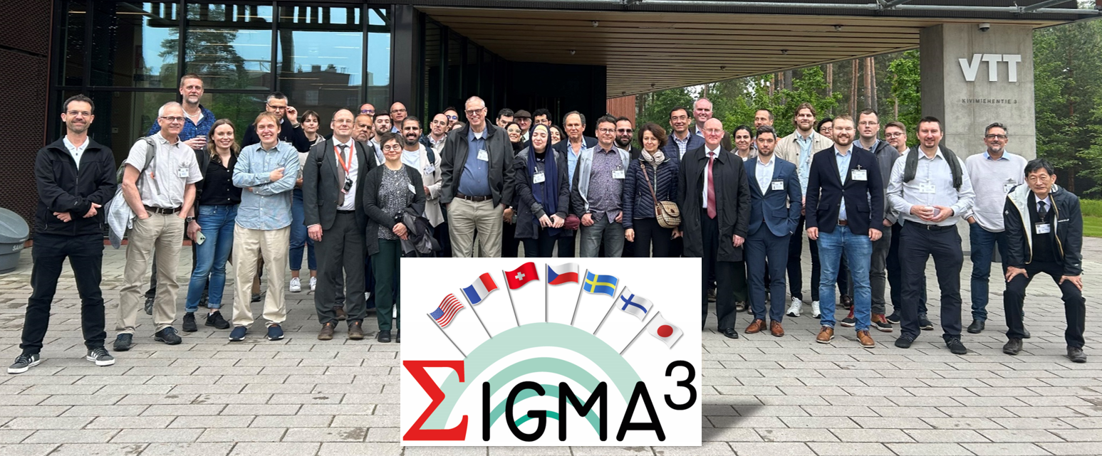
- SIGMA3 | Global Earthquake Model Foundation
Projects SIGMA3 SeismIc hazard and Ground Motion Assessment Versión en español English version Share Facebook LinkedIn Overview Work Packages Training Dissemination Photos Publications Anchor 6 Overview SIGMA3 is a research and development (R&D) program on SeIsmic hazard and Ground Motion Assessment. It is the 3rd part of a larger R&D initiative initiated in 2011 to support innovation in the field of probabilistic hazard assessment (PSHA). SIGMA3 is fully funded by the industry at 100%. The program grounds its roots in methodological developments, as well as in the identified shortcomings of the two preceding editions, labelled SIGMA and SIGMA2. The previous two programs have led to insightful datasets and models to accompany the inception of probabilistic site-specific PSHA studies in low-to-moderate seismicity areas, such as France, for instance. However, nowadays, additional progress is still needed to reduce epistemic uncertainties and improve confidence in probabilistic seismic hazard studies. To this end, SIGMA3 gathers a group of researchers and engineers actively involved in the seismic hazard community and recognized for their expertise. More details about the project are available here: https://sigma-programs.com/ Objectives The SIGMA program is a Research and Development project about seismic hazard and ground motion. It has the objective to improve data and develop methods necessary to best estimate SHA by producing Hazard levels more adapted to the site. Improve available practices for safety demonstration to get consensus with the largest international community for R&D and industrial applications Improve confidence and accountability in seismic hazard assessments by quantifying and propagating uncertainties on Seismic Source and Ground Motion Characterization Strengthen the link between seismologists and engineers, and share feedback among consortium members Collaborators Steering Committee The Steering Committee handles strategic and technical decision-making in the SIGMA3 program and provides recommendations on the program’s orientation, informed by the Scientific Committee’s expertise. Composition: Emmanuel Viallet (EDF France), Fabrice Hollender (CEA France), Vojtech Spanihel (CEZ Group Czech Republic), Masato Nakajima (CRIEPI Japan), Albert Kottke (PG&E USA), Fabienne Chawla (SwissNuclear Switzerland), Ludovic Fulop (VTT Finland) Scientific Committee The members of the SIGMA3 Scientific Committee are independent experts in their field, providing recommendations, insights, and reviews on activities performed through the program. Composition: Philippe RENAULT (Chairperson), Norman ABRAHAMSON, Laurent BOLLINGER, Emmanuel CHALJUB, Maria José CRESPO, John DOUGLAS, Zeynep GULERCE, Sadanori HIGASHI, Pierre LABBE, Ian MAIN, Adrian RODRIGUEZ-MAREK, Alain PECKER, Gabriel TORO, Kris VANNESTE, Jérôme VERGNE Location Global (coordinating agency located in France) Sigma 3 Technical Program Supported by ´Electricité de France (EDF), GEM’s activities cover three work packages: For more details on Sigma3's work packages (WP), click here . 1. Probabilistic Fault Displacement Hazard Analysis. This activity builds upon work carried out in 2024 within the framework of a collaboration with OGS, Trieste. 2. Development and methodologies for probabilistic seismic hazard assessment. In this WP, we will further develop capabilities to compute the conditional aftershock hazard and propagate epistemic uncertainties efficiently. 3. Development of a Simulation Platform. The objective of this activity is to generate a set of Python tools for evaluating fundamental components of a hazard input model - namely, source, ground motion, and site effects - used in Probabilistic Seismic Hazard Analysis (PSHA) computations. Anchor 1 Anchor 5 Conferences and Events For the latest events, training, seminars/webinars and conferences, please visit: https://sigma-programs.com/dissemination-sigma-3/conferences-and-events/ Anchor 4 SIGMA3 - SeismIc hazard and Ground Motion Assessment This section contains outreach activities conducted by the SIGMA3 program. For more details, click here . 1. News - https://sigma-programs.com/dissemination-sigma-3/news/ 2. Conferences and Events - https://sigma-programs.com/dissemination-sigma-3/conferences-and-events/ Anchor3 BUSINESS NEWS 1st General Assembly - June 2025, Helsinki (Finland) 1/1 BUSINESS NEWS Sigma3 Kick-Off - 11 June 2024, Aix-en-Provence (France) 1/1 Publications SIGMA3 - Publications and Reports This section contains project publications and reports as they become available. The list of currently available materials can be accessed here: https://sigma-programs.com/sigma-3/dissemination-sigma-3/publications-reports/
- MALAWI MULTI-HAZARD | Global Earthquake Model Foundation
Projects MALAWI MULTI-HAZARD Comprehensive Multi hazard Risk Assessment in Malawi Versión en español English version Share Facebook LinkedIn Overview Outcomes Training Outreach Photos Publications Anchor 6 Background Malawi is a country strongly affected by the impact of extreme events, exacerbated by rapid population growth and urbanisation. A multi-risk assessment is currently lacking at the national level, while it is available only at the local level in some districts. Therefore, the project consortium intends to produce, for the first time, hazard and risk maps on a national level with a level of detail useful also at provincial level, using a probabilistic risk assessment approach, both for single hazards and for multi-hazard conditions (i.e. extreme winds and precipitation, earthquakes, landslides, river floods). The GEM Risk Team is reponsible for the seismic risk assessment, comprising the modelling of the hazard, exposure and vulnerability components and the calculations of seismic risk in the OpenQuake engine. Duration: 2023-2024 Objectives In line with the guidelines of the Sendai Framework for Disaster Risk Reduction, the multi-hazard probabilistic assessment carried out within the project provides risk estimates for both the most probable and frequent events, as well as for rare ones; at the same time, it allows for the analysis of events that have never been observed but may occur in the future, which is of particular importance considering the uncertainty caused by climate change. The assessment will therefore consider risks under current climate conditions as well as future conditions (2050-2100) under different climate change scenarios. For the realisation of the multi-risk assessment, the project partners will work closely with local stakeholders at all stages of the development, from data collection to the creation of the Risk Atlas and the Risk Information Web Platform, two tools that will collect information from the assessment and will make it easier to communicate and understand, thus following a capacity development approach that combines knowledge development with knowledge transfer. In addition, the partners will develop, again in collaboration with local stakeholders, a sustainability plan containing recommendations for maintaining and updating risk information, supporting the management, updating and accessibility of Malawi’s risk information by national and local authorities. Collaborators GEM Foundation, Centro Internazionale in Monitoraggio Ambientale (CIMA), Malawi University of Business and Applied Sciences (MUBAS), British Geological Survey (BGS) Funding partner: World Bank Group Location Malawi Aiming to empower Malawi with a comprehensive understanding of disaster risks, the project will deliver the following key outputs: Comprehensive Hazard Identification and Assessment: A national-level assessment of various hazards in Malawi, including floods, droughts, landslides, earthquakes, and strong winds. Exposure Mapping: Creation of maps outlining the extent to which people, infrastructure, buildings, and agriculture are exposed to each hazard. Vulnerability Assessment: Evaluation of the physical (infrastructure, buildings) and social (poverty, access to resources) vulnerabilities of Malawian communities to these hazards. National Hazard and Risk Profiles: Development of comprehensive national profiles that detail the hazards, their potential impacts, and the level of risk faced by different regions and communities. Knowledge and Technology Transfer: Training and capacity building for Disaster Risk Reduction (DRR) practitioners and academic institutions in Malawi on using the multi-hazard risk assessment data and tools. Anchor 1 Anchor 5 Platform deployment, knowledge transfer, maintenance and ownership This project builds a long-term plan for Malawian experts to manage the multi-hazard risk atlas database. Through trainings and knowledge transfer, local technicians will become self-sufficient in maintaining the system and training future users. This ensures the platform's sustainability and empowers Malawian authorities to fully utilize the risk information for informed decision-making. a. Hands-on training on the Risk Atlas Database Training of the Department of Disaster Management Affairs (DODMA) ICT team to install and utilise the Risk Atlas Database held in Salima, Malawi, from June 3-7, 2024. b. Exposure and Vulnerability Data The exposure and vulnerability work was delivered to the client and presented in a dedicated training session in November 2023. Anchor 4 GEM Contributes to Multi-Hazard Risk Assessment Progress in Malawi The Global Earthquake Model (GEM) Foundation actively participated in a Multi-Hazard Risk Assessment workshop held in Salima, Malawi, from June 3-7, 2024. This collaborative effort involved the Department of Disaster Management Affairs (DODMA) as the host, alongside the International Centre for Environmental Monitoring (CIMA Research Foundation), Malawi University of Business and Applied Sciences (MUBAS), and the British Geological Survey (BGS). Read more Anchor3 BUSINESS NEWS Multi-Hazard Risk Assessment workshop held in Salima, Malawi, from June 3-7, 2024 1/6 Publications