Thanks for submitting!
You will be contacted as soon as possible


QUICK LINKS


PROFILES
PUBLICATIONS
EXPOSURE
VULNERABILTY
SOFTWARE
EQ MODELS
Search Results
1074 results found with an empty search
- NEAM-COMMITMENT | Global Earthquake Model Foundation
Projects NEAM-COMMITMENT North-Eastern Atlantic and Mediterranean Tsunami Risk Management and Planning Versión en español English version Share Facebook LinkedIn Overview Anchor 6 Background NEAM-COMMITMENT aims to improve tsunami risk management and planning in the NEAM region. It endeavors to contribute primarily to two key components of tsunami risk governance: capacity building through tsunami hazard assessment and mapping at the national scale, and improved tsunami evacuation planning at the local level through a novel multi-hazard approach. Guidelines will be drafted for the methodologies applied to develop the national tsunami inundation and local tsunami evacuation maps to contribute to improved tsunami risk management planning. Duration: 2025 - 2027 More details: https://civil-protection-knowledge-network.europa.eu/projects/neam-commitment#inpage-section-description Objectives The project has two objectives: to develop national tsunami inundation maps in Cyprus, Greece and Spain through the methodology applied to produce tsunami inundation maps for evacuation planning in Italy, aiming to achieve compatible tsunami inundation maps across the NEAM region; to address the need for a multi-hazard approach for effective tsunami evacuation management to complement existing tsunami evacuation management guidelines. The proposed new approach focuses on multi-hazard cascading effects concerning tsunami evacuation and emergency management and will be piloted in local sites in Greece and Italy. Collaborators NATIONAL OBSERVATORY OF ATHENS Greece Coordinator National Institute of Geophysics and Volcanology (INGV), Italy Fundación hidráulica ambiental de Cantabria, Spain Higher Institute for Environmental Protection and Research (ISPRA), Italy Global Earthquake Model (GEM) Foundation, Italy University of Malaga, Spain Municipality of Lipari, Italy Academy of Athens, Greece The General Secretariat for Civil Protection - Greece Ministry of Agriculture, Rural Development and Environment of Cyprus Funding partner: Union Civil Protection Mechanism (UCPM) Location Southern Europe Anchor 1 Anchor 5 Anchor 4 Anchor3 Publications
- ARMENIA PSHA MODELLING | Global Earthquake Model Foundation
Projects ARMENIA PSHA MODELLING Probabilistic Seismic Hazard Assessment for the Republic of Armenia Versión en español English version Share Facebook LinkedIn Overview Anchor 6 Background This project responds to a World Bank request for a probabilistic seismic hazard assessment for the Republic of Armenia. The goal of this study is to better understand the existing seismic hazard information in the country, and to provide an updated hazard model. The GEM Hazard Team supports all aspects of the model development, and in the running of the analyses with the OpenQuake engine. Duration: 2017 Objectives Probabilistic seismic hazard models, such as this model for the Republic of Armenia, can be used as a rigorous and robust basis for the design of a national disaster risk financing and insurance strategy. Collaborators Verisk (AIR Worldwide), GEM Foundation, Georisk Scientific Research Company Funding partner: World Bank Group Location Armenia Anchor 1 Anchor 5 Anchor 4 Anchor3 Publications
- EU DRR | Global Earthquake Model Foundation
Projects EU DRR Regional risk modelling and scenario analysis for EU Member States - Seismic risk analysis and exposure data Versión en español English version Share Facebook LinkedIn Overview Anchor 6 Background This project supports the World Bank Technical Assistance project "Economic Analysis of Prevention and Preparedness in European Union Member States and Countries under EU Civil Protection Mechanism". The GEM Risk Team provides exposure and probabilistic seismic risk assessments for the 27 EU member states and 6 participating states, building upon the EFEHR ESHM20 hazard and ESRM20 exposure datasets [insert link www.efehr.org ], adding educational and healthcare building stock, and forecasting exposure to 2050. Further, retrofitted vulnerability curves are derived to inform the seismic impact analyses and a cost-benefit analysis. Duration: 2020-2021 Objectives The project is conducted in collaboration with the European Commission’s (EC) Directorate-General for European Civil Protection and Humanitarian Aid Operations (DG ECHO). The objectives of this project are to: 1. Provide regionally-consistent probabilistic seismic risk metrics across Union Civil Protection Mechanism (UCPM) countries for population and selected structure types, to inform macro-economic analysis that is to be conducted by the World Bank project team. 2. Provide seismic impact analysis for two selected earthquake scenarios with and without specified DRM intervention, to estimate the impact of that intervention on i) loss due to direct damage and ii) fatalities. This will contribute to cost-benefit analysis of EU-funded DRM investments conducted by the WB project team using the Triple-Dividend framework. Collaborators GEM Foundation Funding partner: World Bank Group Locations EU Member States Anchor 1 Anchor 5 Anchor 4 Anchor3 Publications
- SARA Project | Global Earthquake Model Foundation
Projects SARA Project South American Risk Assessment (SARA) Versión en español English version Share Facebook LinkedIn Overview Outcomes Training Outreach Photos Publications Anchor 6 Overview South America incorporates some of the most seismically active regions on the planet, where the South American subduction zone generates the forces to create the Andes Mountains and drives the occurrence of destructive earthquakes across Chile, western Argentina, Bolivia, Ecuador, Peru, Colombia and Venezuela. In turn, the high vulnerability of many structures and the high population density of the main cities are factors that contribute to the region’s high seismic risk. In the last two decades alone, over 3,000 fatalities have been reported, and the economic losses have exceeded 30 billion USD (EM-DAT, www.emdat.be ). While expert capabilities exist in these countries to assess earthquake risk, the information, infrastructure, tools, and collaboration networks necessary to develop comprehensive knowledge among scientists and engineers and to move this knowledge into the mainstream of disaster risk reduction activities has been lacking. Objectives The approach is to bring together international best practice tools and methodologies with local expertise and knowledge needed to establish local ownership and define risk assessment objectives and priorities. GEM Foundation combined these elements and focused on developing local capacities across sectors (academic, public and private), across technical disciplines (e.g., hazard, risk, IT), and through the implementation of disaster risk reduction policies and programs. The program of capacity development was initiated in 2013 with the South America Risk Assessment (SARA) Project to bring experts, institutions, and stakeholders from 7 countries to develop a regional assessment of earthquake hazard and risk. GEM provided its OpenQuake earthquake hazard and risk analysis software and other tools and databases freely and openly to all participants. More than 50 of the region’s experts across 17 institutions collaborated to produce critical data sets, develop common approaches, and develop open-source tools for both data collection and interpretation. Collaborators The SARA Project, completed in December 2015, provided the foundation for formal and informal collaborations at many levels and for many purposes. GEM subsequently developed formal partnerships across public and private sectors (e.g., SuraAmerica Insurance, the Geological Survey of Colombia, EcoPetrol), academic partnerships (e.g., EAFIT Univ, Univ del Norte, Univ Catolica Chile), non-profits (e.g., OSSO), and most recently, with municipal governments (Cali, Colombia and Quito, Ecuador), for urban risk assessments. (complete list ) Location Andean Region (Venezuela, Colombia, Ecuador, Peru, Bolivia, Chile and Argentina) Introduction The project was carried out by experts and institutions from the region using to the extent possible open data sets, methodologies and tools such as GEM’s new open source software, the OpenQuake Engine and other OpenQuake tools. The project revolved around 5 modules: hazard, exposure and physical vulnerability, socio-economic vulnerability and resilience, loss estimates and city scenarios. The modules were carried out by a variety of experts/scientists from the region , in collaboration with the project coordinators and, where relevant, the GEM Secretariat. 1. Seismic hazard In early 2013 the Global Earthquake Model (GEM) published seven Requests for Proposal covering topics related to the compilation of basic datasets as well as the creation and calculation of an updated probabilistic seismic hazard input model for South America. Five consortia of South American researchers responded to this request and submitted proposals, which were reviewed in an initial stage by scientists working at the GEM Secretariat, and successively discussed in a meeting in Bogota held in December 2013 at the “Servicio Geologico Colombiano”. 2. Exposure and Physical Vulnerability Development of exposure datasets and vulnerability functions for South America at regional, national and/or sub-national levels have been considered. Modelling of exposure and physical vulnerability in the most earthquake prone countries is the main goal in the first stage of the project. 3. Social Vulnerability and Resilience The social vulnerability component of SARA comprises the development of composite indicators of social vulnerability and resilience along with their robustness testing and validation. The objective is to provide tools and information useful for understanding the potential effects of earthquakes in communities of South America. 4. National and subnational estimation of losses An open and transparent seismic risk assessment for the Andean countries has been performed. A probabilistic approach was followed for the calculation of risk metrics, that includes average annual economic and human loss maps, mean loss exceedance curves per country, and statistics that reveal which building classes are most vulnerable to earthquakes. 5. City Scenarios Following the objectives of SARA, the development of city scenarios is crucial for planning risk management strategies in cities with larger concentration of population and exposed to significant hazard. In this sense, the GEM Secretariat has been seeking collaborations with research groups and governmental stakeholders that will be the end users of case studies in Lima (Peru), Quito (Ecuador), Medellín (Colombia), Iquique, Osorno and Rancagua (Chile). Anchor 1 Anchor 5 Capacity development and institutional strengthening To promote sustainability, SARA’s work included the following: capacity development and institutional strengthening, and stakeholder engagement. The outcomes of activities in these areas are described below. Anchor 4 A blog by Carlos Costa featuring the SARA project workshop in Chile 2014. [News ] A wiki project website containing technical information about the SARA project. [Website ] Anchor3 BUSINESS NEWS Quito workshops 2015 1/3 BUSINESS NEWS Lima workshops 2015 1/2 Publications SARA Project Executive Summary [PDF ] Probabilistic Seismic Risk Assessment Of The Residential Building Stock In South America [PDF ] A conference paper on Building A Ground-Motion Logic Tree For South America Within The Gem-Sara Project Framework [PDF ] SARA (South America Risk Assessment Project Workshop) on “Inventory of Quaternary deformation of South America” [PDF ]
- METEOR | Global Earthquake Model Foundation
Projects METEOR Modelling Exposure Through Earth Observation Routines (METEOR) Versión en español English version Share Facebook LinkedIn Overview Outcomes Training Outreach Photos Publications Anchor 6 Background At present, there is a poor understanding of population exposure in some Official Development Assistance (ODA) countries, which causes major challenges when making Disaster Risk Management decisions. Modelling Exposure Through Earth Observation Routines (METEOR) takes a step-change in the application of Earth Observation exposure data by developing and delivering more accurate levels of population exposure to natural hazards. Providing new consistent data to governments, town planners and insurance providers will promote welfare and economic development in these countries and better enable them to respond to the hazards when they do occur. Objectives METEOR aims to formulate an innovative methodology of creating exposure data through the use of EO-based imagery to identify development patterns throughout a country. Stratified sampling technique harnessing traditional land use interpretation methods modified to characterise building patterns can be combined with EO and in-field building characteristics to capture the distribution of building types. These protocols and standards will be developed for broad application to ODA countries and will be tested and validated for both Nepal and Tanzania to assure they are fit-for-purpose. Objectives of the project look to: deliver exposure data for 47 of the least developed ODA countries, including Nepal and Tanzania; create hazard footprints for the specific countries; create open protocol; to develop critical exposure information from EO data; and capacity-building of local decision makers to apply data and assess hazard exposure. Collaborators METEOR Project Consortium The British Geological Survey (BGS) ImageCat National Society for Earthquake Technology (NSET) The Disaster Management Department-Tanzania The Humanitarian OpenStreetMap Team (HOT) Oxford Policy Management Limited (OPM) Fathom Location Nepal, Tanzania For more details on the METEOR Project, click read more below to visit the website. Anchor 1 Anchor 5 Anchor 4 Anirudh and Nicole will be producing vulnerability data for different building types to different hazards for Nepal and Tanzania. About 20 project participants from GEM, Tanzania Prime Minister’s Office-Disaster Management Department (DMD), NSET, BGS, HOT OSM, ImageCat and OPM... Modelling Exposure Through Earth Observation Routines: EO-based Exposure, Nepal and Tanzania granted by the UK Space Agency Anirudh Rao and Nicole Paul participated in the quarterly UK Space Agency #METEOR Project meeting and workshops in Kathmandu, Nepal. Anchor3 Publications To download the METEOR Project official deliverables documents, click the Read More button below.
- GAR 2023 | Global Earthquake Model Foundation
Projects GAR 2023 GAR Special Report 2023: Mapping resilience for the Sustainable Development Goals Versión en español English version Share Facebook LinkedIn Overview Anchor 6 Background The United Nations Office for Disaster Risk Reduction (UNDRR)'s Global Assessment Report on Disaster Risk Reduction 2023 offers a unique perspective on development progress by emphasizing risk and resilience in a changing climate. The report features maps developed in collaboration with the GEM Foundation and other agencies (United Nations Geospatial Information Section, Environmental Systems Research Institute - ESRI), displaying country-level Sustainable Development Goals (SDG) indicators and risk drivers, and showcasing resilience deficits. These maps also present future projections of these deficits under different climate scenarios, incorporating IPCC greenhouse-gas-emission-rate scenarios and representative concentration pathways. Duration: 2023 Objectives The report serves as a comprehensive inter-agency effort to assess and address resilience gaps, aiding in informed decision-making for sustainable development. Collaborators GEM Foundation, United Nations Geospatial Information Section, Environmental Systems Research Institute - ESRI Funding partner: UNDRR Location Geneva, Swizterland Anchor 1 Anchor 5 Anchor 4 Anchor3 Publications
- MONGOLIA DRR | Global Earthquake Model Foundation
Projects MONGOLIA DRR Strengthening capacity on disaster risk assessment, reduction and transfer instruments in Mongolia Versión en español English version Share Facebook LinkedIn Overview Anchor 6 Background This project aims to support Mongolia in developing a set of key disaster risk information and knowledge products for mainstreaming Disaster Risk Management (DRM) into development, including Disaster Risk Financing and Insurance (DRFI). A hazard and risk assessment is conducted at the national and provincial levels and Disaster Risk Reduction (DRR) is promoted for resilience within development and DRFI, and to strengthen the capacity and ability of NEMA, ministries, local government officials and communities to better understand and plan for disaster risks. The project is made up of the following four main components: Conducting multi-hazard disaster risk assessments at the national and local levels; Facilitation of Disaster Reduction planning and mainstreaming through the preparation and delivery of a DRR training program; Development of a strategy for disaster risk financing and revision of the national draft disaster risk insurance law; and Building institutional, technical, and management capacity for DRR and DRF The GEM Risk Team's main contribution to the project is the development of a significantly improved exposure model for Mongolia, based on the latest population and housing census of Mongolia, and a probabilistic seismic risk analyses, making use of GEM's global seismic hazard mosaic. Duration: 2022-2023 Objective The project is implemented in close collaboration with Mongolia’s National Emergency Management Agency (NEMA) and the Department of Disaster Risk Management (DRMD), who are the executing agency and the implementing agency respectively. The Ministry of Finance is also engaged in strengthening DRF and insurance options. This project advances Mongolia’s progress in addressing the Sendai Framework on Disaster Risk Reduction (DRR) priorities by improving the institutional capacities of key ministries and local governments; enhancing understanding of risk; strengthening disaster risk governance; and investing in DRR for resilience through promoting mechanisms for disaster risk transfer, risk-sharing, and insurance. Collaborators GEM Foundation, ICEM Asia Consulting, PwC India, Environ LLC, Willis Towers Watson (WTW), JBA Group, Overseas Development Institute Funding partner: Funded by the Japan Fund of Poverty and Reduction and administered by the Asian Development Bank (ADB) Location Mongolia Anchor 1 Anchor 5 Anchor 4 Anchor3 Publications
- WFP-ADAM+ | Global Earthquake Model Foundation
Projects WFP-ADAM+ WFP-ADAM+ Innovation Accelerator Project Versión en español English version Share Facebook LinkedIn Overview Anchor 6 Background The World Food Programme (WFP) Innovation Accelerator was established in 2016 to identify, support, and scale innovative solutions that contribute to ending global hunger by 2030. Based in Munich, Germany, the Accelerator provides funding, hands-on support, and access to WFP’s global operations and expert networks to empower WFP teams, entrepreneurs, start-ups, and NGOs worldwide. GEM participated in the Accelerator’s five-day bootcamp, held from November 27–29, 2023, where innovation and humanitarian experts collaborated with start-ups and WFP innovators to address field-level challenges, refine project strategies, and develop scalable solutions. Following this process, GEM successfully secured a place in the Accelerator’s Sprint Programme, a six-month initiative designed to advance innovations from proof of concept to prototype implementation. The bootcamp culminated in GEM’s participation in the WFP Accelerator Pitch Event in February 2024 in Munich, where GEM was selected as one of eight innovations to present its project to WFP senior management and potential funders. Duration: 2024 - 2025 Overall Objective The project aims to integrate GEM’s earthquake risk methodologies and datasets into humanitarian emergency preparedness and response efforts. By leveraging GEM’s expertise, the project seeks to enhance global access to reliable earthquake risk data and post-disaster impact assessments for humanitarian actors. This will be achieved by testing GEM’s models within WFP’s ADAM tool , ensuring they align with humanitarian needs in earthquake-prone regions. Expected Outputs 1. Improved Spatial Risk Assessment for Preparedness Development of high-resolution datasets on building exposure, population demographics (including gender and age groups), and vulnerability indicators. Validation of these datasets through ADAM-Preparedness to enhance the identification of at-risk communities. 2. Enhanced Post-Earthquake Impact Assessments Rapid estimation of affected populations within hours of an earthquake using USGS ground-shaking data integrated with GEM’s exposure and vulnerability layers. A refined impact assessment within 48 hours, leveraging GEM’s full modeling capabilities to estimate damaged buildings, displaced populations, homelessness, and fatalities for improved humanitarian response. Collaborators Coordination World Food Programme Project partner Global Earthquake Model (GEM) Foundation, Italy Funding partner: W orld Food Programme Innovation Accelerator Programme, Munich, Germany Locations Earthquake-prone WFP Countries with initial pilots in Afghanistan, Nepal, Turkey, Syria, Haiti, and the Philippines. Anchor 1 Anchor 5 Anchor 4 Anchor3 Publications
- Project locations world map | GEM Foundation
Close Completed Location Ongoing
- ALBANIA HAZARD MODELLING | Global Earthquake Model Foundation
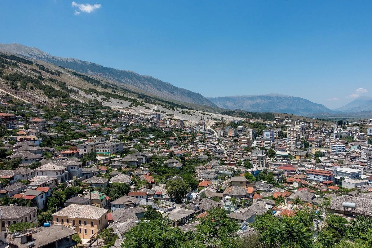
Projects ALBANIA HAZARD MODELLING Joint development of the Albanian seismic hazard model Versión en español English version Share Facebook LinkedIn Overview Outcomes Training Outreach Photos Publications Anchor 6 Background GEM and IGEO-Albania are currently implementing a 1-year project funded by the European Investment Fund and supported by the Electrical Corporation of Albania to update Albania’s probabilistic seismic hazard model through a series of technical workshops. The GEM Hazard Team is providing support on the use of its open source tools for hazard model building and assessment. Duration: 2023 Objectives The main objectives of this project are to update the national seismic hazard model for Albania, and provide the outputs that can be used in the National Annex of Eurocode 8, for the seismic design of buildings in Albania. Collaborators GEM Foundation, Institute of Geosciences (IGEO) Funding Partner: European Investment Fund, Electrical Corporation of Albania Location Albania Anchor 1 Anchor 5 Anchor 4 Strengthening Albania's Earthquake Preparedness: A Collaborative Effort This project, funded by the Central European Initiative and supported by the Albanian Electricity Corporation, has two objectives. It aims to modernize Albania's seismic hazard map, a crucial step in updating the nation's building code to meet Eurocode 8 standards. This marks the first significant revision to Albania's building regulations since 1989. A more updated view of seismic hazard will help in promoting more cost-effective earthquake-resistant construction practices. Read more Albania’s Institute of Geosciences (IGEO) and GEM collaborate to update the national seismic hazard model GEM and IGEO-Albania implemented a 1-year project funded by the Central European Initiative (CEI - https://www.cei.int/) and the Albanian Electricity Corporation (KESH - https://www.kesh.al/en/) to update Albania's probabilistic seismic hazard model through a series of technical workshops. Read more Anchor3 BUSINESS NEWS NSHMA 2024 Presentation, Tirana, Albania - July 16, 2024 Photo credits: IGEO 1/3 BUSINESS NEWS GEM - IGEO Albania Workshop, Pavia 2023 1/4 Publications