top of page
Thanks for submitting!
You will be contacted as soon as possible


PRODUCTS
All of GEM’s products are freely available for public good, non-commercial use, but they may have different license restrictions. Open and free distribution of data, models, and tools remains at the core of GEM’s work, further enhancing their availability and accessibility.


Anchor 1
Search
Available Seismic Hazard and Risk Models and Datasets
The gallery or list will show the region, country, or territory that currently has GEM seismic hazard and exposure models based on your search input.

By selecting a region in the global map below, a table will appear to quickly take you to the available resources in that region. You can also use the Search box to look up any specific region, country or territory.


Popup title
Country/Region | ||||
|---|---|---|---|---|
Benin | Hazard | Exposure | Vulnerability | Risk Profile |
Bhutan | Hazard | Exposure | Vulnerability | Risk Profile |
Bolivia | Hazard | Exposure | Vulnerability | Risk Profile |
Bosnia and Herzegovina | Hazard | Exposure | Vulnerability | Risk Profile |
Botswana | Hazard | Exposure | Vulnerability | Risk Profile |
Brazil | Hazard | Exposure | Vulnerability | Risk Profile |
British Virgin Islands | Hazard | Exposure | Vulnerability | Risk Profile |
Brunei | Hazard | Exposure | Vulnerability | Risk Profile |
Bulgaria | Hazard | Exposure | Vulnerability | Risk Profile |
Burkina Faso | Hazard | Exposure | Vulnerability | Risk Profile |
Burundi | Hazard | Exposure | Vulnerability | Risk Profile |
Cambodia | Hazard | Exposure | Vulnerability | Risk Profile |
Country/Region | ||||
|---|---|---|---|---|
Benin | Hazard | Exposure | Vulnerability | Risk Profile |
Bhutan | Hazard | Exposure | Vulnerability | Risk Profile |
Bolivia | Hazard | Exposure | Vulnerability | Risk Profile |
Bosnia and Herzegovina | Hazard | Exposure | Vulnerability | Risk Profile |
Botswana | Hazard | Exposure | Vulnerability | Risk Profile |
Brazil | Hazard | Exposure | Vulnerability | Risk Profile |
British Virgin Islands | Hazard | Exposure | Vulnerability | Risk Profile |
Brunei | Hazard | Exposure | Vulnerability | Risk Profile |
Bulgaria | Hazard | Exposure | Vulnerability | Risk Profile |
Burkina Faso | Hazard | Exposure | Vulnerability | Risk Profile |
Burundi | Hazard | Exposure | Vulnerability | Risk Profile |
Cambodia | Hazard | Exposure | Vulnerability | Risk Profile |
0
Sort by Title:
Product | Short Description | License | Type |
|---|---|---|---|
GEM Building Taxonomy | A classification scheme for the vulnerability attributes of buildings | CC BY-SA 4.0 / AGPL-3.0 | Dataset |
GEM Global Historical Earthquake Archive (GHEA) | A historical earthquake catalogue for the period 1000–1903, with magnitude Mw7 and over, derived from the Global Historical Earthquake Archive | CC BY-SA 4.0 | Dataset |
GEM Strain Rate Model | A digital model of global strain rate estimates based on geodetic (mainly GPS) velocity data | CC BY-SA 3.0 | Model |
Global Block Model | A global tectonic block model providing internally consistent fault slip rates derived from joint inversion of geodetic and geologic data, developed to support probabilistic seismic hazard assessment. | Custom license | Model |
Global EarthquakE ScEnarios (GEESE) | An OpenQuake Engine-Based Rupture Matching Algorithm and Scenarios Database | CC BY-NC-SA 4.0 | Dataset |
Global Earthquake Impact Database (GEID) | A collection of earthquake footprints and consequences from past events | CC BY-NC-SA 4.0 | Dataset |
Global Exposure Model | Comprehensive datasets of the residential, commercial and industrial building stock worldwide | CC BY-NC-SA 4.0 | Model |
Global Ground Motion Flatfile | A homogenised collection of ground motion metadata files ('flatfiles') from around the world | CC BY-SA 4.0 | Dataset |
Global Liquefaction Hazard | The first global view of earthquake-triggered liquefaction | CC BY-SA 4.0/CC BY-NC-SA 4.0 | Map |
Global Map of Road Exposure to Ground Shaking and Liquefaction | Assessment of the impact of earthquakes on road networks | CC BY-SA 4.0 | Map |
Global Seismic Embodied Carbon Risk | The first global assessment of the carbon cost of earthquakes | CC BY-SA 4.0 | Map |
Global Seismic Hazard Map | First seismic hazard map to depict seismic hazard globally, including the oceans | CC BY-SA 4.0/CC BY-NC-SA 4.0 | Map |


Dataset

Global Earthquake Impact Database (GEID)
License type:
CC BY-NC-SA 4.0
As a part of the 2023 release of the Global Earthquake Risk Model, the GEM Foundation has compiled a collection of earthquake footprints and consequences from past events, with the hope that the data find wide use in research, education and general interest among many users.
Each entry in the database includes the rupture source file, available information from recording stations and ground-motion models, for use in the OpenQuake Engine. Also, a description of the event and estimates of the impact (in terms of multiple metrics) are reported for each event.
Model
Global Exposure Model
License type:
CC BY-NC-SA 4.0
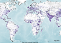
The Global Exposure Model is a mosaic of local and regional models with information regarding the residential, commercial, and industrial building stock at the smallest available administrative division of each country and includes details about the number of buildings, number of occupants, vulnerability characteristics, average built-up area, and average replacement cost. The dataset is developed and maintained by the GEM Foundation, using a bottom-up approach at the global scale, using national statistics, socio-economic data, and local datasets. The datasets employed to develop this model were provided by national institutions, or developed within the scope of regional programs or bilateral collaborations. The global maps and the underlying databases are based on best available and publicly accessible datasets and models. This model allows the identification of the most common types of construction worldwide, regions with large fractions of informal construction, and areas prone to natural disasters with a high concentration of population and building stock.
The underlying datasets used to create the maps are available for all regions of the world, aggregated at Administrative Level 1 under a CC BY-NC-SA license, or further disaggregated under specific licenses.
The open and downloadable Global Exposure Map (v2023.1) in PNG format, presents the geographic distribution of residential, commercial and industrial buildings. The number of buildings and total replacement cost is presented on a hexagonal grid, with a spacing of 0.30 x 0.36 decimal degrees (approximately 1,000 km2 at the equator). The Global Exposure Map (shapefiles) consists of four layers that depict for each hexagon the number of buildings, the built-up area, the total replacement value and the total population.

Map

Global Seismic Hazard Map
License type:
CC BY-SA 4.0/CC BY-NC-SA 4.0
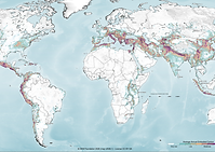
The Global Earthquake Model (GEM) Global Seismic Hazard Map (version 2023.1) depicts the geographic distribution of the Peak Ground Acceleration (PGA) with a 10% probability of being exceeded in 50 years, computed for reference rock conditions (shear wave velocity, Vs30 , of 760-800 m/s). The map was created by collating maps computed using national and regional probabilistic seismic hazard models developed by various institutions and projects, in collaboration with GEM Foundation scientists.
This version represents an update from the previous release from 2018 and features improvements in most regions of the world, as well as a higher spatial definition (approx. 2.5X) compared to the previous version. For the first time, it is now openly available in raster format as a direct download under a CC BY-NC-SA 4.0 license. An interactive online viewer (CC BY-NC-SA 4.0) is available, as well as a PDF poster and a high resolution PNG (CC BY-SA 4.0) through the links in this page.
A set of comprehensive maps is also available that features up to 20 layers with global coverage, considering PGA and spectral acceleration (SA) for four periods of vibration (0.2s, 0.3s, 0.6s and 1.0s), calculated for reference rock and spatially variable soil conditions, for 2% and 10% probability of exceedance in 50 years. By clicking the "License Request" button, the full set or individual layers can be requested freely for research and public-good applications, or for a licensing fee in the case of commercial applications.

Dataset
Global Earthquake Impact Database (GEID)
License type:
CC BY-NC-SA 4.0
As a part of the 2023 release of the Global Earthquake Risk Model, the GEM Foundation has compiled a collection of earthquake footprints and consequences from past events, with the hope that the data find wide use in research, education and general interest among many users.
Each entry in the database includes the rupture source file, available information from recording stations and ground-motion models, for use in the OpenQuake Engine. Also, a description of the event and estimates of the impact (in terms of multiple metrics) are reported for each event.
Model
Global Exposure Model
License type:
CC BY-NC-SA 4.0
The Global Exposure Model is a mosaic of local and regional models with information regarding the residential, commercial, and industrial building stock at the smallest available administrative division of each country and includes details about the number of buildings, number of occupants, vulnerability characteristics, average built-up area, and average replacement cost. The dataset is developed and maintained by the GEM Foundation, using a bottom-up approach at the global scale, using national statistics, socio-economic data, and local datasets. The datasets employed to develop this model were provided by national institutions, or developed within the scope of regional programs or bilateral collaborations. The global maps and the underlying databases are based on best available and publicly accessible datasets and models. This model allows the identification of the most common types of construction worldwide, regions with large fractions of informal construction, and areas prone to natural disasters with a high concentration of population and building stock.
The underlying datasets used to create the maps are available for all regions of the world, aggregated at Administrative Level 1 under a CC BY-NC-SA license, or further disaggregated under specific licenses.
The open and downloadable Global Exposure Map (v2023.1) in PNG format, presents the geographic distribution of residential, commercial and industrial buildings. The number of buildings and total replacement cost is presented on a hexagonal grid, with a spacing of 0.30 x 0.36 decimal degrees (approximately 1,000 km2 at the equator). The Global Exposure Map (shapefiles) consists of four layers that depict for each hexagon the number of buildings, the built-up area, the total replacement value and the total population.
Map
Global Seismic Hazard Map
License type:
CC BY-SA 4.0/CC BY-NC-SA 4.0
The Global Earthquake Model (GEM) Global Seismic Hazard Map (version 2023.1) depicts the geographic distribution of the Peak Ground Acceleration (PGA) with a 10% probability of being exceeded in 50 years, computed for reference rock conditions (shear wave velocity, Vs30 , of 760-800 m/s). The map was created by collating maps computed using national and regional probabilistic seismic hazard models developed by various institutions and projects, in collaboration with GEM Foundation scientists.
This version represents an update from the previous release from 2018 and features improvements in most regions of the world, as well as a higher spatial definition (approx. 2.5X) compared to the previous version. For the first time, it is now openly available in raster format as a direct download under a CC BY-NC-SA 4.0 license. An interactive online viewer (CC BY-NC-SA 4.0) is available, as well as a PDF poster and a high resolution PNG (CC BY-SA 4.0) through the links in this page.
A set of comprehensive maps is also available that features up to 20 layers with global coverage, considering PGA and spectral acceleration (SA) for four periods of vibration (0.2s, 0.3s, 0.6s and 1.0s), calculated for reference rock and spatially variable soil conditions, for 2% and 10% probability of exceedance in 50 years. By clicking the "License Request" button, the full set or individual layers can be requested freely for research and public-good applications, or for a licensing fee in the case of commercial applications.
bottom of page