Thanks for submitting!
You will be contacted as soon as possible


Description
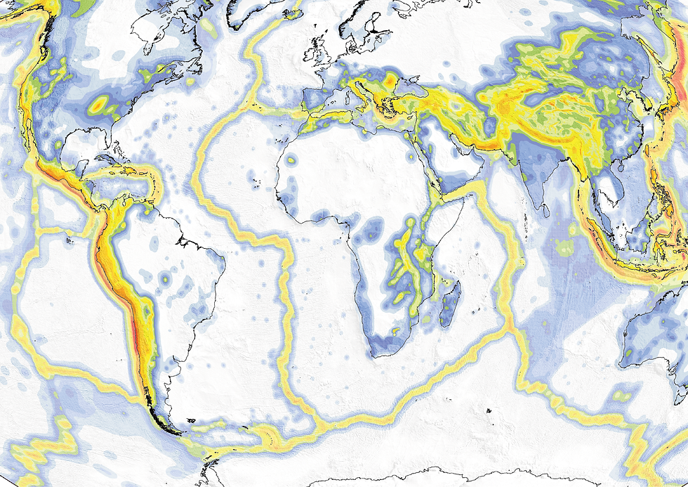
The v2026.1 Global Seismic Hazard Map is the first probabilistic seismic hazard map to depict seismic hazard globally, including the oceans. This map replaces the previous version (v2023.1) released in June 2023. The main map depicts the geographic distribution of the Peak Ground Acceleration (PGA) with a 10% probability of being exceeded in 50 years, computed for reference rock conditions (shear wave velocity, VS,30 of 800 m/s).
The map was created by collating hazard results computed using national and regional probabilistic seismic hazard models developed by various institutions and projects, as well as by GEM Foundation scientists. The map is openly available in both vector and raster formats as direct download under a CC BY-NC-SA 4.0 license.
An interactive online viewer (CC BY-NC-SA 4.0) is available, as well as a PDF poster and a high-resolution PNG (CC BY-SA 4.0) through the links on this page. A set of comprehensive maps is also available that features up to 42 layers with global coverage, considering PGA and spectral acceleration (SA) for four periods of vibration (0.1, 0.2s, 0.3s, 0.6s, 1.0s and 2.0s), calculated for reference rock and spatially variable soil conditions, for 2%, 10% and 50% probability of exceedance in 50 years (though other return periods can be requested). By clicking the "License Request" button, the full set or individual layers can be requested freely for research and public-good applications, or for a licensing fee in the case of commercial applications.
How to cite this work
If you make use of this work, please cite both the publication and the data.
Publication:
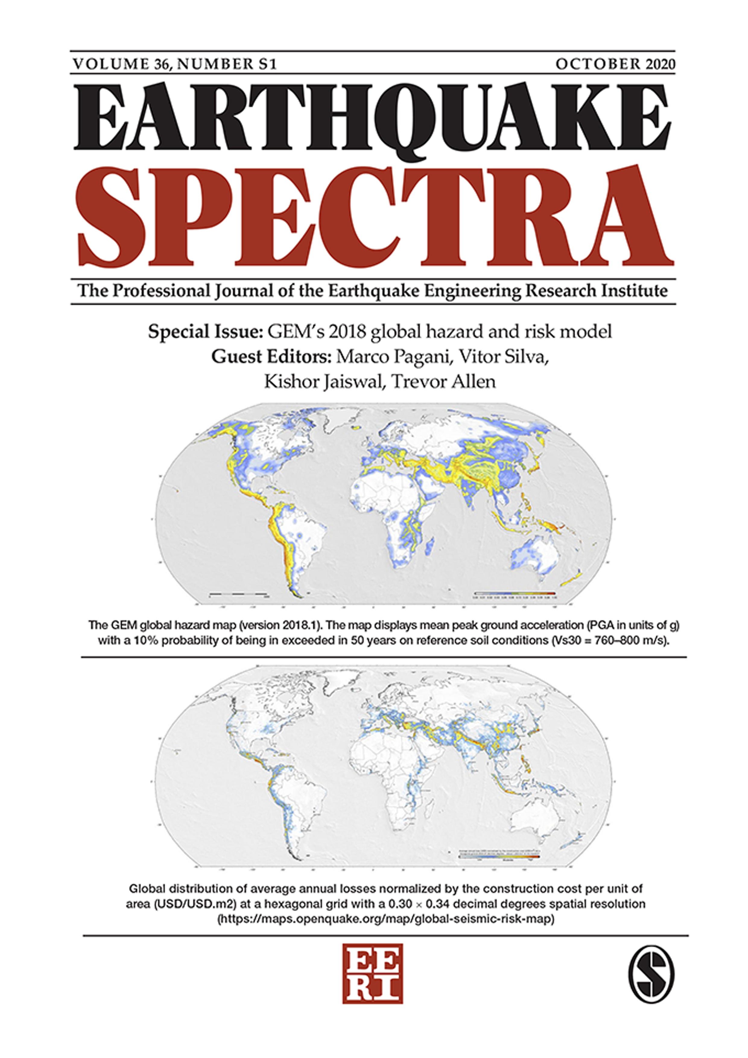
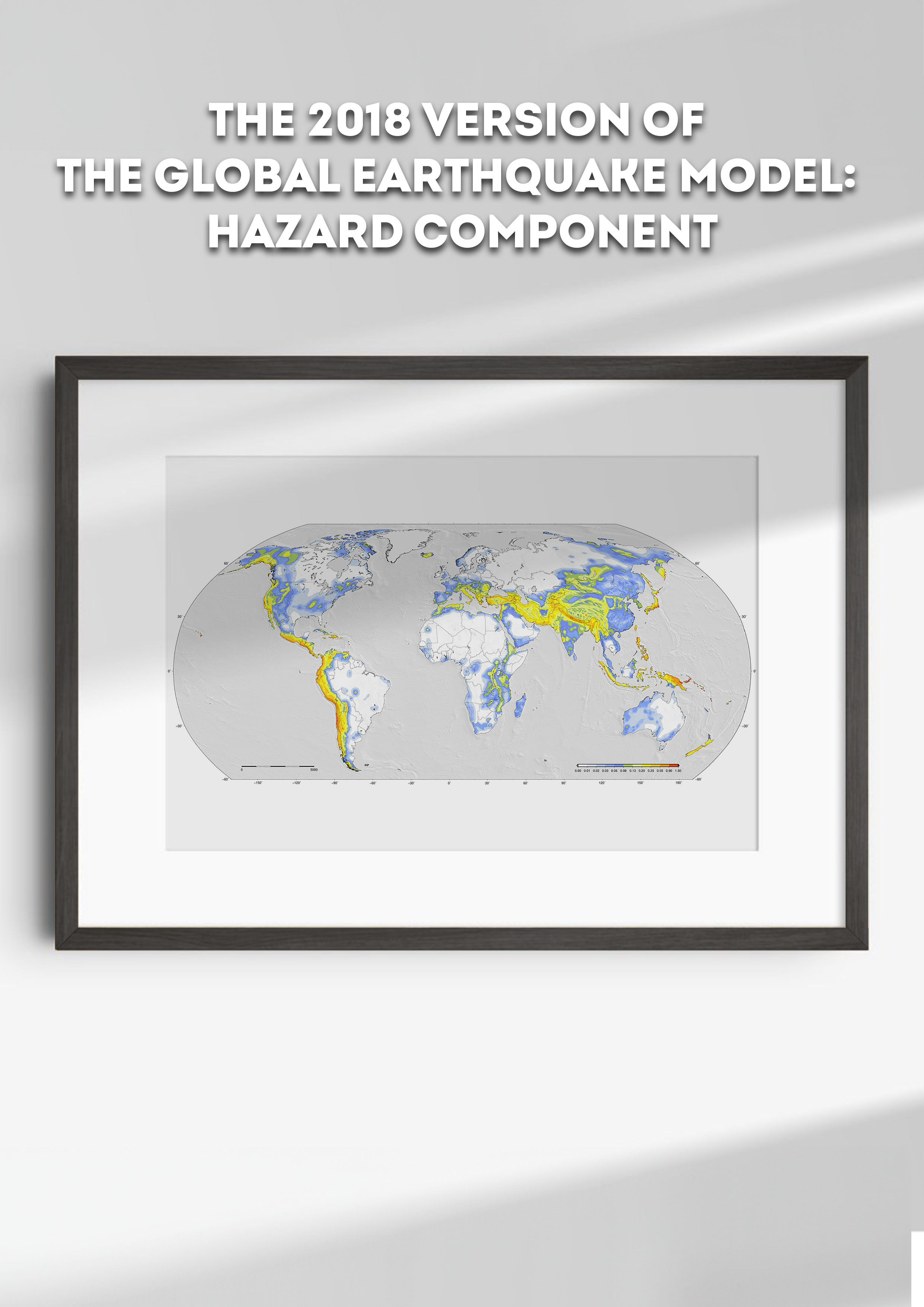
Pagani M, Garcia-Pelaez J, Gee R, et al. (2020) The 2018 version of the Global Earthquake Model: Hazard component, Earthquake Spectra, vol. 36, no. 1_suppl, 2020, pp. 226–251. https://journals.sagepub.com/doi/abs/10.1177/8755293020931866
Data:
Johnson, K., Bayliss, K., Villani, M., Brooks, C., Styron, R., Simionato, M., Chen, Y., Rood, A., & Pagani, M. (2026). Global Earthquake Model (GEM) Seismic Hazard Map (v2026.1). [Data set] Zenodo. https://doi.org/10.5281/zenodo.8409646
Available Versions
The base layer of PGA on rock for 10% exceedance in 50 years is currently available for direct download as a vector file, under a CC BY-SA-NC 4.0 license. Users interested in this version can click the "Open Version Download" button in the right panel to access the information. A PDF poster, as well as a high-resolution PNG, is available for direct download under a CC BY-SA 4.0 license. If your use case does not meet the open license requirement, or if you are interested in obtaining the full set of layers, please submit a request in our system by clicking on the "License Request", where a specific license will be provided, depending on the use case. Additionally, users interested in the previous versions of the Global Seismic Hazard Map can access these from the table at the bottom of this page.
License information
This product is available under multiple Creative Commons licenses (depending on the format), which may require some of the following:
Attribution (you must give appropriate credit, provide a link to the license, and indicate if changes were made)
Non-commercial (you may not use the material for commercial purposes)
ShareAlike (derivatives created must be made available under the same license as the original)
Any deviation from these terms incur in license infringement. For commercial use of the dataset, a specific license agreement must be made tailored to your use case, in such instance please click on "License Request".


Popup title
Country/Region | Available Resources |
|---|---|
Afghanistan | Vulnerability |
Africa | Vulnerability |
Alaska | Vulnerability |
Country/Region | Resource Url |
|---|---|
Afghanistan | Risk Profile |
Africa | Risk Profile |
Alaska | Risk Profile |
Search
Found
Country/Region | Resource Url |
|---|---|
Afghanistan | Vulnerability |
Africa | Vulnerability |
Alaska | Vulnerability |
Preview

Preview is not available.
Search
Found
Country/Region | Resource Url |
|---|---|
Afghanistan | Risk Profile |
Africa | Risk Profile |
Alaska | Risk Profile |
Preview
Preview is not available.
Related products
Global Block Model
Global homogenised earthquake catalogue

ISC - GEM Global Instrumental Earthquake Catalogue

Active Faults Database
Global Ground Motion Flatfile
Model Builder's Toolkit (oq-mbtk)

GEM Global Historical Earthquake Archive (GHEA)
Global Stochastic Catalogue

GEM Strain Rate Model

OpenQuake Engine
Related publications

Development of a global seismic risk model
GEM's 2018 global hazard and risk models
The 2018 version of the Global Earthquake Model: Hazard component