Thanks for submitting!
You will be contacted as soon as possible


CLOSE

QUICK LINKS


PROFILES
PUBLICATIONS
EXPOSURE
VULNERABILTY
SOFTWARE
EQ MODELS
Search Results
966 results found with an empty search
- CRAVE | Global Earthquake Model Foundation
Projects CRAVE Collaborative Risk Assessment for Volcanoes and Earthquakes (CRAVE) Versión en español English version Share Facebook LinkedIn Overview Outcomes Training Outreach Photos Publications Anchor 6 Summary The need to better understand the existing earthquake and volcano risk led to the establishment of the Global Earthquake Model (GEM) and the Global Volcano Model (GVM) network. GEM, founded in Italy in 2009, has been developing open tools and models to calculate and communicate seismic hazard and risk worldwide. Similarly, the GVM network represents an international community aiming to provide systematic evidence, data and analysis of volcanic hazards and risk on national, regional and global scales working with monitoring institutions to implement the best science and DRR strategies. Both GEM and the GVM network are currently leading international efforts that aim to mitigate the adverse effects from these perils. South America and ASEAN regions have been the target of numerous studies in the last two decades. However, most of these studies only focused on one component of the risk problem (e.g. hazard, vulnerability). Such limitation prevents the development of a comprehensive risk profile to properly inform decision-makers. The CRAVE project, through the current GEM and GVM network tools will offer a timely and unique opportunity to advance the understanding of seismic and volcanic risk in the region. Objectives This project aims to develop a common framework for the assessment of the impact from earthquakes and volcanoes, with an application in three countries located around the Pacific Rim. The activities comprised in this project feature several events to bring together global partners with the mandate to calculate and communicate seismic and volcanic risk, as well as training events to increase the capacity of local institutions in the assessment of their hazard and risk. Collaborators This project includes several partners including the following: British Geological Survey; the Earth Observatory of Singapore (EOS); the University of Edinburgh; the Volcano Disaster Assistance Program (VDAP) of the United States Geological Survey (USGS); and key organizations from the region including: the Colombian Geological Survey; the Philippine Institute of Volcanology and Seismology;(PHIVOLCS); and Badan Geologi (Indonesia). Location Colombia, Indonesia and the Philippines Volcano Scenario tool for OpenQuake The CRAVE project required the implementation of a new calculator in the OpenQuake Engine called ‘multi_risk’, which is able to manage at the same time different types of hazards, specifically ash fall, pyroclastic density currents flow, lava flow and lahar flow, passed as CSV files with headers ‘lon’, ‘lat’, ‘intensity’. The calculator is also able to consider the difference between dry and wet ash by setting the `ash_wet_amplification_factor` parameter in the job.ini file. The output of the calculator is a CSV file with ‘Exposure + Risk’ fields. For convenience we also produced a ‘Total Risk’ output which is simply the sum over the assets of the values in the ‘Exposure + Risk’ output. In order to support other formats used in the volcanic hazard community we prepared tools to convert hazard footprints into the format accepted by the OpenQuake-engine. These tools were included in the Input Preparation Toolkit. [Software ] Volcano Model example Full example of the volcano model developed with the Servicio Geológico Colombiano (SGC). [Data ] OpenQuake Volcano Risk Assessment OpenQuake for volcano risk assessment? Yes! Now you can perform volcanic scenarios. Checkout our tutorial! [Video ] Anchor 1 Anchor 5 Introduction The presentation of the tools and datasets from CRAVE took place in Bogota (Colombia) and Bandung (Indonesia). These events were organized by the Colombian Geological Survey and the Institute of Technology of Bandung. Kick-off Meeting The kick-off meeting took place in Bogota at the offices of the Colombian Geological Survey (SGC) on the 22nd of February 2018. During the meeting the goals of the CRAVE project were presented by GEM, as well as some concepts on seismic hazard, vulnerability and risk modelling. The British Geological Survey (BGS) presented general aspects of volcano hazard modelling and the mission of the Global Volcano Model, the SGC demonstrated how three volcanoes are currently being monitored and how seismic hazard maps have been developed in the past and the Rabaul Volcano Observatory (RVO) presented the current situation in terms of volcano hazard monitoring and assessment in Papua New Guinea. During this event all partners also discussed the way forward, including the division of tasks, case studies, relevant risk outputs and the timeframe for the next workshops. Bandung, Indonesia (20-22 of May) Workshop – IT Bandung With support from the Institute of Technology of Bandung (ITB), the event featured a day of presentations and discussion with representatives from the Center for Volcanology and Geological Hazard Mitigation (CVGHM), the Indonesian Ministry of Public Works, the National Disaster Management Agency (Badan Nasional Penanggulangan Bencana - BNPB), the Meteorology, Climatology and Geophysics Agency (Badan Meteorologi, Klimatologi dan Geofisika - BMKG), the Philippine Institute of Volcanology and Seismology (PHIVOLCS) and the British Geological Survey (BGS). Bogota, Colombia (13-17 of May) Workshop - Geological Survey of Colombia Five days in Bogota provided a fruitful time to share and discuss the national volcanic hazard and risk assessment, as well as risk management challenges in the country. The workshop was divided into two main parts: The first part focused on the technical aspects of volcanic hazard and risk assessment. Representatives from the three mains national volcanological observatories participated in the sessions (Manizales, Popayan and Pasto). The second part of the workshop was conceived for a broader audience, involving stakeholders that contribute to the Disaster Risk Reduction strategy in the country. Anchor 4 CRAVE project kicks off in Colombia The USAID project – Collaborative Risk Assessment for Volcanoes and Earthquakes or CRAVE successfully kicked off with a workshop in Bogota, Colombia. [News ] CRAVE in Colombia and Indonesia Members of the USAID-supported project – CRAVE from Colombia and Indonesia participated in two separate workshops to discuss volcanic threats and risks. [News ] CRAVE workshop, Bandung, Indonesia Workshop at IT Bandung exploring open tools and models for #earthquake and #volcano #hazard and #risk assessment with project partners. [Social Media ] Anchor3 BUSINESS NEWS CRAVE project workshops held in Bogota, Colombia 1/3 BUSINESS NEWS CRAVE project workshops held in Bandung, Indonesia 1/5 Publications CRAVE Project Final Report Final Report to USAID/OFDA for: CRAVE-Collaborative Risk Assessment for Volcanoes and Earthquakes [Report ] Disclaimer The contents of this project website such as studies, reports, audio-visual, news articles, blogs, and other information or media products including those in the external links are made possible by the generous support of the American people through the United States Agency for International Development (USAID). The contents are the responsibility of the Global Earthquake Model (GEM) Foundation and do not necessarily reflect the views of USAID or the United States Government.
- HORUS | Global Earthquake Model Foundation
Projects HORUS Horus: Pilot for a generic damage evaluation methodology based on remote-sensing data Versión en español English version Share Facebook LinkedIn Overview Anchor 6 Background Horus is a pilot project that explores the combination of high-resolution building inventory data from OpenStreetMap and other local sources with image-processing algorithms for the detection of earthquake damage and flood extents using remote-sensing data, along with supplementary geospatial datasets as inputs to a machine learning (ML) classification model. The ML model is trained using detailed building damage datasets from past events in a supervised learning framework, and the trained model is intended to be used to estimate the extent of damage and loss in events previously unseen by the model. The proposed framework is applied in three case study applications: March 2020 Mw5.3 Zagreb earthquake; January 2020 Mw6.4 Puerto Rico earthquake and August 2016 Louisiana floods. The GEM Risk Team is responsible for the overall coordination of the project involving multiple partners, compilation of building-level earthquake damage datasets, development of the ML models, and training and testing of the models. Duration: 2020 Objectives This pilot project, initiated and funded by the World Bank, aims to develop a framework for semi-automated damage and loss assessment due to earthquake and floods from Earth Observation (EO) data and other supplementary datasets, while also leveraging recent advances in machine-learning algorithms. These damage and loss estimates can potentially be used for transparent financial compensation and to target the distribution of resources geographically and temporally. Collaborators Advanced Rapid Imaging and Analysis (ARIA) team at the National Aeronautics and Space Administration’s (NASA) Jet Propulsion Laboratory (JPL) and California Institute of Technology (Caltech), the Global Earthquake Model (GEM) Foundation, JBA Risk, and the Humanitarian OpenStreetMap Team (HOT) Funding partner: World Bank Group Locations Earthquake case studies: Gorkha, Nepal; Puebla, Mexico; Puerto Rico, United States; Zagreb, Croatia Flood case study: Louisiana, United States Anchor 1 Anchor 5 Anchor 4 Anchor3 Publications
- METEOR | Global Earthquake Model Foundation
Projects METEOR Modelling Exposure Through Earth Observation Routines (METEOR) Versión en español English version Share Facebook LinkedIn Overview Outcomes Training Outreach Photos Publications Anchor 6 Background At present, there is a poor understanding of population exposure in some Official Development Assistance (ODA) countries, which causes major challenges when making Disaster Risk Management decisions. Modelling Exposure Through Earth Observation Routines (METEOR) takes a step-change in the application of Earth Observation exposure data by developing and delivering more accurate levels of population exposure to natural hazards. Providing new consistent data to governments, town planners and insurance providers will promote welfare and economic development in these countries and better enable them to respond to the hazards when they do occur. Objectives METEOR aims to formulate an innovative methodology of creating exposure data through the use of EO-based imagery to identify development patterns throughout a country. Stratified sampling technique harnessing traditional land use interpretation methods modified to characterise building patterns can be combined with EO and in-field building characteristics to capture the distribution of building types. These protocols and standards will be developed for broad application to ODA countries and will be tested and validated for both Nepal and Tanzania to assure they are fit-for-purpose. Objectives of the project look to: deliver exposure data for 47 of the least developed ODA countries, including Nepal and Tanzania; create hazard footprints for the specific countries; create open protocol; to develop critical exposure information from EO data; and capacity-building of local decision makers to apply data and assess hazard exposure. Collaborators METEOR Project Consortium The British Geological Survey (BGS) ImageCat National Society for Earthquake Technology (NSET) The Disaster Management Department-Tanzania The Humanitarian OpenStreetMap Team (HOT) Oxford Policy Management Limited (OPM) Fathom Location Nepal, Tanzania For more details on the METEOR Project, click read more below to visit the website. Anchor 1 Anchor 5 Anchor 4 Anirudh and Nicole will be producing vulnerability data for different building types to different hazards for Nepal and Tanzania. About 20 project participants from GEM, Tanzania Prime Minister’s Office-Disaster Management Department (DMD), NSET, BGS, HOT OSM, ImageCat and OPM... Modelling Exposure Through Earth Observation Routines: EO-based Exposure, Nepal and Tanzania granted by the UK Space Agency Anirudh Rao and Nicole Paul participated in the quarterly UK Space Agency #METEOR Project meeting and workshops in Kathmandu, Nepal. Anchor3 Publications To download the METEOR Project official deliverables documents, click the Read More button below.
- BEYOND BUTTON PUSHING | Global Earthquake Model Foundation
Projects BEYOND BUTTON PUSHING Earthquake Risk Assessment and Sensitivity Analysis for California Versión en español English version Share Facebook LinkedIn Overview Anchor 6 Background The goal of the project was to show how important the quantification of uncertainty is in estimating and understanding California’s earthquake risk using OpenQuake - GEM Foundation’s state-of-the-art open source earthquake hazard and risk assessment software. With OpenQuake’s plug-and-play capabilities, expert users can individually select or substitute every model component, data, and assumption. This feature will help model users and decision makers to: 1) ‘ask the right questions’ when evaluating model results; 2) better interpret risk assessment results and gain trust in model results; and 3) make better risk management decisions. Duration: 2015-2017 Objectives The main objectives of this project are to: Establish representative sets of exposure: ‣ for the San Francisco Bay Area; ‣ for the Southern California region affected by the Shakeout Scenario Choose specific results (risk metrics) to use as a basis for comparison. Produce ‘baseline’ results from OpenQuake, using a ‘control’ set of assumptions. Undertake a thorough sensitivity analysis for the risk estimates for California based on the UCERF3 model by running OpenQuake multiple times, each time varying one assumption or parameter, such as: ‣ earthquake probabilities (controlled by assumptions about fault geometries, slip rates, maximum magnitudes); ‣ ground motion model selection; ‣ vulnerability functions; ‣ site conditions; and ‣ statistical treatment of uncertainty and correlation Beyond the aims stated at the outset of the project as listed above, several additional objectives were achieved during the course of the project, including the following: Implement within OpenQuake the latest seismic hazard model for California based on the recently published Uniform California Earthquake Rupture Forecast version 3 (UCERF3), produced by the U.S. Geological Survey and the Working Group on California Earthquake Probabilities. Calculate the average annual loss estimates for all 8,057 census tracts in California, using the seismic hazard model based on UCERF3. Establish the range (distribution) of scientifically viable results for the chosen risk metrics by accounting for the various uncertainties in the hazard model. Identify the components of the hazard model contributing most to the overall uncertainty in the risk metrics for the different exposure portfolios. Implement a model simplification (‘logic-tree trimming’) software tool to reduce the number of computer runs and greatly speed up the time required for running the risk model for California. Collaborators GEM Foundation Funding partner: Alfred E. Alquist Seismic Safety Commission (SSC) Location California, United States Anchor 1 Anchor 5 Anchor 4 Anchor3 Publications
- MALAWI MULTI-HAZARD | Global Earthquake Model Foundation
Projects MALAWI MULTI-HAZARD Comprehensive Multi hazard Risk Assessment in Malawi Versión en español English version Share Facebook LinkedIn Overview Outcomes Training Outreach Photos Publications Anchor 6 Background Malawi is a country strongly affected by the impact of extreme events, exacerbated by rapid population growth and urbanisation. A multi-risk assessment is currently lacking at the national level, while it is available only at the local level in some districts. Therefore, the project consortium intends to produce, for the first time, hazard and risk maps on a national level with a level of detail useful also at provincial level, using a probabilistic risk assessment approach, both for single hazards and for multi-hazard conditions (i.e. extreme winds and precipitation, earthquakes, landslides, river floods). The GEM Risk Team is reponsible for the seismic risk assessment, comprising the modelling of the hazard, exposure and vulnerability components and the calculations of seismic risk in the OpenQuake engine. Duration: 2023-2024 Objectives In line with the guidelines of the Sendai Framework for Disaster Risk Reduction, the multi-hazard probabilistic assessment carried out within the project provides risk estimates for both the most probable and frequent events, as well as for rare ones; at the same time, it allows for the analysis of events that have never been observed but may occur in the future, which is of particular importance considering the uncertainty caused by climate change. The assessment will therefore consider risks under current climate conditions as well as future conditions (2050-2100) under different climate change scenarios. For the realisation of the multi-risk assessment, the project partners will work closely with local stakeholders at all stages of the development, from data collection to the creation of the Risk Atlas and the Risk Information Web Platform, two tools that will collect information from the assessment and will make it easier to communicate and understand, thus following a capacity development approach that combines knowledge development with knowledge transfer. In addition, the partners will develop, again in collaboration with local stakeholders, a sustainability plan containing recommendations for maintaining and updating risk information, supporting the management, updating and accessibility of Malawi’s risk information by national and local authorities. Collaborators GEM Foundation, Centro Internazionale in Monitoraggio Ambientale (CIMA), Malawi University of Business and Applied Sciences (MUBAS), British Geological Survey (BGS) Funding partner: World Bank Group Location Malawi Aiming to empower Malawi with a comprehensive understanding of disaster risks, the project will deliver the following key outputs: Comprehensive Hazard Identification and Assessment: A national-level assessment of various hazards in Malawi, including floods, droughts, landslides, earthquakes, and strong winds. Exposure Mapping: Creation of maps outlining the extent to which people, infrastructure, buildings, and agriculture are exposed to each hazard. Vulnerability Assessment: Evaluation of the physical (infrastructure, buildings) and social (poverty, access to resources) vulnerabilities of Malawian communities to these hazards. National Hazard and Risk Profiles: Development of comprehensive national profiles that detail the hazards, their potential impacts, and the level of risk faced by different regions and communities. Knowledge and Technology Transfer: Training and capacity building for Disaster Risk Reduction (DRR) practitioners and academic institutions in Malawi on using the multi-hazard risk assessment data and tools. Anchor 1 Anchor 5 Platform deployment, knowledge transfer, maintenance and ownership This project builds a long-term plan for Malawian experts to manage the multi-hazard risk atlas database. Through trainings and knowledge transfer, local technicians will become self-sufficient in maintaining the system and training future users. This ensures the platform's sustainability and empowers Malawian authorities to fully utilize the risk information for informed decision-making. a. Hands-on training on the Risk Atlas Database Training of the Department of Disaster Management Affairs (DODMA) ICT team to install and utilise the Risk Atlas Database held in Salima, Malawi, from June 3-7, 2024. b. Exposure and Vulnerability Data The exposure and vulnerability work was delivered to the client and presented in a dedicated training session in November 2023. Anchor 4 GEM Contributes to Multi-Hazard Risk Assessment Progress in Malawi The Global Earthquake Model (GEM) Foundation actively participated in a Multi-Hazard Risk Assessment workshop held in Salima, Malawi, from June 3-7, 2024. This collaborative effort involved the Department of Disaster Management Affairs (DODMA) as the host, alongside the International Centre for Environmental Monitoring (CIMA Research Foundation), Malawi University of Business and Applied Sciences (MUBAS), and the British Geological Survey (BGS). Read more Anchor3 BUSINESS NEWS Multi-Hazard Risk Assessment workshop held in Salima, Malawi, from June 3-7, 2024 1/6 Publications
- NEAM-COMMITMENT | Global Earthquake Model Foundation
Projects NEAM-COMMITMENT North-Eastern Atlantic and Mediterranean Tsunami Risk Management and Planning Versión en español English version Share Facebook LinkedIn Overview Anchor 6 Background NEAM-COMMITMENT aims to improve tsunami risk management and planning in the NEAM region. It endeavors to contribute primarily to two key components of tsunami risk governance: capacity building through tsunami hazard assessment and mapping at the national scale, and improved tsunami evacuation planning at the local level through a novel multi-hazard approach. Guidelines will be drafted for the methodologies applied to develop the national tsunami inundation and local tsunami evacuation maps to contribute to improved tsunami risk management planning. Duration: 2025 - 2027 More details: https://civil-protection-knowledge-network.europa.eu/projects/neam-commitment#inpage-section-description Objectives The project has two objectives: to develop national tsunami inundation maps in Cyprus, Greece and Spain through the methodology applied to produce tsunami inundation maps for evacuation planning in Italy, aiming to achieve compatible tsunami inundation maps across the NEAM region; to address the need for a multi-hazard approach for effective tsunami evacuation management to complement existing tsunami evacuation management guidelines. The proposed new approach focuses on multi-hazard cascading effects concerning tsunami evacuation and emergency management and will be piloted in local sites in Greece and Italy. Collaborators NATIONAL OBSERVATORY OF ATHENS Greece Coordinator National Institute of Geophysics and Volcanology (INGV), Italy Fundación hidráulica ambiental de Cantabria, Spain Higher Institute for Environmental Protection and Research (ISPRA), Italy Global Earthquake Model (GEM) Foundation, Italy University of Malaga, Spain Municipality of Lipari, Italy Academy of Athens, Greece The General Secretariat for Civil Protection - Greece Ministry of Agriculture, Rural Development and Environment of Cyprus Funding partner: Union Civil Protection Mechanism (UCPM) Location Southern Europe Anchor 1 Anchor 5 Anchor 4 Anchor3 Publications
- GAR 2023 | Global Earthquake Model Foundation
Projects GAR 2023 GAR Special Report 2023: Mapping resilience for the Sustainable Development Goals Versión en español English version Share Facebook LinkedIn Overview Anchor 6 Background The United Nations Office for Disaster Risk Reduction (UNDRR)'s Global Assessment Report on Disaster Risk Reduction 2023 offers a unique perspective on development progress by emphasizing risk and resilience in a changing climate. The report features maps developed in collaboration with the GEM Foundation and other agencies (United Nations Geospatial Information Section, Environmental Systems Research Institute - ESRI), displaying country-level Sustainable Development Goals (SDG) indicators and risk drivers, and showcasing resilience deficits. These maps also present future projections of these deficits under different climate scenarios, incorporating IPCC greenhouse-gas-emission-rate scenarios and representative concentration pathways. Duration: 2023 Objectives The report serves as a comprehensive inter-agency effort to assess and address resilience gaps, aiding in informed decision-making for sustainable development. Collaborators GEM Foundation, United Nations Geospatial Information Section, Environmental Systems Research Institute - ESRI Funding partner: UNDRR Location Geneva, Swizterland Anchor 1 Anchor 5 Anchor 4 Anchor3 Publications
- TREAD | Global Earthquake Model Foundation
Projects TREAD daTa and pRocesses in sEismic hAzarD Versión en español English version Share Facebook LinkedIn Overview Anchor 6 Background GEM is one of the partners of the Marie Skłodowska-Curie Actions (MSCA) funded TREAD project, which involves a consortium of 14 academic institutions and 8 private partners of the highest scientific level from 7 European countries. TREAD will train a new generation of seismic hazard scientists to tackle the challenges of earthquake forecasting in complex tectonic contexts such as the Europe and Mediterranean regions. During the 4 year project GEM will host and supervise two PhD students, one working with the hazard team and the other with the risk team, on the following topics: 1. Modelling distributed seismicity under innovative approaches (under joint supervision with the University of Milano, Bicocca, 2. Assessment of the impact of advanced seismic hazard modelling approaches on earthquake risk (under joint supervision with the University of Chieti-Pescara) More information at https://tread-horizon.eu/ . Duration: 2023-2027 Objectives The aim of TREAD is to train a new generation of seismic hazard scientists to tackle the challenges of earthquake forecasting in complex tectonic contexts such as the Europe and Mediterranean regions. A change of paradigm in seismic hazard is necessary to be able to fully account for the specific properties of earthquake source and seismic modes in those areas. For example, to calculate the probability of having multiple earthquake ruptures, the interaction between active faults across various space-time scales needs to be accounted for, as well as the effects of stress transfer and fault-fluid interaction in earthquake triggering. TREAD objectives are: 1) Developing a novel integrative approach to seismic hazard analysis in Europe and the Mediterranean by bridging the gap from small-scale laboratory experiments to large-scale observations. 2) Establishing physics-based earthquake modelling by linking computational modelling of earthquakes from millions of years to fractions of a second. 3) Transferring earthquake geology and computational modelling to hazard and risk assessment adapted to the needs of government, industry and scientific stakeholders. Collaborators University of Chieti-Pescara, CNRS, University of Utrecht, GEM Foundation, University of Grenoble Alps, Ludwig Maximilians University, University of Barcelona, University of Padova, ETH Zurich, IRSN, OGS, INGV, Ruhr University Bochum, IPGP, Helmholz Centre, Willis, IFP, EDF, University of Milan Bicocca, Munich Re, TNO, Tre Altamira, University D'Aix Marseille Funding partner: Marie Skłodowska-Curie Actions (MSCA), European Commission Location Pavia, Italy Anchor 1 Anchor 5 Anchor 4 Anchor3 Publications
- Proyecto TREQ | Global Earthquake Model Foundation
Projects Proyecto TREQ Comunicación y Formación en la Evaluación de Riesgos por Terremotos (TREQ) Versión en español English version Share Facebook LinkedIn Visión general Resultados Capacitación Comunicación Fotos Publicaciones Anchor 6 Resumen El Proyecto de Capacitación y Comunicación para la Evaluación de Riesgos de Terremotos (TREQ) fue diseñado para demostrar cómo la evaluación de la amenaza y el riesgo sísmico puede informar a los tomadores de decisiones en el desarrollo de políticas de reducción de riesgos, así como también cómo se puede comunicar adecuadamente el riesgo de terremotos a las partes interesadas y al público en general. [PDF Executive Summary English ] Objetivos El proyecto se organizó en dos partes principales. El primero tuvo como objetivo desarrollar la capacidad para la evaluación de la amenaza y el riesgo sísmico a nivel urbano en América Latina, Quito (Ecuador), Cali (Colombia) y Santiago de los Caballeros (República Dominicana); mientras que la segunda parte fue desarrollar material de capacitación, educación y comunicación para mejorar la comprensión del riesgo de terremotos en todo el mundo. El programa se diseñó para un amplio espectro de partes interesadas, categorizadas en cuatro grupos principales: gobierno(tomadores de decisiones/autoridades públicas), industria (practicantes y profesionales), academia (investigadores y profesores) y la comunidad. Ecuador Municipalidad de Quito Escuela Politécnica Nacional (EPN) Instituto Geofísico (IG) Colegio de Ingenieros Civiles de Pichincha (CICP) Pontificia Universidad Católica del Ecuador Dominican Republic Servicio Geológico Nacional (SGN) Oficina Nacional de Evaluación Sísmica y Vulnerabilidad de Infraestructuras y Edificaciones (ONESVIE) Comité Técnico Nacional (CTN) Pontificia Universidad Católica Madre y Maestra (PUCMM) Colombia Servicio Geológico Colombiano (SGC) Departamento Administrativo de Planeación Municipal (DAPM), Cali Unidad Nacional de Gestión del Riesgo de Desastres (UNGRD) Universidad EAFIT, Medellin Costa Rica Universidad de Costa Rica (UCR) Mexico Universidad Autónoma de Baja California (UABC) Ubicación Quito (Ecuador), Cali (Colombia) y Santiago de los Caballeros (República Dominicana) Evaluación del riesgo urbano en América Latina y el Caribe En este componente se generaron los siguientes entregables: evaluación de amenaza y riesgo sísmico a escala urbana para las tres ciudades TREQ: Quito (Ecuador), Cali (Colombia) y Santiago de los Caballeros (República Dominicana). Se desarrollaron modelos de vanguardia para cada ciudad en estrecha colaboración con socios locales. Los modelos de entrada y los resultados están disponibles en la siguiente dirección URL: [github.com/gem/treq-riesgo-urbano/ ] a. Informes de la ciudad Evaluación de Riesgo Sísmico para el Distrito Metropolitano de Quito [Español ] Evaluación de Riesgo Sísmico para Santiago de Cali [Español ] Evaluación de Riesgo Sísmico para Santiago de los Caballeros [Español ] b. Evaluación de peligros sísmicos Modelos probabilísticos de amenaza sísmica (PSHA) y conjuntos de datos para la evaluación de la amenaza a nivel urbano [PDF English ] Modelo Probabilístico de Amenaza Sísmica para la República Dominicana [PDF English | Español ] [Descargar Modelo ] Resultados de amenaza sísmica (condiciones en roca y en suelo [PDF English ] Análisis de la amenaza sísmica a escala urbana [PDF English ] c. Evaluación de Riesgo Sísmico Resumen ejecutivo sobre la evaluación del riesgo sísmico urbano para las ciudades de Quito, Cali y Santiago de los Caballeros [PDF English ] Tipologías constructivas en Quito, Cali and Santiago de los Caballeros [PDF Español ] Base de datos de exposición georreferenciada de población y edificios en cada ciudad de TREQ [Cali ] [Quito ] [Santiago ] Base de datos de funciones de fragilidad y vulnerabilidad para cada clase de edificio presente en el modelo de exposición [Datos ] Mapas y métricas de riesgo para cada ciudad [Cali ] [Quito ] [Santiago ] d. Escenarios de la ciudad Base de datos con rupturas seleccionadas para análisis de escenarios [Cali ] [Quito ] [Santiago ] Evaluación del escenarios de amenaza para sismos representativos en Quito, Cali y Santiago de los Caballeros [PDF English ] e. Aplicaciones Urbanas Deslizamientos y licuefacción inducidos por sismo en Cali [PDF English ] Anchor 1 Anchor 5 Mejora de la comprensión mundial sobre la amenaza y riesgo sísmico Esta parte del programa fue diseñada para mejorar la comprensión y el conocimiento de la amenaza y el riesgo sísmico, y para ayudar a cerrar la brecha entre la información producida en estudios detallados de amenaza y riesgo y su comunicación a una amplia variedad de partes interesadas (que van desde locales expertos con competencias para evaluar el riesgo sísmico, a los tomadores de decisiones responsables de la implementación de medidas de reducción del riesgo). a. Sitio web para la capacitación en línea de OpenQuake La capacitación en línea de OpenQuake se diseñó para diferentes tipos de audiencia con diversos antecedentes y experiencia. A través de esta plataforma, los participantes interactuaron con los equipos científicos y técnicos del GEM para conocer los principales conceptos de la evaluación del riesgo sísmico, así como las características básicas del software de OpenQuake. [English | Español ] b. Manual de OpenQuake en formato online El manual oficial se convirtió de látex al formato reStructuredText gracias al apoyo de @USAID. El nuevo manual está ahora en línea en formato HTML y se puede accederse en: [Webpage English ] c. Tutoriales en video sobre peligros sísmicos y análisis de riesgos usando OpenQuake El proyecto ha producido 15 videos de capacitación técnica utilizando el software de OpenQuake (en inglés y español), 7 videos con material para difundir los modelos y resultados de la evaluación del riesgo urbano en las ciudades TREQ y 2 videos para comunicar el riesgo sísmico al público en general. público. OQ Engine Video Tutorials [ English | Español ] d. Manual para realizar análisis de amenaza sísmica Este manual presenta los conceptos básicos de la metodología clásica de PSHA y el amplio espectro de alternativas para modelar la sismicidad y las incertidumbres (epistémicas y aleatorias) en el software de OpenQuake. La evaluación probabilística del peligro sísmico (PSHA) es la metodología principal para evaluar el peligro potencial que representan los terremotos. Los mapas de amenaza se utilizan ampliamente en los códigos sísmicos nacionales para la zonificación de la amenaza sísmica y las disposiciones de diseño estructural. [PDF English ] e. Capacitando a educadores TREQ ha colaborado con cinco profesores universitarios de América Latina para conceptualizar, crear e implementar un curso unificado para el estudio del riesgo sísmico a nivel universitario. Los folletos en inglés y español explican con más detalle el concepto detrás de esta iniciativa y describen los primeros resultados y experiencias de los profesores de Colombia, Costa Rica, El Salvador, Guatemala y México. [PDF English | Español ] Anchor 4 Comunicación y sensibilización sobre terremotos Las actividades de este componente se centraron en sensibilizar al público sobre la amenaza y el riesgo sísmico mediante la capacitación de un grupo diverso de profesionales en reducción del riesgo de desastres (RRD), junto con el personal a cargo de comunicar los riesgos al público, y mediante la realización de talleres comunitarios en áreas seleccionadas de las ciudades piloto. Artículos de noticias Eventos El seminario web Comprensión del riesgo sísmico a través del desarrollo de capacidades y el intercambio de conocimientos atrae a cientos de participantes de todo el mundo. [Article ] [Event page English | Español ] [Video ] Presentación del modelo PSHA nacional para la República Dominicana: un seminario web conjunto organizado por el Servicio Geológico Nacional Dominicano en cooperación con GEM, Oficina Nacional de Evaluación Sísmica y Vulnerabilidad de Infraestructura y la Oficina de Asistencia Humanitaria de USAID. [Event flyer Español ] [Video English | Español ] ---- Artículos Raising Earthquake Risk Awareness: TREQ’s community workshops for the general public Urban hazard assessment of selected cities in Latin America Local solutions to global problems: reducing disaster risk through collaboration and openness TREQ Project Updates: Site Effects Modelling and Urban Exposure Models USGS has joined the TREQ initiative for urban earthquake scenarios TREQ capacity building: OQ online training updates Jan-Feb 2021 TREQ2020 – Capacity development and OpenQuake online training, year in review TREQ OpenQuake Online Training: Earthquake Scenarios - Ground Motion Fields Sept 2020 Más en la sección GEM News a. Material didáctico para sensibilizar a la comunidad sobre el riesgo sísmico: Aplicación para el área Metropolitana del Valle de Aburrá (AMVA) [PDF Español ] b. Video para comunicar el riesgo de terremoto al público en general [English | Español ] c. Guía para profesores para el desarrollo de un curso introductorio de riesgo sísmico [PDF Español ] d. Perfiles de respuesta y mitigación de riesgos urbanos para las ciudades TREQ [Cali ] [Quito ] [Santiago ] Boletin informativo El boletín del proyecto TREQ tiene la intención de compartir actividades en evaluación de riesgos urbanos y materiales de capacitación y educación sobre riesgos de terremotos con una amplia gama de partes interesadas locales de la academia, los sectores público y privado, así como la sociedad civil en América Latina,el Caribe, y más allá. Newsletter no. 3 - May 2021 Newsletter no. 2 - September 2020 Newsletter no. 1 - March 2020 Maiden issue [English ] Maiden issue [Españo ] Anchor3 BUSINESS NEWS Concientizando el Riesgo: talleres para el público en general 1/4 BUSINESS NEWS Inicio del proyecto de marzo de 2020 1/4 BUSINESS NEWS Fotos de la formación OpenQuake Online de noviembre de 2020 1/2 BUSINESS NEWS Reuniones en Quito 1/10 BUSINESS NEWS Reuniones en Guayaquil 1/1 Publications Visión general TREQ Resumen Ejecutivo [English ] Evaluación de la amenaza sísmica Modelos probabilísticos de amenaza sísmica (PSHA) y conjuntos de datos para la evaluación de la amenaza a nivel urbano [English ] Modelo Probabilístico de Amenaza Sísmica para la República Dominicana [English | Español ] [Descargar Modelo ] Resultados de amenaza sísmica (condiciones en roca y en suelo [English ] Análisis de la amenaza sísmica a escala urbana [English ] Evaluación de Riesgo Sísmico Resumen ejecutivo sobre la evaluación del riesgo sísmico urbano para las ciudades de Quito, Cali y Santiago de los Caballeros [English ] Tipologías constructivas en Quito, Cali and Santiago de los Caballeros [Español ] Escenarios sísmicos Evaluación del escenarios de amenaza para sismos representativos en Quito, Cali y Santiago de los Caballeros [English ] Aplicaciones urbanas Deslizamientos y licuefacción inducidos por sismo en Cali [English ] Informes de la ciudad Evaluación de Riesgo Sísmico para el Distrito Metropolitano de Quito [Español ] Evaluación de Riesgo Sísmico para Santiago de Cali [Español ] Evaluación de Riesgo Sísmico para Santiago de los Caballeros [Español ] Formación y comunicación del riesgo sísmico Manual de capacitación sobre análisis probabilístico de riesgos sísmicos (PSHA) [English ] Material didáctico para sensibilizar a la comunidad sobre el riesgo sísmico. Aplicación para el área Metropolitana del Valle de Aburrá (AMVA) [Español ] Guía para profesores para el desarrollo de un curso introductorio de riesgo sísmico [Español ] Disclaimer The contents of this project website such as studies, reports, audio-visual, news articles, blogs, and other information or media products including those in the external links are made possible by the generous support of the American people through the United States Agency for International Development (USAID). The contents are the responsibility of the Global Earthquake Model (GEM) Foundation and do not necessarily reflect the views of USAID or the United States Government.
- BACK TO NORMAL | Global Earthquake Model Foundation
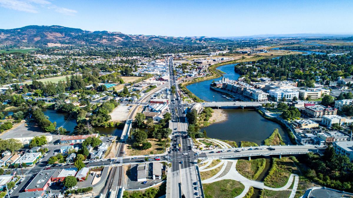
Projects BACK TO NORMAL Earthquake Recovery Modelling Versión en español English version Share Facebook LinkedIn Overview Anchor 6 Background To address some of the key factors that influence recovery following a potentially devastating earthquake, the Alfred E. Alquist Seismic Safety Commission (SSC) engaged the GEM (Global Earthquake Model) Foundation and the University of California at Los Angeles (UCLA), Department of Civil and Environmental Engineering, a) to develop a methodology and an open-source and transparent software tool to estimate recovery states and recovery times following an earthquake; and b) to investigate the effect of external socio-economic factors on these recovery times. Objectives This project achieved the following main objectives: 1. Development of a user-friendly, non-commercial and transparent software tool, herein referred as the Integrated Risk Modelling Toolkit (IRMT), to make map-based comparisons showing the effect of different resilient actions on the recovery times. 2. Development of an analytic methodology, referred as the Reconstruction Recovery Model, to estimate post-earthquake recovery 3. Integration of the Reconstruction Recovery Model for practical use into GEM’s OpenQuake modelling platform. 4. Demonstration of reasonable results by using the methodologies to model past earthquakes. In this context, the 2014 M6 South Napa Earthquake was used as a case study. Collaborators Department of Civil and Environmental Engineering at the University of California at Los Angeles (UCLA) Location California, United States Anchor 1 Anchor 5 Anchor 4 Anchor3 Publications