Thanks for submitting!
You will be contacted as soon as possible


QUICK LINKS


PROFILES
PUBLICATIONS
EXPOSURE
VULNERABILTY
SOFTWARE
EQ MODELS
Search Results
1045 results found with an empty search
- Global Exposure Model
Global Earthquake Maps Global Exposure Model VIEWER PDF PNG CONTRIBUTORS DOCUMENTATION References TECHNICAL DESCRIPTION The Global Exposure Map (v2018.1) presents the geographic distribution of residential, commercial and industrial buildings. The number of buildings is presented on a hexagonal grid, with a spacing of 0.30 x 0.34 decimal degrees (approximately 1,000 km2 at the equator). The datasets employed to develop this exposure map were provided by national institutions, or developed within the scope of regional programs or bilateral collaborations. This global map and the underlying databases are based on best available and publicly accessible datasets and models. The Global Exposure Map is intended to be a dynamic product, such that it may be updated when new datasets and models become available. Releases of updated versions of the Global Exposure Map are anticipated on a regular basis. Additional exposure and risk metrics for each country can be explored at https://www.globalquakemodel.org/gem. Many thanks to our Sponsors and Contributors. Cite this work as: V Silva, D Amo-Oduro, A Calderon, J Dabbeek, V Despotaki, L Martins, A Rao, M Simionato, D Viganò, C Yepes, A Acevedo, N Horspool, H Crowley, K Jaiswal, M Journeay, M Pittore (2018). Global Earthquake Model (GEM) Exposure Map (version 2018.1). DOI: 10.13117/GEM-GLOBAL-EXPOSURE-MAP-2018.1 This work is licensed under the terms of the Creative Commons Attribution-NonCommercial-ShareAlike 4.0 International License (CC BY-NC-SA): https://creativecommons.org/licenses/by-nc-sa/4.0/ Legal statements This map was created for dissemination purposes. The information included in this map must not be used for the design of earthquake-resistant structures or to support any important decision involving human life, capital and movable and immovable properties. The values of seismic hazard in this map do not constitute an alternative nor do they replace building actions defined in national building codes. Readers seeking this information should consult national databases. This hazard map is the combination of results computed using 30 hazard input models covering the vast majority of landmass. These models represent the best information publicly accessible, and the GEM Foundation recognises their credibility and authoritativeness. This hazard map results from an integration process that is solely the responsibility of the GEM Foundation. MAJOR SPONSORS Verisk ARUP GEOSCIENCE AUSTRALIA CSSC NRCan EAFIT ETH ZURICH EUCENTRE FM GLOBAL GFZ GIROJ GNS SCIENCE HANNOVER RE MUNICH RE NTU ICRM NEPHILA NERC NIED NSET OYO PARTNER RE DPC SGC SWISS SER SWISS RE FOUNDATION SURAMERICANA TEM RCN USGS USAID WTW ZURICH INSURANCE
- Seismic Risk Assessment in Nepal | GEM Foundation
Publications Seismic Risk Assessment in Nepal Share Facebook LinkedIn Download 2015 | Peer-reviewed Seismic risk in the form of impending disaster has been seen from past records that moderate to large earthquakes have caused the loss of life and property in all parts of Nepal. Despite the availability of new data, and methodological improvements, the available seismic hazard map of Nepal is about two decades old. So an updated seismic hazard model at the country level is imperative and logical. The seismic hazard and risk model constitute important tools for framing public policies towards land-use planning, building regulations, insurance, and emergency preparedness. In fact, the reliable estimation of seismic hazard and risk eventually minimizes social and economic disruption caused by earthquakes. In this frame of reference, the seismic risk assessment at a country level is elementary in reducing potential losses stemming from future earthquakes. Thus, this study investigates structural vulnerability, seismic risk, and the resulting possible economic losses owing to future earthquakes in Nepal. To this end, seismic risk assessment in Nepal is done using an existing probabilistic seismic hazard, a newly developed structural vulnerability, and recently released exposure data. The OpenQuake-engine, the open source platform for seismic hazard and risk assessment from the Global Earthquake Model initiative, was used to calculate the seismic hazard and risk in Nepal. The seismic hazard and mean economic loss map were formulated for the 1%, 2%, 5%, and 10% probability of exceedance in 50 years. Finally, the distribution of building damage and corresponding economic losses due to the recurrence of the historical 1934 earthquake was presented in this study.
- What role will GEM play as the risk landscape and associated demand evolve between now and 2030? - GEM Foundation
News What role will GEM play as the risk landscape and associated demand evolve between now and 2030? By: Dec 13, 2021 Share Facebook LinkedIn A world that is resilient to earthquakes and other natural hazards will continue to be GEM’s vision over the next decade. The mission to 2030 also calls for GEM to become a global leader in the integrated, multi-hazard risk assessment and resilience planning domain. GEM’s strategy and roadmap to 2030 is underpinned by the global drivers for disaster risk reduction and sustainability - namely the Sendai Framework, the Paris Agreement on climate change, and the Sustainable Development Goals – and by its four core values: openness, collaboration, public good and credibility. GEM’s approach is further placed in the context of the evolution of the science and technology of risk modelling and user needs to address systemic and cascading risks for multi-hazards. GEM plans to maintain its global leadership in earthquake hazard and risk assessment, while at the same time leveraging its broader capabilities, such as in exposure modelling, into partnerships addressing the effects of climate change. GEM will also leverage its public-private partnership approach and collaboration network to support the development of risk solutions and improve resilience including through insurance/risk financing, as well as risk mitigation and reduction through urban planning and building regulation. Watch this space for more updates in early 2022. No images found. GALLERY 1/2 Gallery VIDEO RELATED CONTENTS
- News Briefs: June 2022 Topiqs Newsletter - GEM Foundation
News News Briefs: June 2022 Topiqs Newsletter By: Jun 6, 2022 Share Facebook LinkedIn During this period, GEM scientists have also participated in various international virtual conferences and events on loss models, earthquake risk assessment, and global challenges in earthquake risk and catastrophe modelling. -TREQ project Online OpenQuake engine training More than 80 participants from around the world registered for the online training course which was held on May 6th, 13th, 20th and June 3rd 2022. The course was designed for an audience with a diverse background and expertise and covers the main concepts of earthquake risk assessment, along with the basic features of the OpenQuake Engine. -Comprehensive Multi hazard Risk Assessment in Malawi project GEM will be working soon with a World Bank project led by Centro Internazionale in Monitoraggio Ambientale (CIMA, Italy) and co-partners Malawi University of Business and Applied Sciences (MUBAS) and British Geological Survey (BGS) to provide technical services to fill a gap in Malawi’s national level disaster risk (multi-hazard) risk assessment. -Palestine - preliminary multi-hazard risk map portal delivered GEM has completed a preliminary map portal for multi-hazard risk assessment of Palestine. The project, funded by Palestine’s Municipal Development and Lending Fund (MDLF), is being implemented together with the University of Palestine. -GEM commercial models presented at Reinsurance Association of America (RAA): Cat Risk Management 2022 event by Nasdaq Nasdaq, a GEM distribution partner presented GEM’s commercial earthquake models for Colombia, South Africa and China at the RAA cat risk management event held in Orlando, Florida, USA from May 23rd - May 26th. This year’s Cat Risk Management 2022 discussed insights on how best to position companies and assist clients to stay ahead of a rapidly changing global risk environment. No images found. GALLERY 1/0 Gallery VIDEO RELATED CONTENTS
- SERA European Building Exposure Workshop: From European Hazard to Risk - GEM Foundation
News SERA European Building Exposure Workshop: From European Hazard to Risk By: Apr 26, 2018 Share Facebook LinkedIn The EUCENTRE organized and hosted the European Building Exposure Workshop from 1st – 2nd March in Pavia as part of the Horizon 2020-funded SERA project, with the aim to review initial exposure models and their underlying assumptions for a number of countries in Europe. The workshop brought together experts with knowledge on the residential, commercial and industrial buildings in Europe, or who had developed country-wide building inventories for public or private seismic risk applications. The 2-day workshop facilitated by Helen Crowley - EUCENTRE-SERA, produced the following: - revised classification scheme that could be used for building types in Europe, insights into building practices and design codes from the participants’ respective countries, - mapping schemes for the distribution of building types across each country (residential, commercial and industrial), - identified assumptions on replacement costs and - areas of buildings and list of available sources of data on buildings from the participants’ countries. About 30 professional from various parts of Europe including GEM’s Vitor Silva - Seismic Risk Coordinator and Venetia Despotaki - Physical Risk Engineer participated in the workshop. The 2-day event covered a wide range of topics including filling out a comprehensive online questionnaire on building classification; and presentations on: - GEM’s Risk modelling framework by Vitor Silva;- Development of residential and non-residential exposure models in SERA and- Explanation of SERA preliminary mapping schemes by Venetia Despotaki. Other participants presented insights into building stock in Bulgaria, Croatia, Slovenia, Iceland, and France. The SERA project is collaborating closely with the GEM Foundation (Global Earthquake Model) to: develop a European Risk Modelling framework that brings together the strengths of previous projects such as SHARE, NERA and fills in the research gaps; integrate knowledge and data from other SERA working packages; and build on the risk assessment framework and software developed by GEM. No images found. GALLERY 1/0 VIDEO RELATED CONTENTS
- Governing Board meeting highlights: June 2020 - GEM Foundation
News Governing Board meeting highlights: June 2020 By: Jul 25, 2020 Share Facebook LinkedIn First online Board meeting, June 17-19, 2020. The Governing Board meeting was held from June 17 -19, 2020 virtually. This is the first virtual meeting organized by the GEM Secretariat in its 11 years of operation due to the ongoing COVID-19 pandemic. Despite the situation, the meeting in June was very well received, and also remarkable for the milestone decisions approved by the Board. The Board unanimously approved GEM’s Product and Services Strategy, which outlines GEM’s commitment to develop open products and to make them more accessible to private sector use and public good. The initiative would increase the availability of all GEM products and services across the insurance, engineering, research and DRR sectors. The summary of the strategy is available . It includes comprehensive Frequently Asked Questions from our collaborators and users of GEM products worldwide. A full list of GEM’s products is also now available . In addition to this, the Board also approved a new small business partner category to allow reduced sponsorship fees from organizations that are interested in participating in our Governing Board and/or other activities, but are unable to gain approval for Governor or Advisor level fees. Small companies can now become a if they have less than 20 employees and a revenue of less than 3M euro per year. The following partners have also been formally accepted to the Board: Canada Governor Sponsorship with Sonia Talwar as voting member AXA XL as Advisor Sponsor with Emmanuel de la Fosse as non-voting member OneConcern as Advisor Sponsor with Abhineet Gupta as non-voting member The next meeting will be held on the 3rd and 4th of December 2020 in Pavia if possible, with a virtual meeting as a backup. The subsequent GB meeting was provisionally approved for 17th and 18th of June 2021. If you are interested in more information about GEM products and services or how to become more involved with GEM as a partner or sponsor, please contact us at . No images found. GALLERY 1/7 Gallery VIDEO RELATED CONTENTS
- New guidelines for contributing to the GEM Global Active Faults Database - GEM Foundation
News New guidelines for contributing to the GEM Global Active Faults Database By: Mar 20, 2019 Share Facebook LinkedIn New guidelines for contribution to the GEM Global Active Faults Database have been published on GitHub. They are reproduced below. The GEM GAF-DB is a public, open-data project and contribution is quite welcome. The GEM GAF-DB is a compilation of a set of regional and global fault datasets; most of these are not produced by GEM, but instead have been collected from external sources. The final database is built with a Python script that handles the compilation. Therefore, there is no single, permanent dataset that one can modify to contribute. Instead, contribution can take several forms: Addition to the 'miscellaneous' dataset. This dataset is intended to capture individual faults that are not present in the regional dataset for an area, though the dataset has worldwide scope. If you have studied a fault that isn't present, or you have new data on a fault that is already present, this is likely the best option. Modification of a regional dataset. This option is best if you have data for faults in an area that is covered by one of the fault catalogs maintained by GEM or that is otherwise open for modification (e.g., HimaTibetMap or the Active Tectonics of the Andes catalogs). Addition of a new regional dataset. If you have a dataset that covers some region with higher fidelity or more data than the existing coverage of that region, it's easy to incorporate this data into the GAF-DB compilation. For the full information, click here . No images found. GALLERY 1/2 VIDEO RELATED CONTENTS
- Distinguished Lecture at QuakeCoRE Highlights Global Risk Models - GEM Foundation
News Distinguished Lecture at QuakeCoRE Highlights Global Risk Models By: Oct 6, 2025 Sep 4, 2025 Share Facebook LinkedIn Helen Crowley, Secretary General of the Global Earthquake Model (GEM) Foundation, delivered the 2025 Distinguished Lecture at the QuakeCoRE Annual Meeting, held on 2-4 September in Ōtepoti Dunedin, New Zealand. QuakeCoRE is New Zealand’s Centre for Earthquake Resilience, a Centre of Research Excellence funded by the Tertiary Education Commission. Its mission is to advance earthquake resilience through system-level science and integrated collaborations across engineering, physical and social sciences. This year’s meeting drew its largest attendance to date, with more than 270 participants, including delegates from Italy, Japan, South Korea, Taiwan, Thailand, and the United States. The gathering provided a platform for showcasing innovative research, capacity development, and international knowledge exchange. Engineering the Future Introduced by Programme Area Leader Brendon Bradley, Helen presented her lecture “Engineering the Future – How Seismic Risk Models Can Build More Resilient Societies.” Her address emphasised the critical role of national and global seismic risk models in preparedness, recovery, and long-term resilience. Drawing on GEM’s achievements over the past 15 years, she outlined milestones such as the development of the Global Seismic Hazard Mosaic, the release of the Global Seismic Hazard Model (2018, updated in 2023), and the creation of a global taxonomy for building classification. “Earthquakes don’t kill people – buildings do,” Helen said. “By providing robust hazard and risk models, we can help communities prepare, recover, and plan for a safer and more resilient future.” She also described GEM’s ongoing work in exposure and vulnerability modelling, the challenge of keeping models up to date in a rapidly changing world, and the role of artificial intelligence in supporting model updates. Looking Forward Helen highlighted future directions for GEM, including the integration of the carbon cost of earthquakes into the next release of the global seismic risk model, scheduled for 2026. She also noted the value of closer collaboration between GEM and QuakeCoRE, pointing to the mutual benefits of linking local seismic initiatives with global insights. The Annual Meeting underscored the importance of combining national expertise with international collaboration to advance resilience science. GEM’s participation reflected its commitment to open knowledge exchange and to strengthening partnerships across the global earthquake engineering community. For more information, visit the QuakeCoRE Annual Meeting page. https://quakecore.nz/annual-meeting/ No images found. GALLERY image (7).png image (6).png image (7).png 1/2 VIDEO RELATED CONTENTS
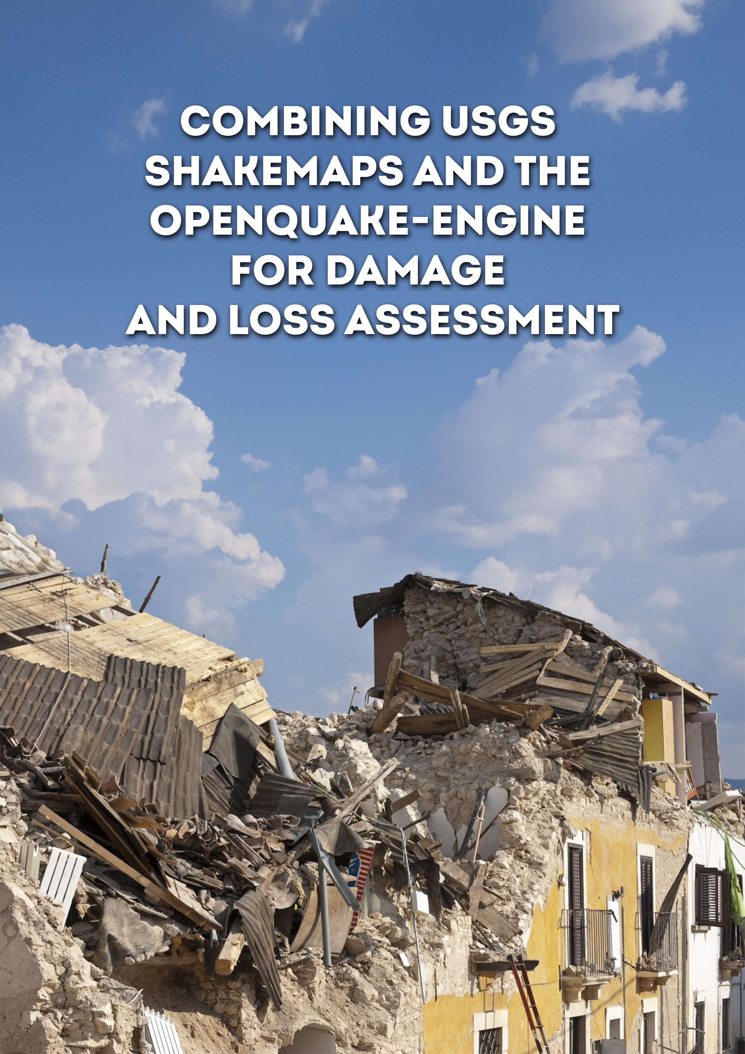
- Combining USGS ShakeMaps and the OpenQuake-engine for damage and loss assessment | GEM Foundation
Publications Combining USGS ShakeMaps and the OpenQuake-engine for damage and loss assessment Share Facebook LinkedIn Download 2019 | Peer-reviewed The evaluation of the potential impact of strong seismic events shortly after their occurrence is a critical step to organise emergency response and consequently minimise the adverse effects of earthquakes. The estimation of the impact from earthquakes considering the observed ground shaking from past events can be useful for the calibration of existing exposure and/or fragility and vulnerability models. This study describes a methodology to combine the publicly available information from the USGS ShakeMap system and the open‐source software OpenQuake engine for the assessment of damage and losses. This approach is employed to estimate the number of structural collapses considering the 2012 Magnitude 5.9 Emilia‐Romagna (Italy) earthquake and the aggregated economic loss because of the 2010 Magnitude 7.1 Darfield (New Zealand) event. Several techniques to calculate the ground shaking in the affected region considering the spatial and interperiod correlations in the intra‐event ground motion residuals are investigated and their influence in the resulting damage or loss estimates are evaluated.
- UNDRR GRAF: enhanced and revitalized approach in the midst of a pandemic - GEM Foundation
News UNDRR GRAF: enhanced and revitalized approach in the midst of a pandemic By: Aug 30, 2021 Share Facebook LinkedIn The UNDRR successfully launched the Global Risk Assessment Framework (GRAF) during the Global Platform for Disaster Risk Reduction (GP2019) Forum held in May 2019 in Geneva, Switzerland. Since then, the agency has created and organized a global collaborative framework for developing, sharing and using risk information across hazards, disciplines, and geographic scales (i.e., global to local), leveraging existing institutions and collaboration frameworks and addressing the systemic nature of risk and its cascading effects. Over the past year, with the COVID 19 pandemic demonstrating its devastating impacts on economies and the health and well-being of millions of people worldwide, the UNDRR has developed a revised approach with concrete deliverables to give GRAF a specific focus on field implementation. “By expanding opportunities for UN member states to benefit from global partnerships with recognized risk experts like GEM, the GRAF is accelerating access to the latest risk science in a world increasingly impacted by compound and systemic risks”, noted Jenty Kirsch-Wood, the head of Global Risk and Reporting in the United Nations Office for Disaster Risk Reduction based in Geneva, Switzerland. GRAF has four working groups, one of which is Mapping & Gap Analysis, co-chaired by GEM Secretary General, John Schneider and John Rees (British Geological Survey). The working group has provided expert advice to GRAF on understanding stakeholder needs as risk assessment information providers and users. John and John are also establishing a working group for Exposure & Vulnerability. “The GRAF is a great opportunity to bring cohesion to the risk assessment community to help national governments in support of Sendai risk indicators and targets,” said John Schneider, GEM Secretary General. He added, “GEM is proud to support the GRAF by contributing its expertise in hazard and risk assessment as well as its experience in local-to-global collaboration on earthquakes and a range of natural hazards risk modelling issues.” GRAF aims to strengthen the capacity of countries to develop and use risk analysis that comprehends the interconnectivity of different systems and the cascading and compound nature of risk. The GRAF approach comprises global and country level activities. Globally, it will focus on the development of methodologies, analytics, the data visualization platform, and partnership within the UN system and across a wide range of disciplines. At the country level, GRAF will be initially rolled-out in Costa Rica, Eswatini and Pakistan in 2021. The GRAF approach is expected to improve information available to national and local governments, planners and other stakeholders on how to manage complex, multi-hazard risks across systems, in the context of climate change. More about GRAF at https://www.preventionweb.net/understanding-disaster-risk/graf . No images found. GALLERY 1/0 Gallery VIDEO RELATED CONTENTS