Thanks for submitting!
You will be contacted as soon as possible


QUICK LINKS


PROFILES
PUBLICATIONS
EXPOSURE
VULNERABILTY
SOFTWARE
EQ MODELS
Search Results
Search this site
1170 results found with an empty search
- Executive summary Urban seismic risk assessment for the cities of Quito, Cali and Santiago de los Caballeros | GEM Foundation
Publications Executive summary Urban seismic risk assessment for the cities of Quito, Cali and Santiago de los Caballeros Share Facebook LinkedIn Download 2022 | Report This seismic risk component at urban level covers the development of uniform, open and transparent datasets for the urban building inventory (exposure model), the physical response of the infrastructure under seismic loads (vulnerability model), and the assessment of the impact from earthquakes, along with risk metrics required for the development of risk reduction plans.
- Vision to 2030 | GEM Foundation
VISION TO 2030 Since 2009, GEM has led a global effort to improve the state of practice of earthquake hazard and risk assessment. GEM has developed open global databases, models and the OpenQuake software, and developed capacity for risk assessment worldwide. What role will GEM play as the risk landscape and associated demand evolve between now and 2030? Share Facebook LinkedIn Our Goal Integrated risk and resilience solutions With loss from natural catastrophic events projected to reach up to $2trn by 2030 (RMS, 2022) due to increasing global population, rapid urbanisation and extreme weather events, GEM’s strategic plan roadmap to 2030 aims to develop capabilities that serve the broader need for integrated risk assessment for resilience and sustainability due to globally increasing vulnerability and exposure of populations to natural hazards, including from climate change. DRIVING PRINCIPLES Credibility, Openness, Collaboration, Public Good Three core strategic objectives that are driving the next 5 years leading up to 2030 are as follows: Provide: continue to develop global standards for risk modelling for all earthquake-related hazards. GEM will maintain expertise and global leadership in earthquake hazard and risk modelling and its applications to disaster risk reduction, in particular, the continuous development and user support for GEM’s flagship programmes and products: the OpenQuake Engine and the global earthquake hazard and risk models. INITIATIVES Global improvement and harmonisation of seismic hazard and risk models Global time-dependent seismic hazard and risk models Global impact assessment due to (all) earthquake-triggered hazards Advancing Science in PSHA and PSRA Support: be a global partner to local, regional and global disaster risk reduction communities for earthquakes and other natural hazards. Driven by global drivers such as the Sendai Framework, Sustainable Development Goals, and Paris Climate Agreement, and guided by its core values, GEM will expand its organizational, technical and scientific relationships and diversify its risk products and services to engage with stakeholders in the broader disaster risk reduction community. INITIATIVES Multi-hazard risk assessment - software and services Hazard-agnostic global exposure Disaster preparedness, response and recovery - software and services Global partnerships with other hazards and climate change communities Strengthen: strengthen the capacity of developing countries and the Global South. GEM will invest in strengthening the capacity of developing countries and the Global South to assess their risk to earthquakes and other natural hazards through public partnerships, training and collaborative projects. INITIATIVES Improve national seismic hazard and risk modelling, assessment and communication around the world Strengthen public partnerships Education, training, capacity building HOW TO SUPPORT OUR WORK various ways to support our work GEM offers flexible mechanisms to enable potential partners to contribute to its ongoing and future work programs. Partners and collaborators can enter into sponsorships, project partnerships and service agreements, and can select the level of engagement based on their needs and requirements. GEM’s sponsorship structure and fees have been designed to incentivize the participation of public and private organizations. Get Involved Sponsorship Projects & Technical Cooperation Publications & Research Bespoke Products & Services STRATEGIC PLAN AND ROADMAP TO 2030 Download GEM’s overall objective to 2030 is to develop capabilities and to serve the broader need for integrated risk assessment for resilience and sustainability due to globally increasing vulnerability and exposure of populations to natural hazards, including from climate change. To get a complete view of our future programs, download our brochure.
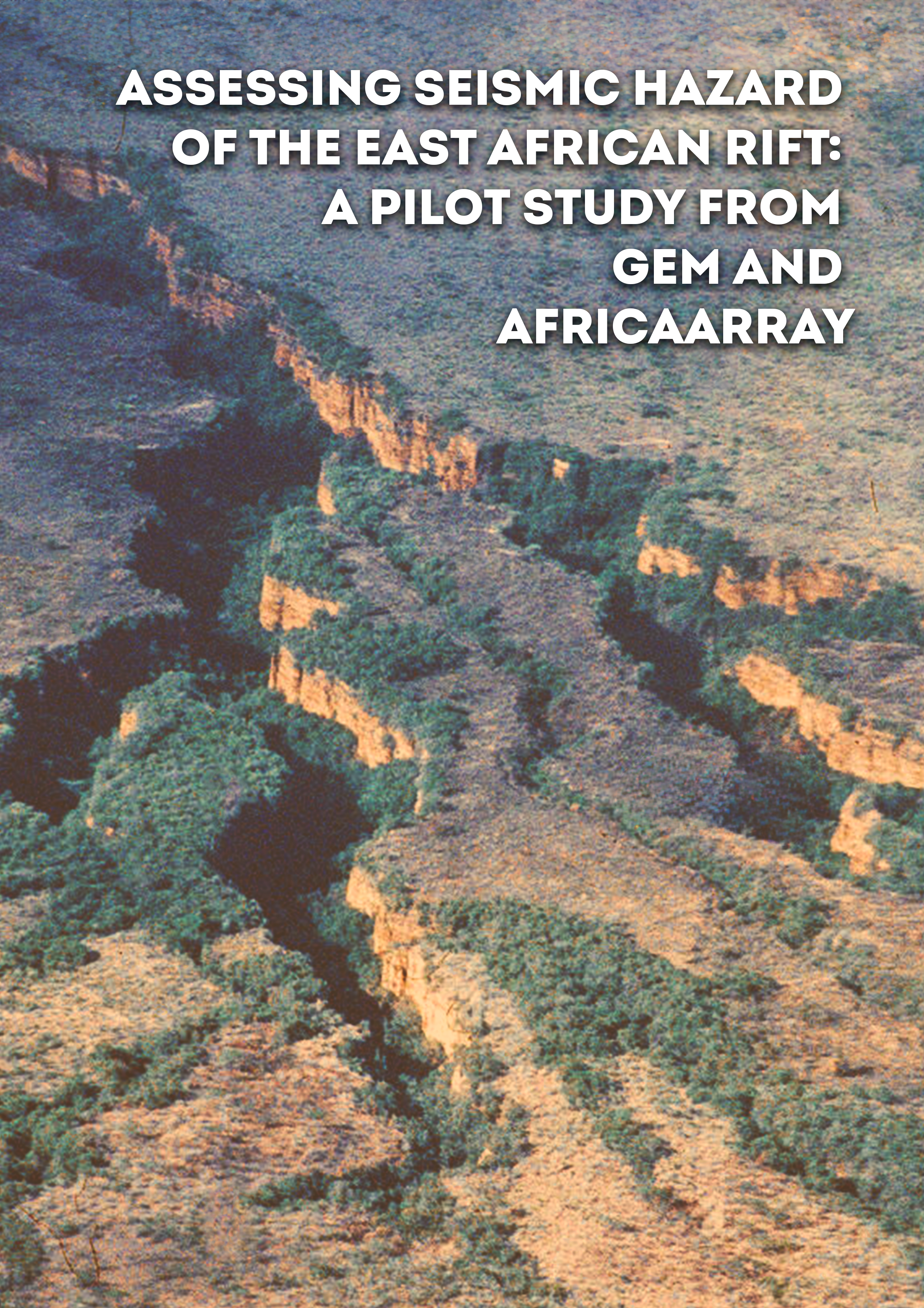
- Assessing seismic hazard of the East African Rift: a pilot study from GEM and AfricaArray | GEM Foundation
Publications Assessing seismic hazard of the East African Rift: a pilot study from GEM and AfricaArray Share Facebook LinkedIn Download 2017 | Peer-reviewed The East African Rift System is the major active tectonic feature of the Sub-Saharan Africa region. Although the seismicity level of this divergent plate boundary can be described as moderate, several damaging earthquakes have been reported in historical times, and the seismic risk is exacerbated by the high vulnerability of the local buildings and structures. Formulation and enforcement of national seismic codes is therefore an essential future risk mitigation strategy. Nonetheless, a reliable risk assessment cannot be done without the calibration of an updated seismic hazard model for the region. A major limitation affecting the assessment of seismic hazard in Sub-Saharan Africa is the lack of basic information needed to construct source and ground motion models. The historical earthquake record is sparse, with significant variation in completeness over time across different regions. The instrumental catalogue is complete down to sufficient magnitude only for a relatively short time span. In addition, mapping of seismogenically active faults is still an on-going task, and few faults in the region are sufficiently constrained as to allow them to be directly represented within the seismic hazard model. Recent studies have identified major seismogenic lineaments, but there is substantial lack of kinematic information for intermediate-to-small scale tectonic features, information that is essential for the proper calibration of earthquake recurrence models. In this study, we use new data and Global Earthquake Model (GEM) computational tools such as the Hazard Modeller’s Toolkit and the OpenQuake engine to perform a pilot study of the seismic hazard associated with the East African Rift. The hazard model obtained has been created using the most recent information available from scientific literature, global bulletins and local earthquake catalogues, including those from AfricaArray projects. In this report, in accordance with the GEM philosophy, we describe in detail all working assumptions, main processing steps, data analyses and interpretations used for the model setup.
- Request demo for South America Hazard | GEM Foundation
You have chosen to request a demo on: South America Hazard First Name Last Name Email Company or Institution Name Country Sector Provide Details I accept the license terms and the conditions of products use. Email us at product@globalquakemodel.org if you're experiencing problems submitting this form or if you have any inquiries. Thank you. Request Thanks for submitting! You will be contacted as soon as possible Add answer here
- Successful GEM Industry Event at Zurich Insurance’s Quai Zurich Campus - GEM Foundation
News Successful GEM Industry Event at Zurich Insurance’s Quai Zurich Campus By: Oct 9, 2024 Sep 5, 2024 Share Facebook LinkedIn On September 5th, 2024, over 30 participants from Zurich-based companies and academic institutions gathered for the Global Earthquake Model (GEM) Foundation’s industry event, hosted by Zurich Insurance at its Quai Zurich campus. The agenda featured presentations from leading experts, including GEM's Secretary General Helen Crowley, Vitor Silva, Head of Risk Engineering, Marco Pagani, Head of Seismic Hazards, and Andrés Abarca, Product Manager. Their discussions highlighted the scientific work behind GEM's models, focusing on how the findings can be applied to products and services of importance to both humanitarian efforts and commercial initiatives. Attendees gained valuable insights into GEM's cutting-edge tools and data, which are designed to inform risk assessment practices across various sectors. GEM expresses gratitude to all attendees for their participation and contributions, which were instrumental in making the event a success. The organization looks forward to continued collaboration in advancing the field of earthquake risk assessment in Switzerland and beyond. ## No images found. GALLERY 1/8 VIDEO RELATED CONTENTS
- Global Exposure Model | Global EarthQuake Model Foundation
Comprehensive datasets of the residential, commercial and industrial building stock worldwide Products Global Exposure Model Comprehensive datasets of the residential, commercial and industrial building stock worldwide Share Facebook LinkedIn Description The v2026.1 Global Exposure Model is a mosaic of local and regional models with information regarding the residential, commercial, and industrial building stock at the smallest available administrative division of each country and includes details about the number of buildings, number of occupants, vulnerability characteristics, average built-up area, and average replacement cost. The dataset is developed and maintained by the GEM Foundation, using a bottom-up approach at the global scale, using national statistics, socio-economic data, and local datasets. The datasets employed to develop this model were provided by national institutions, or developed within the scope of regional programs or bilateral collaborations. The global maps and the underlying databases are based on best available and publicly accessible datasets and models. This model allows the identification of the most common types of construction worldwide, regions with large fractions of informal construction, and areas prone to natural disasters with a high concentration of population and building stock. The underlying datasets used to create the maps are available for all regions of the world, aggregated at Administrative Level 1 under a CC BY-NC-SA license, or further disaggregated to higher administraive units or 1km grid cells, under specific licenses. The open and downloadable Global Exposure Maps (v2026.1) in PNG format, represent the geographic distribution of residential, commercial and industrial buildings in terms of four exposure metrics: number of buildings, economic loss, number of occupants and the replacement embodied carbon. The data is presented on a hexagonal grid, with a spacing of 0.25 × 0.30 decimal degrees, corresponding to an area of about 1,700 km2 per cell. These maps can also be explored through the Geoviewer. How to cite this work If you make use of this work, please cite both the publication and the data. Publication: Yepes-Estrada, C., Calderon, A., Costa, C., Crowley, H., Dabbeek, J., Hoyos, M., Martins, L., Paul, N., Rao, A., Silva, V. (2023). Global Building Exposure Model for Earthquake Risk Assessment. Earthquake Spectra. doi:10.1177/87552930231194048 Data: Yepes-Estrada, C., Baiguera, M., Calderon, A., Caruso, M., Costa, C., Gonzalez, D., Nafeh, A.M.B., Rao, A., Silva, V. (2026). Global Exposure Model (2026.0.0). Zenodo. https://doi.org/10.5281/zenodo.8117363. Available Versions An open version (v2026.0.0) of the model, agreggated at Administrative Level 1, is available for direct download under a CC BY-NC-SA 4.0 license. Users interested in this version can click the "Open Repository" button in the right panel to access the information. The full version for any country/territory, at the highest resolution available or disaggregated to 1km grid cells, can be requested by clicking on the "License Request", where a specific license will be provided, depending on the use case. Additionally, users interested in the previous versions of the Global Exposure Maps can access these from the table at the bottom of this page. License information The open version is available under a Creative Commons CC BY-NC-SA 4.0 license, which requires: Attribution (you must give appropriate credit, provide a link to the license, and indicate if changes were made) Non-commercial (you may not use the material for commercial purposes) ShareAlike (derivatives created must be made available under the same license as the original) Any deviation from these terms incur in license infringement. For commercial use of the dataset, a specific license agreement must be made tailored to your use case, in such instance please click on "License Request". Facebook LinkedIn Share Latest Version v2026.1 License CC BY-NC-SA 4.0 Available resources Open Repository Geoviewer PNG Documentation License Request Acknowledgements By selecting a region in the global map below, a table will appear with the region, country, or territory for which GEM currently has exposure models. You can also use the Search box to find a specific country or territory's exposure model. Map View Search Popup title Close Country/Region Available Resources Afghanistan Exposure Africa Exposure Alaska Exposure Country/Region Available Resources Afghanistan Vulnerability Africa Vulnerability Alaska Vulnerability Country/Region Resource Url Afghanistan Risk Profile Africa Risk Profile Alaska Risk Profile Search Found Country/Region Resource Url Afghanistan Exposure Africa Exposure Alaska Exposure Preview Preview is not available. Search Found Country/Region Resource Url Afghanistan Vulnerability Africa Vulnerability Alaska Vulnerability Preview Preview is not available. Search Found Country/Region Resource Url Afghanistan Risk Profile Africa Risk Profile Alaska Risk Profile Preview Preview is not available. Previous Product Versions Product Version Data Image Poster Documentation Geoviewer v2018.1 N/A N/A PDF Silva et al. (2020) View v2023.1 Repository PNG PDF Read View Related products GEM Building Taxonomy Global Seismic Embodied Carbon Risk Global Seismic Risk Map Country-Territory Seismic Risk Profiles Global Liquefaction Hazard OpenQuake Engine Global Seismic Hazard Map Global Map of Road Exposure to Ground Shaking and Liquefaction Global Exposure Model Global Vulnerability Model Related publications Global building exposure model for earthquake risk assessment Read More Development of a global seismic risk model Read More For downloading or accessing detailed product information like PNG/PDF maps, datasets, license request, shapefiles and more, please switch to a desktop or laptop computer. Thank you for your understanding.
- New Horizon 2020 project launched to develop an advanced approach for Seismic Risk Assessment of Nuclear Power Plants - GEM Foundation
News New Horizon 2020 project launched to develop an advanced approach for Seismic Risk Assessment of Nuclear Power Plants By: Nov 3, 2020 Share Facebook LinkedIn The METHODS AND TOOLS INNOVATIONS FOR SEISMIC RISK ASSESSMENT (METIS) H2020 Project has been officially launched opening a promising research collaboration to improve confidence in nuclear safety by advancing the approach utilised for seismic safety assessments for Nuclear Power Plants. The major goal of METIS is to propose innovations in tools and methodologies for seismic safety assessment of reactors, and supporting technology transfer from the research community to the industry. It aims to develop common guidelines for seismic safety assessment at the European level, in line with international practice and consensus, and promote good practices across the community. The outcome contributes to facilitate risk-informed decision-making in the European context. The advanced tools and methodologies developed by METIS will be made available to a wider community thanks to the capitalisation in modern high-performance open source tools as OpenQuake, code_aster/ salome_meca, OpenSees, and SCRAM. METIS is an EU-funded 4-year project under the Horizon 2020 EURATOM Programme for Research and Innovation having a total budget of €5 million, of which €4 million is funded from the European Commission. The project will be delivered by an international consortium gathering 13 European partners from France, Germany, Italy, Greece, UK, Ukraine and Slovenia alongside with 3 organisations from US and Japan. The consortium brings together universities, research organisations and industrials so as to create an ideal ecosystem for research, development, and its dissemination and application by end users. The consortium had a virtual kick off meeting held over two days 29th-30th September 2020 attended by 78 participants. The first day was the plenary session which outlined all the Work Packages’ (WP) and on the second day, there was a WP coordination session for more detailed discussion. “We are really excited to start this project, where we aim to improve confidence in nuclear power plants and their competitiveness using advanced seismic safety assessments. In these challenging times, we had a successful collaboration with all the partners to build up METIS and get it funded by H2020 Programme. Our recent kick-off meeting, while held remotely, was a really successful event with high engagement from all partners promising a rich and effective collaboration going forward.” Electricté de France EDF R&D UK Centre Limited Liability Company Energorisk Fondazione GEM GeoForschungsZentrum Institut de Radioprotection et de Sûreté Nucléaire University School for Advanced Studies Pavia LGI National Technical University of Athens Géodynamique et Structures State Scientific and Technical Center for Nuclear and Radiation Safety Technical University of Kaiserslautern University of Ljubljana Geotechnical Research Institute North Carolina State University Pacific Earthquake Engineering Research Institute For further information contact: Emma.Luguterah@edfenergy.com or 0208 935 2714 Electricité de France (EDF) was set up in 1946 out of the desire to have a national electrical utility that could help rebuild the country after the Second World War. Since its creation, the company has had the responsibility for generating, transmitting, and distributing electricity in France. EDF remains one of the European utilities with a significant R&D activity and effort on innovation. Around 2500 people are presently employed at EDF R&D, amongst which, 70% are researchers and executives. EDF is today one of the leading energy companies, with solid positions in major European countries. EDF is committed to creating long term, low carbon affordable energy and the safety and sustained performance of nuclear and hydraulic plants is one of the key issues in this regard. EDF participates in the project through its research and development (R&D) unit. EDF R&D has the mission to contribute to increasing performance, efficiency and safety of operating units of EDF Group. Collaborative research projects are a vital component for EDF, creating an invaluable forum for exchange and knowledge-sharing. Through them, innovations are developed, disseminated, and industrialized. EDF R&D is also a major national player in opensource simulation software development and dissemination. In particular, it develops and disseminates code_aster opensource Finite Elements Software www.code-aster.org. Website address: Horizon 2020 is the biggest EU Research and Innovation programme ever with nearly €80 billion of funding available over 7 years (2014 to 2020) In addition to the private investment that this money will attract. It promises more breakthroughs, discoveries and world-firsts by taking great ideas from the lab to the market. Horizon 2020 is the financial instrument implementing the Innovation Union, a Europe 2020 flagship initiative aimed at securing Europe's global competitiveness. EURATOM aims to pursue nuclear research and training activities with an emphasis on continually improving nuclear safety, security and radiation protection, notably to contribute to the long-term decarbonisation of the energy system in a safe, efficient and secure way. By contributing to these objectives, the Euratom Programme will reinforce outcomes under the three priorities of Horizon 2020: Excellent science, Industrial leadership and Societal challenges No images found. GALLERY 1/0 Gallery VIDEO RELATED CONTENTS
- Sura and GEM continue collaboration to understand earthquake risk for Latin America - GEM Foundation
News Sura and GEM continue collaboration to understand earthquake risk for Latin America By: Mar 17, 2020 Share Facebook LinkedIn https://www.suramericana.com/index.html Suramericana S.A., an insurance company with presence in nine countries in Latin America and the Caribbean (Argentina, Brazil, Chile, Colombia, Dominican Republic, El Salvador, Mexico, Panama, Uruguay), most of which have significant earthquake risk, will work with GEM to further enhance the understanding of seismic risk in the region. The project, which will run for two years to the end of 2021, continues the partnership with Suramericana which, over the past 6 years, has contributed significantly to GEM’s hazard and risk information and models in Latin America. In the area of seismic hazard, the new project will focus on the implementation of site response analysis in the OpenQuake engine, which will enable GEM to implement Sura’s information on site conditions, and on the development of improved tools to reduce the uncertainty in the estimation of earthquake hazard in the region. In seismic risk, the project will focus on validation, testing and calibration of building vulnerability models, with a particular focus on high-rise structures, and on assessing losses due to business interruption and human fatalities. No images found. GALLERY 1/0 VIDEO RELATED CONTENTS
- Social Vulnerability Index Construction: Accessing Open Data from National Censuses - GEM Foundation
News Social Vulnerability Index Construction: Accessing Open Data from National Censuses By: Jul 2, 2018 Share Facebook LinkedIn Miguel Toquica - GEM Social Vulnerability and Resilience Specialist shares his insights on GEM's experience in accessing socio-economic data from national censuses and public online databases. When it comes to accessing the demographic characteristics of the population of a country, researchers usually consider national population and household censuses as reliable sources of information. Ideally, most countries should update their national census data and procedures every 10 years. The need to keep track of socio-economic factors and statistical measures of societies is recognized globally to better understand the living conditions and characteristics of the population in a specific country. In this regard, national censuses are considered as the most reliable source of such type of information at specific level of territorial organization, i.e. regions, states, parishes, and local level. A national population and housing census has several uses for a country. It provides not just the total number of population and households but also the demographic information for population estimates and specific information for national agencies in the fields of education, health and economy. A national census also gives quantified information of socio-economic conditions of a specific subdivision and groups of people in a country.At GEM we are collecting and processing national census data for our research on what socio-economic conditions could contribute to the population’s vulnerability to natural hazards, i.e. earthquakes, volcanic eruptions, landslides, flooding, hurricanes, and droughts. In most cases, our research using census data have led us to information on the pre-existing characteristics i.e. average household size, unemployment rates, etc. that relate directly to why differential impacts from natural hazards occur across space. Social vulnerability helps to explain why some areas, such as a country’s sub-national parishes or city neighbourhoods, will experience the consequences of a natural hazard in different ways. Understanding the varying impacts of a natural hazard through social vulnerability assessments is a critical element for risk reduction, elaboration of mitigation plans, and the development of public policies to reduce the risk. To measure social vulnerability, the starting point is to capture the contextual conditions within the social structure of the study area. This social structure includes characteristics of the population and factors that increase or decrease the impact of natural hazards in the community. These factors include access to basic needs (potable water, electricity, and sanitary services), access to education and health, and characteristics of specific groups within the society that makes them vulnerable, e.g. the elderly population, children, population with disabilities, ethnic groups and so forth. As an example, indigenous people, like the women working in the crafts industry belonging to the Wayuu ethnic community in Colombia (Figure 2), typically live in isolated regions where access to financial means and basic public services like potable water, electricity, as well as public infrastructure is difficult or non-existent. These conditions may compromise their capacity for disaster preparedness and make it harder for government agencies to respond and conduct recovery efforts, thereby increasing their vulnerability in case of an emergency. In this context, information obtained from national censuses in Latin America has allowed the Social Vulnerability and Resilience (SVR) team at GEM (i) to develop databases for indicators of social vulnerability, and (ii) to construct social vulnerability indices for over 20 countries in Latin America and the Caribbean. This task has been possible thanks to the online access to national census databases made available by several countries in Latin America and the Caribbean such as the CELADE-Redatam. To start the development and construction of social vulnerability indices, GEM’s SVR team obtained the most recent socioeconomic data from available national population and housing censuses from countries in Latin America and the Caribbean. The collected raw values within the population, economy, infrastructure, health, and education dimensions were then processed to obtain standardised values using percentage, per capita, and density functions that can be used for country comparisons. In addition, a statistical multivariable analysis has been conducted to select a consistent set of indicators for all countries. The socio-economic variables obtained are then standardised and rescaled to create a set of indicators with the same measurement. The analysis also includes a correlation analysis, which is used to quantify the association between two continuous variables, hence narrowing the data to be selected for the regional set of variables that are acceptable to represent the social vulnerability, economic resilience and recovery capacity of the population in Latin America and the Caribbean. Figure 3 provides an example of the Social Vulnerability Index for Central America and the Caribbean region. Challenges Even though the process of collecting, processing and building SV databases and indices seem quite straight forward, accessing the data from censuses and other sources can prove to be challenging and sometimes frustrating. In some cases, the censuses are not fully available, or they are not provided in the desired working format. Some of the most common challenges we have encountered and possible solutions are outlined below:- There is lack of common data processing techniques that are compatible across all countries. Trying to keep the standards of data and indicators selected for all countries may not always work as most censuses are conducted on different basis and using different techniques. This may result in slightly different social vulnerability datasets per country, and therefore the final indicator selection and index composition may differ from country to country. This challenge has been minimized by performing multivariate and correlation analyses on the full set of socio-economic indicators. This technique allows the SVR team to carefully select a set of indicators that better represent the themes of social vulnerability, maintaining the robustness and composition of the index in all cases.- Not all statistical services in each country make the entire census available using a simple database or accessible format. This fact makes accessing and post-processing of data difficult. Some countries do not even make censuses open and available online. Nonetheless, new techniques of data extraction have been implemented so indexes are built with the most reliable and recent sets of data.- Accessing the most recent data from national censuses can be difficult. Some census data can be as old as early 2000’s and late 1990’s. The use of old data must be considered with caution as final results may be skewed. Keeping information of up-to-date country statistics may provide proxies of specific indicators, for example the total population and employment rate can be updated on a yearly basis for some countries. However, processing quantities using data from different time periods can drastically change the unit of measure of comparable values so special care is fundamental when doing so. The GEM social vulnerability team has been overcoming the challenges presented, and we keep improving data collection for index construction. We are also proud to produce and make available to the public the subnational social vulnerability databases and indices. The work is fundamental and a pivotal component for other risk information products developed at GEM. No images found. GALLERY 1/0 VIDEO RELATED CONTENTS
- Likelihood- and residual-based evaluation of medium-term earthquake forecast models for California | GEM Foundation
Publications Likelihood- and residual-based evaluation of medium-term earthquake forecast models for California Share Facebook LinkedIn Download 2014 | Peer-reviewed Seven competing models for forecasting medium-term earthquake rates in California are quantitatively evaluated using the framework of the Collaboratory for the Study of Earthquake Predictability (CSEP). The model class consists of contrasting versions of the Every Earthquake a Precursor According to Size (EEPAS) and Proximity to Past Earthquakes (PPE) modelling approaches. Models are ranked by their performance on likelihood-based tests, which measure the consistency between a model forecast and observed earthquakes. To directly compare one model against another, we run a classical paired t-test and its non-parametric alternative on an information gain score based on the forecasts. These test scores are complemented by several residual-based methods, which offer detailed spatial information. The experiment period covers 2009 June–2012 September, when California experienced 23 earthquakes above the magnitude threshold. Though all models fail to capture seismicity during an earthquake sequence, spatio-temporal differences between models also emerge. The overall best-performing model has strong time- and magnitude-dependence, weights all earthquakes equally as medium-term precursors of larger events and has a full set of fitted parameters. Models with this time- and magnitude-dependence offer a statistically significant advantage over simpler baseline models. In addition, models that down-weight aftershocks when forecasting larger events have a desirable feature in that they do not overpredict following an observed earthquake sequence. This tendency towards overprediction differs between the simpler model, which is based on fewer parameters, and more complex models that include more parameters.