Thanks for submitting!
You will be contacted as soon as possible


QUICK LINKS


PROFILES
PUBLICATIONS
EXPOSURE
VULNERABILTY
SOFTWARE
EQ MODELS
Search Results
Search this site
1170 results found with an empty search
- Strain partitioning in the Southeastern Tibetan Plateau from kinematic modeling of high-resolution Sentinel-1 InSAR and GNSS | GEM Foundation
Publications Strain partitioning in the Southeastern Tibetan Plateau from kinematic modeling of high-resolution Sentinel-1 InSAR and GNSS Share Facebook LinkedIn Download 2024 | Peer-reviewed Fault slip rates estimated from geodetic data are being integrated into seismic hazard models. The standard approach requires modeling velocities and relative (micro-)plate motions, which is challenging for fault-based models. We present a new approach to directly invert strain rates to solve for slip rates and distributed strain simultaneously. We generate velocity and strain rate fields over the southeastern Tibetan Plateau, utilizing Sentinel-1 Interferometric Synthetic Aperture Radar data spanning 2014–2023. We derive slip rates using block modeling and by inverting strain rates. Our results show a partitioning between localized strain on faults and distributed deformation. The direct inversion of strain rates matches the geodetic data best when incorporating distributed moment sources, accounting for a similar proportion to on-fault sources. The direct strain methodology also aligns best with the independent geological slip rates, especially near fault tips. As high-resolution strain rate fields become increasingly available, we recommend direct inversion as the preferred practice.
- Caribbean & Central America Hazard | Global EarthQuake Model Foundation
OpenQuake engine input model to perform hazard calculations for the Caribbean & Central America Products Caribbean & Central America Hazard OpenQuake engine input model to perform hazard calculations for the Caribbean & Central America Share Facebook LinkedIn Description During the USAID-funded FORCE project, the GEM hazard team developed new models for the Central America and the Caribbean region, using the FERMI tool to develop the fault-based source model, with updated subduction sources, and a backbone ground motion model. The v2026.0.0 model includes both a time-independent and a time-dependent (TD) hazard model. The previous model covering the Central America and the Caribbean region (v2018.0.0) was initially developed in the framework of the CCARA project, a GEM collaboration project funded by USAID. Several significant updates were made to the model by the GEM hazard team, leading to the v2019.1.0 release. How to cite this work K. Johnson, R. Styron, C. Brooks, M. Villani, J. Garcia-Pelaez, R. Gee, V. Poggi (2026). PSHA input model documentation for Carribbean and Central America (CCA-2026.0.0). GEM Foundation. Available Versions The latest open versions (v2026.0.0 time-indepdent model) is available for direct download under a CC BY-NC-SA 4.0 license. Users interested in this version can click the "Open Version Download" button in the right panel to access the information. If your use case does not comply with the license terms, a license can be requested by clicking on the "License Request", where a specific agreement will be provided, depending on the use case. Previous versions of this model are listed in the table at the bottom of this page. License information The open version is available under a Creative Commons CC BY-NC-SA 4.0 license, which requires: Attribution (you must give appropriate credit, provide a link to the license, and indicate if changes were made) Non-commercial (you may not use the material for commercial purposes) ShareAlike (derivatives created must be made available under the same license as the original) Any deviation from these terms incur in license infringement. For commercial use of the model, a specific license agreement must be made tailored to your use case, in such instance please click on "License Request". Facebook LinkedIn Share Latest Version v2026.0.0 License CC BY-NC-SA 4.0 Available resources Open Version Download Documentation License Request text Map View Search Popup title Close Country/Region Available Resources Afghanistan Exposure Africa Exposure Alaska Exposure Country/Region Available Resources Afghanistan Vulnerability Africa Vulnerability Alaska Vulnerability Country/Region Resource Url Afghanistan Risk Profile Africa Risk Profile Alaska Risk Profile Search Found Country/Region Resource Url Afghanistan Exposure Africa Exposure Alaska Exposure Preview Preview is not available. Search Found Country/Region Resource Url Afghanistan Vulnerability Africa Vulnerability Alaska Vulnerability Preview Preview is not available. Search Found Country/Region Resource Url Afghanistan Risk Profile Africa Risk Profile Alaska Risk Profile Preview Preview is not available. Previous Product Versions Product Version License Documentation Access Request / Open Repository v2018.0.0 CC BY-SA 4.0 Read https://cloud.openquake.org/s/CSyTcQZTN3nXcxN v2019.1.0 Custom License Read License request Related products Global Liquefaction Hazard Global Exposure Model Global Vulnerability Model Global Seismic Embodied Carbon Risk Global Seismic Risk Map Country-Territory Seismic Risk Profiles Model Builder's Toolkit (oq-mbtk) Global Seismic Hazard Map Related publications Exposure forecasting for seismic risk estimation: Application to Costa Rica Read More Probabilistic Seismic Risk Assessment for Costa Rica Read More For downloading or accessing detailed product information like PNG/PDF maps, datasets, license request, shapefiles and more, please switch to a desktop or laptop computer. Thank you for your understanding.
- Participatory Evaluation of Earthquake Risk and Resilience in Lalitpur Sub-Metropolitan City | GEM Foundation
Publications Participatory Evaluation of Earthquake Risk and Resilience in Lalitpur Sub-Metropolitan City Share Facebook LinkedIn Download 2014 | Report This reportsummarizes theresultsfromtheWorkshopon“ParticipatoryEvaluationofEarthquake RiskandResilienceinLalitpurSubMetropolitanCity”heldfrom25th- 26th March2014,atLalitpurSub MetropolitanCityAssemblyHall,Pulchok. Theaim ofthisreportisto fosterfurther communicationandexchangeonearthquakeresilience betweenthedifferentadministrativelevelsfromtheLalitpurSub-MetropolitanCity(LSMC),the LalitpurWardsandrelevantlocalstakeholdersincludingtheNationalSocietyforEarthquake TechnologyNepal(NSET) basedontheResilienceScorecardresults
- New Zealand Hazard | Global EarthQuake Model Foundation
OpenQuake engine input model to perform hazard calculations for New Zealand Products New Zealand Hazard OpenQuake engine input model to perform hazard calculations for New Zealand Share Facebook LinkedIn Description The development of the 2022 national seismic hazard model for New Zealand was led by Earth Sciences New Zealand (Gerstenberger et al. 2022). The 2022 model covers the North, South, and Stewart Islands. The previous v2010.0.0 seismic hazard model for New Zealand was led by GNS Science, New Zealand (Stirling et al. 2012). It has been translated from its original format into the OpenQuake (OQ) engine by GNS Science. A corrected version of the model was made available in 2018 and is available from the link at the bottom of this page. How to cite this work Gerstenberger MC, Bora S, Bradley BA, DiCaprio C, Van Dissen RJ, Atkinson GM, Chamberlain C, Christophersen A, Clark KJ, Coffey GL, et al. 2022. New Zealand National Seismic Hazard Model 2022 revision: model, hazard and process overview. Lower Hutt (NZ): GNS Science. 106 p. (GNS Science report; 2022/57). doi:10.21420/TB83-7X19. Available Versions Users interested in the 2022 version developed by Earth Sciences New Zealand (Gerstenberger et al. 2022) version can click the "Access to model" button in the right panel to access the information, where you will be redirected to the Earth Sciences New Zealand website for instructions to request access. Previous versions of this model are listed in the table at the bottom of this page. License information Please see the original source of the models for the license restrictions. Facebook LinkedIn Share Latest Version v2022.0.0 License As original Available resources Access Model Documentation License Request text Map View Search Popup title Close Country/Region Available Resources Afghanistan Exposure Africa Exposure Alaska Exposure Country/Region Available Resources Afghanistan Vulnerability Africa Vulnerability Alaska Vulnerability Country/Region Resource Url Afghanistan Risk Profile Africa Risk Profile Alaska Risk Profile Search Found Country/Region Resource Url Afghanistan Exposure Africa Exposure Alaska Exposure Preview Preview is not available. Search Found Country/Region Resource Url Afghanistan Vulnerability Africa Vulnerability Alaska Vulnerability Preview Preview is not available. Search Found Country/Region Resource Url Afghanistan Risk Profile Africa Risk Profile Alaska Risk Profile Preview Preview is not available. Previous Product Versions Product Version License Documentation Access Request / Open Repository v2010.0.0 As Original Read https://www.gns.cri.nz/data-and-resources/2010-national-seismic-hazard-model/ Related products Global Liquefaction Hazard Global Exposure Model Global Vulnerability Model Global Seismic Embodied Carbon Risk Global Seismic Risk Map Country-Territory Seismic Risk Profiles Model Builder's Toolkit (oq-mbtk) Global Seismic Hazard Map Related publications Appraising the PSHA earthquake source models of Japan, New Zealand, and Taiwan Read More For downloading or accessing detailed product information like PNG/PDF maps, datasets, license request, shapefiles and more, please switch to a desktop or laptop computer. Thank you for your understanding.
- OQ Engine used in the UNDP Risk Atlas Project for Rwanda - GEM Foundation
News OQ Engine used in the UNDP Risk Atlas Project for Rwanda By: Jul 2, 2018 Share Facebook LinkedIn Rwanda is a country prone to a wide range of natural hazards that every year put a strain on the most vulnerable communities and take a considerable toll both in terms of economic losses and human lives. In 2013 MIDIMAR (Ministry of Disaster Management and Refugees Affairs) in collaboration with UNDP launched the Risk Atlas Project (2013-2018), funded by the ACP-EU-WB (Africa Caribbean Pacific – European Union, World Bank) aimed at comprehensively assessing existing risks so as to enhance risk management capacity at a national level. We recently learnt that the OpenQuake Engine was used for the earthquake hazard assessment of Rwanda and consider it a step in further strengthening the capability of communities and local experts to leverage advanced resources and apply them to meet their needs. The project involved a team of national/regional consultants with coaching and technical backstopping by UNDP Disaster Risk Assessment specialists from the Headquarter and was led by MIDIMAR and other governmental institutions. Georges Mavonga, former Head of Department of Seismology at the Volcanic Observatory of Goma, was among the regional consultants. In 2012 Georges was trained by GEM scientists on the use of the OpenQuake-engine, which allowed him to train in turn his team and ease the entire assessment process. No images found. GALLERY 1/0 VIDEO RELATED CONTENTS
- The European Seismic Risk Model 2020 (ESRM 2020) | GEM Foundation
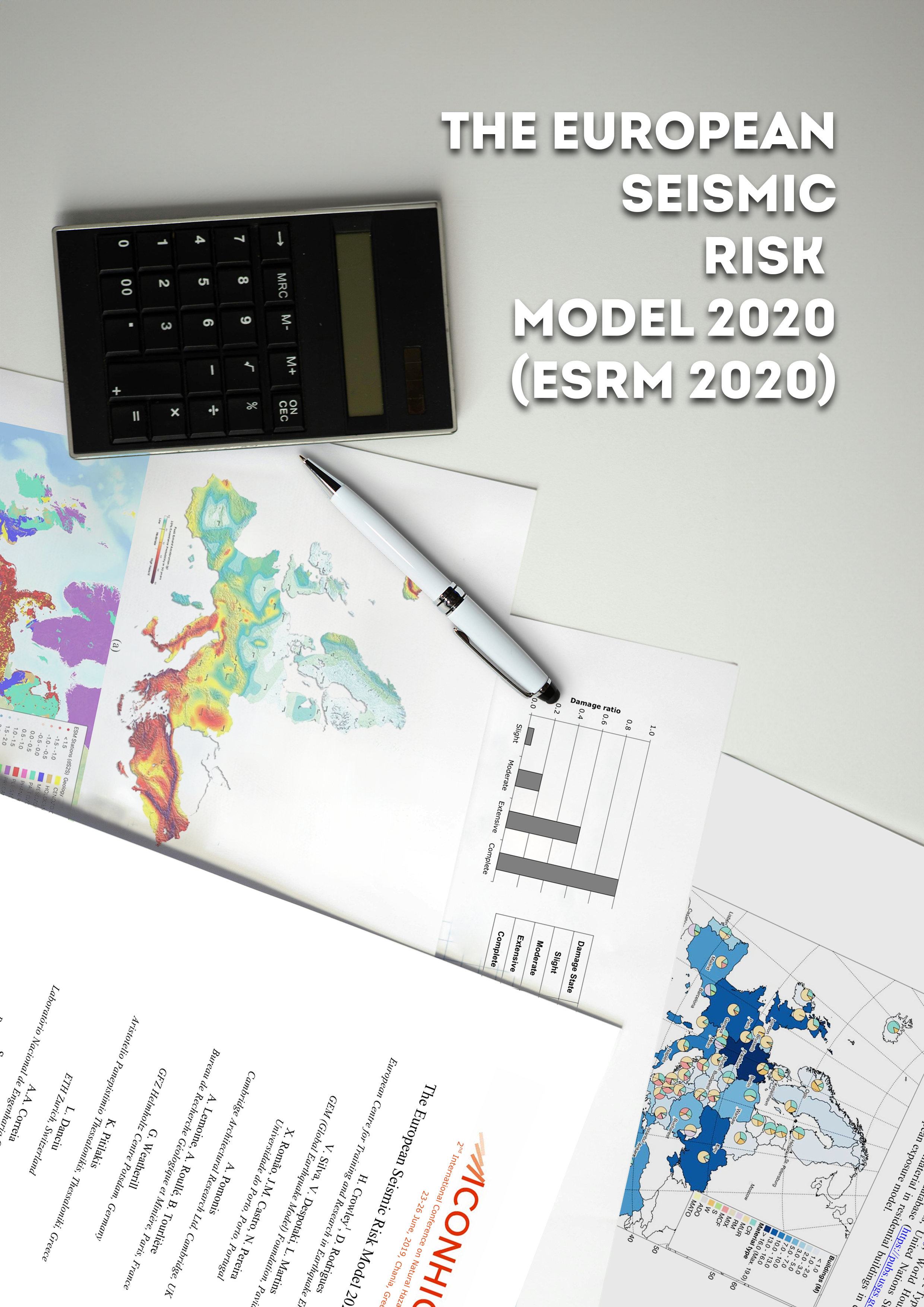
Publications The European Seismic Risk Model 2020 (ESRM 2020) Share Facebook LinkedIn Download 2019 | Peer-reviewed This study describes the development of the various components of the European Seismic Risk Model 2020 (ESRM2020) which will be able to generate, using open-source software developed by the GEM Foundation (the OpenQuake-engine), a number of Europe-wide risk metrics including average annualised human and economic losses (AAL), probable maximum losses (PML), and risk maps showing the losses for specific return periods or scenario events. The latest developments towards pan-European exposure models for residential and non-residential buildings and fragility/vulnerability models for damage, economic loss and casualty assessment will be presented. For engineered buildings within the exposure model (reinforced concrete, steel), a simulated design is undertaken using the key aspects of seismic design codes in force across Europe over the past 100 years. The designed MDOF building is then transformed to a SDOF model and nonlinear dynamic analyses are run using a large number of ground motion records, after which cloud analysis is used to develop the fragility functions. For non-engineered buildings (unreinforced masonry, confined masonry, adobe), the SDOF models have been directly developed from simplified formulae, experimental tests and previous studies. Collaboration from local experts at various stages of the model development, initiated through workshops, is an important component of the model, as well as the extensive calibration and validation.
- Probabilistic Seismic Hazard Analysis (PSHA) Training Manual | GEM Foundation
Publications Probabilistic Seismic Hazard Analysis (PSHA) Training Manual Share Facebook LinkedIn Download 2021 | User manual An example-based guide to building PSHA models using open-source data and tools.
- Educating for Tomorrow: How GEM Supports the Next Generation’s Disaster Preparedness - GEM Foundation
News Educating for Tomorrow: How GEM Supports the Next Generation’s Disaster Preparedness By: Oct 9, 2024 Oct 13, 2024 Share Facebook LinkedIn The International Day for Disaster Risk Reduction (IDDRR) 2024, themed “Empowering the next generation for a resilient future,” highlights the crucial role of education in safeguarding children and youth from escalating disaster risks. As climate change intensifies the frequency and severity of natural hazards, ensuring that educational institutions are resilient and that young people are equipped with essential disaster risk management knowledge becomes increasingly vital. “For this year's International Day for Disaster Risk Reduction, we are calling on countries to protect and empower children and youth through education. We must ensure that all schools are disaster-resilient and retrofit those at risk. Children must be equipped with knowledge about hazards and disaster risk management, and countries should endorse the Comprehensive School Safety Framework 2022-2030. If we achieve 100% school safety by 2030, we will be acting responsibly toward future generations.” - Kamal Kishore, Special Representative of the Secretary-General of the United Nations Office for Disaster Risk Reduction (UNDRR) https://www.youtube.com/watch?v=dQKgBQ7Mbnc https://youtu.be/dQKgBQ7Mbnc?si=ocGaomK9WZlZSeRE GEM's Contributions While the Global Earthquake Model (GEM) Foundation does not directly focus on youth-specific activities, our broader projects and activities support the goals of IDDRR 2024. Initiatives such as the FORCE Project , which enhances earthquake risk modeling and communicating hazard and risk information effectively, and the TREQ Project , which promotes public understanding of earthquake risks by focusing on capacity building and effective risk communication. Another key example is the Malawi Multi-Hazard Risk Assessment , which emphasises safeguarding educational infrastructure from various hazards, including floods, droughts, earthquakes, and strong winds. By analysing the vulnerability of schools to multiple hazards and recommending seismic risk awareness campaigns, the project highlights how schools can be central to building disaster resilience and empowering youth in Malawi. Additionally, the recent GEM-EGU Summer School on GeoHazards Risk Assessment provided young scientists and professionals with hands-on training in risk assessment, ushering a new generation of disaster risk professionals equipped to contribute to global resilience efforts. Forecasting and Communicating Earthquake Hazard and Risk (FORCE) The ongoing project Forecasting and Communicating Earthquake Hazard and Risk (FORCE) is dedicated to improving earthquake risk modeling and communicating hazard information effectively to diverse audiences. By integrating cutting-edge risk assessment tools and promoting collaboration among local stakeholders, FORCE empowers communities to better understand seismic risks. The project’s focus includes creating earthquake hazard and risk models for smaller regions, where the capacity to assess risk may be limited. FORCE also emphasises knowledge transfer through training workshops, ensuring that local governments and communities are equipped with the tools needed for effective disaster risk reduction. One of the project’s core objectives is to enhance the ability of local communities to interpret and act on earthquake risk information. FORCE engages a wide range of stakeholders, including government agencies, disaster management professionals, and community leaders. While not directly targeting youth, FORCE’s training initiatives contribute to a more informed public, helping create a resilient future for all generations. Learn more here . Malawi Multi-Hazard Risk Assessment The Malawi Multi-Hazard Risk Assessment project provided critical insights into the country's vulnerability to various hazards, including floods, droughts, earthquakes, and strong winds. Key elements of the project involved exposure mapping and the definition of social vulnerability indicators, alongside the estimation of multi-risk indicators for various building types, such as schools, residential, industrial, government and healthcare facilities. The project thoroughly examined the vulnerability of schools, assessing infrastructure weaknesses that could disrupt education during disasters. Data provided by Malawi's Ministry of Education included details on primary and secondary schools. In the absence of local building typology data, the project used international benchmarks to estimate building and content values. A crucial aspect of the project was identifying 60 social vulnerability factors, 11 of which were related to education, with two focused specifically on schools: the lack of internet connectivity and school inaccessibility during the rainy season. These factors underscore the infrastructure deficiencies that can hinder education and emergency responses during disasters. Limited internet access affects the flow of critical information, while poor infrastructure can worsen during heavy rains, affecting school attendance. GEM’s seismic risk assessment also highlighted the importance of safeguarding educational infrastructure and recommended local-level seismic risk awareness campaigns. Schools can serve as vital hubs for building disaster resilience by educating communities about earthquake preparedness and ensuring a safer future for Malawi’s youth. Learn more here . Training and Communication for Earthquake Risk Assessment (TREQ) The Training and Communication for Earthquake Risk Assessment (TREQ) project aims to enhance public understanding of earthquake risks by focusing on capacity building and community-level awareness. The project trained disaster risk professionals and public communicators, enabling them to lead community workshops in cities like Cali, Quito, and Santiago. These efforts help raise seismic risk awareness and encourage local stakeholders to engage actively in disaster preparedness. TREQ also develops educational materials such as teacher guidelines, public-facing videos, and urban risk profiles for targeted cities. These resources play a crucial role in spreading seismic risk knowledge to the broader public, empowering communities, including youth, to mitigate disaster risks and take proactive steps toward resilience. Learn more here . GEM-EGU Summer School on GeoHazards Risk Assessment The GEM-EGU Summer School on GeoHazards Risk Assessment, held in September 2024, provided young scientists and professionals with advanced training in earthquake and geohazard risk assessment. Through interactive sessions and hands-on exercises, participants learned to use GEM’s tools, such as the OpenQuake engine, to assess earthquake risk and enhance resilience in their local communities. The program encouraged collaboration among participants from diverse backgrounds, facilitating knowledge exchange and the development of practical skills. Read the related article here . Preparing Future Generations for a Safer Tomorrow Through a diverse range of projects like the Malawi Multi-Hazard Risk Assessment, FORCE, TREQ, and the GEM-EGU Summer School, the Global Earthquake Model (GEM) Foundation is actively contributing to global disaster risk reduction efforts. By promoting resilience in communities and equipping stakeholders with the tools and knowledge needed to understand and mitigate earthquake risks, GEM plays a crucial role in preparing future generations to face the growing challenges of natural hazards. While GEM’s focus may not be specifically on youth, its initiatives align with the goals of IDDRR 2024 by ensuring that education and preparedness are at the forefront of building a more resilient future for all. ## No images found. GALLERY 1/0 VIDEO RELATED CONTENTS
- India and surroundings Hazard | GEM Foundation
License Request Form You have chosen to get more information about: India and surroundings Hazard Hazard Please check the link below to see if this product already meets your your requirements before submitting your request for a license. Thank you. DOWNLOAD THE OPEN VERSION Summary of steps to obtain a license for the requested product. Fill in the application form below. Click Submit. Please check your email Inbox or Spam folder for the summary of your request. You will then be contacted by the GEM Product Manager with either a request for more information, or a request to sign the license. If you do not hear from us within 2 weeks, please send an email to product@globalquakemodel.org . REQUEST DETAILS A. Requesting party information First Name Last Name Role/Job Email Business type Business type Other business Sector Sector Other sector B. License agreement signatory information The signatory must be someone who is authorised to sign license agreements on your behalf such as your immediate supervisor, manager or legal officer. If you’re a PhD student, the signatory must be your adviser or a university officer in charge of license agreements or similar legal documents. Full Name of Signatory Position Company Email of Signatory Organisation name Complete Address C. Purpose of request GEM is able to offer products for free because of the support of our project partners, national collaborators and institutional sponsors. All of GEM’s products are freely available for public good, non-commercial use, but with different license restrictions. In most cases we release products under an open license (e.g., CC BY-SA or CC BY-NC-SA), which permits (re)distribution. In this case, we are granting access under a more restricted license that forbids distribution or disclosure and requires signing by GEM and the licensee in order to better assure accountability for the confidentiality of the information. In order for GEM to properly assess your request, please answer the following questions below. 1. Explain briefly how will the GEM product be used e.g. project, research including the expected results and the foreseen public benefit. Minimum 60 words. 2. Will you be able to share the results of your work with GEM? YES NO 3. Will you be able to provide feedback to GEM on the quality and usefulness of this product via a survey? YES NO D. Privacy Policy By submitting this form, you consent to the processing of your personal data in accordance with our Privacy Policy and the EU General Data Protection Regulation (GDPR). We are committed to safeguarding your information and ensuring it is only used for the purpose outlined in this form. You have the right to access, rectify, or delete your data at any time. For more information, please refer to our Privacy Policy. I agree Words: 0 Email us at product@globalquakemodel.org if you're experiencing problems submitting your application. Thank you. Submit Thanks for submitting! You will be contacted as soon as possible Incomplete data. Please fill in all required fields. Thank you.
- China Financial Loss Model | Global EarthQuake Model Foundation
Country model to assess potential financial losses to commercial, industrial and residential buildings due to earthquakes Products China Financial Loss Model Country model to assess potential financial losses to commercial, industrial and residential buildings due to earthquakes Share Facebook LinkedIn Description The China financial loss model has been developed by GEM using public sources of information, such as past seismicity, and geodetic and geologic data for the hazard component, combined with exposure and vulnerability data. The hazard component incorporates both faults and area sources. Earthquake occurrence rates on active faults are based on a new tectonic block model derived from the joint inversion of geodetic and geologic data. The model provides estimates of financial risk to residential, commercial and industrial buildings using GEM’s vulnerability models appropriate to Chinese construction practice. GEM has also developed an exposure model that can be used to estimate total losses to the building stock in addition to portfolio losses. Further technical information can be found in the documentation. GEM extensively collaborated with its private and public partners to test and validate the model against industry standards in order to produce a new model that represents GEM’s view of risk. The model is available in Oasis LMF format. How to cite this work N.A. Available Versions The latest version (v2022) created by GEM can be requested by clicking on the "License Request", where a specific license will be provided, depending on the use case. The model is also available through Verisk's Model Exchange platform formats by clicking on the links in the right panel. License information Currently, the model is only available under a restricted license that has to be tailored for each specific use case. Facebook LinkedIn Share Latest Version v2022 License Custom License Available resources OASIS Model License Request text Map View Search Popup title Close Country/Region Available Resources Afghanistan Exposure Africa Exposure Alaska Exposure Country/Region Available Resources Afghanistan Vulnerability Africa Vulnerability Alaska Vulnerability Country/Region Resource Url Afghanistan Risk Profile Africa Risk Profile Alaska Risk Profile Search Found Country/Region Resource Url Afghanistan Exposure Africa Exposure Alaska Exposure Preview Preview is not available. Search Found Country/Region Resource Url Afghanistan Vulnerability Africa Vulnerability Alaska Vulnerability Preview Preview is not available. Search Found Country/Region Resource Url Afghanistan Risk Profile Africa Risk Profile Alaska Risk Profile Preview Preview is not available. Related products Colombia Financial Loss Model South Africa Financial Loss Model Related publications For downloading or accessing detailed product information like PNG/PDF maps, datasets, license request, shapefiles and more, please switch to a desktop or laptop computer. Thank you for your understanding.