Thanks for submitting!
You will be contacted as soon as possible


QUICK LINKS


PROFILES
PUBLICATIONS
EXPOSURE
VULNERABILTY
SOFTWARE
EQ MODELS
Search Results
1046 results found with an empty search
- PAPERS | Global Earthquake Model Foundation
Projects PAPERS Piattaforma Analisi Pericolosità E Rischio Sismico Versión en español English version Share Facebook LinkedIn Overview Anchor 6 Background The Global Earthquake Model (GEM) Foundation has launched the PAPERS project (Piattaforma Analisi Pericolosità E Rischio Sismico), an initiative aimed at developing a new WebGIS platform for scenario hazard and risk assessment in Italy. The project has been funded as one of the cascade grants launched by the High-Performance Computing, Big Data e Quantum Computing Research Centre, one of the five National Centres established by the Italian National Recovery and Resilience Plan (NRRP), under Spoke 5 - Environment and Natural Disasters . The first training workshop of the project related to the use of the OpenQuake engine was successfully conducted online on April 1st, 2025, marking the first in a series of planned training events. This first workshop also served for exploring potential third-party contributions to models that could be integrated into the platform. Objectives PAPERS will enhance seismic risk assessment in Italy through advanced computational techniques and open-source models and tools. The project is organised into three modules, each focusing on a critical objective. The first module involves building the operational platform, leveraging the OpenQuake (OQ) Engine. The integration of High-Performance Computing (HPC) will facilitate complex analyses, while interoperability with external software will streamline data management. The second module focuses on updating Italy’s national exposure models. This involves compiling databases of buildings, critical infrastructure, and distributed networks at different geographic scales in the country. The project will integrate existing models with newly available datasets. This effort will provide a more comprehensive understanding of the seismic vulnerability of the Italian-built environment. As part of the third module, the platform will feature preloaded models of seismic hazard, exposure, and vulnerability, along with a range of earthquake scenarios, including historical earthquakes and events from a stochastic catalog based on the 2020 European Seismic Hazard Model (ESHM20). Alternative risk mitigation strategies will also be explored through dedicated multi-criteria decision-making approaches. Collaborators Project Coordination: Fondazione GEM (Global Earthquake Model Foundation) Main Collaborating Institution: Università degli Studi di Bari Aldo Moro Funding Agency: The project is funded under the Italian National Recovery and Resilience Plan (PNRR), Mission 4, "Education and Research" - Component 2, "From Research to Business" - Investment Line 1.4, supported by NextGenerationEU. Locations Pilot Site for Seismic Risk Analysis: An Italian city to be determined during the project, intended as a demonstration case for urban-scale seismic risk analysis. Testing Locations: The project will involve data collection and analysis on a national scale across Italy. Anchor 1 Anchor 5 Anchor 4 Anchor3 Publications
- SOLOMON ISLANDS EXPOSURE | Global Earthquake Model Foundation
Projects SOLOMON ISLANDS EXPOSURE Assessing the Risk Exposure of Road Network to Climate and Natural Hazard Risks in Solomon Islands Versión en español English version Share Facebook LinkedIn Overview Anchor 6 Background This project aims to conduct a robust multi-hazard risk assessment of the road network to climate and natural hazards in the Solomon Islands, both historically and under future climate projections. The project includes three main dimensions: - Characterization of the climate and natural hazards - Physical vulnerability of the road network - Multi-criteria criticality analysis The three main outputs are: - Multi-hazard maps - Road network risk exposure analysis (global risk score) - Identification of "first priority" road segments and estimation of their rehabilitation costs The GEM Hazard Team supports the project by computing seismic hazard maps and uses these to produce maps to classify low to high risks of earthquake hazards, according to their intensity and frequency. Duration: 2021 Objectives Many Small Island Developing States (SIDS) share a major common feature: they are among the most exposed nations to natural hazards and climate change. SIDS are also characterized by insularity and geographic remoteness, as well as small geographic area, economies, and population, all of which increase their social and economic vulnerability. This project aims to assist the Solomon Islands to better manage climate and disaster risks by improving the understanding of risk and the use of this information for risk reduction decision-making, and the design and implementation of investments at the provincial and community level. Collaborators GEM Foundation, ARIA Technologies, Actimar, Suez Consulting, Setec Group Funding partner: World Bank Group Location Solomon Islands Anchor 1 Anchor 5 Anchor 4 Anchor3 Publications
- ARISTOTLE | Global Earthquake Model Foundation
Projects ARISTOTLE Multi-Hazard Expert Advice System for ERCC Versión en español English version Share Facebook LinkedIn Overview Anchor 6 Background The All Risk Integrated System TOwards Trans-boundary hoListic Early-warning or ARISTOTLE consortium combines a number of services that enable a rapid understanding of events from various natural hazards (earthquakes and tsunami, volcanoes, severe weather and floods) and how they might unfold, thus aiding a deeper interpretation of the resulting hazards and impact. The GEM Foundation is supporting the consortium by providing an assessment of the impact of earthquakes using GEM's global exposure and vulnerability models, with a focus on metrics such as collapsed buildings and displaced people, such that it may provide an added value to existing rapid loss assessment services such as the USGS's Prompt Assessment of Global Earthquakes for Response (PAGER). Visit http://pilot.aristotle.ingv.it/ for more details about the project. Duration: 2022 - 2028 Objectives ARISTOTLE aims to provide Multi-Hazard Advice to the European Research Coordination Centre, either in advance of / during the activation of the EC Civil Protection Mechanism (CPM), in order to increase preparedness and response levels of the EU and to improve the ERCC’s assessment capacity. Collaborators ARISTOTLE is a multi-disciplinary partnership consisting of world-leading scientific centres in the areas of Earth and Climate sciences, providing operational and monitoring services, early warning and information systems as well as contributing to innovation and research actions. Location Global (Rome, Italy) Anchor 1 Anchor 5 Anchor 4 Anchor3 Publications
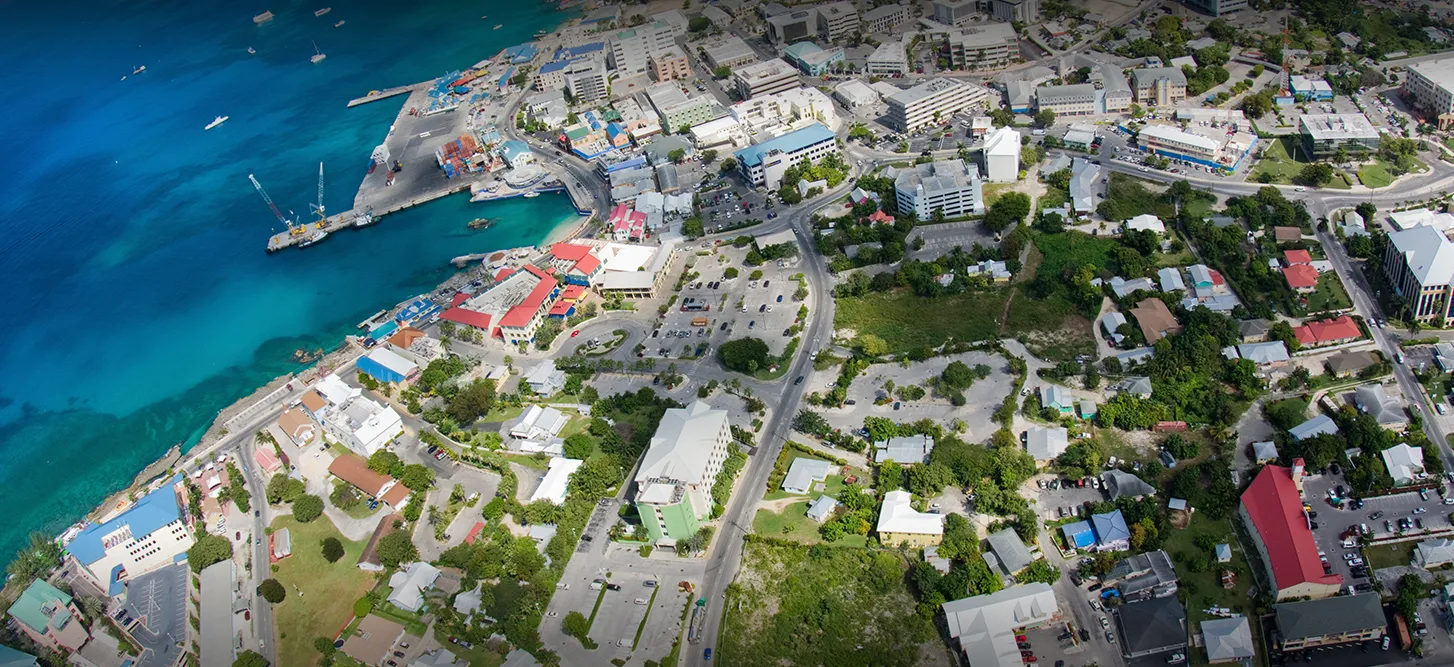
- CAYMAN ISLANDS PSHA | Global Earthquake Model Foundation
Projects CAYMAN ISLANDS PSHA Probabilistic seismic hazard assessment of Cayman Islands Versión en español English version Share Facebook LinkedIn Overview Anchor 6 Background Thr project aims to perform a probabilistic seismic hazard assessment for the Cayman Islands, and provide the seismic input necessary for the International Building Code (IBC). The GEM Hazard Team is responsible for the seismotectonic and geodynamic characterisation of the study area, the definition of distributed seismicity and fault sources, and the modelling of the epistemic uncertainties. Duration: 2020 Objectives The main objective is to provide input to the 2016 Cayman Islands Building Code, to support engineers in the seismic design and assessment of structures. Collaborators GEM Foundation, EUCENTRE Foundation Funding partner: Cayman Islands Government Location Cayman Islands Anchor 1 Anchor 5 Anchor 4 Anchor3 Publications
- SIGMA3 | Global Earthquake Model Foundation
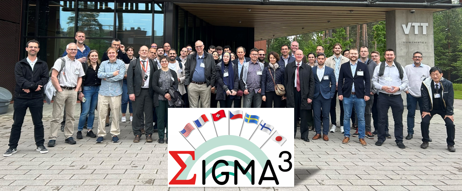
Projects SIGMA3 SeismIc hazard and Ground Motion Assessment Versión en español English version Share Facebook LinkedIn Overview Work Packages Training Dissemination Photos Publications Anchor 6 Overview SIGMA3 is a research and development (R&D) program on SeIsmic hazard and Ground Motion Assessment. It is the 3rd part of a larger R&D initiative initiated in 2011 to support innovation in the field of probabilistic hazard assessment (PSHA). SIGMA3 is fully funded by the industry at 100%. The program grounds its roots in methodological developments, as well as in the identified shortcomings of the two preceding editions, labelled SIGMA and SIGMA2. The previous two programs have led to insightful datasets and models to accompany the inception of probabilistic site-specific PSHA studies in low-to-moderate seismicity areas, such as France, for instance. However, nowadays, additional progress is still needed to reduce epistemic uncertainties and improve confidence in probabilistic seismic hazard studies. To this end, SIGMA3 gathers a group of researchers and engineers actively involved in the seismic hazard community and recognized for their expertise. Objectives The SIGMA program is a Research and Development project about seismic hazard and ground motion. It has the objective to improve data and develop methods necessary to best estimate SHA by producing Hazard levels more adapted to the site. Improve available practices for safety demonstration to get consensus with the largest international community for R&D and industrial applications Improve confidence and accountability in seismic hazard assessments by quantifying and propagating uncertainties on Seismic Source and Ground Motion Characterization Strengthen the link between seismologists and engineers, and share feedback among consortium members Collaborators Steering Committee The Steering Committee handles strategic and technical decision-making in the SIGMA3 program and provides recommendations on the program’s orientation, informed by the Scientific Committee’s expertise. Composition: Emmanuel Viallet (EDF France), Fabrice Hollender (CEA France), Vojtech Spanihel (CEZ Group Czech Republic), Masato Nakajima (CRIEPI Japan), Albert Kottke (PG&E USA), Fabienne Chawla (SwissNuclear Switzerland), Ludovic Fulop (VTT Finland) Scientific Committee The members of the SIGMA3 Scientific Committee are independent experts in their field, providing recommendations, insights, and reviews on activities performed through the program. Composition: Philippe RENAULT (Chairperson), Norman ABRAHAMSON, Laurent BOLLINGER, Emmanuel CHALJUB, Maria José CRESPO, John DOUGLAS, Zeynep GULERCE, Sadanori HIGASHI, Pierre LABBE, Ian MAIN, Adrian RODRIGUEZ-MAREK, Alain PECKER, Gabriel TORO, Kris VANNESTE, Jérôme VERGNE Location Global (coordinating agency located in France) Sigma 3 Technical Program Supported by ´Electricité de France (EDF), GEM’s activities cover three work packages: For more details on Sigma3's work packages (WP), click here . 1. Probabilistic Fault Displacement Hazard Analysis. This activity builds upon work carried out in 2024 within the framework of a collaboration with OGS, Trieste. 2. Development and methodologies for probabilistic seismic hazard assessment. In this WP, we will further develop capabilities to compute the conditional aftershock hazard and propagate epistemic uncertainties efficiently. 3. Development of a Simulation Platform. The objective of this activity is to generate a set of Python tools for evaluating fundamental components of a hazard input model - namely, source, ground motion, and site effects - used in Probabilistic Seismic Hazard Analysis (PSHA) computations. Anchor 1 Anchor 5 Conferences and Events For the latest events, training, seminars/webinars and conferences, please visit: https://sigma-programs.com/dissemination-sigma-3/conferences-and-events/ Anchor 4 SIGMA3 - SeismIc hazard and Ground Motion Assessment This section contains outreach activities conducted by the SIGMA3 program. For more details, click here . 1. News - https://sigma-programs.com/dissemination-sigma-3/news/ 2. Conferences and Events - https://sigma-programs.com/dissemination-sigma-3/conferences-and-events/ Anchor3 BUSINESS NEWS 1st General Assembly - June 2025, Helsinki (Finland) 1/1 BUSINESS NEWS Sigma3 Kick-Off - 11 June 2024, Aix-en-Provence (France) 1/1 Publications SIGMA3 - Publications and Reports This section contains project publications and reports as they become available. The list of currently available materials can be accessed here: https://sigma-programs.com/sigma-3/dissemination-sigma-3/publications-reports/
- TURKEY DRR | Global Earthquake Model Foundation
Projects TURKEY DRR Seismic risk and exposure data for Turkey Versión en español English version Share Facebook LinkedIn Overview Anchor 6 Background The World Bank is developing a thematic Paper on Building Climate and Disaster Resilience in Turkey that will apply a new World Bank Guidance Note on how to prepare resilience and adaptation strategies. The Guidance Note provides a practical guide for designing national strategies for climate change adaptation and resilience. It specifies actions that reflect universal principles of effective climate change adaptation and disaster resilience, emphasizing that each country needs to tailor the relative importance and sequencing of these actions to its specific needs and priorities. Given the best practice of mitigating natural hazards for a more resilient future, and the high risk of catastrophic earthquakes, the adaptation paper needs to consider seismic risk in Turkey. To contribute to the seismic risk component of this adaptation paper, the GEM Risk Team is responsible for the following tasks: - Assessment of earthquake ground shaking hazard in Turkey - Definition of the exposure: residential, commercial and industrial buildings; education and healthcare facilities; population - Assessment of vulnerability/fragility for the exposed elements - Risk modelling based on the current exposure - Risk projections to 2030 and 2050 (based on future socio-economic conditions) Duration: 2021 Objectives The World Bank thematic Paper on Building Climate and Disaster Resilience in Turkey aims to support the Turkish government by providing guidance on how to prepare resilience and adaptation strategies, including those related to earthquakes. The objectives of this project are to: 1. Provide deterministic and probabilistic seismic risk metrics in Turkey for population and selected structure types, to inform macro-economic and public finance analysis (conducted by the World Bank project team). 2. Provide seismic impact analysis for three earthquake scenarios aimed at reducing risk in Turkey to estimate the impact of these interventions on i) loss due to direct damage and ii) fatalities. Collaborators GEM Foundation Funding partner: World Bank Group Location Turkey Anchor 1 Anchor 5 Anchor 4 Anchor3 Publications
- NEAM-COMMITMENT | Global Earthquake Model Foundation
Projects NEAM-COMMITMENT North-Eastern Atlantic and Mediterranean Tsunami Risk Management and Planning Versión en español English version Share Facebook LinkedIn Overview Anchor 6 Background NEAM-COMMITMENT aims to improve tsunami risk management and planning in the NEAM region. It endeavors to contribute primarily to two key components of tsunami risk governance: capacity building through tsunami hazard assessment and mapping at the national scale, and improved tsunami evacuation planning at the local level through a novel multi-hazard approach. Guidelines will be drafted for the methodologies applied to develop the national tsunami inundation and local tsunami evacuation maps to contribute to improved tsunami risk management planning. Duration: 2025 - 2027 More details: https://civil-protection-knowledge-network.europa.eu/projects/neam-commitment#inpage-section-description Objectives The project has two objectives: to develop national tsunami inundation maps in Cyprus, Greece and Spain through the methodology applied to produce tsunami inundation maps for evacuation planning in Italy, aiming to achieve compatible tsunami inundation maps across the NEAM region; to address the need for a multi-hazard approach for effective tsunami evacuation management to complement existing tsunami evacuation management guidelines. The proposed new approach focuses on multi-hazard cascading effects concerning tsunami evacuation and emergency management and will be piloted in local sites in Greece and Italy. Collaborators NATIONAL OBSERVATORY OF ATHENS Greece Coordinator National Institute of Geophysics and Volcanology (INGV), Italy Fundación hidráulica ambiental de Cantabria, Spain Higher Institute for Environmental Protection and Research (ISPRA), Italy Global Earthquake Model (GEM) Foundation, Italy University of Malaga, Spain Municipality of Lipari, Italy Academy of Athens, Greece The General Secretariat for Civil Protection - Greece Ministry of Agriculture, Rural Development and Environment of Cyprus Funding partner: Union Civil Protection Mechanism (UCPM) Location Southern Europe Anchor 1 Anchor 5 Anchor 4 Anchor3 Publications
- GAR 2023 | Global Earthquake Model Foundation
Projects GAR 2023 GAR Special Report 2023: Mapping resilience for the Sustainable Development Goals Versión en español English version Share Facebook LinkedIn Overview Anchor 6 Background The United Nations Office for Disaster Risk Reduction (UNDRR)'s Global Assessment Report on Disaster Risk Reduction 2023 offers a unique perspective on development progress by emphasizing risk and resilience in a changing climate. The report features maps developed in collaboration with the GEM Foundation and other agencies (United Nations Geospatial Information Section, Environmental Systems Research Institute - ESRI), displaying country-level Sustainable Development Goals (SDG) indicators and risk drivers, and showcasing resilience deficits. These maps also present future projections of these deficits under different climate scenarios, incorporating IPCC greenhouse-gas-emission-rate scenarios and representative concentration pathways. Duration: 2023 Objectives The report serves as a comprehensive inter-agency effort to assess and address resilience gaps, aiding in informed decision-making for sustainable development. Collaborators GEM Foundation, United Nations Geospatial Information Section, Environmental Systems Research Institute - ESRI Funding partner: UNDRR Location Geneva, Swizterland Anchor 1 Anchor 5 Anchor 4 Anchor3 Publications
- EPOS ON | Global Earthquake Model Foundation
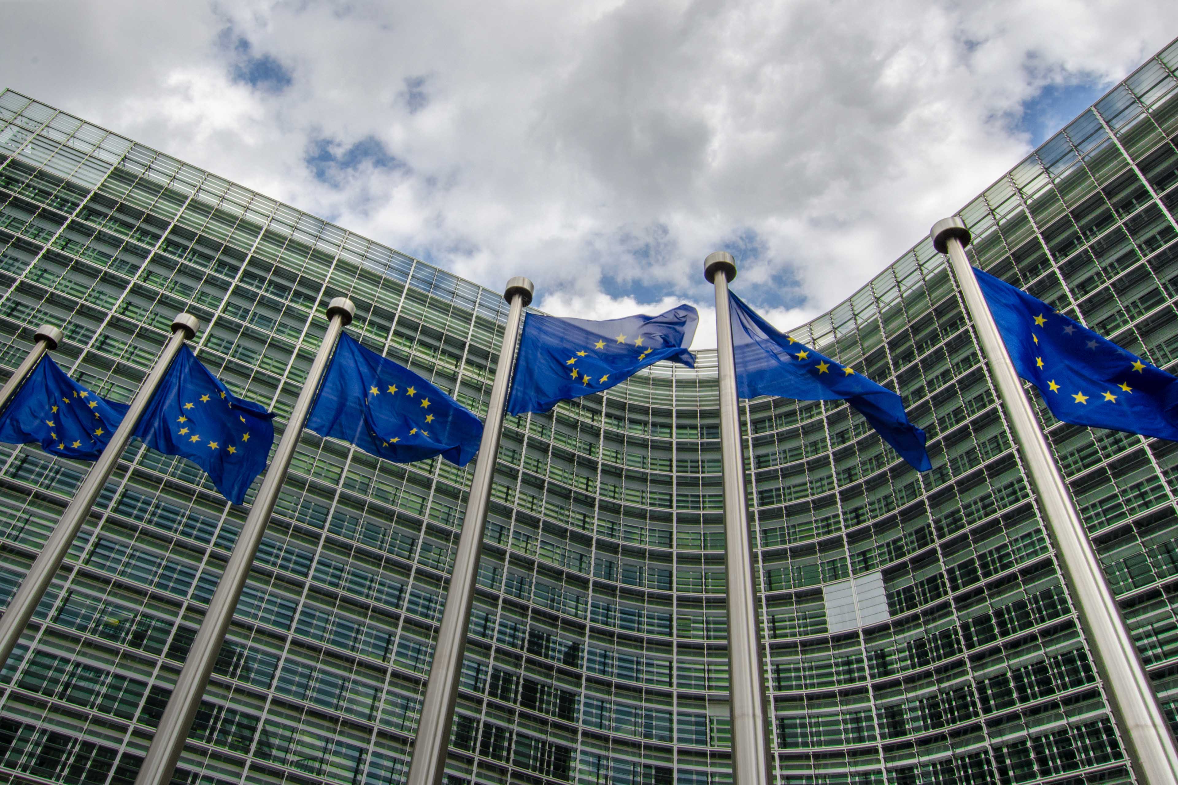
Projects EPOS ON European Plate Observing System-Optimisation and EvolutioN (EPOS ON) Project Versión en español English version Share Facebook LinkedIn Background Anchor 6 Background The European Plate Observing System-Optimisation and EvolutioN (EPOS ON) project, a collaborative initiative involving a consortium of 34 partners across 18 countries aims to support the optimisation and evolution of the EPOS Research Infrastructure (EPOS RI) by enhancing the interoperability, accessibility, and integration of various datasets for effective risk management and resilience against natural hazards. The project is led and coordinated by EPOS ERIC with funding support from the European Union (EU) under the Horizon Europe program, and will be implemented across various geographic locations within Europe and may extend its partnerships to other regions globally. Duration: September 1, 2024 to August 31, 2024 More details: https://www.epos-eu.org/on . Expected Key Outputs GEM work packages (WP) include scientific products that support risk management: WP3 Contribution to Tackle Societal Challenges - Enhancement of existing EPOS services for improved risk management for natural hazards, supported by dialogue with the EU Union Civil Protection Knowledge Network (UCPKN). Data products and services for rapid post-event assessment: this includes the improvement of existing tools (e.g., European ShakeMap service) for rapid post-event assessment of earthquake impacts and associated secondary hazards (e.g. liquefaction), tools to predict population dynamics in the immediate aftermath of a disaster, and databases of damage-dependent seismic vulnerability models for European buildings. WP5 Enlarging European and International Collaborations - Establishment of collaborative partnerships with relevant research infrastructures to promote synergies and expand global access to EPOS services and data. Support for the expansion of the existing European seismic risk services to include maps representing the environmental impact associated with earthquakes in terms of equivalent carbon dioxide (eCO2) emissions arising from damage and subsequent repair activities. Collaborators EPOS ON includes 34 partners from 18 countries, which represent not only research and academy, but also private sector companies and new communities. Funding partner: EPOS ON is funded by the EC Horizon Europe programme under G.A. n 101131592 Location Europe Anchor 1 Anchor 5 Anchor 4 Anchor3 Publications
- EU DRR | Global Earthquake Model Foundation
Projects EU DRR Regional risk modelling and scenario analysis for EU Member States - Seismic risk analysis and exposure data Versión en español English version Share Facebook LinkedIn Overview Anchor 6 Background This project supports the World Bank Technical Assistance project "Economic Analysis of Prevention and Preparedness in European Union Member States and Countries under EU Civil Protection Mechanism". The GEM Risk Team provides exposure and probabilistic seismic risk assessments for the 27 EU member states and 6 participating states, building upon the EFEHR ESHM20 hazard and ESRM20 exposure datasets [insert link www.efehr.org ], adding educational and healthcare building stock, and forecasting exposure to 2050. Further, retrofitted vulnerability curves are derived to inform the seismic impact analyses and a cost-benefit analysis. Duration: 2020-2021 Objectives The project is conducted in collaboration with the European Commission’s (EC) Directorate-General for European Civil Protection and Humanitarian Aid Operations (DG ECHO). The objectives of this project are to: 1. Provide regionally-consistent probabilistic seismic risk metrics across Union Civil Protection Mechanism (UCPM) countries for population and selected structure types, to inform macro-economic analysis that is to be conducted by the World Bank project team. 2. Provide seismic impact analysis for two selected earthquake scenarios with and without specified DRM intervention, to estimate the impact of that intervention on i) loss due to direct damage and ii) fatalities. This will contribute to cost-benefit analysis of EU-funded DRM investments conducted by the WB project team using the Triple-Dividend framework. Collaborators GEM Foundation Funding partner: World Bank Group Locations EU Member States Anchor 1 Anchor 5 Anchor 4 Anchor3 Publications