CLOSE

QUICK LINKS


PROFILES
PUBLICATIONS
EXPOSURE
VULNERABILTY
SOFTWARE
EQ MODELS
Search Results
538 items found for ""
- Canada renews support for GEM as Public Sponsor - GEM Foundation
News Canada renews support for GEM as Public Sponsor By: May 21, 2020 Share Facebook X (Twitter) LinkedIn The GEM-Canada National Steering Committee led by Natural Resources Canada - with members Public Safety Canada, Insurance Bureau of Canada, Defence Research and Development Canada, the Department of Finance, Institute for Catastrophic Loss Reduction, Canadian Institute of Planners, Assembly of First Nations, and the Métis National Council – renews its commitment to support GEM for five years as Public Sponsor. GEM Governing Board officially welcomed Canada as a new member in 2017. The renewed partnership is expected to continue its contribution to the assessment of earthquake risk using OpenQuake in support of disaster risk reduction (DRR) planning in Canada. Sonia Talwar, Geological Survey of Canada, who has replaced Phil Hill as official representative, expressed excitement and is looking forward to a continued fruitful collaboration in the development of GEM’s future tools and risk models for earthquakes and other hazards in Canada. “I am happy to represent Canada in the GEM Governing Board and continue the excellent working relationship that Phil Hill started three years ago. Canada will remain committed in the next five years to support GEM’s vision of a world that is resilient to earthquakes through development and enhancement of hazard and risk models, tools and data that are critical in formulating disaster risk reduction plans and strategies,” Sonia Talwar, Geological Survey of Canada. Sonia was officially welcomed in the governing board meeting held in December 2019 at the GEM headquarters in Pavia, Italy. Phil Hill represented Canada from 2017-2019. His dedication to achieve earthquake risk reduction during his tenure paved the way for a sustained commitment from Canada. “GEM is very pleased to continue our collaborative work with Canada to reduce and manage earthquake risk. We are thankful for the generous support that the government of Canada has committed for the years ahead. This will definitely strengthen our efforts in systemic risk and recovery modelling; and capacity development for integrated assessment and scenario planning,” John Schneider, GEM Secretary General. Under the new agreement, the partnership will deliver a high-resolution profile of earthquake risk in Canada with support for the use of tools and methods to understand earthquake risk and take decisions to improve resilience. The GEM-Canada partnership will use the open source hazard and risk assessment tools developed by GEM’s international consortium of experts and combine these with expertise and knowledge on the Canadian risk environment. No images found. GALLERY 1/0 VIDEO RELATED CONTENTS
- Western Africa Hazard | Global EarthQuake Model Foundation
Project Name Products Western Africa Hazard OpenQuake engine input model to perform hazard calculations for Western Africa Share Facebook X (Twitter) LinkedIn Description The Western Africa model (v2018.0.0) was developed internally by GEM. The model encompasses the whole Atlantic side of the Africa continent. An ad-hoc homogenised earthquake catalogue was developed based on globally available information, which was used as the primary base for seismic occurrence analysis and the subsequent development of the source zonation model. The analysis was particularly challenging in the region, due to the severe incompleteness of calibration data, and the virtually nonexistent neotectonic information. Since the original version, an update was made to the model by the GEM hazard team, leading to the latest release (v2018.1.0), which was used in the computation of the 2023 Global Earthquake Hazard and Risk Maps. This model extends the minimum magnitude of events for crustal distributed seismicity and includes an additional GMPE in the logic tree. How to cite this work Poggi, V. (2023). PSHA input model documentation for Western Africa (WAF-2018.1.0). GEM Foundation. Available Versions The latest version (v2018.1.0) is available for direct download under a CC BY-NC-SA 4.0 license. Users interested in this version can click the "Open Version Download" button in the right panel to access the information. If your use case does not comply with the license terms, a license can be requested by clicking on the "License Request", where a specific agreement will be provided, depending on the use case. License information The open version is available under a Creative Commons CC BY-NC-SA 4.0 license, which requires: *Attribution (you must give appropriate credit, provide a link to the license, and indicate if changes were made) *Non-commercial (you may not use the material for commercial purposes) *ShareAlike (derivatives created must be made available under the same license as the original) Any deviation from these terms incur in license infringement. For commercial use of the model, a specific license agreement must be made tailored to your use case, in such instance please click on "License Request". Share License CC BY-NC-SA 4.0 Available resources Open Version Download Documentation License Request Facebook X (Twitter) LinkedIn text Map View Search Popup title Close Country/Region Available Resources Country/Region Available Resources Country/Region Resource Url Search Found Country/Region Resource Url Preview Preview is not available. Search Found Country/Region Resource Url Preview Preview is not available. Search Found Country/Region Resource Url Preview Preview is not available. Related products Global Exposure Model Global Vulnerability Model Global Seismic Risk Map Country-Territory Seismic Risk Profiles Global Seismic Hazard Map Related publications For downloading or accessing detailed product information like PNG/PDF maps, datasets, license request, shapefiles and more, please switch to a desktop or laptop computer. Thank you for your understanding.
- GEM-World Bank/GFDRR-DFID challenge fund projects kick off - GEM Foundation
News GEM-World Bank/GFDRR-DFID challenge fund projects kick off By: Jul 2, 2018 Share Facebook X (Twitter) LinkedIn The GFDRR-DFID Challenge Fund projects on the development of exposure, vulnerability and hazard footprints databases kicked off with a 2-day inception workshop held at GEM Headquarters from 10-11 April 2017. Several organizations attended the workshop led by World Bank’s GFDRR, British Geological Survey (BGS), GEM Foundation and the University College London (UCL). BGS leads the development of a data schema and data for a multi-hazard database (Challenge 1) while GEM and University College London lead the development of a global exposure database (Challenge 2) and open vulnerability platform for evaluating risk (Challenge 3) respectively. GEM also contributes to Challenge Fund 1 and 3. The goal of the workshop is to integrate the three Challenge Funds so that the final product contributes to the broader objectives of the building evidence for action on disaster risk management and the Sendai Framework. Alanna Simpson, Senior Disaster Risk Management Specialist and leader of the GFDRR Labs team notes that “GEM has done very well in the development of earthquake exposure data” but added that “the idea of the three Challenge Funds is for people to collect information - hazard, exposure and vulnerability - on the built environment at the same time for multiple perils.” She further adds that “the projects would not only develop an exposure database schema that will allow people to collect data only once for many purposes, but would also look into how this framework would be flexible enough to take the top down and bottom up information, including official and non-official data so that they can be used to build the whole picture.” The GFDRR-DFID Challenge Fund seeks to bridge the gap between technology and on-the-ground user needs in the field of disaster risk identification. The Global Facility for Disaster Reduction and Recovery (GFDRR) is a global partnership that helps developing countries better understand and reduce their vulnerability to natural hazards and climate change.For more information, visit https://www.gfdrr.org and https://www.gfdrr.org/the-challenge-fund . No images found. GALLERY 1/0 VIDEO RELATED CONTENTS
- GEM conducts OpenQuake Workshop of 2019 at IIT Gandhinagar, India - GEM Foundation
News GEM conducts OpenQuake Workshop of 2019 at IIT Gandhinagar, India By: Mar 25, 2019 Share Facebook X (Twitter) LinkedIn OpenQuake workshop participants, IIT Gandhinagar, India About 20 individuals participated in GEM’s first OpenQuake Workshop of 2019. The event, organized and coordinated by the Indian Institute of Technology Gandhinagar (IITGN) professors Svetlana Brzev and Manish Kumar was held in Gandhinagar from 18-19 March 2019. Vitor Silva and Anirudh Rao of the GEM Risk Team presented the Global Earthquake Model and discussed the seismic hazard and risk assessment for India, which was developed jointly with the GEM team and members from IIT Bombay, IIT Madras, and IIT Gandhinagar. The model allows the estimation of losses due to earthquakes in India, considering the local construction practices. “Seismic risk associated with the Indian building stock is an important topic and we are pleased to support this important research initiative by hosting the workshop” said Prof. Sudhir K. Jain, earthquake engineer and IITGN Director. The workshop was covered by local online news media in Gujarati (gandhinagarsamachar.com) and English ( indiatimes.com ) . No images found. GALLERY 1/4 VIDEO RELATED CONTENTS
- Hazard Information Profiles Launched - GEM Foundation
News Hazard Information Profiles Launched By: Dec 13, 2021 Share Facebook X (Twitter) LinkedIn This new supplement to the UNDRR-ISC Hazard Definition & Classification Review – Technical Report provides hazard information profiles (HIPs) for 302 hazards of concern for disaster risk reduction efforts. The report and accompanying HIPs are the result of the collaboration of hundreds of scientists globally. GEM hazard scientists Kendra Johnson, Richard Styron and Robin Gee provided the HIPs for earthquakes and associated or triggered hazards, and John Schneider participated in the working group that produced the 2020 report on the “ Hazard Definition & Classification Review: Technical Review . The supplement is the first ever compilation of definitions of over 300 hazards that are relevant to the 2015 United Nations landmark agreements of the Sendai Framework for Disaster Risk Reduction, the Paris Agreement on climate change and the Sustainable Development Goals. This compilation of existing information provides a starting point for bringing together information on hazards that will need to be regularly reviewed and updated by the relevant international institutions in partnership with the scientific community in order to build an information ecosystem better suited to the risks of today and tomorrow. No images found. GALLERY 1/1 VIDEO RELATED CONTENTS
- TREQ Project Updates: Site Effects Modelling and Urban Exposure Models - GEM Foundation
News TREQ Project Updates: Site Effects Modelling and Urban Exposure Models By: Jun 3, 2021 Share Facebook X (Twitter) LinkedIn Site Effects Modelling and Urban Exposure Models Over the past year, TREQ has made significant progress in the risk and hazard assessment for the selected cities: Santiago (Dominican Republic), Quito (Ecuador) and Cali (Colombia). This includes compiling and preparing existing PSHA models for hazard calculations; and the development of detailed exposure and vulnerability models. Urban Hazard Assessment For Santiago de los Caballeros, Dominican Republic, the project team worked with local experts from the National Geological Survey (SGN) and the Autonomous University (UASD) at compiling, reviewing, and preparing a new seismic catalogue to be used in hazard calculations for Hispaniola. The team has also prepared the national database of active faults, using the information compiled in the CCARA project and additional information provided by SGN (i.e. data and reports). The project is now using the catalogue and fault data to construct the national probabilistic seismic hazard model for the Dominican Republic. A preliminary version has been completed, and construction of the final model is underway. For Cali, Colombia, the project improved the national model proposed by Arcila et al. (2020) by adding a new fault located underlying the city (i.e. Cauca-Cali-Patia fault), consistent with the seismic zonations used in the microzonation study for Cali (Ingeominas-Dagma, 2005), and the Colombian building code (AIS, 2009). For Quito, Ecuador, the project selected the model of Beauval et al. (2018), composed of shallow and subduction seismic sources characterized using an ISC-based catalogue and active shallow fault sources considering geodetic slip-rates assuming a 50% of aseismic slip. Now, the project is consolidating the available geological, geophysical, and geotechnical data for each of the three cities needed to compute site-response (amplification of ground shaking in surficial sediments (or soil) during an earthquake). Future versions of the OpenQuake engine will support the calculation of site response through detailed site/soil amplification functions and their corresponding uncertainty. Urban Risk Assessment GEM has already developed exposure datasets at the subnational level in the Dominican Republic, Colombia and Ecuador. However, the risk assessment activities planned within the context of TREQ require exposure datasets at urban scale. To this end, GEM has focused on the development of high-resolution exposure models. These have been established with support from the municipal governments in each city, namely, Oficina de Planeamiento Territorial (Santiago de los Caballeros), Oficina de Planeación y la Secretaría de Gestión del Riesgo de Emergencias y Desastres (Cali), and Dirección Metropolitana de Gestión del Riesgo (Quito). The exposure models were developed using dedicated databases from each city. These databases include the most recent information from the census, cadaster, and urban planning offices. As a result, they feature better estimates for the number of occupants, building counts, replacement costs and vulnerability classification of structures. In close collaboration GEM and the USGS are validating the exposure models by means of assessing the potential impacts of earthquake scenarios at a neighborhood level. The objective is to use recorded/estimated damage and economic losses from relevant historical scenarios to assess the accuracy of the exposure and hazard model data. The risk metrics that are being analyzed in each city include building damage, economic losses and fatalities. No images found. GALLERY 1/0 VIDEO RELATED CONTENTS
- Southeast Asia
Please fill in the form below to download or view the document. Thank you. Southeast Asia Product Additional Requests Sector I have read and agree to comply with the license terms of this product, and the conditions of products use. Reset fields Submit Download Thank you. Please click Download to get your item. Provide feedback to GEM on the use and impact of the product e.g. feedback survey. Share with GEM where the product was used i.e. research, publications or projects.
- Indonesia Hazard | Global EarthQuake Model Foundation
Project Name Products Indonesia Hazard OpenQuake engine input model to perform hazard calculations for Indonesia Share Facebook X (Twitter) LinkedIn Description The initial version (v2017.0.0) of the seismic hazard model for Indonesia was developed by the Team for Updating Seismic Hazard Maps of Indonesia of the National Center for Earthquake Studies, Indonesia. (Irsyam et al., 2017). The model builds on the experience collected throughout the last 15 years and on international collaborations notably with the United States Geological Survey (USGS) and Geoscience Australia. The model was originally produced partly using the NSHMP software of the USGS and partly in the OpenQuake (OQ) engine. To achieve an entirely OQ implementation, part of the model has been translated from its original format into OQ. Since the original version, an update was made to the model by the GEM hazard team, leading to the latest release (v2017.1.0), which was used in the computation of the 2023 Global Earthquake Hazard and Risk Maps. This model extends the minimum magnitude of events for crustal distributed seismicity and updates the GMPEs used for more recent ones. How to cite this work Irsyam, M., Natawijaya D. H., Daryono M.R., Widiyantoro S., Asrurifak M., Meilano I., Triyoso W., Hidayati S., Rudiyanto A., Sabaruddin A., Faisal L. (2017). Development of new seismic hazard maps of Indonesia 2017. In Proceedings of the19th International Conference on Soil Mechanics and Geotechnical Engineering, Seoul 2017. Irsyam M, Cummins PR, Asrurifak M, et al. Development of the 2017 national seismic hazard maps of Indonesia. Earthquake Spectra. 2020;36:112-136. doi:10.1177/8755293020951206 Available Versions The latest version (v2017.1.0) is available for direct download under a CC BY-SA 4.0 license. Users interested in this version can click the "Open Version Download" button in the right panel to access the information. If your use case does not comply with the license terms, a license can be requested by clicking on the "License Request", where a specific agreement will be provided, depending on the use case. License information The latest version is available under a Creative Commons CC BY-SA 4.0 license, which requires: *Attribution (you must give appropriate credit, provide a link to the license, and indicate if changes were made) *ShareAlike (derivatives created must be made available under the same license as the original) Any deviation from these terms incur in license infringement. If your use case does not comply with these terms, a specific license agreement must be made tailored to your use case, in such instance please click on "License Request". Share License CC BY-NC-SA 4.0 Available resources Open Version Download Documentation License Request Facebook X (Twitter) LinkedIn text Map View Search Popup title Close Country/Region Available Resources Country/Region Available Resources Country/Region Resource Url Search Found Country/Region Resource Url Preview Preview is not available. Search Found Country/Region Resource Url Preview Preview is not available. Search Found Country/Region Resource Url Preview Preview is not available. Related products Global Exposure Model Global Vulnerability Model Global Seismic Risk Map Country-Territory Seismic Risk Profiles Global Seismic Hazard Map Related publications For downloading or accessing detailed product information like PNG/PDF maps, datasets, license request, shapefiles and more, please switch to a desktop or laptop computer. Thank you for your understanding.
- Science in the spotlight - GEM Foundation
News Science in the spotlight By: Jul 2, 2018 Share Facebook X (Twitter) LinkedIn The Third UN World Conference on Disaster Risk Reduction took place in March this year and what the 187 member states have agreed, after a long marathon of negotiations, is a 15-year plan made of seven guiding principles and four priorities for action. Precedence in the post-2015 framework was given to implementing activities that will prevent the creation of new disaster risks and that will better tackle all those risk multipliers such as poverty, poor land management, scarce access to trustable data and technology, lack of building regulations etc. that exponentially worsen the consequences for communities. Special attention was given to understanding risk (Priority 1), with recommendations to promote dissemination of science and to facilitate the adoption of new tools and resources. The importance of science and technology for DRR policy and practice was also extensively expressed in the Science and Technology Advisory Group Report 2015, which provided key commitments on behalf of the scientific community to assist with the implementation of the Post-2015 Framework.Unfortunately in the past 10 years (during execution of the Hyogo Framework for Action) the involvement of relevant stakeholders in sharing knowledge and information was insufficient and actions undertaken to reduce losses often inadequate, so the “exposure of persons and assets in all countries has increased faster than vulnerability has decreased” (SFDRR – Sendai Framework for Disaster Risk Reduction 2015-2030). This is the reason why the new agreement is also calling for stronger mutual reinforcement: stakeholders from government, private sector and civil society are encouraged to mobilize commitments and take coordinated action to reduce risk.The GEM Foundation actively participated in the main working sessions and side events, reporting a great deal of interest in its possible role as an enabling mechanism for implementation of the commitments to understanding risk and supporting the DRR monitoring framework. Specifically, in the monitoring and evaluation process (yet to be defined) risk models will likely play an increasingly important role and GEM is well-placed to contribute. What is more, the very nature of the Foundation based on a private-public partnership seems to perfectly match with the latest recommendations from Sendai to boost collaborative efforts and cross-cutting initiatives.What also clearly emerged from the conference was the increased interest in open data and open source tools and software to assess risk, either as a participatory science or as a technology transfer. Open access to key resources for development and implementation of risk assessments has found a new wave of interest at the 3WCDRR and various organisations from around the world pointed the audience to a number of compelling case studies. “New generations now are more familiar with the concept of open data and hopefully they will soon recognize its potential” Kuo- Fuong Ma, Taiwan Earthquake Model and member of the GEM Governing Board. What was also evident was the demand for risk assessment tools and guidelines to support evidence-based DRR decisions, the more open and accessible they are, the better they will be.The GEM Foundation will certainly draw on Japan’s conclusions to reiterate its pledge for an earthquake resilient world, renewing its call to develop private-public collaborations in many areas of the world and making data and cutting-edge resources available to everyone. No images found. GALLERY 1/0 VIDEO RELATED CONTENTS
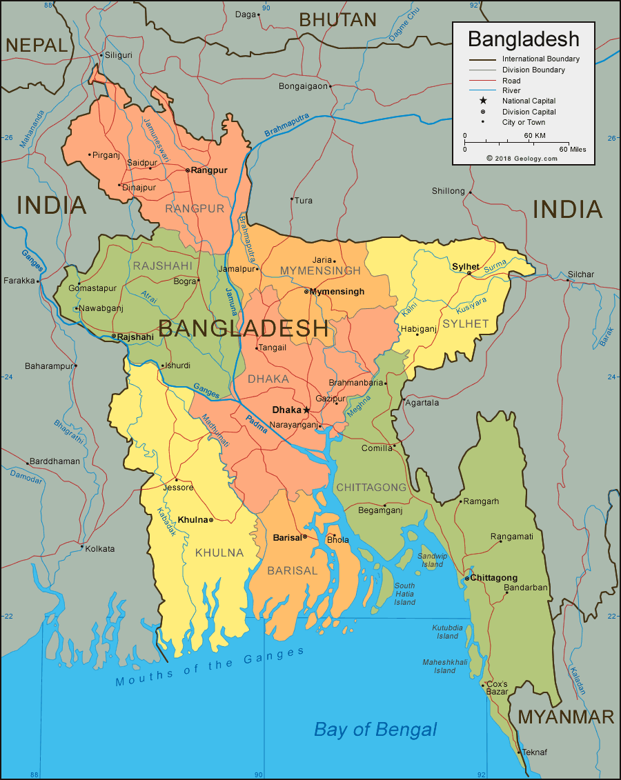
- Towards Improved Probabilistic Seismic Hazard Assessment for Bangladesh - GEM Foundation
News Towards Improved Probabilistic Seismic Hazard Assessment for Bangladesh By: May 21, 2020 Share Facebook X (Twitter) LinkedIn A team of scientists from the University of Dhaka, Bangladesh led by Dewan Md. Enamul Haque, Assistant Professor at Department of Disaster Science and Management, Faculty of Earth and Environmental Sciences published a paper Towards Improved Probabilistic Seismic Hazard Assessment for Bangladesh . The authors used GEM’s OQ-engine to develop the PSHA for Bangladesh. The study aims to build on the existing knowledge and improve the overall PSHA results by modifying source, path and site characteristics for Bangladesh. The ground motions - PGA and SA (at 0.2, 1.0 and 2.0 s) were computed using GEM’s OpenQuake and presented in form of hazard maps for 2% and 10% probabilities of exceedance in 50 years as well as mean hazard curves and uniform hazard spectra. The lead author, Asst. Prof. Dewan Haque learned about the OQ software from GEM’s website, and is actively using it for modelling and research work. He found the software easy to use and said he would definitely recommend it to others. “I’m satisfied and happy with my experience with the OQ-engine. Comparing it with other hazard and risk modeling software, I believe that it is better than most software out there. I found the one of the most valuable features of the engine,” says Asst. Prof. Dewan Haque. He further adds that “it is easy to use” but pointed out the OQ-engine would better suit his needs if a “step by step manual on how to upgrade the tools are shared upon the release of new versions”. The OpenQuake Engine is GEM’s state-of-the-art, open-source software collaboratively developed for earthquake hazard and risk modelling. The functionality to analyze hazards and risks at specific site, city, country or regional level makes the OpenQuake Engine a powerful and dynamic tool for assessing the potential impacts of earthquakes at any location in the world. GEM continues to strive to provide open products and software to disaster risk reduction professionals, emergency responders, and scientists and researchers around the world. To learn more or to download the latest version, click here . No images found. GALLERY 1/0 VIDEO RELATED CONTENTS