Thanks for submitting!
You will be contacted as soon as possible


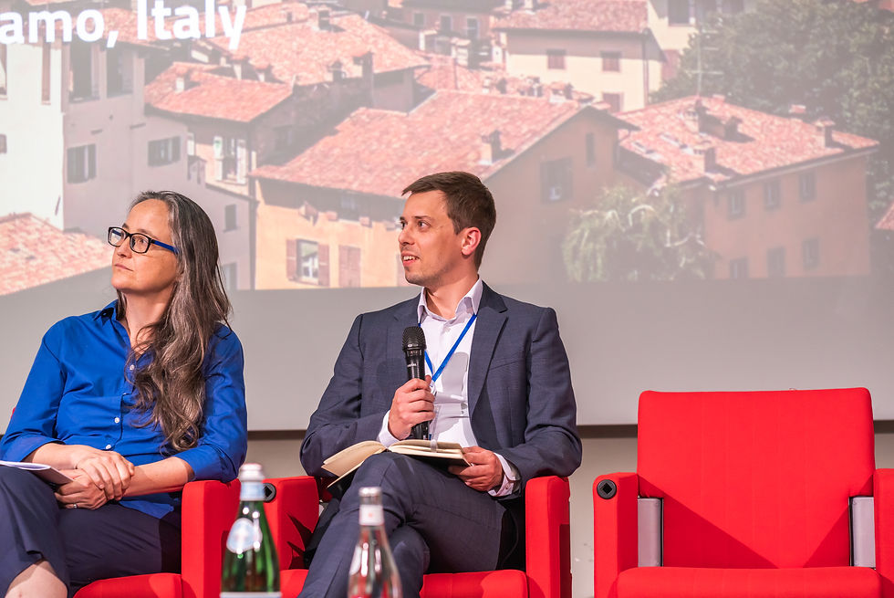
Bergamo, Italy: venue of the GEM 2023 Conference: Are we making a difference?
OVERVIEW
The recent devastating earthquake sequence that affected Türkiye and Syria reminded us again of the importance of our vision to reduce earthquake risk worldwide. This conference brought leading researchers and risk management experts worldwide together to discuss recent developments and future directions on the road to earthquake resilience.
The event featured sessions on GEM’s new global earthquake hazard and risk models, maps, and databases; applications to risk reduction and management; and the future of earthquake risk assessment science and practice.
Speakers & Panelists
Session Title

More invited speakers coming soon!
AGENDA
Session Title
Collapsible text is great for longer section titles and descriptions. It gives people access to all the info they need, while keeping your layout clean. Link your text to anything, or set your text box to expand on click. Write your text here...
Auditorium
Time | Topic | Speaker | Organisation |
|---|---|---|---|
Session: GEM Global Release 2026 | |||
Daniel Gomez | |||
Marzia Santini | |||
Hugo Rodrigues | |||
Daniel Emilio | |||
Catalina Yepes | |||
Catarina Costa | |||
Lana Todorovic | |||
Christopher Brooks | |||
Karim Aljawhari | |||
Finn Løvholt
| |||
Vitor Silva | GEM | ||
09:30 - 10:00 | National seismic hazard assessment for dams: emphasis on Himalaya and Northeast Indian region | Mukat Lal Sharma | Indian Institute of Technology Roorkee |
10:00 - 10:30 | From fault data to fault sources in South America: Experiences and challenges from the GEM-SARA Project | Carlos Costa | Universidad Nacional de San Luis, Argentina |
10:30 - 11:15 | Coffee break + demos + posters | ||
11:15 - 11:45 | Understanding the Regional Variability of Ground Motion across South America for Subduction Earthquakes | Jorge Luis Paredes Estacio | University of Bristol, UK |
11:45 - 12:15 | Residual Analysis of Algerian Strong-Motion Data for GMPE Validation and Site-Effects Assessment | Faouzi Gherboudj | Centre National de Recherche en Génie Parasismique, Algeria |
12:15 - 12:45 | Closure of National seismic hazard modelling workshop | Marco Pagani | GEM Foundation |
12:45 - 13:00 | Closure of GEM Conference 2026 (in Main Auditorium) | ||
09:00 - 09:30 | Transforming Seismic Hazard Models to Industry-Ready Risk Models | Jochen Woessner | Moody's RMS, Switzerland |
09:00 - 09:30 | Australian National Seismic Hazard Model (NSHM) | Trevor Allen | Geoscience Australia |
09:30 - 10:00 | Probabilistic seismic hazard assessment for mainland France and the French Lesser Antilles islands | Céline Beauval | ISTerre, France |
10:00 - 10:30 | New Zealand NSHM | Matt Gerstenberger | Earth Sciences New Zealand |
10:30 - 11:15 | Coffee break + demos + posters | ||
11:15 - 11:45 | Seismic Hazard Assessment in Japan: Recent Updates and Emerging Challenges | Asako Iwaki | NIED, Japan |
11:45 - 12:15 | The USGS National Seismic Hazard Models and Their Use in U.S. Building Codes | Nico Luco | U.S. Geological Survey |
12:15 - 12:45 | Swiss NSHM | Laurentiu Danciu | SED/ETH Zurich, Switzerland |
12:45 - 14:15 | Lunch | ||
14:15 - 14:45 | Probabilistic Seismic Hazard Assessment for Taiwan: Updates and Improvements in TEM PSHA2025 | Chung-Han Chan | Earthquake-Disaster & Risk Evaluation and Management (E-DREaM) Center, Taiwan |
14:45 - 15:15 | Italian NSHM | Akinci and D'Amico | INGV, Italy |
15:15 - 15:45 | Progress towards updating Canada’s National Seismic Hazard and Risk Models | Michal Kolaj | Natural Resources Canada |
15:45 - 16:30 | Coffee break + demos + posters | ||
16:30 - 17:00 | Country-Scale Seismic Hazard Assessment in Data-Scarce Regions of the East African Rift | Mohammed Al-Ajamee | University of Khartoum, Sudan |
17:00 - 17:30 | NSHM Guidelines | ||
17:30 - 18:00 | Discussion | ||
09:00 - 09:10 | Welcome to day 3 | Helen Crowley | GEM Foundation |
Session: Scenarios and Cascading Hazards
Moderator: Indranil Kongar, University College London | |||
09:10 - 09:25 | The Global Tsunami Model association Probabilistic Tsunami Hazard Model (GTMTHM26) progress | Stefano Lorito | INGV, Italy |
09:25 - 09:40 | From Hazard Science to Actionable Insights: Bridging the Global Tsunami Risk Gap for Societal and Financial Resilience | Naveen Ragu Ramalingam^ | Norwegian Geotechnical Institute |
09:40 - 09:55 | Toward Enhanced Portfolio Seismic Risk Estimates via Physics-Based Ground Motion Simulations | Preetish Kakoty | University College London, UK |
09:55 - 10:10 | A Methodology for Modeling of Mainshock-Aftershock Seismic Loss Assessment | Ömer Faruk Kalayci* | Istanbul Technical University, Turkey |
10:10 - 10:25 | Modelling earthquake sequences: When does damage accumulation matter? | Cecilia Nievas | GFZ Helmholtz Centre for Geosciences, Germany |
10:25 - 10:40 | Rethinking uncertainties for seismic hazard scenarios: A case study of the Lembang and Cimandiri faults in Indonesia | Ekbal Hussain | British Geological Survey |
10:40 - 11:25 | Coffee break + demos + posters | ||
Session: Recent Damaging Earthquakes and Emergency Response
Moderator: Alexandru Tiganescu | |||
11:25 - 11:40 | Was the 30 September 2025 Mw6.9 Offshore Northern Cebu Earthquake Effectively Forecasted Using Event-Based Probabilistic Seismic Risk Assessment (EBSPRA)? | Azdine Kay Ysulan* | Philippine Institute of Volcanology and Seismology |
11:40 - 11:55 | Towards the Development of Static Ground Displacement and Transient Ground Strain ShakeMaps | David Wald | U.S. Geological Survey |
11:55 - 12:10 | Developing PAGER 2.0: Next Generation Forecasts to Inform Rapid Global Earthquake Response | Kishor Jaiswal | U.S. Geological Survey |
12:10 - 12:25 | Towards uncertainty-based tsunami exposure models for rapid post-event assessment | Finn Løvholt | Norwegian Geotechnical Institute |
12:25 - 12:45 | Invited Talk: Title TBD | Marzia Santini | Joint Research Centre, Italy |
12:45 - 13:00 | Closure of GEM Conference 2026 | Helen Crowley | GEM Foundation |
13:00 - 14:30 | Lunch / Governing Board Meeting | ||
15:00 | Field Trip | ||
09:00 - 09:10 | Welcome to day 2 | Helen Crowley | GEM Foundation |
Session: Dynamic Exposure Modelling
Moderator: TBD | |||
09:10 - 09:30 | Invited Talk: Forward‑looking Exposure Modelling for Human‑centred Urban Disaster Mitigation | Carmine Galasso | University College London, UK |
09:30 - 09:45 | Machine Learning Forecasting Techniques for Earth Observation Data | Christian Geiß | German Aerospace Center |
09:45 - 10:00 | Spatial Disaggregation and Temporal Projection of Building Exposure and Physical Vulnerability using Deep Constrained Clustering and Probabilistic Graph Deep Learning | Joshua Dimasaka* | University of Cambridge, UK |
10:00 - 10:15 | Predicting population displacement due to earthquakes globally | Nicole Paul | University College London, UK/ETH Zurich, Swizterland |
10:15 - 10:30 | Baseline Survey Framework for GEM-Standardised National Building Exposure Model towards Earthquake Risk Assessment in Uganda | Morris Oleng* | National Building Review Board, Uganda |
10:30 - 11:30 | Coffee break + demos + posters | ||
Session: Next Generation Vulnerability
Moderator: Ana Beatriz Acevedo, EAFIT University, Colombia | |||
11:30 - 11:45 | A Framework for Assessing the Seismic Vulnerability of Indonesian Infilled Masonry Dwellings | Angga Sabaruliman | The University of Sydney, Australia |
11:45 - 12:00 | Integrated Seismic Risk Assessment for Masonry Structures in the Marmara Region: AEM-Based Simulations and PML Comparative Analysis | Seyhan Okuyan Akcan^ | Boğaziçi University, Turkey |
12:00 - 12:15 | Reduction of seismic risk for typical URM residential buildings in Zagreb using target retrofitting | Ante Pilipović | University of Zagreb, Croatia |
12:15 - 12:30 | From spatial correlation to damage dependence and IM conversion in seismic risk models | Gerard O'Reilly | IUSS Pavia, Italy |
12:30 - 12:45 | Vulnerability modelling for embodied carbon (title TBD) | Karim Aljawhari | GEM Foundation |
12:45 - 14:15 | Lunch | ||
Session: Disaster Risk Reduction Applications
Moderator: Jenty Kirsch Wood, UNDRR | |||
14:15 - 14:30 | Reducing Disaster Risk: Translating Technical Models to Implementation | Veronica Cedillos | GeoHazards International, USA |
14:30 - 14:45 | Implementing and Scaling Up Earthquake Desks: A Practical Disaster Risk Reduction Application for Schools | Sweata Sijapati* | GeoHazards International, Nepal |
14:45 - 15:00 | From Risk Modelling to Policy Development: Early Applications of Canada’s National Seismic Risk Model | Carlos Molina Hutt | University of British Columbia, Canada |
15:00 - 15:15 | Scenario Risk Results for the Department of Antioquia (Colombia) | Ana Beatriz Acevedo | EAFIT University, Colombia |
15:15 - 15:45 | Panel Taking stock: Measuring impact in disaster risk reduction
Moderator: Jenty Kirsch Wood, UNDRR | ||
15:45 - 16:45 | Coffee break + demos + posters | ||
Session: Financial Risk Transfer
Moderator: Laurie Johnson, Laurie Johnson Consulting | |||
16:45 - 17:00 | Invited Talk: Title TBD | Iwan Stalder | Zurich Insurance, Switzerland |
17:00 - 17:15 | Building a Nationwide, Seismic Sensor-based, Parametric Earthquake Insurance Program for Morocco | Evan Reis | Safehub, USA |
17:15 - 17:30 | GEM Product Applications in the (Re)insurance Industry | Molly Gallahue | Gallagher Re, UK |
17:30 - 17:45 | Understanding Earthquake Catastrophe Risk in the Balkans: A new Guy Carpenter Model | Robert Churchill | Guy Carpenter, UK |
17:45 - 18:00 | Advancing Catastrophe Models with Earthquake-Triggered Secondary Geoperils: A Case Study for Italy | Abril Sanchez | Aon/Impact Forecasting, Czech Republic |
Furkan Narlitepe | IUSS Pavia/GEM Foundation | ||
Karim Aljawhari | GEM Foundation | ||
Al Mouayed Bellah Nafeh | GEM Foundation | ||
09:00 - 09:10 | Institutional Welcome | TBD | |
09:10 - 09:20 | CCEE and GEM | Josip Atalic | University of Zagreb |
09:20 - 09:30 | Welcome to the GEM Conference 2026 | Helen Crowley | GEM Foundation |
09:30 - 10:00 | Global Seismic Hazard v2026 | Marco Pagani | GEM Foundation |
10:00 - 10:30 | Global Seismic Risk v2026 | Vitor Silva | GEM Foundation |
10:30 - 11:30 | Coffee break + GEM demos + GEM PhD posters | ||
11:30 - 13:00 | GEM's Seismic Hazard Mosaic | Kendra Johnson | GEM Foundation |
Global Block Model (Active Faults Database) | Richard Styron | GEM Foundation | |
Global Stochastic Event Set (SEESAWS) | Manuela Vilani | GEM Foundation | |
Global Earthquake Catalogue | Kirsty Bayliss | GEM Foundation | |
Global Ground Motion Flat File | Christopher Brooks | GEM Foundation | |
13:00 - 14:30 | Lunch | ||
14:30 - 14:45 | GEM's New Vulnerability Modelling Framework | Al Mouayed Bellah Nafeh | GEM Foundation |
POSTERS & DEMOS
Showcasing GEM Integration, Innovative Tools, and Advanced Data for Enhanced Hazard and Risk Assessment
Abstract

TREQ Project Understanding earthquake risk at the urban and city levels
Alejandro Calderon
Seismic Risk Engineer
GEM
Abstract

GEM Foundation Global Interactive Maps
Paul Henshaw
Director of Technology and Development
GEM
Abstract

Interactive earthquake demo, simulating how Safehub sensors work using a K'NEX Building Model
Andy Thompson
CEO and Co-Founder
Safehub
Abstract

Leveraging and Improving GEM Tools to Model and Communicate Integrated Risk and Resilience to Earthquakes
Christopher Burton
Professor
University of Connecticut
Abstract

New Frontiers of Earthquake Model development: Aon Impact Forecasting and GEM partnership
Athanasios Gkimprixis
Earthquake Catastrophe Model Developer
Aon Impact Forecasting
Abstract

RiskProfiler.ca Sharing earthquake risk assessment results in Canada
Malaika Ulmi
Public Safety Geoscience Program Manager
NRCan
Abstract

NEEV a digital platform to remote resilience and sustainability within low income Communities
Marco Ferrario
Co-Founder
MHS Global Impact
Abstract

Multi-hazard risk assessment and mapping in West Bank & Gaza using GEM standards, models, tools & technologies
Jamal Dabbeek
Professor
An-Najah National University
Abstract

Applications of Global Economic Disruption Index (GEDI) in Multi-Hazard Disaster Response, Mitigation and Planning
Shubaroop Ghosh
Vice President of Data Services
ImageCat
Abstract

Exploring new data analysis techniques on an extended earthquake catalogue for evaluating seismic hazard in Europe
Jochen Woessner
Senior Principal Modeller
Moody’s RMS
REGISTRATION
The GEM Conference: Are we making a difference? is available in a hybrid format. The event is by invitation only for in-person attendance. It is open for online registration for those who wish to attend virtually. If you'd like to join virtually, click the online registration buttons below. Contact communication@globalquakemodel.org if you have any inquiries or clarifications.
If you have not registered on Zoom by the start of the event, you can still watch and participate. The conference will be live-streamed on GEM's YouTube channel on June 13th and 14th. To watch the event live, click the "LIVE" button below once it has been activated. You can submit your questions in the comments section, and GEM staff will monitor and submit them on your behalf.
LOCATION
HOTEL
NH HOTEL BERGAMO
MERCURE BERGAMO
BEST WESTERN HOTEL PIEMONTESE
ARLI HOTEL BUSINESS & WELLNESS
TRANSPORTATION
TRANSFERS FROM BERGAMO AIRPORT TO BERGAMO
https://www.atb.bergamo.it/en/atb-network/tourism-in-bergamo/airport-bus
BERGAMO AIRPORT WEBSITE
https://www.milanbergamoairport.it/en/
ORIOSHUTTLE (FROM MALPENSA AIRPORT TO BERGAMO ORIO AL SERIO AIRPORT)
http://www.orioshuttle.com/_eng/
CAPITAL OF ITALIAN CULTURE FOR 2023
RESOURCES
Conference resources for downloading
Videos
Gallery
Maps
Recording
Videos


Gallery




Maps
Recording
