Thanks for submitting!
You will be contacted as soon as possible


QUICK LINKS


PROFILES
PUBLICATIONS
EXPOSURE
VULNERABILTY
SOFTWARE
EQ MODELS
Search Results
Search this site
1145 results found with an empty search
- A Building Classification System for Multi-hazard Risk Assessment | GEM Foundation
Publications A Building Classification System for Multi-hazard Risk Assessment Share Facebook LinkedIn Download 2022 | Peer-reviewed A uniform and comprehensive classification system, often referred to as taxonomy, is fundamental for the characterization of building portfolios for natural hazard risk assessment. A building taxonomy characterizes assets according to attributes that can influence the likelihood of damage due to the effects of natural hazards. Within the scope of the Global Earthquake Model (GEM) initiative, a building taxonomy (GEM Building Taxonomy V2.0) was developed with the goal of classifying buildings according to their seismic vulnerability. This taxonomy contained 13 building attributes, including the main material of construction, lateral load-resisting system, date of construction and number of stories. Since its release in 2012, the taxonomy has been used by hundreds of experts working on exposure and risk modeling efforts. These applications allowed the identification of several limitations, which led to the improvement and expansion of this taxonomy into a new classification system compatible with multi-hazard risk assessment. This expanded taxonomy (named GED4ALL) includes more attributes and several details relevant for buildings exposed to natural hazards beyond earthquakes. GED4ALL has been applied in several international initiatives, enabling the identification of the most common building classes in the world, and facilitating compatibility between exposure models and databases of vulnerability and damage databases.
- ATLAS 2.0: Ground-shaking intensities at multiple return periods all over the world | GEM Foundation
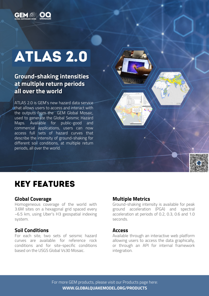
Publications ATLAS 2.0: Ground-shaking intensities at multiple return periods all over the world Share Facebook LinkedIn Download 2024 | Brochure ATLAS 2.0 is GEM’s new hazard data service that allows users to access and interact with the outputs from the GEM Global Mosaic, used to generate the Global Seismic Hazard Maps. Available for public-good and commercial applications, users can now access full sets of hazard curves that describe the intensity of ground-shaking for different soil conditions, at multiple return periods, all over the world.
- Global homogenised earthquake catalogue | GEM Foundation
License Request Form You have chosen to get more information about: Global homogenised earthquake catalogue Hazard Please check the link below to see if this product already meets your your requirements before submitting your request for a license. Thank you. DOWNLOAD THE OPEN VERSION Summary of steps to obtain a license for the requested product. Fill in the application form below. Click Submit. Please check your email Inbox or Spam folder for the summary of your request. You will then be contacted by the GEM Product Manager with either a request for more information, or a request to sign the license. If you do not hear from us within 2 weeks, please send an email to product@globalquakemodel.org . REQUEST DETAILS A. Requesting party information First Name Last Name Role/Job Email Business type Business type Other business Sector Sector Other sector B. License agreement signatory information The signatory must be someone who is authorised to sign license agreements on your behalf such as your immediate supervisor, manager or legal officer. If you’re a PhD student, the signatory must be your adviser or a university officer in charge of license agreements or similar legal documents. Full Name of Signatory Position Company Email of Signatory Organisation name Complete Address C. Purpose of request GEM is able to offer products for free because of the support of our project partners, national collaborators and institutional sponsors. All of GEM’s products are freely available for public good, non-commercial use, but with different license restrictions. In most cases we release products under an open license (e.g., CC BY-SA or CC BY-NC-SA), which permits (re)distribution. In this case, we are granting access under a more restricted license that forbids distribution or disclosure and requires signing by GEM and the licensee in order to better assure accountability for the confidentiality of the information. In order for GEM to properly assess your request, please answer the following questions below. 1. Explain briefly how will the GEM product be used e.g. project, research including the expected results and the foreseen public benefit. Minimum 60 words. 2. Will you be able to share the results of your work with GEM? YES NO 3. Will you be able to provide feedback to GEM on the quality and usefulness of this product via a survey? YES NO D. Privacy Policy By submitting this form, you consent to the processing of your personal data in accordance with our Privacy Policy and the EU General Data Protection Regulation (GDPR). We are committed to safeguarding your information and ensuring it is only used for the purpose outlined in this form. You have the right to access, rectify, or delete your data at any time. For more information, please refer to our Privacy Policy. I agree Words: 0 Email us at product@globalquakemodel.org if you're experiencing problems submitting your application. Thank you. Submit Thanks for submitting! You will be contacted as soon as possible Incomplete data. Please fill in all required fields. Thank you.
- Indonesia Hazard | Global EarthQuake Model Foundation
OpenQuake engine input model to perform hazard calculations for Indonesia Products Indonesia Hazard OpenQuake engine input model to perform hazard calculations for Indonesia Share Facebook LinkedIn Description The v2024 model was developed by the Team for Updating Seismic Hazard Maps of Indonesia. The team belongs to the National Center for Earthquake Studies under the Directorate Engineering Affairs for Buildings and Environmental Health, Directorate General of Human Settlements, Ministry of Public Works. Ministries involved: Ministry of Public Works; Ministry of Energy and Mineral Resources; Ministry of Transportation; The Ministry of Higher Education, Science, and Technology; and National Disaster Management Authority of Indonesia. Organizations involved: Bureau of Meteorology, Climatology and Geophysics; The National Research and Innovation Agency; Geospatial Information Agency; Centre of Volcanology and Geological Hazard Mitigation; Indonesian Academy of Sciences; Bandung Institute of Technology; University of Indonesia; University of Gajah Mada; University of Diponegoro; November 10 Institute of Technology Surabaya; National Institute of Science and Technology; Indonesian Society for Geotechnical Engineering; and Indonesian Disaster Expert Association, Indonesian Society of Civil and Structural Engineers. The team collaborated internationally with Geoscience Australia, Australia and U.S. Geological Survey. The previous model (v2017.1.0) was a slightly modified version of the model developed by the Team for Updating Seismic Hazard Maps of Indonesia of the National Center for Earthquake Studies, Indonesia (Irsyam et al., 2017). How to cite this work M. Irsyam, S. Widiyantoro, L. Faizal., D.H. Natawidjaja, I. Meilano, W. Triyoso, D. Djarwadi, A.D.Nugraha, M. Asrurifak, B. Suhendro, W.A. Prakoso, S. Pramono, P. Suprobo, P. Cummins, M. Petersen, M. Pagani Publication: https://ciptakarya.pu.go.id/admin/assets/upload/galeri/gempa/2026/02/10/887359_0.%20Final_BUKU_PETA_SUMBER_DAN_BAHAYA_GEMPA_2024_Publish.pdf Available Versions The open versions (v2024.0.0) is available for direct download under a CC BY-NC-SA 4.0 license. Users interested in this version can click the "Open Version Download" button in the right panel to access the information. If your use case does not comply with the license terms, a license can be requested by clicking on the "License Request", where a specific agreement will be provided, depending on the use case. Previous versions of this model are listed in the table at the bottom of this page. License information The open version is available under a Creative Commons CC BY-NC-SA 4.0 license, which requires: Attribution (you must give appropriate credit, provide a link to the license, and indicate if changes were made) Non-commercial (you may not use the material for commercial purposes) ShareAlike (derivatives created must be made available under the same license as the original) Any deviation from these terms incur in license infringement. For commercial use of the model, a specific license agreement must be made tailored to your use case, in such instance please click on "License Request". Facebook LinkedIn Share Latest Version v2024.0.0 License CC BY-NC-SA 4.0 Available resources Open Version Download Documentation License Request text Map View Search Popup title Close Country/Region Available Resources Afghanistan Exposure Africa Exposure Alaska Exposure Country/Region Available Resources Afghanistan Vulnerability Africa Vulnerability Alaska Vulnerability Country/Region Resource Url Afghanistan Risk Profile Africa Risk Profile Alaska Risk Profile Search Found Country/Region Resource Url Afghanistan Exposure Africa Exposure Alaska Exposure Preview Preview is not available. Search Found Country/Region Resource Url Afghanistan Vulnerability Africa Vulnerability Alaska Vulnerability Preview Preview is not available. Search Found Country/Region Resource Url Afghanistan Risk Profile Africa Risk Profile Alaska Risk Profile Preview Preview is not available. Previous Product Versions Product Version License Documentation Access Request / Open Repository v2017.1.0 CC BY-SA 4.0 Read https://cloud.openquake.org/s/zsoZY55oe2gSwFZ Related products Global Liquefaction Hazard Global Exposure Model Global Vulnerability Model Global Seismic Embodied Carbon Risk Global Seismic Risk Map Country-Territory Seismic Risk Profiles Model Builder's Toolkit (oq-mbtk) Global Seismic Hazard Map Related publications For downloading or accessing detailed product information like PNG/PDF maps, datasets, license request, shapefiles and more, please switch to a desktop or laptop computer. Thank you for your understanding.
- Seismic Risk Model for the Beijing–Tianjin–Hebei Region, China-Considering Epistemic Uncertainty from the Seismic Hazard Models | GEM Foundation
Publications Seismic Risk Model for the Beijing–Tianjin–Hebei Region, China-Considering Epistemic Uncertainty from the Seismic Hazard Models Share Facebook LinkedIn Download 2024 | Peer-reviewed This study presents a probabilistic seismic risk model for the Beijing–Tianjin–Hebei region in China. The model comprises a township-level residential building exposure model, a vulnerability model derived from the Chinese building taxonomy, and a regional probabilistic seismic hazard model. The three components are integrated by a stochastic event-based method of the OpenQuake engine to assess the regional seismic risk in terms of average annual loss and exceedance probability curve at the city, province, and regional levels. The novelty and uniqueness of this study are that a probabilistic seismic risk model for the Beijing–Tianjin–Hebei region in China is developed by considering the impact of site conditions and epistemic uncertainty from the seismic hazard model.
- Africa Earthquake Model: brochure | GEM Foundation
Publications Africa Earthquake Model: brochure Share Facebook LinkedIn Download 2019 | Brochure The Africa Earthquake Hazard and Risk model underpin the African portion of GEM’s global maps released in December 2018. The Africa Model is composed of North Africa, West Africa, Eastern Sub-Saharan Africa and South Africa regional models, developed in collaboration with various African public and private institutions, national governments, and individual experts using the OpenQuake engine.
- Alaska Hazard | Global EarthQuake Model Foundation
OpenQuake engine input model to perform hazard calculations for Alaska Products Alaska Hazard OpenQuake engine input model to perform hazard calculations for Alaska Share Facebook LinkedIn Description The 2007.0.0 seismic hazard model for Alaska (USA) was developed by the United States Geological Survey (Wesson et al., 2007). The model covers the state of Alaska including the Aleutian Islands. The model has been translated from its original format into the OpenQuake (OQ) engine by GEM. Since the original version, two updates were made to the model by the GEM hazard team, leading to the latest release (v2007.2.0), which was used in the computation of the 2026 Global Earthquake Hazard Maps. How to cite this work Wesson, Robert L., Boyd, Oliver S., Mueller, Charles S., Bufe, Charles G., Frankel, Arthur D., Petersen, Mark D., 2007, Revision of time-Independent probabilistic seismic hazard maps for Alaska: U.S. Geological Survey Open-File Report 2007-1043 Available Versions The latest version (v2007.2.0) is available for direct download under a CC BY-SA 4.0 license. Users interested in this version can click the "Open Version Download" button in the right panel to access the information. If your use case does not comply with the license terms, a license can be requested by clicking on the "License Request", where a specific agreement will be provided, depending on the use case. License information The latest version is available under a Creative Commons CC BY-SA 4.0 license, which requires: Attribution (you must give appropriate credit, provide a link to the license, and indicate if changes were made) ShareAlike (derivatives created must be made available under the same license as the original) Any deviation from these terms incur in license infringement and requires a license agreement that must be made tailored to your use case, in such instance please click on "License Request". Facebook LinkedIn Share Latest Version v2007.2.0 License CC BY-SA 4.0 Available resources Open Version Download Documentation License Request text Map View Search Popup title Close Country/Region Available Resources Afghanistan Exposure Africa Exposure Alaska Exposure Country/Region Available Resources Afghanistan Vulnerability Africa Vulnerability Alaska Vulnerability Country/Region Resource Url Afghanistan Risk Profile Africa Risk Profile Alaska Risk Profile Search Found Country/Region Resource Url Afghanistan Exposure Africa Exposure Alaska Exposure Preview Preview is not available. Search Found Country/Region Resource Url Afghanistan Vulnerability Africa Vulnerability Alaska Vulnerability Preview Preview is not available. Search Found Country/Region Resource Url Afghanistan Risk Profile Africa Risk Profile Alaska Risk Profile Preview Preview is not available. Related products Global Liquefaction Hazard Hawaii Hazard Global Seismic Risk Map Country-Territory Seismic Risk Profiles Global Seismic Embodied Carbon Risk Conterminous US Hazard Global Seismic Hazard Map Model Builder's Toolkit (oq-mbtk) Global Exposure Model Global Vulnerability Model Related publications For downloading or accessing detailed product information like PNG/PDF maps, datasets, license request, shapefiles and more, please switch to a desktop or laptop computer. Thank you for your understanding.
- Request demo for South Asia Exposure | GEM Foundation
You have chosen to request a demo on: South Asia Exposure First Name Last Name Email Company or Institution Name Country Sector Provide Details I accept the license terms and the conditions of products use. Email us at product@globalquakemodel.org if you're experiencing problems submitting this form or if you have any inquiries. Thank you. Request Thanks for submitting! You will be contacted as soon as possible Add answer here
- Remote Sensing for Building Inventory Generation: GEM-Driven Global Solutions | GEM Foundation
Publications Remote Sensing for Building Inventory Generation: GEM-Driven Global Solutions Share Facebook LinkedIn Download 2011 | Peer-reviewed Not available
- Request demo for OpenQuake Engine | GEM Foundation
You have chosen to request a demo on: OpenQuake Engine First Name Last Name Email Company or Institution Name Country Sector Provide Details I accept the license terms and the conditions of products use. Email us at product@globalquakemodel.org if you're experiencing problems submitting this form or if you have any inquiries. Thank you. Request Thanks for submitting! You will be contacted as soon as possible Add answer here