Thanks for submitting!
You will be contacted as soon as possible


QUICK LINKS


PROFILES
PUBLICATIONS
EXPOSURE
VULNERABILTY
SOFTWARE
EQ MODELS
Search Results
1045 results found with an empty search
- Scenario impact assessment for volcanoes using the OpenQuake engine | GEM Foundation
Publications Scenario impact assessment for volcanoes using the OpenQuake engine Share Facebook LinkedIn Download 2025 | Peer-reviewed This study introduces a unified framework for evaluating the physical impacts of earthquakes and volcanic eruptions on buildings, leveraging upon the existing capabilities of the OpenQuake engine for earthquake risk assessment and various existing packages for computing volcanic hazard footprints. We illustrate the capabilities of the new OpenQuake volcanic scenario module using two case studies: a VEI (Volcanic Explosivity Index) 3-4 eruption of Nevado del Ruiz volcano in Colombia and a VEI 6 eruption of Mount Pinatubo in the Philippines, employing various methods for simulating hazard footprints for tephra fall, lava flows, pyroclastic density currents, and lahars. The findings demonstrate the versatility of OpenQuake in managing diverse geohazards and its potential for further extension to other hazards, while this integration advances our ability to assess and manage disaster risk.
- Presentation of the Dominican Republic seismic hazard model - GEM Foundation
News Presentation of the Dominican Republic seismic hazard model By: Sep 15, 2022 Share Facebook LinkedIn More than 100 people participated in the webinar presentation of the national probabilistic seismic hazard analysis (PSHA) model for the Dominican Republic held on June 14th. Servicio Geológico Nacional Dominicano (SGN) hosted the event in cooperation with GEM, Oficina Nacional de Evaluación Sísmica y Vulnerabilidad de Infraestructura, and USAID's Bureau for Humanitarian Assistance. The national seismic hazard model was developed in collaboration with SGN and with local scientists under the TREQ project. Due to the ongoing covid pandemic, the strong partnership was made possible through multiple online sessions with local executives and risk professionals. This approach demonstrated the importance of incorporating detailed information and local knowledge in the assessment of earthquake hazard and risk at the city or local level through participation and collaboration. GEM’s Kendra Johnson who led the development of the seismic hazard model for the Dominican Republic in the context of the TREQ project said, “This was really a collective effort with other scientists at the GEM Foundation and in the Dominican Republic. Completing this seismic hazard model is one of the important results of the TREQ project, and one that we hope will become more useful going forward, especially in its application in the seismic building code.” The report on the national PSHA model for the Dominican Republic developed by the project describes the PSHA input model and presents: i) the primary data sources and their preparation; ii) the methodology used to develop the seismic source characterization and to select ground motion models; iii) the hazard results computed; and iv) how the results compare to former models used to compute seismic hazard for the country. GEM worked closely with SGN whose staff had been very involved from the start, in particular Yesica Perez, Vladimir Guzman, Maria Betania Roque Quezada and Santiago Muñoz during the technical stages, and with Edwin Garcia, Freddy Duran, and the IT support at the later stages. Additionally, both the Universidad Autónoma de Santo Domingo and SGN contributed data that was especially useful in developing the hazard model. To download the model and documentation, please visit the model page at: https://www.globalquakemodel.org/product/dominican-republic-hazard-model . No images found. GALLERY 1/0 VIDEO RELATED CONTENTS
- GEM partners with Nasdaq and AIR Worldwide to provide earthquake risk models to the financial risk management sector - GEM Foundation
News GEM partners with Nasdaq and AIR Worldwide to provide earthquake risk models to the financial risk management sector By: Jul 25, 2020 Share Facebook LinkedIn A Nasdaq banner welcomes GEM in Times Square, New York, USA. GEM is pleased to announce its partnerships with Nasdaq and AIR Worldwide, which are expected to pave the way for GEM Foundation’s seismic hazard and risk models to become available via the Nasdaq Risk Modelling for Catastrophes and AIR Touchstone platforms. GEM’s OpenQuake models will be rendered into their respective OASIS LMF format, an open-source format developed by OASIS LMF, and Touchstone format using AIR’s Model Builder. The resulting models will support financial risk analysis including (re)insurance portfolios. Nasdaq and AIR will act as non-exclusive distributors of GEM models to their customers. This is the first time GEM, a non-profit Foundation specializing in seismic hazard and risk assessment, will partner with external risk model platform providers to market and demonstrate models for end user evaluation and distribute licenses for the purpose of modelling catastrophe risk. However, all models will be freely available in OQ for non-commercial, public-good use, and revenue from these partnerships will be used to maintain models and support activities in developing countries. GEM Secretary General, John Schneider, explains GEM’s role in the private and public sector with the signing of its respective agreements with Nasdaq and AIR and emphasizes the Foundation’s interest in diversifying its approach to make the latest risk information as accessible as possible to a broad range of stakeholders. “Fundamental to GEM’s success is the maintenance of the public-private partnership which is at the core of the Foundation’s governance and operational model. Making GEM models available via Nasdaq and AIR platforms can broaden our stakeholder reach and diversify how GEM models can be accessed. We are optimistic that this move will usher in a new chapter in GEM’s pursuit to reduce earthquake risk worldwide.” Nasdaq Risk Modelling for Catastrophes - powered by - enables insurers, reinsurers, brokers and corporates to unlock access to a broad range of catastrophe risk models from multiple vendors through a single service, increasing ease of model accessibility and strengthening risk management programs. Matthew Jones, Head of Catastrophe Risk Product at Nasdaq, said “This agreement means that we can now start providing GEM’s risk models on our service, filling essential gaps in the ability to assess earthquake risk globally. The industry wants choice and GEM is the 10th model developer to join the Nasdaq catastrophe risk modelling community, offering firms the strategic benefits of utilizing industry standards and Software as a Service, including ease of access to a wide choice of models and cost efficiency.” AIR Worldwide is a risk modeling and data analytics company headquartered in Boston, Massachusetts, with customers in insurance, reinsurance, financial services, and government markets. AIR’s Touchstone platform enables real-time decision-making that helps companies to make more informed underwriting, pricing, and risk management decisions; compare different views of risk; investigate the sensitivity of model assumptions; and satisfy regulatory reporting requirements. Jay Guin, Executive Vice President of AIR and Chief Research Officer, says, “This is a milestone for GEM. AIR has been a long-time sponsor of GEM and we are happy to be part of this new journey through AIR’s Touchstone platform. Model Builder enables clients to access additional views of risk while leveraging Touchstone’s financial module, scalability and performance capabilities. We will continue to support GEM’s efforts to promote openly available and accessible risk information.” Click the linked texts for more on and . No images found. GALLERY 1/2 Gallery VIDEO RELATED CONTENTS
- GRII agreement signing with UNDRR, University of Oxford, and GEM Foundation - GEM Foundation
News GRII agreement signing with UNDRR, University of Oxford, and GEM Foundation By: Jun 28, 2023 Share Facebook LinkedIn GEM Foundation has signed an important agreement between the Insurance Development Forum (IDF), the UNDRR, and Oxford University to collaborate on the Global Resilience Index Initiative (GRII). The GRII was established to make climate risk data available to governments and financial institutions to inform and foster climate-resilient investments worldwide. GEM’s inclusion in this partnership recognises that GEM’s expertise, tools, data and collaboration framework can also be applied to assessing climate change impacts and risks. I.T. represents an important link for GEM with the climate change risk assessment community. Zurich, Switzerland, 1 June 2023: Today at the IDF Summit 2023, the UN Office for Disaster Risk Reduction (UNDRR), the Insurance Development Forum (IDF), the University of Oxford, and the GEM Foundation signed a new agreement to advance the Global Resilience Index Initiative (GRII) and establish a Global Resilience Hub to help countries, financial institutions and investors, map and quantify their current and future climate and disaster risks and demonstrate the benefits of investing in resilience. The collaboration will prevent leaders from ‘flying blind’ on physical climate risk and focus vital investments on areas of greatest need. Combining the insurance industry’s unparalleled foresight and modelling expertise, with the best UN and scientific data, the GRII will work with financial institutions and governments and capacity building programmes such as the Global Risk Modelling Alliance to improve the metrics and analysis essential to mobilise finance for adaptation and to better understand potential future loss and damage. An Operational Launch is planned for COP28 in Dubai and has been enabled by new in-kind and funding support from Climate Arc, the World Bank and the ongoing support of the UNDRR, UKCGFI, UK Research and Innovation, and the IDF. Further upgrades are being planned for COP29 in Australia assuming additional resources become available. Announced at COP26 under the mandate of UN Special Envoy for Climate Action & Finance, Mark Carney, the GRII provides critical data and metrics to save lives, mobilise finance for adaptation and incentivise resilient development. The initiative has gained remarkable traction as concerns over climate resilience have grown in the wake of recent disasters across both developed and developing countries. The data challenge has required an unprecedented collaboration across public, private and academic sectors combining resources and sharing expertise. GRII will respond to this challenge and the growing demand and will work to provide metrics, tools and guidance to support financial institutions, businesses and governments to increase investment in adaptation. Speaking at the IDF Summit 2023 Summit in Zurich, Switzerland, GRII patron and UN Special Representative for Disaster Risk Reduction, Mami Mizutori, said: “Currently, we know that only about 4 percent of all official development assistance related to disasters goes into prevention; the rest goes into response and recovery. This is not sustainable in the face of growing climate risks. There must be a rebalance towards investing more in prevention. The GRII helps point to where investment is needed and can have the most impact. By directing investments and resources to reduce climate risks before they create disasters, countries can build a sustainable resilient future for all.”By December it is expected that the GRII will provide open-access data to support solutions to some of the biggest challenges at CoP28 including climate adaptation investment and loss and damage implementation. Meryam Omi, Chief Executive, Climate Arc, founding funder of the new Hub, said, “Climate Arc is proud to support GRII’s work to improve the availability of physical climate risk and resilience data. GRII’s open, transparent asset-level data will support public and private financial institutions in accelerating the mobilisation of finance for adaptation and resilience in emerging and developing economies. We look forward to seeing the initiative continue to grow and reach even greater scale and impact in the future.”The worldwide risk modelling collaboration and work with financial institutions is coordinated by a Global Resilience Hub, hosted by Oxford University . Dr Nicola Ranger, Director of the new Hub and Leader, Resilience and International Development at the Environmental Change Institute, University of Oxford, said: “Oxford has a strong record of advancing frontier science to save lives through public private academic collaboration. The data we are collectively building and making available through the Global Resilience Index Initiative is urgently needed to close the gap in investment in adaptation and nature-based solutions to protect people, prosperity and the planet and align finance with climate resilient development. We’re delighted to be working with partners internationally to deliver this important initiative.” John Schneider, Secretary General of the GEM (Global Earthquake Model) Foundation , a public-private partnership that is committed to reducing the risk of earthquakes and other natural hazards worldwide, said: “GEM recognises that the tools for assessing earthquake risk can be leveraged to assist in assessing climate change impacts and risks. Moreover, an understanding of physical and socio-economic vulnerability and the evolution of our natural and built environment are fundamental to understanding all of these risks. It is exciting to be part of the GRI Initiative to bring our collective expertise and information to the table.”The GRII has been coordinated by the Insurance Development Forum the platform co-chaired by the UN, World Bank and Industry to support practical climate resilience measures. The GRII is seen as key to directing financial flows towards resilient investments including homes, schools and infrastructure. Michel Liès, Chair of the Insurance Development Forum and Zurich, said: “We are delighted that the GRII has reached this important milestone in its capabilities, resources and governance. Our thanks to all our partners and supporters who have joined this collective endeavour to solve this grand challenge on the Race to Resilience.” Link to the press release: https://www.insdevforum.org/press-release-un-insurance-and-academic-leaders-sign-agreement-to-draw-upon-insurance-data-and-expertise-to-advance-climate-and-disaster-risk-analytics-and-help-mobilise-finance-for-adaptation/ No images found. GALLERY 1/0 VIDEO RELATED CONTENTS
- A UNISDR survey is underway to help develop an international framework for sharing risk information and promoting a pro-active culture of risk-informed decision-making - GEM Foundation
News A UNISDR survey is underway to help develop an international framework for sharing risk information and promoting a pro-active culture of risk-informed decision-making By: Mar 20, 2019 Share Facebook LinkedIn The UNISDR is currently conducting a survey to inform the development of a Global Risk Assessment Framework (GRAF). The information will be used to develop an initial assessment and understanding of the profiles of potential users of GRAF and their needs (existing and anticipated) with the goal of establishing an international framework for developing and sharing risk information and promoting a pro-active culture of risk-informed decision-making. The survey was developed by the GRAF Mapping & Gap Analysis Working Group, co-led by John Schneider (GEM) and John Rees (BGS representative the GEM Governing Board), which is providing expert advice to the the UNISDR on the GRAF. Inasmuch as GEM itself is a part of the envisaged GRAF, GEM also aims to use the results of the survey to inform GEM’s strategic planning process. Therefore, for the benefit of the GRAF and GEM, we would very much appreciate your filling out the questionnaire. The GRAF and GEM would like to better understand: how your organisation is perceiving the barriers and opportunities for leveraging disaster risk management from different angles, including: i. Geographic scales – from global, national, sub-national, to local; ii. Risk dimensions – hazard, exposure and vulnerability; iii. Impact dimensions – human, ecological, economic, infrastructural and political. The questionnaire has nine questions and takes about 10-20 minutes to complete. We would very much appreciate your responses by 1st April. Thank you in advance for your participation. << TAKE THE SURVEY >> No images found. GALLERY 1/4 VIDEO RELATED CONTENTS
- Global Recovery Map
Global Earthquake Maps Global Recovery Map VIEWER PDF PNG CONTRIBUTORS DOCUMENTATION References Burton C.G. (2015). A Validation of Metrics for Community Resilience to Natural Hazards and Disasters using the Recovery from Hurricane Katrina as a Case Study. 150(1):67–86. Cutter, S.L., Burton, C.G. and Emrich, C. (2010). Disaster Resilience Indicators for Benchmarking Baseline Conditions. , 7(1): 1-22. Cutter, S.L., Barnes, L., Berry, M., Burton, C.G., Evans, E., Tate, E.C. and Webb, J. (2008). A Place-based Model for Understanding Community Resilience to Natural Disasters. 18: 598-606. Despotaki*, V., Sousa, L., and Burton, C.G., (2018). Using Socio-economic Indicators for Earthquake Recovery Prediction. Earthquake Spectra, 34: 265-282. TECHNICAL DESCRIPTION The Recovery/Reconstruction Potential Map is closely aligned with the concept of disaster resilience. Enhancing a country’s resilience to earthquakes is to improve its capacity to anticipate threats, to reduce its overall vulnerability, and to allow its communities to recover from adverse impacts from earthquakes when they occur. The measurement of recovery and reconstruction potential includes capturing inherent conditions that allow communities within a country to absorb impacts and cope with a damaging earthquake event, such as the density of the built environment, education levels, and political participation. It also encompasses post event processes that facilitate a population’s ability to reorganize, change, and learn in response to a damaging earthquake. Criteria for indicator selection To choose indicators contextually exclusive for use in each map, the starting point was an exhaustive review of the literature on earthquake social vulnerability and resilience. For a variable to be considered appropriate and selected, three equally important criteria were met: - variables were justified based on the literature regarding its relevance to one or more of the indices. - variables needed to be of consistent quality and freely available from sources such as the United Nations and the World Bank; and - variables must be scalable or available at various levels of geography to promote sub-country level analyses. This procedure resulted in a ‘wish list’ of approximately 300 variables of which 78 were available and fit for use based on the three criteria. Process for indicator selection For variables to be allocated to an index, a two-tiered validation procedure was utilized. For the first tier, variables were assigned to each of the respective indices based on how each variable was cited within the literature, i.e., as being part of an index of social vulnerability, economic vulnerability, or recovery/resilience. For the second tier, machine learning and a multivariate ordinal logistic regression modelling procedure was used for external validation. Here, focus was placed on the statistical association between the socio-economic vulnerability indicators and the adverse impacts from historical earthquakes on a country-by country-basis. The Global Significant Earthquake Database provided the external validation metrics that were used as dependent variables in the statistical analysis. To include both severe and moderate earthquakes within the dependent variables, adverse impact data was collected from damaging earthquake events that conformed to at least one of five criteria: 1) caused deaths, 2) caused moderate damage (approximately $1 million USD or more), 3) had a magnitude 7.5 or greater 4) had a Modified Mercalli Intensity (MMI) X or greater, or 5) generated a tsunami. This database was chosen because it considers low magnitude earthquakes that were damaging (e.g., MW >=2.5 & MW<=5.5) and contains socio-economic data such as the total number of fatalities, injuries, houses damaged or destroyed, and dollar loss estimates in $USD. Countries not demonstrating at least a minimal earthquake risk, i.e., seismicity <0.05 PGA (Pagani et al. 2018) and <$10,000 USD in predicted average annual losses (Silva et al. 2018) were eliminated from the analyses so as not to include countries with minimal to no earthquake risk. A total study area consists of 136 countries. The Global Earthquake Model (GEM) Foundation The Global Socio-Economic Vulnerability Maps 2020 is a product of the GEM Foundation’s collaborative work with the Department of Geography at the University of Connecticut, USA. GEM is a non-profit foundation in Pavia, Italy funded through a public-private partnership with a vision to create a world that is resilient to earthquakes. Formed in 2009 through the initiative of the Organization for Economic Co-operation and Development (OECD) Global Science Forum in 2006, GEM participants represent national research and disaster management institutions; private sector companies mainly in insurance, risk financing and engineering; and academic and international organizations. GEM’s OpenQuake Platform website (platform.openquake.org) provides access to all of the data, models, tools and software behind the maps. GEM’s open-source OpenQuake engine enables probabilistic hazard and risk calculations worldwide and at all scales, from global down to regional, national, local, and site-specific applications in a single software package. GEM supports the Sendai Framework for Disaster Risk Reduction (SFDRR) goals by contributing openly accessible products for hazard and risk assessment and capacity development through risk reduction projects. GEM also serves as a baseline or exemplar for the development of a broader multi-hazard framework for risk assessment in support of a holistic and comprehensive approach to disaster risk reduction. Technical details on the development and compilation of the socio-economic vulnerability maps, underlying models and the list of contributors can be found at: https://www.globalquakemodel.org/svrmaps/Reconstruction-and-Recovery-Index-Technical-Description. How to use and cite this work Please cite this work as: C Burton, M. Toquica (September 2020). Global Earthquake Model (GEM) Social Vulnerability Map (version 2020.1) DOI: 10.13117/GEM-RECONSTRUCTION-RECOVERY-MAP. This work is licensed under the terms of the Creative Commons Attribution - Non Commercial-Share Alike 4.0 International License (CC BY-NC-SA). Acknowledgements This map is the result of a collaborative effort and extensively relies on the enthusiasm and commitment of various organisations to openly share and collaborate. The creation of this map would not have been possible without the support provided by several public and private organisations during GEM’s second and third working programmes, 2014-2018 and 2019-2021 respectively. None of this would have been possible without the extensive support of all GEM Secretariat staff. These key contributions are profoundly acknowledged. A complete list of the contributors can be found at: www. globalquakemodel.org/global-social-vulnerability. Legal statements This map is an informational product created by the GEM Foundation for public dissemination purposes. The information included in this map must not be used for the design of seismic socio-economic policies or to support any important decisions involving human life, capital and movable and immovable properties. The values of social vulnerability and risk values used in this map do not constitute an alternative nor do they replace any national government policy or actions defined in national codes or earthquake risk estimates derived nationally. Readers seeking this information should contact the national authorities tasked with socio economic and risk assessment. The socio-economic vulnerability maps are based on the results of an integration process that is solely the responsibility of the GEM Foundation. Contact GEM (Global Earthquake Model) Foundation Via Ferrata, 1 - 27100, Pavia, Italy info@globalquakemodel.org . More information available at: www. globalquakemodel.org/global-social-vulnerability MAJOR SPONSORS Verisk ARUP GEOSCIENCE AUSTRALIA CSSC NRCan EAFIT ETH ZURICH EUCENTRE FM GLOBAL GFZ GIROJ GNS SCIENCE HANNOVER RE MUNICH RE NTU ICRM NEPHILA NERC NIED NSET OYO PARTNER RE DPC SGC SWISS SER SWISS RE FOUNDATION SURAMERICANA TEM RCN USGS USAID WTW ZURICH INSURANCE
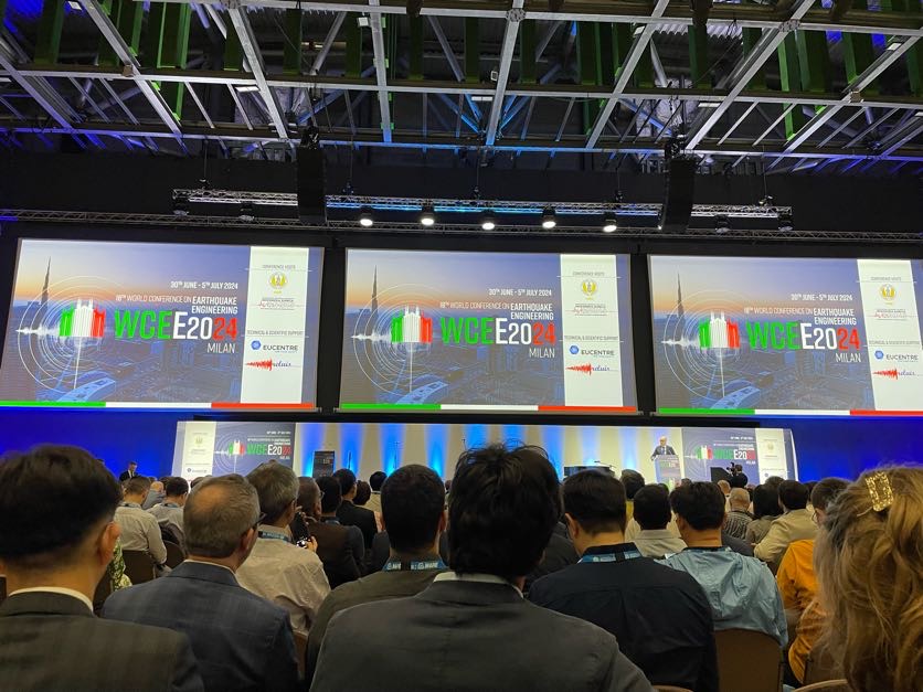
- GEM's Success at WCEE2024: Sharing Knowledge, Expertise, and Strengthening Collaboration in Earthquake Resilience - GEM Foundation
News GEM's Success at WCEE2024: Sharing Knowledge, Expertise, and Strengthening Collaboration in Earthquake Resilience By: Jul 8, 2024 Jul 8, 2024 Share Facebook LinkedIn The Global Earthquake Model (GEM) Foundation solidified its position as a key partner in earthquake hazard and risk assessment at the prestigious 18th World Conference on Earthquake Engineering (WCEE2024) held in Milan, Italy, from June 30th to July 5th, 2024. This premier event provided GEM with a valuable platform to showcase its ongoing projects, collaborate with international peers, and contribute to advancing global earthquake resilience. "Participating in WCEE2024 was a great opportunity for us to share our research on the future of seismic hazard and risk modelling, and to learn from our global community. I extend my sincere gratitude to the organisers for this stimulating event and commend our dedicated GEM staff whose expertise, passion and contributions made our WCEE2024 participation a big success." - Helen Crowley, GEM Secretary General. GEM actively participated in various sessions throughout the week, delivering presentations on a wide range of topics critical to earthquake risk assessment, reduction, and mitigation. Here's a glimpse into GEM's successful week: Day 1 focused on core earthquake science. Through GEM-led technical sessions, experts discussed advances in hazard analysis, characterising ground motion, and how to build a systemic approach to risk assessment. Day 2 offered in-depth exploration. Presentations explored how earthquakes affect access to healthcare, the resilience of masonry buildings, and the estimation of tsunami flow depths using data and machine learning. The day was capped by the well-attended panel session co-hosted by GEM and Aon, titled “From Academia to Insurance Industry: What's in it for Earthquake Engineers?" This session brought together over 100 industry experts and academics to explore, amongst other topics, the career opportunities available for earthquake engineering researchers within the insurance sector. Day 3 showcased a number of GEM's projects. Talks covered diverse areas such as nuclear power plant safety, global earthquake loss assessment, and advancements in the OpenQuake software. Other notable sessions explored topics ranging from using artificial intelligence for exposure models to the impact of recovery efforts on future earthquake risk. The day concluded with a stakeholder needs assessment session run by the Global Tsunami Model (GTM) community, providing a valuable opportunity to connect with colleagues in tsunami hazard and risk assessment. Day 4 wrapped up with prestigious talks. GEM presented on how we evaluate our models after damaging earthquakes, along with advancements in global environmental impact models. The day concluded with the prestigious Joyner Memorial Lecture by GEM Secretary General, Helen Crowley, which looked at the history of seismic zonation in Italy, the criticisms often (unjustly) targeted at seismic hazard models and the ways in which seismic risk modelling can be used to define seismic actions for design. Watch Helen's presentation below. Day 5 offered some final insights. Presentations explored a global vulnerability function database and a multi-criteria approach for optimal building retrofitting, leaving attendees with valuable knowledge on products and methods for earthquake risk mitigation. A Hub of Knowledge Exchange and Collaboration The GEM booth (B12) served as a vibrant hub for attendees and offered opportunities to engage with GEM’s earthquake engineering and hazard experts including GEM’s Product Manager, Andres Abarca. Discussions centred on GEM's latest tools and methodologies for earthquake hazard and risk assessment, promoting a collaborative environment for knowledge exchange and capacity building. Many attendees also stopped by and filled out our survey to contribute to GEM's Global Seismic Regulation Database and Mapping Initiative. WCEE2024: A Stepping Stone for Future Collaboration GEM's active participation at WCEE2024 served as a springboard for continued collaboration and knowledge-sharing within the earthquake engineering community. By presenting its latest advancements, engaging in discussions, and strengthening partnerships, GEM has solidified its role as a global partner in building global seismic resilience. "As we reflect on WCEE2024, it's clear that GEM's contributions are important in shaping seismic hazard and risk assessment globally. It was incredible to see the depth and breadth of GEM's influence and impact throughout the conference. This conference has underlined the importance of collaborative efforts in advancing earthquake engineering, and I'm grateful for the opportunity to share insights that drive our field forward." - John Schneider, GEM Senior Advisor. Stay Connected! Visit the dedicated GEM WCEE2024 event page or contact us at communication@globalquakemodel.org for further information, presentations, and other resources from the conference. Other Photos from the WCEE2024 Event (Photo credit: WCEE2024/EUCENTRE) No images found. GALLERY 1/42 VIDEO RELATED CONTENTS
- Building Resilience in the Himalayas: GEM at the International Symposium - GEM Foundation
News Building Resilience in the Himalayas: GEM at the International Symposium By: Apr 5, 2025 Jan 30, 2025 Share Facebook LinkedIn The International Symposium on Earthquake Risk Reduction in the Himalayan Region, held in Kathmandu on January 27-28, 2025, brought together experts, researchers, and policymakers to address seismic challenges in one of the world’s most earthquake-prone regions. The event, part of Nepal’s 27th Earthquake Safety Day, was organised by the Department of Urban Development and Building Construction (DUDBC), the National Disaster Risk Reduction and Management Authority (NDRRMA), Kirtipur Municipality, the University of Bristol, and the National Society for Earthquake Technology - Nepal (NSET). Representing the Global Earthquake Model (GEM) Foundation, Vitor Silva, Head of Risk Engineering, participated in the thematic session on Novel Practices for Rapid Visual Inspection of Buildings, Seismic Strengthening, and Low-Cost Seismic Isolation. Vitor’s presentation showcased GEM’s advancements in seismic risk modelling and highlighted innovative approaches that can support disaster preparedness, especially in earthquake-prone areas like the Himalayas. One of the key topics discussed was the development of science-driven methodologies to enhance structural resilience. Vitor emphasised that combining risk modelling with practical applications can lead to more informed decision-making and cost-effective solutions. He shared insights on how GEM’s tools and data can be leveraged to improve earthquake safety, with a particular focus on low-cost seismic isolation techniques. During the symposium, participants had the opportunity to visit a seismically isolated school building in Kathmandu, a project that stands out for its use of a low-cost PVC–sand–PVC interface instead of conventional seismic isolators. This innovative approach moves seismic isolation from the structural to the geotechnical realm, making it more accessible for low-income countries. Reflecting on the visit, Vitor noted: “It’s not every day that you see plots, tables, and formulae turn into bricks, mortar, and concrete. Witnessing a practical application of seismic isolation that could save lives, especially in schools, was truly inspiring.” The event strengthened collaboration among practitioners and policymakers, reinforcing the importance of integrating science-based strategies into disaster risk reduction policies. GEM’s involvement underscores the foundation’s commitment to advancing earthquake resilience through practical solutions and regional cooperation. By bringing together global expertise and local innovation, the symposium marked a step forward in addressing the unique seismic risks faced by communities in the Himalayan region. As GEM continues to support such initiatives, it remains dedicated to building safer, more resilient environments through scientific collaboration and knowledge sharing. No images found. GALLERY 1/4 VIDEO RELATED CONTENTS
- INQUIMUS into ACTION Workshop - GEM Foundation
News INQUIMUS into ACTION Workshop By: Jul 2, 2018 Share Facebook LinkedIn GEM’s Paul Henshaw, Director of Technology and Development, delivered a presentation titled “OpenQuake: informing Disaster Risk Reduction Policy through open and collaborative Earthquake Risk Assessment” during the 4th INQUIMUS workshop held from 19th-21st September at Eurac Research, Bolzano, Italy. The organizers - the Department of Geoinformatics-Z_GIS at the University of Salzburg, Austria and the European Academy of Bozen/Bolzano (EURAC) - selected GEM’s presentation as one of the state-of-the-art talks (SOTA) for this year’s theme: “INQUIMUS into ACTION - How can scientific assessments inform decisions for problem-solving in practice”. Paul discussed how GEM promotes an integrated understanding of earthquake risk through a 3-step scientific framework composed of seismic hazard, physical risk and social vulnerability assessments using the OpenQuake engine - GEM’s state-of-the-art seismic hazard and risk computational software. He also emphasized the role of the OpenQuake Platform - a website that provides access to software, datasets, models and guidelines - on how these open tools and a collaborative approach promote stakeholder engagement and encourages risk mitigation actions. In addition, the presentation also highlighted GEM’s strategy of engaging end-users from the very beginning to ensure local conditions are reflected and outputs align with the needs of the local communities. During the discussion on how GEM used open tools to inform and contribute to the improvement of public policy, Paul said, “Throughout our work at GEM, the combination of open data, open models and open-source software have resulted in a powerful integrated workflow that permits transparent and repeatable calculations important not only for scientific credibility, but also for facilitating regulation compliance and community collaboration." The 4th INQUIMUS workshop also featured the works and experiences from the Deutsche Gesellschaft für Internationale Zusammenarbeit (GIZ), The Swedish Civil Contingencies Agency and the Federal Office of Civil Protection and Disaster Assistance, Germany (BBK). No images found. GALLERY 1/0 VIDEO RELATED CONTENTS
- Seismic hazard analysis at the urban scale | GEM Foundation
Publications Seismic hazard analysis at the urban scale Share Facebook LinkedIn Download 2021 | Report We perform seismic hazard analysis for three urban centers (Cali, Colombia; Quito, Ecuador; and Santiago, Dominican Republic) within the TREQ project, explicitly accounting for the local soil response in each city. The two requirements for this analysis are (1) hazard estimates on reference bedrock at each city, for which we use the models described in D2.2.2 and D2.2.3 and (2) soil response models that quantify the amplification (or deamplification) of ground shaking throughout the three urban centers due to the shallow soil layers. In this study, in collaboration with local experts, we develop the soil response models for each city using available local geotechnical and geophysical data. We simulate the soil response using 1D equivalent linear analysis using pySRA, and a large suite of input motions generated from (and therefore fully compatible with) the underlying hazard model, which accounts for uncertainty in the input motions. The computed soil response models consist of a set of soil amplification factors (AF) and their uncertainty (�lnAF), covering the respective urban centers. The AFs are defined for periods relevant for risk analysis (PGA – 2.0 s), as well as for a wide range of bedrock shaking intensity levels (0.05 – ~4 g), and can therefore be readily used for probabilistic hazard and risk analysis. Finally, hazard curves are computed at the surface by convolving the bedrock hazard with the AFs and �lnAF at a set of sites. The results are compared to those computed using the ergodic site terms within the GMPEs, which depend on the shear wave velocity in the upper 30 m (Vs30), for which we find significant differences at some sites. Specifically, using the local soil response models can either increase (up to a factor ~2) or decrease the hazard results compared to when an inferred Vs30 is used. For soft sites at longer return periods, the hazard can be lower (and sometimes lower than the hazard on rock) due to soil nonlinearity. These differences can have a significant impact on the risk results, which are described in Deliverable D2.3.5. This study demonstrates the importance of incorporating local soil response when the goal is to model hazard at the urban scale with a higher level of detail compared to more standard approaches using Vs30.