Thanks for submitting!
You will be contacted as soon as possible


QUICK LINKS


PROFILES
PUBLICATIONS
EXPOSURE
VULNERABILTY
SOFTWARE
EQ MODELS
Search Results
1135 results found with an empty search
- HORUS | Global Earthquake Model Foundation
Projects HORUS Horus: Pilot for a generic damage evaluation methodology based on remote-sensing data Versión en español English version Share Facebook LinkedIn Overview Anchor 6 Background Horus is a pilot project that explores the combination of high-resolution building inventory data from OpenStreetMap and other local sources with image-processing algorithms for the detection of earthquake damage and flood extents using remote-sensing data, along with supplementary geospatial datasets as inputs to a machine learning (ML) classification model. The ML model is trained using detailed building damage datasets from past events in a supervised learning framework, and the trained model is intended to be used to estimate the extent of damage and loss in events previously unseen by the model. The proposed framework is applied in three case study applications: March 2020 Mw5.3 Zagreb earthquake; January 2020 Mw6.4 Puerto Rico earthquake and August 2016 Louisiana floods. The GEM Risk Team is responsible for the overall coordination of the project involving multiple partners, compilation of building-level earthquake damage datasets, development of the ML models, and training and testing of the models. Duration: 2020 Objectives This pilot project, initiated and funded by the World Bank, aims to develop a framework for semi-automated damage and loss assessment due to earthquake and floods from Earth Observation (EO) data and other supplementary datasets, while also leveraging recent advances in machine-learning algorithms. These damage and loss estimates can potentially be used for transparent financial compensation and to target the distribution of resources geographically and temporally. Collaborators Advanced Rapid Imaging and Analysis (ARIA) team at the National Aeronautics and Space Administration’s (NASA) Jet Propulsion Laboratory (JPL) and California Institute of Technology (Caltech), the Global Earthquake Model (GEM) Foundation, JBA Risk, and the Humanitarian OpenStreetMap Team (HOT) Funding partner: World Bank Group Locations Earthquake case studies: Gorkha, Nepal; Puebla, Mexico; Puerto Rico, United States; Zagreb, Croatia Flood case study: Louisiana, United States Anchor 1 Anchor 5 Anchor 4 Anchor3 Publications
- WFP-ADAM+ | Global Earthquake Model Foundation
Projects WFP-ADAM+ WFP-ADAM+ Innovation Accelerator Project Versión en español English version Share Facebook LinkedIn Overview Anchor 6 Background The World Food Programme (WFP) Innovation Accelerator was established in 2016 to identify, support, and scale innovative solutions that contribute to ending global hunger by 2030. Based in Munich, Germany, the Accelerator provides funding, hands-on support, and access to WFP’s global operations and expert networks to empower WFP teams, entrepreneurs, start-ups, and NGOs worldwide. GEM participated in the Accelerator’s five-day bootcamp, held from November 27–29, 2023, where innovation and humanitarian experts collaborated with start-ups and WFP innovators to address field-level challenges, refine project strategies, and develop scalable solutions. Following this process, GEM successfully secured a place in the Accelerator’s Sprint Programme, a six-month initiative designed to advance innovations from proof of concept to prototype implementation. The bootcamp culminated in GEM’s participation in the WFP Accelerator Pitch Event in February 2024 in Munich, where GEM was selected as one of eight innovations to present its project to WFP senior management and potential funders. Duration: 2024 - 2025 Overall Objective The project aims to integrate GEM’s earthquake risk methodologies and datasets into humanitarian emergency preparedness and response efforts. By leveraging GEM’s expertise, the project seeks to enhance global access to reliable earthquake risk data and post-disaster impact assessments for humanitarian actors. This will be achieved by testing GEM’s models within WFP’s ADAM tool , ensuring they align with humanitarian needs in earthquake-prone regions. Expected Outputs 1. Improved Spatial Risk Assessment for Preparedness Development of high-resolution datasets on building exposure, population demographics (including gender and age groups), and vulnerability indicators. Validation of these datasets through ADAM-Preparedness to enhance the identification of at-risk communities. 2. Enhanced Post-Earthquake Impact Assessments Rapid estimation of affected populations within hours of an earthquake using USGS ground-shaking data integrated with GEM’s exposure and vulnerability layers. A refined impact assessment within 48 hours, leveraging GEM’s full modeling capabilities to estimate damaged buildings, displaced populations, homelessness, and fatalities for improved humanitarian response. Collaborators Coordination World Food Programme Project partner Global Earthquake Model (GEM) Foundation, Italy Funding partner: W orld Food Programme Innovation Accelerator Programme, Munich, Germany Locations Earthquake-prone WFP Countries with initial pilots in Afghanistan, Nepal, Turkey, Syria, Haiti, and the Philippines. Anchor 1 Anchor 5 Anchor 4 Anchor3 Publications
- MONGOLIA DRR | Global Earthquake Model Foundation
Projects MONGOLIA DRR Strengthening capacity on disaster risk assessment, reduction and transfer instruments in Mongolia Versión en español English version Share Facebook LinkedIn Overview Anchor 6 Background This project aims to support Mongolia in developing a set of key disaster risk information and knowledge products for mainstreaming Disaster Risk Management (DRM) into development, including Disaster Risk Financing and Insurance (DRFI). A hazard and risk assessment is conducted at the national and provincial levels and Disaster Risk Reduction (DRR) is promoted for resilience within development and DRFI, and to strengthen the capacity and ability of NEMA, ministries, local government officials and communities to better understand and plan for disaster risks. The project is made up of the following four main components: Conducting multi-hazard disaster risk assessments at the national and local levels; Facilitation of Disaster Reduction planning and mainstreaming through the preparation and delivery of a DRR training program; Development of a strategy for disaster risk financing and revision of the national draft disaster risk insurance law; and Building institutional, technical, and management capacity for DRR and DRF The GEM Risk Team's main contribution to the project is the development of a significantly improved exposure model for Mongolia, based on the latest population and housing census of Mongolia, and a probabilistic seismic risk analyses, making use of GEM's global seismic hazard mosaic. Duration: 2022-2023 Objective The project is implemented in close collaboration with Mongolia’s National Emergency Management Agency (NEMA) and the Department of Disaster Risk Management (DRMD), who are the executing agency and the implementing agency respectively. The Ministry of Finance is also engaged in strengthening DRF and insurance options. This project advances Mongolia’s progress in addressing the Sendai Framework on Disaster Risk Reduction (DRR) priorities by improving the institutional capacities of key ministries and local governments; enhancing understanding of risk; strengthening disaster risk governance; and investing in DRR for resilience through promoting mechanisms for disaster risk transfer, risk-sharing, and insurance. Collaborators GEM Foundation, ICEM Asia Consulting, PwC India, Environ LLC, Willis Towers Watson (WTW), JBA Group, Overseas Development Institute Funding partner: Funded by the Japan Fund of Poverty and Reduction and administered by the Asian Development Bank (ADB) Location Mongolia Anchor 1 Anchor 5 Anchor 4 Anchor3 Publications
- TURKEY DRR | Global Earthquake Model Foundation
Projects TURKEY DRR Seismic risk and exposure data for Turkey Versión en español English version Share Facebook LinkedIn Overview Anchor 6 Background The World Bank is developing a thematic Paper on Building Climate and Disaster Resilience in Turkey that will apply a new World Bank Guidance Note on how to prepare resilience and adaptation strategies. The Guidance Note provides a practical guide for designing national strategies for climate change adaptation and resilience. It specifies actions that reflect universal principles of effective climate change adaptation and disaster resilience, emphasizing that each country needs to tailor the relative importance and sequencing of these actions to its specific needs and priorities. Given the best practice of mitigating natural hazards for a more resilient future, and the high risk of catastrophic earthquakes, the adaptation paper needs to consider seismic risk in Turkey. To contribute to the seismic risk component of this adaptation paper, the GEM Risk Team is responsible for the following tasks: - Assessment of earthquake ground shaking hazard in Turkey - Definition of the exposure: residential, commercial and industrial buildings; education and healthcare facilities; population - Assessment of vulnerability/fragility for the exposed elements - Risk modelling based on the current exposure - Risk projections to 2030 and 2050 (based on future socio-economic conditions) Duration: 2021 Objectives The World Bank thematic Paper on Building Climate and Disaster Resilience in Turkey aims to support the Turkish government by providing guidance on how to prepare resilience and adaptation strategies, including those related to earthquakes. The objectives of this project are to: 1. Provide deterministic and probabilistic seismic risk metrics in Turkey for population and selected structure types, to inform macro-economic and public finance analysis (conducted by the World Bank project team). 2. Provide seismic impact analysis for three earthquake scenarios aimed at reducing risk in Turkey to estimate the impact of these interventions on i) loss due to direct damage and ii) fatalities. Collaborators GEM Foundation Funding partner: World Bank Group Location Turkey Anchor 1 Anchor 5 Anchor 4 Anchor3 Publications
- INDONESIA DRR | Global Earthquake Model Foundation
Projects INDONESIA DRR Seismic Resilience Baseline Analysis and Investment Option Needs in Indonesia Versión en español English version Share Facebook LinkedIn Overview Anchor 6 Background This project, funded by the World Bank's GFDRR, aims to conduct a seismic baseline analysis to support the development of a potential national seismic risk mitigation program in Indonesia. The study focuses on public assets, which include education facilities (primary and secondary schools, universities), health facilities (health clinics, hospitals), commercial facilities (shophouse), emergency services facilities (e.g., ambulance stations, fire stations, early warning service providers), and critical government administration buildings (e.g., local disaster management offices). The project has five main tasks: 1. Inception: literature review on seismic risk in Indonesia, methodology, definition of stakeholder/consultation workshops, preliminary data collection 2. Baseline analysis of Indonesia’s exposure and vulnerabilities to seismic hazards (earthquakes and tsunami) 3. Seismic Risk Assessment and Rapid Prioritization of Potential Investments in Three Selected Districts 4. Development of Baseline Data and Conceptual Framework Design 5. Final Report and Completion Report The GEM Risk Team contributes to all tasks, ranging from support on hazard modelling, development of exposure, selection of vulnerbaility models and the computation of seismic risk using the OpenQuake engine. Duration: 2022-2023 Objectives The methodology, workplan, programme and potential target cities is elaborated together with the World Bank and Indonesian Ministry of Public Works and Housing (MPWH) stakeholders and other relevant agencies such as Ministry of National Development Planning (Bappenas), National Disaster Management Authority (BNPB), Ministry of Home Affairs (MoHA) and Agency for Meteorology, Climatology and Geophysics (BMKG). The objectives include: (a) a rapid baseline analysis of the exposure and vulnerability of the country and three Indonesian districts to earthquakes and tsunami, baseline information/data, and gap analysis, including disaggregated analysis of risk and vulnerability of women and other vulnerable groups; (b) a conceptual framework for improving seismic resilience and recommendations for a national program that aims to reduce the vulnerability of people (with consideration for diverse groups) and assets to earthquakes and tsunami through an integrated package of structural and non-structural investments; and (c) stakeholder consultations to seek inputs on the potential program design, investment funding mechanisms, and institutional set-up options for the national program. Collaborators GEM Foundation, Arup, LAPI-ITB and Kota Kita Funding partner: World Bank GFDRR Locations Three cities in Indonesia: ‣ Kota Bengkulu, Bengkulu province ‣ Kota Cilegon, Banten province ‣ Kota Gorontalo, Gorontalo province Anchor 1 Anchor 5 Anchor 4 Anchor3 Publications
- SERENE Project | Global Earthquake Model Foundation
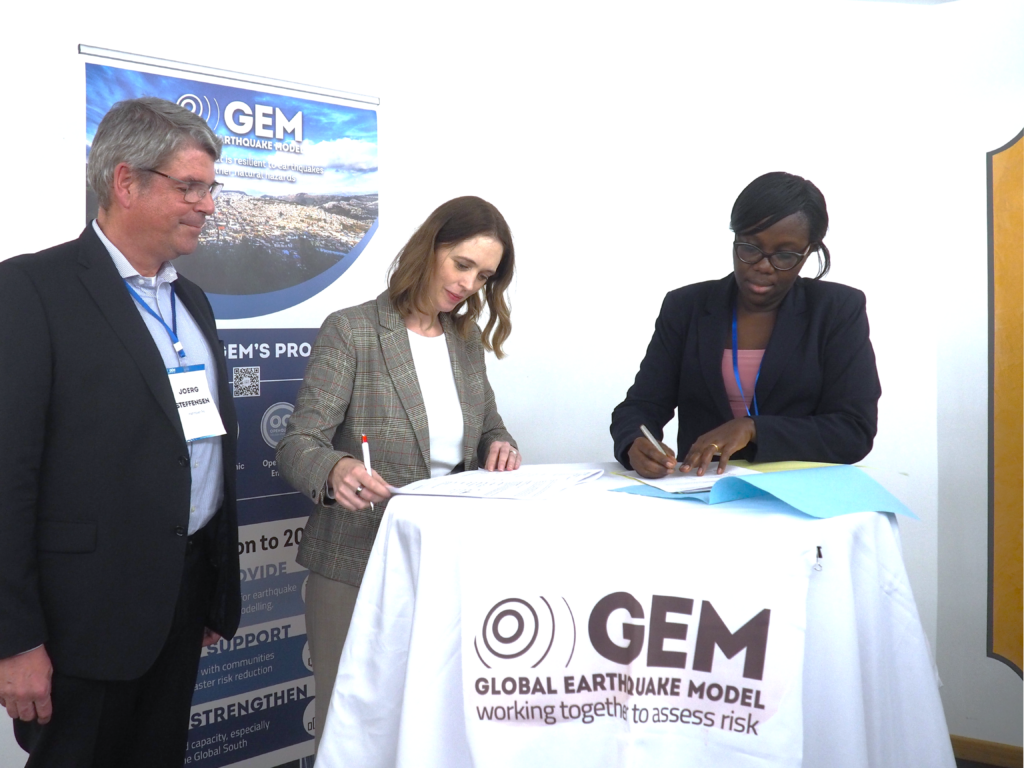
Projects SERENE Project Scientific Evidence for Risk Engineering Norms and Education (SERENE) Versión en español English version Share Facebook LinkedIn Overview Anchor 6 The SERENE Project stands for Scientific Evidence for Risk Engineering Norms and Education . It’s a strategic, public-private partnership between the National Building Review Board (NBRB) and the Global Earthquake Model (GEM) Foundation, a globally recognized authority on seismic hazard and risk modeling. This multi-year program brings together world-class seismic risk models, technical mentorship, and national policy frameworks to strengthen Uganda’s ability to withstand earthquake-related disasters. This initiative is all about protecting lives, homes, schools, hospitals, and infrastructure across Uganda by applying world-class science and data to strengthen how we plan, build, and regulate our cities. While natural hazards cannot be prevented, many building-related disasters - particularly fires and structural failures - are avoidable through improved design, compliance, and enforcement. SERENE integrates both natural and human-induced risks to support a safer and more resilient built environment. SERENE is not only a seismic risk initiative - it is a national platform for understanding and reducing risks in the built environment, including those arising from fires, building failures, and unsafe construction practices. For more information, please visit: https://serene-project.nbrb.go.ug/ Goals of the Project The SERENE Project addresses seismic risk at every level, from scientific modelling to on-the-ground training. Its key goals include: Developing Uganda’s first national seismic hazard map Creating exposure models to assess vulnerable building stock Updating Uganda’s seismic code (US319:2003), seismic design updates, and disaster planning. Training engineers, inspectors, and policymakers Supporting disaster-preparedness and early warning strategies Enhancing regulations for future construction and retrofitting All of this aligns with Uganda’s Vision 2040, the National Development Plan (NDP IV), National Disaster Risk Reduction Strategy, Uganda Seismic Code modernization process and the Sustainable Development Goals Collaborators This partnership is formalized under a 3-year agreement (2025–2028), making Uganda the first African country to be granted full participation in GEM’s strategic governance without financial contribution. Uganda holds a Governor-level seat on GEM’s board, joining an elite global group shaping earthquake safety policy. NBRB A statutory body established under the Building Control Act, is mandated to promote and ensure planned, decent and safe building structures that are developed in harmony with the environment in Uganda. GEM Foundation Provides open-source software, seismic hazard models, technical mentorship, and access to global risk modelling platforms like OpenQuake. Location Uganda Anchor 1 Anchor 5 Anchor 4 Anchor3 Publications
- READY2RESPOND | Global Earthquake Model Foundation
Projects READY2RESPOND Rapid Diagnostic in Uttarakhand and Himachal Pradesh Versión en español English version Share Facebook LinkedIn Overview Anchor 6 Background Ready2Respond (R2R) is a rapid diagnostic guide, designed to improve national, sub-national and city resilience mechanisms and to protect development gains through investments in emergency preparedness and response systems. It is informed by the World Bank Group (WBG) City Resilience Program (CRP) and other WBG resilience platforms. In this project R2R is applied to the Uttarakhand and Himachal Pradesh states in the Himalayan region of India. The GEM Risk Team contributes to the project by providing: Literature review and stakeholder mapping around hazard and risk initiatives, risk data and models for both states Provision of seismic hazard/risk model outputs and related descriptive information for both states (to support diagnostic activities) Review of legal regulation of the built environment and associated initiatives Review of seismic preparedness of the critical infrastructure defined in the project Preparation and remote input into stakeholder workshops Duration: 2023 Objectives This project responds to the need to provide effective and comprehensive diagnosis of the Uttarakhand and Himachal Pradesh states’ emergency preparedness and response systems in the Himalayan region of India. This enables the World Bank and the government to tailor investments to strengthen institutional capacity and capability, ensure public safety, and limit economic disruption in the face of multiple, and often cascading, geological and hydrometeorological hazards. Collaborators GEM Foundation, JBA Consulting, Geo Climate Risk Solutions (GCRS) Funding partner: World Bank Group Location India Himalayas Anchor 1 Anchor 5 Anchor 4 Anchor3 Publications
- SSAHARA Project | Global Earthquake Model Foundation
Projects SSAHARA Project Sub Saharan Hazard and Risk Assessment (SSAHARA) Versión en español English version Share Facebook LinkedIn Overview Outcomes Training Outreach Photos Publications Anchor 6 Background The East African Rift System (EARS) is the major active tectonic feature of the Sub-Saharan Africa (SSA) region. Although the seismicity level of such a divergent plate boundary can be described as moderate, several damaging earthquakes have been reported in historical times, and the seismic risk is exacerbated by the high vulnerability of the local buildings and structures. Formulation and enforcement of national seismic codes is therefore an essential risk mitigation strategy. A reliable risk assessment must be based on an updated and reliable seismic hazard model for the region. The last published regional model for SSA was developed within the frame of the GSHAP project and is almost 20 years old (Midzi et al., 1999). The availability of new data, local and regional seismotectonic studies and recently developed methods and tools prompt the development of a new PSHA model summarizing the current state of knowledge in Sub-Saharan Africa. Objectives In September 2014, the United States Agency for International Development (USAID) GEM funding support to implement a program entitled “Reducing Earthquake Risk collaboratively by Building Capacity and Leveraging GEM’s Open Tools and Resources”. One of the objectives of this program was: to build the capacity in sub-Saharan Africa for integrated risk assessment and development of city earthquake scenarios involving local decision-makers. The project produced the SSA-GEM homogenized catalogue; the Seismic Source Zones; the Probabilistic Hazard Calculations; the Strain Rate Model; earthquake risk in East Sub-Saharan Africa; the residential building stock; and the Social Vulnerability and Integrated Risk in Sub Sahara Africa. Collaborators The development of a regional model would not have been possible without the contribution of experts from the local scientific community. Partnership with local governmental institutions and authorities was an essential step to facilitate model acceptance and for potential integration with national seismic codes. GEM worked with the following institutions for the implementation of the SSAHARA project. African Union; AfricaArray; FEPRA – Ethiopia; University of Pennsylvania; Addis Ababa City Government; UNDP Regional Office; and international agencies, municipalities and government agencies Location Burundi, Ethiopia, Kenya, Malawi, Mozambique, Rwanda, Tanzania, Uganda Website SSAHARA wiki website containing technical descriptions and overview of the project. Anchor 1 Anchor 5 Anchor 4 News Preventionweb article on the release of the Africa Model developed as part of the Sub-Sahara Hazard and Risk Assessment (SSAHARA) project funded by USAID. Anchor3 Publications Disclaimer The contents of this project website such as studies, reports, audio-visual, news articles, blogs, and other information or media products including those in the external links are made possible by the generous support of the American people through the United States Agency for International Development (USAID). The contents are the responsibility of the Global Earthquake Model (GEM) Foundation and do not necessarily reflect the views of USAID or the United States Government.
- SARA Project | Global Earthquake Model Foundation
Projects SARA Project South American Risk Assessment (SARA) Versión en español English version Share Facebook LinkedIn Overview Outcomes Training Outreach Photos Publications Anchor 6 Overview South America incorporates some of the most seismically active regions on the planet, where the South American subduction zone generates the forces to create the Andes Mountains and drives the occurrence of destructive earthquakes across Chile, western Argentina, Bolivia, Ecuador, Peru, Colombia and Venezuela. In turn, the high vulnerability of many structures and the high population density of the main cities are factors that contribute to the region’s high seismic risk. In the last two decades alone, over 3,000 fatalities have been reported, and the economic losses have exceeded 30 billion USD (EM-DAT, www.emdat.be ). While expert capabilities exist in these countries to assess earthquake risk, the information, infrastructure, tools, and collaboration networks necessary to develop comprehensive knowledge among scientists and engineers and to move this knowledge into the mainstream of disaster risk reduction activities has been lacking. Objectives The approach is to bring together international best practice tools and methodologies with local expertise and knowledge needed to establish local ownership and define risk assessment objectives and priorities. GEM Foundation combined these elements and focused on developing local capacities across sectors (academic, public and private), across technical disciplines (e.g., hazard, risk, IT), and through the implementation of disaster risk reduction policies and programs. The program of capacity development was initiated in 2013 with the South America Risk Assessment (SARA) Project to bring experts, institutions, and stakeholders from 7 countries to develop a regional assessment of earthquake hazard and risk. GEM provided its OpenQuake earthquake hazard and risk analysis software and other tools and databases freely and openly to all participants. More than 50 of the region’s experts across 17 institutions collaborated to produce critical data sets, develop common approaches, and develop open-source tools for both data collection and interpretation. Collaborators The SARA Project, completed in December 2015, provided the foundation for formal and informal collaborations at many levels and for many purposes. GEM subsequently developed formal partnerships across public and private sectors (e.g., SuraAmerica Insurance, the Geological Survey of Colombia, EcoPetrol), academic partnerships (e.g., EAFIT Univ, Univ del Norte, Univ Catolica Chile), non-profits (e.g., OSSO), and most recently, with municipal governments (Cali, Colombia and Quito, Ecuador), for urban risk assessments. (complete list ) Location Andean Region (Venezuela, Colombia, Ecuador, Peru, Bolivia, Chile and Argentina) Introduction The project was carried out by experts and institutions from the region using to the extent possible open data sets, methodologies and tools such as GEM’s new open source software, the OpenQuake Engine and other OpenQuake tools. The project revolved around 5 modules: hazard, exposure and physical vulnerability, socio-economic vulnerability and resilience, loss estimates and city scenarios. The modules were carried out by a variety of experts/scientists from the region , in collaboration with the project coordinators and, where relevant, the GEM Secretariat. 5. City Scenarios Following the objectives of SARA, the development of city scenarios is crucial for planning risk management strategies in cities with larger concentration of population and exposed to significant hazard. In this sense, the GEM Secretariat has been seeking collaborations with research groups and governmental stakeholders that will be the end users of case studies in Lima (Peru), Quito (Ecuador), Medellín (Colombia), Iquique, Osorno and Rancagua (Chile). 1. Seismic hazard In early 2013 the Global Earthquake Model (GEM) published seven Requests for Proposal covering topics related to the compilation of basic datasets as well as the creation and calculation of an updated probabilistic seismic hazard input model for South America. Five consortia of South American researchers responded to this request and submitted proposals, which were reviewed in an initial stage by scientists working at the GEM Secretariat, and successively discussed in a meeting in Bogota held in December 2013 at the “Servicio Geologico Colombiano”. 3. Social Vulnerability and Resilience The social vulnerability component of SARA comprises the development of composite indicators of social vulnerability and resilience along with their robustness testing and validation. The objective is to provide tools and information useful for understanding the potential effects of earthquakes in communities of South America. 2. Exposure and Physical Vulnerability Development of exposure datasets and vulnerability functions for South America at regional, national and/or sub-national levels have been considered. Modelling of exposure and physical vulnerability in the most earthquake prone countries is the main goal in the first stage of the project. 4. National and subnational estimation of losses An open and transparent seismic risk assessment for the Andean countries has been performed. A probabilistic approach was followed for the calculation of risk metrics, that includes average annual economic and human loss maps, mean loss exceedance curves per country, and statistics that reveal which building classes are most vulnerable to earthquakes. Anchor 1 Anchor 5 Capacity development and institutional strengthening To promote sustainability, SARA’s work included the following: capacity development and institutional strengthening, and stakeholder engagement. The outcomes of activities in these areas are described below. Anchor 4 A blog by Carlos Costa featuring the SARA project workshop in Chile 2014. [News ] A wiki project website containing technical information about the SARA project. [Website ] Anchor3 BUSINESS NEWS Quito workshops 2015 1/3 BUSINESS NEWS Lima workshops 2015 1/2 Publications Probabilistic Seismic Risk Assessment Of The Residential Building Stock In South America [PDF ] SARA (South America Risk Assessment Project Workshop) on “Inventory of Quaternary deformation of South America” [PDF ] SARA Project Executive Summary [PDF ] A conference paper on Building A Ground-Motion Logic Tree For South America Within The Gem-Sara Project Framework [PDF ]
- ARISTOTLE | Global Earthquake Model Foundation
Projects ARISTOTLE Multi-Hazard Expert Advice System for ERCC Versión en español English version Share Facebook LinkedIn Overview Anchor 6 Background The All Risk Integrated System TOwards Trans-boundary hoListic Early-warning or ARISTOTLE consortium combines a number of services that enable a rapid understanding of events from various natural hazards (earthquakes and tsunami, volcanoes, severe weather and floods) and how they might unfold, thus aiding a deeper interpretation of the resulting hazards and impact. The GEM Foundation is supporting the consortium by providing an assessment of the impact of earthquakes using GEM's global exposure and vulnerability models, with a focus on metrics such as collapsed buildings and displaced people, such that it may provide an added value to existing rapid loss assessment services such as the USGS's Prompt Assessment of Global Earthquakes for Response (PAGER). Visit http://pilot.aristotle.ingv.it/ for more details about the project. Duration: 2022 - 2028 Objectives ARISTOTLE aims to provide Multi-Hazard Advice to the European Research Coordination Centre, either in advance of / during the activation of the EC Civil Protection Mechanism (CPM), in order to increase preparedness and response levels of the EU and to improve the ERCC’s assessment capacity. Collaborators ARISTOTLE is a multi-disciplinary partnership consisting of world-leading scientific centres in the areas of Earth and Climate sciences, providing operational and monitoring services, early warning and information systems as well as contributing to innovation and research actions. Location Global (Rome, Italy) Anchor 1 Anchor 5 Anchor 4 Anchor3 Publications