Thanks for submitting!
You will be contacted as soon as possible


QUICK LINKS


PROFILES
PUBLICATIONS
EXPOSURE
VULNERABILTY
SOFTWARE
EQ MODELS
Search Results
1136 results found with an empty search
- WB-Istanbul | Global Earthquake Model Foundation
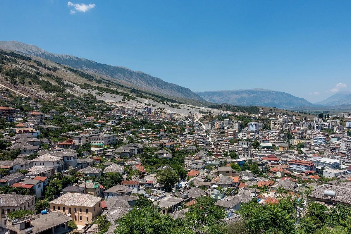
Projects WB-Istanbul Seismic impact scenarios for Istanbul Versión en español English version Share Facebook LinkedIn Overview Anchor 6 Background Türkiye is situated in a seismically active region, with a history of significant earthquakes that have led to substantial loss of life, economic disruption, and damage to infrastructure. The country's rapid urbanization and the presence of numerous buildings constructed before the introduction of modern building codes contribute to its vulnerability to seismic events. Istanbul, Türkiye’s largest city, is of particular concern due to its high population density, economic significance, and the potential impact of a major earthquake. The city has a mix of old and new structures, with many residential buildings constructed before the year 2000, when the country's modern building codes were introduced. These older structures are often not designed to withstand significant seismic forces, making them particularly susceptible to damage or collapse in the event of an earthquake. Given this context, there is a critical need to understand the costs associated with retrofitting and reconstructing buildings to meet current seismic safety standards. The World Bank was interested in preparing accurate unit cost estimations for both reconstruction and retrofitting scenarios. Such estimations are essential for planning, budgeting, and implementing risk reduction activities. Additionally, preparing seismic impact scenarios for Istanbul is imperative to quantify the potential post-earthquake recovery and reconstruction costs, identify the most vulnerable structures, and inform prioritization of interventions that can mitigate the risks posed by earthquakes. Duration: 2024 Objectives The objectives of this Consultancy were: Provide information on the cost per square meter (USD) for reconstruction and various retrofitting options in the case of Türkiye for pre-2000 residential buildings, considering emerging information from the 2023 earthquakes on building performance/vulnerability. Provide seismic impact scenarios for the Istanbul metropolitan area, with disaggregated information on building types, building age, and spatial areas, considering at least four different earthquake scenarios. The analysis was expected to consider damage estimates (considering pre-earthquake costs), as well as recovery and reconstruction costs that consider build back better, emergency response costs, surge pricing, etc. Collaborators Collaborators: GEM Foundation Funding partner: World Bank Group Anchor 1 Anchor 5 Anchor 4 Anchor3 Publications
- HORUS | Global Earthquake Model Foundation
Projects HORUS Horus: Pilot for a generic damage evaluation methodology based on remote-sensing data Versión en español English version Share Facebook LinkedIn Overview Anchor 6 Background Horus is a pilot project that explores the combination of high-resolution building inventory data from OpenStreetMap and other local sources with image-processing algorithms for the detection of earthquake damage and flood extents using remote-sensing data, along with supplementary geospatial datasets as inputs to a machine learning (ML) classification model. The ML model is trained using detailed building damage datasets from past events in a supervised learning framework, and the trained model is intended to be used to estimate the extent of damage and loss in events previously unseen by the model. The proposed framework is applied in three case study applications: March 2020 Mw5.3 Zagreb earthquake; January 2020 Mw6.4 Puerto Rico earthquake and August 2016 Louisiana floods. The GEM Risk Team is responsible for the overall coordination of the project involving multiple partners, compilation of building-level earthquake damage datasets, development of the ML models, and training and testing of the models. Duration: 2020 Objectives This pilot project, initiated and funded by the World Bank, aims to develop a framework for semi-automated damage and loss assessment due to earthquake and floods from Earth Observation (EO) data and other supplementary datasets, while also leveraging recent advances in machine-learning algorithms. These damage and loss estimates can potentially be used for transparent financial compensation and to target the distribution of resources geographically and temporally. Collaborators Advanced Rapid Imaging and Analysis (ARIA) team at the National Aeronautics and Space Administration’s (NASA) Jet Propulsion Laboratory (JPL) and California Institute of Technology (Caltech), the Global Earthquake Model (GEM) Foundation, JBA Risk, and the Humanitarian OpenStreetMap Team (HOT) Funding partner: World Bank Group Locations Earthquake case studies: Gorkha, Nepal; Puebla, Mexico; Puerto Rico, United States; Zagreb, Croatia Flood case study: Louisiana, United States Anchor 1 Anchor 5 Anchor 4 Anchor3 Publications
- ALBANIA HAZARD MODELLING | Global Earthquake Model Foundation
Projects ALBANIA HAZARD MODELLING Joint development of the Albanian seismic hazard model Versión en español English version Share Facebook LinkedIn Overview Outreach Photos Publications Anchor 6 Background GEM and IGEO-Albania are currently implementing a 1-year project funded by the European Investment Fund and supported by the Electrical Corporation of Albania to update Albania’s probabilistic seismic hazard model through a series of technical workshops. The GEM Hazard Team is providing support on the use of its open source tools for hazard model building and assessment. Duration: 2023 Objectives The main objectives of this project are to update the national seismic hazard model for Albania, and provide the outputs that can be used in the National Annex of Eurocode 8, for the seismic design of buildings in Albania. Collaborators GEM Foundation, Institute of Geosciences (IGEO) Funding Partner: European Investment Fund, Electrical Corporation of Albania Location Albania Anchor 1 Anchor 5 Anchor 4 Strengthening Albania's Earthquake Preparedness: A Collaborative Effort This project, funded by the Central European Initiative and supported by the Albanian Electricity Corporation, has two objectives. It aims to modernize Albania's seismic hazard map, a crucial step in updating the nation's building code to meet Eurocode 8 standards. This marks the first significant revision to Albania's building regulations since 1989. A more updated view of seismic hazard will help in promoting more cost-effective earthquake-resistant construction practices. Read more Albania’s Institute of Geosciences (IGEO) and GEM collaborate to update the national seismic hazard model GEM and IGEO-Albania implemented a 1-year project funded by the Central European Initiative (CEI - https://www.cei.int/) and the Albanian Electricity Corporation (KESH - https://www.kesh.al/en/) to update Albania's probabilistic seismic hazard model through a series of technical workshops. Read more Anchor3 BUSINESS NEWS NSHMA 2024 Presentation, Tirana, Albania - July 16, 2024 Photo credits: IGEO 1/3 BUSINESS NEWS GEM - IGEO Albania Workshop, Pavia 2023 1/4 Publications
- NEAM-COMMITMENT | Global Earthquake Model Foundation
Projects NEAM-COMMITMENT North-Eastern Atlantic and Mediterranean Tsunami Risk Management and Planning Versión en español English version Share Facebook LinkedIn Overview Anchor 6 Background NEAM-COMMITMENT aims to improve tsunami risk management and planning in the NEAM region. It endeavors to contribute primarily to two key components of tsunami risk governance: capacity building through tsunami hazard assessment and mapping at the national scale, and improved tsunami evacuation planning at the local level through a novel multi-hazard approach. Guidelines will be drafted for the methodologies applied to develop the national tsunami inundation and local tsunami evacuation maps to contribute to improved tsunami risk management planning. Duration: 2025 - 2027 More details: https://civil-protection-knowledge-network.europa.eu/projects/neam-commitment#inpage-section-description Objectives The project has two objectives: to develop national tsunami inundation maps in Cyprus, Greece and Spain through the methodology applied to produce tsunami inundation maps for evacuation planning in Italy, aiming to achieve compatible tsunami inundation maps across the NEAM region; to address the need for a multi-hazard approach for effective tsunami evacuation management to complement existing tsunami evacuation management guidelines. The proposed new approach focuses on multi-hazard cascading effects concerning tsunami evacuation and emergency management and will be piloted in local sites in Greece and Italy. Collaborators NATIONAL OBSERVATORY OF ATHENS Greece Coordinator National Institute of Geophysics and Volcanology (INGV), Italy Fundación hidráulica ambiental de Cantabria, Spain Higher Institute for Environmental Protection and Research (ISPRA), Italy Global Earthquake Model (GEM) Foundation, Italy University of Malaga, Spain Municipality of Lipari, Italy Academy of Athens, Greece The General Secretariat for Civil Protection - Greece Ministry of Agriculture, Rural Development and Environment of Cyprus Funding partner: Union Civil Protection Mechanism (UCPM) Location Southern Europe Anchor 1 Anchor 5 Anchor 4 Anchor3 Publications
- BACK TO NORMAL | Global Earthquake Model Foundation
Projects BACK TO NORMAL Earthquake Recovery Modelling Versión en español English version Share Facebook LinkedIn Overview Anchor 6 Background To address some of the key factors that influence recovery following a potentially devastating earthquake, the Alfred E. Alquist Seismic Safety Commission (SSC) engaged the GEM (Global Earthquake Model) Foundation and the University of California at Los Angeles (UCLA), Department of Civil and Environmental Engineering, a) to develop a methodology and an open-source and transparent software tool to estimate recovery states and recovery times following an earthquake; and b) to investigate the effect of external socio-economic factors on these recovery times. Objectives This project achieved the following main objectives: 1. Development of a user-friendly, non-commercial and transparent software tool, herein referred as the Integrated Risk Modelling Toolkit (IRMT), to make map-based comparisons showing the effect of different resilient actions on the recovery times. 2. Development of an analytic methodology, referred as the Reconstruction Recovery Model, to estimate post-earthquake recovery 3. Integration of the Reconstruction Recovery Model for practical use into GEM’s OpenQuake modelling platform. 4. Demonstration of reasonable results by using the methodologies to model past earthquakes. In this context, the 2014 M6 South Napa Earthquake was used as a case study. Collaborators Department of Civil and Environmental Engineering at the University of California at Los Angeles (UCLA) Location California, United States Anchor 1 Anchor 5 Anchor 4 Anchor3 Publications
- CAREC | Global Earthquake Model Foundation
Projects CAREC Developing a Disaster Risk Transfer Facility in the Central Asia Regional Economic Cooperation Region Versión en español English version Share Facebook LinkedIn Overview Outreach Anchor 6 Background Willis Towers Watson, a GEM Advisor Sponsor is leading the consortium of organizations to implement the project, “Developing a Disaster Risk Transfer Facility in the Central Asia Regional Economic Cooperation Region” supported by the Asian Development Bank. The GEM Risk Team is responsible for the exposure and seismic vulnerability components of the project, with the Hazard Team providing support in the preparation of risk profiles for countries in the Central Asia Regional Economic Cooperation Region. Objectives The project has three main components: (i) development of disaster risk assessments and modeling in all CAREC countries; (ii) design of a regional pilot disaster risk transfer facility for at least three CAREC countries; and (iii) capacity building and awareness raising activities to sensitize key public and private stakeholders in all CAREC countries about the benefits of disaster risk reduction, risk retention and risk transfer solutions. Willis Towers Watson, a GEM Advisor Sponsor is leading the consortium of organizations that will implement the project. The Central Asia Regional Economic Cooperation, or CAREC Program is a partnership of 11 countries (Afghanistan, Azerbaijan, People's Republic of China, Georgia, Kazakhstan, Kyrgyz Republic, Mongolia, Pakistan, Tajikistan, Turkmenistan, and Uzbekistan), supported by 6 multilateral institutions, working together to promote development through cooperation, leading to accelerated growth and poverty reduction. Location Central Asia Anchor 1 Anchor 5 Anchor 4 ADB project overview and data sheet Read more GEM has started a new project with WTW supported by the Asian Development Bank Read more About the CAREC program Read more Anchor3 Publications
- SOLOMON ISLANDS EXPOSURE | Global Earthquake Model Foundation
Projects SOLOMON ISLANDS EXPOSURE Assessing the Risk Exposure of Road Network to Climate and Natural Hazard Risks in Solomon Islands Versión en español English version Share Facebook LinkedIn Overview Anchor 6 Background This project aims to conduct a robust multi-hazard risk assessment of the road network to climate and natural hazards in the Solomon Islands, both historically and under future climate projections. The project includes three main dimensions: - Characterization of the climate and natural hazards - Physical vulnerability of the road network - Multi-criteria criticality analysis The three main outputs are: - Multi-hazard maps - Road network risk exposure analysis (global risk score) - Identification of "first priority" road segments and estimation of their rehabilitation costs The GEM Hazard Team supports the project by computing seismic hazard maps and uses these to produce maps to classify low to high risks of earthquake hazards, according to their intensity and frequency. Duration: 2021 Objectives Many Small Island Developing States (SIDS) share a major common feature: they are among the most exposed nations to natural hazards and climate change. SIDS are also characterized by insularity and geographic remoteness, as well as small geographic area, economies, and population, all of which increase their social and economic vulnerability. This project aims to assist the Solomon Islands to better manage climate and disaster risks by improving the understanding of risk and the use of this information for risk reduction decision-making, and the design and implementation of investments at the provincial and community level. Collaborators GEM Foundation, ARIA Technologies, Actimar, Suez Consulting, Setec Group Funding partner: World Bank Group Location Solomon Islands Anchor 1 Anchor 5 Anchor 4 Anchor3 Publications
- SSAHARA Project | Global Earthquake Model Foundation
Projects SSAHARA Project Sub Saharan Hazard and Risk Assessment (SSAHARA) Versión en español English version Share Facebook LinkedIn Overview Outcomes Training Outreach Photos Publications Anchor 6 Background The East African Rift System (EARS) is the major active tectonic feature of the Sub-Saharan Africa (SSA) region. Although the seismicity level of such a divergent plate boundary can be described as moderate, several damaging earthquakes have been reported in historical times, and the seismic risk is exacerbated by the high vulnerability of the local buildings and structures. Formulation and enforcement of national seismic codes is therefore an essential risk mitigation strategy. A reliable risk assessment must be based on an updated and reliable seismic hazard model for the region. The last published regional model for SSA was developed within the frame of the GSHAP project and is almost 20 years old (Midzi et al., 1999). The availability of new data, local and regional seismotectonic studies and recently developed methods and tools prompt the development of a new PSHA model summarizing the current state of knowledge in Sub-Saharan Africa. Objectives In September 2014, the United States Agency for International Development (USAID) GEM funding support to implement a program entitled “Reducing Earthquake Risk collaboratively by Building Capacity and Leveraging GEM’s Open Tools and Resources”. One of the objectives of this program was: to build the capacity in sub-Saharan Africa for integrated risk assessment and development of city earthquake scenarios involving local decision-makers. The project produced the SSA-GEM homogenized catalogue; the Seismic Source Zones; the Probabilistic Hazard Calculations; the Strain Rate Model; earthquake risk in East Sub-Saharan Africa; the residential building stock; and the Social Vulnerability and Integrated Risk in Sub Sahara Africa. Collaborators The development of a regional model would not have been possible without the contribution of experts from the local scientific community. Partnership with local governmental institutions and authorities was an essential step to facilitate model acceptance and for potential integration with national seismic codes. GEM worked with the following institutions for the implementation of the SSAHARA project. African Union; AfricaArray; FEPRA – Ethiopia; University of Pennsylvania; Addis Ababa City Government; UNDP Regional Office; and international agencies, municipalities and government agencies Location Burundi, Ethiopia, Kenya, Malawi, Mozambique, Rwanda, Tanzania, Uganda Website SSAHARA wiki website containing technical descriptions and overview of the project. Anchor 1 Anchor 5 Anchor 4 News Preventionweb article on the release of the Africa Model developed as part of the Sub-Sahara Hazard and Risk Assessment (SSAHARA) project funded by USAID. Anchor3 Publications Disclaimer The contents of this project website such as studies, reports, audio-visual, news articles, blogs, and other information or media products including those in the external links are made possible by the generous support of the American people through the United States Agency for International Development (USAID). The contents are the responsibility of the Global Earthquake Model (GEM) Foundation and do not necessarily reflect the views of USAID or the United States Government.
- ARISTOTLE | Global Earthquake Model Foundation
Projects ARISTOTLE Multi-Hazard Expert Advice System for ERCC Versión en español English version Share Facebook LinkedIn Overview Anchor 6 Background The All Risk Integrated System TOwards Trans-boundary hoListic Early-warning or ARISTOTLE consortium combines a number of services that enable a rapid understanding of events from various natural hazards (earthquakes and tsunami, volcanoes, severe weather and floods) and how they might unfold, thus aiding a deeper interpretation of the resulting hazards and impact. The GEM Foundation is supporting the consortium by providing an assessment of the impact of earthquakes using GEM's global exposure and vulnerability models, with a focus on metrics such as collapsed buildings and displaced people, such that it may provide an added value to existing rapid loss assessment services such as the USGS's Prompt Assessment of Global Earthquakes for Response (PAGER). Visit http://pilot.aristotle.ingv.it/ for more details about the project. Duration: 2022 - 2028 Objectives ARISTOTLE aims to provide Multi-Hazard Advice to the European Research Coordination Centre, either in advance of / during the activation of the EC Civil Protection Mechanism (CPM), in order to increase preparedness and response levels of the EU and to improve the ERCC’s assessment capacity. Collaborators ARISTOTLE is a multi-disciplinary partnership consisting of world-leading scientific centres in the areas of Earth and Climate sciences, providing operational and monitoring services, early warning and information systems as well as contributing to innovation and research actions. Location Global (Rome, Italy) Anchor 1 Anchor 5 Anchor 4 Anchor3 Publications
- INDONESIA DRR | Global Earthquake Model Foundation
Projects INDONESIA DRR Seismic Resilience Baseline Analysis and Investment Option Needs in Indonesia Versión en español English version Share Facebook LinkedIn Overview Anchor 6 Background This project, funded by the World Bank's GFDRR, aims to conduct a seismic baseline analysis to support the development of a potential national seismic risk mitigation program in Indonesia. The study focuses on public assets, which include education facilities (primary and secondary schools, universities), health facilities (health clinics, hospitals), commercial facilities (shophouse), emergency services facilities (e.g., ambulance stations, fire stations, early warning service providers), and critical government administration buildings (e.g., local disaster management offices). The project has five main tasks: 1. Inception: literature review on seismic risk in Indonesia, methodology, definition of stakeholder/consultation workshops, preliminary data collection 2. Baseline analysis of Indonesia’s exposure and vulnerabilities to seismic hazards (earthquakes and tsunami) 3. Seismic Risk Assessment and Rapid Prioritization of Potential Investments in Three Selected Districts 4. Development of Baseline Data and Conceptual Framework Design 5. Final Report and Completion Report The GEM Risk Team contributes to all tasks, ranging from support on hazard modelling, development of exposure, selection of vulnerbaility models and the computation of seismic risk using the OpenQuake engine. Duration: 2022-2023 Objectives The methodology, workplan, programme and potential target cities is elaborated together with the World Bank and Indonesian Ministry of Public Works and Housing (MPWH) stakeholders and other relevant agencies such as Ministry of National Development Planning (Bappenas), National Disaster Management Authority (BNPB), Ministry of Home Affairs (MoHA) and Agency for Meteorology, Climatology and Geophysics (BMKG). The objectives include: (a) a rapid baseline analysis of the exposure and vulnerability of the country and three Indonesian districts to earthquakes and tsunami, baseline information/data, and gap analysis, including disaggregated analysis of risk and vulnerability of women and other vulnerable groups; (b) a conceptual framework for improving seismic resilience and recommendations for a national program that aims to reduce the vulnerability of people (with consideration for diverse groups) and assets to earthquakes and tsunami through an integrated package of structural and non-structural investments; and (c) stakeholder consultations to seek inputs on the potential program design, investment funding mechanisms, and institutional set-up options for the national program. Collaborators GEM Foundation, Arup, LAPI-ITB and Kota Kita Funding partner: World Bank GFDRR Locations Three cities in Indonesia: ‣ Kota Bengkulu, Bengkulu province ‣ Kota Cilegon, Banten province ‣ Kota Gorontalo, Gorontalo province Anchor 1 Anchor 5 Anchor 4 Anchor3 Publications