Thanks for submitting!
You will be contacted as soon as possible


QUICK LINKS


PROFILES
PUBLICATIONS
EXPOSURE
VULNERABILTY
SOFTWARE
EQ MODELS
Search Results
Search this site
1170 results found with an empty search
- Global Recovery Map
Global Earthquake Maps Global Recovery Map VIEWER PDF PNG CONTRIBUTORS DOCUMENTATION References Burton C.G. (2015). A Validation of Metrics for Community Resilience to Natural Hazards and Disasters using the Recovery from Hurricane Katrina as a Case Study. 150(1):67–86. Cutter, S.L., Burton, C.G. and Emrich, C. (2010). Disaster Resilience Indicators for Benchmarking Baseline Conditions. , 7(1): 1-22. Cutter, S.L., Barnes, L., Berry, M., Burton, C.G., Evans, E., Tate, E.C. and Webb, J. (2008). A Place-based Model for Understanding Community Resilience to Natural Disasters. 18: 598-606. Despotaki*, V., Sousa, L., and Burton, C.G., (2018). Using Socio-economic Indicators for Earthquake Recovery Prediction. Earthquake Spectra, 34: 265-282. TECHNICAL DESCRIPTION The Recovery/Reconstruction Potential Map is closely aligned with the concept of disaster resilience. Enhancing a country’s resilience to earthquakes is to improve its capacity to anticipate threats, to reduce its overall vulnerability, and to allow its communities to recover from adverse impacts from earthquakes when they occur. The measurement of recovery and reconstruction potential includes capturing inherent conditions that allow communities within a country to absorb impacts and cope with a damaging earthquake event, such as the density of the built environment, education levels, and political participation. It also encompasses post event processes that facilitate a population’s ability to reorganize, change, and learn in response to a damaging earthquake. Criteria for indicator selection To choose indicators contextually exclusive for use in each map, the starting point was an exhaustive review of the literature on earthquake social vulnerability and resilience. For a variable to be considered appropriate and selected, three equally important criteria were met: - variables were justified based on the literature regarding its relevance to one or more of the indices. - variables needed to be of consistent quality and freely available from sources such as the United Nations and the World Bank; and - variables must be scalable or available at various levels of geography to promote sub-country level analyses. This procedure resulted in a ‘wish list’ of approximately 300 variables of which 78 were available and fit for use based on the three criteria. Process for indicator selection For variables to be allocated to an index, a two-tiered validation procedure was utilized. For the first tier, variables were assigned to each of the respective indices based on how each variable was cited within the literature, i.e., as being part of an index of social vulnerability, economic vulnerability, or recovery/resilience. For the second tier, machine learning and a multivariate ordinal logistic regression modelling procedure was used for external validation. Here, focus was placed on the statistical association between the socio-economic vulnerability indicators and the adverse impacts from historical earthquakes on a country-by country-basis. The Global Significant Earthquake Database provided the external validation metrics that were used as dependent variables in the statistical analysis. To include both severe and moderate earthquakes within the dependent variables, adverse impact data was collected from damaging earthquake events that conformed to at least one of five criteria: 1) caused deaths, 2) caused moderate damage (approximately $1 million USD or more), 3) had a magnitude 7.5 or greater 4) had a Modified Mercalli Intensity (MMI) X or greater, or 5) generated a tsunami. This database was chosen because it considers low magnitude earthquakes that were damaging (e.g., MW >=2.5 & MW<=5.5) and contains socio-economic data such as the total number of fatalities, injuries, houses damaged or destroyed, and dollar loss estimates in $USD. Countries not demonstrating at least a minimal earthquake risk, i.e., seismicity <0.05 PGA (Pagani et al. 2018) and <$10,000 USD in predicted average annual losses (Silva et al. 2018) were eliminated from the analyses so as not to include countries with minimal to no earthquake risk. A total study area consists of 136 countries. The Global Earthquake Model (GEM) Foundation The Global Socio-Economic Vulnerability Maps 2020 is a product of the GEM Foundation’s collaborative work with the Department of Geography at the University of Connecticut, USA. GEM is a non-profit foundation in Pavia, Italy funded through a public-private partnership with a vision to create a world that is resilient to earthquakes. Formed in 2009 through the initiative of the Organization for Economic Co-operation and Development (OECD) Global Science Forum in 2006, GEM participants represent national research and disaster management institutions; private sector companies mainly in insurance, risk financing and engineering; and academic and international organizations. GEM’s OpenQuake Platform website (platform.openquake.org) provides access to all of the data, models, tools and software behind the maps. GEM’s open-source OpenQuake engine enables probabilistic hazard and risk calculations worldwide and at all scales, from global down to regional, national, local, and site-specific applications in a single software package. GEM supports the Sendai Framework for Disaster Risk Reduction (SFDRR) goals by contributing openly accessible products for hazard and risk assessment and capacity development through risk reduction projects. GEM also serves as a baseline or exemplar for the development of a broader multi-hazard framework for risk assessment in support of a holistic and comprehensive approach to disaster risk reduction. Technical details on the development and compilation of the socio-economic vulnerability maps, underlying models and the list of contributors can be found at: https://www.globalquakemodel.org/svrmaps/Reconstruction-and-Recovery-Index-Technical-Description. How to use and cite this work Please cite this work as: C Burton, M. Toquica (September 2020). Global Earthquake Model (GEM) Social Vulnerability Map (version 2020.1) DOI: 10.13117/GEM-RECONSTRUCTION-RECOVERY-MAP. This work is licensed under the terms of the Creative Commons Attribution - Non Commercial-Share Alike 4.0 International License (CC BY-NC-SA). Acknowledgements This map is the result of a collaborative effort and extensively relies on the enthusiasm and commitment of various organisations to openly share and collaborate. The creation of this map would not have been possible without the support provided by several public and private organisations during GEM’s second and third working programmes, 2014-2018 and 2019-2021 respectively. None of this would have been possible without the extensive support of all GEM Secretariat staff. These key contributions are profoundly acknowledged. A complete list of the contributors can be found at: www. globalquakemodel.org/global-social-vulnerability. Legal statements This map is an informational product created by the GEM Foundation for public dissemination purposes. The information included in this map must not be used for the design of seismic socio-economic policies or to support any important decisions involving human life, capital and movable and immovable properties. The values of social vulnerability and risk values used in this map do not constitute an alternative nor do they replace any national government policy or actions defined in national codes or earthquake risk estimates derived nationally. Readers seeking this information should contact the national authorities tasked with socio economic and risk assessment. The socio-economic vulnerability maps are based on the results of an integration process that is solely the responsibility of the GEM Foundation. Contact GEM (Global Earthquake Model) Foundation Via Ferrata, 1 - 27100, Pavia, Italy info@globalquakemodel.org . More information available at: www. globalquakemodel.org/global-social-vulnerability MAJOR SPONSORS Verisk ARUP GEOSCIENCE AUSTRALIA CSSC NRCan EAFIT ETH ZURICH EUCENTRE FM GLOBAL GFZ GIROJ GNS SCIENCE HANNOVER RE MUNICH RE NTU ICRM NEPHILA NERC NIED NSET OYO PARTNER RE DPC SGC SWISS SER SWISS RE FOUNDATION SURAMERICANA TEM RCN USGS USAID WTW ZURICH INSURANCE
- OpenQuake Ground Motion Toolkit - UserGuide | GEM Foundation
Publications OpenQuake Ground Motion Toolkit - UserGuide Share Facebook LinkedIn Download 2014 | User manual This is the web repository of the GMPE Strong Motion Modeller's Toolkit (gmpe-smtk). The gmpe-smtk is a suite of tools developed by Scientists working at the GEM (i.e. Global Earthquake Model) Model Facility. The GMPE Strong Motion Modeller's Toolkit is free software: you can redistribute it and/or modify it under the terms of the GNU Affero General Public License as published by the Free Software Foundation, either version 3 of the License, or (at your option) any later version.
- Enhancing Disaster Resilience: GEM's Role in Malawi's Multi-Hazard Risk Project - GEM Foundation
News Enhancing Disaster Resilience: GEM's Role in Malawi's Multi-Hazard Risk Project By: Sep 29, 2023 Share Facebook LinkedIn Malawi has embarked on a critical multi-hazard risk assessment project supported by the World Bank. This initiative seeks to strengthen the nation's disaster resilience by assessing the potential impact of various hazards comprehensively. The project, executed by a consortium of partners, is geared towards enhancing disaster risk management (DRM) in Malawi. The primary objective is clear: to empower Malawi with tools and knowledge to mitigate the diverse risks it faces. To achieve this, the consortium, comprised of GEM, CIMA, BGS and Malawi University of Business and Applied Sciences (MUBAS) emphasizes collaboration and stakeholder engagement. Identifying and integrating stakeholder needs and priorities is central to the project's approach. The challenges are substantial. Malawi's limited hazard and risk assessment capacity can pose significant hurdles. These challenges require concerted efforts to improve risk science and develop the country's capacity in these areas. The project's multi-hazard focus aligns with the Malawi Growth and Development Strategy (MGDS III), aimed at strengthening population resilience and reducing vulnerability. Capacity development plays a pivotal role. The project leverages local institutions and academia to enhance capabilities in the next 2 years. Additionally, it recognizes the link between humanitarian needs and the risk-development nexus. Ensuring youth and gender balance is a priority, promoting their meaningful engagement in DRM efforts. GEM, in close collaboration with Malawian experts, assumes a crucial role in this endeavour. GEM's responsibilities encompass seismic hazard and risk assessment, exposure development, physical vulnerability analysis, and social vulnerability assessment as well as database design and metadata interoperability standards. GEM’s work involves looking into local construction practices and understanding the intricate factors contributing to social vulnerability. Together with local experts, they aim to build a comprehensive risk assessment framework that reinforces Malawi's resilience in the face of a range of hazards. This project signifies Malawi's commitment to proactive disaster risk management, harnessing the consortium’s expertise to fortify the nation's ability to withstand and respond to diverse risks effectively. No images found. GALLERY 1/0 VIDEO RELATED CONTENTS
- News Briefs: April-June 2025 - GEM Foundation
News News Briefs: April-June 2025 By: Jul 7, 2025 Jul 8, 2025 Share Facebook LinkedIn GEM Governing Board Meets in Pavia GEM’s Summer Governing Board meeting was held on 26–27 June 2025 in Pavia. The agenda included partner presentations, project updates, and public sponsorship renewals. Four new members were also confirmed to GEM’s Advisory Board: Justin Ginnetti (IFRC), Finn Løvholt (NGI and Global Tsunami Model Association), Renato Solidum Jr. (Secretary, DOST Philippines), and Iain Stewart (University of Plymouth/Royal Scientific Society of Jordan), who was appointed Vice Chair. The group brings a valuable mix of science, governance, and risk expertise. GEM concludes participation in EU METIS project GEM wrapped up its role in the EU-funded METIS project this June. Coordinated by EDF under Horizon 2020 Euratom, METIS aimed to advance seismic risk assessment for nuclear facilities. GEM led enhancements to OpenQuake for hazard-to-risk modelling and supported workflows linking seismic hazard with probabilistic safety assessments. The project’s open methodologies are expected to benefit nuclear safety reviews across Europe. More at www.metis-h2020.eu . GEM at Oasis Insight 2025 in London GEM joined industry leaders at the Oasis Insight Conference, held 30 April – 1 May at Glaziers Hall, London. Vitor Silva spoke on emerging global risk modelling challenges, while Pratim Parash Kalita showcased GEM’s open tools and datasets at the exhibit booth. The event, hosted by Oasis and Lloyd’s Market Association, highlighted advances in open catastrophe modelling and cross-sector collaboration. GEM at EGU2025 GEM researchers and collaborators participated in the European Geosciences Union (EGU) General Assembly 2025 in Vienna from 27 April – 2 May 2025, presenting new methods on rupture geometry, site effects, hazard grid optimisation, and EO-based exposure disaggregation. Julián Santiago Montejo, a GEM-TREAD PhD student, received an OSPP Award (outstanding student and PhD candidate presentation) for his poster on optimal site hazard grids. GEM also supported Lisa Jusufi’s participation, following her team’s success as Best Group Presentation at the GEM-EGU Summer School last year. Presentations highlighted GEM’s applied risk science in Colombia, Türkiye, Nepal, and France. GEM holds PSHA and OpenQuake training in Camerino From 9–12 June, GEM delivered a four-day course on probabilistic seismic hazard analysis (PSHA) and OpenQuake at the University of Camerino, Italy. Led by GEM Seismic Hazard Scientists Kirsty Bayliss and Christopher Brooks, the training combined lectures and hands-on exercises for students and researchers. The course aimed to strengthen local capacity in applying open-source hazard modelling tools. Ground failure meets ShakeMap EU At the Third European ShakeMap Workshop, funded by the GeoINQUIRE project, on 5 June 2025 at INGV Milan, Lana Todorović, GEM Collaborator on Liquefaction and Landslide Modeling, presented her work on integrating liquefaction models into the ShakeMap EU workflow. Her presentation explored how combining ground failure modelling with real-time ground shaking maps can improve impact assessments and emergency response across Europe. Celebrating research milestones in seismic risk On 29 May 2025, during the International ROSE Seminar in Pavia, GEM PhD researchers Lana Todorović and Naveen Ragu Ramalingam successfully defended their doctoral theses. Lana presented her work on liquefaction risk assessment, while Naveen introduced machine learning methods for modelling offshore-to-onshore tsunami impacts. Both are PhD students at IUSS Pavia. Congratulations to them for advancing research in geohazard and tsunami risk. Bridging modelling and vulnerability at COMPDYN2025 At COMPDYN2025 in Rhodes, Greece (10–12 June), GEM’s Al Mouayed Bellah Nafeh and Karim Aljawhari presented work on open-source tools and global vulnerability databases. Furkan Narlitepe (IUSS Pavia) shared his research on retrofitted building vulnerability and cost–benefit analysis, while Amir Taherian (University of Aveiro) introduced machine learning models calibrated with nonlinear simulations. The event convened experts in structural dynamics and earthquake engineering, highlighting applied research supporting improved seismic risk and disaster mitigation strategies. GEM at ICOSSAR’25 in Los Angeles At the 14th ICOSSAR, held 1–6 June 2025 at the University of Southern California, GEM’s Karim Aljawhari co-convened Session 37: Vulnerability of the Built Environment with Meera Raghunandan (IIT Bombay) and Eyitayo Opabola (UC Berkeley). The session explored data-driven strategies to assess direct and indirect impacts of natural hazards. GEM also joined broader discussions on structural reliability and uncertainty quantification, reinforcing its commitment to science-based, collaborative approaches to disaster risk reduction and resilience of the global built environment. GEM LinkedIn Poll: Where Public Institutions Need Support Most In a recent GEM LinkedIn poll, 54% of respondents said collaborative risk modelling would most support seismic risk mitigation in their country, followed by model and software training (37%) and input to seismic design codes (9%). The poll was held alongside the launch of GEM’s Public Sponsorship Scheme. Although applications for the merit-based sponsorship tier closed on 24 May 2025, updates and partnership opportunities can be followed at: https://www.globalquakemodel.org/get-involved?tab=partnership-opportunity 29 April: International Day in Memory of Earthquake Victims The UN General Assembly has officially designated 29 April as the International Day in Memory of the Victims of Earthquakes, following a resolution led by Uzbekistan, Chile, and the Philippines. GEM welcomes this recognition as a reminder of the shared responsibility to turn remembrance into action. Honouring the lives lost means continuing to build seismic knowledge, support safer construction, and train local capacity to reduce future risk. Click here for more details. No images found. GALLERY 1/0 VIDEO RELATED CONTENTS
- 11th National Conference on Earthquake Engineering - GEM Foundation
News 11th National Conference on Earthquake Engineering By: Jul 12, 2018 Share Facebook LinkedIn From June 25 to 29, the 11th National Conference on Earthquake Engineering took place in Los Angeles, California. The theme of this year’s conference was integrating science, engineering, & policy. “11NCEE is the U.S. National Conference on Earthquake Engineering. It is hosted by the Earthquake Engineering Research Institute (EERI) every 4 years in conjunction with federal and local partners. This milestone conference brings together professionals from a broad range of disciplines: architecture, civil and structural engineering, seismology, geology, geophysics, geotechnical engineering, business, public policy, the social sciences, regional planning, emergency response, and regulation.” On June 28, GEM’s Vitor Silva, Seismic Risk Coordinator, was awarded the 2017 Shah Family Innovation Prize by EERI, which “rewards younger professionals and academics for creativity, innovation and entrepreneurial spirit in the field of earthquake risk mitigation and management.” No images found. GALLERY 1/0 VIDEO RELATED CONTENTS
- Southeast Asia Exposure | Global EarthQuake Model Foundation
Repository with the inventory of residential, commercial and industrial buildings in Southeast Asia Products Southeast Asia Exposure Repository with the inventory of residential, commercial and industrial buildings in Southeast Asia Share Facebook LinkedIn Description The Global Exposure Model is a mosaic of local and regional models with information regarding the residential, commercial, and industrial building stock at the smallest available administrative division of each country and includes details about the number of buildings, number of occupants, vulnerability characteristics, average built-up area, and average replacement cost. The dataset is developed and maintained by the GEM Foundation, using a bottom-up approach at the global scale, using national statistics, socio-economic data, and local datasets. This model allows the identification of the most common types of construction worldwide, regions with large fractions of informal construction, and areas prone to natural disasters with a high concentration of population and building stock. The Southeast Asia region of the model includes the information pertaining the following countries/territories: Brunei, Cambodia, Indonesia, Laos, Malaysia, Myanmar, Philippines, Singapore, Thailand, Timor_Leste, Vietnam How to cite this work If you make use of this work, please cite both the publication and the data. Publication: Yepes-Estrada, C., Calderon, A., Costa, C., Crowley, H., Dabbeek, J., Hoyos, M., Martins, L., Paul, N., Rao, A., Silva, V. (2023). Global Building Exposure Model for Earthquake Risk Assessment. Earthquake Spectra. doi:10.1177/87552930231194048 Data: Yepes-Estrada, C., Calderon, A., Costa, C., Crowley, H., Rao, A., Paul, N., & Silva, V. (2026). Global Exposure Model (2026.0.0). Zenodo. https://doi.org/10.5281/zenodo.8117363. Available Versions An open version (v2026.1) of the model, agreggated at Administrative Level 1, is available for direct download under a CC BY-NC-SA 4.0 license. Users interested in this version can click the "Open Repository" button in the right panel to access the information. The full version for any country/territory, at the highest resolution available, can be requested by clicking on the "License Request", where a specific license will be provided, depending on the use case. License information The open version is available under a Creative Commons CC BY-NC-SA 4.0 license, which requires: Attribution (you must give appropriate credit, provide a link to the license, and indicate if changes were made) Non-commercial (you may not use the material for commercial purposes) ShareAlike (derivatives created must be made available under the same license as the original) Any deviation from these terms incur in license infringement. For commercial use of the model, a specific license agreement must be made tailored to your use case, in such instance please click on "License Request". Facebook LinkedIn Share Latest Version v2026.0 License CC BY-NC-SA 4.0 Available resources Open Repository License Request text Map View Search Popup title Close Country/Region Available Resources Afghanistan Exposure Africa Exposure Alaska Exposure Country/Region Available Resources Afghanistan Vulnerability Africa Vulnerability Alaska Vulnerability Country/Region Resource Url Afghanistan Risk Profile Africa Risk Profile Alaska Risk Profile Search Found Country/Region Resource Url Afghanistan Exposure Africa Exposure Alaska Exposure Preview Preview is not available. Search Found Country/Region Resource Url Afghanistan Vulnerability Africa Vulnerability Alaska Vulnerability Preview Preview is not available. Search Found Country/Region Resource Url Afghanistan Risk Profile Africa Risk Profile Alaska Risk Profile Preview Preview is not available. Related products GEM Building Taxonomy Global Seismic Embodied Carbon Risk Global Seismic Hazard Map Global Liquefaction Hazard Global Exposure Model Global Vulnerability Model Global Map of Road Exposure to Ground Shaking and Liquefaction Global Seismic Risk Map Country-Territory Seismic Risk Profiles Related publications For downloading or accessing detailed product information like PNG/PDF maps, datasets, license request, shapefiles and more, please switch to a desktop or laptop computer. Thank you for your understanding.
- OQ Engine certified user Genio Lay da Silva | GEM Foundation
OpenQuake Engine certified user page This is to certify that Genio Lay da Silva has successfully completed the requirements to become a Certified OpenQuake Engine User for Scenario Assessment demonstrating the required knowledge and skills as assessed by the Global Earthquake Model (GEM) Foundation. GEM Foundation Secretary General Helen Crowley (signed) Date of Completion: Valid until: September 11, 2026 September 11, 2029
- Earthquake loss assessment of precast RC industrial structures in Tuscany (Italy), Bulletin of Earthquake Engineering | GEM Foundation
Publications Earthquake loss assessment of precast RC industrial structures in Tuscany (Italy), Bulletin of Earthquake Engineering Share Facebook LinkedIn Download 2017 | Peer-reviewed A seismic loss assessment for structural, non-structural, contents and business interruption is presented for precast reinforced concrete industrial buildings located in Italy. The correlation that exists between the performances of such spatially distributed buildings (i.e. spatial correlation) given a seismic event should be considered when estimating losses at a local or regional level. Loss assessment is thus performed herein using the OpenQuake-engine, an open-source tool capable of including the spatial correlation of ground-motion residuals and uncertainty in building vulnerability. The annual probability of structural collapse is employed as an initial risk measure, in which each industrial facility is considered as an individual asset. Then the economic loss for 300 buildings in the province of Arezzo is computed using a probabilistic event-based risk approach and presented in terms of annual average losses and losses at given annual rates of exceedance. The impact of the losses due to business interruption is also explored, and the extent of customer base is used as a prioritization metric for risk mitigation. It is observed that risk reduction should be applied as a priority in the facilities that are compromising the current level of acceptable risk, and the results show that business interruption has a significant contribution for economic losses, whose repercussions go beyond the regional level. Although this application is confined to the province of Arezzo, the same methodology can be used in other regions in Italy with similar building stock.
- Call for Applications - Public Partnership Opportunity with the GEM Foundation | GEM Foundation
Publications Call for Applications - Public Partnership Opportunity with the GEM Foundation Share Facebook LinkedIn Download 2025 | Brochure The Global Earthquake Model (GEM) Foundation is committed to advancing earthquake risk assessment, modelling, and mitigation efforts worldwide. As part of our mission to strengthen global collaboration, we are offering a unique opportunity for public organisations to join GEM’s Governing Board as Public Governors. While GEM’s Public Governors typically contribute annual sponsorship fees, selected public sector partners under this opportunity will instead be granted Public Governor status (for a period of 3 years) based purely on merit, strategic alignment, and contributions to seismic risk reduction. Through this partnership, Public Governors will gain access to GEM’s global network, research, models and tools, thus contributing to and benefiting from the latest advances in earthquake hazard and risk knowledge. We invite interested public organisations to submit a proposal outlining their commitment and potential contributions to GEM’s mission using the template that can be downloaded from the GEM website .
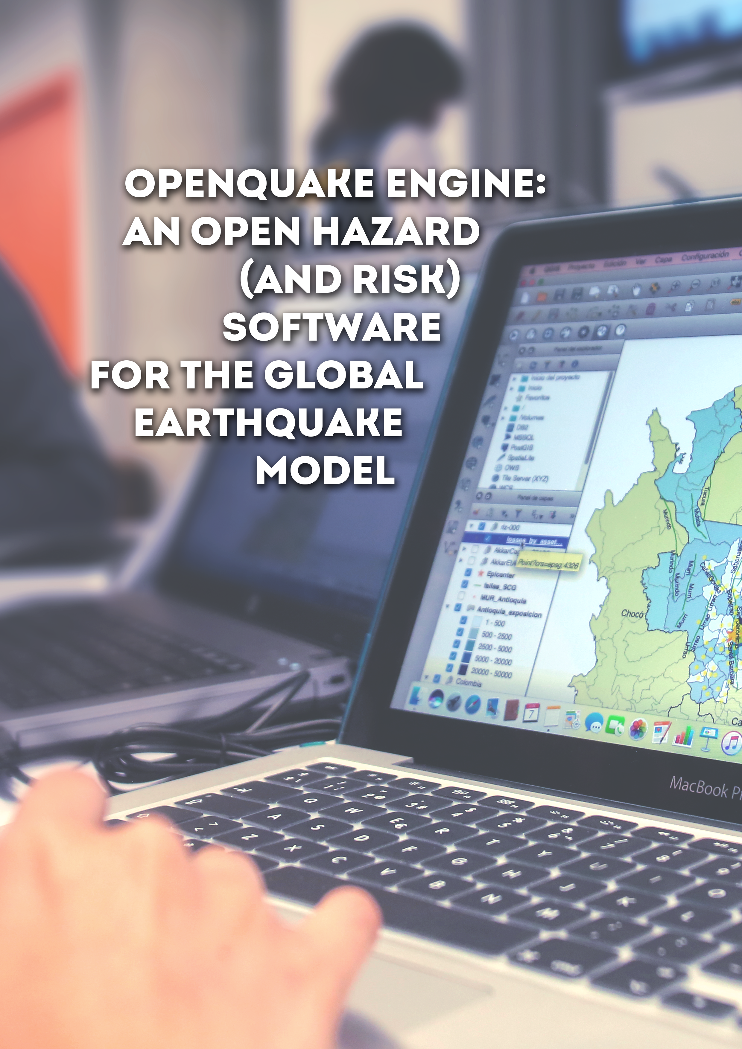
- OpenQuake Engine: An Open Hazard (and Risk) Software for the Global Earthquake Model | GEM Foundation
Publications OpenQuake Engine: An Open Hazard (and Risk) Software for the Global Earthquake Model Share Facebook LinkedIn Download 2014 | Peer-reviewed Since its inception in the 1960s, probabilistic seismic‐hazard analysis (PSHA) (Cornell, 1968; McGuire, 2004, 2008) has emerged as the principal methodology for assessing the potential hazard posed by earthquake ground motion in a broad range of contexts. Seismic‐hazard analysis serves different needs coming from a wide spectrum of users and applications. These may encompass engineering design, assessment of earthquake risk to portfolios of assets within the insurance and reinsurance sectors, engineering seismological research, and effective mitigation via public policy in the form of urban zoning and building design code formulation. End users of seismic‐hazard analyses from...