Thanks for submitting!
You will be contacted as soon as possible


QUICK LINKS


PROFILES
PUBLICATIONS
EXPOSURE
VULNERABILTY
SOFTWARE
EQ MODELS
Search Results
Search this site
1170 results found with an empty search
- Antarctica Hazard | GEM Foundation
License Request Form You have chosen to get more information about: Antarctica Hazard Hazard Please check the link below to see if this product already meets your your requirements before submitting your request for a license. Thank you. DOWNLOAD THE OPEN VERSION Summary of steps to obtain a license for the requested product. Fill in the application form below. Click Submit. Please check your email Inbox or Spam folder for the summary of your request. You will then be contacted by the GEM Product Manager with either a request for more information, or a request to sign the license. If you do not hear from us within 2 weeks, please send an email to product@globalquakemodel.org . REQUEST DETAILS A. Requesting party information First Name Last Name Role/Job Email Business type Business type Other business Sector Sector Other sector B. License agreement signatory information The signatory must be someone who is authorised to sign license agreements on your behalf such as your immediate supervisor, manager or legal officer. If you’re a PhD student, the signatory must be your adviser or a university officer in charge of license agreements or similar legal documents. Full Name of Signatory Position Company Email of Signatory Organisation name Complete Address C. Purpose of request GEM is able to offer products for free because of the support of our project partners, national collaborators and institutional sponsors. All of GEM’s products are freely available for public good, non-commercial use, but with different license restrictions. In most cases we release products under an open license (e.g., CC BY-SA or CC BY-NC-SA), which permits (re)distribution. In this case, we are granting access under a more restricted license that forbids distribution or disclosure and requires signing by GEM and the licensee in order to better assure accountability for the confidentiality of the information. In order for GEM to properly assess your request, please answer the following questions below. 1. Explain briefly how will the GEM product be used e.g. project, research including the expected results and the foreseen public benefit. Minimum 60 words. 2. Will you be able to share the results of your work with GEM? YES NO 3. Will you be able to provide feedback to GEM on the quality and usefulness of this product via a survey? YES NO D. Privacy Policy By submitting this form, you consent to the processing of your personal data in accordance with our Privacy Policy and the EU General Data Protection Regulation (GDPR). We are committed to safeguarding your information and ensuring it is only used for the purpose outlined in this form. You have the right to access, rectify, or delete your data at any time. For more information, please refer to our Privacy Policy. I agree Words: 0 Email us at product@globalquakemodel.org if you're experiencing problems submitting your application. Thank you. Submit Thanks for submitting! You will be contacted as soon as possible Incomplete data. Please fill in all required fields. Thank you.
- Exposure Data Development for the Global Earthquake Model: Inventory Data Capture Tools (IDCT) | GEM Foundation
Publications Exposure Data Development for the Global Earthquake Model: Inventory Data Capture Tools (IDCT) Share Facebook LinkedIn Download 2012 | Peer-reviewed The Global Earthquake Model represents a open initiative to develop software and tools for assessment of global seismic risk. This paper describes an open-source software suite and protocols for populating a Global Exposure Database of structural information being developed by GEM’s Inventory Data Capture Tools (IDCT) risk global component. Several data collection methods are used: remote sensing, direct field observations, and statisticallyinferred mapping schemes. Data are collected on pre-earthquake inventory, as well as post-event damage: rudimentary building information from optical satellite or aerial sensors, including the building footprints and height. Field-based observations collected on digital and paper tools by survey teams allow expert users to generate detailed structural information, including structural type, year built, and occupancy. Mapping schemes allow the generation of exposure information for user-defined areas of homogenous urban land use, using sampled field observations. These methods converge to feed GEM's Global Exposure Database and the Earthquake Consequences Database.
- Test Event 4 Homepage Banner
Post Event List PURPOSE The purpose of this page is to provide GEM website visitors, researchers, loss modellers, and emergency and disaster risk reduction professionals with specific downloadable information related to red alert events based on USGS PAGER alerts. GEM promotes the sharing of seismic hazard and risk information with a wide range of stakeholders to enhance understanding of damaging earthquake events. This initiative aims not only to give an overview of the models, data and publications available in areas recently impacted by earthquakes, but also hopes to serve as a resource that can inform future risk reduction strategies. The information provided is intended solely for situational awareness purposes and is not aimed towards driving an official emergency response. Please contact your local authorities for further assistance related to official emergency response services and support. Test Event 4 Homepage Banner Second round of add and edit tests for the post-event Homepage Banner USGS PAGER Alert https://earthquake.usgs.gov/data/pager/ Related GEM Products Name Description Caribbean & Central America Exposure Repository with the inventory of residential, commercial and industrial buildings in the Caribbean and Central America No content. Related GEM Publications Understanding seismic risk in Santiago de Cali (Colombia) for its application in risk management Earthquake-induced liquefaction and landslides in Cali, Colombia Modelling the Residential Building Inventory in South America for Seismic Risk Assessment Tipologías constructivas en Quito, Cali and Santiago de los Caballeros Seismic risk assessment for the residential buildings of the three major cities in Colombia: Bogotá, Medellín, and Cali Executive summary Urban seismic risk assessment for the cities of Quito, Cali and Santiago de los Caballeros Scenario selection for representative earthquakes in Quito, Cali and Santiago de los Caballeros Assessment of earthquake damage considering the characteristics of past events in South America Evaluación de Riesgo Sísmico para Santiago de Cali Model of seismic design regulations and lateral force coefficients for buildings in South America Exploring the seismic risk of the unreinforced masonry building stock in Antioquia, Colombia Modelling the Residential Building Inventory in South America for Seismic Risk Assessment No content. Other Related Products GEM Vulnerability Model for Colombia GEM's country risk profile for Colombia GEM's Country Risk Profile for Venezuela GEM Vulnerability Model for Venezuela GEM Exposure Model for Venezuela GEM's country risk profile for Japan GEM Exposure Model for Japan GEM Vulnerability Model for Japan GEM's country risk profile for Afghanistan GEM vulnerability model for Afghanistan GEM exposure model for Afghanistan (admin 1) Other Related Publications South America Risk Assessment (SARA) Project GEM's PSHA input model documentation for Middle East 1234 Yang et al. (2023) Probabilistic seismic hazard assessments for Myanmar and its metropolitan areas. Geoscience Letters, 10(1), 48 Tun et al. (2017) The Sagaing Fault, Myanmar. In A. J. Barber, K. Zaw, & M. J. Crow (Eds.), Myanmar: Geology, Resources and Tectonics (Vol. 48, p. 0). The Geological Society of London GEM's PSHA input model documentation for SouthEast Asia GEM's PSHA input model documentation for China GEM's PSHA input model documentation for China DISCLAIMER The information and data provided on this page are for informational purposes only. The Global Earthquake Model (GEM) Foundation makes no warranties, expressed or implied, regarding the accuracy, completeness, or reliability of the data. Users are responsible for their own interpretation and use of the information. GEM shall not be liable for any loss, damage, or injury arising from the use of, or reliance on, the information provided on this page. By downloading or utilising the data, users acknowledge and agree to these terms. The information presented on this page is provided by different organisations and governed by different licenses, please check the individual license before use. CONTACT US
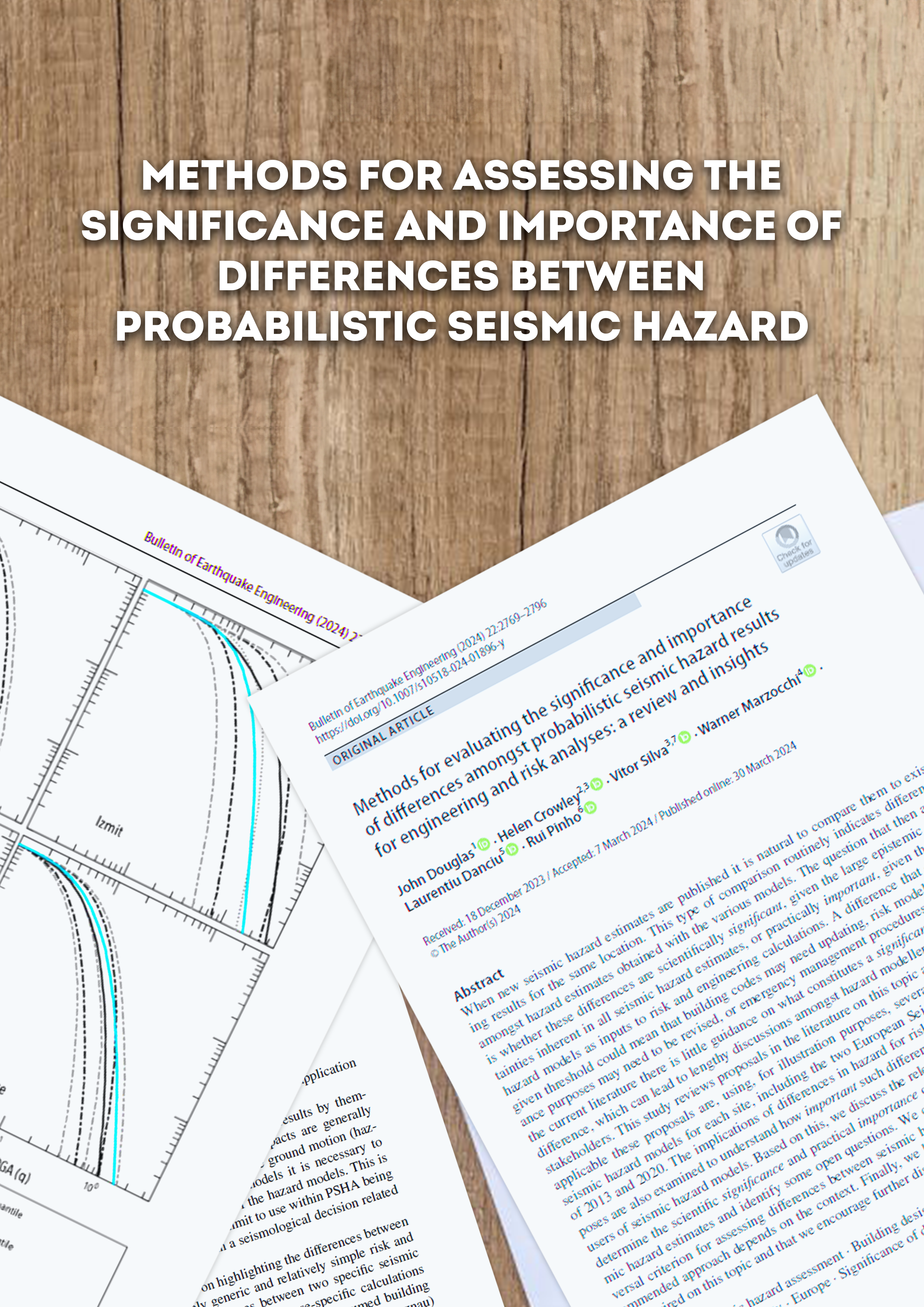
- Methods for assessing the significance and importance of differences between probabilistic seismic hazard | GEM Foundation
Publications Methods for assessing the significance and importance of differences between probabilistic seismic hazard Share Facebook LinkedIn Download 2024 | Peer-reviewed When new seismic hazard estimates are published it is natural to compare them to existing results for the same location. This type of comparison routinely indicates differences amongst hazard estimates obtained with the various models. The question that then arises is whether these differences are scientifically significant, given the large epistemic uncertainties inherent in all seismic hazard estimates, or practically important, given the use of hazard models as inputs to risk and engineering calculations. A difference that exceeds a given threshold could mean that building codes may need updating, risk models for insurance purposes may need to be revised, or emergency management procedures revisited. In the current literature there is little guidance on what constitutes a significant or important difference, which can lead to lengthy discussions amongst hazard modellers, end users and stakeholders. This study reviews proposals in the literature on this topic and examines how applicable these proposals are, using, for illustration purposes, several sites and various seismic hazard models for each site, including the two European Seismic Hazard Models of 2013 and 2020. The implications of differences in hazard for risk and engineering purposes are also examined to understand how important such differences are for potential end users of seismic hazard models. Based on this, we discuss the relevance of such methods to determine the scientific significance and practical importance of differences between seismic hazard estimates and identify some open questions. We conclude that there is no universal criterion for assessing differences between seismic hazard results and that the recommended approach depends on the context. Finally, we highlight where additional work is required on this topic and that we encourage further discussion of this topic.
- Seismic Risk Assessment Tools Workshop - Demonstration and Evaluation of Seismic Risk Assessment Tools - GEM Foundation
News Seismic Risk Assessment Tools Workshop - Demonstration and Evaluation of Seismic Risk Assessment Tools By: Jul 2, 2018 Share Facebook LinkedIn GEM showcased OpenQuake at the Seismic Risk Assessment Tools Workshop hosted by EU Science Hub's Joint Research Centre (JRC). Marco Pagani, GEM Hazard Coordinator and Catalina Yepes, GEM Seismic Risk Engineer presented OpenQuake’s data and tools during the Seismic Risk Assessment Tools workshop held in Ispra, Lombardia, Italy on May 11-12, 2017. Held in the European Crisis Management Laboratory, the Workshop brought together some of the most widely used modern seismic risk assessment tools and a number of Civil Protection authorities from countries of the European Civil Protection Mechanism. The objective was to demonstrate the use and capabilities of the tools, explore the possible use in near-real-time impact assessment and promote their use in risk planning and disaster response. No images found. GALLERY 1/0 VIDEO RELATED CONTENTS
- Understanding Seismic Resilience: GEM's Global Seismic Regulation Initiative - GEM Foundation
News Understanding Seismic Resilience: GEM's Global Seismic Regulation Initiative By: Jul 8, 2024 Jun 20, 2024 Share Facebook LinkedIn Building earthquake-resilient communities requires a deep understanding of national seismic design regulations. The Global Earthquake Model (GEM) Foundation is launching The Global Seismic Regulation Database and Mapping Project initiative. This project aims to create a comprehensive database of current and past seismic design regulations across the globe. This information, along with enforcement levels and seismic zonations, is important for earthquake engineers and risk modellers. It allows for the development of more accurate exposure and vulnerability models used in probabilistic seismic risk assessments and earthquake scenario planning. Your Contribution Matters To enrich this valuable resource, GEM is conducting a brief survey - "Evaluation of Seismic Design Code Enforcement Around the World". This survey gathers insights into the evolution and enforcement of seismic regulations in various countries. By participating, you'll be directly contributing to a more comprehensive understanding of seismic vulnerability and risk around the world. Rest assured, all responses are confidential and used solely for seismic risk-related activities by GEM. We encourage you to participate! Please click the button below to fill out the form. Take the survey! No images found. GALLERY 1/0 VIDEO RELATED CONTENTS
- GAR - Global Assessment Report on Disaster Risk Reduction 2019 | GEM Foundation
Publications GAR - Global Assessment Report on Disaster Risk Reduction 2019 Share Facebook LinkedIn Download 2019 | Report This fifth edition of the United Nations Global Assessment Report on Disaster Risk Reduction (GAR) is being issued four years after the adoption of the Sendai Framework for Disaster Risk Reduction 2015–2030 (Sendai Framework). Now is a time of heightened global urgency, and the need for ambitious collective action to reduce disaster risk, build resilience and achieve sustainable development has never been greater.
- Request demo for Country-Territory Seismic Risk Profiles | GEM Foundation
You have chosen to request a demo on: Country-Territory Seismic Risk Profiles First Name Last Name Email Company or Institution Name Country Sector Provide Details I accept the license terms and the conditions of products use. Email us at product@globalquakemodel.org if you're experiencing problems submitting this form or if you have any inquiries. Thank you. Request Thanks for submitting! You will be contacted as soon as possible Add answer here
- Global Recovery Map
Global Earthquake Maps Global Recovery Map VIEWER PDF PNG CONTRIBUTORS DOCUMENTATION References Burton C.G. (2015). A Validation of Metrics for Community Resilience to Natural Hazards and Disasters using the Recovery from Hurricane Katrina as a Case Study. 150(1):67–86. Cutter, S.L., Burton, C.G. and Emrich, C. (2010). Disaster Resilience Indicators for Benchmarking Baseline Conditions. , 7(1): 1-22. Cutter, S.L., Barnes, L., Berry, M., Burton, C.G., Evans, E., Tate, E.C. and Webb, J. (2008). A Place-based Model for Understanding Community Resilience to Natural Disasters. 18: 598-606. Despotaki*, V., Sousa, L., and Burton, C.G., (2018). Using Socio-economic Indicators for Earthquake Recovery Prediction. Earthquake Spectra, 34: 265-282. TECHNICAL DESCRIPTION The Recovery/Reconstruction Potential Map is closely aligned with the concept of disaster resilience. Enhancing a country’s resilience to earthquakes is to improve its capacity to anticipate threats, to reduce its overall vulnerability, and to allow its communities to recover from adverse impacts from earthquakes when they occur. The measurement of recovery and reconstruction potential includes capturing inherent conditions that allow communities within a country to absorb impacts and cope with a damaging earthquake event, such as the density of the built environment, education levels, and political participation. It also encompasses post event processes that facilitate a population’s ability to reorganize, change, and learn in response to a damaging earthquake. Criteria for indicator selection To choose indicators contextually exclusive for use in each map, the starting point was an exhaustive review of the literature on earthquake social vulnerability and resilience. For a variable to be considered appropriate and selected, three equally important criteria were met: - variables were justified based on the literature regarding its relevance to one or more of the indices. - variables needed to be of consistent quality and freely available from sources such as the United Nations and the World Bank; and - variables must be scalable or available at various levels of geography to promote sub-country level analyses. This procedure resulted in a ‘wish list’ of approximately 300 variables of which 78 were available and fit for use based on the three criteria. Process for indicator selection For variables to be allocated to an index, a two-tiered validation procedure was utilized. For the first tier, variables were assigned to each of the respective indices based on how each variable was cited within the literature, i.e., as being part of an index of social vulnerability, economic vulnerability, or recovery/resilience. For the second tier, machine learning and a multivariate ordinal logistic regression modelling procedure was used for external validation. Here, focus was placed on the statistical association between the socio-economic vulnerability indicators and the adverse impacts from historical earthquakes on a country-by country-basis. The Global Significant Earthquake Database provided the external validation metrics that were used as dependent variables in the statistical analysis. To include both severe and moderate earthquakes within the dependent variables, adverse impact data was collected from damaging earthquake events that conformed to at least one of five criteria: 1) caused deaths, 2) caused moderate damage (approximately $1 million USD or more), 3) had a magnitude 7.5 or greater 4) had a Modified Mercalli Intensity (MMI) X or greater, or 5) generated a tsunami. This database was chosen because it considers low magnitude earthquakes that were damaging (e.g., MW >=2.5 & MW<=5.5) and contains socio-economic data such as the total number of fatalities, injuries, houses damaged or destroyed, and dollar loss estimates in $USD. Countries not demonstrating at least a minimal earthquake risk, i.e., seismicity <0.05 PGA (Pagani et al. 2018) and <$10,000 USD in predicted average annual losses (Silva et al. 2018) were eliminated from the analyses so as not to include countries with minimal to no earthquake risk. A total study area consists of 136 countries. The Global Earthquake Model (GEM) Foundation The Global Socio-Economic Vulnerability Maps 2020 is a product of the GEM Foundation’s collaborative work with the Department of Geography at the University of Connecticut, USA. GEM is a non-profit foundation in Pavia, Italy funded through a public-private partnership with a vision to create a world that is resilient to earthquakes. Formed in 2009 through the initiative of the Organization for Economic Co-operation and Development (OECD) Global Science Forum in 2006, GEM participants represent national research and disaster management institutions; private sector companies mainly in insurance, risk financing and engineering; and academic and international organizations. GEM’s OpenQuake Platform website (platform.openquake.org) provides access to all of the data, models, tools and software behind the maps. GEM’s open-source OpenQuake engine enables probabilistic hazard and risk calculations worldwide and at all scales, from global down to regional, national, local, and site-specific applications in a single software package. GEM supports the Sendai Framework for Disaster Risk Reduction (SFDRR) goals by contributing openly accessible products for hazard and risk assessment and capacity development through risk reduction projects. GEM also serves as a baseline or exemplar for the development of a broader multi-hazard framework for risk assessment in support of a holistic and comprehensive approach to disaster risk reduction. Technical details on the development and compilation of the socio-economic vulnerability maps, underlying models and the list of contributors can be found at: https://www.globalquakemodel.org/svrmaps/Reconstruction-and-Recovery-Index-Technical-Description. How to use and cite this work Please cite this work as: C Burton, M. Toquica (September 2020). Global Earthquake Model (GEM) Social Vulnerability Map (version 2020.1) DOI: 10.13117/GEM-RECONSTRUCTION-RECOVERY-MAP. This work is licensed under the terms of the Creative Commons Attribution - Non Commercial-Share Alike 4.0 International License (CC BY-NC-SA). Acknowledgements This map is the result of a collaborative effort and extensively relies on the enthusiasm and commitment of various organisations to openly share and collaborate. The creation of this map would not have been possible without the support provided by several public and private organisations during GEM’s second and third working programmes, 2014-2018 and 2019-2021 respectively. None of this would have been possible without the extensive support of all GEM Secretariat staff. These key contributions are profoundly acknowledged. A complete list of the contributors can be found at: www. globalquakemodel.org/global-social-vulnerability. Legal statements This map is an informational product created by the GEM Foundation for public dissemination purposes. The information included in this map must not be used for the design of seismic socio-economic policies or to support any important decisions involving human life, capital and movable and immovable properties. The values of social vulnerability and risk values used in this map do not constitute an alternative nor do they replace any national government policy or actions defined in national codes or earthquake risk estimates derived nationally. Readers seeking this information should contact the national authorities tasked with socio economic and risk assessment. The socio-economic vulnerability maps are based on the results of an integration process that is solely the responsibility of the GEM Foundation. Contact GEM (Global Earthquake Model) Foundation Via Ferrata, 1 - 27100, Pavia, Italy info@globalquakemodel.org . More information available at: www. globalquakemodel.org/global-social-vulnerability MAJOR SPONSORS Verisk ARUP GEOSCIENCE AUSTRALIA CSSC NRCan EAFIT ETH ZURICH EUCENTRE FM GLOBAL GFZ GIROJ GNS SCIENCE HANNOVER RE MUNICH RE NTU ICRM NEPHILA NERC NIED NSET OYO PARTNER RE DPC SGC SWISS SER SWISS RE FOUNDATION SURAMERICANA TEM RCN USGS USAID WTW ZURICH INSURANCE
- OpenQuake Ground Motion Toolkit - UserGuide | GEM Foundation
Publications OpenQuake Ground Motion Toolkit - UserGuide Share Facebook LinkedIn Download 2014 | User manual This is the web repository of the GMPE Strong Motion Modeller's Toolkit (gmpe-smtk). The gmpe-smtk is a suite of tools developed by Scientists working at the GEM (i.e. Global Earthquake Model) Model Facility. The GMPE Strong Motion Modeller's Toolkit is free software: you can redistribute it and/or modify it under the terms of the GNU Affero General Public License as published by the Free Software Foundation, either version 3 of the License, or (at your option) any later version.