Thanks for submitting!
You will be contacted as soon as possible


QUICK LINKS


PROFILES
PUBLICATIONS
EXPOSURE
VULNERABILTY
SOFTWARE
EQ MODELS
Search Results
Search this site
1170 results found with an empty search
- Careers | Global Earthquake Model Foundation
GEM is an equal opportunity employer, and we do not discriminate in hiring or employment on the basis of any characteristic protected by law. WORK WITH US GEM is an equal opportunity employer, and we do not discriminate in hiring or employment on the basis of any characteristic protected by law. We offer a safe and comfortable working environment with competitive salaries based on a non-profit scale and commensurate with experience and qualifications. We offer a young, innovative and stimulating international working environment in Pavia, a university town in the North of Italy (35kms from Milan). Share Facebook LinkedIn Anchor 1 List of Vacancies Go Position Description Deadline Apply online Entry-Level Seismic Hazard Modeller The position involves developing probabilistic seismic hazard models, conducting research, and supporting scientific training. Open until a suitable candidate has been identified Geotechnical Earthquake Risk Modeller - Liquefaction and Landslides To help develop earthquake-triggered hazards and their integration into regional and global seismic risk assessment. Open until a suitable candidate has been identified Search
- Request demo for Sub-Saharan Africa Hazard | GEM Foundation
You have chosen to request a demo on: Sub-Saharan Africa Hazard First Name Last Name Email Company or Institution Name Country Sector Provide Details I accept the license terms and the conditions of products use. Email us at product@globalquakemodel.org if you're experiencing problems submitting this form or if you have any inquiries. Thank you. Request Thanks for submitting! You will be contacted as soon as possible Add answer here
- UNDRR Grant Boosts Seismic Risk Assessment in Bangladesh - GEM Foundation
News UNDRR Grant Boosts Seismic Risk Assessment in Bangladesh By: Sep 29, 2023 Share Facebook LinkedIn The United Nations Office for Disaster Risk Reduction (UNDRR) has granted support to the Global Earthquake Model Foundation (GEM) for a fundamental initiative aimed at earthquake risk assessment in Bangladesh. This project, running from August 2023 to March 2024, primarily focuses on generating sub-national earthquake risk analyses for Bangladesh. Closing the Knowledge Gap Bangladesh faces substantial seismic risks due to its diverse geography, from the active Himalayan belt in the north to seismic-prone southern regions. Vulnerable building typologies, rapid urbanization, liquefiable soils, non-engineered structures, and inadequate code enforcement contribute to high seismic risk. Earthquakes not only result in human and economic losses but also disrupt society and businesses for extended periods. To address this, this project aims to develop an open seismic risk model for Bangladesh, offering valuable insights for informed decision-making in disaster risk management. Expanding Collaborations with MoDMR Bangladesh's Ministry of Disaster Management and Relief (MoDMR), since 1972, has partnered with national and international entities for disaster risk assessment and mitigation. Collaborations with the United Nations Development Programme (UNDP) led to the Comprehensive Disaster Management Plan (CDMP) in 2004. The Bangladesh Urban Earthquake Resilience Project (BUERP) by the World Bank, in tandem with the Earthquakes and Megacities Initiative (EMI), commenced in 2012. More recent efforts include a localized Index for Risk Management (INFORM) and various academic studies. However, there is a gap signaled by the absence of an open seismic risk model for Bangladesh that may undermine the efficacy of earthquake risk management policies, programs, and investments. Within the scope of this project, we aim to bridge this gap to develop an open-source probabilistic seismic risk model for Bangladesh and transfer key insights from the risk assessment to decision-makers in the government and other key stakeholders in the disaster risk mitigation community in the country. Data Integration and Validation The main objective of this project is to develop a detailed, open, sub-national earthquake risk model and evaluate seismic risk for Bangladesh at the zila (district) and upazila (subdistrict) level. The project incorporates certain key updates to the probabilistic seismic hazard model for the Indian subcontinent in GEM’s Global Hazard mosaic, and integrates the hazard with updated high-resolution exposure and vulnerability data for Bangladesh, ensuring context-specific risk assessment. GEM's prior division-level maps for Bangladesh will be enhanced to upazila (subdistrict) level in this endeavor. Data sources include the Bangladesh Bureau of Statistics (BBS), Comprehensive Disaster Management Programme (CDMP), Ministry of Disaster Management and Relief (MoDMR), and others. A Collaborative Effort Kazi Shahidur Rahman, Humanitarian Affairs Specialist at the UN Resident Coordinator’s Office in Bangladesh, expressed his enthusiasm, acknowledging the project's alignment with government and stakeholder risk assessment activities. He conveyed gratitude to the Ministry of Disaster Management and Relief (MoDMR) for their enduring partnership with the Humanitarian Coordination Task Team (HCTT), underscoring their commitment to this crucial endeavor. Additional notes: Expert Panel Composition The technical panel steering this seismic risk assessment initiative is a collaborative assembly of key stakeholders and experts. Led by the Additional Secretary of Bangladesh's Ministry of Disaster Management and Relief (MoDMR), it comprises representatives from vital entities, including the Department Of Disaster Management (DDM), the Fire Service and Civil Defence of Bangladesh, the Ministry of Housing & Public Works (MoHPW), and the Statistics and Informatics Division (SID) of the Bangladesh Bureau of Statistics (BBS). In addition, the panel includes the participation of seasoned national experts specializing in seismic hazard and risk assessment from institutions such as the University of Dhaka (DU), Bangladesh University of Engineering and Technology (BUET), and Jahangirnagar University (JU). Further enriching the panel's knowledge base are contributions from the Geological Survey of Bangladesh, the Centre for Urban Studies (CUS), and the United Nations Development Programme (UNDP), Bangladesh. This diverse and multidisciplinary collaboration underscores the commitment to ensuring the project's success in bolstering earthquake preparedness and resilience across Bangladesh. No images found. GALLERY 1/0 VIDEO RELATED CONTENTS
- Evaluation of Seismic Risk on UNESCO Cultural Heritage sites in Europe | GEM Foundation
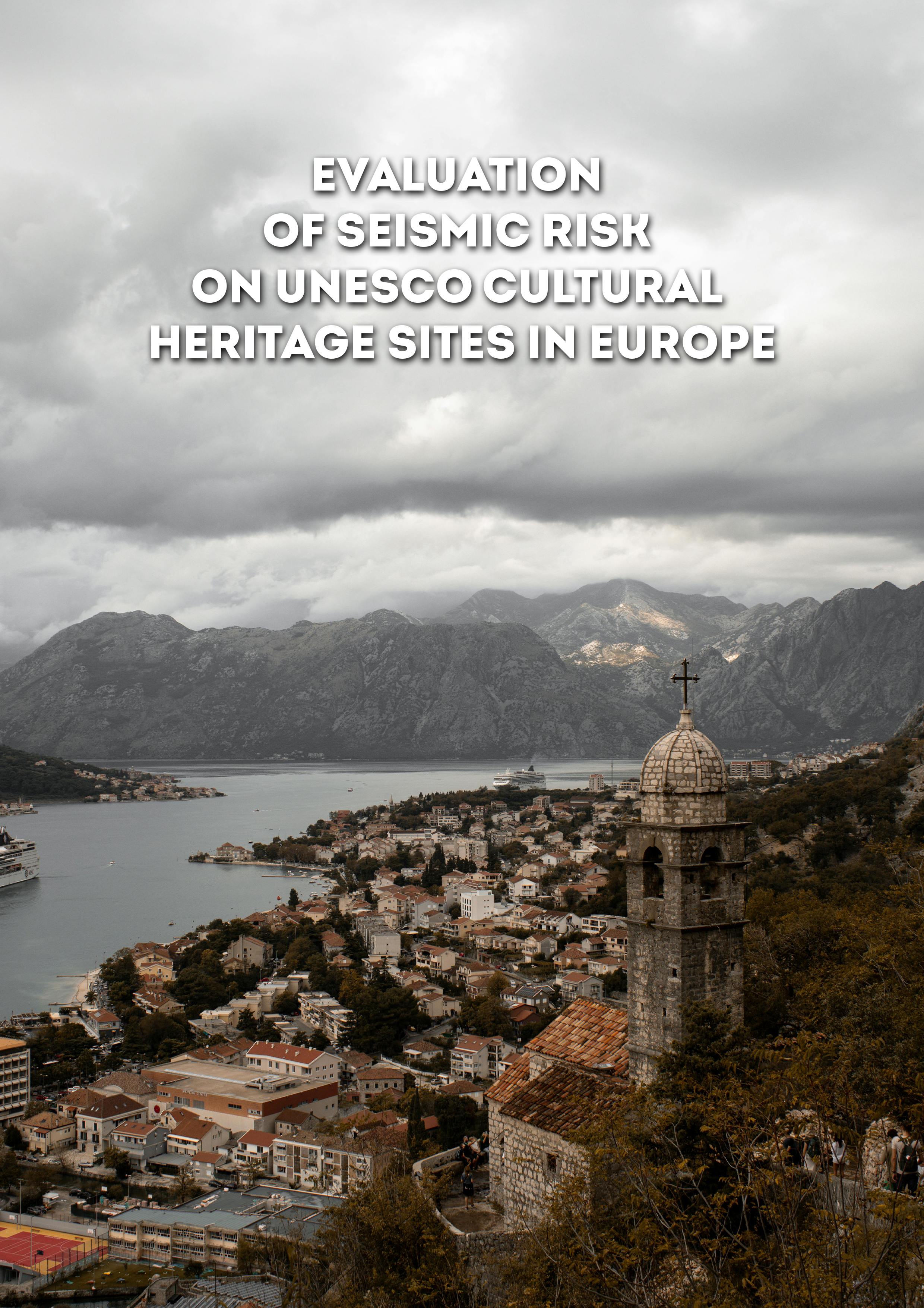
Publications Evaluation of Seismic Risk on UNESCO Cultural Heritage sites in Europe Share Facebook LinkedIn Download 2018 | Peer-reviewed Earthquakes have been responsible for the destruction of hundreds of monuments throughout human history. Due to their size, conservation state, and lack of seismic provisions, monuments are particularly vulnerable to the effects of geological hazards. The first step toward the mitigation of the earthquake threat consists of understanding the existing seismic risk and evaluating possible strategies to reduce it. This study presents a simplified assessment to evaluate the probability of damage due to ground shaking on UNESCO World Heritage cultural sites throughout Europe. The seismic hazard model (SHARE) has been employed to derive hazard curves, which were combined with a fragility model to calculate the annual probability of damage or collapse. These calculations were performed assuming different soil conditions, and the resulting risk metrics can be used for risk awareness, to inform the prioritization of the sites in need of structural interventions, and to support additional risk analysis.
- OpenQuake | Global Earthquake Model Foundation
OpenQuake (OQ) - comprised of the engine, platform and tools - caters to a variety of users, from modellers and researchers to emergency planners openquake OpenQuake (OQ) - comprised of the engine, platform and tools - caters to a variety of users, from modellers and researchers to emergency planners - OpenQuake is used for a wide range of purposes for disaster risk reduction and management. OQ Data & Tools OQ Training OQ Tutorials OQ Engine OQ Platform Anchor 1 Get started with the OQ Engine: read on below or visit our OQ GitHub website . The OpenQuake Engine is the Global Earthquake Model Foundation’s (GEM) state-of-the-art, open-source software collaboratively developed for earthquake hazard and risk modelling. It runs on operating systems such as Linux, macOS and Windows; and can be deployed on laptops, desktops, standalone servers and multi-node clusters. The functionality to analyze hazard and risks at specific site, city, country or regional level makes the OpenQuake Engine a powerful and dynamic tool for assessing the potential impacts of earthquakes at any location in the world. Instructions For modellers, researchers, scientists and engineers 01 Download the latest user manual . 02 Download the latest version of the 03 Follow the installation guide here . OpenQuake Engine Related Documentation Aunt Bette's Homemade Pecan Pie Rockin’ Rocky Road Ice Cream Tom’s Heavenly Apple Strudel Joe’s Divine Butter Tarts For developers 01 Follow the instructions here . Join the OpenQuake Forum Check OQ Engine's Project Status here. OpenQuake Engine Key Features HAZARD Classical PSHA*: hazard curves, hazard maps, uniform hazard spectra (UHS), disaggregation Event-based hazard : stochastic earthquake event sets and ground motion fields, hazard curves, hazard maps Scenario hazard: single event - stochastically generated ground motion fields Additional features: 5 typologies for modeling seismic sources 100+ GMPEs implemented and tested Tools for harmonizing catalogs, creating seismogenic input files, analyzing strong motions and GMPEs PHYSICAL RISK Classical PSHA-based: asset-specific loss exceedance curves, average annual loss, loss maps, building typology disaggregation Event-based risk: event loss tables, loss exceedance curves - asset specific and aggregated, average annual loss, loss maps, loss disaggregation Scenario hazard: loss statistics, loss maps Scenario damage: collapse maps, damage distribution per asset and building typology Single software Combines hazard and risk in a single software Compatibility Compatible with various existing hazard, vulnerability and exposure models Calculations Calculates scenario and probabilistic hazard and risk analysis Different Scales Supports calculations at different scales Uncertainties Accounts for wide spectrum of uncertainties Typologies Large set of source typologies for modelling faults as well as distributed seismicity Logic Tree Logic tree support (representing epistemic uncertainty) Explicit Uncertainty Explicit representation of uncertainty, including separation of epistemic from aleatory Pre-computed data Runs risk calculations for precomputed hazard curves and ground motion fields OQ Engine Calculators and Outputs OQ Platform The OpenQuake Platform is a website that allows the community to explore, manipulate and visualize the datasets and models and to use tools that GEM produces. The platform also allows users to contribute, share and discuss new findings and results with the GEM community. Share your outputs - datasets, maps, models - to the GEM OpenQuake community through the Platform. The OpenQuake Platform hosts a number of national, regional and global models. Follow the instructions below to access data from GEM and the OQ community. For users who only need outputs such as datasets, layers or maps, you can simply register for free and browse the Platform for the data that you need. To start sharing your data, follow the instructions below. Sign in or register here . Click Layers > Upload Layers Create maps based on GEM’s existing datasets or create one based on your uploaded Layer. Click Maps > Create Maps Save and Publish your map to share with the OpenQuake community. To start browsing and downloading data, follow the instructions below. Sign in or register here . In the Search box, type the name of the map or dataset you’re looking for. Look for your item from the search results, click to Download. To customize or create your own maps, click Maps > Create Maps Click the Add Layer icon and select from the available layers from the dropdown list. Save and Publish your map. Download your map. Sign in Register Openquake: Tools and Data GEM works on a wide range of open-source source (software) tools to allow you to calculate, share and explore earthquake risk. Most of these are already embedded in the platform , but others are released as stand-alone applications. All 0 Small Title BUSINESS NEWS License type: License type License type: License type Collapsible text is great for longer section titles and descriptions. It gives people access to all the info they need, while keeping your layout clean. Link your text to anything, or set your text box to expand on click. Write your text here... Product Group Sub Product Group Product Type License Type Sort by Order by View: Table Blocks 1 2 3 4 5 1 ... 1 2 3 4 5 6 7 8 9 10 11 12 13 14 15 16 17 18 19 20 21 22 23 24 25 26 27 28 29 30 31 32 33 34 35 36 37 38 39 40 41 42 43 44 45 46 47 48 49 50 51 52 53 54 55 56 57 58 59 60 61 62 63 64 65 66 67 68 69 70 71 72 73 74 75 76 77 78 79 80 81 82 83 84 85 86 87 88 89 90 91 92 93 94 95 96 97 98 99 100 ... 100 Openquake: Training The OpenQuake online training is designed for an audience with a diverse background and expertise and covers the main concepts of earthquake risk assessment, along with the basic features of the engine. The training activities have been tailored for beginner users, and are divided into four modules that cover different types of calculations using the OpenQuake-engine. Each module is approached from a technical and practical perspective. It includes a theoretical introduction, followed by step-by-step examples that help to consolidate the concepts, as well as exploring the OpenQuake tools for each type of calculation. Modules Module I: OpenQuake introduction https://www.training.openquake.org/oq-introduction Module II: Earthquake scenarios https://www.training.openquake.org/eq-scenarios Module III: Classical PSHA https://www.training.openquake.org/psha Module IV: Event-based analysis https://www.training.openquake.org/event-based Openquake: Tutorials OQ Engine Video Tutorials on seismic hazard and risk analysis available in English and Spanish. English https://www.youtube.com/watch?v=J46boursIRc&list=PL08aqbvcszvQxT_HMoSk0XisLw1twc3V4 Español https://www.youtube.com/watch?v=2rbDm-wiwbw&list=PL08aqbvcszvT6YG353CnIyL9d7gdZblBX OpenQuake - Software Installation and Demos OpenQuake Introduction - A software for Seismic Hazard and Risk Assessment OpenQuake - Ground Motion Fields: Theoretical Background OpenQuake - Scenario Damage and Loss: Theoretical Background OpenQuake - Scenario Damage and Loss: Hands-on exercise OpenQuake - Classical PSHA: Theoretical Background OpenQuake - Classical PSHA: Hands-on Exercise OpenQuake - Event-based Risk: Theoretical Background OpenQuake - Event-Based Risk: Hands-on Exercise OpenQuake - Volcanic Risk Scenarios: Theory and Hands-On Exercise https://www.youtube.com/watch?v=leF4aQXGdjk&t=1013s Learn the basics to perform volcanic risk scenarios using the OpenQuake engine. In this video we cover the main components of a seismic risk model and discuss how their modelling assumptions and products may be useful for volcanic risk assessment. We include a hands-on exercise using the software to calculate volcanic risk and the QGIS OpenQuake plug-in to export and visualize results, like total losses and loss maps for the El Ruiz Volcano.
- 10th Anniversary of OpenQuake | GEM Foundation
October 22, 2020 1600-1730 CEST the openquake 10 year anniversary webinar Read article Background The OpenQuake Engine is at the foundation of GEM’s hazard and risk assessment capability and is a hallmark of GEM’s open framework and global collaboration network. Since its first release 10 years ago, the OQ Engine has become the primary analysis tool used by a wide range of scientists and engineers worldwide for the analysis of earthquake hazard and risk at scales from site-specific and urban through to national, regional and global. Purpose To celebrate GEM’s and the OQ communities’ achievements in developing OQ and applying it to analyze seismic hazard and risk worldwide. To explore current capabilities and future directions in the development of the software and its applications. speakers John Schneider GEM Secretary General Marco Pagani GEM Hazard Laurentiu Danciu ETH Zurich Yufang Rong FM Global, USA Vitor Silva GEM Risk Murray Journeay NRCan, Canada Ana Beatriz Acevedo EAFIT Univ, Colombia agenda October 22, 2020 1600-1730 CEST topic speaker Introduction and brief history OQ Engine Hazard: past, present and future Working with the OQ Engine for site-specific, national and regional hazard assessment Seismic hazard analysis for engineering-based insurance applications OQ Engine Risk: past, present and future Building a national risk model for Canada Urban Risk Assessment in Colombia Questions and Answers, wrap-up John Schneider Marco Pagani Laurentiu Danciu Yufang Rong Vitor Silva Murray Journeay Ana Beatriz Acevedo John Schneider brochures presentations video a decade of serving oq engine to analize seismic hazard & risk to reduce losS of lives and properties for a safer and resilient future.
- GFDRR-DFID Challenge Funds Expert Workshop - GEM Foundation
News GFDRR-DFID Challenge Funds Expert Workshop By: Jul 2, 2018 Share Facebook LinkedIn The Global Facility for Disaster Reduction and Recovery (GFDRR) in collaboration with the Department for International Development of the United Kingdom is supporting the development of an open data schema for hazard, exposure and vulnerability data. This initiative is part of the Challenge Fund program to further the understanding of disaster risk in developing countries through access to risk data. The second round of the Challenge Fund focuses on three pilot projects that address the recommendations made in the recent GFDRR report Solving the Puzzle: Innovating to Reduce Risk - namely, to expand the effort to decrease disaster risk management costs and increase resilience by developing a framework that facilitates a multi-hazard view of risk. This effort is currently underway to develop the first set of open and internally consistent data on multiple hazards, exposure, and vulnerability. This work began last April with a project inception workshop at GEM Headquarters in Pavia. The University College London (UCL) EPICentre and CatLin XL hosted the second workshop held on July 27 in London to collect feedback from a number of partners across the disaster risk reduction (DRR), insurance, academia and CAT modelling communities on the following: the prototype data schemas; approaches to rating different indicators and data sources; and best ways on how to communicate risk information to different stakeholders. The GEM team, which leads Challenge Fund 2 on the development of a global exposure data framework, co-facilitated the physical vulnerability characteristics and exposure taxonomy roundtable discussion, which focused on identifying the most important vulnerability characteristics; ways to account for uncertainties in exposure and vulnerability models; type of assets that should be supported by the vulnerability and exposure database; and the most common and useful intensity measure types. Initial feedbackParticipants generally agreed that the vulnerability characteristics used to classify the building stock are well established, and that the GEM building taxonomy is a good starting point. For the most common or useful intensity measures to define the vulnerability functions for earthquakes, participants suggested ground shaking, landslides, liquefaction, ground failure and fire following. Other workshop sessions covered multihazard characteristics, social vulnerability, vulnerability scoring system and data schema uses and challenges in scaling globally. The expert workshop report is currently being prepared and will be shared with the public soon. GFDRR/DFID Challenge Fund 2The Global Earthquake Model Foundation (GEM) leads the GFDRR/DFID Challenge Fund 2 which to develop a global open exposure data repository framework. GEM is joined in the consortium by ImageCat Inc. and the Humanitarian OpenStreetMap Team to develop an open exposure database for multihazard risk assessment. No images found. GALLERY 1/0 VIDEO RELATED CONTENTS
- GEM-USAID CCARA Hazard Assessment in San José de Costa Rica - GEM Foundation
News GEM-USAID CCARA Hazard Assessment in San José de Costa Rica By: Jul 2, 2018 Share Facebook LinkedIn Some 16 scientists from Costa Rica, Dominican Republic, El Salvador, Haiti, Nicaragua, Panama and Spain attended a hazard workshop in San José, Costa Rica from September 18th to 22nd as part of the risk assessment activities of the CCARA project (Assessing and Mitigating Earthquake Risk in the Caribbean and Central America). GEM, in collaboration with the United States Agency for International Development (USAID) conducted the workshop while the Laboratorio Nacional de Materiales y Modelos Estructurales (LANAMME - http://www.lanamme.ucr.ac.cr/ ) - University of Costa Rica hosted the week-long event. GEM representatives - Julio García, Senior Hazard Scientist, and Marco Pagani, Hazard Coordinator - delivered the workshop in two parts: the first focused on the tools developed by GEM for the construction of seismic hazard models and for the calculation of hazard; while the second focused on the participants’ discussion on the current status of the datasets and hazard models developed in the context of the CCARA project. During the workshop, there was general agreement and appreciation among the participants for the intermediate results presented. However, despite significant progress, they also recognized that the work to be completed was still considerable. Dr. Rolando Castillo, (Coordinator - Programme of Structural Engineering, Lanamme, Universidad de Costa Rica) considered the workshop “a complete success”. He expressed satisfaction with the presentations by GEM scientists because they “provided [the participants] with useful information on seismic source definition and modelling; hazard catalogue and modeler’s toolkit; ground motion prediction equations; and ground motion toolkit and demos”. Dr. Douglas Hernández (Dirección General del Observatorio Ambiental. Ministerio de Medio Ambiente y Recursos Naturales (MARN), El Salvador) shared the same observation saying after the workshop, “users learned how to evaluate each step of the hazard assessment process”. In general, participants demonstrated a strong interest to continue collaborating with GEM to reduce seismic risk and to improve the knowledge on this topic. Dr. Vladimir Jiménez (Structural and Geotechnical Engineer, Pontificia Universidad Católica de Chile, Dominican Republic) agreed and expressed the same enthusiasm to collaborate more with institutions with the aim of reducing earthquake risk in South America. On the last day of the workshop, a broad discussion on synergies between CCARA and national initiatives opened potential collaborations that could help in expanding the impact of the CCARA project beyond its completion date in March 2018. No images found. GALLERY 1/0 VIDEO RELATED CONTENTS
- Canada Hazard | Global EarthQuake Model Foundation
OpenQuake engine input model to perform hazard calculations for Canada Products Canada Hazard OpenQuake engine input model to perform hazard calculations for Canada Share Facebook LinkedIn Description The v2025.0.0 Canada model is a modified implementation of the 6th Generation Seismic Hazard Model of Canada. For official documentation, refer to https://www.earthquakescanada.nrcan.gc.ca/. The previous model for Canada, the 5th Generation Seismic Hazard Model (Halchuk et al., 2015), was produced by Natural Resources Canada (NRC) in order to develop the 2015 National Building Code of Canada. How to cite this work For official documentation and citation, please refer to https://www.earthquakescanada.nrcan.gc.ca/. Available Versions The latest version (v2025.0.0) is available for direct download under an Open Government License - Canada 2.0 license. Users interested in this version can click the "Open Version Download" button in the right panel to access the information. Previous versions of this model are listed in the table at the bottom of this page. License information The open version is available under an OPen Government License - Canada. See https://open.canada.ca/en/open-government-licence-canada You are free to: Copy, modify, publish, translate, adapt, distribute or otherwise use the Information in any medium, mode or format for any lawful purpose. You must, where you do any of the above: Acknowledge the source of the Information by including any attribution statement specified by the Information Provider(s) and, where possible, provide a link to this licence. If the Information Provider does not provide a specific attribution statement, or if you are using Information from several information providers and multiple attributions are not practical for your product or application, you must use the following attribution statement: Contains information licensed under the Open Government Licence – Canada. Any deviation from these terms incur in license infringement. Facebook LinkedIn Share Latest Version v2025.0.0 License Open Government License - Canada 2.0 Available resources Open Version Download Documentation License Request text Map View Search Popup title Close Country/Region Available Resources Afghanistan Exposure Africa Exposure Alaska Exposure Country/Region Available Resources Afghanistan Vulnerability Africa Vulnerability Alaska Vulnerability Country/Region Resource Url Afghanistan Risk Profile Africa Risk Profile Alaska Risk Profile Search Found Country/Region Resource Url Afghanistan Exposure Africa Exposure Alaska Exposure Preview Preview is not available. Search Found Country/Region Resource Url Afghanistan Vulnerability Africa Vulnerability Alaska Vulnerability Preview Preview is not available. Search Found Country/Region Resource Url Afghanistan Risk Profile Africa Risk Profile Alaska Risk Profile Preview Preview is not available. Previous Product Versions Product Version License Documentation Access Request / Open Repository v2015.1.1 CC BY-NC-SA 4.0 Read https://cloud.openquake.org/s/8TH6ikPBRG4eGcC Related products Global Liquefaction Hazard Global Exposure Model Global Vulnerability Model Global Seismic Embodied Carbon Risk Global Seismic Risk Map Country-Territory Seismic Risk Profiles Model Builder's Toolkit (oq-mbtk) Global Seismic Hazard Map Related publications For downloading or accessing detailed product information like PNG/PDF maps, datasets, license request, shapefiles and more, please switch to a desktop or laptop computer. Thank you for your understanding.
- GEM launches its Impact Story Series project - GEM Foundation
News GEM launches its Impact Story Series project By: Dec 18, 2019 Share Facebook LinkedIn Science for Social Change: pilot GEM Impact Story GEM is proud to announce the launch of its Impact Story Series project as part of the organizational strategy to capture the successes of its project partners, collaborators and sponsors in the use of GEM tools, products and expertise. Earthquake risk assessment remains abstract and highly technical, and there are significant risks that due to poor or limited understanding of it, policymakers and the public at large may not be able to fully take advantage of existing and future information that can either help create better or enhance existing earthquake risk reduction and management strategies, especially at the local and national level. Specifically, the GEM Impact Story project aims to: Collect and document stories where GEM and its partners have contributed to positive change Encourage policy and decision makers to use science- and evidence- based information to formulate earthquake DRR strategy at the national level through positive stories of change Increase awareness of the public at large on earthquake risk and preparedness The project is expected to encourage and inspire sponsors to share their stories that leverage GEM products and expert advice; and to identify demonstrators and champions to concretely showcase GEM impact or use of GEM products. The collected stories are also envisioned to catalyze the development of a clearer, impact-oriented documentation of GEM projects and organizational activities. In the pilot story, Science for Social Change, GEM interviewed Prof. Ana Beatriz Acevedo of EAFIT University to get to know her insights, perspectives and her work in Colombia around earthquake risk awareness, understanding and resilience. The interview also touched on how and why she got involved with GEM. To get a preview of her story, click . The full launch of pilot story will be done early next year. This will include a photo blog, a brochure of the full text of her interview and a 3-minute video. If you have a story to share, please contact jephraim.oro@globalquakemodel.org. No images found. GALLERY 1/9 Gallery VIDEO RELATED CONTENTS