Thanks for submitting!
You will be contacted as soon as possible


QUICK LINKS


PROFILES
PUBLICATIONS
EXPOSURE
VULNERABILTY
SOFTWARE
EQ MODELS
Search Results
Search this site
1170 results found with an empty search
- Educating for Tomorrow: How GEM Supports the Next Generation’s Disaster Preparedness - GEM Foundation
News Educating for Tomorrow: How GEM Supports the Next Generation’s Disaster Preparedness By: Oct 9, 2024 Oct 13, 2024 Share Facebook LinkedIn The International Day for Disaster Risk Reduction (IDDRR) 2024, themed “Empowering the next generation for a resilient future,” highlights the crucial role of education in safeguarding children and youth from escalating disaster risks. As climate change intensifies the frequency and severity of natural hazards, ensuring that educational institutions are resilient and that young people are equipped with essential disaster risk management knowledge becomes increasingly vital. “For this year's International Day for Disaster Risk Reduction, we are calling on countries to protect and empower children and youth through education. We must ensure that all schools are disaster-resilient and retrofit those at risk. Children must be equipped with knowledge about hazards and disaster risk management, and countries should endorse the Comprehensive School Safety Framework 2022-2030. If we achieve 100% school safety by 2030, we will be acting responsibly toward future generations.” - Kamal Kishore, Special Representative of the Secretary-General of the United Nations Office for Disaster Risk Reduction (UNDRR) https://www.youtube.com/watch?v=dQKgBQ7Mbnc https://youtu.be/dQKgBQ7Mbnc?si=ocGaomK9WZlZSeRE GEM's Contributions While the Global Earthquake Model (GEM) Foundation does not directly focus on youth-specific activities, our broader projects and activities support the goals of IDDRR 2024. Initiatives such as the FORCE Project , which enhances earthquake risk modeling and communicating hazard and risk information effectively, and the TREQ Project , which promotes public understanding of earthquake risks by focusing on capacity building and effective risk communication. Another key example is the Malawi Multi-Hazard Risk Assessment , which emphasises safeguarding educational infrastructure from various hazards, including floods, droughts, earthquakes, and strong winds. By analysing the vulnerability of schools to multiple hazards and recommending seismic risk awareness campaigns, the project highlights how schools can be central to building disaster resilience and empowering youth in Malawi. Additionally, the recent GEM-EGU Summer School on GeoHazards Risk Assessment provided young scientists and professionals with hands-on training in risk assessment, ushering a new generation of disaster risk professionals equipped to contribute to global resilience efforts. Forecasting and Communicating Earthquake Hazard and Risk (FORCE) The ongoing project Forecasting and Communicating Earthquake Hazard and Risk (FORCE) is dedicated to improving earthquake risk modeling and communicating hazard information effectively to diverse audiences. By integrating cutting-edge risk assessment tools and promoting collaboration among local stakeholders, FORCE empowers communities to better understand seismic risks. The project’s focus includes creating earthquake hazard and risk models for smaller regions, where the capacity to assess risk may be limited. FORCE also emphasises knowledge transfer through training workshops, ensuring that local governments and communities are equipped with the tools needed for effective disaster risk reduction. One of the project’s core objectives is to enhance the ability of local communities to interpret and act on earthquake risk information. FORCE engages a wide range of stakeholders, including government agencies, disaster management professionals, and community leaders. While not directly targeting youth, FORCE’s training initiatives contribute to a more informed public, helping create a resilient future for all generations. Learn more here . Malawi Multi-Hazard Risk Assessment The Malawi Multi-Hazard Risk Assessment project provided critical insights into the country's vulnerability to various hazards, including floods, droughts, earthquakes, and strong winds. Key elements of the project involved exposure mapping and the definition of social vulnerability indicators, alongside the estimation of multi-risk indicators for various building types, such as schools, residential, industrial, government and healthcare facilities. The project thoroughly examined the vulnerability of schools, assessing infrastructure weaknesses that could disrupt education during disasters. Data provided by Malawi's Ministry of Education included details on primary and secondary schools. In the absence of local building typology data, the project used international benchmarks to estimate building and content values. A crucial aspect of the project was identifying 60 social vulnerability factors, 11 of which were related to education, with two focused specifically on schools: the lack of internet connectivity and school inaccessibility during the rainy season. These factors underscore the infrastructure deficiencies that can hinder education and emergency responses during disasters. Limited internet access affects the flow of critical information, while poor infrastructure can worsen during heavy rains, affecting school attendance. GEM’s seismic risk assessment also highlighted the importance of safeguarding educational infrastructure and recommended local-level seismic risk awareness campaigns. Schools can serve as vital hubs for building disaster resilience by educating communities about earthquake preparedness and ensuring a safer future for Malawi’s youth. Learn more here . Training and Communication for Earthquake Risk Assessment (TREQ) The Training and Communication for Earthquake Risk Assessment (TREQ) project aims to enhance public understanding of earthquake risks by focusing on capacity building and community-level awareness. The project trained disaster risk professionals and public communicators, enabling them to lead community workshops in cities like Cali, Quito, and Santiago. These efforts help raise seismic risk awareness and encourage local stakeholders to engage actively in disaster preparedness. TREQ also develops educational materials such as teacher guidelines, public-facing videos, and urban risk profiles for targeted cities. These resources play a crucial role in spreading seismic risk knowledge to the broader public, empowering communities, including youth, to mitigate disaster risks and take proactive steps toward resilience. Learn more here . GEM-EGU Summer School on GeoHazards Risk Assessment The GEM-EGU Summer School on GeoHazards Risk Assessment, held in September 2024, provided young scientists and professionals with advanced training in earthquake and geohazard risk assessment. Through interactive sessions and hands-on exercises, participants learned to use GEM’s tools, such as the OpenQuake engine, to assess earthquake risk and enhance resilience in their local communities. The program encouraged collaboration among participants from diverse backgrounds, facilitating knowledge exchange and the development of practical skills. Read the related article here . Preparing Future Generations for a Safer Tomorrow Through a diverse range of projects like the Malawi Multi-Hazard Risk Assessment, FORCE, TREQ, and the GEM-EGU Summer School, the Global Earthquake Model (GEM) Foundation is actively contributing to global disaster risk reduction efforts. By promoting resilience in communities and equipping stakeholders with the tools and knowledge needed to understand and mitigate earthquake risks, GEM plays a crucial role in preparing future generations to face the growing challenges of natural hazards. While GEM’s focus may not be specifically on youth, its initiatives align with the goals of IDDRR 2024 by ensuring that education and preparedness are at the forefront of building a more resilient future for all. ## No images found. GALLERY 1/0 VIDEO RELATED CONTENTS
- India and surroundings Hazard | GEM Foundation
License Request Form You have chosen to get more information about: India and surroundings Hazard Hazard Please check the link below to see if this product already meets your your requirements before submitting your request for a license. Thank you. DOWNLOAD THE OPEN VERSION Summary of steps to obtain a license for the requested product. Fill in the application form below. Click Submit. Please check your email Inbox or Spam folder for the summary of your request. You will then be contacted by the GEM Product Manager with either a request for more information, or a request to sign the license. If you do not hear from us within 2 weeks, please send an email to product@globalquakemodel.org . REQUEST DETAILS A. Requesting party information First Name Last Name Role/Job Email Business type Business type Other business Sector Sector Other sector B. License agreement signatory information The signatory must be someone who is authorised to sign license agreements on your behalf such as your immediate supervisor, manager or legal officer. If you’re a PhD student, the signatory must be your adviser or a university officer in charge of license agreements or similar legal documents. Full Name of Signatory Position Company Email of Signatory Organisation name Complete Address C. Purpose of request GEM is able to offer products for free because of the support of our project partners, national collaborators and institutional sponsors. All of GEM’s products are freely available for public good, non-commercial use, but with different license restrictions. In most cases we release products under an open license (e.g., CC BY-SA or CC BY-NC-SA), which permits (re)distribution. In this case, we are granting access under a more restricted license that forbids distribution or disclosure and requires signing by GEM and the licensee in order to better assure accountability for the confidentiality of the information. In order for GEM to properly assess your request, please answer the following questions below. 1. Explain briefly how will the GEM product be used e.g. project, research including the expected results and the foreseen public benefit. Minimum 60 words. 2. Will you be able to share the results of your work with GEM? YES NO 3. Will you be able to provide feedback to GEM on the quality and usefulness of this product via a survey? YES NO D. Privacy Policy By submitting this form, you consent to the processing of your personal data in accordance with our Privacy Policy and the EU General Data Protection Regulation (GDPR). We are committed to safeguarding your information and ensuring it is only used for the purpose outlined in this form. You have the right to access, rectify, or delete your data at any time. For more information, please refer to our Privacy Policy. I agree Words: 0 Email us at product@globalquakemodel.org if you're experiencing problems submitting your application. Thank you. Submit Thanks for submitting! You will be contacted as soon as possible Incomplete data. Please fill in all required fields. Thank you.
- China Financial Loss Model | Global EarthQuake Model Foundation
Country model to assess potential financial losses to commercial, industrial and residential buildings due to earthquakes Products China Financial Loss Model Country model to assess potential financial losses to commercial, industrial and residential buildings due to earthquakes Share Facebook LinkedIn Description The China financial loss model has been developed by GEM using public sources of information, such as past seismicity, and geodetic and geologic data for the hazard component, combined with exposure and vulnerability data. The hazard component incorporates both faults and area sources. Earthquake occurrence rates on active faults are based on a new tectonic block model derived from the joint inversion of geodetic and geologic data. The model provides estimates of financial risk to residential, commercial and industrial buildings using GEM’s vulnerability models appropriate to Chinese construction practice. GEM has also developed an exposure model that can be used to estimate total losses to the building stock in addition to portfolio losses. Further technical information can be found in the documentation. GEM extensively collaborated with its private and public partners to test and validate the model against industry standards in order to produce a new model that represents GEM’s view of risk. The model is available in Oasis LMF format. How to cite this work N.A. Available Versions The latest version (v2022) created by GEM can be requested by clicking on the "License Request", where a specific license will be provided, depending on the use case. The model is also available through Verisk's Model Exchange platform formats by clicking on the links in the right panel. License information Currently, the model is only available under a restricted license that has to be tailored for each specific use case. Facebook LinkedIn Share Latest Version v2022 License Custom License Available resources OASIS Model License Request text Map View Search Popup title Close Country/Region Available Resources Afghanistan Exposure Africa Exposure Alaska Exposure Country/Region Available Resources Afghanistan Vulnerability Africa Vulnerability Alaska Vulnerability Country/Region Resource Url Afghanistan Risk Profile Africa Risk Profile Alaska Risk Profile Search Found Country/Region Resource Url Afghanistan Exposure Africa Exposure Alaska Exposure Preview Preview is not available. Search Found Country/Region Resource Url Afghanistan Vulnerability Africa Vulnerability Alaska Vulnerability Preview Preview is not available. Search Found Country/Region Resource Url Afghanistan Risk Profile Africa Risk Profile Alaska Risk Profile Preview Preview is not available. Related products Colombia Financial Loss Model South Africa Financial Loss Model Related publications For downloading or accessing detailed product information like PNG/PDF maps, datasets, license request, shapefiles and more, please switch to a desktop or laptop computer. Thank you for your understanding.
- GEM Global Historical Earthquake Archive (GHEA) | GEM Foundation
License Request Form You have chosen to get more information about: GEM Global Historical Earthquake Archive (GHEA) Hazard Please check the link below to see if this product already meets your your requirements before submitting your request for a license. Thank you. DOWNLOAD THE OPEN VERSION Summary of steps to obtain a license for the requested product. Fill in the application form below. Click Submit. Please check your email Inbox or Spam folder for the summary of your request. You will then be contacted by the GEM Product Manager with either a request for more information, or a request to sign the license. If you do not hear from us within 2 weeks, please send an email to product@globalquakemodel.org . REQUEST DETAILS A. Requesting party information First Name Last Name Role/Job Email Business type Business type Other business Sector Sector Other sector B. License agreement signatory information The signatory must be someone who is authorised to sign license agreements on your behalf such as your immediate supervisor, manager or legal officer. If you’re a PhD student, the signatory must be your adviser or a university officer in charge of license agreements or similar legal documents. Full Name of Signatory Position Company Email of Signatory Organisation name Complete Address C. Purpose of request GEM is able to offer products for free because of the support of our project partners, national collaborators and institutional sponsors. All of GEM’s products are freely available for public good, non-commercial use, but with different license restrictions. In most cases we release products under an open license (e.g., CC BY-SA or CC BY-NC-SA), which permits (re)distribution. In this case, we are granting access under a more restricted license that forbids distribution or disclosure and requires signing by GEM and the licensee in order to better assure accountability for the confidentiality of the information. In order for GEM to properly assess your request, please answer the following questions below. 1. Explain briefly how will the GEM product be used e.g. project, research including the expected results and the foreseen public benefit. Minimum 60 words. 2. Will you be able to share the results of your work with GEM? YES NO 3. Will you be able to provide feedback to GEM on the quality and usefulness of this product via a survey? YES NO D. Privacy Policy By submitting this form, you consent to the processing of your personal data in accordance with our Privacy Policy and the EU General Data Protection Regulation (GDPR). We are committed to safeguarding your information and ensuring it is only used for the purpose outlined in this form. You have the right to access, rectify, or delete your data at any time. For more information, please refer to our Privacy Policy. I agree Words: 0 Email us at product@globalquakemodel.org if you're experiencing problems submitting your application. Thank you. Submit Thanks for submitting! You will be contacted as soon as possible Incomplete data. Please fill in all required fields. Thank you.
- A Conference, an Earthquake and a Reminder of Why We Do This Work - GEM Foundation
News A Conference, an Earthquake and a Reminder of Why We Do This Work By: by Helen Crowley Jul 15, 2026 Jul 15, 2026 Share Facebook LinkedIn During the GEM Conference in Zagreb, two powerful earthquakes struck Venezuela in quick succession. As news emerged and the scale of the disaster became clearer, with thousands of lives lost and many more people injured or displaced, our conversations about earthquake hazard and risk assessment suddenly felt much less theoretical. Only afterwards did it occur to me how extraordinary the timing had been. The conference had brought together many of the scientists and practitioners behind the world's leading rapid earthquake impact systems, including ShakeMap , PAGER , GDACS and GEM , to discuss how earthquake impact information can be made faster, more reliable and more useful. Coincidentally, the conference also marked the release of GEM's new generation of global earthquake hazard and risk models, the result of several years of collaboration with partners around the world. Within hours, many of those same tools and models were being used to produce an initial picture of the earthquake's impacts. Through GEM's role in the ARISTOTLE consortium, we shared our rapid impact assessment for the Venezuela earthquakes with the European Union's Emergency Response Coordination Centre. It was an early estimate, not a substitute for information from those on the ground. But in the first hours after an earthquake, this type of analysis can help identify where the impacts are likely to be greatest, providing valuable situational awareness while more detailed information is still emerging. For me, it was a powerful reminder of why this work matters. Earthquake risk modelling can often sound highly technical. We talk about hazard curves, exposure databases, vulnerability functions, loss estimates and uncertainty. These are all essential, but behind them lie some very practical questions: where is the ground likely to shake or deform, how often might it happen, who and what is at risk, and how can that information help people make better decisions before and after earthquakes? Those questions are becoming more urgent because the world exposed to earthquakes is changing. Cities continue to grow. Infrastructure systems are becoming increasingly interconnected. Buildings, populations and economies are evolving. The consequences of earthquakes are no longer measured only by damaged buildings, they also affect transport networks, utilities, hospitals, livelihoods, supply chains and public finances. This means our models need to evolve as well. That idea was reflected throughout this year's conference and underpins GEM's latest global model release. The aim is not simply to update datasets, but to broaden our understanding of earthquake risk and provide information that is more relevant to the decisions governments, businesses, emergency managers and communities face before and after earthquakes. This includes expanding our understanding of topics such as infrastructure risk, future exposure and the environmental consequences of earthquakes. None of this can be achieved by a single organisation. One of GEM's greatest strengths is its ability to bring together researchers, governments, civil protection agencies, development banks, engineers, insurers and many others around shared tools, data and models. Earthquakes cross borders, and the science we use to understand them has to be collaborative too. Looking back, what stays with me most from the conference is not only the scientific advances that were presented, but how quickly they became relevant. Within hours of discussing new approaches to earthquake hazard and risk assessment, many of those same methods were being applied to help understand a real disaster unfolding thousands of kilometres away. It was a reminder that our work is never just about developing better models. It is about helping societies prepare before earthquakes happen and supporting better decisions when they do. Of course, better models will never prevent earthquakes from happening. But they can help countries identify where risk is highest, prioritise investment, strengthen infrastructure, prepare financially and respond with better information when disasters occur. That is the main message I took away from Zagreb. If we want to reduce future losses, we need to keep investing in the models, data and partnerships that turn scientific advances into better decisions. ## No images found. GALLERY 1/0 VIDEO RELATED CONTENTS
- GEM and its partners complete GFDRR’s Challenge Funds Global Exposure Database for Multi-hazard Risk Analysis (GED4ALL) - GEM Foundation
News GEM and its partners complete GFDRR’s Challenge Funds Global Exposure Database for Multi-hazard Risk Analysis (GED4ALL) By: May 28, 2018 Share Facebook LinkedIn A consortium led by the GEM Foundation with partners ImageCat Inc. and the Humanitarian OpenStreetMap Team completed recently an open exposure database for multi-hazard risk assessment, as part of the Challenge Funds portfolio, managed by the GFDRR, and funded by the Department for International Development (DFID) of the United Kingdom. The main objective of Challenge Fund Global Exposure Database for Multi-hazard Risk Analysis is the development of an open exposure database, for the purposes of performing multi-hazard risk analyses. The database is capable of storing different assets (building stock, lifelines, crops, socio-economic data) across six natural hazards: earthquakes, floods, volcanoes, strong winds, tsunamis and drought. The database has been successfully piloted in Tanzania for the development of an exposure model at the national scale, and to the city of Dar Es Salaam demonstrating how an exposure dataset at a building-by-building resolution can be created. The process has also been demonstrated for five countries around Tanzania (Ethiopia, Uganda, Kenya, Malawi and Mozambique) as well as Cape Verde, Senegal, Mali, Niger and in other countries outside of the African continent. The outputs include a detailed description of the structure of the tables comprising the GED4ALL exposure database schema and the relationships between them, a description of the software components required for installation and basic operation of the database and the associated tools for converting, importing and exporting data. Paul Henshaw, GEM Director of Technology and Development also notes that “The project is a major step forward in defining a global multi-hazard database for use in assessing risks due to natural hazards. The approach also demonstrates how the combination of international expertise, open standards, local knowledge, inclusiveness and collaborative approach can encourage risk awareness and mitigation.” Paul also presented the final outputs of Global Facility for Disaster Recovery and Reduction (GFDRR) Challenge Fund 2: Global Exposure Database for Multi-hazard Risk Analysis (GED4ALL) during the projects closing workshop held in Dar Es Salaam, Tanzania from 22-24 March. The British Geological Survey (BGS) and University College London (UCL) presented the results of Challenge Fund 1 (multi-hazard database) and 3 (vulnerability database) respectively. More than 30 individuals participated from various organizations such as Geological Survey of Tanzania, Ardhi University (Tanzania), Dar Es Salaam University (Tanzania), DFID Tanzania, Prime Minister's Office - Disaster Management Department (Tanzania), DoMA (Malawi), INGC (Mozambique), Ministry of Energy & Mineral Development (Uganda), ImageCat (USA), Humanitarian OpenStreetMap Team (HOT Indonesia), NSET (Nepal), GFDRR (USA), DFID UK, IDF (Switzerland), BGS (UK), UA (Netherlands), NGI (Norway), NOC (UK), CIMA (Italy) and UCL-EPI (UK). No images found. GALLERY 1/0 VIDEO RELATED CONTENTS
- GEM1 Best Practices for Using Macroseismic Intensity and Ground Motion Intensity Conversion Equations for Hazard and Loss Models in GEM1 | GEM Foundation
Publications GEM1 Best Practices for Using Macroseismic Intensity and Ground Motion Intensity Conversion Equations for Hazard and Loss Models in GEM1 Share Facebook LinkedIn Download 2010 | Report Macroseismic shaking intensity is a fundamental parameter for the development, calibration, and use in a variety of hazard maps as well as in empirical (direct) and semi-empirical (indirect) earthquake shaking loss methodologies. Macroseismic data also quantify damage from past and present events and facilitate communicating ground motion levels in terms of human experiences and incurred losses. The aim of this report is to summarize and recommend “best practices” for the use of macroseismic intensity in conjunction with hazard maps (particularly ShakeMaps) and as input to associated loss models. The continued reliance on macroseismic intensity data dictates that ground motion prediction equations (GMPEs) alone are not always sufficient for estimating or constraining shaking hazards. Relations that allow direct estimation of intensity given an earthquake magnitude and distance, and those that convert ground motions to intensity (and vice versa) are required. Forward estimation of macroseismic intensities take two primary forms: 1) direct intensity prediction equations (IPEs), and 2) ground-motion-to-intensity conversion equations (GMICE). In addition, one can potentially better constrain historical ground motions at particular sites by employing intensity-to-ground-motion conversion equations (IGMCEs), though such equations are rare. Both the Global Earthquake Model (GEM) and Global ShakeMap (GSM) require advice and optimization in the state-of-the-art use of ground motion and intensity data. We provide background on the issues relating ground motions to intensities, directly predicting intensities, and offer insight into their uses. In the end, we recommend initial default IPE and GMICE selections for use in the immediate short term while additional research on these fronts continues and develops. A brief summary of highly related, current studies that help inform this report is also provided. Based on these ongoing analyses, and this report’s summary, we provide recommendations for further refinements in the form of continued research and development efforts.
- Combining USGS ShakeMaps and the OpenQuake-engine for damage and loss assessment | GEM Foundation
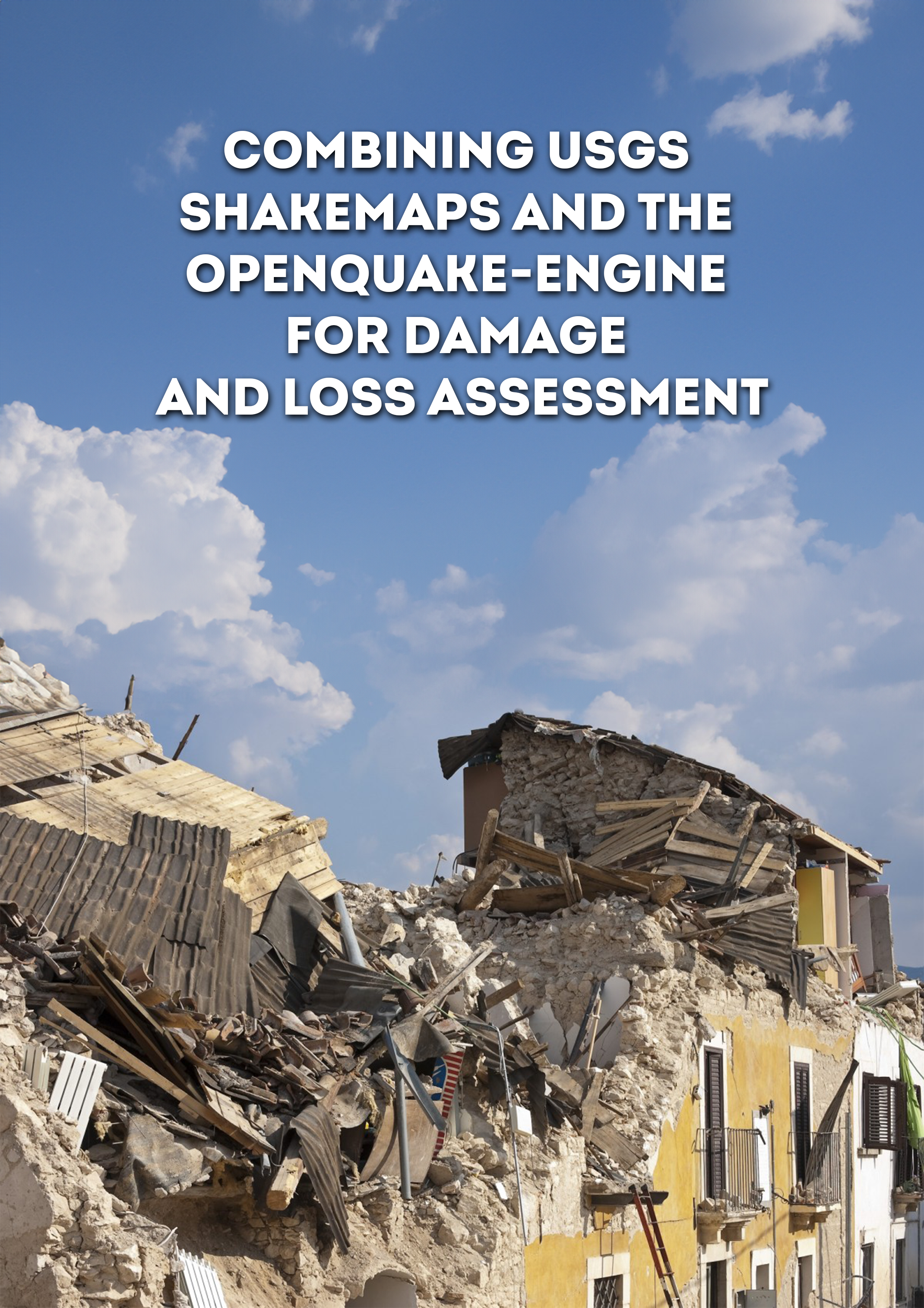
Publications Combining USGS ShakeMaps and the OpenQuake-engine for damage and loss assessment Share Facebook LinkedIn Download 2019 | Peer-reviewed The evaluation of the potential impact of strong seismic events shortly after their occurrence is a critical step to organise emergency response and consequently minimise the adverse effects of earthquakes. The estimation of the impact from earthquakes considering the observed ground shaking from past events can be useful for the calibration of existing exposure and/or fragility and vulnerability models. This study describes a methodology to combine the publicly available information from the USGS ShakeMap system and the open‐source software OpenQuake engine for the assessment of damage and losses. This approach is employed to estimate the number of structural collapses considering the 2012 Magnitude 5.9 Emilia‐Romagna (Italy) earthquake and the aggregated economic loss because of the 2010 Magnitude 7.1 Darfield (New Zealand) event. Several techniques to calculate the ground shaking in the affected region considering the spatial and interperiod correlations in the intra‐event ground motion residuals are investigated and their influence in the resulting damage or loss estimates are evaluated.
- Active Faults Database | GEM Foundation
License Request Form You have chosen to get more information about: Active Faults Database Hazard Please check the link below to see if this product already meets your your requirements before submitting your request for a license. Thank you. DOWNLOAD THE OPEN VERSION Summary of steps to obtain a license for the requested product. Fill in the application form below. Click Submit. Please check your email Inbox or Spam folder for the summary of your request. You will then be contacted by the GEM Product Manager with either a request for more information, or a request to sign the license. If you do not hear from us within 2 weeks, please send an email to product@globalquakemodel.org . REQUEST DETAILS A. Requesting party information First Name Last Name Role/Job Email Business type Business type Other business Sector Sector Other sector B. License agreement signatory information The signatory must be someone who is authorised to sign license agreements on your behalf such as your immediate supervisor, manager or legal officer. If you’re a PhD student, the signatory must be your adviser or a university officer in charge of license agreements or similar legal documents. Full Name of Signatory Position Company Email of Signatory Organisation name Complete Address C. Purpose of request GEM is able to offer products for free because of the support of our project partners, national collaborators and institutional sponsors. All of GEM’s products are freely available for public good, non-commercial use, but with different license restrictions. In most cases we release products under an open license (e.g., CC BY-SA or CC BY-NC-SA), which permits (re)distribution. In this case, we are granting access under a more restricted license that forbids distribution or disclosure and requires signing by GEM and the licensee in order to better assure accountability for the confidentiality of the information. In order for GEM to properly assess your request, please answer the following questions below. 1. Explain briefly how will the GEM product be used e.g. project, research including the expected results and the foreseen public benefit. Minimum 60 words. 2. Will you be able to share the results of your work with GEM? YES NO 3. Will you be able to provide feedback to GEM on the quality and usefulness of this product via a survey? YES NO D. Privacy Policy By submitting this form, you consent to the processing of your personal data in accordance with our Privacy Policy and the EU General Data Protection Regulation (GDPR). We are committed to safeguarding your information and ensuring it is only used for the purpose outlined in this form. You have the right to access, rectify, or delete your data at any time. For more information, please refer to our Privacy Policy. I agree Words: 0 Email us at product@globalquakemodel.org if you're experiencing problems submitting your application. Thank you. Submit Thanks for submitting! You will be contacted as soon as possible Incomplete data. Please fill in all required fields. Thank you.
- GEM at Jornadas de Amenaza y Riesgo Sísmico 2018 in Bogotá, Colombia - GEM Foundation
News GEM at Jornadas de Amenaza y Riesgo Sísmico 2018 in Bogotá, Colombia By: Jul 2, 2018 Share Facebook LinkedIn From February 19th to 21st, the GEM Foundation was hosted by the Colombian Geological Service during their Jornadas de Amenaza y Riesgo Sísmico 2018, three days dedicated to discuss seismic hazard and risk assessment, and its application in structural design and building code regulations. One full day was also dedicated to GEM’s OpenQuake engine. More than 220 people attended the event, among whom were hazard and risk modelers, public and private stakeholders, and students of Engineering and Earth Science. To open the three-day workshop, Dr Óscar Eladio Paredes, Director General of the SGC said. “We take the challenge of knowing the seismic hazard and risk as rigorously as possible. Likewise, we are aware that knowledge does not come from a single institution, and this implies a greater challenge, and that is to build it with the contribution of an open and participative technical community. This approach has allowed the Geological Service to explore novel methodologies and establish alliances with national and international experts for the development of a national seismic hazard model, which we have developed jointly with the GEM Foundation (Global Earthquake Model) during the last two years.” On February 19th, during the session “De la amenaza sísmica al diseño sismo resistente” session (“From seismic hazard to seismic resistant design”), Julio García, Senior Hazard Scientist at GEM, in collaboration with the Colombian Geological Service, presented the new seismic hazard model for Colombia, also sharing methodological aspects, results and application of the model. The afternoon sessions dealt with the use of national hazard models for structural design of infrastructure, new methodologies for risk assessment on buildings, and the use of active faults in seismic hazard analysis. During the last session, in addition to the participants, professionals from Geoestudios (Ecuador), Universidad del Norte (Colombia), Sociedad Colombiana de Geotecnia, Universidad de San Luís (Argentina) and Universidad Eafit (Colombia) were involved in a debate on the state of knowledge of seismic resistant design and the prospects for Colombia. On February 20th, the sessions were dedicated to seismic risk assessment. Public and private, as well as national and international authorities, addressed many issues related to comprehensive risk management, among which were the elaboration of exposure models for Colombia, financial risk management for disaster risk reduction - presented by the Treasury Department, and safe and sustainable construction. In the afternoon of February 20th and on the 21st, GEM carried out a workshop called “Evaluación del riesgo sísmico usando OpenQuake” (“Seismic risk assessment using OpenQuake”), facilitated by the GEM risk team. During the event, participants experienced first hand how to use OpenQuake, in particular the use of data to calculate seismic risk, the procedure to evaluate and describe inputs for the analysis of loss and damage scenarios, and in general, how to measure seismic risk. Workshops on the OpenQuake engine are particularly welcomed in countries like Colombia, where learning how to assess seismic risk is considered essential. The Universidad Nacional de Colombia mentions the GEM workshop in this article: https://agenciadenoticias.unal.edu.co/detalle/article/estudiantes-aprenden-a-calcular-amenaza-sismica-con-openquake.html GEM and SGC are committed to continue its strong collaboration to further advance seismic hazard and risk assessment in the country and the region. No images found. GALLERY 1/0 VIDEO RELATED CONTENTS