Thanks for submitting!
You will be contacted as soon as possible


Description
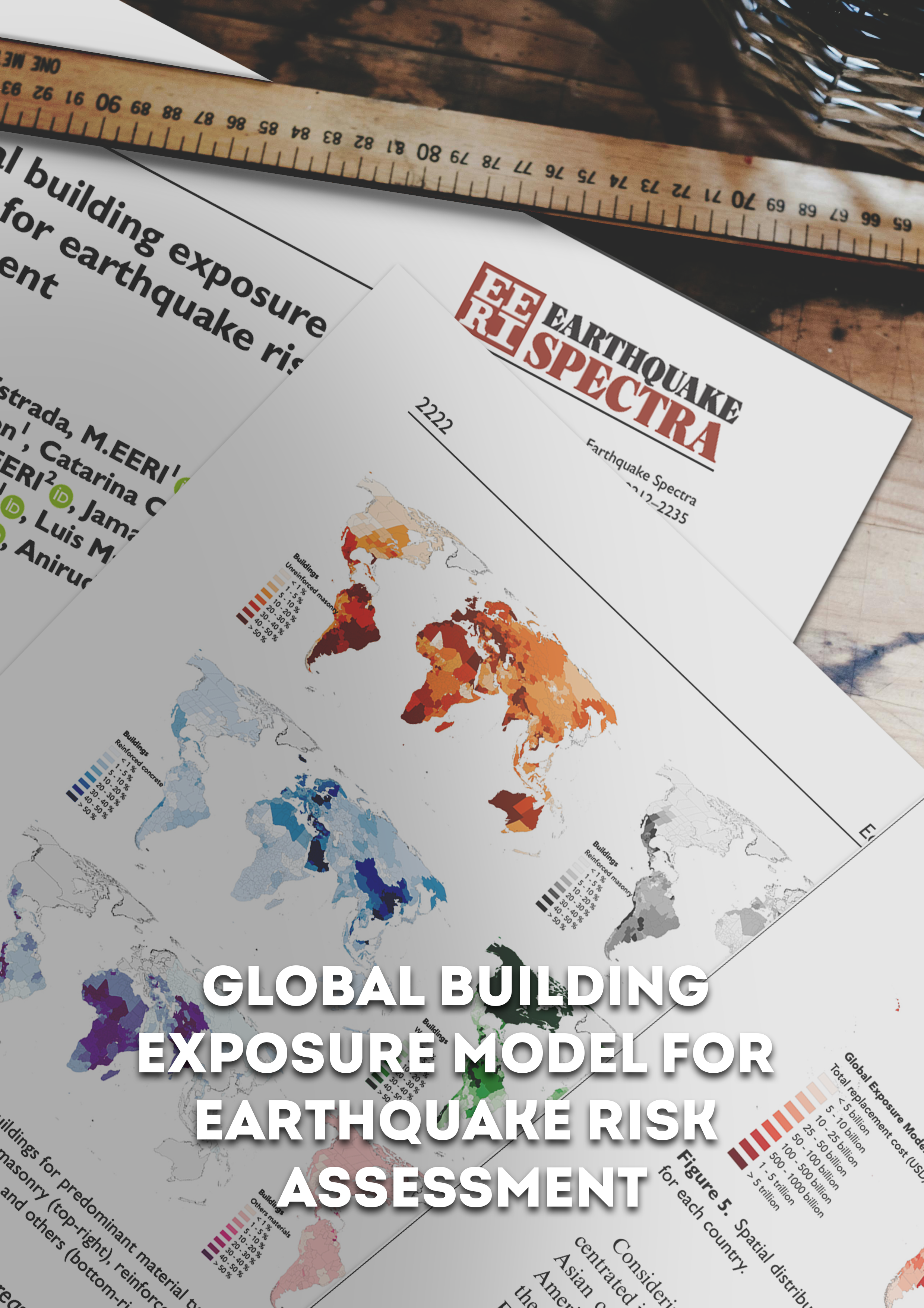
The v2026.1 Global Exposure Model is a mosaic of local and regional models with information regarding the residential, commercial, and industrial building stock at the smallest available administrative division of each country and includes details about the number of buildings, number of occupants, vulnerability characteristics, average built-up area, and average replacement cost.
The dataset is developed and maintained by the GEM Foundation, using a bottom-up approach at the global scale, using national statistics, socio-economic data, and local datasets. The datasets employed to develop this model were provided by national institutions, or developed within the scope of regional programs or bilateral collaborations. The global maps and the underlying databases are based on best available and publicly accessible datasets and models.
This model allows the identification of the most common types of construction worldwide, regions with large fractions of informal construction, and areas prone to natural disasters with a high concentration of population and building stock. The underlying datasets used to create the maps are available for all regions of the world, aggregated at Administrative Level 1 under a CC BY-NC-SA license, or further disaggregated to higher administraive units or 1km grid cells, under specific licenses.
The open and downloadable Global Exposure Maps (v2026.1) in PNG format, represent the geographic distribution of residential, commercial and industrial buildings in terms of four exposure metrics: number of buildings, economic loss, number of occupants and the replacement embodied carbon. The data is presented on a hexagonal grid, with a spacing of 0.25 × 0.30 decimal degrees, corresponding to an area of about 1,700 km2 per cell. These maps can also be explored through the Geoviewer.
How to cite this work
If you make use of this work, please cite both the publication and the data.
Publication:
Yepes-Estrada, C., Calderon, A., Costa, C., Crowley, H., Dabbeek, J., Hoyos, M., Martins, L., Paul, N., Rao, A., Silva, V. (2023). Global Building Exposure Model for Earthquake Risk Assessment. Earthquake Spectra. doi:10.1177/87552930231194048
Data:
Yepes-Estrada, C., Baiguera, M., Calderon, A., Caruso, M., Costa, C., Gonzalez, D., Nafeh, A.M.B., Rao, A., Silva, V. (2026). Global Exposure Model (2026.0.0). Zenodo. https://doi.org/10.5281/zenodo.8117363.
Available Versions
An open version (v2026.0.0) of the model, agreggated at Administrative Level 1, is available for direct download under a CC BY-NC-SA 4.0 license. Users interested in this version can click the "Open Repository" button in the right panel to access the information. The full version for any country/territory, at the highest resolution available or disaggregated to 1km grid cells, can be requested by clicking on the "License Request", where a specific license will be provided, depending on the use case. Additionally, users interested in the previous versions of the Global Exposure Maps can access these from the table at the bottom of this page.
License information
The open version is available under a Creative Commons CC BY-NC-SA 4.0 license, which requires:
Attribution (you must give appropriate credit, provide a link to the license, and indicate if changes were made)
Non-commercial (you may not use the material for commercial purposes)
ShareAlike (derivatives created must be made available under the same license as the original)
Any deviation from these terms incur in license infringement. For commercial use of the dataset, a specific license agreement must be made tailored to your use case, in such instance please click on "License Request".
By selecting a region in the global map below, a table will appear with the region, country, or territory for which GEM currently has exposure models. You can also use the Search box to find a specific country or territory's exposure model.


Popup title
Country/Region | Available Resources |
|---|---|
Albania | Vulnerability |
Algeria | Vulnerability |
American Samoa | Vulnerability |
Country/Region | Resource Url |
|---|---|
Albania | Risk Profile |
Algeria | Risk Profile |
American Samoa | Risk Profile |
Search
Found
Country/Region | Resource Url |
|---|---|
Albania | Vulnerability |
Algeria | Vulnerability |
American Samoa | Vulnerability |
Preview

Preview is not available.
Search
Found
Country/Region | Resource Url |
|---|---|
Albania | Risk Profile |
Algeria | Risk Profile |
American Samoa | Risk Profile |
Preview
Preview is not available.
Previous Product Versions
Product Version | Data | Image | Poster | Documentation | Geoviewer |
v2018.1 | N/A | N/A | |||
v2023.1 |
Related products

GEM Building Taxonomy

Global Seismic Embodied Carbon Risk

Global Seismic Risk Map

Country-Territory Seismic Risk Profiles

Global Liquefaction Hazard

OpenQuake Engine

Global Seismic Hazard Map
Global Map of Road Exposure to Ground Shaking and Liquefaction

Global Exposure Model

Global Vulnerability Model
Related publications
Global building exposure model for earthquake risk assessment

Development of a global seismic risk model