Thanks for submitting!
You will be contacted as soon as possible


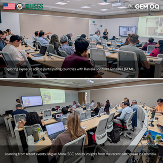
More than 30 researchers, engineers and public sector practitioners from 11 countries gathered in San Salvador from 25 to 27 August to examine how earthquake hazard and risk information can support rapid response during destructive seismic events, and the design of safer buildings through the use of modern seismic provisions and regulations.
The workshop was held as part of SAFER (Seismic Hazard Models to Earthquake Shaking for Construction and Next Generation Forecasts for Rapid Global Earthquake Response), a GEM project sponsored by the U.S. Department of State and the USGS Earthquake Disaster Assistance Team (EDAT). As the project drew to a close, the meeting offered an opportunity to bring SAFER’s technical work into conversation with local experts and identify common priorities across the region.



Improving rapid impact assessment
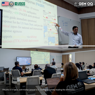
One focus was the next generation of the USGS PAGER system, which provides estimates of fatalities and economic losses following significant earthquakes worldwide. Discussions brought together GEM’s 2026 Global Risk Model, the International Macroseismic Scale (IMS-25) and national annexes, exposure data, and methods for assessing damage from post-earthquake images.
Participants also considered the information available in their countries and how local knowledge could help interpret and improve the data used in rapid impact assessment.
Informing seismic design
The workshop also examined how seismic hazard information informs earthquake loads in building codes across Europe and the Americas. Participants compared design ground motions and risk-targeted approaches in the United States, Europe, and Latin America, with further insights into the Model Seismic Code for the region (CMS), alongside the ASCE Earthquake Loads Overseas (AELO) initiative.
Perspectives on national codes and recent earthquakes in Colombia and Venezuela helped ground the discussion in the conditions and decisions facing institutions at present.


Continuing the exchange
Together, these conversations addressed two applications of earthquake risk information: estimating impacts soon after an event and informing the design of safer buildings. They also created space for GEM, USGS and participating institutions to consolidate a group of experts with common goals in the region, compare approaches and identify questions for continued exchange beyond the SAFER project.
GEM thanks the U.S. Department of State, USGS, El Salvador’s Ministry of Environment and Natural Resources (MARN), and all participants for their contributions.
No images found.
GALLERY


VIDEO

RELATED CONTENTS
