Thanks for submitting!
You will be contacted as soon as possible


QUICK LINKS


PROFILES
PUBLICATIONS
EXPOSURE
VULNERABILTY
SOFTWARE
EQ MODELS
Search Results
1136 results found with an empty search
- GFDRR-DFID | Global Earthquake Model Foundation
Projects GFDRR-DFID GFDRR-DFID Challenge Funds Versión en español English version Share Facebook LinkedIn Overview Anchor 6 Background The Global Facility for Disaster Reduction and Recovery (GFDRR) and the UK Department for International Development's (DFID) competitive Challenge Fund pilots new and innovative approaches to overcoming technical and technological challenges in order to strengthen disaster and climate risk decision-making in developing countries. To this end, this project is supporting the development of data, products, and approaches to support disaster risk management decision-making and build resilience, including through better information, but also strengthening key steps in moving from information to insight and behaviour change. Each challenge is focusing on the development of a database with hazard footprints, exposure information and vulnerability models. The viability of the databases will be demonstrated using exposure data for Tanzania and another DFID priority country. Objectives The project is divided into three components. The British Geological Survey leads the development of a data schema and data for a multi-hazard database (Challenge 1) while GEM and University College London lead the development of a global exposure database (Challenge 2) and open vulnerability platform for evaluating risk (Challenge 3) respectively. GEM also contributes to Challenge Fund 1 and 3. GEM leads Challenge Fund 2 on the development of a global exposure data framework, which includes the physical vulnerability characteristics and exposure taxonomy. The aim is to identify the most important vulnerability characteristics; ways to account for uncertainties in exposure and vulnerability models; type of assets that should be supported by the vulnerability and exposure database; and the most common and useful intensity measure types. The objective of this project is to develop a Data Exploration Tool to promote the ability of a user to access, understand and use hazard, exposure and vulnerability data stored in a format that follows the data schema developed by the Challenge Fund consortia. British Geological Survey (BGS) leads the development of a data schema and data for a multi-hazard database (Challenge 1) GEM Foundation leads the development of a global exposure database (Challenge 2) University College London (UCL) leads the development of open vulnerability platform for evaluating risk (Challenge 3) Various organizations also participated and contributed to the project such as the Geological Survey of Tanzania; Ardhi University (Tanzania); Dar Es Salaam University (Tanzania); DFID Tanzania; Prime Minister's Office - Disaster Management Department (Tanzania); DoMA (Malawi); INGC (Mozambique); Ministry of Energy & Mineral Development (Uganda); ImageCat (USA); Humanitarian OpenStreetMap Team (HOT Indonesia); NSET (Nepal); IDF (Switzerland); UA (Netherlands); NGI (Norway); NOC (UK); CIMA (Italy); and UCL-EPI (UK). Locations Tanzania and neighbouring countries Anchor 1 Anchor 5 Anchor 4 The GFDRR-DFID Challenge Fund projects on the development of exposure, vulnerability and hazard footprints databases kicked off with a 2-day inception workshop. The University College London (UCL) EPICentre and CatLin XL hosted the second workshop held on July 27 in London to collect feedback. A consortium led by the GEM Foundation with partners ImageCat Inc. and the Humanitarian OpenStreetMap Team completed recently an open exposure database for multi-hazard risk assessment... Anchor3 Publications GFDRR-UK Aid Challenge Fund: Final Learning Report: Value of Risk Information for Decision Making May 31, 2018 How can innovative approaches make communities more resilient to climate change and natural disasters? GFDRR-DFID Challenge Funds Round 2 Extensible Data Schemas for Multiple Hazards, Exposure and Vulnerability Data published as part of the UNDRR GAR2019 . Data schema and data: for multi-hazard database (BGS), for global exposure database (GEM), for a global database of vulnerability functions (UCL)
- CAREC | Global Earthquake Model Foundation
Projects CAREC Developing a Disaster Risk Transfer Facility in the Central Asia Regional Economic Cooperation Region Versión en español English version Share Facebook LinkedIn Overview Outreach Anchor 6 Background Willis Towers Watson, a GEM Advisor Sponsor is leading the consortium of organizations to implement the project, “Developing a Disaster Risk Transfer Facility in the Central Asia Regional Economic Cooperation Region” supported by the Asian Development Bank. The GEM Risk Team is responsible for the exposure and seismic vulnerability components of the project, with the Hazard Team providing support in the preparation of risk profiles for countries in the Central Asia Regional Economic Cooperation Region. Objectives The project has three main components: (i) development of disaster risk assessments and modeling in all CAREC countries; (ii) design of a regional pilot disaster risk transfer facility for at least three CAREC countries; and (iii) capacity building and awareness raising activities to sensitize key public and private stakeholders in all CAREC countries about the benefits of disaster risk reduction, risk retention and risk transfer solutions. Willis Towers Watson, a GEM Advisor Sponsor is leading the consortium of organizations that will implement the project. The Central Asia Regional Economic Cooperation, or CAREC Program is a partnership of 11 countries (Afghanistan, Azerbaijan, People's Republic of China, Georgia, Kazakhstan, Kyrgyz Republic, Mongolia, Pakistan, Tajikistan, Turkmenistan, and Uzbekistan), supported by 6 multilateral institutions, working together to promote development through cooperation, leading to accelerated growth and poverty reduction. Location Central Asia Anchor 1 Anchor 5 Anchor 4 ADB project overview and data sheet Read more GEM has started a new project with WTW supported by the Asian Development Bank Read more About the CAREC program Read more Anchor3 Publications
- MONGOLIA DRR | Global Earthquake Model Foundation
Projects MONGOLIA DRR Strengthening capacity on disaster risk assessment, reduction and transfer instruments in Mongolia Versión en español English version Share Facebook LinkedIn Overview Anchor 6 Background This project aims to support Mongolia in developing a set of key disaster risk information and knowledge products for mainstreaming Disaster Risk Management (DRM) into development, including Disaster Risk Financing and Insurance (DRFI). A hazard and risk assessment is conducted at the national and provincial levels and Disaster Risk Reduction (DRR) is promoted for resilience within development and DRFI, and to strengthen the capacity and ability of NEMA, ministries, local government officials and communities to better understand and plan for disaster risks. The project is made up of the following four main components: Conducting multi-hazard disaster risk assessments at the national and local levels; Facilitation of Disaster Reduction planning and mainstreaming through the preparation and delivery of a DRR training program; Development of a strategy for disaster risk financing and revision of the national draft disaster risk insurance law; and Building institutional, technical, and management capacity for DRR and DRF The GEM Risk Team's main contribution to the project is the development of a significantly improved exposure model for Mongolia, based on the latest population and housing census of Mongolia, and a probabilistic seismic risk analyses, making use of GEM's global seismic hazard mosaic. Duration: 2022-2023 Objective The project is implemented in close collaboration with Mongolia’s National Emergency Management Agency (NEMA) and the Department of Disaster Risk Management (DRMD), who are the executing agency and the implementing agency respectively. The Ministry of Finance is also engaged in strengthening DRF and insurance options. This project advances Mongolia’s progress in addressing the Sendai Framework on Disaster Risk Reduction (DRR) priorities by improving the institutional capacities of key ministries and local governments; enhancing understanding of risk; strengthening disaster risk governance; and investing in DRR for resilience through promoting mechanisms for disaster risk transfer, risk-sharing, and insurance. Collaborators GEM Foundation, ICEM Asia Consulting, PwC India, Environ LLC, Willis Towers Watson (WTW), JBA Group, Overseas Development Institute Funding partner: Funded by the Japan Fund of Poverty and Reduction and administered by the Asian Development Bank (ADB) Location Mongolia Anchor 1 Anchor 5 Anchor 4 Anchor3 Publications
- SOLOMON ISLANDS EXPOSURE | Global Earthquake Model Foundation
Projects SOLOMON ISLANDS EXPOSURE Assessing the Risk Exposure of Road Network to Climate and Natural Hazard Risks in Solomon Islands Versión en español English version Share Facebook LinkedIn Overview Anchor 6 Background This project aims to conduct a robust multi-hazard risk assessment of the road network to climate and natural hazards in the Solomon Islands, both historically and under future climate projections. The project includes three main dimensions: - Characterization of the climate and natural hazards - Physical vulnerability of the road network - Multi-criteria criticality analysis The three main outputs are: - Multi-hazard maps - Road network risk exposure analysis (global risk score) - Identification of "first priority" road segments and estimation of their rehabilitation costs The GEM Hazard Team supports the project by computing seismic hazard maps and uses these to produce maps to classify low to high risks of earthquake hazards, according to their intensity and frequency. Duration: 2021 Objectives Many Small Island Developing States (SIDS) share a major common feature: they are among the most exposed nations to natural hazards and climate change. SIDS are also characterized by insularity and geographic remoteness, as well as small geographic area, economies, and population, all of which increase their social and economic vulnerability. This project aims to assist the Solomon Islands to better manage climate and disaster risks by improving the understanding of risk and the use of this information for risk reduction decision-making, and the design and implementation of investments at the provincial and community level. Collaborators GEM Foundation, ARIA Technologies, Actimar, Suez Consulting, Setec Group Funding partner: World Bank Group Location Solomon Islands Anchor 1 Anchor 5 Anchor 4 Anchor3 Publications
- WFP-ADAM+ | Global Earthquake Model Foundation
Projects WFP-ADAM+ WFP-ADAM+ Innovation Accelerator Project Versión en español English version Share Facebook LinkedIn Overview Anchor 6 Background The World Food Programme (WFP) Innovation Accelerator was established in 2016 to identify, support, and scale innovative solutions that contribute to ending global hunger by 2030. Based in Munich, Germany, the Accelerator provides funding, hands-on support, and access to WFP’s global operations and expert networks to empower WFP teams, entrepreneurs, start-ups, and NGOs worldwide. GEM participated in the Accelerator’s five-day bootcamp, held from November 27–29, 2023, where innovation and humanitarian experts collaborated with start-ups and WFP innovators to address field-level challenges, refine project strategies, and develop scalable solutions. Following this process, GEM successfully secured a place in the Accelerator’s Sprint Programme, a six-month initiative designed to advance innovations from proof of concept to prototype implementation. The bootcamp culminated in GEM’s participation in the WFP Accelerator Pitch Event in February 2024 in Munich, where GEM was selected as one of eight innovations to present its project to WFP senior management and potential funders. Duration: 2024 - 2025 Overall Objective The project aims to integrate GEM’s earthquake risk methodologies and datasets into humanitarian emergency preparedness and response efforts. By leveraging GEM’s expertise, the project seeks to enhance global access to reliable earthquake risk data and post-disaster impact assessments for humanitarian actors. This will be achieved by testing GEM’s models within WFP’s ADAM tool , ensuring they align with humanitarian needs in earthquake-prone regions. Expected Outputs 1. Improved Spatial Risk Assessment for Preparedness Development of high-resolution datasets on building exposure, population demographics (including gender and age groups), and vulnerability indicators. Validation of these datasets through ADAM-Preparedness to enhance the identification of at-risk communities. 2. Enhanced Post-Earthquake Impact Assessments Rapid estimation of affected populations within hours of an earthquake using USGS ground-shaking data integrated with GEM’s exposure and vulnerability layers. A refined impact assessment within 48 hours, leveraging GEM’s full modeling capabilities to estimate damaged buildings, displaced populations, homelessness, and fatalities for improved humanitarian response. Collaborators Coordination World Food Programme Project partner Global Earthquake Model (GEM) Foundation, Italy Funding partner: W orld Food Programme Innovation Accelerator Programme, Munich, Germany Locations Earthquake-prone WFP Countries with initial pilots in Afghanistan, Nepal, Turkey, Syria, Haiti, and the Philippines. Anchor 1 Anchor 5 Anchor 4 Anchor3 Publications
- FORCE | Global Earthquake Model Foundation
Projects FORCE Forecasting and Communicating Earthquake Hazard and Risk (FORCE) Versión en español English version Share Facebook LinkedIn Profile Outcomes Training Schedule Outreach Photos Publications Anchor 6 Overview This project, supported by USAID Bureau for Humanitarian Assistance (BHA), aims to enhance earthquake hazard modeling capabilities in small communities, as well as to provide better risk models to account for changes in the number of occupants, structures and economic value exposed to earthquakes and the adverse effects of climate change. The project will evaluate future earthquake risk losses, thus supporting decision makers with risk metrics that account for the expected evolution of the built environment, which are fundamental for the design and implementation of long-term risk reduction measures. Objectives The project aims to strengthen the capacities and understanding to manage and respond to future earthquake risk by: introducing future growth or change into national and global exposure models to enable the quantification of future disaster losses, including those associated with climate change; developing communication and dissemination tools to maximize the uptake of disaster risk information in policy making bodies; and improving the reliability of earthquake hazard and risk assessment, in particular in regions that lack information. To achieve the above, the project will implement five components below: Predicting the evolution of the built environment and population Forecasting future disaster risk due to earthquakes Incorporating infrastructure in exposure modeling for risk assessment Modeling earthquake hazard and risk for small communities Advancing communication and dissemination of risk information Collaborators Funding partner: USAID Bureau for Humanitarian Assistance (BHA) El Salvador: Science partner: University of El Salvador (contact Manual Menjivar, associate Professor). Government partner: Ministerio de Medio Ambiente y Recursos Naturales, MARN (contacts Douglas Antonio Hernández, Geology Area Coordinator, and Luis Mixco, seismologist). Nepal: Science partner: National Society for Earthquake Technology, NSET (contact Surya Narayan Shrestha, Executive Director). Government partner: National Disaster Risk Reduction and Management Authority (NDRRMA). Bhutan: Science partner: College of Science and Technology-Royal University of Bhutan (contact Chimi Wangmo, Head of Department, Civil Engineering DepartmentCheki Dorji). Pacific partners: Secretariat of Pacific Community (SPC), Geoscience, Energy and Maritime Division (contact Litea Biukoto, Geohazards Risk Management Leader) Indian Ocean partner: The Indian Ocean Commission IOC, (contact Gina Bonne, Director) Government partners: Member states and territories of the SPC and IOC through their representatives. Additionally, collaboration is expected from GEM partners Geoscience Australia (GA) and Geological and Nuclear Sciences (GNS), New Zealand, considering their active role in the region. Location Bhutan, El Salvador, Nepal, and small communities in oceans 3. Forecasting Seismic Risk in El Salvador How will seismic risk evolve in the next 30 years? This risk forecast presents two possible futures - one where risk remains high due to unregulated construction and another where proactive policies and seismic codes reduce vulnerabilities. The results underscore the importance of long-term planning for disaster resilience. Pronostico_Riesgo View details | Download Seismic Risk Forecasting for a Safer El Salvador The FORCE project assesses El Salvador’s seismic risk today and projects future impacts over the next 30 years under two scenarios: continuing current construction practices or fully adopting modern seismic codes. The findings highlight the urgent need for stronger building regulations to reduce economic and human losses. View summary of results | Download 2. Seismic Codes and Future Risk Scenarios What role do building regulations play in disaster risk reduction? This study examines the impact of seismic codes on El Salvador’s future risk landscape. By comparing scenarios with and without strengthened regulations, the findings emphasize how improved construction practices can significantly reduce losses and enhance community resilience. Codigo-Riesgo_Futuro View details | Download 1. Historical Earthquakes and Their Destructive Potential El Salvador has experienced numerous significant earthquakes, each shaping the country’s approach to disaster preparedness. This dashboard provides a comprehensive analysis of historical seismic events, highlighting their destructive potential and reinforcing the need for proactive risk management to reduce future impacts. Eventos_históricos_potencial_destructivo_Dashboard_Luis_Mixco_PPT View details | Download Anchor 1 Anchor 5 OpenQuake Online Training Language: Spanish Upcoming session dates Module II (part 1) February 6, 2024 Module II (part 2) February 20, 2024 Module III February 13, 2024 Module IV February 27, 2024 ----- OpenQuake Training: an online course for beginners Language: English Completed session dates March 20, 2023 March 27, 2023 April 17, 2023 April 24, 2023 ----- Online and Onsite Training Workshops This part of the program is designed to improve the understanding and awareness of earthquake hazards and risks and to help bridge the gap between the information produced in the project sites and its communication to a wide variety of stakeholders through online and onsite training workshops. Under the FORCE project, Spring and Autumn OpenQuake training courses will be offered. Please check back regularly for the latest training activities. Modules covered by the OpenQuake Online Training Courses The online training Modules 2-4, discuss how to explore and prepare the required input files for earthquake scenarios, PSHA (such as hazard maps for different return periods, hazard curves, and uniform hazard spectra), and event-based risk analysis in the OpenQuake-engine, how to run an example and visualise the results. Module 1 OQ Introduction is a self-learning module available at training.openquake.org . Anchor 4 Advancing communication and dissemination of risk information The activities in this component are focused on raising awareness of the public on earthquake hazard and risk by training a diverse group of disaster risk reduction (DRR) professionals together with personnel in charge of communicating risk to the public, and by conducting community-based workshops in the pilot countries. SATIC Event, OpenQuake Conference, Cali Risk Assessment and Community Awareness Workshops An event was held at the Banco de la República Auditorium in Cali, Colombia from November 21-25 to present seismic scenarios for Cali using Cali risk models; introduction of OpenQuake Tools; and training workshop for the use of the information repository and risk models, including awareness workshops for the community (local trainers, firefighters, civil defense). Read more Strengthening Bhutan's Resilience: GEM's Collaborative Efforts in Seismic Risk Reduction Thimphu, Bhutan - March 15, 2024. The Global Earthquake Model (GEM) Foundation's USAID-supported project, Forecasting and Communicating Earthquake Hazard and Risk (FORCE), recently concluded a successful week of activities in Bhutan (March 11-15, 2024). Led by GEM's Alejandro Calderon and Catarina Costa, the project focuses on strengthening local capacities and improving earthquake risk reduction in the country (report with detailed information ). Read more FORCE project: Groundwork activities gain strong support from local and national stakeholders in Nepal GEM’s USAID-supported Forecasting and Communicating Earthquake Hazard and Risk (FORCE) project kicked off in Kathmandu, Nepal from February 20th to 24th by meeting local and national partners involved in disaster risk reduction activities in the country. A half-day introductory workshop for key project stakeholders on February 24th capped the groundwork activities. (report with detailed information ) Read more PSHA for the Oceans Webinar In this webinar, we explored the key features of the Global Seismic Hazard Mosaic and the PAC model, with a special focus on the ocean models in the Southwest Pacific. We presented GEM’s approach to building PSHA models that span vast regions, even in data-scarce areas. Additionally, we highlighted seismic hazard trends across the region, including insights for key population centers. The recording and presentation are now available and can be accessed here: https://www.globalquakemodel.org/gemevents/psha-oceans-force-project Read more Workshop on Probabilistic Seismic Hazard Assessment (PSHA), Risk Analysis, and the OpenQuakeEngine at FEPADE in El Salvador The Ministry of Environment and Natural Resources (MARN) of #ElSalvador and the GEM Foundation successfully concluded a workshop on Probabilistic Seismic Hazard Assessment (#PSHA), #Risk #Analysis, and the #OpenQuakeEngine at FEPADE in El Salvador, as part of the USAID - Bureau for Humanitarian Assistance-supported #FORCE #Project. This workshop substantially contributes to building local expertise in this crucial pilot project area, reinforcing El Salvador's #earthquake #resilience. We extend heartfelt thanks to our dedicated #local #partners for their invaluable contributions, pivotal in ensuring the success of this event! Read more Earthquakes in El Salvador: What Do We Know and How Could They Affect Us in the Coming Years? GEM's FORCE project made notable developments in #ElSalvador last week. Various meetings and technical activities were conducted highlighted by a workshop that convened stakeholders to discuss the topic "#Earthquakes in El Salvador: What Do We Know and How Could They Affect Us in the Coming Years?" In collaboration with the USAID - Bureau for Humanitarian Assistance (USAID/BHA), and national partners Ministerio de Medio Ambiente y Recursos Naturales de El Salvador (MARN) and Dirección General de Protección Civil de El Salvador, this session marked a crucial step in advancing #seismic #risk #understanding and response capabilities. Thanks to all for the productive discussions and active participation! Online session on seismic hazard and risk assessment in the Pacific Our FORCE project team successfully concluded an online session on seismic hazard and risk assessment in the #Pacific. With participation from 15 attendees representing 7 countries, the session explored Session 1 - Seismic #hazard and #risk information available in the Global Mosaic. Attendees were informed of various #earthquake #hazard and #risk outputs within the GEM Foundation, such as hazard maps, hazard curves, uniform hazard spectra, #exposure models, #vulnerability and #fragility models, and risk metrics. Discussions also focused on what information is included in GEM’s Country Seismic Risk Profiles. These insights underscored the significance of #seismic #assessment in the region. Stay tuned for updates on future sessions! #FORCEProject #SeismicAssessment #GEMFoundation Strengthening Pacific Resilience: Highlights from the Workshop GEM concluded a successful two-day training workshop in Suva, Fiji, as part of the FORCE project. Held on November 18-19, the workshop focused on understanding earthquake hazard and risk in the Southwest Pacific - a region highly vulnerable to seismic activity. Facilitated by GEM’s Catalina Yepes Estrada, Exposure Development Lead, and Kendra Johnson, Senior Seismic Hazard Scientist, the training brought together local stakeholders and experts to explore practical approaches to earthquake risk assessment and disaster preparedness. Participants engaged in hands-on exercises using GEM’s OpenQuake engine, explored probabilistic seismic hazard and risk analysis, and discussed ways to improve resilience through better data and modeling. A key takeaway was the importance of tailoring risk models to local needs, with opportunities for participants to share insights on addressing data and resource challenges unique to the Pacific region. The workshop was held alongside the STAR Conference, where GEM also presented on leveraging hazard and risk models for sustainable development and disaster risk reduction. A big thank you to all participants for their active engagement and to our partners - the Mineral Resources Department (MRD) in Fiji, the Pacific Community (SPC), UNESCO, and the USAID Bureau for Humanitarian Assistance, GEM's funding partner for the FORCE project - for their collaboration in making this event possible. These shared efforts are crucial as we work toward a safer and more resilient future for communities in the Pacific. Read more Luis Mixco and GEM’s Cata Yepes Featured on El Salvador’s National News El Salvador’s Ministry of Environment has launched a new tool designed to quickly estimate earthquake damage, enabling a faster response to affected communities. Watch as Luis Mixco, Ministry of Environment and Natural Resources of El Salvador, and GEM’s Cata Yepes discuss this important development in a national news segment. https://youtu.be/MfGn347363c?si=WrpbeeVkjsVFrnZ3 New GEM-USAID Project Forecasting and Communicating Earthquake Hazard and Risk (FORCE) launched On the heels of the successful completion of the TREQ project partnership this year, GEM and USAID Bureau for Humanitarian Assistance (BHA) are embarking on a new project called Forecasting and Communicating Earthquake Hazard and Risk or FORCE. The project aims to strengthen the capacities and understanding to manage and respond to future earthquake risk. Read more FORCE Project Updates: City Zonation workshops Our sessions with USAID focused on city zonation for #emergencyresponse in #Medellin, followed by a workshop communicating #seismic #risk to first responders in our ongoing collaboration with Universidad EAFIT, #SIATA - Sistema de Alerta Temprana del Valle de Aburrá, and #AMVA - Área Metropolitana del Valle de Aburrá. These initiatives are fundamental in enhancing emergency preparedness efforts. #EmergencyPreparedness #SeismicRiskCommunication A Resilient Future: Embracing Innovation and Leveraging Local Expertise and Collaboration to Enhance Seismic Risk Reduction in El Salvador The Global Earthquake Model (GEM) Foundation's USAID-supported project, Forecasting and Communicating Earthquake Hazard and Risk (FORCE), has been working to help strengthen local capacities and improve earthquake risk reduction in El Salvador. The project has conducted two visits to the country, bringing together government agencies, scientists, engineers, and other stakeholders to discuss seismic hazard assessment, risk analysis, and communication strategies (report with detailed information ). Read more - English | Spanish FORCE Project Update: Predicting Urban Growth and Population Evolution One critical component of this project involves predicting urban growth and population evolution. This involves analysing more than 20 potential drivers of urban development over several decades. These encompass factors such as demographic trends, economic metrics, and land-use patterns. The FORCE team is actively developing urban growth models utilising techniques like regression analysis and machine learning. Currently, these models are undergoing meticulous evaluation to ensure their ability to replicate observed increases in dwelling numbers and construction areas. Read more Anchor3 BUSINESS NEWS Medellin Workshops December 2023 with AMVA Workshops on city zonation for #emergencyresponse in #Medellin , followed by a workshop communicating #seismic #risk to first responders in our ongoing collaboration with Universidad EAFIT , #SIATA - Sistema de Alerta Temprana del valle de Aburrá, and #AMVA - Área Metropolitana del Valle de Aburrá. 1/2 BUSINESS NEWS El Salvador Meetings January 9, 2024 Meetings with the Protección Civil de El Salvador. 1/3 BUSINESS NEWS Activities in Bhutan (March 11-15, 2024) A series of technical meetings and workshops on the FORCE project in Bhutan was held from the 11th to the 15th of March 2024. 1/3 BUSINESS NEWS El Salvador Stakeholder Workshop January 11, 2024 Earthquakes in El Salvador: What Do We Know and How Could They Affect Us in the Coming Years? 1/8 BUSINESS NEWS El Salvador November 2023 Workshop Introduction to Probabilistic Seismic Hazard (PSHA) and Risk Analysis and the OpenQuake Engine with MARN hosted by the Fundación Empresarial para el Desarrollo Educativo (FEPADE) November 6-10, 2023. 1/5 BUSINESS NEWS Strengthening Pacific Resilience: Highlights from the Workshop - November 18-19, 2024, Suva, Fiji GEM concluded a successful two-day training workshop in Suva, Fiji, as part of the FORCE project. Held on November 18-19, the workshop focused on understanding earthquake hazard and risk in the Southwest Pacific - a region highly vulnerable to seismic activity. 1/2 BUSINESS NEWS SATIC event in Cali, Colombia Nov 21-25, 2022 1/6 BUSINESS NEWS Kick-off meetings in Nepal The launch meetings of the FORCE project – Forecasting and Communicating Earthquake Hazard and Risk were held in the city of Kathmandu, Nepal, from 20th to 24th February 2023. 1/11 BUSINESS NEWS Workshop summarising the USAID-supported initiative in El Salvador led by GEM’s local partners, January 21-24, 2025 The activities focused on sharing and communicating the project's outcomes, including updated earthquake hazard and risk models, impact metrics, and capacity-building activities. GEM's Alejandro Calderon and Catalina Yepes-Estrada joined as participants to share insights on project outcomes, tools, and lessons learned with stakeholders. 1/4 Publications Similar to the TREQ project, reports and publications relevant to each of the FORCE project components will be produced and published in due course. This page is dedicated to this purpose. Pronostico y Comunicacion de Riesgos por Terremotos Visitas técnicas en El Salvador EL proyecto FORCE: Pronóstico y comunicación de la amenaza y el riesgo de terremotos (Forecasting and Communicating Earthquake Hazard and Risk por sus siglas en inglés), realizó dos visitas a El Salvador con el objetivo de fortalecer las capacidades locales y la comunicación de los resultados de riesgo sísmico a las diferentes entidades que forman parte de la prevención, gestión y respuesta ante terremotos destructivos en el país. De la mano del Ministerio de Medio Ambiente y Recursos Naturales (MARN) se realizaron talleres y reuniones con diferentes actores del sector público como Protección Civil, Ministerio de Obras Públicas, Fondo de Conservación Vial de El Salvador, Cuerpo de Bomberos, Ministerio de Educación, Instituto Salvadoreño del Seguro Social, Oficina de Planificación del Área Metropolitana de San Salvador (OPAMSS), entre otros. Kick-off meetings in Nepal FORCE Project The launch meetings of the FORCE project – Forecasting and Communication Earthquake Risk were held in Kathmandu, Nepal, from 20th to 24th February 2023. Multiple one-to-one meetings were held with the main governmental departments involved in Disaster Risk Reduction activities, and a workshop with an important group of stakeholders was held on 24th February 2023. Representatives of the GEM Foundation and NSET attended all meetings and will be the coordinators of the project activities in the country. Forecasting and Communicating Earthquake Risk - Bhutan Technical Visits in Bhutan A series of technical meetings and workshops of the FORCE project – Forecasting and Communication Earthquake Risk – were held in Bhutan from the 11th to the 15th of March 2024. One-to-one meetings were organised with the main governmental departments involved in Disaster Risk Reduction activities in the country, along with a workshop held in Thimphu on 12th March 2024, that included an important group of stakeholders. Moreover, a presentation to students and college staff from the Royal University of Bhutan in Phuentsholing was held on the 14th of March 2024. Representatives of the GEM Foundation and the College of Science and Technology (CST) from the Royal University of Bhutan (RUB) attended all meetings and were the coordinators of the visit activities in the country. Disclaimer The contents of this project website such as studies, reports, audio-visual, news articles, blogs, and other information or media products including those in the external links are made possible by the generous support of the American people through the United States Agency for International Development (USAID). The contents are the responsibility of the Global Earthquake Model (GEM) Foundation and do not necessarily reflect the views of USAID or the United States Government.
- MYANMAR RISK MODELLING | Global Earthquake Model Foundation
Projects MYANMAR RISK MODELLING Development of an Earthquake Risk Model for Myanmar. GEM contribution to ADB TA 9307-MYA: Strengthening Climate and Disaster Resilience of Myanmar Communities Versión en español English version Share Facebook LinkedIn Overview Anchor 6 Background The Government of Myanmar has identified in its disaster risk management (DRM) and climate change adaptation (CCA) related policy frameworks the increasing suffering of the population from disasters, and the need for support in strengthening resilience to extreme weather events. Accordingly, since 2015, the Asian Development Bank (ADB) has supported the Government of Myanmar develop a National Framework for Community Disaster Resilience, which identifies potential opportunities for strengthening resilience of communities through investments in key sectors and themes of development, such as, agriculture, rural development, and financial inclusion, among others. The proposed technical assistance (TA) project responds to the request from the Government of Myanmar to support its implementation of the National Framework for Community Disaster Resilience. As part of this project, the ADB contracted the GEM Foundation to provide updated seismic hazard, exposure, vulnerability, and seismic risk information for Myanmar, with risk information presented at the third administrative level. Objective The main objective of this project was to develop, in collaboration with experts from the Myanmar Earthquake Committee, updated exposure, vulnerability, and seismic risk information for Myanmar, with risk information presented at the third administrative level. Collaborators GEM Foundation, Myanmar Earthquake Committee (MEC) Funding partner: Asian Development Bank (ADB) Location Myanmar Anchor 1 Anchor 5 Anchor 4 Anchor3 Publications
- INDONESIA DRR | Global Earthquake Model Foundation
Projects INDONESIA DRR Seismic Resilience Baseline Analysis and Investment Option Needs in Indonesia Versión en español English version Share Facebook LinkedIn Overview Anchor 6 Background This project, funded by the World Bank's GFDRR, aims to conduct a seismic baseline analysis to support the development of a potential national seismic risk mitigation program in Indonesia. The study focuses on public assets, which include education facilities (primary and secondary schools, universities), health facilities (health clinics, hospitals), commercial facilities (shophouse), emergency services facilities (e.g., ambulance stations, fire stations, early warning service providers), and critical government administration buildings (e.g., local disaster management offices). The project has five main tasks: 1. Inception: literature review on seismic risk in Indonesia, methodology, definition of stakeholder/consultation workshops, preliminary data collection 2. Baseline analysis of Indonesia’s exposure and vulnerabilities to seismic hazards (earthquakes and tsunami) 3. Seismic Risk Assessment and Rapid Prioritization of Potential Investments in Three Selected Districts 4. Development of Baseline Data and Conceptual Framework Design 5. Final Report and Completion Report The GEM Risk Team contributes to all tasks, ranging from support on hazard modelling, development of exposure, selection of vulnerbaility models and the computation of seismic risk using the OpenQuake engine. Duration: 2022-2023 Objectives The methodology, workplan, programme and potential target cities is elaborated together with the World Bank and Indonesian Ministry of Public Works and Housing (MPWH) stakeholders and other relevant agencies such as Ministry of National Development Planning (Bappenas), National Disaster Management Authority (BNPB), Ministry of Home Affairs (MoHA) and Agency for Meteorology, Climatology and Geophysics (BMKG). The objectives include: (a) a rapid baseline analysis of the exposure and vulnerability of the country and three Indonesian districts to earthquakes and tsunami, baseline information/data, and gap analysis, including disaggregated analysis of risk and vulnerability of women and other vulnerable groups; (b) a conceptual framework for improving seismic resilience and recommendations for a national program that aims to reduce the vulnerability of people (with consideration for diverse groups) and assets to earthquakes and tsunami through an integrated package of structural and non-structural investments; and (c) stakeholder consultations to seek inputs on the potential program design, investment funding mechanisms, and institutional set-up options for the national program. Collaborators GEM Foundation, Arup, LAPI-ITB and Kota Kita Funding partner: World Bank GFDRR Locations Three cities in Indonesia: ‣ Kota Bengkulu, Bengkulu province ‣ Kota Cilegon, Banten province ‣ Kota Gorontalo, Gorontalo province Anchor 1 Anchor 5 Anchor 4 Anchor3 Publications
- WESTERN BALKANS CCDR | Global Earthquake Model Foundation
Projects WESTERN BALKANS CCDR Input to World Banks' Country Climate and Development Report (CCDR) for Western Balkans Versión en español English version Share Facebook LinkedIn Overview Anchor 6 Background As part of the World Bank Groups' Country Climate and Development Reports (CCDRs), the GEM Foundation and JBA Risk Management are working together to provide current (2021) and future (2050) earthquake and flood risk assessment for 6 West Balkans countries: Albania, Bosnia and Herzegovina, Kosovo, Montenegro, North Macedonia and Serbia. The GEM Risk Team is providing the exposure database (property and population data) for both the flood and seismic risk assessment for six Western Balkan countries at the lowest administrative level, using both existing datasets for 2021 and socio-economic projections for forecasted exposure to 2050. Seismic hazard and risk assessment for the current and future exposure is also being undertaken with the OpenQuake engine, leading to average annual losses and losses for specific return periods for each country. Duration: 2023 Objectives The World Bank is preparing the Country Climate and Development Report for the Western Balkans. The CCDR aims to inform policy dialogue and engagement with governments. This provides an opportunity to carry out several analytical pieces, including in the area of Disaster Risk Management, bringing together existing knowledge on the economic and social impacts of disasters and climate change, and delivering new analytical insights to support policy recommendations. Collaborators JBA Risk Management, GEM Foundation Funding partner: World Bank Group Locations Albania, Bosnia and Herzegovina, Kosovo, Montenegro, North Macedonia and Serbia. Anchor 1 Anchor 5 Anchor 4 Anchor3 Publications
- BACK TO NORMAL | Global Earthquake Model Foundation
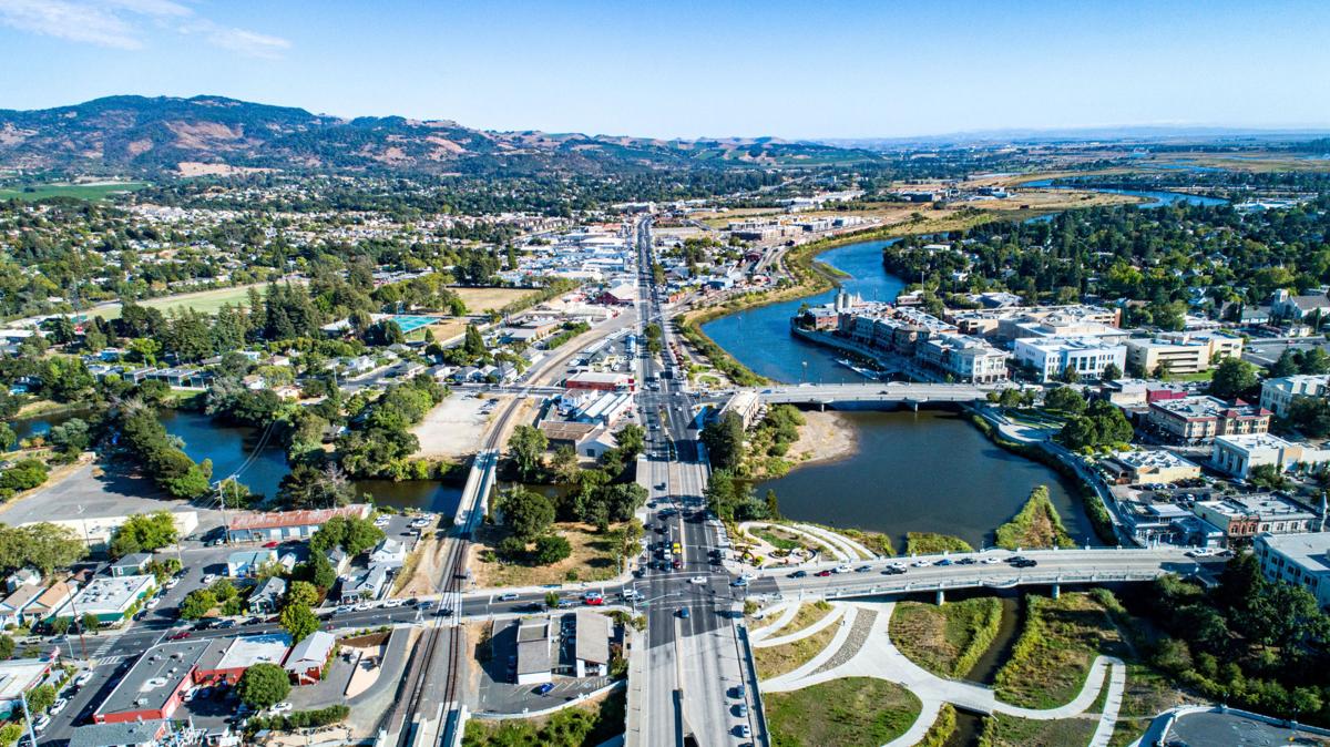
Projects BACK TO NORMAL Earthquake Recovery Modelling Versión en español English version Share Facebook LinkedIn Overview Anchor 6 Background To address some of the key factors that influence recovery following a potentially devastating earthquake, the Alfred E. Alquist Seismic Safety Commission (SSC) engaged the GEM (Global Earthquake Model) Foundation and the University of California at Los Angeles (UCLA), Department of Civil and Environmental Engineering, a) to develop a methodology and an open-source and transparent software tool to estimate recovery states and recovery times following an earthquake; and b) to investigate the effect of external socio-economic factors on these recovery times. Objectives This project achieved the following main objectives: 1. Development of a user-friendly, non-commercial and transparent software tool, herein referred as the Integrated Risk Modelling Toolkit (IRMT), to make map-based comparisons showing the effect of different resilient actions on the recovery times. 2. Development of an analytic methodology, referred as the Reconstruction Recovery Model, to estimate post-earthquake recovery 3. Integration of the Reconstruction Recovery Model for practical use into GEM’s OpenQuake modelling platform. 4. Demonstration of reasonable results by using the methodologies to model past earthquakes. In this context, the 2014 M6 South Napa Earthquake was used as a case study. Collaborators Department of Civil and Environmental Engineering at the University of California at Los Angeles (UCLA) Location California, United States Anchor 1 Anchor 5 Anchor 4 Anchor3 Publications