Thanks for submitting!
You will be contacted as soon as possible


QUICK LINKS


PROFILES
PUBLICATIONS
EXPOSURE
VULNERABILTY
SOFTWARE
EQ MODELS
Search Results
1069 results found with an empty search
- Collaborative Projects | Global Earthquake Model Foundation | Italy
Hazard and risk assessment projects with regional, national and local collaborators covering more than 150 countries in Europe, Middle East, South America, Central America, North America, Sub-Saharan Africa, Asia and the Pacific. PROJECTS GEM’s collaborative network comprises more than 100 public and private institutions, which has led to GEM’s participation in more than 50 regional, national, and multilateral projects covering Europe, Middle East, South America, Central America, North America, Sub-Saharan Africa, Asia and the Pacific. Share Facebook LinkedIn Anchor 1 Key Projects - 2013 and beyond Sort by Order by 1 2 3 4 5 1 ... 1 2 3 4 5 6 7 8 9 ... 9 0 Filters: 46 results found View: Map List Gallery Seismic impact scenarios for Istanbul Status: Completed The project aims to provide information on the cost per square meter (USD) for reconstruction and various retrofitting options, and provide seismic impact scenarios for the Istanbul metropolitan area, with disaggregated information on building types, building age, and spatial areas. View CAREC Phase II: Developing a Disaster and Climate Risk Transfer Facility in the Central Asia Regional Economic Cooperation Region Status: Ongoing This project builds upon the modelling and analytical work conducted under TA-9878 (https://www.globalquakemodel.org/proj/carec) . It involves the preparation and implementation of a pilot disaster relief bond (DRB) that will be issued by the Asian Development Bank (ADB) for two countries, namely, the Kyrgyz Republic and Tajikistan. View SeismIc hazard and Ground Motion Assessment Status: Ongoing The SIGMA program is a Research and Development project about seismic hazard and ground motion. View Piattaforma Analisi Pericolosità E Rischio Sismico Status: Ongoing The Global Earthquake Model (GEM) Foundation has launched the PAPERS project (Piattaforma Analisi Pericolosità E Rischio Sismico), an initiative aimed at developing a new WebGIS platform for scenario hazard and risk assessment in Italy. The project has been funded as one of the cascade grants launched by the High-Performance Computing, Big Data e Quantum Computing Research Centre, one of the five National Centres established by the Italian National Recovery and Resilience Plan (NRRP), under Spoke 5 - Environment and Natural Disasters . View COMET-GEM Central Asia Seismic Hazard Project Status: Completed The COMET-GEM collaboration aims to develop an advanced, publicly accessible seismic hazard and risk model for Central Asia, integrating cutting-edge scientific methods such as satellite geodesy, palaeoseismology, and geodetic data analysis. View Title Location Status Seismic impact scenarios for Istanbul Completed CAREC Phase II: Developing a Disaster and Climate Risk Transfer Facility in the Central Asia Regional Economic Cooperation Region Central Asia Ongoing SeismIc hazard and Ground Motion Assessment Ongoing Piattaforma Analisi Pericolosità E Rischio Sismico Pilot Site for Seismic Risk Analysis: An Italian city to be determined during the project, intended as a demonstration case for urban-scale seismic risk analysis. Testing Locations: The project will involve data collection and analysis on a national scale across Italy. Ongoing COMET-GEM Central Asia Seismic Hazard Project Primary Focus Region: Central Asia Additional Areas of Study: South Caucasus, Türkiye, Mongolia Completed WFP-ADAM+ Innovation Accelerator Project Earthquake-prone WFP Countries with initial pilots in Afghanistan, Nepal, Turkey, Syria, Haiti, and the Philippines. Completed Renovation with automation and optimization of processes and products Austria Ongoing North-Eastern Atlantic and Mediterranean Tsunami Risk Management and Planning Southern Europe Ongoing European Plate Observing System-Optimisation and EvolutioN (EPOS ON) Project Europe Ongoing ASCE Earthquake Loads Overseas (AELO) Global (Washington DC, USA) Ongoing Page 1 of 5 1 2 3 4 5 1 ... 1 2 3 4 5 6 7 8 9 ... 9 Completed Ongoing Washington DC Close Completed Location Ongoing
- COMET GEM | Global Earthquake Model Foundation
Projects COMET GEM COMET-GEM Central Asia Seismic Hazard Project Versión en español English version Share Facebook LinkedIn Overview Anchor 6 Background Since 2021, COMET and GEM have partnered to integrate the latest advancements in earthquake science into seismic hazard and risk modeling. The first phase of the collaboration (2020–2022) focused on building essential datasets, including an active fault database, a homogenized earthquake catalog, GNSS data, and a preliminary seismic hazard model for Central Asia. The ongoing second phase (2023–2025), supported by the Natural Environment Research Council (NERC), UK, expands on these efforts by incorporating time-dependent hazard modeling, earthquake clustering analysis, and geodetic data processing. By bridging scientific research with practical applications, the collaboration ensures that hazard models remain at the forefront of earthquake risk assessment, strengthening disaster preparedness efforts in Central Asia and beyond. Duration: Phase 1: 2021 -2023, Phase 2: 2023 - 2025 More details: https://comet.nerc.ac.uk/ Overall Objective The COMET-GEM collaboration aims to develop an advanced, publicly accessible seismic hazard and risk model for Central Asia, integrating cutting-edge scientific methods such as satellite geodesy, palaeoseismology, and geodetic data analysis. The goal is to provide local communities, researchers, and policymakers with robust hazard and risk assessments to inform disaster risk reduction strategies and enhance preparedness for future seismic events. Specific Objectives / Expected Outputs 1. Enhancing Seismic Hazard Models Refining fault databases, earthquake catalogs, and strain rate fields to improve hazard predictions. Incorporating time-dependent earthquake occurrence models and earthquake clustering analysis to improve forecasting. 2. Integrating Advanced Scientific Techniques Utilizing InSAR-based deformation data and GNSS datasets to quantify seismic strain accumulation across Central Asia. Developing high-resolution geodetic velocity fields for improved hazard modeling. 3. Supporting Disaster Risk Reduction Integrating hazard models into seismic risk assessments to estimate economic and human losses. Engaging local communities and stakeholders in seismic hazard model development. 4. Collaborative Research and Capacity Building Hosting workshops and training sessions to enhance regional expertise in seismic hazard assessment. Supporting research collaborations in Central Asia, the South Caucasus, and beyond. Collaborators Project Coordination: COMET and GEM, with contributions from UK-based institutions Global Earthquake Model (GEM) Foundation COMET (Centre for Observation and Modelling of Earthquakes, Volcanoes & Tectonics) British Geological Survey (BGS) University of Oxford (geologic data compilation) University of Leeds (geodetic data processing) Various local and international research institutions Funding Partner: Natural Environment Research Council (NERC), UK Locations Primary Focus Region: Central Asia Additional Areas of Study: South Caucasus, Türkiye, Mongolia Anchor 1 Anchor 5 Anchor 4 Anchor3 Publications
- INDONESIA DRR | Global Earthquake Model Foundation
Projects INDONESIA DRR Seismic Resilience Baseline Analysis and Investment Option Needs in Indonesia Versión en español English version Share Facebook LinkedIn Overview Anchor 6 Background This project, funded by the World Bank's GFDRR, aims to conduct a seismic baseline analysis to support the development of a potential national seismic risk mitigation program in Indonesia. The study focuses on public assets, which include education facilities (primary and secondary schools, universities), health facilities (health clinics, hospitals), commercial facilities (shophouse), emergency services facilities (e.g., ambulance stations, fire stations, early warning service providers), and critical government administration buildings (e.g., local disaster management offices). The project has five main tasks: 1. Inception: literature review on seismic risk in Indonesia, methodology, definition of stakeholder/consultation workshops, preliminary data collection 2. Baseline analysis of Indonesia’s exposure and vulnerabilities to seismic hazards (earthquakes and tsunami) 3. Seismic Risk Assessment and Rapid Prioritization of Potential Investments in Three Selected Districts 4. Development of Baseline Data and Conceptual Framework Design 5. Final Report and Completion Report The GEM Risk Team contributes to all tasks, ranging from support on hazard modelling, development of exposure, selection of vulnerbaility models and the computation of seismic risk using the OpenQuake engine. Duration: 2022-2023 Objectives The methodology, workplan, programme and potential target cities is elaborated together with the World Bank and Indonesian Ministry of Public Works and Housing (MPWH) stakeholders and other relevant agencies such as Ministry of National Development Planning (Bappenas), National Disaster Management Authority (BNPB), Ministry of Home Affairs (MoHA) and Agency for Meteorology, Climatology and Geophysics (BMKG). The objectives include: (a) a rapid baseline analysis of the exposure and vulnerability of the country and three Indonesian districts to earthquakes and tsunami, baseline information/data, and gap analysis, including disaggregated analysis of risk and vulnerability of women and other vulnerable groups; (b) a conceptual framework for improving seismic resilience and recommendations for a national program that aims to reduce the vulnerability of people (with consideration for diverse groups) and assets to earthquakes and tsunami through an integrated package of structural and non-structural investments; and (c) stakeholder consultations to seek inputs on the potential program design, investment funding mechanisms, and institutional set-up options for the national program. Collaborators GEM Foundation, Arup, LAPI-ITB and Kota Kita Funding partner: World Bank GFDRR Locations Three cities in Indonesia: ‣ Kota Bengkulu, Bengkulu province ‣ Kota Cilegon, Banten province ‣ Kota Gorontalo, Gorontalo province Anchor 1 Anchor 5 Anchor 4 Anchor3 Publications
- AELO | Global Earthquake Model Foundation
Projects AELO ASCE Earthquake Loads Overseas (AELO) Versión en español English version Share Facebook LinkedIn Overview Anchor 6 Background The project is carried out within a collaboration between GEM and the U.S. Geological Survey (USGS) and is sponsored by the U.S. Department of State (DoS) and the U.S. Department of Defence (DoD). The aim of the project is to provide a web service for computing design ground motions (on rock and soil) that are compliant with the ASCE guidelines (ASCE 7-16, ASCE 41-17, ASCE 7-22, ASCE 41-23) for 500 locations worldwide. In its inaugural year, AELO focuses on rigorously calculating seismic parameters, including Peak Ground Acceleration (PGA), Ss, and S1 design values across 500 diverse global locations, particularly emphasizing rock site conditions. This aims to ensure compliance with ASCE7-16 and ASCE41-17 standards, essential for seismic assessment and design practices. In the following year, the project progresses to establish a secure webservice for computing design ground motions. This password-protected platform will provide access to ASCE7-16 and ASCE41-17 aligned calculations, simplifying access to these critical seismic design parameters. Transitioning into the third year, AELO expands its computational scope to encompass ground motion calculations across various soil conditions worldwide, encompassing 500 locations to adhere to ASCE 7-22 and ASCE 41-23 standards. This phase seeks to enhance the breadth of seismic assessments, offering a comprehensive understanding of seismic hazards on diverse soil types. Finally, in its fourth year, the project concludes with the introduction of a sophisticated, password-protected webservice. This platform offers the capability to compute design ground motions based on the latest ASCE7-22 and ASCE41-23 standards, supporting seismic engineers and researchers globally by providing accurate, standardized, and essential seismic design parameters for diverse geographical locations. Duration: 2022 - 2026 Objectives The primary objective of the project is to create a web service capable of calculating design ground motions, both on rock and soil, in adherence to the American Society of Civil Engineers (ASCE) guidelines. These guidelines include ASCE 7-16, ASCE 41-17, ASCE 7-22, and ASCE 41-23. This web service heavily relies on the hazard models that are part of GEM’s global mosaic and the OpenQuake Engine. Collaborators GEM, the U.S. Geological Survey (USGS), with support from the U.S. Department of State (DoS) and the U.S. Department of Defense (DoD). Location Global (Washington DC, USA) Anchor 1 Anchor 5 Anchor 4 Anchor3 Publications
- GFDRR-DFID | Global Earthquake Model Foundation
Projects GFDRR-DFID GFDRR-DFID Challenge Funds Versión en español English version Share Facebook LinkedIn Overview Anchor 6 Background The Global Facility for Disaster Reduction and Recovery (GFDRR) and the UK Department for International Development's (DFID) competitive Challenge Fund pilots new and innovative approaches to overcoming technical and technological challenges in order to strengthen disaster and climate risk decision-making in developing countries. To this end, this project is supporting the development of data, products, and approaches to support disaster risk management decision-making and build resilience, including through better information, but also strengthening key steps in moving from information to insight and behaviour change. Each challenge is focusing on the development of a database with hazard footprints, exposure information and vulnerability models. The viability of the databases will be demonstrated using exposure data for Tanzania and another DFID priority country. Objectives The project is divided into three components. The British Geological Survey leads the development of a data schema and data for a multi-hazard database (Challenge 1) while GEM and University College London lead the development of a global exposure database (Challenge 2) and open vulnerability platform for evaluating risk (Challenge 3) respectively. GEM also contributes to Challenge Fund 1 and 3. GEM leads Challenge Fund 2 on the development of a global exposure data framework, which includes the physical vulnerability characteristics and exposure taxonomy. The aim is to identify the most important vulnerability characteristics; ways to account for uncertainties in exposure and vulnerability models; type of assets that should be supported by the vulnerability and exposure database; and the most common and useful intensity measure types. The objective of this project is to develop a Data Exploration Tool to promote the ability of a user to access, understand and use hazard, exposure and vulnerability data stored in a format that follows the data schema developed by the Challenge Fund consortia. British Geological Survey (BGS) leads the development of a data schema and data for a multi-hazard database (Challenge 1) GEM Foundation leads the development of a global exposure database (Challenge 2) University College London (UCL) leads the development of open vulnerability platform for evaluating risk (Challenge 3) Various organizations also participated and contributed to the project such as the Geological Survey of Tanzania; Ardhi University (Tanzania); Dar Es Salaam University (Tanzania); DFID Tanzania; Prime Minister's Office - Disaster Management Department (Tanzania); DoMA (Malawi); INGC (Mozambique); Ministry of Energy & Mineral Development (Uganda); ImageCat (USA); Humanitarian OpenStreetMap Team (HOT Indonesia); NSET (Nepal); IDF (Switzerland); UA (Netherlands); NGI (Norway); NOC (UK); CIMA (Italy); and UCL-EPI (UK). Locations Tanzania and neighbouring countries Anchor 1 Anchor 5 Anchor 4 The University College London (UCL) EPICentre and CatLin XL hosted the second workshop held on July 27 in London to collect feedback. A consortium led by the GEM Foundation with partners ImageCat Inc. and the Humanitarian OpenStreetMap Team completed recently an open exposure database for multi-hazard risk assessment... The GFDRR-DFID Challenge Fund projects on the development of exposure, vulnerability and hazard footprints databases kicked off with a 2-day inception workshop. Anchor3 Publications GFDRR-DFID Challenge Funds Round 2 How can innovative approaches make communities more resilient to climate change and natural disasters? GFDRR-UK Aid Challenge Fund: Final Learning Report: Value of Risk Information for Decision Making May 31, 2018 Data schema and data: for multi-hazard database (BGS), for global exposure database (GEM), for a global database of vulnerability functions (UCL) Extensible Data Schemas for Multiple Hazards, Exposure and Vulnerability Data published as part of the UNDRR GAR2019 .
- MALAWI MULTI-HAZARD | Global Earthquake Model Foundation
Projects MALAWI MULTI-HAZARD Comprehensive Multi hazard Risk Assessment in Malawi Versión en español English version Share Facebook LinkedIn Overview Outcomes Training Outreach Photos Publications Anchor 6 Background Malawi is a country strongly affected by the impact of extreme events, exacerbated by rapid population growth and urbanisation. A multi-risk assessment is currently lacking at the national level, while it is available only at the local level in some districts. Therefore, the project consortium intends to produce, for the first time, hazard and risk maps on a national level with a level of detail useful also at provincial level, using a probabilistic risk assessment approach, both for single hazards and for multi-hazard conditions (i.e. extreme winds and precipitation, earthquakes, landslides, river floods). The GEM Risk Team is reponsible for the seismic risk assessment, comprising the modelling of the hazard, exposure and vulnerability components and the calculations of seismic risk in the OpenQuake engine. Duration: 2023-2024 Objectives In line with the guidelines of the Sendai Framework for Disaster Risk Reduction, the multi-hazard probabilistic assessment carried out within the project provides risk estimates for both the most probable and frequent events, as well as for rare ones; at the same time, it allows for the analysis of events that have never been observed but may occur in the future, which is of particular importance considering the uncertainty caused by climate change. The assessment will therefore consider risks under current climate conditions as well as future conditions (2050-2100) under different climate change scenarios. For the realisation of the multi-risk assessment, the project partners will work closely with local stakeholders at all stages of the development, from data collection to the creation of the Risk Atlas and the Risk Information Web Platform, two tools that will collect information from the assessment and will make it easier to communicate and understand, thus following a capacity development approach that combines knowledge development with knowledge transfer. In addition, the partners will develop, again in collaboration with local stakeholders, a sustainability plan containing recommendations for maintaining and updating risk information, supporting the management, updating and accessibility of Malawi’s risk information by national and local authorities. Collaborators GEM Foundation, Centro Internazionale in Monitoraggio Ambientale (CIMA), Malawi University of Business and Applied Sciences (MUBAS), British Geological Survey (BGS) Funding partner: World Bank Group Location Malawi Aiming to empower Malawi with a comprehensive understanding of disaster risks, the project will deliver the following key outputs: Comprehensive Hazard Identification and Assessment: A national-level assessment of various hazards in Malawi, including floods, droughts, landslides, earthquakes, and strong winds. Exposure Mapping: Creation of maps outlining the extent to which people, infrastructure, buildings, and agriculture are exposed to each hazard. Vulnerability Assessment: Evaluation of the physical (infrastructure, buildings) and social (poverty, access to resources) vulnerabilities of Malawian communities to these hazards. National Hazard and Risk Profiles: Development of comprehensive national profiles that detail the hazards, their potential impacts, and the level of risk faced by different regions and communities. Knowledge and Technology Transfer: Training and capacity building for Disaster Risk Reduction (DRR) practitioners and academic institutions in Malawi on using the multi-hazard risk assessment data and tools. Anchor 1 Anchor 5 Platform deployment, knowledge transfer, maintenance and ownership This project builds a long-term plan for Malawian experts to manage the multi-hazard risk atlas database. Through trainings and knowledge transfer, local technicians will become self-sufficient in maintaining the system and training future users. This ensures the platform's sustainability and empowers Malawian authorities to fully utilize the risk information for informed decision-making. a. Hands-on training on the Risk Atlas Database Training of the Department of Disaster Management Affairs (DODMA) ICT team to install and utilise the Risk Atlas Database held in Salima, Malawi, from June 3-7, 2024. b. Exposure and Vulnerability Data The exposure and vulnerability work was delivered to the client and presented in a dedicated training session in November 2023. Anchor 4 GEM Contributes to Multi-Hazard Risk Assessment Progress in Malawi The Global Earthquake Model (GEM) Foundation actively participated in a Multi-Hazard Risk Assessment workshop held in Salima, Malawi, from June 3-7, 2024. This collaborative effort involved the Department of Disaster Management Affairs (DODMA) as the host, alongside the International Centre for Environmental Monitoring (CIMA Research Foundation), Malawi University of Business and Applied Sciences (MUBAS), and the British Geological Survey (BGS). Read more Anchor3 BUSINESS NEWS Multi-Hazard Risk Assessment workshop held in Salima, Malawi, from June 3-7, 2024 1/6 Publications
- GAR 2023 | Global Earthquake Model Foundation
Projects GAR 2023 GAR Special Report 2023: Mapping resilience for the Sustainable Development Goals Versión en español English version Share Facebook LinkedIn Overview Anchor 6 Background The United Nations Office for Disaster Risk Reduction (UNDRR)'s Global Assessment Report on Disaster Risk Reduction 2023 offers a unique perspective on development progress by emphasizing risk and resilience in a changing climate. The report features maps developed in collaboration with the GEM Foundation and other agencies (United Nations Geospatial Information Section, Environmental Systems Research Institute - ESRI), displaying country-level Sustainable Development Goals (SDG) indicators and risk drivers, and showcasing resilience deficits. These maps also present future projections of these deficits under different climate scenarios, incorporating IPCC greenhouse-gas-emission-rate scenarios and representative concentration pathways. Duration: 2023 Objectives The report serves as a comprehensive inter-agency effort to assess and address resilience gaps, aiding in informed decision-making for sustainable development. Collaborators GEM Foundation, United Nations Geospatial Information Section, Environmental Systems Research Institute - ESRI Funding partner: UNDRR Location Geneva, Swizterland Anchor 1 Anchor 5 Anchor 4 Anchor3 Publications
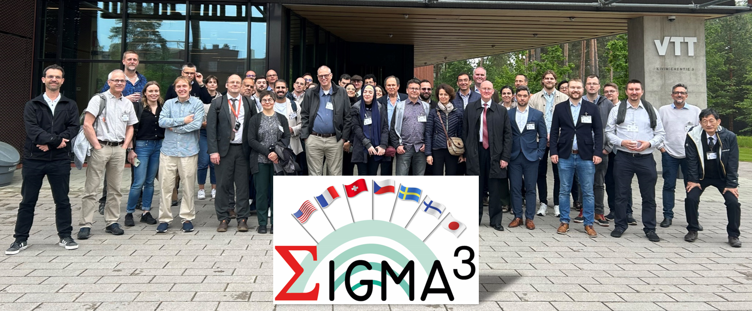
- SIGMA3 | Global Earthquake Model Foundation
Projects SIGMA3 SeismIc hazard and Ground Motion Assessment Versión en español English version Share Facebook LinkedIn Overview Work Packages Training Dissemination Photos Publications Anchor 6 Overview SIGMA3 is a research and development (R&D) program on SeIsmic hazard and Ground Motion Assessment. It is the 3rd part of a larger R&D initiative initiated in 2011 to support innovation in the field of probabilistic hazard assessment (PSHA). SIGMA3 is fully funded by the industry at 100%. The program grounds its roots in methodological developments, as well as in the identified shortcomings of the two preceding editions, labelled SIGMA and SIGMA2. The previous two programs have led to insightful datasets and models to accompany the inception of probabilistic site-specific PSHA studies in low-to-moderate seismicity areas, such as France, for instance. However, nowadays, additional progress is still needed to reduce epistemic uncertainties and improve confidence in probabilistic seismic hazard studies. To this end, SIGMA3 gathers a group of researchers and engineers actively involved in the seismic hazard community and recognized for their expertise. More details about the project are available here: https://sigma-programs.com/ Objectives The SIGMA program is a Research and Development project about seismic hazard and ground motion. It has the objective to improve data and develop methods necessary to best estimate SHA by producing Hazard levels more adapted to the site. Improve available practices for safety demonstration to get consensus with the largest international community for R&D and industrial applications Improve confidence and accountability in seismic hazard assessments by quantifying and propagating uncertainties on Seismic Source and Ground Motion Characterization Strengthen the link between seismologists and engineers, and share feedback among consortium members Collaborators Steering Committee The Steering Committee handles strategic and technical decision-making in the SIGMA3 program and provides recommendations on the program’s orientation, informed by the Scientific Committee’s expertise. Composition: Emmanuel Viallet (EDF France), Fabrice Hollender (CEA France), Vojtech Spanihel (CEZ Group Czech Republic), Masato Nakajima (CRIEPI Japan), Albert Kottke (PG&E USA), Fabienne Chawla (SwissNuclear Switzerland), Ludovic Fulop (VTT Finland) Scientific Committee The members of the SIGMA3 Scientific Committee are independent experts in their field, providing recommendations, insights, and reviews on activities performed through the program. Composition: Philippe RENAULT (Chairperson), Norman ABRAHAMSON, Laurent BOLLINGER, Emmanuel CHALJUB, Maria José CRESPO, John DOUGLAS, Zeynep GULERCE, Sadanori HIGASHI, Pierre LABBE, Ian MAIN, Adrian RODRIGUEZ-MAREK, Alain PECKER, Gabriel TORO, Kris VANNESTE, Jérôme VERGNE Location Global (coordinating agency located in France) Sigma 3 Technical Program Supported by ´Electricité de France (EDF), GEM’s activities cover three work packages: For more details on Sigma3's work packages (WP), click here . 1. Probabilistic Fault Displacement Hazard Analysis. This activity builds upon work carried out in 2024 within the framework of a collaboration with OGS, Trieste. 2. Development and methodologies for probabilistic seismic hazard assessment. In this WP, we will further develop capabilities to compute the conditional aftershock hazard and propagate epistemic uncertainties efficiently. 3. Development of a Simulation Platform. The objective of this activity is to generate a set of Python tools for evaluating fundamental components of a hazard input model - namely, source, ground motion, and site effects - used in Probabilistic Seismic Hazard Analysis (PSHA) computations. Anchor 1 Anchor 5 Conferences and Events For the latest events, training, seminars/webinars and conferences, please visit: https://sigma-programs.com/dissemination-sigma-3/conferences-and-events/ Anchor 4 SIGMA3 - SeismIc hazard and Ground Motion Assessment This section contains outreach activities conducted by the SIGMA3 program. For more details, click here . 1. News - https://sigma-programs.com/dissemination-sigma-3/news/ 2. Conferences and Events - https://sigma-programs.com/dissemination-sigma-3/conferences-and-events/ Anchor3 BUSINESS NEWS 1st General Assembly - June 2025, Helsinki (Finland) 1/1 BUSINESS NEWS Sigma3 Kick-Off - 11 June 2024, Aix-en-Provence (France) 1/1 Publications SIGMA3 - Publications and Reports This section contains project publications and reports as they become available. The list of currently available materials can be accessed here: https://sigma-programs.com/sigma-3/dissemination-sigma-3/publications-reports/
- ARISTOTLE | Global Earthquake Model Foundation
Projects ARISTOTLE Multi-Hazard Expert Advice System for ERCC Versión en español English version Share Facebook LinkedIn Overview Anchor 6 Background The All Risk Integrated System TOwards Trans-boundary hoListic Early-warning or ARISTOTLE consortium combines a number of services that enable a rapid understanding of events from various natural hazards (earthquakes and tsunami, volcanoes, severe weather and floods) and how they might unfold, thus aiding a deeper interpretation of the resulting hazards and impact. The GEM Foundation is supporting the consortium by providing an assessment of the impact of earthquakes using GEM's global exposure and vulnerability models, with a focus on metrics such as collapsed buildings and displaced people, such that it may provide an added value to existing rapid loss assessment services such as the USGS's Prompt Assessment of Global Earthquakes for Response (PAGER). Visit http://pilot.aristotle.ingv.it/ for more details about the project. Duration: 2022 - 2028 Objectives ARISTOTLE aims to provide Multi-Hazard Advice to the European Research Coordination Centre, either in advance of / during the activation of the EC Civil Protection Mechanism (CPM), in order to increase preparedness and response levels of the EU and to improve the ERCC’s assessment capacity. Collaborators ARISTOTLE is a multi-disciplinary partnership consisting of world-leading scientific centres in the areas of Earth and Climate sciences, providing operational and monitoring services, early warning and information systems as well as contributing to innovation and research actions. Location Global (Rome, Italy) Anchor 1 Anchor 5 Anchor 4 Anchor3 Publications
- TREAD | Global Earthquake Model Foundation
Projects TREAD daTa and pRocesses in sEismic hAzarD Versión en español English version Share Facebook LinkedIn Overview Anchor 6 Background GEM is one of the partners of the Marie Skłodowska-Curie Actions (MSCA) funded TREAD project, which involves a consortium of 14 academic institutions and 8 private partners of the highest scientific level from 7 European countries. TREAD will train a new generation of seismic hazard scientists to tackle the challenges of earthquake forecasting in complex tectonic contexts such as the Europe and Mediterranean regions. During the 4 year project GEM will host and supervise two PhD students, one working with the hazard team and the other with the risk team, on the following topics: 1. Modelling distributed seismicity under innovative approaches (under joint supervision with the University of Milano, Bicocca, 2. Assessment of the impact of advanced seismic hazard modelling approaches on earthquake risk (under joint supervision with the University of Chieti-Pescara) More information at https://tread-horizon.eu/ . Duration: 2023-2027 Objectives The aim of TREAD is to train a new generation of seismic hazard scientists to tackle the challenges of earthquake forecasting in complex tectonic contexts such as the Europe and Mediterranean regions. A change of paradigm in seismic hazard is necessary to be able to fully account for the specific properties of earthquake source and seismic modes in those areas. For example, to calculate the probability of having multiple earthquake ruptures, the interaction between active faults across various space-time scales needs to be accounted for, as well as the effects of stress transfer and fault-fluid interaction in earthquake triggering. TREAD objectives are: 1) Developing a novel integrative approach to seismic hazard analysis in Europe and the Mediterranean by bridging the gap from small-scale laboratory experiments to large-scale observations. 2) Establishing physics-based earthquake modelling by linking computational modelling of earthquakes from millions of years to fractions of a second. 3) Transferring earthquake geology and computational modelling to hazard and risk assessment adapted to the needs of government, industry and scientific stakeholders. Collaborators University of Chieti-Pescara, CNRS, University of Utrecht, GEM Foundation, University of Grenoble Alps, Ludwig Maximilians University, University of Barcelona, University of Padova, ETH Zurich, IRSN, OGS, INGV, Ruhr University Bochum, IPGP, Helmholz Centre, Willis, IFP, EDF, University of Milan Bicocca, Munich Re, TNO, Tre Altamira, University D'Aix Marseille Funding partner: Marie Skłodowska-Curie Actions (MSCA), European Commission Location Pavia, Italy Anchor 1 Anchor 5 Anchor 4 Anchor3 Publications