Thanks for submitting!
You will be contacted as soon as possible


QUICK LINKS


PROFILES
PUBLICATIONS
EXPOSURE
VULNERABILTY
SOFTWARE
EQ MODELS
Search Results
Search this site
1170 results found with an empty search
- GEM and its partners complete GFDRR’s Challenge Funds Global Exposure Database for Multi-hazard Risk Analysis (GED4ALL) - GEM Foundation
News GEM and its partners complete GFDRR’s Challenge Funds Global Exposure Database for Multi-hazard Risk Analysis (GED4ALL) By: May 28, 2018 Share Facebook LinkedIn A consortium led by the GEM Foundation with partners ImageCat Inc. and the Humanitarian OpenStreetMap Team completed recently an open exposure database for multi-hazard risk assessment, as part of the Challenge Funds portfolio, managed by the GFDRR, and funded by the Department for International Development (DFID) of the United Kingdom. The main objective of Challenge Fund Global Exposure Database for Multi-hazard Risk Analysis is the development of an open exposure database, for the purposes of performing multi-hazard risk analyses. The database is capable of storing different assets (building stock, lifelines, crops, socio-economic data) across six natural hazards: earthquakes, floods, volcanoes, strong winds, tsunamis and drought. The database has been successfully piloted in Tanzania for the development of an exposure model at the national scale, and to the city of Dar Es Salaam demonstrating how an exposure dataset at a building-by-building resolution can be created. The process has also been demonstrated for five countries around Tanzania (Ethiopia, Uganda, Kenya, Malawi and Mozambique) as well as Cape Verde, Senegal, Mali, Niger and in other countries outside of the African continent. The outputs include a detailed description of the structure of the tables comprising the GED4ALL exposure database schema and the relationships between them, a description of the software components required for installation and basic operation of the database and the associated tools for converting, importing and exporting data. Paul Henshaw, GEM Director of Technology and Development also notes that “The project is a major step forward in defining a global multi-hazard database for use in assessing risks due to natural hazards. The approach also demonstrates how the combination of international expertise, open standards, local knowledge, inclusiveness and collaborative approach can encourage risk awareness and mitigation.” Paul also presented the final outputs of Global Facility for Disaster Recovery and Reduction (GFDRR) Challenge Fund 2: Global Exposure Database for Multi-hazard Risk Analysis (GED4ALL) during the projects closing workshop held in Dar Es Salaam, Tanzania from 22-24 March. The British Geological Survey (BGS) and University College London (UCL) presented the results of Challenge Fund 1 (multi-hazard database) and 3 (vulnerability database) respectively. More than 30 individuals participated from various organizations such as Geological Survey of Tanzania, Ardhi University (Tanzania), Dar Es Salaam University (Tanzania), DFID Tanzania, Prime Minister's Office - Disaster Management Department (Tanzania), DoMA (Malawi), INGC (Mozambique), Ministry of Energy & Mineral Development (Uganda), ImageCat (USA), Humanitarian OpenStreetMap Team (HOT Indonesia), NSET (Nepal), GFDRR (USA), DFID UK, IDF (Switzerland), BGS (UK), UA (Netherlands), NGI (Norway), NOC (UK), CIMA (Italy) and UCL-EPI (UK). No images found. GALLERY 1/0 VIDEO RELATED CONTENTS
- GEM1 Best Practices for Using Macroseismic Intensity and Ground Motion Intensity Conversion Equations for Hazard and Loss Models in GEM1 | GEM Foundation
Publications GEM1 Best Practices for Using Macroseismic Intensity and Ground Motion Intensity Conversion Equations for Hazard and Loss Models in GEM1 Share Facebook LinkedIn Download 2010 | Report Macroseismic shaking intensity is a fundamental parameter for the development, calibration, and use in a variety of hazard maps as well as in empirical (direct) and semi-empirical (indirect) earthquake shaking loss methodologies. Macroseismic data also quantify damage from past and present events and facilitate communicating ground motion levels in terms of human experiences and incurred losses. The aim of this report is to summarize and recommend “best practices” for the use of macroseismic intensity in conjunction with hazard maps (particularly ShakeMaps) and as input to associated loss models. The continued reliance on macroseismic intensity data dictates that ground motion prediction equations (GMPEs) alone are not always sufficient for estimating or constraining shaking hazards. Relations that allow direct estimation of intensity given an earthquake magnitude and distance, and those that convert ground motions to intensity (and vice versa) are required. Forward estimation of macroseismic intensities take two primary forms: 1) direct intensity prediction equations (IPEs), and 2) ground-motion-to-intensity conversion equations (GMICE). In addition, one can potentially better constrain historical ground motions at particular sites by employing intensity-to-ground-motion conversion equations (IGMCEs), though such equations are rare. Both the Global Earthquake Model (GEM) and Global ShakeMap (GSM) require advice and optimization in the state-of-the-art use of ground motion and intensity data. We provide background on the issues relating ground motions to intensities, directly predicting intensities, and offer insight into their uses. In the end, we recommend initial default IPE and GMICE selections for use in the immediate short term while additional research on these fronts continues and develops. A brief summary of highly related, current studies that help inform this report is also provided. Based on these ongoing analyses, and this report’s summary, we provide recommendations for further refinements in the form of continued research and development efforts.
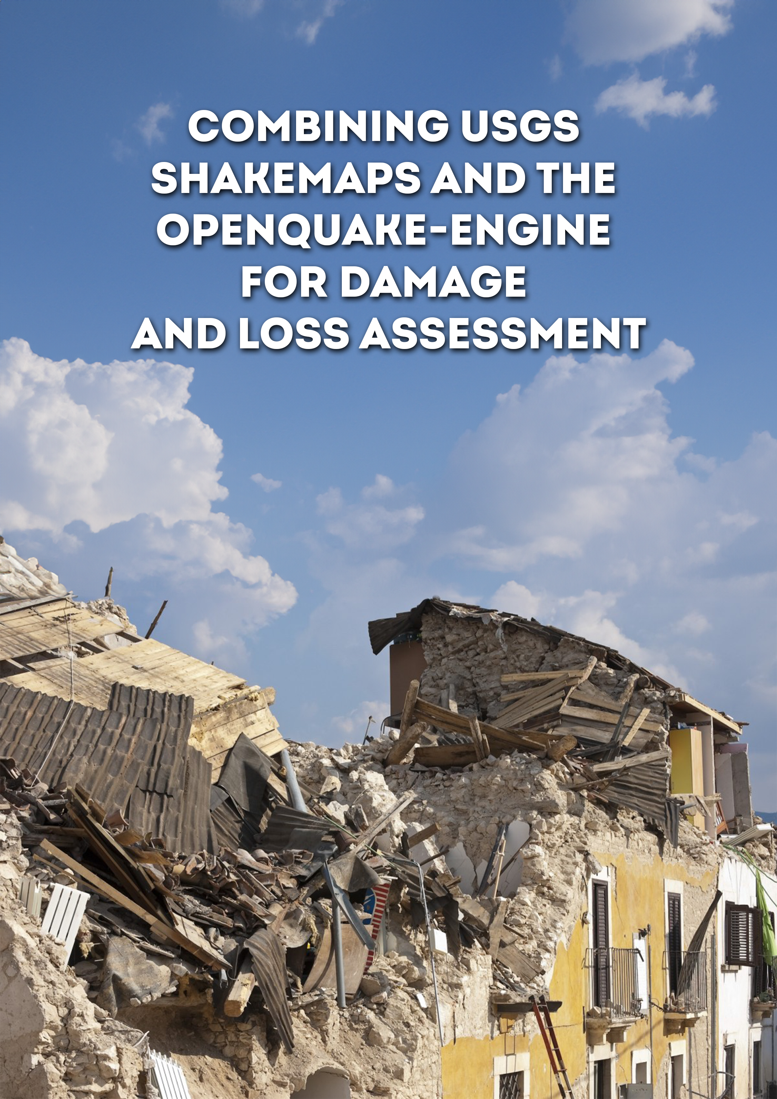
- Combining USGS ShakeMaps and the OpenQuake-engine for damage and loss assessment | GEM Foundation
Publications Combining USGS ShakeMaps and the OpenQuake-engine for damage and loss assessment Share Facebook LinkedIn Download 2019 | Peer-reviewed The evaluation of the potential impact of strong seismic events shortly after their occurrence is a critical step to organise emergency response and consequently minimise the adverse effects of earthquakes. The estimation of the impact from earthquakes considering the observed ground shaking from past events can be useful for the calibration of existing exposure and/or fragility and vulnerability models. This study describes a methodology to combine the publicly available information from the USGS ShakeMap system and the open‐source software OpenQuake engine for the assessment of damage and losses. This approach is employed to estimate the number of structural collapses considering the 2012 Magnitude 5.9 Emilia‐Romagna (Italy) earthquake and the aggregated economic loss because of the 2010 Magnitude 7.1 Darfield (New Zealand) event. Several techniques to calculate the ground shaking in the affected region considering the spatial and interperiod correlations in the intra‐event ground motion residuals are investigated and their influence in the resulting damage or loss estimates are evaluated.
- Active Faults Database | GEM Foundation
License Request Form You have chosen to get more information about: Active Faults Database Hazard Please check the link below to see if this product already meets your your requirements before submitting your request for a license. Thank you. DOWNLOAD THE OPEN VERSION Summary of steps to obtain a license for the requested product. Fill in the application form below. Click Submit. Please check your email Inbox or Spam folder for the summary of your request. You will then be contacted by the GEM Product Manager with either a request for more information, or a request to sign the license. If you do not hear from us within 2 weeks, please send an email to product@globalquakemodel.org . REQUEST DETAILS A. Requesting party information First Name Last Name Role/Job Email Business type Business type Other business Sector Sector Other sector B. License agreement signatory information The signatory must be someone who is authorised to sign license agreements on your behalf such as your immediate supervisor, manager or legal officer. If you’re a PhD student, the signatory must be your adviser or a university officer in charge of license agreements or similar legal documents. Full Name of Signatory Position Company Email of Signatory Organisation name Complete Address C. Purpose of request GEM is able to offer products for free because of the support of our project partners, national collaborators and institutional sponsors. All of GEM’s products are freely available for public good, non-commercial use, but with different license restrictions. In most cases we release products under an open license (e.g., CC BY-SA or CC BY-NC-SA), which permits (re)distribution. In this case, we are granting access under a more restricted license that forbids distribution or disclosure and requires signing by GEM and the licensee in order to better assure accountability for the confidentiality of the information. In order for GEM to properly assess your request, please answer the following questions below. 1. Explain briefly how will the GEM product be used e.g. project, research including the expected results and the foreseen public benefit. Minimum 60 words. 2. Will you be able to share the results of your work with GEM? YES NO 3. Will you be able to provide feedback to GEM on the quality and usefulness of this product via a survey? YES NO D. Privacy Policy By submitting this form, you consent to the processing of your personal data in accordance with our Privacy Policy and the EU General Data Protection Regulation (GDPR). We are committed to safeguarding your information and ensuring it is only used for the purpose outlined in this form. You have the right to access, rectify, or delete your data at any time. For more information, please refer to our Privacy Policy. I agree Words: 0 Email us at product@globalquakemodel.org if you're experiencing problems submitting your application. Thank you. Submit Thanks for submitting! You will be contacted as soon as possible Incomplete data. Please fill in all required fields. Thank you.
- GEM at Jornadas de Amenaza y Riesgo Sísmico 2018 in Bogotá, Colombia - GEM Foundation
News GEM at Jornadas de Amenaza y Riesgo Sísmico 2018 in Bogotá, Colombia By: Jul 2, 2018 Share Facebook LinkedIn From February 19th to 21st, the GEM Foundation was hosted by the Colombian Geological Service during their Jornadas de Amenaza y Riesgo Sísmico 2018, three days dedicated to discuss seismic hazard and risk assessment, and its application in structural design and building code regulations. One full day was also dedicated to GEM’s OpenQuake engine. More than 220 people attended the event, among whom were hazard and risk modelers, public and private stakeholders, and students of Engineering and Earth Science. To open the three-day workshop, Dr Óscar Eladio Paredes, Director General of the SGC said. “We take the challenge of knowing the seismic hazard and risk as rigorously as possible. Likewise, we are aware that knowledge does not come from a single institution, and this implies a greater challenge, and that is to build it with the contribution of an open and participative technical community. This approach has allowed the Geological Service to explore novel methodologies and establish alliances with national and international experts for the development of a national seismic hazard model, which we have developed jointly with the GEM Foundation (Global Earthquake Model) during the last two years.” On February 19th, during the session “De la amenaza sísmica al diseño sismo resistente” session (“From seismic hazard to seismic resistant design”), Julio García, Senior Hazard Scientist at GEM, in collaboration with the Colombian Geological Service, presented the new seismic hazard model for Colombia, also sharing methodological aspects, results and application of the model. The afternoon sessions dealt with the use of national hazard models for structural design of infrastructure, new methodologies for risk assessment on buildings, and the use of active faults in seismic hazard analysis. During the last session, in addition to the participants, professionals from Geoestudios (Ecuador), Universidad del Norte (Colombia), Sociedad Colombiana de Geotecnia, Universidad de San Luís (Argentina) and Universidad Eafit (Colombia) were involved in a debate on the state of knowledge of seismic resistant design and the prospects for Colombia. On February 20th, the sessions were dedicated to seismic risk assessment. Public and private, as well as national and international authorities, addressed many issues related to comprehensive risk management, among which were the elaboration of exposure models for Colombia, financial risk management for disaster risk reduction - presented by the Treasury Department, and safe and sustainable construction. In the afternoon of February 20th and on the 21st, GEM carried out a workshop called “Evaluación del riesgo sísmico usando OpenQuake” (“Seismic risk assessment using OpenQuake”), facilitated by the GEM risk team. During the event, participants experienced first hand how to use OpenQuake, in particular the use of data to calculate seismic risk, the procedure to evaluate and describe inputs for the analysis of loss and damage scenarios, and in general, how to measure seismic risk. Workshops on the OpenQuake engine are particularly welcomed in countries like Colombia, where learning how to assess seismic risk is considered essential. The Universidad Nacional de Colombia mentions the GEM workshop in this article: https://agenciadenoticias.unal.edu.co/detalle/article/estudiantes-aprenden-a-calcular-amenaza-sismica-con-openquake.html GEM and SGC are committed to continue its strong collaboration to further advance seismic hazard and risk assessment in the country and the region. No images found. GALLERY 1/0 VIDEO RELATED CONTENTS
- Taiwan Hazard | GEM Foundation
License Request Form You have chosen to get more information about: Taiwan Hazard Hazard Please check the link below to see if this product already meets your your requirements before submitting your request for a license. Thank you. DOWNLOAD THE OPEN VERSION Summary of steps to obtain a license for the requested product. Fill in the application form below. Click Submit. Please check your email Inbox or Spam folder for the summary of your request. You will then be contacted by the GEM Product Manager with either a request for more information, or a request to sign the license. If you do not hear from us within 2 weeks, please send an email to product@globalquakemodel.org . REQUEST DETAILS A. Requesting party information First Name Last Name Role/Job Email Business type Business type Other business Sector Sector Other sector B. License agreement signatory information The signatory must be someone who is authorised to sign license agreements on your behalf such as your immediate supervisor, manager or legal officer. If you’re a PhD student, the signatory must be your adviser or a university officer in charge of license agreements or similar legal documents. Full Name of Signatory Position Company Email of Signatory Organisation name Complete Address C. Purpose of request GEM is able to offer products for free because of the support of our project partners, national collaborators and institutional sponsors. All of GEM’s products are freely available for public good, non-commercial use, but with different license restrictions. In most cases we release products under an open license (e.g., CC BY-SA or CC BY-NC-SA), which permits (re)distribution. In this case, we are granting access under a more restricted license that forbids distribution or disclosure and requires signing by GEM and the licensee in order to better assure accountability for the confidentiality of the information. In order for GEM to properly assess your request, please answer the following questions below. 1. Explain briefly how will the GEM product be used e.g. project, research including the expected results and the foreseen public benefit. Minimum 60 words. 2. Will you be able to share the results of your work with GEM? YES NO 3. Will you be able to provide feedback to GEM on the quality and usefulness of this product via a survey? YES NO D. Privacy Policy By submitting this form, you consent to the processing of your personal data in accordance with our Privacy Policy and the EU General Data Protection Regulation (GDPR). We are committed to safeguarding your information and ensuring it is only used for the purpose outlined in this form. You have the right to access, rectify, or delete your data at any time. For more information, please refer to our Privacy Policy. I agree Words: 0 Email us at product@globalquakemodel.org if you're experiencing problems submitting your application. Thank you. Submit Thanks for submitting! You will be contacted as soon as possible Incomplete data. Please fill in all required fields. Thank you.
- Risk understanding in South Eastern Europe - GEM Foundation
News Risk understanding in South Eastern Europe By: Jul 2, 2018 Share Facebook LinkedIn Exciting opportunities for GEM’s possible support to understanding risk in South Eastern Europe (SEE) is one of the outcomes of the 31st DPPI (Disaster Preparedness and Prevention Initiative) SEE Regional Meeting held in Sarajevo on November 3-4, 2015. The Italian Department for Civil Protection (DPC) facilitated GEM’s participation at this important meeting. The DPPI was established in 2000 by the Stability Pact for South Eastern Europe in an effort to contribute to the development of a cohesive regional strategy for disaster preparedness and prevention for its member States. Following the directions of the Sendai Framework, as well as the requirements for EU membership, risk assessment has become increasingly important in the region and a priority for most of the DPPI countries in which there is still a need for better understanding of disaster risk. The presentation of GEM, its resources and work in regions around the world was seen as a potentially valuable contribution to satisfying the SEE region’s needs for better risk understanding. Three specific GEM-supported activities were discussed:- Enhancing local capacities through regional training workshops on risk assessment- Implementation of a pilot project on incorporation of new hazard and risk information in Seismic Codes for compliance with EU regulations, and- Implementation of a pilot project on a multi-hazard approach to provide integrated Flood-Earthquake risk assessments. International organizations such as the UNDP Regional Office, UN-OCHA, the German Initiative for Exchange of Experts in Civil Protection and the UNDP Office for Bosnia and - Herzegovina responded positively to the possibility of collaboration with GEM in the region, with the DPPI Secretariat expressing their willingness to coordinate such activities. SEE member countries Romania and Bosnia and Herzegovina, also inquired about collaboration and sponsorship. Meanwhile, concrete steps are already being taken. In close coordination with the International Center on Environmental Monitoring (CIMA) Foundation, in Italy, and the Italian Department for Civil Protection, GEM is preparing a proposal for a pilot project on integrated flood and earthquake risk assessment in the South Eastern Europe region. After consultation with key partners, the proposal will be submitted to the EU, for a funding call which is anticipated in early in 2016. No images found. GALLERY 1/0 VIDEO RELATED CONTENTS
- Assessing Seismic Hazard and Risk Globally for an Earthquake Resilient World | GEM Foundation
Publications Assessing Seismic Hazard and Risk Globally for an Earthquake Resilient World Share Facebook LinkedIn Download 2019 | Report The constant growth of world population has led to growth in conurbations prone to disasters associated with natural hazards and - as a consequence - to an increase in the overall level of societal risk. Amongst natural catastrophes, earthquakes represent about one fifth of the economic losses, and are responsible for an average of 20 thousand fatalities per year. This increasing pressure requires the development and implementation of risk reduction measures, ideally supported by reliable and technically sound risk information, such as maps, with expected hazard intensities, annualised average losses, or losses for a particular return period (or probability of exceedance). Some of the challenges to the generation of this information are due to the lack of open models, datasets and tools, as well as insufficient local capacity to create or use such resources. The recognition of this shortage of models and need to improve institutional capacity to assess the impact of earthquakes propelled the Global Earthquake Model (GEM) and its partners to develop an open seismic hazard and risk model with global coverage. In this contribution we describe the hazard, exposure and vulnerability components of this model, and the open-source tools that have been created to allow experts to reproduce the hazard and risk results, or tailor parts of the model to specific needs. We also provide a discussion regarding how the results from the global earthquake model may be used to identify global risk trends, and support the monitoring of the Sendai Framework for Disaster Risk Reduction.
- The Hazard Component of the GEM Modeller's Toolkit: A Framework for the Preparation and Analysis of Probabilistic Seismic Hazard (PSHA) Input Tools | GEM Foundation
Publications The Hazard Component of the GEM Modeller's Toolkit: A Framework for the Preparation and Analysis of Probabilistic Seismic Hazard (PSHA) Input Tools Share Facebook LinkedIn Download 2012 | Peer-reviewed The development of the seismic source model is a fundamental component in the modelling of seismic hazard on both a site-specific and regional scale. The characterisation of different source typologies (e.g. fault sources, area sources or grid sources) requires careful consideration of information from different fields of research, including geology, statistical seismology and geodesy. This presents many challenges in reconciling this information and a subsequent understanding and treatment of the respective uncertainties. To support both the regional programs and wider hazard modelling community, the GEM Model Facility is developing the Hazard Modeller’s Toolkit: a suite of tools for the preparation and development of seismogenic source models for earthquake hazard analysis. Functionalities include: i) algorithms for preparation of earthquake catalogues, ii) pre-processing of the earthquake recurrence model (e.g. declustering, statistical estimation of completeness), iii) earthquake recurrence for area sources and iv) earthquake recurrence from geological and/or geodetic slip data.
- GEM completes USAID-supported Global Vulnerability Database Project - GEM Foundation
News GEM completes USAID-supported Global Vulnerability Database Project By: Jun 27, 2018 Share Facebook LinkedIn The completion of the Global Vulnerability Database project, supported by the United States Agency for International Development (USAID) resulted in the development of vulnerability and fragility models for the most common building classes at a global scale. This has considerably addressed the lack of reliable fragility and vulnerability models for many regions of the globe, which are fundamental for seismic risk assessment at various scales (see map below). The project results also contributed significantly to our understanding of seismic risk - giving us scientific insights important for the improvement of building codes around world. "The lack of vulnerability models is undoubtedly the strongest impediment to the understanding of seismic risk at any scale. This project provides not just default functions for places where nothing exists, but also an open framework that can be used to improve existing functions, or develop completely new ones,” Vitor Silva, GEM Risk Coordinator. Within this project, GEM developed a comprehensive catalogue of the most representative building classes by conducting a worldwide survey targeted at experts in the field of structural and earthquake engineering. A supporting web-based application accessible through the OpenQuake-platform at https://platform.openquake.org/building-class/ was also created for this purpose. Currently, the app has collected over 500 entries from 50 different countries. The database is designed to be an open repository of building information, and intended to be continuously revised and improved beyond the project by the scientific community. Data collected from the global survey produced a list of building typologies comprising over 200 classes distributed between masonry (15%), concrete (51%), steel (23%) and wooden (11%) construction.GEM has extensively tested and calibrated the fragility and vulnerability models by computing seismic risk for several countries (e.g. Colombia, Guatemala, Panamá and Nicaragua), and running earthquake scenarios for different nations (e.g. Chile, Greece and Turkey). No images found. GALLERY 1/2 VIDEO RELATED CONTENTS