CLOSE

QUICK LINKS


PROFILES
PUBLICATIONS
EXPOSURE
VULNERABILTY
SOFTWARE
EQ MODELS
Search Results
538 items found for ""
- SSAHARA Project | Global Earthquake Model Foundation
Projects SSAHARA Project Sub Saharan Hazard and Risk Assessment (SSAHARA) Versión en español English version Share Facebook X (Twitter) LinkedIn Overview Outcomes Training Outreach Photos Publications Background The East African Rift System (EARS) is the major active tectonic feature of the Sub-Saharan Africa (SSA) region. Although the seismicity level of such a divergent plate boundary can be described as moderate, several damaging earthquakes have been reported in historical times, and the seismic risk is exacerbated by the high vulnerability of the local buildings and structures. Formulation and enforcement of national seismic codes is therefore an essential risk mitigation strategy. A reliable risk assessment must be based on an updated and reliable seismic hazard model for the region. The last published regional model for SSA was developed within the frame of the GSHAP project and is almost 20 years old (Midzi et al., 1999). The availability of new data, local and regional seismotectonic studies and recently developed methods and tools prompt the development of a new PSHA model summarizing the current state of knowledge in Sub-Saharan Africa. Objectives In September 2014, the United States Agency for International Development (USAID) GEM funding support to implement a program entitled “Reducing Earthquake Risk collaboratively by Building Capacity and Leveraging GEM’s Open Tools and Resources”. One of the objectives of this program was: to build the capacity in sub-Saharan Africa for integrated risk assessment and development of city earthquake scenarios involving local decision-makers. The project produced the SSA-GEM homogenized catalogue; the Seismic Source Zones; the Probabilistic Hazard Calculations; the Strain Rate Model; earthquake risk in East Sub-Saharan Africa; the residential building stock; and the Social Vulnerability and Integrated Risk in Sub Sahara Africa. Collaborators The development of a regional model would not have been possible without the contribution of experts from the local scientific community. Partnership with local governmental institutions and authorities was an essential step to facilitate model acceptance and for potential integration with national seismic codes. GEM worked with the following institutions for the implementation of the SSAHARA project. African Union; AfricaArray; FEPRA – Ethiopia; University of Pennsylvania; Addis Ababa City Government; UNDP Regional Office; and international agencies, municipalities and government agencies Location Burundi, Ethiopia, Kenya, Malawi, Mozambique, Rwanda, Tanzania, Uganda Website SSAHARA wiki website containing technical descriptions and overview of the project. News Preventionweb article on the release of the Africa Model developed as part of the Sub-Sahara Hazard and Risk Assessment (SSAHARA) project funded by USAID. Disclaimer The contents of this project website such as studies, reports, audio-visual, news articles, blogs, and other information or media products including those in the external links are made possible by the generous support of the American people through the United States Agency for International Development (USAID). The contents are the responsibility of the Global Earthquake Model (GEM) Foundation and do not necessarily reflect the views of USAID or the United States Government.
- WESTERN BALKANS CCDR | Global Earthquake Model Foundation
Projects WESTERN BALKANS CCDR Input to World Banks' Country Climate and Development Report (CCDR) for Western Balkans Versión en español English version Share Facebook X (Twitter) LinkedIn Overview Background As part of the World Bank Groups' Country Climate and Development Reports (CCDRs), the GEM Foundation and JBA Risk Management are working together to provide current (2021) and future (2050) earthquake and flood risk assessment for 6 West Balkans countries: Albania, Bosnia and Herzegovina, Kosovo, Montenegro, North Macedonia and Serbia. The GEM Risk Team is providing the exposure database (property and population data) for both the flood and seismic risk assessment for six Western Balkan countries at the lowest administrative level, using both existing datasets for 2021 and socio-economic projections for forecasted exposure to 2050. Seismic hazard and risk assessment for the current and future exposure is also being undertaken with the OpenQuake engine, leading to average annual losses and losses for specific return periods for each country. Duration: 2023 Objectives The World Bank is preparing the Country Climate and Development Report for the Western Balkans. The CCDR aims to inform policy dialogue and engagement with governments. This provides an opportunity to carry out several analytical pieces, including in the area of Disaster Risk Management, bringing together existing knowledge on the economic and social impacts of disasters and climate change, and delivering new analytical insights to support policy recommendations. Collaborators JBA Risk Management, GEM Foundation Funding partner: World Bank Group Locations Albania, Bosnia and Herzegovina, Kosovo, Montenegro, North Macedonia and Serbia.
- TREAD | Global Earthquake Model Foundation
Projects TREAD daTa and pRocesses in sEismic hAzarD Versión en español English version Share Facebook X (Twitter) LinkedIn Overview Background GEM is one of the partners of the Marie Skłodowska-Curie Actions (MSCA) funded TREAD project, which involves a consortium of 14 academic institutions and 8 private partners of the highest scientific level from 7 European countries. TREAD will train a new generation of seismic hazard scientists to tackle the challenges of earthquake forecasting in complex tectonic contexts such as the Europe and Mediterranean regions. During the 4 year project GEM will host and supervise two PhD students, one working with the hazard team and the other with the risk team, on the following topics: 1. Modelling distributed seismicity under innovative approaches (under joint supervision with the University of Milano, Bicocca, 2. Assessment of the impact of advanced seismic hazard modelling approaches on earthquake risk (under joint supervision with the University of Chieti-Pescara) Duration: 2023-2027 Objectives The aim of TREAD is to train a new generation of seismic hazard scientists to tackle the challenges of earthquake forecasting in complex tectonic contexts such as the Europe and Mediterranean regions. A change of paradigm in seismic hazard is necessary to be able to fully account for the specific properties of earthquake source and seismic modes in those areas. For example, to calculate the probability of having multiple earthquake ruptures, the interaction between active faults across various space-time scales needs to be accounted for, as well as the effects of stress transfer and fault-fluid interaction in earthquake triggering. TREAD objectives are: 1) Developing a novel integrative approach to seismic hazard analysis in Europe and the Mediterranean by bridging the gap from small-scale laboratory experiments to large-scale observations. 2) Establishing physics-based earthquake modelling by linking computational modelling of earthquakes from millions of years to fractions of a second. 3) Transferring earthquake geology and computational modelling to hazard and risk assessment adapted to the needs of government, industry and scientific stakeholders. Collaborators University of Chieti-Pescara, CNRS, University of Utrecht, GEM Foundation, University of Grenoble Alps, Ludwig Maximilians University, University of Barcelona, University of Padova, ETH Zurich, IRSN, OGS, INGV, Ruhr University Bochum, IPGP, Helmholz Centre, Willis, IFP, EDF, University of Milan Bicocca, Munich Re, TNO, Tre Altamira, University D'Aix Marseille Funding partner: Marie Skłodowska-Curie Actions (MSCA), European Commission Location Pavia, Italy
- READY2RESPOND | Global Earthquake Model Foundation
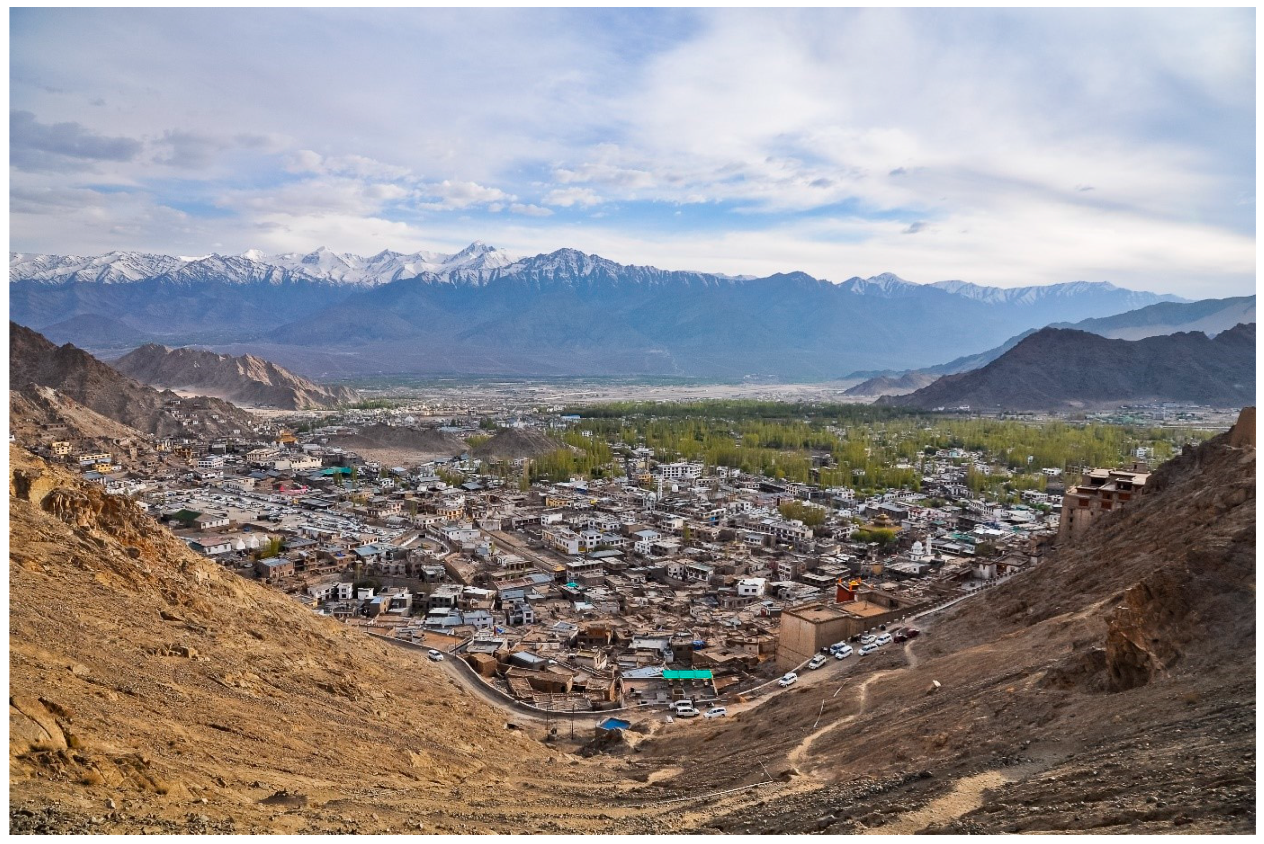
Projects READY2RESPOND Rapid Diagnostic in Uttarakhand and Himachal Pradesh Versión en español English version Share Facebook X (Twitter) LinkedIn Overview Background Ready2Respond (R2R) is a rapid diagnostic guide, designed to improve national, sub-national and city resilience mechanisms and to protect development gains through investments in emergency preparedness and response systems. It is informed by the World Bank Group (WBG) City Resilience Program (CRP) and other WBG resilience platforms. In this project R2R is applied to the Uttarakhand and Himachal Pradesh states in the Himalayan region of India. The GEM Risk Team contributes to the project by providing: Literature review and stakeholder mapping around hazard and risk initiatives, risk data and models for both states Provision of seismic hazard/risk model outputs and related descriptive information for both states (to support diagnostic activities) Review of legal regulation of the built environment and associated initiatives Review of seismic preparedness of the critical infrastructure defined in the project Preparation and remote input into stakeholder workshops Duration: 2023 Objectives This project responds to the need to provide effective and comprehensive diagnosis of the Uttarakhand and Himachal Pradesh states’ emergency preparedness and response systems in the Himalayan region of India. This enables the World Bank and the government to tailor investments to strengthen institutional capacity and capability, ensure public safety, and limit economic disruption in the face of multiple, and often cascading, geological and hydrometeorological hazards. Collaborators GEM Foundation, JBA Consulting, Geo Climate Risk Solutions (GCRS) Funding partner: World Bank Group Location India Himalayas
- CAREC | Global Earthquake Model Foundation
Projects CAREC Developing a Disaster Risk Transfer Facility in the Central Asia Regional Economic Cooperation Region Versión en español English version Share Facebook X (Twitter) LinkedIn Overview Background Willis Towers Watson, a GEM Advisor Sponsor is leading the consortium of organizations to implement the project, “Developing a Disaster Risk Transfer Facility in the Central Asia Regional Economic Cooperation Region” supported by the Asian Development Bank. The GEM Risk Team is responsible for the exposure and seismic vulnerability components of the project, with the Hazard Team providing support in the preparation of risk profiles for countries in the Central Asia Regional Economic Cooperation Region. Objectives The project has three main components: (i) development of disaster risk assessments and modeling in all CAREC countries; (ii) design of a regional pilot disaster risk transfer facility for at least three CAREC countries; and (iii) capacity building and awareness raising activities to sensitize key public and private stakeholders in all CAREC countries about the benefits of disaster risk reduction, risk retention and risk transfer solutions. Willis Towers Watson, a GEM Advisor Sponsor is leading the consortium of organizations that will implement the project. The Central Asia Regional Economic Cooperation, or CAREC Program is a partnership of 11 countries (Afghanistan, Azerbaijan, People's Republic of China, Georgia, Kazakhstan, Kyrgyz Republic, Mongolia, Pakistan, Tajikistan, Turkmenistan, and Uzbekistan), supported by 6 multilateral institutions, working together to promote development through cooperation, leading to accelerated growth and poverty reduction. Location Central Asia GEM has started a new project with WTW supported by the Asian Development Bank.
- AZERBAIJAN DRR | Global Earthquake Model Foundation
Projects AZERBAIJAN DRR Risk modeling and scenario analysis for Azerbaijan - Seismic risk analysis Versión en español English version Share Facebook X (Twitter) LinkedIn Overview Background One of the analyses to be conducted under the World Bank Groups' Country Climate and Development Reports (CCDRs), is to look at the fiscal and economic impacts of disasters in Azerbaijan, including the size of the macro-fiscal risk posed by earthquakes, floods, and droughts, and identify potential opportunities to increase financial resilience. For the risk modeling and scenario analysis for Azerbaijan, the GEM Risk Team further expands the Azerbaijan model in GEM's Global Seismic Risk Model, by projecting the exposure and risk to 2050 by taking into account the evolving demographics and socio-economic conditions in Azerbaijan. Duration: 2022 Objectives The World Bank is preparing the Country Climate and Development Report for Azerbaijan. The CCDR aims to inform policy dialogue and engagement with the Government of Azerbaijan. This provides an opportunity to carry out several analytical pieces, including in the area of Disaster Risk Management, bringing together existing knowledge on the economic and social impacts of disasters and climate change, and delivering new analytical insights to support policy recommendations. Collaborators GEM Foundation Funding partner: World Bank Group Location Azerbaijan
- MONGOLIA DRR | Global Earthquake Model Foundation
Projects MONGOLIA DRR Strengthening capacity on disaster risk assessment, reduction and transfer instruments in Mongolia Versión en español English version Share Facebook X (Twitter) LinkedIn Overview Background This project aims to support Mongolia in developing a set of key disaster risk information and knowledge products for mainstreaming Disaster Risk Management (DRM) into development, including Disaster Risk Financing and Insurance (DRFI). A hazard and risk assessment is conducted at the national and provincial levels and Disaster Risk Reduction (DRR) is promoted for resilience within development and DRFI, and to strengthen the capacity and ability of NEMA, ministries, local government officials and communities to better understand and plan for disaster risks. The project is made up of the following four main components: Conducting multi-hazard disaster risk assessments at the national and local levels; Facilitation of Disaster Reduction planning and mainstreaming through the preparation and delivery of a DRR training program; Development of a strategy for disaster risk financing and revision of the national draft disaster risk insurance law; and Building institutional, technical, and management capacity for DRR and DRF The GEM Risk Team's main contribution to the project is the development of a significantly improved exposure model for Mongolia, based on the latest population and housing census of Mongolia, and a probabilistic seismic risk analyses, making use of GEM's global seismic hazard mosaic. Duration: 2022-2023 Objective The project is implemented in close collaboration with Mongolia’s National Emergency Management Agency (NEMA) and the Department of Disaster Risk Management (DRMD), who are the executing agency and the implementing agency respectively. The Ministry of Finance is also engaged in strengthening DRF and insurance options. This project advances Mongolia’s progress in addressing the Sendai Framework on Disaster Risk Reduction (DRR) priorities by improving the institutional capacities of key ministries and local governments; enhancing understanding of risk; strengthening disaster risk governance; and investing in DRR for resilience through promoting mechanisms for disaster risk transfer, risk-sharing, and insurance. Collaborators GEM Foundation, ICEM Asia Consulting, PwC India, Environ LLC, Willis Towers Watson (WTW), JBA Group, Overseas Development Institute Funding partner: Funded by the Japan Fund of Poverty and Reduction and administered by the Asian Development Bank (ADB) Location Mongolia
- ARMENIA POST DRR | Global Earthquake Model Foundation
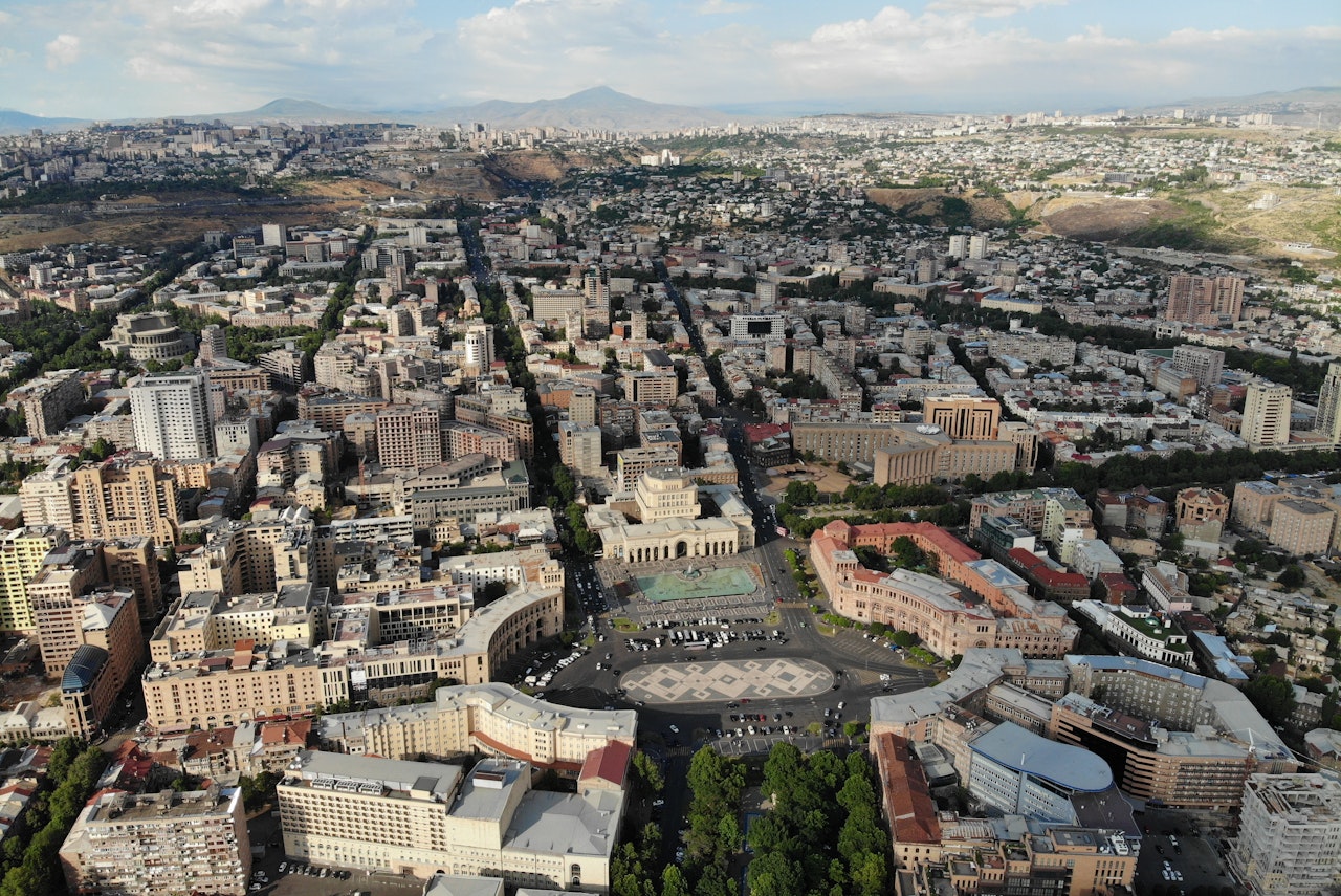
Projects ARMENIA POST DRR Improving Post-Disaster Damage Data Collection to Inform Decision Making Versión en español English version Share Facebook X (Twitter) LinkedIn Overview Background This project, responding to a request from the World Bank for improved post-disaster damage collection, focuses on the collection of data on physical damage to assets such as buildings (residential, commercial, industrial, public), infrastructure, and crops. The aim is to evaluate the current state-of-the-art in post-disaster damage collection – in protocols, tools and systems – in order to identify a suitable protocol and toolset that could be adopted by the Government of Armenia that would be generalisable and available, allowing adoption by other national government agencies or interested parties. The GEM Foundation leads the consortium working on this project, with the GEM Risk Team undertaking the following main tasks: Review of existing protocols, tools and systems Design of a conceptual protocol and toolset Application to the context of Armenia Recommendations Duration: 2018 Objectives Collection of damage data following major disaster events is a fundamental exercise for a multitude of purposes, such as emergency management, resource allocation, fund mobilization and reconstruction planning. The processes involved, and scales of damage assessments vary by country, peril and context. Numerous sector-specific data collection activities provide an estimation of damage, loss and post-disaster needs in order to provide relief and facilitate the commencement of reconstruction and recovery efforts. The project includes identifying and reviewing tools for collecting data in the field as well as damage data aggregation and reporting tools. Of particular interest is the use case in Armenia, demonstrating the needs of a Ministry of Finance requiring national-level reporting of damage on a sub-national level in a transparent system that allows the user to store, retrieve and interrogate damage data down to the asset-level. Collaborators GEM Foundation, JBA Consulting, CIMA Foundation and Geocom Ltd Funding partner: World Bank Group Location Armenia
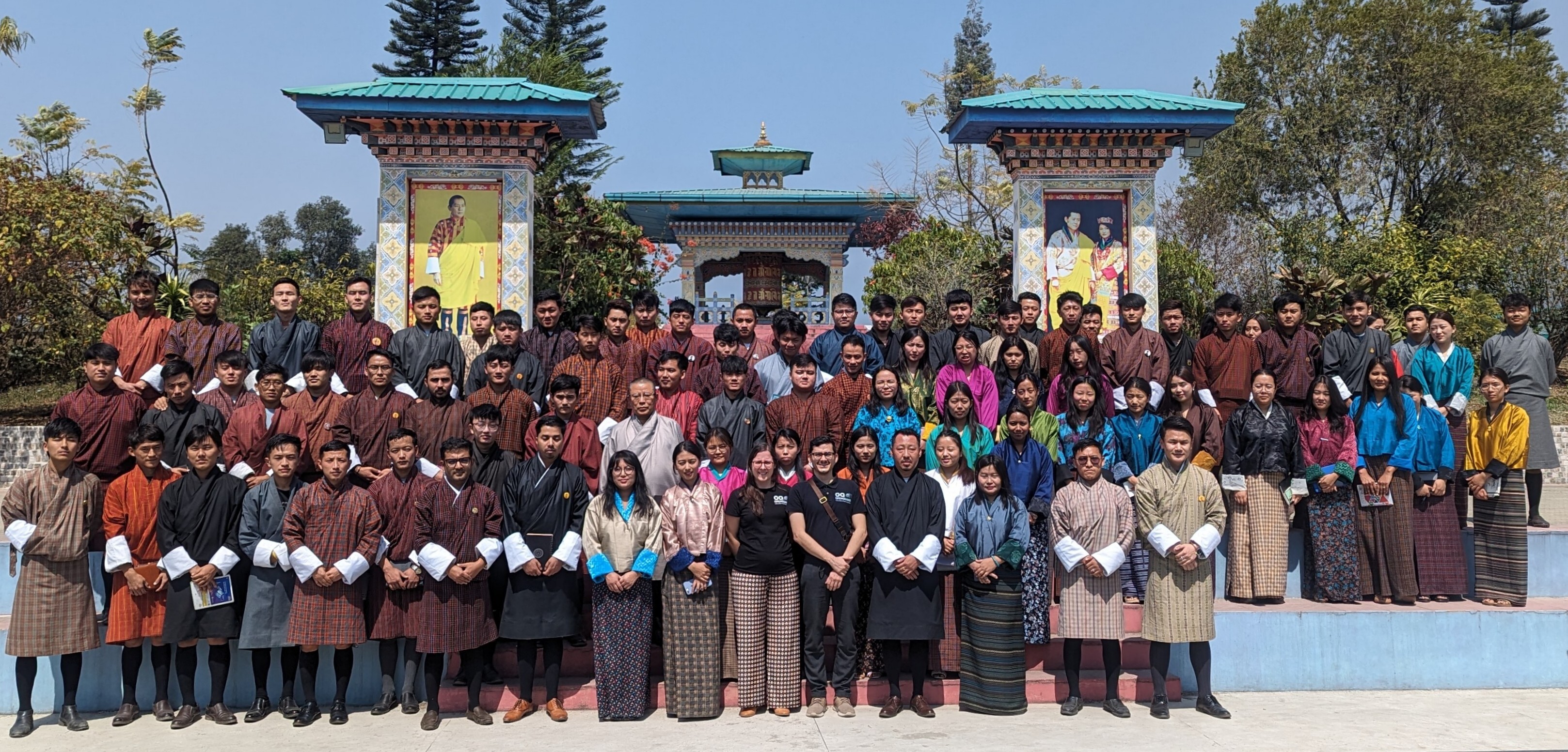
- Strengthening Bhutan's Resilience: GEM's Collaborative Efforts in Seismic Risk Reduction - GEM Foundation
News Strengthening Bhutan's Resilience: GEM's Collaborative Efforts in Seismic Risk Reduction By: Mar 27, 2024 Mar 15, 2024 Share Facebook X (Twitter) LinkedIn Thimphu, Bhutan - March 15, 2024. The Global Earthquake Model (GEM) Foundation's USAID-supported project, Forecasting and Communicating Earthquake Hazard and Risk (FORCE), recently concluded a successful week of activities in Bhutan (March 11-15, 2024), led by GEM's Alejandro Calderon and Catarina Costa. In Bhutan, the FORCE project focuses on strengthening local capacities and improving earthquake risk reduction in the country ( report with detailed information ). Engaging Stakeholders: Collaborative Efforts for Risk Reduction The activities in Bhutan commenced with productive meetings on March 11th, where Alejandro Calderon and Catarina Costa engaged in constructive dialogues with key government agencies responsible for disaster management and cultural preservation. These discussions laid the groundwork for collaborative efforts, ensuring that the FORCE project's objectives align closely with Bhutan's specific needs. Specifically, discussions with the Department of Disaster Management (DDM) highlighted their interest in participating in training programs and potentially hosting project results on their online Geonode platform, expected to be operational by mid-2025. This collaboration will ensure wider accessibility of critical risk information. The Department of Cultural Heritage (DCH), responsible for safeguarding Bhutan's heritage sites, echoed similar enthusiasm. They highlighted their existing database of classified buildings and risk maps and expressed keen interest in leveraging the project's training and OpenQuake software to gain a deeper understanding of earthquake risks to cultural heritage structures. On March 12th, Day 2 a workshop titled "Seismic Risk in Bhutan: What we know and where we are headed," brought together a diverse group of 25 participants from government, academia, and emergency response sectors. Supported by USAID BHA and RUB, this session served as a platform for knowledge exchange and discussion on how the project's outcomes can inform policy decisions and future risk reduction strategies in Bhutan. Empowering Future Generations: Knowledge Dissemination and Capacity Building The Royal University of Bhutan (RUB) serves as the central hub for the FORCE project in Bhutan. A meeting with the university's President reaffirmed their commitment to the project and opened doors for future collaborations with GEM. Building upon this momentum, a well-attended session introduced participants to the concepts of earthquake hazard and risk assessment and showcased the functionalities of OpenQuake held at RUB's College of Science and Technology in Phuntsholing. The sessions gathered over 70 participants, including students and faculty members from civil engineering and geology programs. This session not only showcased the project's objectives but also laid the groundwork for future capacity-building initiatives within Bhutan's scientific community. “The project outcomes will significantly benefit various stakeholders, including informing local building codes, risk mitigation strategies, resource allocation, and emergency response plans. Students and faculty from the College of Science and Technology have actively participated in the project workshops and are using the provided materials for teaching and research. The project is expected to equip students with practical skills and provide research opportunities for faculty to integrate findings into curriculum and building code development.” - Nimesh Chhetri, Lecturer - Head of the Centre for Disaster Risk Reduction and Community Development Studies, CST-RUB. More on Nimesh’s insights here . Reflecting on the successful week in Bhutan, Alejandro highlighted the importance of collaborative partnerships, stating, "Our engagement with key stakeholders and the enthusiastic participation from the Bhutanese scientific community underscore the collective commitment towards enhancing earthquake resilience in Bhutan." Catarina Costa echoed these sentiments, highlighting the significance of knowledge-sharing initiatives in seismic risk reduction. "Through collaborative efforts like the FORCE project, we aim to support local communities with the necessary tools and insights to mitigate seismic risks effectively," she remarked. Moving Forward: A Shared Vision for a More Resilient Bhutan The FORCE project activities in Bhutan illustrated the importance of collaboration in earthquake risk reduction. Stakeholders across government, academia, and the public domains have expressed their interest in leveraging the project's outcomes. “The successful workshops and meetings have opened up extensive possibilities for further collaboration between RUB, GEM, and USAID BHA. RUB can act as GEM's local representative, facilitating communication, data acquisition, and curriculum development focused on disaster management and risk reduction. The collaboration offers exciting opportunities for joint research in areas like landslide and flood hazard assessment, along with studies on non-structural elements in Bhutan. Additionally, RUB can leverage financial aid from USAID BHA and expertise from GEM to enhance ongoing or planned earthquake research projects.” - Nimesh Chhetri, CST-RUB. During the discussions, the College of Science and Technology (CST) has been identified as the central hub for future project communication and knowledge exchange in Bhutan. This includes facilitating access to existing data, ensuring the maintenance and distribution of project results, and collaborating with the Royal University of Bhutan to develop and update earthquake risk models. Looking beyond the current project, stakeholders expressed interest in collaborating on future initiatives. These include: Refining earthquake hazard models Conducting detailed studies on the vulnerability of traditional buildings Expanding risk assessments to include cultural heritage sites, bridges, and dams Investigating other natural hazards like floods, landslides, and rockfalls The FORCE project's multifaceted approach, covering stakeholder engagement, knowledge dissemination, and capacity building, demonstrates the transformative potential of collaborative efforts in disaster risk reduction. With gratitude extended to Bhutanese partners, including the Royal University of Bhutan (RUB) and associated institutions, as well as the continued support from USAID BHA, the Foundation remains steadfast in its mission to help create a more earthquake-resilient Bhutan through collaboration. Learn more about the FORCE project: https://www.globalquakemodel.org/proj/force . Disclaimer This web article about the FORCE project activities in Bhutan is made possible by the generous support of the American people through the United States Agency for International Development (USAID). The contents are the responsibility of the Global Earthquake Model (GEM) Foundation and do not necessarily reflect the views of USAID or the United States Government. No images found. GALLERY 14 march FORCE project in Bhutan.png bhutan 11.03.2024.png bhutan 12.03.2024.png 14 march FORCE project in Bhutan.png 1/3 VIDEO RELATED CONTENTS
- Latest News | Global Earthquake Model Foundation | Italy
LATEST UPDATES Top Story 15 Years of GEM: Transforming the Latest Science into Action for a Safer World Since its inception in 2009, the Global Earthquake Model (GEM) Foundation has been at the forefront of seismic risk reduction efforts worldwide. With a mission to enhance understanding and resilience against earthquakes and other natural hazards, GEM has catalysed transformative change through its collaborative approach and innovative solutions. More Share Facebook X (Twitter) LinkedIn MORE NEWS Search Archive 1 2 3 4 5 1 ... 1 2 3 4 5 6 7 8 9 10 11 12 13 14 15 16 17 18 19 20 21 22 23 24 25 26 27 28 29 30 31 32 33 34 35 36 37 38 39 40 41 42 43 44 45 46 47 48 49 50 51 52 53 ... 53 Strengthening Bhutan's Resilience: GEM's Collaborative Efforts in Seismic Risk Reduction Making Seismic Risk Information Open and Accessible: A Collaboration Between PreventionWeb and GEM Foundation Helen Crowley, GEM Secretary General Receives Prestigious Joyner Memorial Lecture Award GEM Foundation Strengthens Ties with the Global Tsunami Model Community 15 Years of GEM: Transforming the Latest Science into Action for a Safer World GEM Concludes Comprehensive Earthquake Risk Assessment in Bangladesh