CLOSE

QUICK LINKS


PROFILES
PUBLICATIONS
EXPOSURE
VULNERABILTY
SOFTWARE
EQ MODELS
Search Results
537 items found for ""
- SSAHARA Project | Global Earthquake Model Foundation
Projects SSAHARA Project Sub Saharan Hazard and Risk Assessment (SSAHARA) Versión en español English version Share Facebook X (Twitter) LinkedIn Overview Outcomes Training Outreach Photos Publications Background The East African Rift System (EARS) is the major active tectonic feature of the Sub-Saharan Africa (SSA) region. Although the seismicity level of such a divergent plate boundary can be described as moderate, several damaging earthquakes have been reported in historical times, and the seismic risk is exacerbated by the high vulnerability of the local buildings and structures. Formulation and enforcement of national seismic codes is therefore an essential risk mitigation strategy. A reliable risk assessment must be based on an updated and reliable seismic hazard model for the region. The last published regional model for SSA was developed within the frame of the GSHAP project and is almost 20 years old (Midzi et al., 1999). The availability of new data, local and regional seismotectonic studies and recently developed methods and tools prompt the development of a new PSHA model summarizing the current state of knowledge in Sub-Saharan Africa. Objectives In September 2014, the United States Agency for International Development (USAID) GEM funding support to implement a program entitled “Reducing Earthquake Risk collaboratively by Building Capacity and Leveraging GEM’s Open Tools and Resources”. One of the objectives of this program was: to build the capacity in sub-Saharan Africa for integrated risk assessment and development of city earthquake scenarios involving local decision-makers. The project produced the SSA-GEM homogenized catalogue; the Seismic Source Zones; the Probabilistic Hazard Calculations; the Strain Rate Model; earthquake risk in East Sub-Saharan Africa; the residential building stock; and the Social Vulnerability and Integrated Risk in Sub Sahara Africa. Collaborators The development of a regional model would not have been possible without the contribution of experts from the local scientific community. Partnership with local governmental institutions and authorities was an essential step to facilitate model acceptance and for potential integration with national seismic codes. GEM worked with the following institutions for the implementation of the SSAHARA project. African Union; AfricaArray; FEPRA – Ethiopia; University of Pennsylvania; Addis Ababa City Government; UNDP Regional Office; and international agencies, municipalities and government agencies Location Burundi, Ethiopia, Kenya, Malawi, Mozambique, Rwanda, Tanzania, Uganda Website SSAHARA wiki website containing technical descriptions and overview of the project. News Preventionweb article on the release of the Africa Model developed as part of the Sub-Sahara Hazard and Risk Assessment (SSAHARA) project funded by USAID. Disclaimer The contents of this project website such as studies, reports, audio-visual, news articles, blogs, and other information or media products including those in the external links are made possible by the generous support of the American people through the United States Agency for International Development (USAID). The contents are the responsibility of the Global Earthquake Model (GEM) Foundation and do not necessarily reflect the views of USAID or the United States Government.
- TREAD | Global Earthquake Model Foundation
Projects TREAD daTa and pRocesses in sEismic hAzarD Versión en español English version Share Facebook X (Twitter) LinkedIn Overview Background GEM is one of the partners of the Marie Skłodowska-Curie Actions (MSCA) funded TREAD project, which involves a consortium of 14 academic institutions and 8 private partners of the highest scientific level from 7 European countries. TREAD will train a new generation of seismic hazard scientists to tackle the challenges of earthquake forecasting in complex tectonic contexts such as the Europe and Mediterranean regions. During the 4 year project GEM will host and supervise two PhD students, one working with the hazard team and the other with the risk team, on the following topics: 1. Modelling distributed seismicity under innovative approaches (under joint supervision with the University of Milano, Bicocca, 2. Assessment of the impact of advanced seismic hazard modelling approaches on earthquake risk (under joint supervision with the University of Chieti-Pescara) Duration: 2023-2027 Objectives The aim of TREAD is to train a new generation of seismic hazard scientists to tackle the challenges of earthquake forecasting in complex tectonic contexts such as the Europe and Mediterranean regions. A change of paradigm in seismic hazard is necessary to be able to fully account for the specific properties of earthquake source and seismic modes in those areas. For example, to calculate the probability of having multiple earthquake ruptures, the interaction between active faults across various space-time scales needs to be accounted for, as well as the effects of stress transfer and fault-fluid interaction in earthquake triggering. TREAD objectives are: 1) Developing a novel integrative approach to seismic hazard analysis in Europe and the Mediterranean by bridging the gap from small-scale laboratory experiments to large-scale observations. 2) Establishing physics-based earthquake modelling by linking computational modelling of earthquakes from millions of years to fractions of a second. 3) Transferring earthquake geology and computational modelling to hazard and risk assessment adapted to the needs of government, industry and scientific stakeholders. Collaborators University of Chieti-Pescara, CNRS, University of Utrecht, GEM Foundation, University of Grenoble Alps, Ludwig Maximilians University, University of Barcelona, University of Padova, ETH Zurich, IRSN, OGS, INGV, Ruhr University Bochum, IPGP, Helmholz Centre, Willis, IFP, EDF, University of Milan Bicocca, Munich Re, TNO, Tre Altamira, University D'Aix Marseille Funding partner: Marie Skłodowska-Curie Actions (MSCA), European Commission Location Pavia, Italy
- METEOR | Global Earthquake Model Foundation
Projects METEOR Modelling Exposure Through Earth Observation Routines (METEOR) Versión en español English version Share Facebook X (Twitter) LinkedIn Overview Outcomes Training Outreach Photos Publications Background At present, there is a poor understanding of population exposure in some Official Development Assistance (ODA) countries, which causes major challenges when making Disaster Risk Management decisions. Modelling Exposure Through Earth Observation Routines (METEOR) takes a step-change in the application of Earth Observation exposure data by developing and delivering more accurate levels of population exposure to natural hazards. Providing new consistent data to governments, town planners and insurance providers will promote welfare and economic development in these countries and better enable them to respond to the hazards when they do occur. Objectives METEOR aims to formulate an innovative methodology of creating exposure data through the use of EO-based imagery to identify development patterns throughout a country. Stratified sampling technique harnessing traditional land use interpretation methods modified to characterise building patterns can be combined with EO and in-field building characteristics to capture the distribution of building types. These protocols and standards will be developed for broad application to ODA countries and will be tested and validated for both Nepal and Tanzania to assure they are fit-for-purpose. Objectives of the project look to: deliver exposure data for 47 of the least developed ODA countries, including Nepal and Tanzania; create hazard footprints for the specific countries; create open protocol; to develop critical exposure information from EO data; and capacity-building of local decision makers to apply data and assess hazard exposure. Collaborators METEOR Project Consortium The British Geological Survey (BGS) ImageCat National Society for Earthquake Technology (NSET) The Disaster Management Department-Tanzania The Humanitarian OpenStreetMap Team (HOT) Oxford Policy Management Limited (OPM) Fathom Location Nepal, Tanzania For more details on the METEOR Project, click read more below to visit the website. Anirudh and Nicole will be producing vulnerability data for different building types to different hazards for Nepal and Tanzania. About 20 project participants from GEM, Tanzania Prime Minister’s Office-Disaster Management Department (DMD), NSET, BGS, HOT OSM, ImageCat and OPM... Modelling Exposure Through Earth Observation Routines: EO-based Exposure, Nepal and Tanzania granted by the UK Space Agency Anirudh Rao and Nicole Paul participated in the quarterly UK Space Agency #METEOR Project meeting and workshops in Kathmandu, Nepal. To download the METEOR Project official deliverables documents, click the Read More button below.
- CAREC | Global Earthquake Model Foundation
Projects CAREC Developing a Disaster Risk Transfer Facility in the Central Asia Regional Economic Cooperation Region Versión en español English version Share Facebook X (Twitter) LinkedIn Overview Background Willis Towers Watson, a GEM Advisor Sponsor is leading the consortium of organizations to implement the project, “Developing a Disaster Risk Transfer Facility in the Central Asia Regional Economic Cooperation Region” supported by the Asian Development Bank. The GEM Risk Team is responsible for the exposure and seismic vulnerability components of the project, with the Hazard Team providing support in the preparation of risk profiles for countries in the Central Asia Regional Economic Cooperation Region. Objectives The project has three main components: (i) development of disaster risk assessments and modeling in all CAREC countries; (ii) design of a regional pilot disaster risk transfer facility for at least three CAREC countries; and (iii) capacity building and awareness raising activities to sensitize key public and private stakeholders in all CAREC countries about the benefits of disaster risk reduction, risk retention and risk transfer solutions. Willis Towers Watson, a GEM Advisor Sponsor is leading the consortium of organizations that will implement the project. The Central Asia Regional Economic Cooperation, or CAREC Program is a partnership of 11 countries (Afghanistan, Azerbaijan, People's Republic of China, Georgia, Kazakhstan, Kyrgyz Republic, Mongolia, Pakistan, Tajikistan, Turkmenistan, and Uzbekistan), supported by 6 multilateral institutions, working together to promote development through cooperation, leading to accelerated growth and poverty reduction. Location Central Asia GEM has started a new project with WTW supported by the Asian Development Bank.
- BANGLADESH | Global Earthquake Model Foundation
Projects BANGLADESH Earthquake Vulnerability and Systemic Risk Assessment in Bangladesh Versión en español English version Share Facebook X (Twitter) LinkedIn Overview Outcomes Training Outreach Photos Publications Background This project follows a specific support request made by the Ministry of Disaster Management and Relief (MoMDR) to the UN Office for Disaster Risk Reduction (UNDRR) and UN Resident Coordinator’s Office (UNRCO) for a sub-national earthquake hazard and risk assessment in Bangladesh. The GEM Foundation has the role of technical expert lead of the project which will include the following activities: Needs and Gaps Assessment Technical Panel Formation and Initial Consultations Seismic Hazard Mapping Exposure Mapping Seismic Vulnerability Assessment Seismic Risk Mapping and Interpretation Stakeholder Consultation and Validation Preliminary Model Dissemination and Training Workshop Funding and technical partner: UNDRR Duration: 2023 - 2024 Objectives The main objective of this project is to develop a detailed, open, sub-national earthquake risk model and evaluate seismic risk for Bangladesh at the zila and upazila level. The complete risk model itself will comprise a probabilistic seismic hazard model, a building exposure model, and a seismic fragility and vulnerability model for the building stock of Bangladesh. Additionally, it includes critical scenarios for key cities, identified based on the results of the probabilistic risk assessment and in consultation with local stakeholders and experts, in a panel led by the Ministry of Disaster Management and Relief (MoMDR), and including representatives from the Ministry of Housing and Public Works, Bangladesh Bureau of Statistics, Geological Survey of Bangladesh, Bangladesh University of Engineering and Technology, and University of Dhaka.` Collaborators In collaboration with the GEM Foundation, the Technical Panel steering this seismic risk assessment initiative is a collaborative assembly of key stakeholders and experts. Led by the Additional Secretary of Bangladesh's Ministry of Disaster Management and Relief (MoDMR), it comprises representatives from vital entities, including the Department Of Disaster Management (DDM), the Fire Service and Civil Defence of Bangladesh, the Ministry of Housing & Public Works (MoHPW), and the Statistics and Informatics Division (SID) of the Bangladesh Bureau of Statistics (BBS). In addition, the panel includes the participation of seasoned national experts specializing in seismic hazard and risk assessment from institutions such as the University of Dhaka (DU), Bangladesh University of Engineering and Technology (BUET), and Jahangirnagar University (JU). Further enriching the panel's knowledge base are contributions from the Geological Survey of Bangladesh, the Centre for Urban Studies (CUS), and the United Nations Development Programme (UNDP), Bangladesh.) Location Bangladesh Earthquake Hazard and Risk Assessment Results This section summarises the various assessments conducted to understand the potential impact of earthquakes in Bangladesh. These assessments cover a range of factors, including the likelihood and severity of ground shaking, liquefaction potential, exposure of people and buildings, vulnerability of infrastructure, and the overall seismic risk posed to the country. The following list details the outputs generated from each assessment. Bangladesh Profiles | Past Earthquakes ***ALL OUTPUTS ARE PRELIMINARY*** a. Population and Building Exposure The "Population and Building Exposure" section utilised data from various sources to create an exposure model for Bangladesh. The 2011 Population and Housing Census and the 2013 Economic Census provided the foundation for residential and commercial/industrial exposure, respectively. While detailed housing information from the 2022 census wasn't yet available at lower administrative levels, preliminary population counts at the district level were incorporated to update the model at the start of the project. Additionally, information on building materials used throughout the country, derived from the 2011 census, was employed. For informal urban constructions, data from the 2014 Slum Areas and Floating Population Census was used to infer vulnerability based on dwelling unit types, though specific construction materials weren't available. Finally, the project team actively sought and obtained upazila-level data on building materials from the 2022 census to further refine the exposure model. Maps | Profile b. Infrastructure Exposure In addition to residential, industrial, and commercial structures that were previously covered by GEM’s exposure models at the zila level (which have been updated to the upazila level during this project), we have also developed exposure models for the healthcare and educational facilities at the country, including all hospitals and clinics, and all schools, colleges, and universities. Map | Profile c. Earthquake Scenarios The project also constructed the rupture geometries for these events, selected a range of ground motion models, and assessed the potential impact—both in terms of damage and losses—that each event could inflict on the country if it were to occur today. The full scenario set consists of twelve events: seven historical events from 1664-1918, chosen out of many in this period, supplemented by five hypothetical events. Maps | Profile d. Probabilistic Seismic Hazard Assessment The seismic hazard modelling and mapping section describes the approach taken to assess the seismic hazard in Bangladesh with the goal of creating a comprehensive seismic hazard model for Bangladesh that can be used for risk assessment and mitigation. The project started with a probabilistic seismic hazard model for the Indian subcontinent, which was updated and implemented for the OpenQuake engine. The model includes seismogenic source models, ground motion models, and considers various tectonic regions. This section also mentions the review of the seismic source model for northeast India and the improvements made to the model. Maps | Profile e. Liquefaction Hazard Assessment The section "Liquefaction susceptibility and hazard assessment" discusses the inclusion of regional liquefaction occurrence models in the project, which predict ground failure using existing mapped information and above-ground inferences of below-ground conditions. These models were used for the national scale liquefaction hazard assessment in the second phase of the project identifying the factors that contribute to liquefaction, the methods used for assessment, and the potential damage and losses that can result from liquefaction. Maps | Charts | Tables f. Seismic Risk Assessment The project estimated seismic risk metrics utilising the OpenQuake-engine's stochastic event-based risk assessment calculator. A probabilistic seismic hazard analysis model was employed to generate earthquake rupture forecasts, forming a stochastic event set over a 100,000-year span. Economic and human losses were computed for each event, producing event loss tables and year loss tables. Risk metrics included exceedance probability curves and average annualized losses. Fatality and injury estimates relied on vulnerability models informed by global earthquake data, with a focus on South Asian building characteristics. Results were tabulated nationally and regionally by the project. The assessment also considers the exposure and risk of healthcare facilities, educational facilities, and the national road network to seismic hazards. Maps set 1 | Maps set 2 | Profile Improving global capacity for seismic hazard and risk This part of the program was designed to improve the understanding and awareness of earthquake hazard and risk, and to help bridge the gap between the information produced in detailed hazard and risk assessment studies and its communication to a wide variety of stakeholders (which range from local experts with the remit to assess seismic risk to decision-makers responsible for the implementation of risk reduction measures). a. Website for OpenQuake online training The OpenQuake online training was designed for different types of audiences with diverse backgrounds and expertise. Through this platform, participants interact with GEM scientific and technical teams to learn the main concepts of earthquake risk assessment, along with the basic features of the engine. [English ] b. Onsite Training Workshop One-day workshop designed to improve the understanding and awareness of earthquake hazard and risk and to help bridge the gap between the information produced in the project and its communication to a wide variety of stakeholders. The session allowed participants to explore and prepare the required input files for earthquake scenarios in the OpenQuake engine. OQ Engine Video Tutorials | English | Example Material Communicating and raising earthquake risk awareness The activities in this component focused on raising the awareness of the public on earthquake hazard and risk by training a diverse group of disaster risk reduction (DRR) professionals together with personnel in charge of communicating risk to the public, and by conducting community-based workshops in selected areas of the pilot cities by those who were trained by the project. a. GEM presentation to the Ministry of Disaster Management and Relief (MoDR), Bangladesh This is an introductory presentation on Bangladesh's earthquake risk assessment project that outlines past efforts, emphasises the need for a nationwide evaluation, and introduces the GEM Foundation's methodology. It highlights completed division-level risk maps and ongoing project activities like data collection, vulnerability assessment, and stakeholder engagement. Additionally, five other presentations below will address different aspects of the project in Bangladesh. View Presentation b. Technical Panel Session #1 This presentation discusses the methodology used to collect and process data related to earthquake risk components such as hazard, exposure, and vulnerability. It also mentions the project activities and the formation of a technical panel for consultation and validation. View Presentation c. Technical Panel Session (PSHA) #2 This presentation is about the tailored version of the PSHA (Probabilistic Seismic Hazard Assessment) model for the Indian sub-continent, which is based on the original model developed by Nath and Thingbaijam in 2012. The presentation discusses the main areas identified for improvement in the model, the changes that were introduced, and the impact of these changes on the hazard results. View Presentation d. Technical Panel Session (Scenario Ruptures) #2 This presentation is about the hazard analysis of earthquakes in Bangladesh, including an overview of the fault systems, historical ruptures, and potential ruptures. It also mentions the ground motion models used for the analysis. View Presentation e. Technical Panel Session #3 This presentation focuses on exposure and physical and social vulnerability, as components of seismic risk. It discusses the details of exposure models, seismic vulnerability analysis, and social vulnerability. The presentation also mentions the use of the Global Earthquake Model (GEM) and the INFORM Index in assessing and understanding the seismic risk in Bangladesh. View Presentation f. Technical Panel Session (Scenarios and Risk) #4 This presentation details data collection and processing methods for seismic hazards, exposure, and vulnerability. It presents preliminary results on potential earthquake impacts like building collapse and economic loss using an 1885 event as an example. The presentation also mentions probabilistic risk assessment and division-level risk maps, alongside details about 12 "scenario ruptures" based on historical and potential earthquake events. View Presentation g. Technical Panel Session (Liquefaction) #4 This presentation focuses on factors such as soil liquefaction, susceptibility to ground failure, population density, urbanisation, and the country's river delta geography. It discusses various methodologies and models used to assess liquefaction hazard and suggests the use of geospatial methodologies for identifying areas with a higher likelihood of occurrence. View Presentation BUSINESS NEWS Images from online meetings: September to December 2023 1/1 Interim Substantive Reports The documents below are interim substantive reports on the project "Earthquake Vulnerability and Systemic Risk Assessment in Bangladesh". The main objective of the project is to develop a detailed earthquake risk model for Bangladesh at the zila and upazila levels. They describe the development of an open-source probabilistic seismic risk model for Bangladesh and provide key insights to decision-makers and stakeholders in the disaster risk mitigation community. a. First Interim Substantive Report This report highlights the need for a seismic risk model in the country and discusses the gaps and needs assessment. The report also explains the technical approach and methodology for developing the risk model, including seismic hazard modeling, liquefaction susceptibility and hazard assessment, exposure modeling, and seismic fragility and vulnerability modeling. The seismic risk assessment process is described, along with the formation of a technical panel and stakeholder engagement. Download the Report b. Second Interim Substantive Report This report provides updates on various aspects of the project, including the development of earthquake scenarios, liquefaction susceptibility and hazard assessment, exposure modeling, and social vulnerability modeling. The report mentions that the project has engaged a technical panel comprising key experts and stakeholders, and their feedback and suggestions are being incorporated into the project. The report also includes information on the distribution of hospitals, clinics, schools, and colleges in Bangladesh. Download the Report
- SOLOMON ISLANDS EXPOSURE | Global Earthquake Model Foundation
Projects SOLOMON ISLANDS EXPOSURE Assessing the Risk Exposure of Road Network to Climate and Natural Hazard Risks in Solomon Islands Versión en español English version Share Facebook X (Twitter) LinkedIn Overview Background This project aims to conduct a robust multi-hazard risk assessment of the road network to climate and natural hazards in the Solomon Islands, both historically and under future climate projections. The project includes three main dimensions: - Characterization of the climate and natural hazards - Physical vulnerability of the road network - Multi-criteria criticality analysis The three main outputs are: - Multi-hazard maps - Road network risk exposure analysis (global risk score) - Identification of "first priority" road segments and estimation of their rehabilitation costs The GEM Hazard Team supports the project by computing seismic hazard maps and uses these to produce maps to classify low to high risks of earthquake hazards, according to their intensity and frequency. Duration: 2021 Objectives Many Small Island Developing States (SIDS) share a major common feature: they are among the most exposed nations to natural hazards and climate change. SIDS are also characterized by insularity and geographic remoteness, as well as small geographic area, economies, and population, all of which increase their social and economic vulnerability. This project aims to assist the Solomon Islands to better manage climate and disaster risks by improving the understanding of risk and the use of this information for risk reduction decision-making, and the design and implementation of investments at the provincial and community level. Collaborators GEM Foundation, ARIA Technologies, Actimar, Suez Consulting, Setec Group Funding partner: World Bank Group Location Solomon Islands
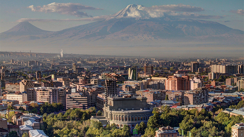
- ARMENIA PSHA MODELLING | Global Earthquake Model Foundation
Projects ARMENIA PSHA MODELLING Probabilistic Seismic Hazard Assessment for the Republic of Armenia Versión en español English version Share Facebook X (Twitter) LinkedIn Overview Background This project responds to a World Bank request for a probabilistic seismic hazard assessment for the Republic of Armenia. The goal of this study is to better understand the existing seismic hazard information in the country, and to provide an updated hazard model. The GEM Hazard Team supports all aspects of the model development, and in the running of the analyses with the OpenQuake engine. Duration: 2017 Objectives Probabilistic seismic hazard models, such as this model for the Republic of Armenia, can be used as a rigorous and robust basis for the design of a national disaster risk financing and insurance strategy. Collaborators Verisk (AIR Worldwide), GEM Foundation, Georisk Scientific Research Company Funding partner: World Bank Group Location Armenia
- AELO | Global Earthquake Model Foundation
Projects AELO ASCE Earthquake Loads Overseas (AELO) Versión en español English version Share Facebook X (Twitter) LinkedIn Overview Background The project is carried out within a collaboration between GEM and the U.S. Geological Survey (USGS) and is sponsored by the U.S. Department of State (DoS) and the U.S. Department of Defence (DoD). The aim of the project is to provide a web service for computing design ground motions (on rock and soil) that are compliant with the ASCE guidelines (ASCE 7-16, ASCE 41-17, ASCE 7-22, ASCE 41-23) for 500 locations worldwide. In its inaugural year, AELO focuses on rigorously calculating seismic parameters, including Peak Ground Acceleration (PGA), Ss, and S1 design values across 500 diverse global locations, particularly emphasizing rock site conditions. This aims to ensure compliance with ASCE7-16 and ASCE41-17 standards, essential for seismic assessment and design practices. In the following year, the project progresses to establish a secure webservice for computing design ground motions. This password-protected platform will provide access to ASCE7-16 and ASCE41-17 aligned calculations, simplifying access to these critical seismic design parameters. Transitioning into the third year, AELO expands its computational scope to encompass ground motion calculations across various soil conditions worldwide, encompassing 500 locations to adhere to ASCE 7-22 and ASCE 41-23 standards. This phase seeks to enhance the breadth of seismic assessments, offering a comprehensive understanding of seismic hazards on diverse soil types. Finally, in its fourth year, the project concludes with the introduction of a sophisticated, password-protected webservice. This platform offers the capability to compute design ground motions based on the latest ASCE7-22 and ASCE41-23 standards, supporting seismic engineers and researchers globally by providing accurate, standardized, and essential seismic design parameters for diverse geographical locations. Duration: 2022 - 2026 Objectives The primary objective of the project is to create a web service capable of calculating design ground motions, both on rock and soil, in adherence to the American Society of Civil Engineers (ASCE) guidelines. These guidelines include ASCE 7-16, ASCE 41-17, ASCE 7-22, and ASCE 41-23. This web service heavily relies on the hazard models that are part of GEM’s global mosaic and the OpenQuake Engine. Collaborators GEM, the U.S. Geological Survey (USGS), with support from the U.S. Department of State (DoS) and the U.S. Department of Defense (DoD). Location Global (Washington DC, USA)
- SARA Project | Global Earthquake Model Foundation
Projects SARA Project South American Risk Assessment (SARA) Versión en español English version Share Facebook X (Twitter) LinkedIn Overview Outcomes Training Outreach Photos Publications Overview South America incorporates some of the most seismically active regions on the planet, where the South American subduction zone generates the forces to create the Andes Mountains and drives the occurrence of destructive earthquakes across Chile, western Argentina, Bolivia, Ecuador, Peru, Colombia and Venezuela. In turn, the high vulnerability of many structures and the high population density of the main cities are factors that contribute to the region’s high seismic risk. In the last two decades alone, over 3,000 fatalities have been reported, and the economic losses have exceeded 30 billion USD (EM-DAT, www.emdat.be ). While expert capabilities exist in these countries to assess earthquake risk, the information, infrastructure, tools, and collaboration networks necessary to develop comprehensive knowledge among scientists and engineers and to move this knowledge into the mainstream of disaster risk reduction activities has been lacking. Objectives The approach is to bring together international best practice tools and methodologies with local expertise and knowledge needed to establish local ownership and define risk assessment objectives and priorities. GEM Foundation combined these elements and focused on developing local capacities across sectors (academic, public and private), across technical disciplines (e.g., hazard, risk, IT), and through the implementation of disaster risk reduction policies and programs. The program of capacity development was initiated in 2013 with the South America Risk Assessment (SARA) Project to bring experts, institutions, and stakeholders from 7 countries to develop a regional assessment of earthquake hazard and risk. GEM provided its OpenQuake earthquake hazard and risk analysis software and other tools and databases freely and openly to all participants. More than 50 of the region’s experts across 17 institutions collaborated to produce critical data sets, develop common approaches, and develop open-source tools for both data collection and interpretation. Collaborators The SARA Project, completed in December 2015, provided the foundation for formal and informal collaborations at many levels and for many purposes. GEM subsequently developed formal partnerships across public and private sectors (e.g., SuraAmerica Insurance, the Geological Survey of Colombia, EcoPetrol), academic partnerships (e.g., EAFIT Univ, Univ del Norte, Univ Catolica Chile), non-profits (e.g., OSSO), and most recently, with municipal governments (Cali, Colombia and Quito, Ecuador), for urban risk assessments. (complete list ) Location Andean Region (Venezuela, Colombia, Ecuador, Peru, Bolivia, Chile and Argentina) Introduction The project was carried out by experts and institutions from the region using to the extent possible open data sets, methodologies and tools such as GEM’s new open source software, the OpenQuake Engine and other OpenQuake tools. The project revolved around 5 modules: hazard, exposure and physical vulnerability, socio-economic vulnerability and resilience, loss estimates and city scenarios. The modules were carried out by a variety of experts/scientists from the region , in collaboration with the project coordinators and, where relevant, the GEM Secretariat. 1. Seismic hazard In early 2013 the Global Earthquake Model (GEM) published seven Requests for Proposal covering topics related to the compilation of basic datasets as well as the creation and calculation of an updated probabilistic seismic hazard input model for South America. Five consortia of South American researchers responded to this request and submitted proposals, which were reviewed in an initial stage by scientists working at the GEM Secretariat, and successively discussed in a meeting in Bogota held in December 2013 at the “Servicio Geologico Colombiano”. 2. Exposure and Physical Vulnerability Development of exposure datasets and vulnerability functions for South America at regional, national and/or sub-national levels have been considered. Modelling of exposure and physical vulnerability in the most earthquake prone countries is the main goal in the first stage of the project. 3. Social Vulnerability and Resilience The social vulnerability component of SARA comprises the development of composite indicators of social vulnerability and resilience along with their robustness testing and validation. The objective is to provide tools and information useful for understanding the potential effects of earthquakes in communities of South America. 4. National and subnational estimation of losses An open and transparent seismic risk assessment for the Andean countries has been performed. A probabilistic approach was followed for the calculation of risk metrics, that includes average annual economic and human loss maps, mean loss exceedance curves per country, and statistics that reveal which building classes are most vulnerable to earthquakes. 5. City Scenarios Following the objectives of SARA, the development of city scenarios is crucial for planning risk management strategies in cities with larger concentration of population and exposed to significant hazard. In this sense, the GEM Secretariat has been seeking collaborations with research groups and governmental stakeholders that will be the end users of case studies in Lima (Peru), Quito (Ecuador), Medellín (Colombia), Iquique, Osorno and Rancagua (Chile). Capacity development and institutional strengthening To promote sustainability, SARA’s work included the following: capacity development and institutional strengthening, and stakeholder engagement. The outcomes of activities in these areas are described below. A blog by Carlos Costa featuring the SARA project workshop in Chile 2014. [News ] A wiki project website containing technical information about the SARA project. [Website ] BUSINESS NEWS Quito workshops 2015 1/3 BUSINESS NEWS Lima workshops 2015 1/2 SARA Project Executive Summary [PDF ] Probabilistic Seismic Risk Assessment Of The Residential Building Stock In South America [PDF ] A conference paper on Building A Ground-Motion Logic Tree For South America Within The Gem-Sara Project Framework [PDF ] SARA (South America Risk Assessment Project Workshop) on “Inventory of Quaternary deformation of South America” [PDF ]
- HORUS | Global Earthquake Model Foundation
Projects HORUS Horus: Pilot for a generic damage evaluation methodology based on remote-sensing data Versión en español English version Share Facebook X (Twitter) LinkedIn Overview Background Horus is a pilot project that explores the combination of high-resolution building inventory data from OpenStreetMap and other local sources with image-processing algorithms for the detection of earthquake damage and flood extents using remote-sensing data, along with supplementary geospatial datasets as inputs to a machine learning (ML) classification model. The ML model is trained using detailed building damage datasets from past events in a supervised learning framework, and the trained model is intended to be used to estimate the extent of damage and loss in events previously unseen by the model. The proposed framework is applied in three case study applications: March 2020 Mw5.3 Zagreb earthquake; January 2020 Mw6.4 Puerto Rico earthquake and August 2016 Louisiana floods. The GEM Risk Team is responsible for the overall coordination of the project involving multiple partners, compilation of building-level earthquake damage datasets, development of the ML models, and training and testing of the models. Duration: 2020 Objectives This pilot project, initiated and funded by the World Bank, aims to develop a framework for semi-automated damage and loss assessment due to earthquake and floods from Earth Observation (EO) data and other supplementary datasets, while also leveraging recent advances in machine-learning algorithms. These damage and loss estimates can potentially be used for transparent financial compensation and to target the distribution of resources geographically and temporally. Collaborators Advanced Rapid Imaging and Analysis (ARIA) team at the National Aeronautics and Space Administration’s (NASA) Jet Propulsion Laboratory (JPL) and California Institute of Technology (Caltech), the Global Earthquake Model (GEM) Foundation, JBA Risk, and the Humanitarian OpenStreetMap Team (HOT) Funding partner: World Bank Group Locations Earthquake case studies: Gorkha, Nepal; Puebla, Mexico; Puerto Rico, United States; Zagreb, Croatia Flood case study: Louisiana, United States